The New Georgia Encyclopedia is supported by funding from A More Perfect Union, a special initiative of the National Endowment for the Humanities.
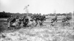
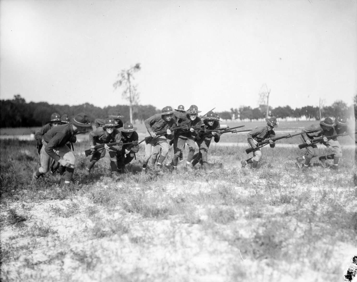
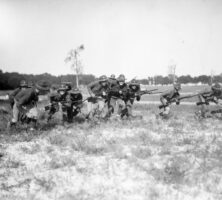
During World War I General John Pershing insisted that U.S. troops, pictured here in 1917 near Camp Gordon in DeKalb County, learn open warfare techniques as well as European-style trench warfare.
Courtesy of Atlanta History Center, Photograph by Kenneth Rogers.
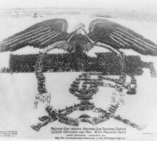
This military formation, shown from an aerial view circa 1918, included 22,500 soldiers and 600 machine guns to replicate the insignia of the Machine Gun Training Center at Camp Hancock, near Augusta.
Courtesy of Library of Congress, Prints and Photographs Division
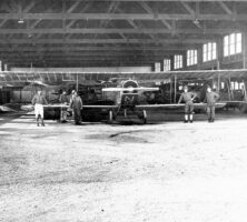
Soldiers pose in an airplane hangar at Souther Field, near Americus, in 1918. During World War I Souther Field, with 16 hangars, 150 aircraft, and 2,000 pilots, was essential to meeting the Allied forces' aerial warfare needs.
Courtesy of Georgia Archives, Vanishing Georgia, #
sum042.
Oglethorpe University cadets in the Student Army Training Corps (SATC) during World War I rally around the flag. "It makes Oglethorpe look like West Point," said university president Thornwell Jacobs.
Courtesy of Philip Weltner Library, Oglethorpe University.
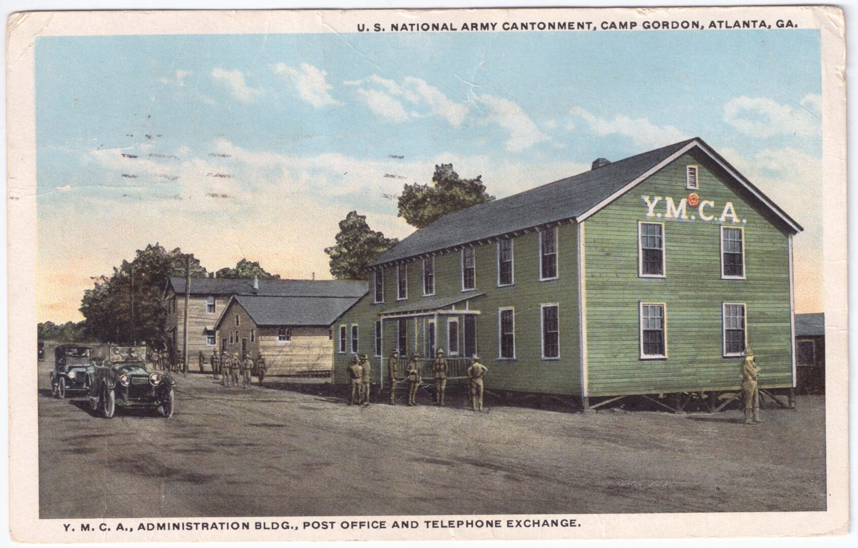
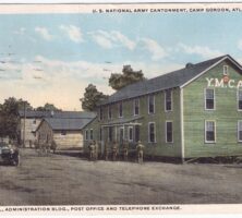
The YMCA, present at all military camps, was vital to army morale during World War I (1917-18). This building at Camp Gordon housed the first telephone exchange in Chamblee.
Courtesy of Paul Stephen Hudson and Lora Pond Mirza
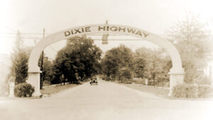
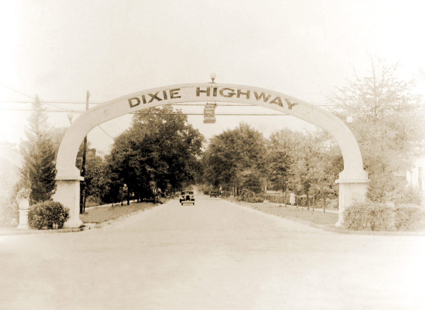
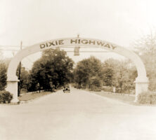
A concrete arch stretches over the Dixie Highway in Waycross, circa 1925.
Courtesy of Edwin L. Jackson
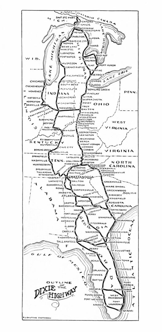
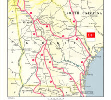
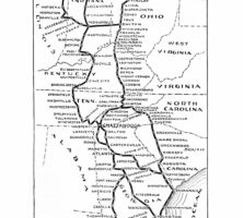
Divisions of the Dixie Highway in Georgia and Dates Authorized: (1) Western Division (1915)—between Chattanooga and Cassville, divided into a Rome branch and a Dalton branch; (2) Eastern Division (1916)—also known as "Old State Capital Route"; (3) Eastern Division (1916)—formerly known as the "Atlantic Coastal Highway," "Atlantic Highway," and "Quebec-Miami Highway"; (4) Central Division (1916)—commonly known as the "Central Dixie Highway"; (5) Carolina Division (1918); and (6) Untitled Division (1922)—consisting of that portion of what was then known as the "National Highway" from Perry to Florida and sometimes referred to as the "Dixie-National Highway."See full-size map.
Courtesy of Edwin L. Jackson
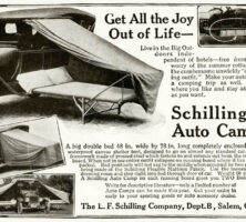
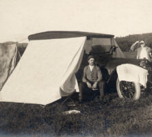
To save lodging costs, many Dixie Highway motorists spent the night sleeping on a cot in a waterproof canvas tent that attached to the side of their car.
Courtesy of Edwin L. Jackson
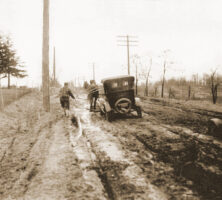
For years, many portions of the Dixie Highway in Georgia remained dirt roads. After heavy rains, many cars became stuck in the mud. Rural residents living along these dirt roads often earned extra money by using a team of horses to pull cars through the muddy sections.
Courtesy of Edwin L. Jackson
The Dixie Highway stretched from Sault Ste. Marie, Michigan, south to Miami, Florida.See full-size map.
Courtesy of Edwin L. Jackson
As evening approached, many Dixie Highway tourists would pull off the road and set up one or more tents, often spending the night along the road or in a grove of trees.
Courtesy of Edwin L. Jackson
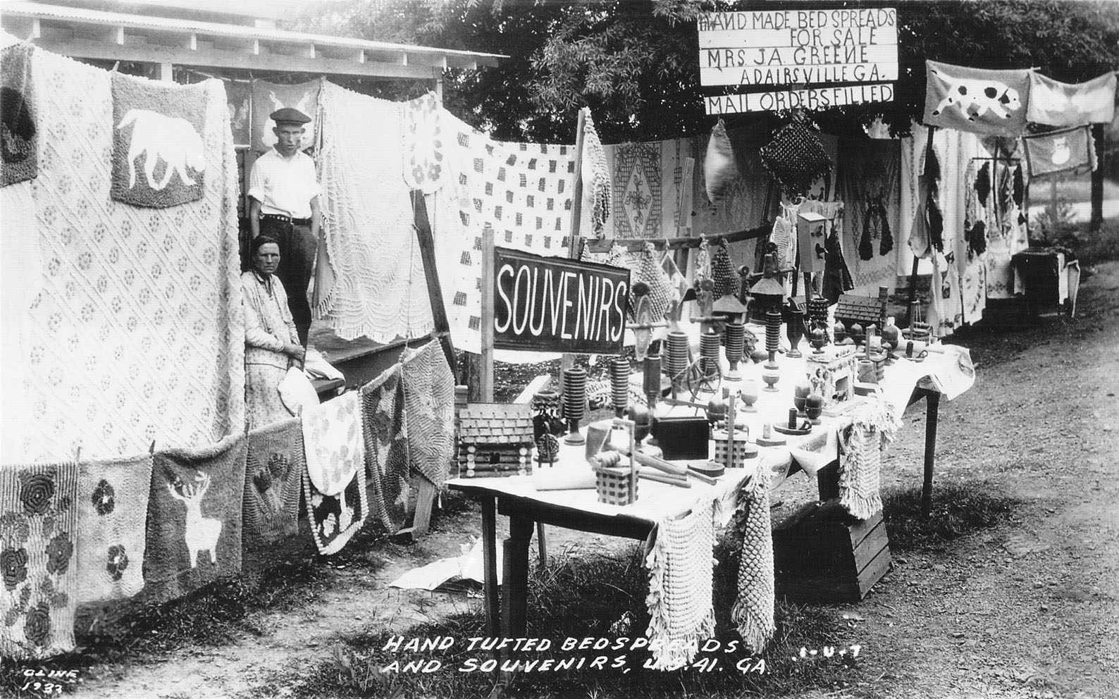
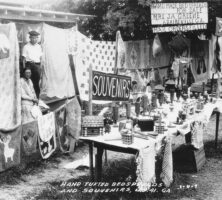
Chenille bedspreads and other souvenirs are sold at a roadside stand on the Dixie Highway in Adairsville, circa 1930. The chenille industry first developed in Dalton, and roadside stands selling bedspreads, bathrobes, throw rugs, and other items became popular along the Dixie Highway from Michigan to Florida.
Courtesy of Georgia Archives, Vanishing Georgia, #
brt126.
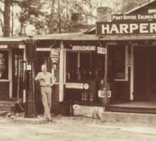
Entrepreneurs along the Dixie Highway opened up all types of businesses to serve the traveling motorist—including tourist camps, lodges, garages, restaurants, and souvenir shops. This Eulonia businessman opened a combination gas station, grocery store, restaurant, post office, bus station, and public telephone.
Courtesy of Edwin L. Jackson
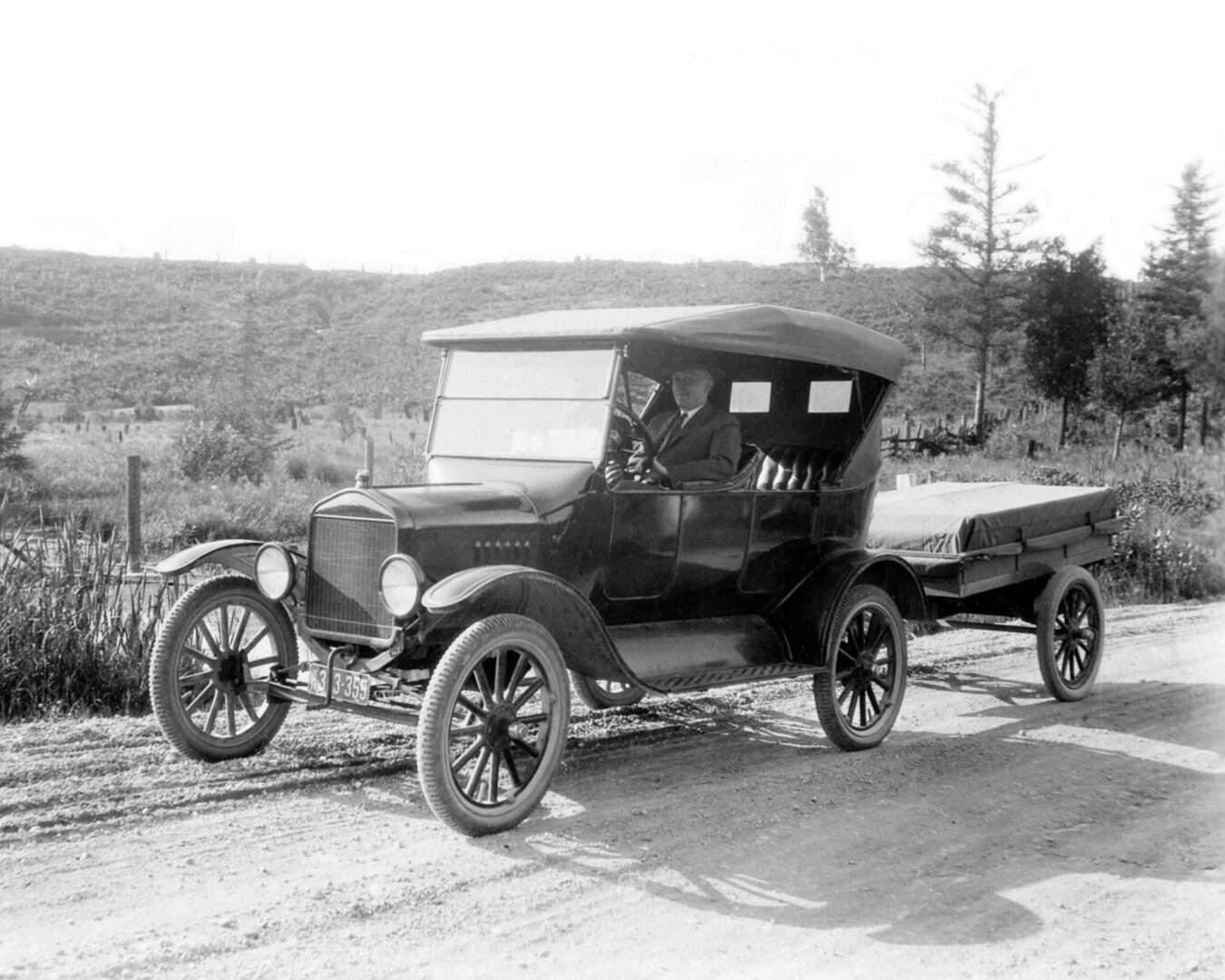
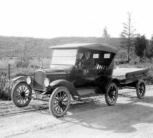
A Ford Model T and attached trailer are pictured circa 1925. Because early automobiles did not have trunks for storage of suitcases, tents, portable stoves, food, extra gas, and other traveling necessities, many tourists used a two-wheel utility trailer to carry supplies.
Courtesy of Edwin L. Jackson
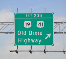
An exit sign on I-75 south of Hartsfield-Jackson Atlanta International Airport is one of the few remaining markers of old Dixie Highway routes in Georgia.
Courtesy of Edwin L. Jackson
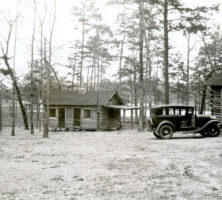
A tourist lodge in Calhoun is pictured circa 1925. Entrepreneurs developed rustic lodges, inns, and courts for Dixie Highway tourists. The early lodges were primitive, often without heat, running water, or a private bathroom. By the early 1930s motels dotted the Dixie Highway, spelling the beginning of the end for small-town hotels.
Courtesy of Edwin L. Jackson
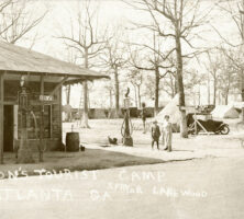
Wilson's Tourist Camp, which was located along the Dixie Higway in Lakewood, south of Atlanta, is pictured circa 1925.
Courtesy of Edwin L. Jackson
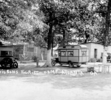
A section of Wilson's Tourist Camp, pictured circa 1925, was reserved for early motor homes. The camp was located along the Dixie Highway in Lakewood, south of Atlanta.
Courtesy of Edwin L. Jackson
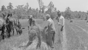
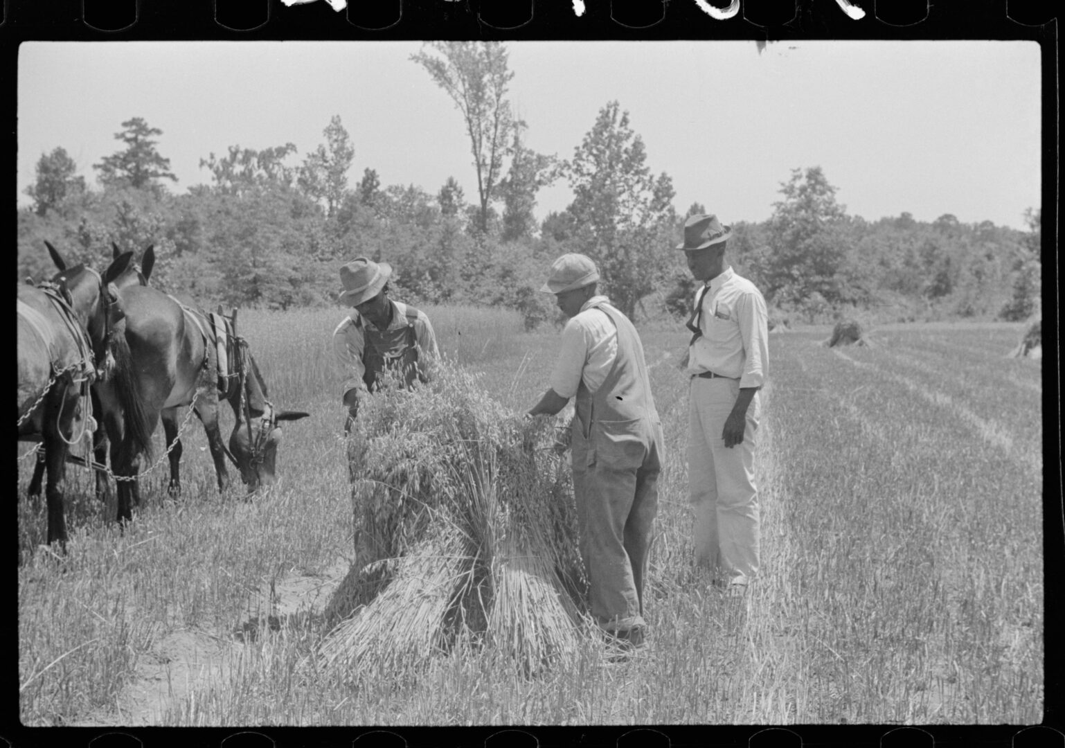
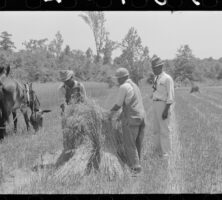
Alonzo Fields (far right), the farm supervisor at the Flint River Farms Resettlement Community in Macon County, directs the harvesting of oats in 1939. Flint River Farms was an experimental planned community established in 1937 for African American sharecroppers.
Courtesy of Library of Congress, Prints and Photographs Division, Farm Security Administration - Office of War Information Photograph Collection, #LC-USF33- 030402-M1 [P&P].
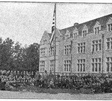
The school building at the Flint River Farms Resettlement Community, an experimental farm established in Macon County for African American sharecroppers, included a schoolhouse, teacher's residence, and related buildings.
Courtesy of Library of Congress, Prints and Photographs Division
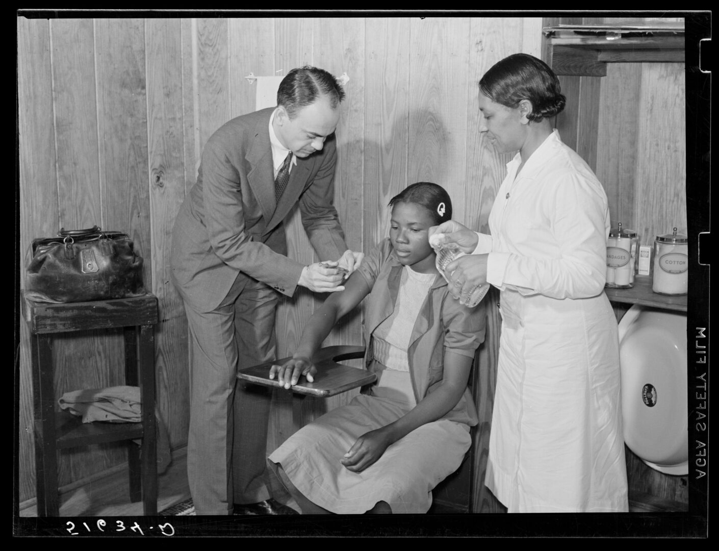
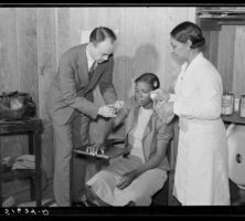
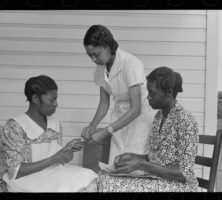
Dr. Thomas M. Adams and project nurse Lillie Mae McCormick, pictured in 1937, administer a typhoid shot in the health clinic at the Flint River Farms Resettlement Community in Macon County.
Courtesy of Library of Congress, Prints and Photographs Division, Farm Security Administration - Office of War Information Photograph Collection, #LC-USF34- 051634-D [P&P] LOT 1541.
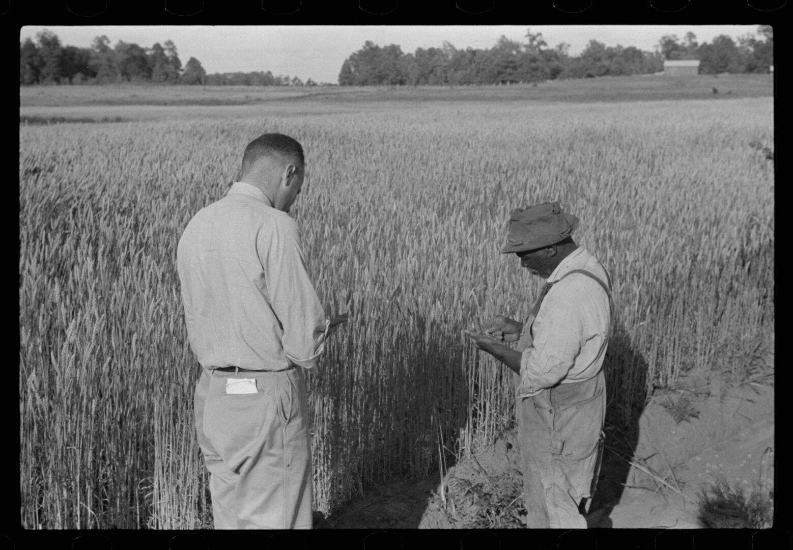
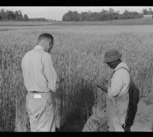
Project manager Amos Ward (left?) and Farm Security Administration borrower Simon Joiner inspect wheat in 1939 at the Flint River Farms Resettlement Community in Macon County. A variety of crops, including wheat, oats, cotton, pecans, and peaches were grown at the farms.
Courtesy of Library of Congress, Prints and Photographs Division, Farm Security Administration - Office of War Information Photograph Collection, #LC-USF33- 030398-M4 [P&P] LOT 1541.
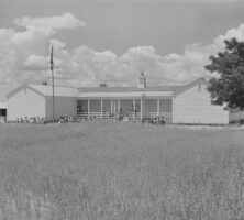
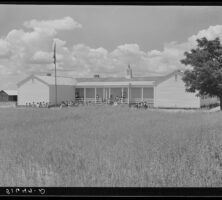
Students, pictured in 1939, gather outside the schoolhouse at the Flint River Farms Resettlement Community in Macon County. A field of oats grows in front of the school.
Courtesy of Library of Congress, Prints and Photographs Division, Farm Security Administration - Office of War Information Photograph Collection, #LC-USF34- 051647-D [P&P] LOT 1541.
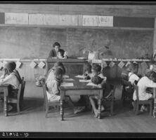
A classroom of first graders is pictured in 1939 at the Flint River Farms Resettlement Community in Macon County. The school opened to elementary-age children in 1938, and by 1946 it offered classes in all twelve grades.
Courtesy of Library of Congress, Prints and Photographs Division, Farm Security Administration - Office of War Information Photograph Collection, #LC-USF34- 051617-D [P&P] LOT 1541.
Evelyn M. Driver (center) instructs students in home economics and management in 1939 at the Flint River Farms Resettlement Community in Macon County.
Courtesy of Library of Congress, Prints and Photographs Division, Farm Security Administration - Office of War Information Photograph Collection, #LC-USF33- 030379-M3 [P&P] LOT 1541.