The New Georgia Encyclopedia is supported by funding from A More Perfect Union, a special initiative of the National Endowment for the Humanities.
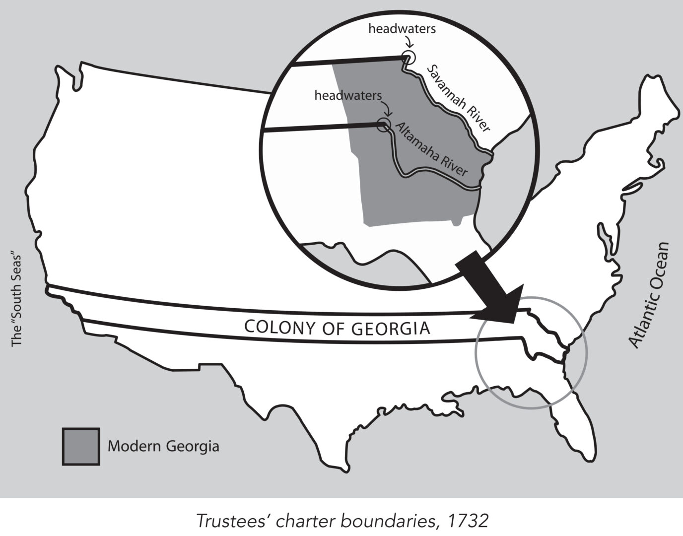
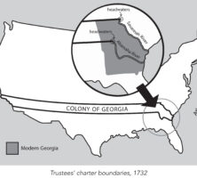
King George II granted James Oglethorpe and the Trustees a charter in 1732 to establish the colony of Georgia. This charter provided, among other things, that the new colony would consist of all the land between the headwaters of the Savannah and the Altamaha rivers, with its eastern boundary formed by the Atlantic Ocean and its western boundary by the "south seas," a reference to the Pacific Ocean.
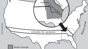
Map by John Nelson. Reprinted by permission of William J. Morton
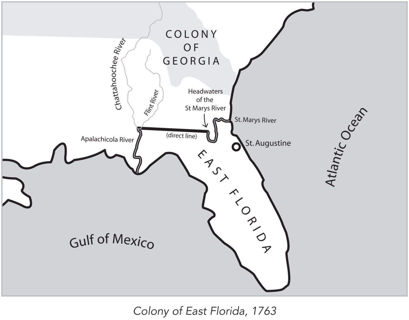
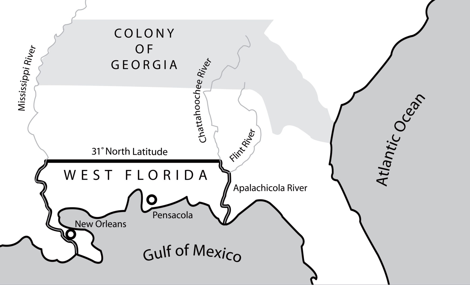
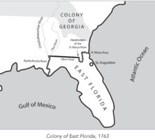
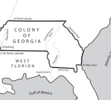
In 1763 the British divided what had been Spanish Florida into the two new colonies of West Florida and East Florida, with the Apalachicola River serving as the dividing line between them. East Florida was all the land east of the Apalachicola River, with St. Augustine as its capital.
Map by John Nelson. Reprinted by permission of William J. Morton
In 1763 the British divided what had been Spanish Florida into the two new colonies of West Florida and East Florida, with the Apalachicola River serving as the dividing line between them. West Florida, with Pensacola as its capital, extended west to the Mississippi River.
Map by John Nelson. Reprinted by permission of William J. Morton
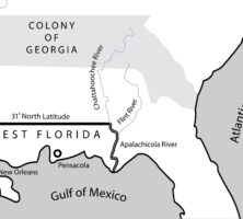
The appointment of James Wright in 1760 as governor of Georgia coincided with a period of expansion. By 1764 the boundaries of the colony had expanded to include those territories between the Mississippi and Chattahoochee rivers that had not been granted to the Florida colonies.
Map by John Nelson. Reprinted by permission of William J. Morton
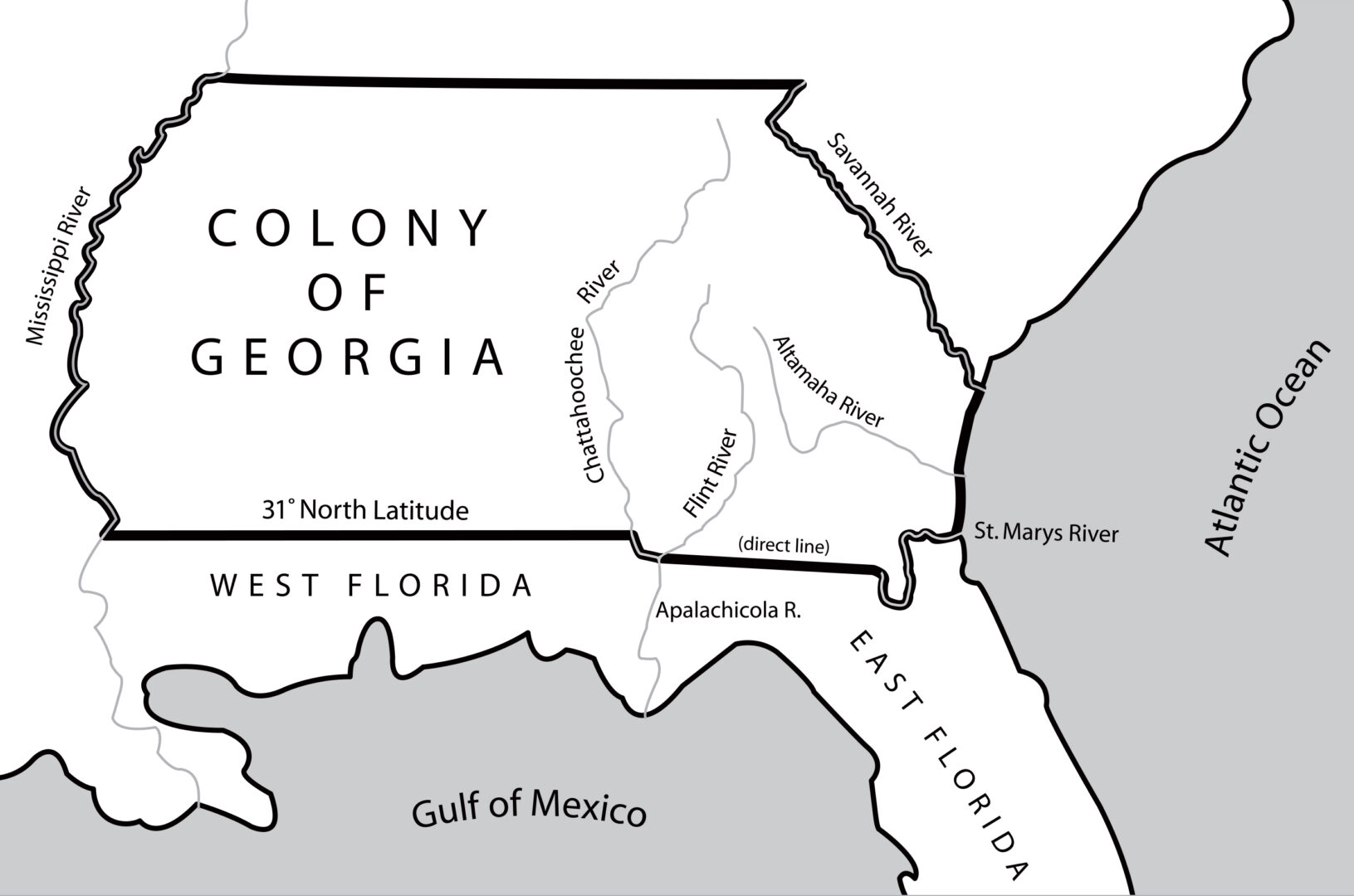
In 1767 the governor of West Florida received permission from the king of England to advance the colony's northern border along the Mississippi and Chattahoochee rivers, where royal trading posts were located. Georgia's land holdings significantly decreased as a result.
Map by John Nelson. Reprinted by permission of William J. Morton
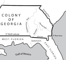
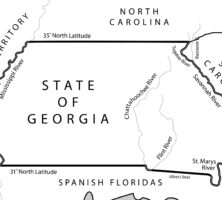
The 1783 Treaty of Paris, which ended the Revolutionary War (1775-83), fixed the 31st latitude north as the southern boundary of the new United States. The line extended from the Mississippi River eastward to the Chattahoochee River, moved down that river to its junction with the Flint River, and then followed a direct line east to the headwaters of the St. Marys River.
Map by John Nelson. Reprinted by permission of William J. Morton
The Orr-Whitner line was accepted by Florida in 1861 and Georgia in 1866 as their official boundary, although the outbreak of the Civil War (1861-65) delayed the line's approval by the U.S. Congress until 1872.
Map by John Nelson. Reprinted by permission of William J. Morton
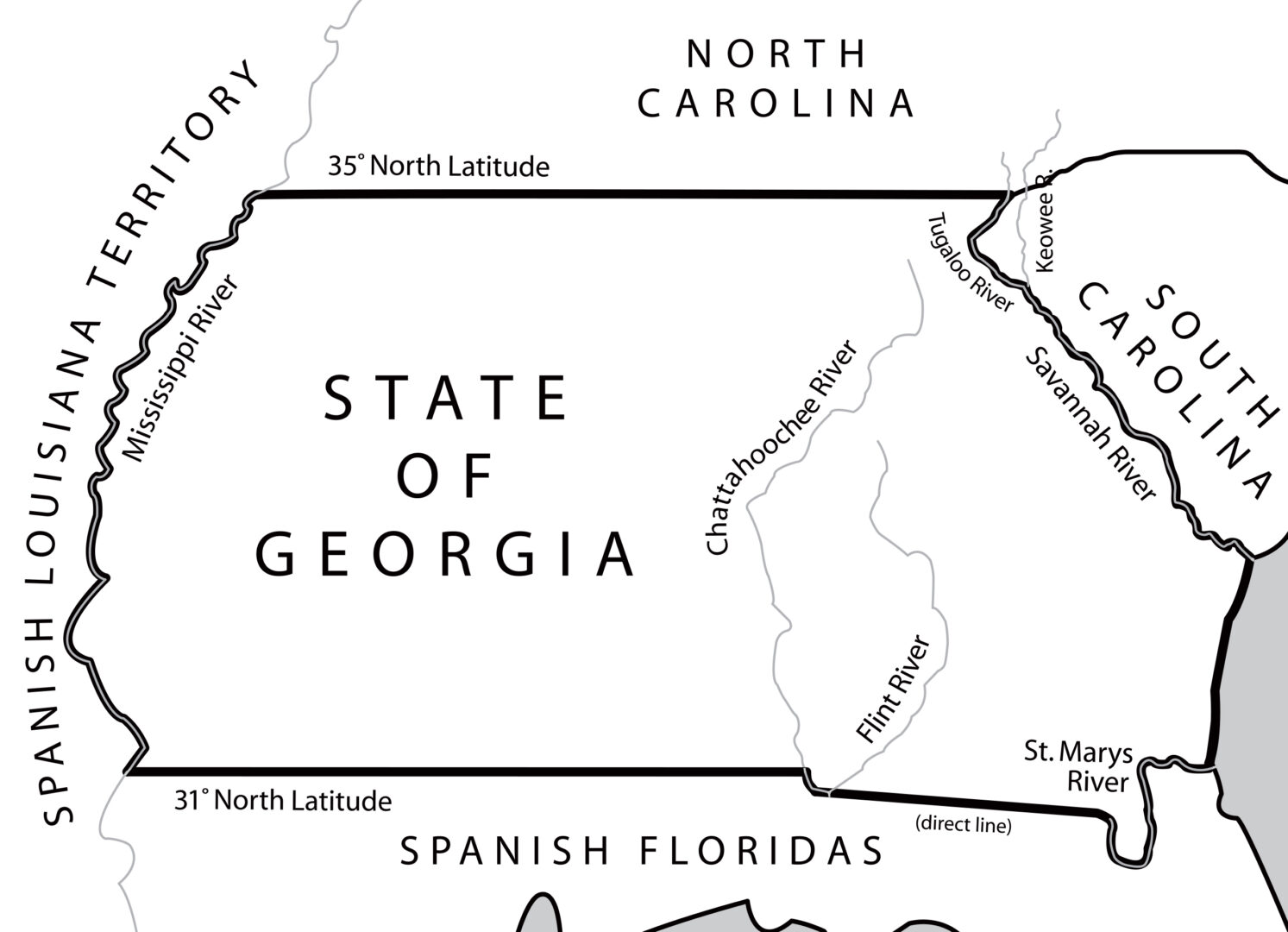
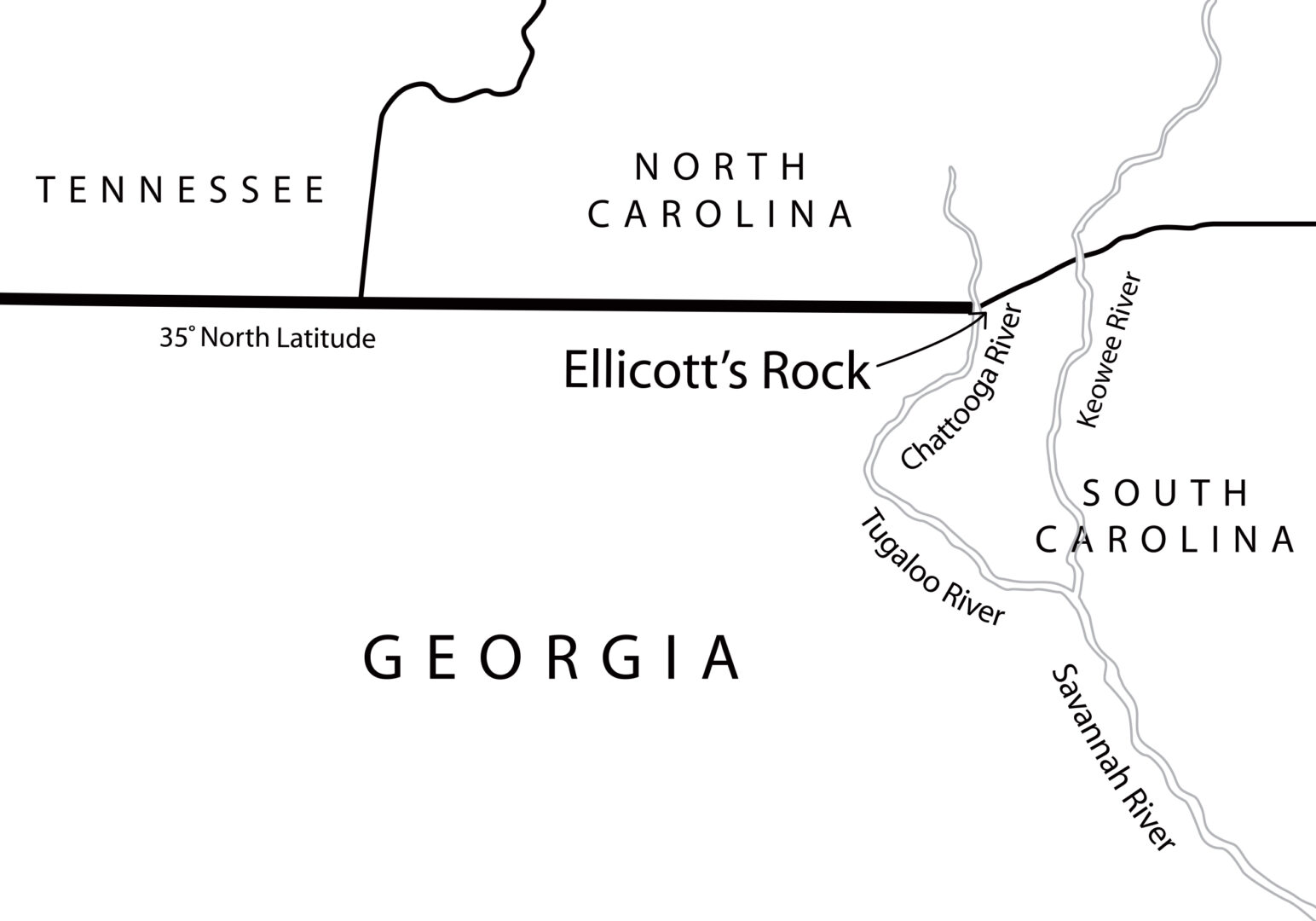
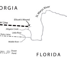
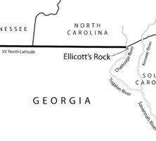
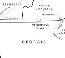
In 1811 Georgia hired Andrew Ellicott to survey and mark the location of the 35th latitude north, which formed the boundary between Georgia and North Carolina. In an 1812 letter to North Carolina governor William Hawkins, Ellicott states: "In the parallel of 35 degree N. latitude, on the west side of the Chatoga river, a stone is set up marked on the South side (G. lat 35 N.) and on the north side, (N.C.) for North Carolina." This map locates what is currently and erroneously called Ellicott's Rock on the east side of the Chattooga River.
Map by John Nelson. Reprinted by permission of William J. Morton
This map shows the surveyed line as marked by James Camak, which set Georgia's northern boundary line south of the 35th latitude north, including the offset known as Montgomery's Corner.
Map by John Nelson. Reprinted by permission of William J. Morton
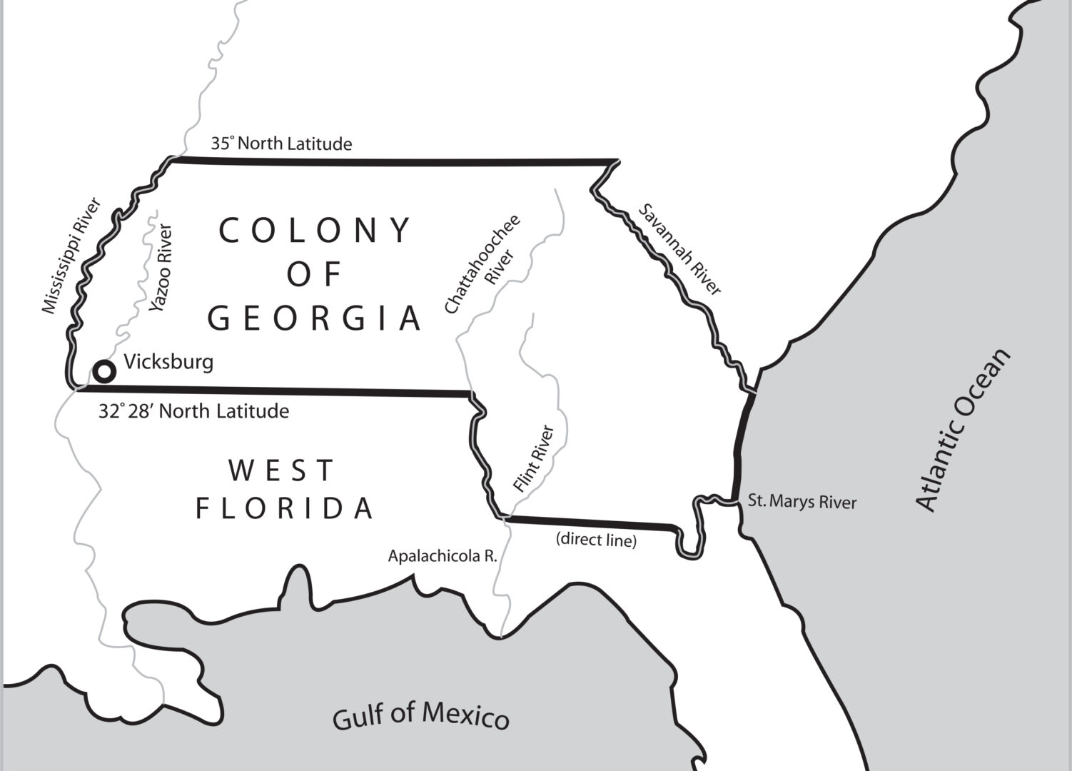
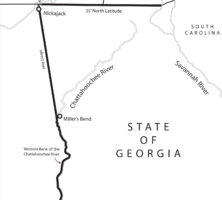
Following the 1802 Article of Agreement and Cession, Georgia's new western boundary began with the juncture of the Chattahoochee and Flint rivers in southwest Georgia and proceeded north to the great bend of the river (at present-day West Point, Georgia). From there it stretched for 160 miles to the Indian village of Nickajack on the Tennessee River and continued from there up to the 35th latitude north.
Map by John Nelson. Reprinted by permission of William J. Morton
Austin Dabney, an enslaved Georgian, earned freedom in exchange for his service in the patriot army. Dabney was banned from participating in the land lottery open to Revolutionary War veterans in 1819, but the legislature granted him acreage in Washington County in 1821.
From The Black Presence in the Era of the American Revolution, by S. Kaplan and E. N. Kaplan
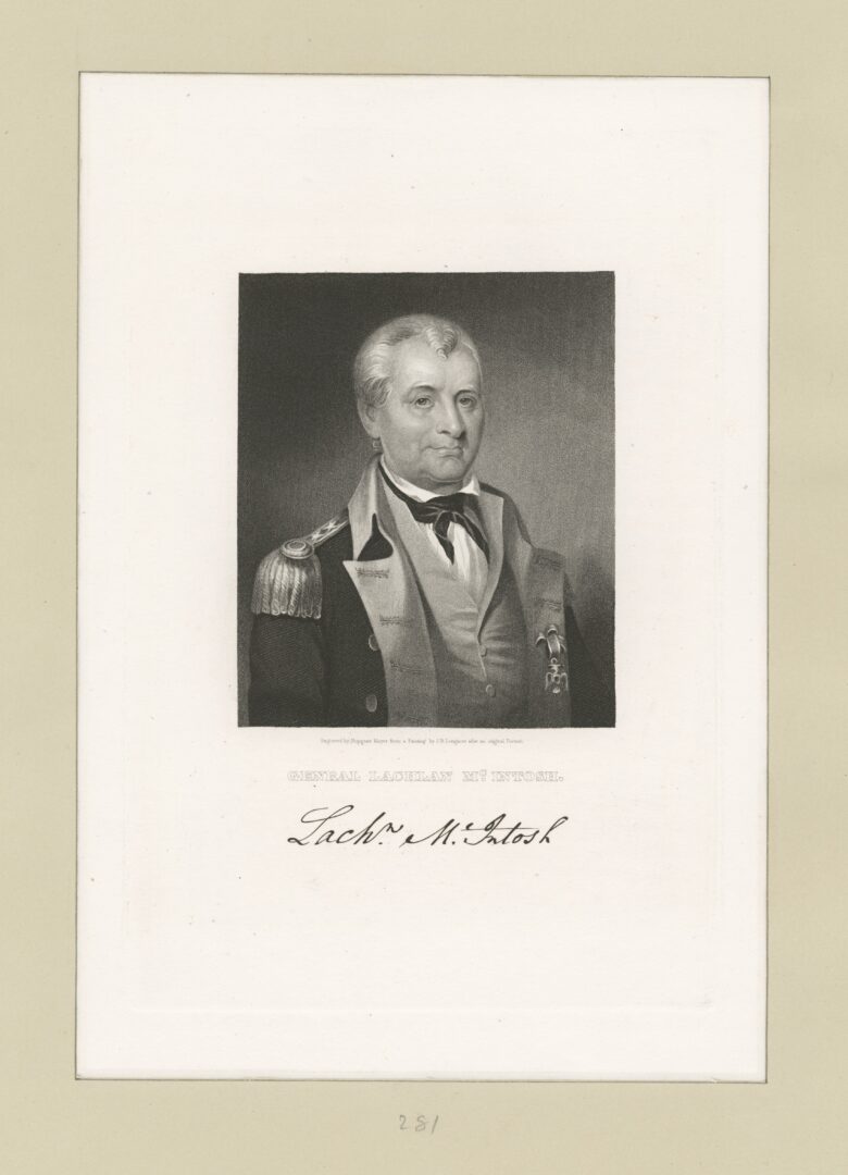
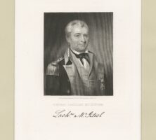
Colonel Lachlan McIntosh, a Scottish immigrant, served as a military and political leader in revolutionary Georgia. He defended Savannah from the British during the Battle of the Rice Boats on March 2-3, 1776, and later served with General George Washington at Valley Forge, Pennsylvania, in 1778.
Image from the New York Public Library Digital Collections, The Miriam and Ira D. Wallach Division of Art, Prints and Photographs: Print Collection.
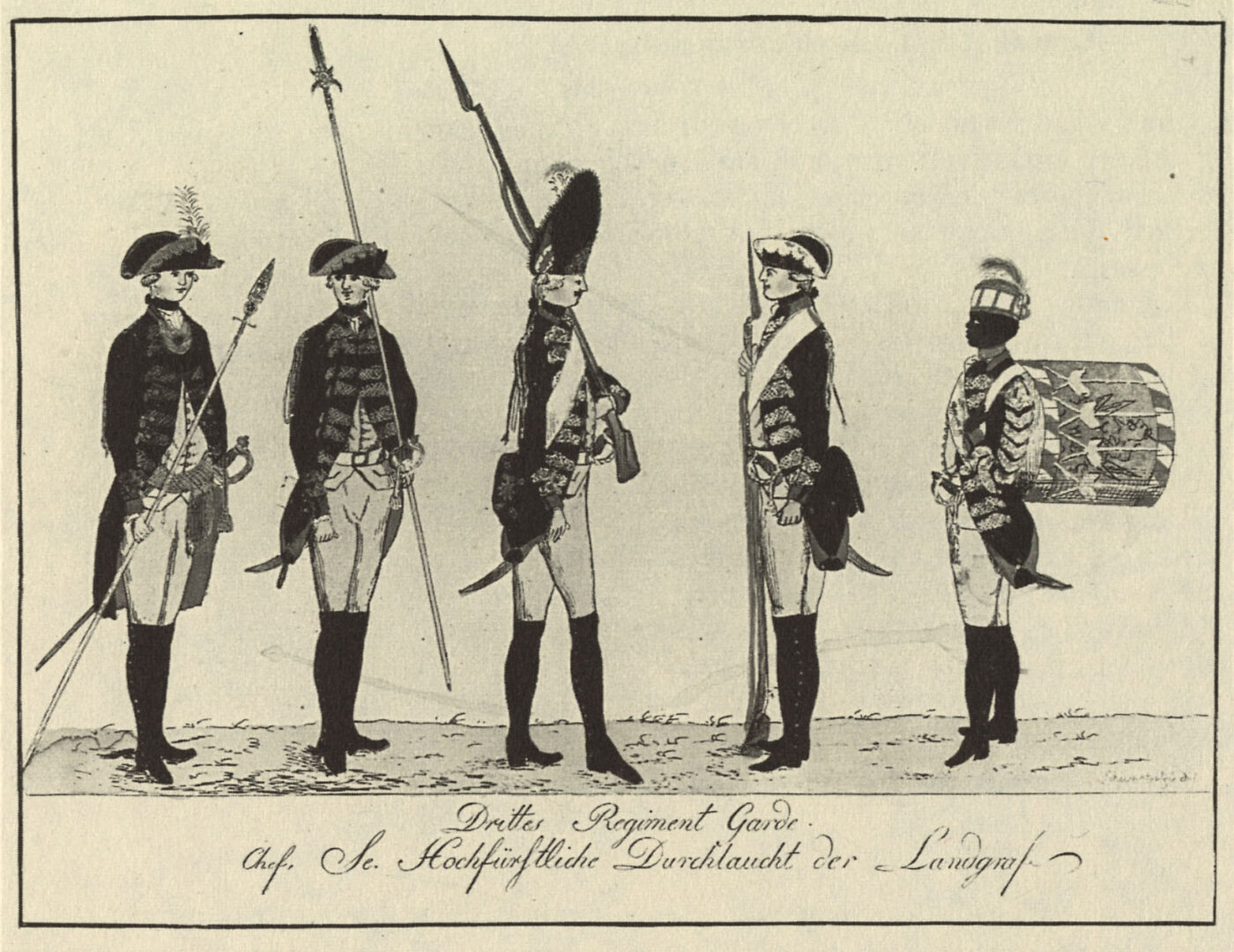
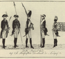
This depiction of the Hessian Third Guard Regiment was engraved by J. C. Muller after a drawing by J. H. Carl, circa 1784. American soldiers during the Revolutionary War occasionally fought against Black Georgians, recruited by the British and their allies in exchange for freedom. The active participation of these Black residents contributed to the British success during the Siege of Savannah.
From The Black Presence in the Era of the American Revolution, by S. K. and E. N. Kaplan
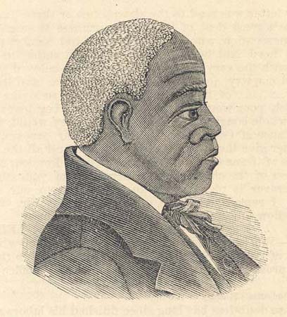
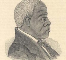
Andrew Bryan, born enslaved in 1737, was a founder and leader of First African Baptist Church in Savannah along with his brother Sampson. The congregation grew and established two satellite churches after 1800, despite opposition and threats of violence from the white community. This sketch of Bryan appeared in Savannah's Morning News Print in 1888.
Reprinted by permission of the University Library, University of North Carolina