Montgomery County, in east central Georgia, is the state’s twentieth county. It was created from part of Washington County in 1793 and received additional land from Telfair County in 1812.
The county is named for Richard Montgomery, a brigadier general in the Continental army who was killed leading an assault against Quebec in 1775. In 1877 a portion of the county was returned to Telfair, and more of the county’s land later went to the creation of Dodge (1870), Emanuel (1812), Tattnall (1801), Toombs (1905), Treutlen (1918), and Wheeler (1912) counties, leaving Montgomery County with its current 245 square miles.
The area was originally inhabited by Indians of the Lower Creek Nation. Many of the first white settlers were veterans of the American Revolution (1775-83) and came to the region from North Carolina very soon after the war ended. These settlers were attracted to the area for its wiregrass, which was adaptable to the needs of grazing cattle, and for its pine forests. Newcomers acquired land through the headright system, which technically limited each family to 1,000 acres but was loosely enforced, allowing some to acquire huge tracts of land.

Land speculators sometimes acquired acreage in the territory called the Pine Barrens, which consisted of land that was unsuitable for farming. In partnership with some state and local officials, the speculators then conducted fraudulent schemes to attract northern buyers, such as advertising the barrens as rich land good for raising cotton or advertising nonexistent plots. One such scheme, the Pine Barren Speculation, rivaled the infamous Yazoo Land Fraud in the magnitude of its deception.
Montgomery County began as a rural county in which inhabitants raised a variety of crops to sustain themselves. They also harvested timber for cash, using local waterways to float the logs to Darien for market. Most people lived in isolated locations because of the difficulty of building roads in the region. The development of towns did not occur until after the Civil War (1861-65), when the wiregrass region was opened up by the arrival of railroads. Large logging companies encouraged this development.

Population in the county grew steadily after the war, partly due to enhanced transportation and partly due to the production of chemical fertilizers, which made previously barren soil attractive for those who desired to go into truck farming. Property values doubled between 1870 and 1900, and the population grew from 3,586 to 16,359. Many of the new residents were African Americans. Among the signals of the county’s growth was an active bid in 1904 by several of its communities to become the home of a new college, the Union Baptist Institute. The towns of Mount Vernon and Ailey were chosen to share the school, which became Brewton-Parker College.
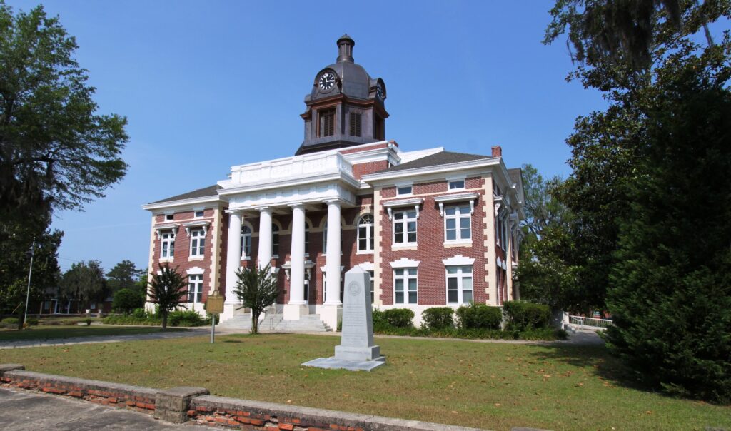
The county seat is Mount Vernon, which was settled in 1795. It was designated the county seat in 1813 but not incorporated until 1872. Initially court was held in the residence of William Neal. His home also functioned as the jail. In 1797 these functions were moved to Arthur Lott’s plantation. When Mount Vernon was chosen as county seat, it is probable that a wooden frame building was constructed specifically for the court and other official business. Erection of a jail was authorized in 1838, and legislative authorization for the repair of a courthouse was enacted. The current courthouse, built in 1907 and renovated and restored in 1991-92, was placed on the National Register of Historic Places in 1980.

Other incorporated towns in Montgomery County include Ailey, Alston, Higgston, Tarrytown, and Uvalda. The county maintains a chiefly rural nature, however, with more than half of its land devoted to farming.
According to the 2020 U.S. census, the population of Montgomery County was 8,610.


