Soils, which are composed of minerals, organic material, water, and air, serve as the foundation for terrestrial ecosystems. The rates at which nitrogen, phosphorus, and other nutrients are released into the soil and transported to plants drive several major processes within an ecosystem, including respiration, nutrient recycling, and the production of plants, animals, and microbes.
Types by Geographic Region
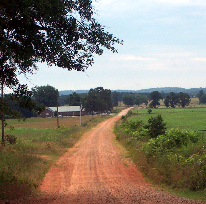
Soils are relatively thin zones (less than one meter or one yard in depth) formed by the physical-chemical and biological weathering of the earth’s land surface. Soil types are influenced by many factors, including climate, parent material, the extent of the topography’s slope and aspect (or relief), and the presence of organisms. Such major ecosystem processes as plant growth, decomposition, and nutrient recycling further contribute to the development of unique soil types in each of the state’s geographic regions.
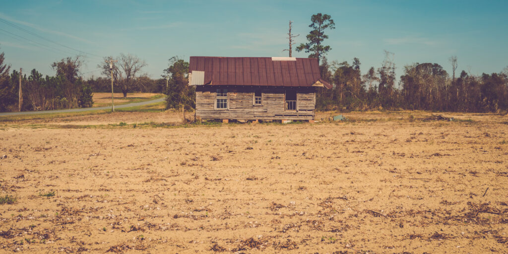
Image from Lee Coursey
Appalachian Plateau
The soils of the Appalachian Plateau are generally thin and acidic, making them unsuited for farming.
Valley and Ridge
Separated from the Blue Ridge Mountains and the Piedmont regions by the Cartersville Fault, this region’s “valleys and ridges” are the product of alternating hard and soft rock. Harder sandstone and chert makes up the ridges, and softer limestone, shale, and other sedimentary deposits make up the valleys, which were formed by eroding wind and rain. The lowland soils, coupled with the streams that run along the valleys, are more supportive of agricultural activity. The highland soils, on the other hand, are thinner and more acidic, similar to the neighboring Appalachian Plateau.
Blue Ridge Mountains
The soils of the Blue Ridge Mountains support a rich ecosystem of diverse plants and animals. The soil is loamy, a mixture of clay, silt, and sand. It is acidic, well drained, and brown in color. The region is primarily composed of low- to high-grade metamorphic rock.
Piedmont
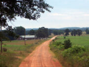
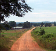
Clays and sometimes granite are prominent features across the Piedmont. (The region is home to Stone Mountain, the largest exposed mass of granite in the world.) Georgia’s famous “red clay” is the result of long-term weathering processes that leave behind iron oxides, which give the soil its distinctive color. The red clay’s mixture of silicon, aluminum, and other elements, including iron oxides, is called saprolite, which erodes easily when trees and other vegetation are removed. The more rugged topography of the northern Piedmont results in a thinner soil, while a more nutrient-rich soil, better suited for growing crops, occurs in the region’s southern portion.
Photograph from Elizabeth Prata
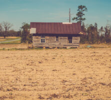
Coastal Plain
Separated from the Piedmont by the fall line, an ancient coastline of the Mesozoic Era, the Coastal Plain includes a wide variety of soil types, including red clay, sands, and gravels deposited at various points in its marine geologic history. The Coastal Plain’s porous limestone soils are a part of the Floridian Aquifer, which holds rainwater underground that can be used for drinking and agriculture. The Floridian aquifer is one of the largest sources of freshwater east of the Mississippi River. The agricultural soil found on the Upper Coastal Plain, from which most of the plant material is regularly harvested, contains less organic matter than the soil in a Piedmont forest. The Lower Coastal Plain features the sandy and nutrient-poor soils of the state’s coastal islands and Okefenokee Swamp.
Role in the Ecosystem
Living entities in the soil, including microbes, microbe-feeding fauna, and vegetation, are influenced by soil processes, and these organisms in turn have an impact on the soil system. Maintaining a good soil cover in forests and croplands facilitates the retention of organic matter and the cycling of nutrients within the ecosystem. These activities occur through the process of decomposition, which drives complex food webs in the soil. Decomposition begins when dead organic litter, representing 80 to 90 percent of the new plant growth previously produced by an ecosystem, is returned to the soil. The litter, consisting of leaves, roots, and wood from trees, as well as organic residues from agricultural fields, is decomposed on or in the soil, and the nutrients contained within it are recycled for use by living plants.
The breakdown of organic litter begins with the chewing action of both large and small animals, which derive nutrients from the plant material, and continues as the organic compounds within these smaller pieces are broken down by the activities of bacteria, fungi, and other fauna. Throughout this process numerous interactions occur between bacteria and fungi, and the fauna that in turn feed upon them.
Soils provide a wide range and variety of microhabitats accommodating diverse flora and fauna. An enormous amount of surface area (hundreds of square meters per gram of soil) exists on the soil particles, which range in size, from small to large in diameter, as sands (0.05-2 micrometer), clays (0.1-2 micrometer), and silts (2-50 micrometer). Numerous microbes, protozoa, and nematodes live in water films on these particles, while the more-mobile fauna, from collembola and mites to such macrofauna as earthworms, millipedes, ants, termites, and moles, move through pores and create burrows in the soil. Because of their role in moving the soil around, macrofauna are often called ecological engineers.
Human Impact
Much of the early history of Georgia and other eastern states consists of the successive clearing and conversion of forests to croplands, followed by continual agricultural use of the land. Such activities led to the extensive erosion of upland areas in Georgia’s Piedmont, with the top foot or more of soil disappearing over several decades. Many of the streams in the Piedmont and Coastal Plain were clear before Europeans settled there but were steadily eroded when settlers began cultivating crops in the late eighteenth and early nineteenth centuries. Many of the cropland soils farmed today, when compared with the soils as they existed before colonization, are depleted in organic matter.
A map of principal land-use types in Georgia, created at Iowa State University in Ames, shows agricultural land (including cropland and pastureland), as well as deciduous, coniferous, and mixed-species forests. Relatively high amounts of organic matter per unit area exist in the very wet soils of the Lower Coastal Plain and estuaries, and the largest amounts are found in the Okefenokee Swamp, on the Florida border. Low levels of organic matter predominate around urban areas, particularly in the Atlanta metropolitan area. Fortunately, because of several developments in Georgia, including the extensive conversion of cropland into forest, conservation tillage in croplands, and the Conservation Reserve Program, organic matter is now increasing in the soils of many areas of Georgia.