The New Georgia Encyclopedia is supported by funding from A More Perfect Union, a special initiative of the National Endowment for the Humanities.
The east wall trench of Fort Daniel, constructed in Gwinnett County in 1814, was discovered by researchers with the Gwinnett Archaeological Research Society in 2009. Other intact buried features at the site include the entire stockade wall trench and evidence of two corner blockhouses.
Courtesy of The Fort Daniel Foundation, Inc.
U.S. secretary of war Henry Knox sent this sketch of a proposed frontier fort to Georgia governor George Mathews in 1794. The drawing closely resembles the archaeological remains at the site of Fort Daniel, a stockade constructed in 1814 at Hog Mountain, in Gwinnett County.
Courtesy of James D'Angelo
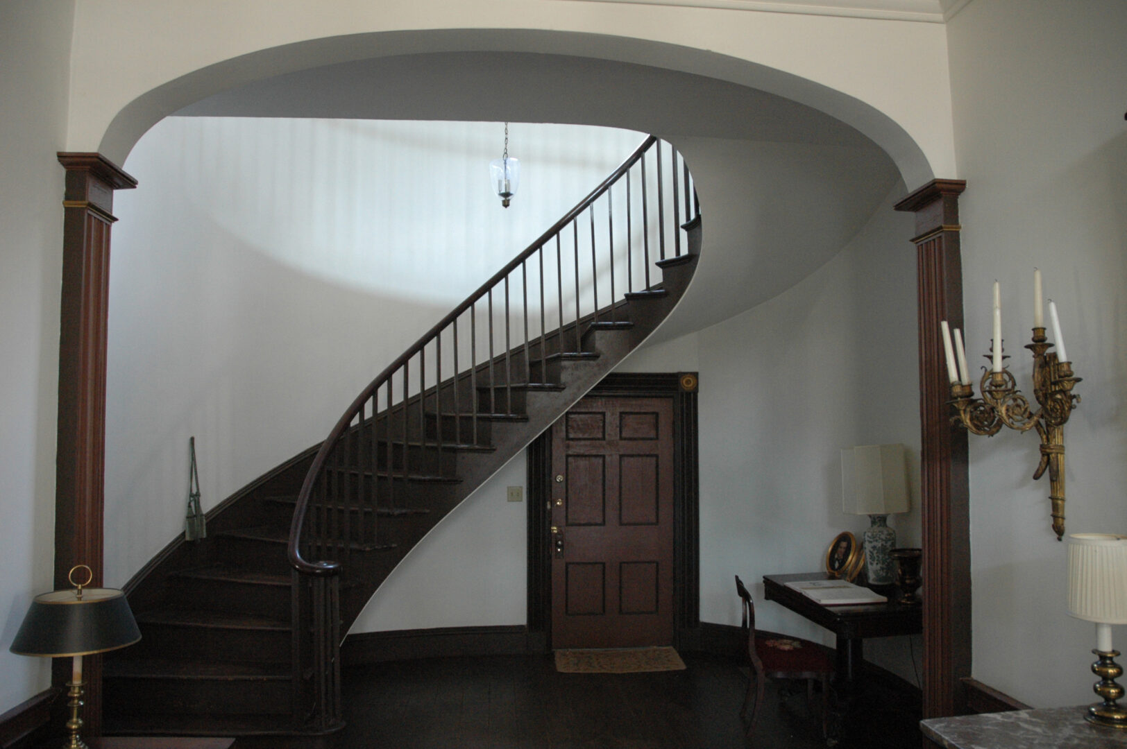
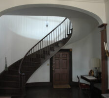
The building that housed the State's Rights Hotel in Milledgeville was designed in the Federal style by John Marlor and completed in 1825. The structure was probably used as a tavern until 1837, when the building was sold. The hotel opened about two years later and became a center of political activity for several years.
Courtesy of Georgia's Old Capital Museum
The Brown-Stetson-Sanford House in Milledgeville, the former home of the State's Rights Hotel, was moved from its original location on North Wilkinson Street to West Hancock Street in 1966. Today the home, pictured in 2006, houses a museum and civic center operated by the Old Capital Museum.
Courtesy of Georgia's Old Capital Museum
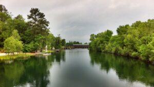
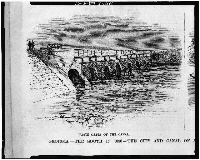
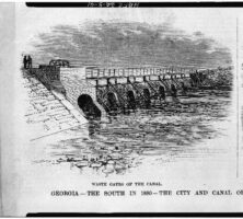
This sketch of the Augusta Canal, a project championed and partially funded by Augusta attorney Henry Cumming, was made in 1880.
Courtesy of Library of Congress, Prints and Photographs Division
Built in 1845 by Henry Cumming, the Augusta canal is seven miles long, extending from above the rapids of the Savannah River to the heart of Augusta. In 1996 the canal was designated a National Heritage Area, the first site in Georgia to receive this designation.
Image from TranceMist
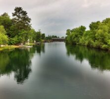
Preservationists in Georgia are working to conserve both the Savannah-Ogeechee Canal and the Augusta Canal. The Augusta Canal was named a National Heritage Area in 1996.
Courtesy of Explore Georgia, Photograph by Ralph Daniel.
The Augusta Canal, designed to generate waterpower for manufacturing as Georgia entrepreneurs attempted to diversify the state's economy, was the last canal built in Georgia and by far the most successful. Construction on the canal started in 1844, and the canal became operational in 1846.
Courtesy of Explore Georgia, Photograph by Ralph Daniel.
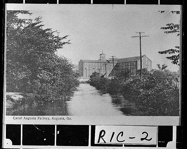
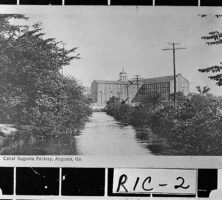
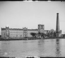
The Augusta Factory, a cotton mill, was powered by the Augusta Canal during the 1890s. The factory was built in 1847 and demolished in 1960.
Courtesy of Georgia Archives, Vanishing Georgia, #
ric002.
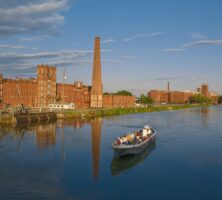
The Confederate Powder Works in Augusta sits along the Augusta Canal. The canal, which opened in 1846, provided transportation and waterpower during the Civil War for the powder works, as well as for a Confederate firearms plant, ordnance foundry, and bakery.
Courtesy of Library of Congress, Prints and Photographs Division
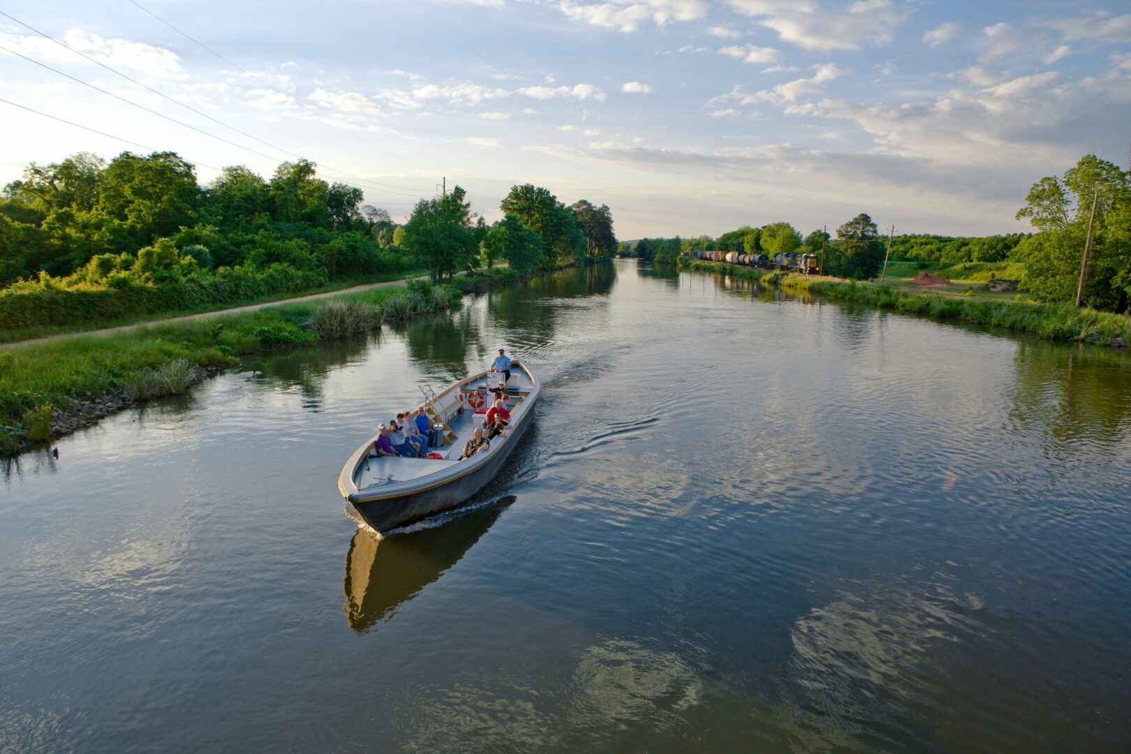
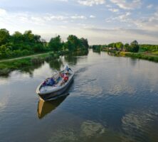
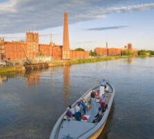
A modern tourboat passes the Confederate Powder Works chimney in Augusta along the Augusta Canal. The Georgia Community Greenspace Program has worked to preserve the Augusta Canal as an important historic and archaeological site.
Courtesy of Explore Georgia, Photograph by Ralph Daniel.
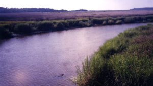
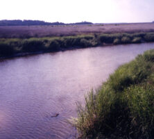
Ebos Landing is a bend in Dunbar Creek on St. Simons Island. Although conflicting accounts of the "Myth of the Flying Africans" exist, many locals designate this spot as the site from which a boatload of enslaved West Africans either flew away or drowned themselves during an 1803 rebellion.
Photograph by Elisabeth Hughes, New Georgia Encyclopedia
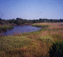
Ebos Landing, pictured in 2004, was the site of an 1803 slave rebellion, during which a group of Ebo Africans drowned themselves rather than submit to slavery.
Photograph by Elisabeth Hughes, New Georgia Encyclopedia
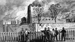
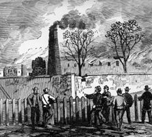
The Georgia penitentiary in Milledgeville burning in 1864. The illustration appeared in Frank Leslie's Illustrated Newspaper, on January 14, 1865.
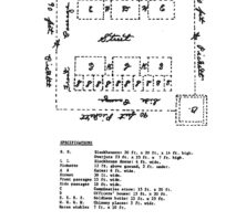
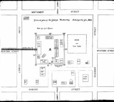
Layout of the Georgia penitentiary in Milledgeville, circa 1860.
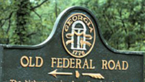
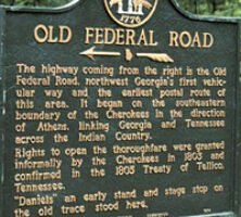
The highway coming from the right is the Old Federal Road, northwest Georgia's first vehicular way and the earliest postal route of this area. It began on the southeastern boundary of the Cherokees in the direction of Athens, linking Georgia and Tennessee across the Indian Country. Rights to open the thoroughfare were granted informally by the Cherokees in 1803 and confirmed in the 1805 Treaty of Tellico, Tennessee. 'Daniels,' an early stand and stage stop, on the old trace stood here.
Courtesy of Georgia Info, Digital Library of Georgia.
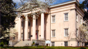
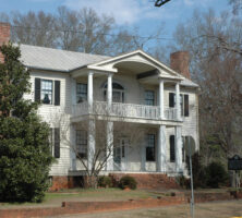
The Old Governor's Mansion is located in Milledgeville, the state's capital from 1807 to 1868. Construction on the mansion began in 1836 and was completed in 1838 or 1839. It is considered one of the finest examples of Greek revival style in the nation.
Courtesy of Georgia College and State University
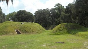
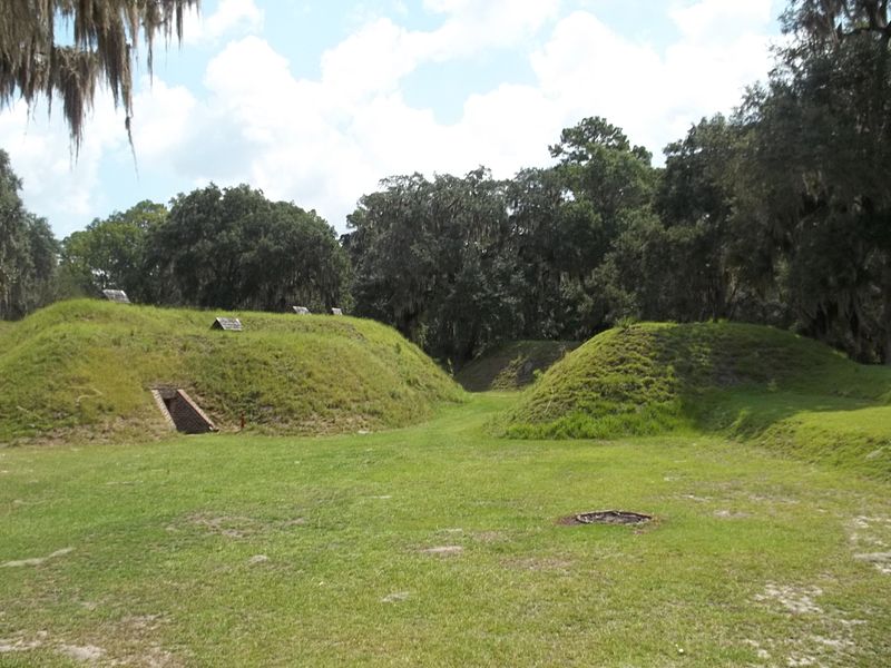
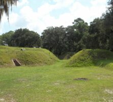
Present-day view of Fort McAllister State Historic Park, in Bryan County.
Photograph by Wikimedia
Fort McAllister, a Confederate earthwork fortification near the mouth of the Ogeechee River, was designed by military engineers to absorb considerable punishment from Union bombardment. The fort was built chiefly for defense against naval attacks.
Photograph from Wikimedia
During 1862 and 1863, Fort McAllister repelled seven Union naval attacks. Fort McAllister never fell to Union naval forces because of its unique earthen construction. In 1864 Union general William T. Sherman's army captured the fort from the landward side.
Photograph from Wikimedia
A Union land assault on December 13, 1864, overwhelmed the heavily outnumbered Confederate defenders in a brief, but very intense, battle. Fort McAllister is now maintained by the Georgia Department of Natural Resources as a state historic park.
Courtesy of Library of Congress, Prints & Photographs Division, Civil War Photographs collection, #LC-B8184-3287.
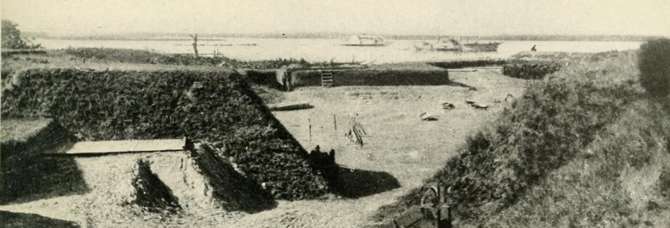
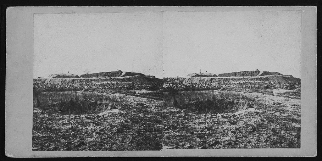
Fort McAllister earthworks and abatis from the Civil War, ca. 1864.
Courtesy of Library of Congress, Prints and Photographs Division
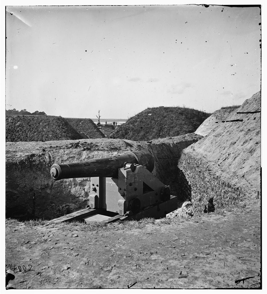
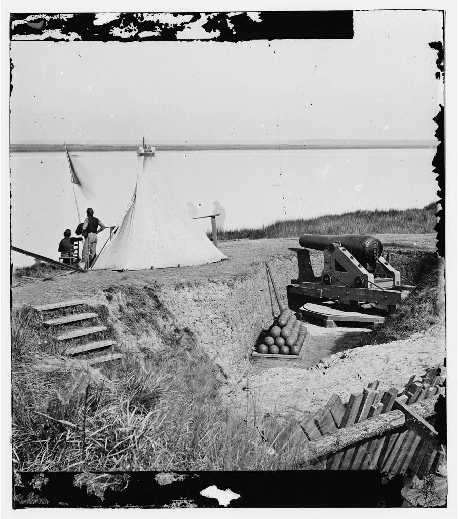
A signal station on the Ogeechee River, at Fort McAllister. After General William T. Sherman's Union troops occupied Fort McAllister on December 13, 1864, personnel were ordered to dismantle the stronghold in preparation for Sherman's march northward.
Courtesy of Library of Congress, Prints and Photographs Division
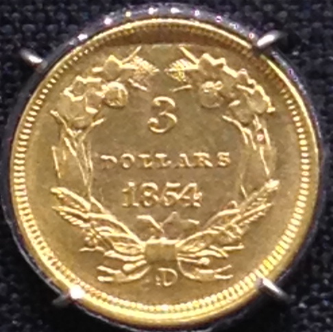
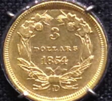
Coins minted in Dahlonega were of high quality and are still prized by coin collectors. Mint officers preferred making the larger and easier-to-coin half eagles, but they also produced quarter eagles, gold dollars, and for one year, three-dollar gold pieces.
Photograph from Wikimedia
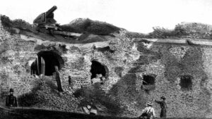
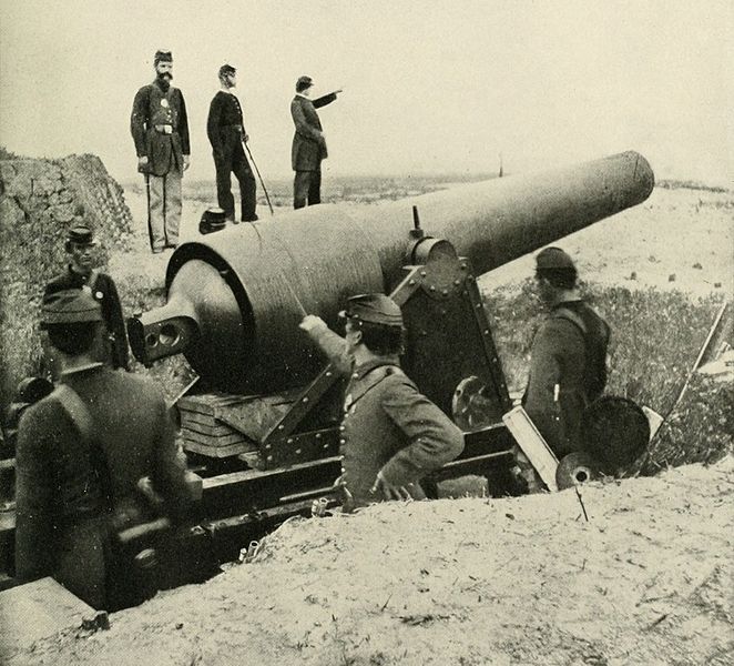
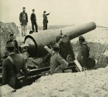
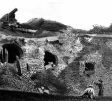
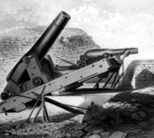
On April 11, 1862, the Union bombardment opened two thirty-foot holes in the southeast face of Fort Pulaski. In less than thirty-six hours the Union's new rifled cannon had brought the surrender of a fort that took eighteen years to build.
Courtesy of Georgia Historical Society.
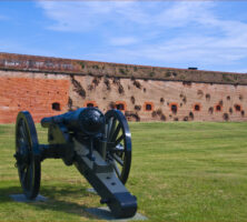
Fort Pulaski, situated on Cockspur Island at the mouth of the Savannah River, was built in the 1830s and 1840s to defend Savannah. During the Civil War, Union forces captured the fort on April 11, 1862, and controlled it for the remainder of the war.
Photograph by Brooke Novak
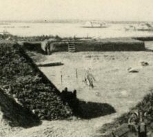
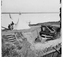
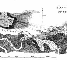
Union captain Quincy Gillmore of the Engineer Corps, in charge of preparing the siege on Fort Pulaski, ordered his engineers to construct a series of eleven artillery batteries along the north shore of Tybee Island.
Courtesy of Georgia Historical Society.
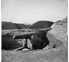
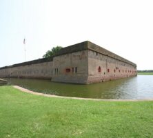
Fort Pulaski, completed in 1847, could mount 146 cannons, some on the parapet atop the seven-and-a-half-foot-wide walls and others in casemates inside the walls. The fort is positioned at the mouth of the Savannah River, across from Tybee Island.
Courtesy of Georgia Historical Society.
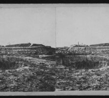
The Union attack on Fort Pulaski began at 8:15 a.m. on April 10, 1862. The Union guns maintained a slow, steady fire all day, and by afternoon it became apparent that the heavy shells from the rifled cannons would be able to break through the walls of Fort Pulaski.
Courtesy of Georgia Historical Society.
The government designated Fort Pulaski a national monument in 1924. Nine years later it became a unit of the National Park Service, which continues to maintain it.
Image from Ron Cogswell
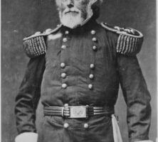
In 1831 Lieutenant Joseph K. Mansfield took charge of Fort Pulaski's construction and oversaw the project for the next fourteen years.
Courtesy of National Archives and Records Administration.