The New Georgia Encyclopedia is supported by funding from A More Perfect Union, a special initiative of the National Endowment for the Humanities.
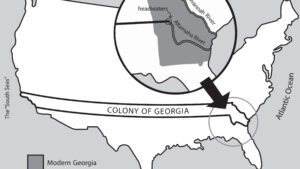
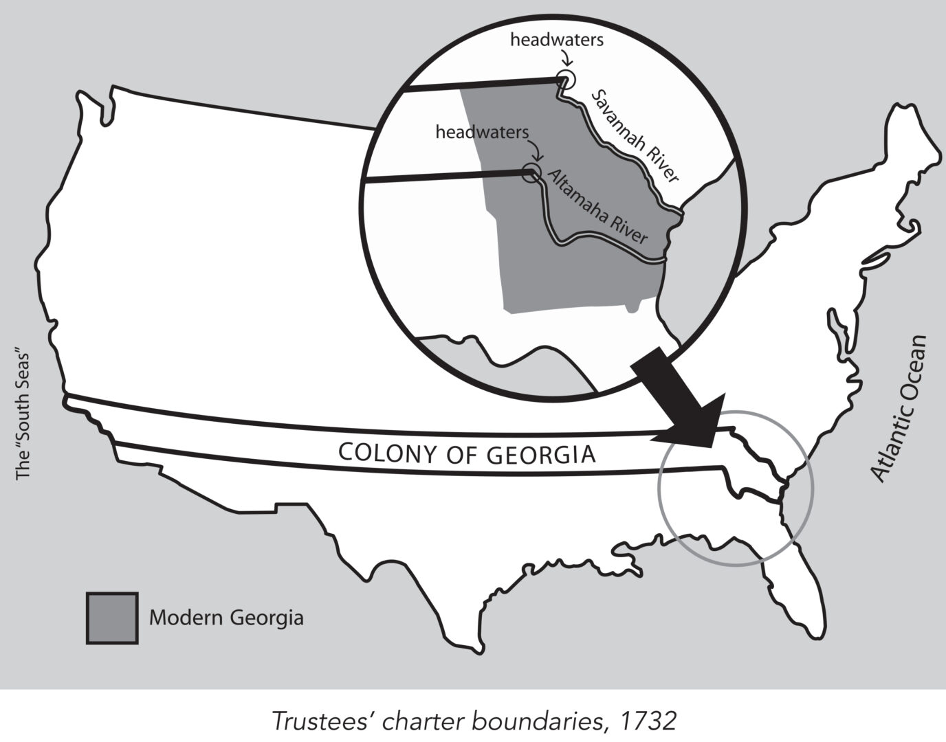
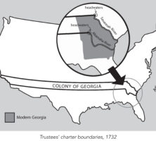
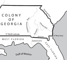
King George II granted James Oglethorpe and the Trustees a charter in 1732 to establish the colony of Georgia. This charter provided, among other things, that the new colony would consist of all the land between the headwaters of the Savannah and the Altamaha rivers, with its eastern boundary formed by the Atlantic Ocean and its western boundary by the "south seas," a reference to the Pacific Ocean.
Map by John Nelson. Reprinted by permission of William J. Morton
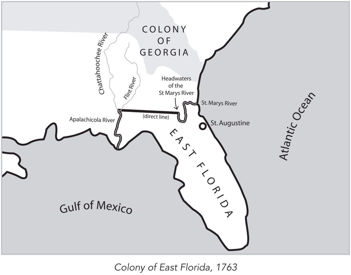
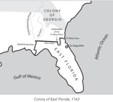
In 1763 the British divided what had been Spanish Florida into the two new colonies of West Florida and East Florida, with the Apalachicola River serving as the dividing line between them. East Florida was all the land east of the Apalachicola River, with St. Augustine as its capital.
Map by John Nelson. Reprinted by permission of William J. Morton
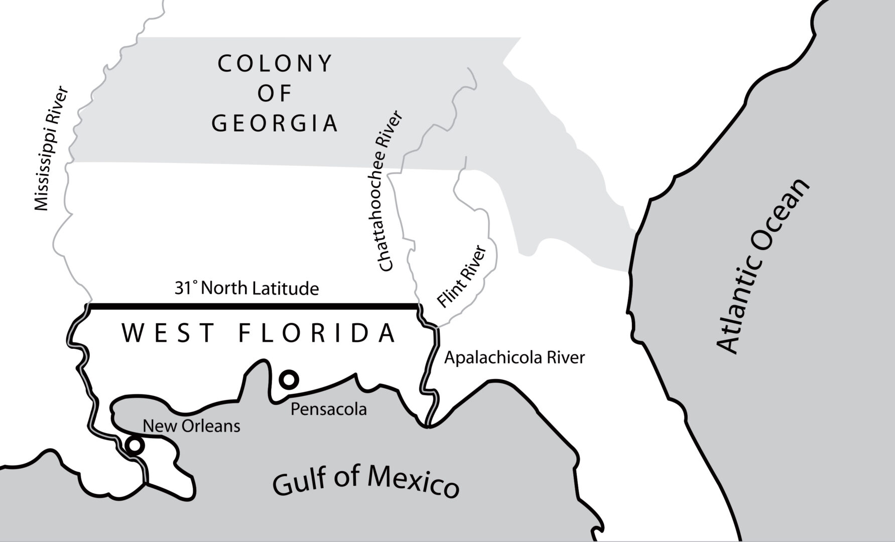
In 1763 the British divided what had been Spanish Florida into the two new colonies of West Florida and East Florida, with the Apalachicola River serving as the dividing line between them. West Florida, with Pensacola as its capital, extended west to the Mississippi River.
Map by John Nelson. Reprinted by permission of William J. Morton
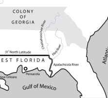
The appointment of James Wright in 1760 as governor of Georgia coincided with a period of expansion. By 1764 the boundaries of the colony had expanded to include those territories between the Mississippi and Chattahoochee rivers that had not been granted to the Florida colonies.
Map by John Nelson. Reprinted by permission of William J. Morton
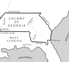
In 1767 the governor of West Florida received permission from the king of England to advance the colony's northern border along the Mississippi and Chattahoochee rivers, where royal trading posts were located. Georgia's land holdings significantly decreased as a result.
Map by John Nelson. Reprinted by permission of William J. Morton
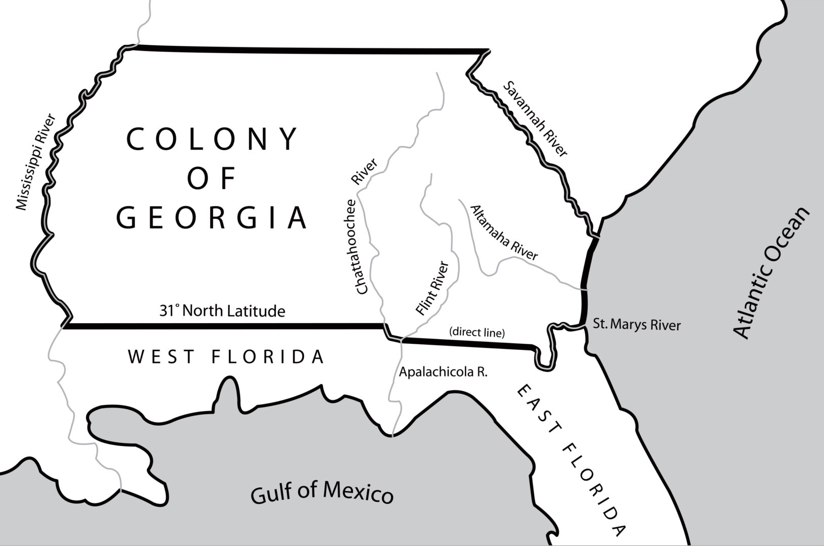
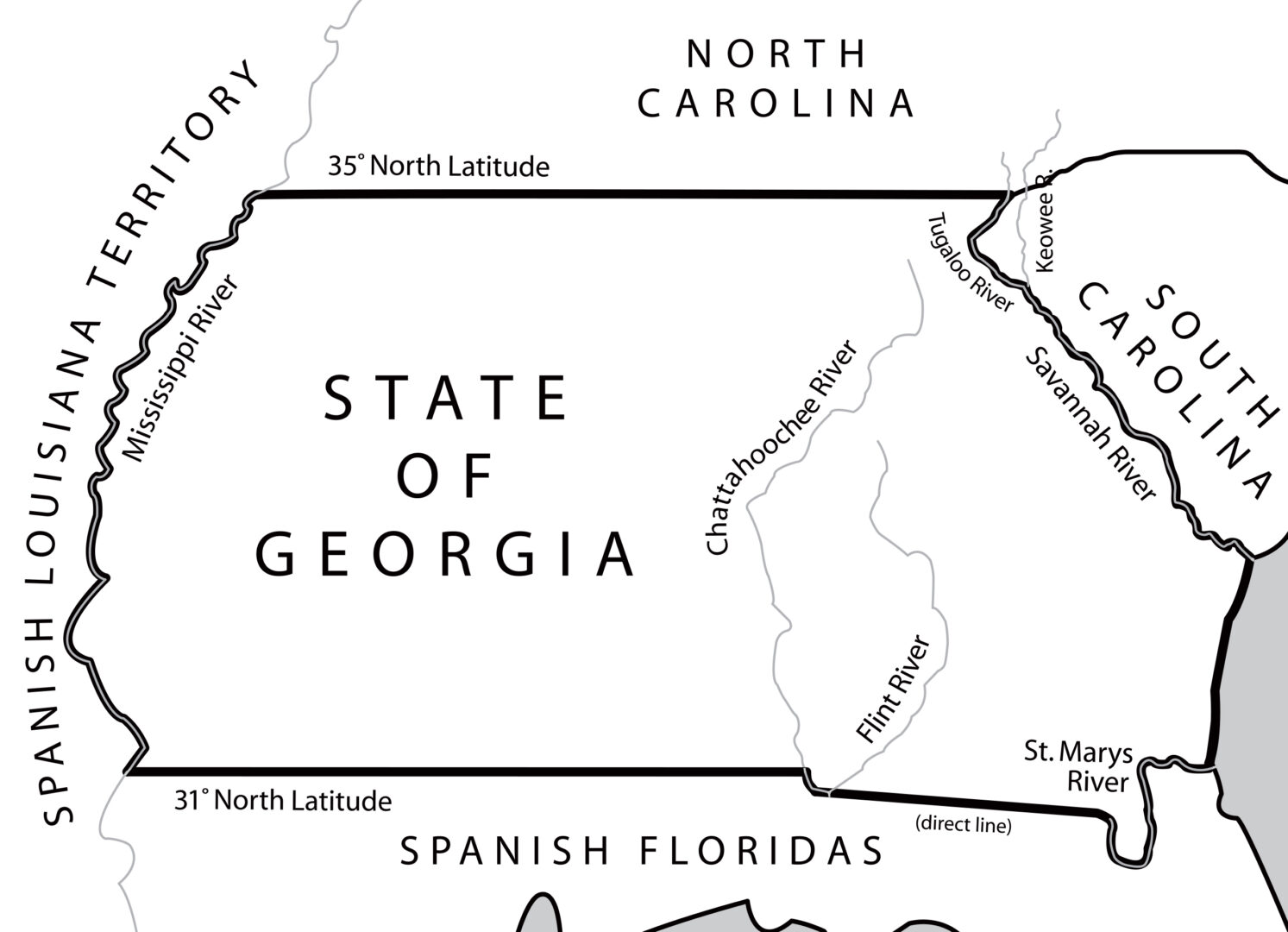
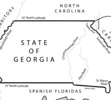
The 1783 Treaty of Paris, which ended the Revolutionary War (1775-83), fixed the 31st latitude north as the southern boundary of the new United States. The line extended from the Mississippi River eastward to the Chattahoochee River, moved down that river to its junction with the Flint River, and then followed a direct line east to the headwaters of the St. Marys River.
Map by John Nelson. Reprinted by permission of William J. Morton
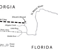
The Orr-Whitner line was accepted by Florida in 1861 and Georgia in 1866 as their official boundary, although the outbreak of the Civil War (1861-65) delayed the line's approval by the U.S. Congress until 1872.
Map by John Nelson. Reprinted by permission of William J. Morton
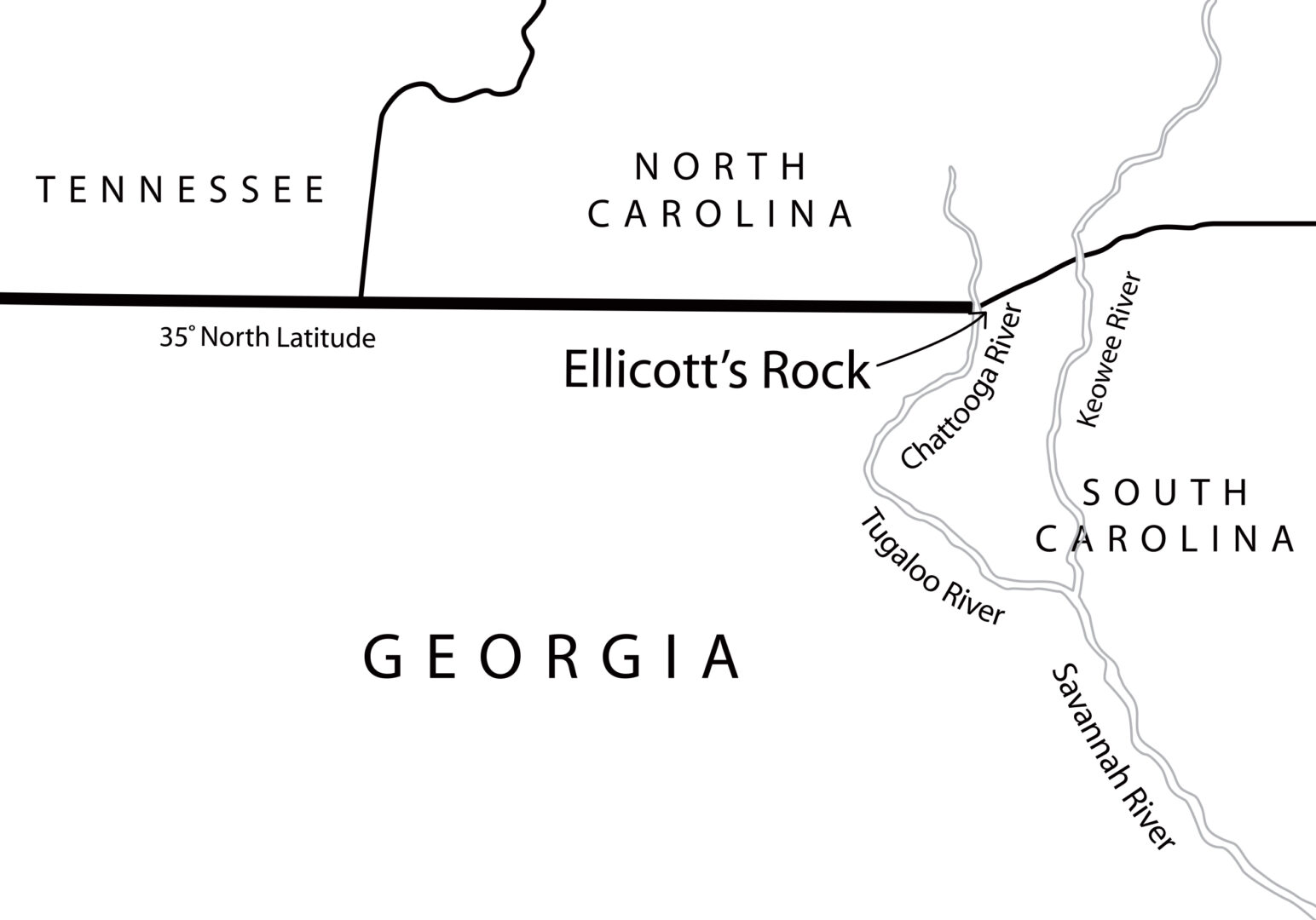
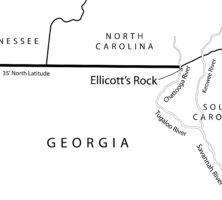
In 1811 Georgia hired Andrew Ellicott to survey and mark the location of the 35th latitude north, which formed the boundary between Georgia and North Carolina. In an 1812 letter to North Carolina governor William Hawkins, Ellicott states: "In the parallel of 35 degree N. latitude, on the west side of the Chatoga river, a stone is set up marked on the South side (G. lat 35 N.) and on the north side, (N.C.) for North Carolina." This map locates what is currently and erroneously called Ellicott's Rock on the east side of the Chattooga River.
Map by John Nelson. Reprinted by permission of William J. Morton
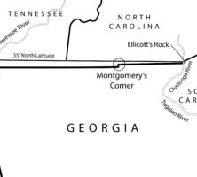
This map shows the surveyed line as marked by James Camak, which set Georgia's northern boundary line south of the 35th latitude north, including the offset known as Montgomery's Corner.
Map by John Nelson. Reprinted by permission of William J. Morton
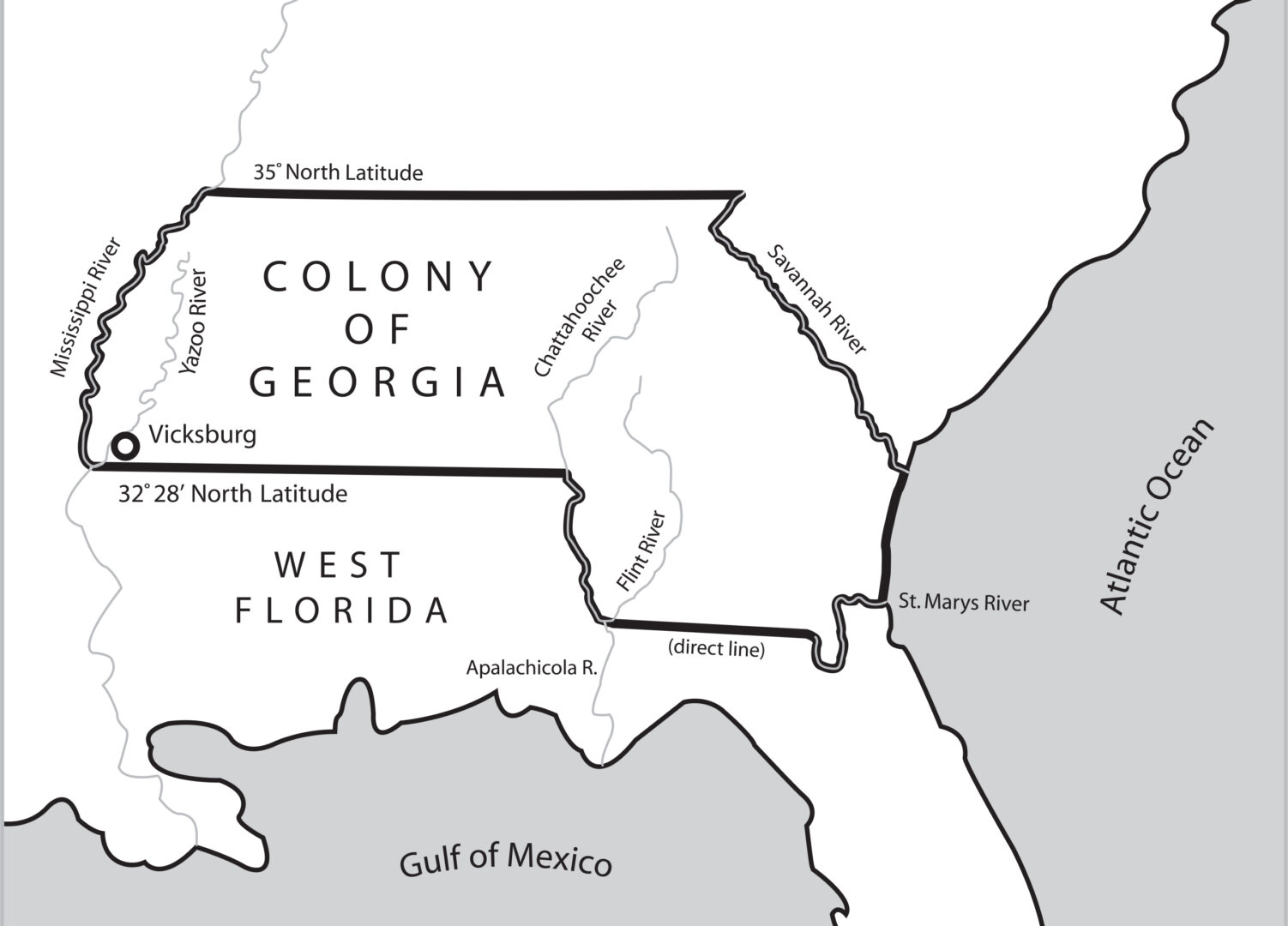
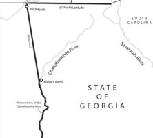
Following the 1802 Article of Agreement and Cession, Georgia's new western boundary began with the juncture of the Chattahoochee and Flint rivers in southwest Georgia and proceeded north to the great bend of the river (at present-day West Point, Georgia). From there it stretched for 160 miles to the Indian village of Nickajack on the Tennessee River and continued from there up to the 35th latitude north.
Map by John Nelson. Reprinted by permission of William J. Morton
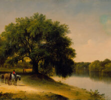
British artist Thomas Addison Richards painted River Plantation (1855-60) from sketches made in Georgia during his travels through the South in the 1840s. Oil on canvas (20 1/4" x 30").
Courtesy of Morris Museum of Art
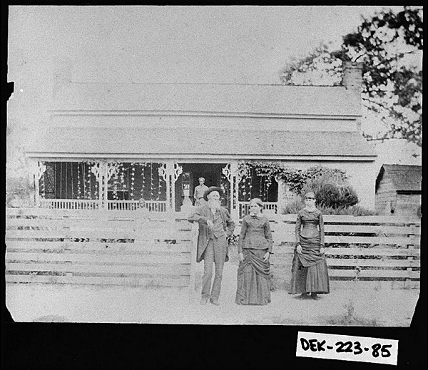
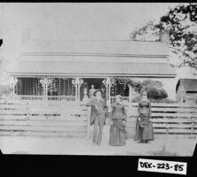
DeKalb County resident John Brandon Morris (far left) is pictured at his home, Cedar Grove, around the time of the Civil War.
Courtesy of Georgia Archives, Vanishing Georgia, #
dek223-85.
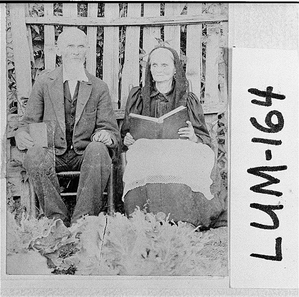
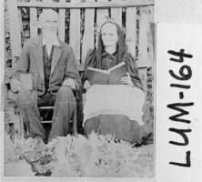
Eligea and Hanna Ricketts of Porter Springs, in Lumpkin County, are pictured circa 1860. In that year nearly a third of Georgia's populace lived in the state's upcountry and mountain counties.
Courtesy of Georgia Archives, Vanishing Georgia, #
lum164.
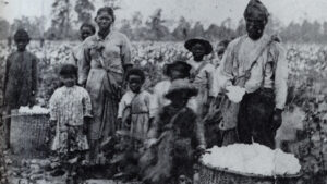
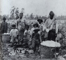
An enslaved family picking cotton outside Savannah in the 1850s.
Courtesy of New York Historical Society, Photograph by Pierre Havens..
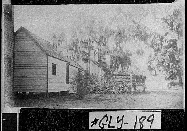
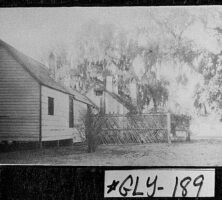
The Hofwyl Plantation (later the Hofwyl-Broadfield Plantation) in Glynn County, a state historic site, is pictured circa 1910. The plantation, established in 1801, produced rice until shortly after the Civil War ended in 1865.
Courtesy of Georgia Archives, Vanishing Georgia, #
gly189.
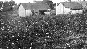
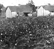
The homes of tenant farmers stand alongside a cotton field in Georgia. Landless whites, many of whom were farm tenants, made up nearly half the white populace in the state by 1860.
From Plantation Slavery in Georgia, by R. B. Flanders
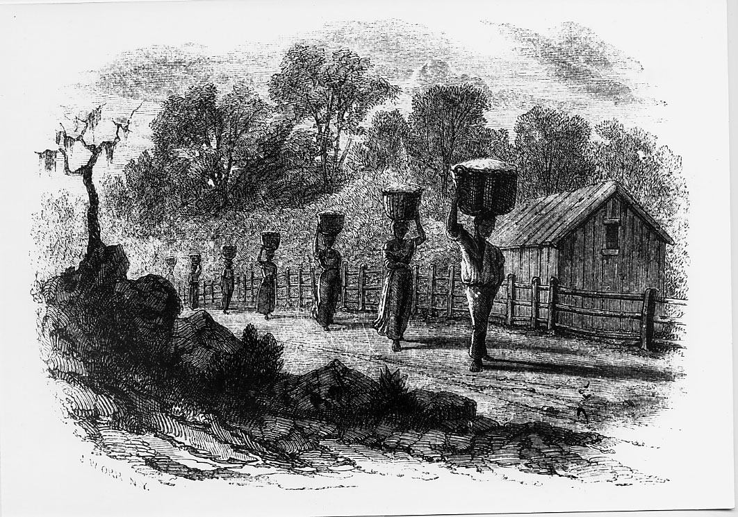
Enslaved workers are pictured carrying cotton to the gin at twilight in an 1854 drawing. Beginning in late July and continuing through December, enslaved workers would each pick between 250 and 300 pounds of cotton per day. The cotton gin, invented by Eli Whitney on a Georgia plantation in 1793, led to dramatically increased cotton yields and a greater dependence on slavery.
From Harper's New Monthly, March 1854
A. R. Waud's sketch Rice Culture on the Ogeechee, Near Savannah, Georgia depicts enslaved African Americans working in the rice fields.
From Harper's Weekly
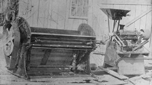
Healan's Mill in Hall County was a gristmill built prior to the Civil War. Most industry in antebellum Georgia was related to agriculture, which formed the base of the state's economy at that time.
Image from Neal Wellons
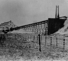
Timber from St. Simons Lumber Mills on St. Simons Island was shipped to market from this dock in Brunswick. After coming to a halt during the Civil War, the timber industry on the island was revived during the 1870s.
Courtesy of Coastal Georgia Historical Society.
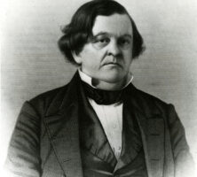
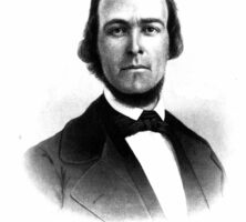
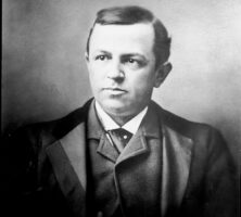
Georgia native Howell Cobb served as congressman (1843-51; 1855-57), Speaker of the U.S. House of Representatives (1849-51), governor of Georgia (1851-53), and secretary of the treasury (1857-60).
Courtesy of Hargrett Rare Book and Manuscript Library, University of Georgia Libraries, Georgia Photo File.
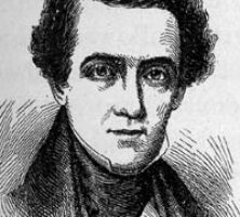
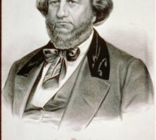
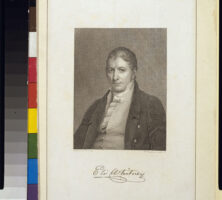
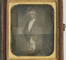
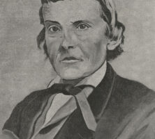
Alexander Stephens, a native of Taliaferro County, was a prominent member of the Whig Party during the sectional crisis that arose in the wake of the Mexican War (1846-48). He later joined the ranks of the Democratic party and served as vice president of the Confederacy during the Civil War (1861-65).
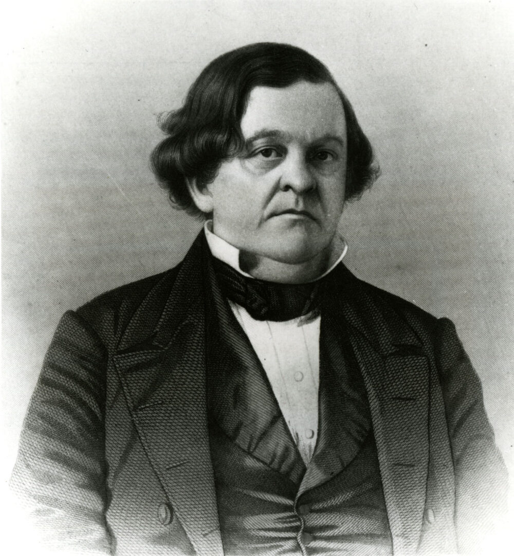
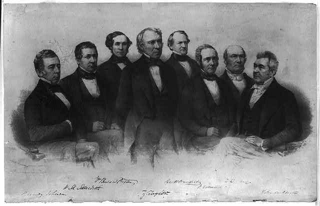
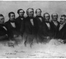
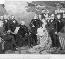
In 1849 George W. Crawford, a former governor of Georgia, joined U.S. president Zachary Taylor's cabinet as secretary of war. From left, Reverdy Johnson, William M. Meredith, William B. Preston, Zachary Taylor, Crawford, Jacob Collamer, Thomas Ewing, and John M. Clayton.
Courtesy of Library of Congress, Prints and Photographs Division
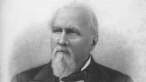
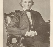
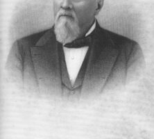
George W. Towns served as the governor of Georgia from 1847 to 1851. Earlier in his career, Towns served as both a state legislator and a U.S. congressman. Although he entered politics as a Unionist, Towns was known as an ardent states' rights secessionist during his governorship.
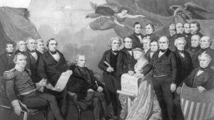
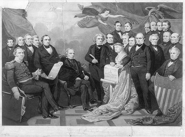
Painter Tompkins H. Matteson's Union, engraved by Henry S. Sadd, is a symbolic portrait celebrating the legislators responsible for brokering the Compromise of 1850. Henry Clay, John Calhoun, and Daniel Webster appear in the center, from left to right. Georgian Howell Cobb is portrayed in the far left background.
Courtesy of Library of Congress, Prints and Photographs Division
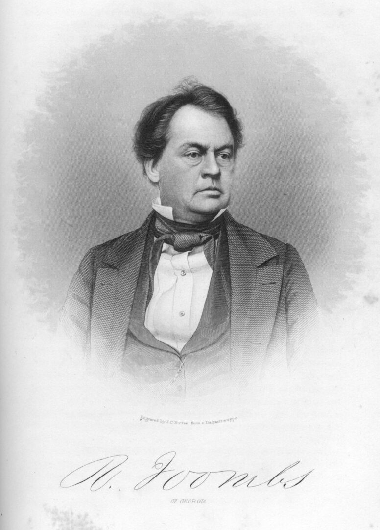
Robert Toombs helped to lead Georgia out of the Union on the eve of the Civil War, though his support for the Georgia Platform in 1850 had demonstrated his commitment to preserving the Union.
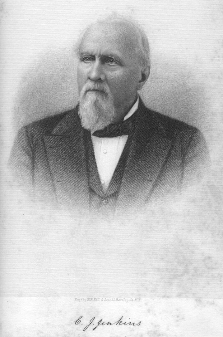
The Georgia Platform established Georgia's conditional acceptance of the Compromise of 1850. Much of the document followed a draft written by Charles Jones Jenkins, who later served as Georgia's governor from 1865 to 1868.
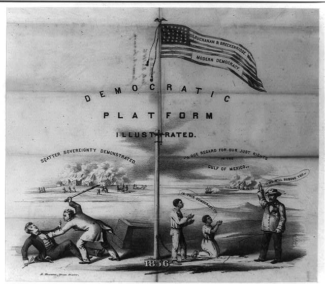
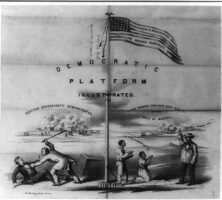
An 1856 political cartoon attacks the proslavery platform of the Democratic Party. In the lower right corner, an enslaved man and woman kneel before an overseer. One asks, "Is this democracy?" The overseer responds, "We will subdue you." In the left background a Kansas settlement burns, representing the violent response to the passage of the Kansas-Nebraska Act of 1854. This act, endorsed by Democrats, allowed for popular sovereignty to decide the slavery question in the western territories.
Courtesy of Library of Congress, Prints and Photographs Division
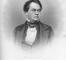
In 1857 Joseph E. Brown edged aside better-known politicians to become the Democrats' gubernatorial candidate. He won decisively, and from then on he was unbeatable in statewide elections.
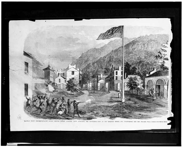
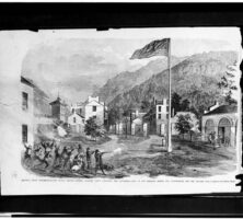
This 1859 sketch of the abolitionist John Brown's raid on Harpers Ferry, Virginia, appeared in Frank Leslie's Illustrated Newspaper and depicts an attack on the raiders at the railroad bridge. News of the raid intensified the call for secession by many southern slaveowners.
Courtesy of Library of Congress, Prints and Photographs Division
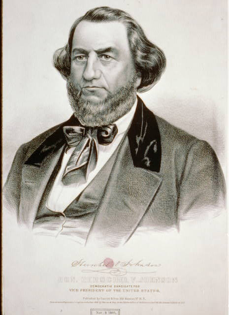
Herschel Johnson, a nineteenth-century Georgia politician, is pictured in an 1860 Currier and Ives portrait. That same year, Johnson was the vice-presidential running mate for Democratic candidate Stephen Douglas, who lost the election to Abraham Lincoln.
Courtesy of Library of Congress, Prints and Photographs Division
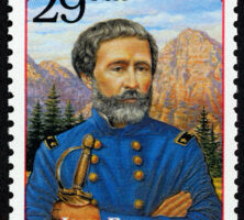
This 1990s postage stamp features Savannah native John C. Fremont, the first Republican US presidential candidate.
Courtesy of Smithsonian National Postal Museum
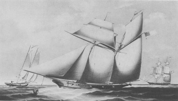
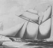
The Wanderer is pictured during the Civil War (1861-65). Prior to its service in the Union navy, the Wanderer was the last ship to transport African captives to Georgia as part of the slave trade. Commissioned as a yacht in 1857, the ship was converted into a slave ship the following year, and was seized by the Union navy in 1861.
Courtesy of U.S. Naval Historical Center
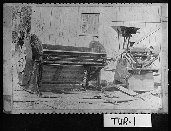
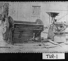
This roller gin, built by William Van Houten in Turner County, won first place at the Savannah State Fair in 1901. Farmers have continued to modify and improve Eli Whitney's original cotton gin since its invention in 1793.
Courtesy of Georgia Archives, Vanishing Georgia, #
tur001.
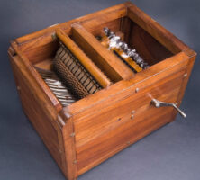
An original model of an Eli Whitney cotton gin (circa 1800) is on display in Washington, D.C., at the National Museum of American History.
Image from National Museum of American History, Smithsonian Institution
The inventor of the cotton gin, Eli Whitney lived in Georgia for just a year, on Catharine Greene's Mulberry Grove plantation near Savannah. After learning of the difficulty planters had with separating seeds from fibers in upland, or "short-staple," cotton, he set out to create a machine that could perform such a task more efficiently. His invention, the cotton gin, revolutionized the southern economy.
Courtesy of Library of Congress, Prints and Photographs Division
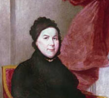
Catharine Greene was the noted wife of Revolutionary War general Nathanael Greene and later a supporter of Eli Whitney, the inventor of the cotton gin. This painting of Greene (oil on panel, 32 3/4" x 25 3/4"), dated circa 1809, is attributed to James Frothingham.
Courtesy of Telfair Museums.
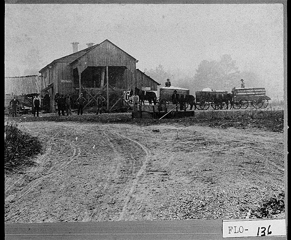
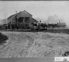
The Dykes Creek Cotton Gin, pictured circa 1890, was located on Kingston Road in Rome. In the decades after the Civil War, cotton farmers brought their cotton to a community gin, rather than installing cotton gins on their own property.
Courtesy of Georgia Archives, Vanishing Georgia, #flo136.
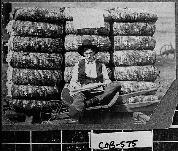
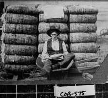
James Marion Prance, the proprietor of a cotton gin in Cobb County, is pictured sitting in front of bales of cotton in the early 1900s.
Courtesy of Georgia Archives, Vanishing Georgia, #
cob575.
Cherokee land lots were parceled out to white Georgians in one of the two state land lotteries held in 1832. The state conducted a total of eight lotteries between 1805 and 1833. Sketch by George I. Parrish Jr., circa 1832.
Artwork by George I. Parrish Jr. Courtesy of Cindy Parrish, Maryville,TN
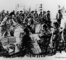
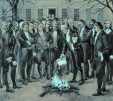
The burning of the Yazoo Act, which resulted in the Yazoo land fraud of 1795, took place on the grounds of the capitol building in Louisville. Louisville served as the state capital from 1796 until 1806, when the legislature moved to Milledgeville.
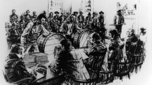
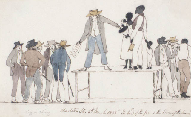
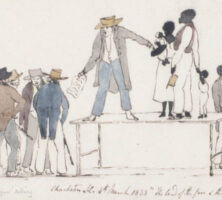
This pen-and-ink drawing and watercolor by Henry Byam Martin depicts a slave market in Charleston, South Carolina, in 1833. An inscription on the original reads "Charleston S.C. 4th March 1833 'The land of the free & home of the brave.'"
Courtesy of Library and Archives Canada
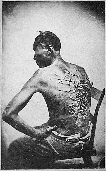
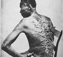
According to his testimony, the injuries sustained from a whipping by his overseer kept Peter, an enslaved man, bedridden for two months.
Courtesy of National Archives and Records Administration
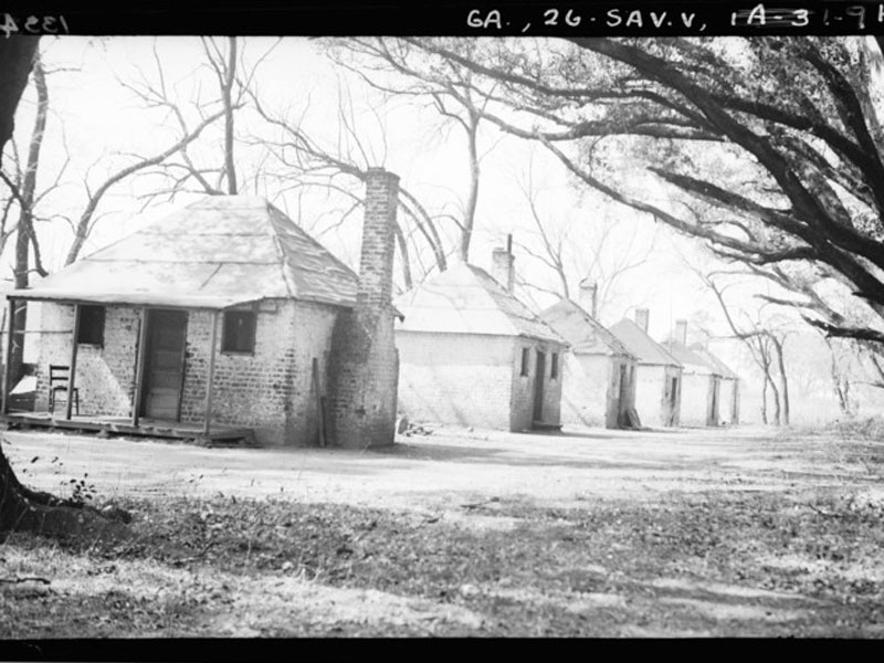
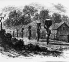
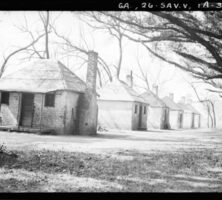
A row of slave cabins in Chatham County is pictured in 1934. Enslaved people fostered family relationships and communities in and among their quarters.
Photograph by Wikimedia
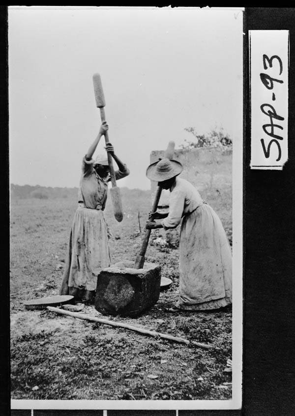
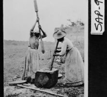
In the same manner as their enslaved ancestors, women on Sapelo Island hull rice with a mortar and pestle, circa 1925. Language and cultural traditions from West Africa were retained in the Geechee culture that developed in the Sea Islands.
Courtesy of Georgia Archives, Vanishing Georgia, #
sap093.
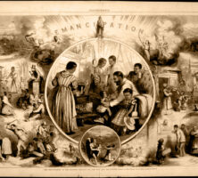
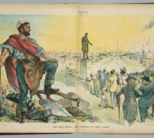
Thomas Nast's famous wood engraving originally appeared in Harper's Weekly on January 24, 1863. The liberation of the state's enslaved population, numbering more than 400,000, began during the chaos of the Civil War and continued well into 1865. Nast's cartoon aimed to arouse sympathy for freedpeople following emancipation.
From Harper's Weekly
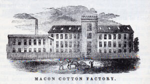
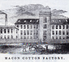
Antebellum towns including Macon, Milledgeville, Madison, and Greensboro experimented with steam-powered cotton factories, with varying degrees of success. The steam-powered factories in Madison and Greensboro went broke in the 1850s, while those in Milledgeville and Macon survived to serve the Confederacy.
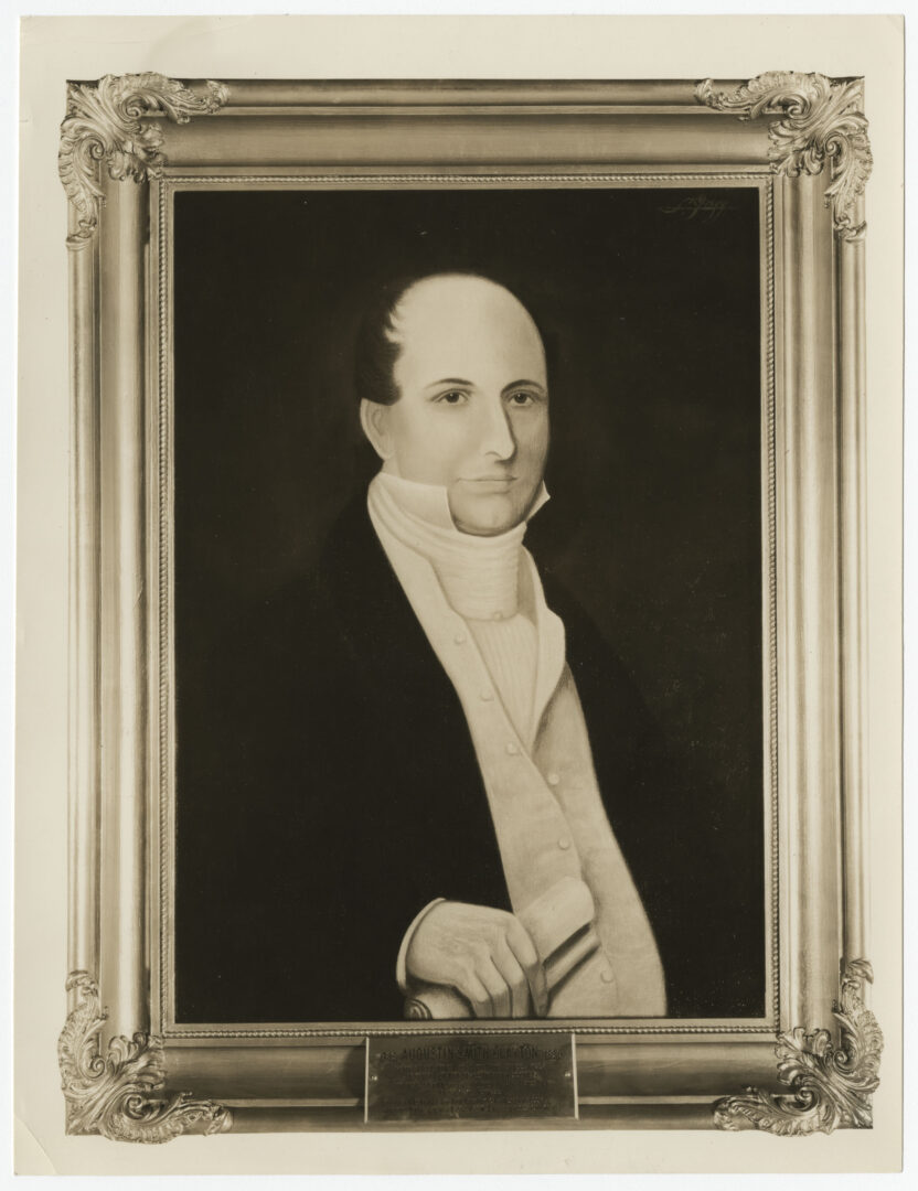
At the end of the 1820s Augustin Smith Clayton of Athens constructed a cotton mill near his hometown, hoping to prove the protective tariff that subsidized northern industry at the expense of southerners unnecessary.
Courtesy of Hargrett Rare Book and Manuscript Library, University of Georgia Libraries, Georgia Photo File.
At the end of the 1820s, William Schley of Augusta constructed a cotton mill near his hometown, hoping to prove that the protective tariff subsidizing northern industry at the expense of southerners was unnecessary.
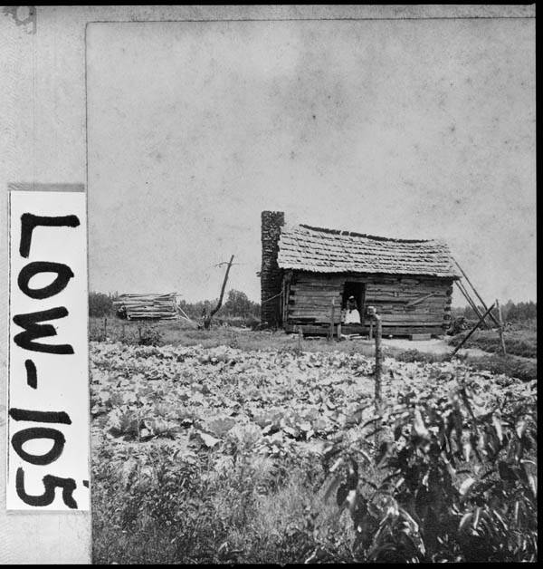
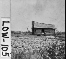
With few exceptions, antebellum tenant farmers in Georgia were white. After the Civil War, most tenants (including sharecroppers) were formerly enslaved people.
Courtesy of Georgia Archives, Vanishing Georgia, #
low105.
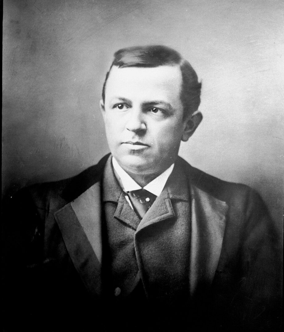
Atlantan Henry Grady, a prominent orator and editor of the Atlanta Constitution, heralded the coming of the New South after the end of the Civil War.
Courtesy of Special Collections & Archives, Georgia State University Library, Lane Brothers Commercial Photographers Photographic Collection.
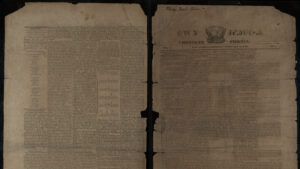
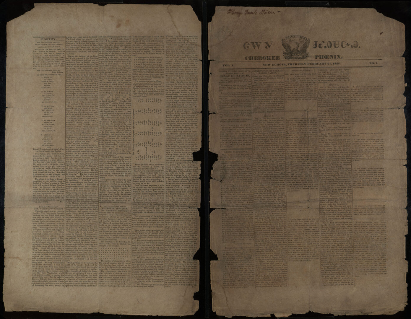
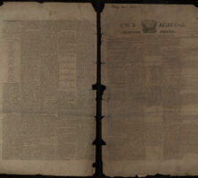
The Cherokee Phoenix, the first Native American newspaper in the United States, was first printed in 1828 in New Echota, Georgia, the capital of the Cherokee Nation. The paper was published weekly until May 1834, when the Cherokee annuity was not paid and the presses came to a stop. This issue is dated January 28, 1829.
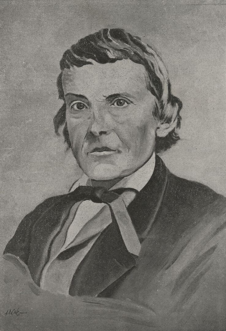
Alexander Stephens, the Confederate vice president and a Georgia native, was a master at managing relations with journalists, and he used his stable of press supporters, including the Augusta Chronicle and Sentinel and the Southern Confederacy of Atlanta, to spread his peace doctrine.
Courtesy of Hargrett Rare Book and Manuscript Library, University of Georgia Libraries, Georgia Photo File.
Antebellum newspapers were mostly political in nature. Editors commonly harassed and abused other journalists, politicians, and even private citizens who were of a different political persuasion, with scathing editorials or editorial cartoons.
Courtesy of Library of Congress, Prints and Photographs Division
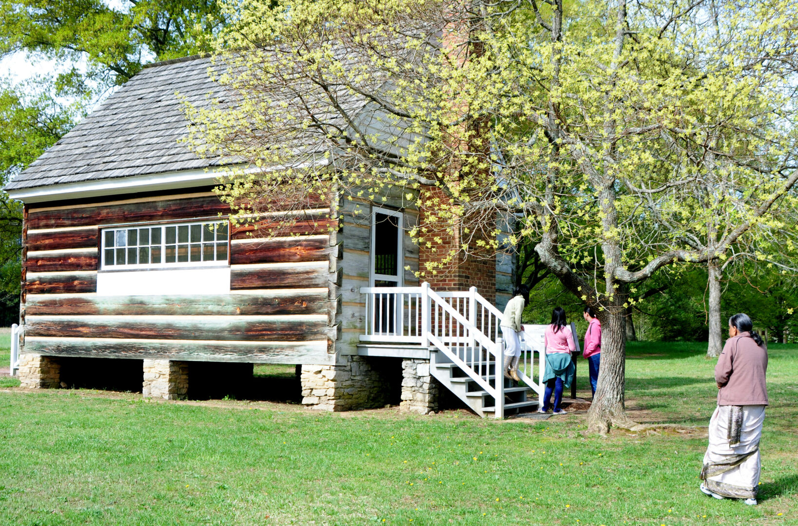
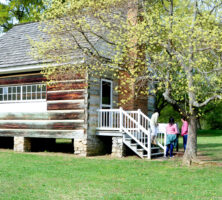
The reconstructed print shop at the New Echota Historic Site is where the Cherokee Phoenix, the first Native American newspaper in the United States, was published. The New Echota Historic Site, located in Calhoun, commemorates the former capital of the Cherokee Nation.
Image from George Puvvada
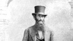
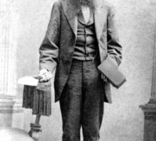
An anonymous Savannah artisan (ca. 1850s) took pride in his skill as a brick maker and posed for posterity bearing the tools of his trade, dressed in his best suit.
Courtesy of Georgia Historical Society, Benjamin Remington Armstrong papers, #GHS 25-01-VM01-02.