The New Georgia Encyclopedia is supported by funding from A More Perfect Union, a special initiative of the National Endowment for the Humanities.
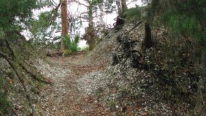
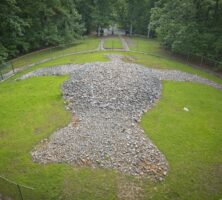
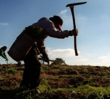
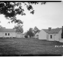
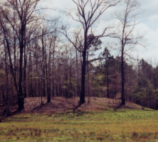
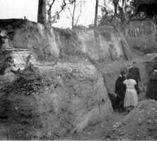
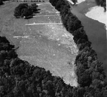
The remains of a Confederate earthwork, used during the Battle of Kennesaw Mountain in June 1864. In the1930s archaeologist Charles Fairbanks, in one of the earliest Civil War excavations, documented the earthworks on top of Kennesaw Mountain in Cobb County.
Courtesy of Garrett W. Silliman
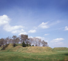
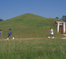
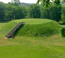
The Etowah Mounds in Bartow County include one of the largest Indian mounds in North America. The mounds, constructed during the Mississippian Period, served as platforms for public buildings in a town that occupied the site from around 1100 until the 1600s.
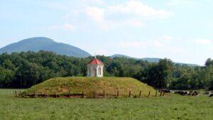
Rock Eagle, a stone effigy built by Native Americans during the Woodland Period, circa A.D. 200, is located in Putnam County. The structure, made of quartz cobbles, measures 102 feet across the wings.
Courtesy of Explore Georgia, Photograph by Ralph Daniel.
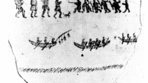
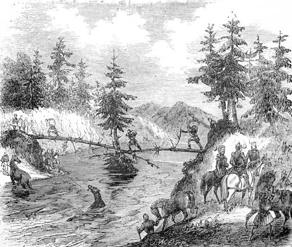
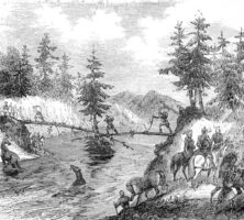
A drawing from Lambert A. Wilmer's Life, Travels and Adventures of Ferdinand de Soto, Discoverer of the Mississippi (1859) depicts Hernando de Soto and his men crossing the Chattahoochee River. The accidental introduction of European diseases by explorers destroyed many of the civilizations along the river's banks.
Courtesy of Florida State Archives, Photographic Collection.
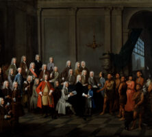
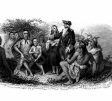
This oil painting by William Verelst shows the founders of Georgia, the Georgia Trustees, and a delegation of Georgia Indians in July 1734. One year later the Trustees persuaded the British government to support a ban on slavery in Georgia.
Courtesy of Georgia Info, Digital Library of Georgia.
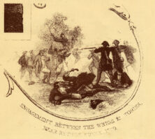
This sketch, likely a small portion of a larger work, depicts the Battle of Kettle Creek, which took place in Wilkes County on February 14, 1779, during the Revolutionary War. The original caption reads: "Engagement between the Whigs and Tories."
Courtesy of Kettle Creek Chapter of the National Society Daughters of the American Revolution
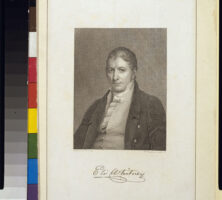
The inventor of the cotton gin, Eli Whitney lived in Georgia for just a year, on Catharine Greene's Mulberry Grove plantation near Savannah. After learning of the difficulty planters had with separating seeds from fibers in upland, or "short-staple," cotton, he set out to create a machine that could perform such a task more efficiently. His invention, the cotton gin, revolutionized the southern economy.
Courtesy of Library of Congress, Prints and Photographs Division
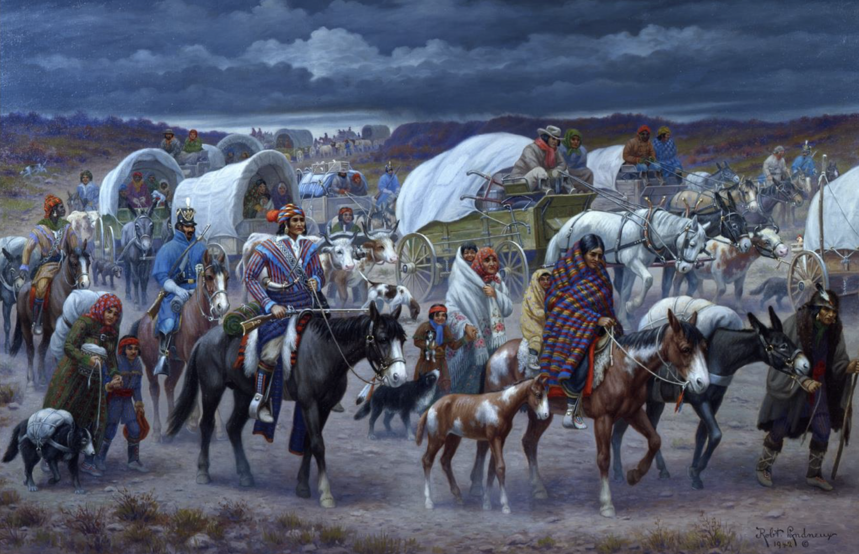
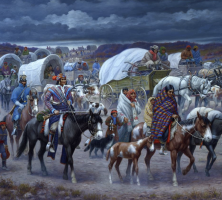
In his 1942 painting Cherokee Trail of Tears, Robert Lindneux depicts the forced journey of the Cherokees in 1838 to present-day Oklahoma.
Courtesy of Woolaroc Museum, Bartlesville, Oklahoma
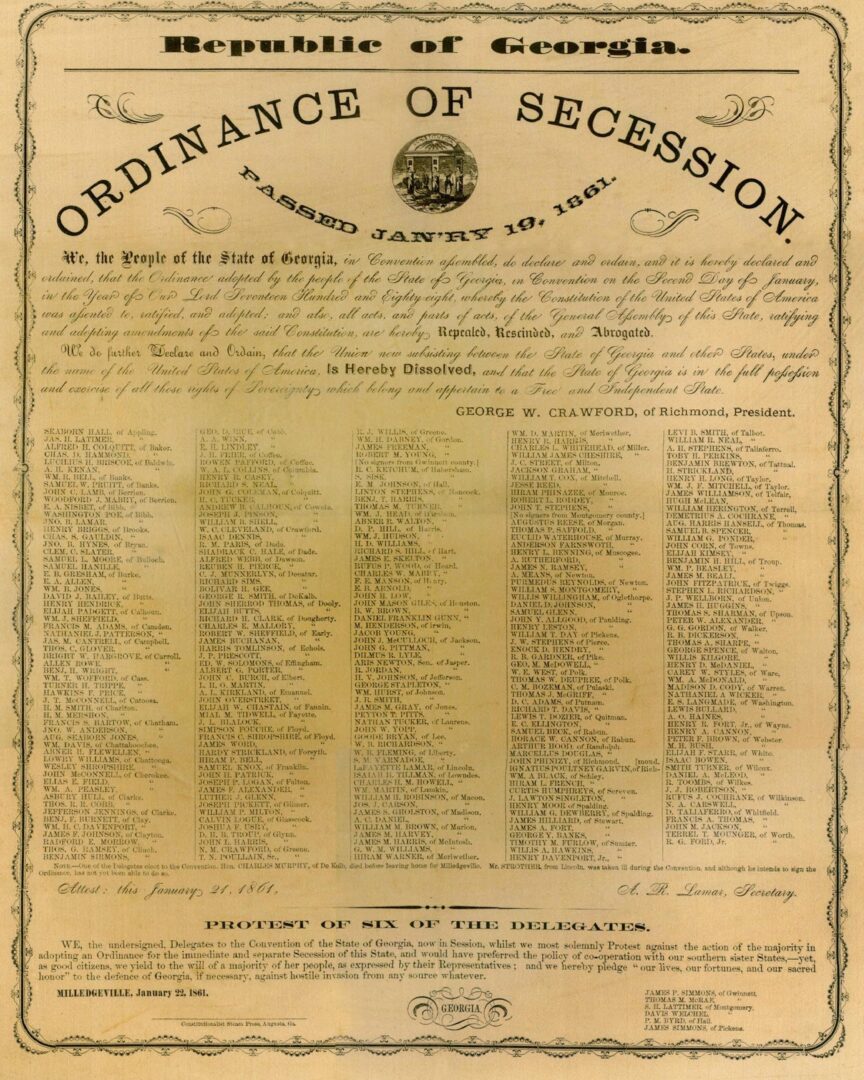
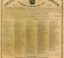
On January 21, 1861, the ordinance of secession was publicly signed in a ceremony by Georgia politicians. Two days earlier, delegates to a convention in Milledgeville voted 208 to 89 for the state to secede from the Union.
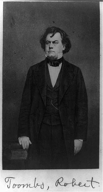
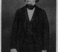
Wilkes County native Robert Toombs, pictured circa 1865, served briefly as the Confederate government's secretary of state and as a brigadier general during the Civil War.
Courtesy of Library of Congress, Prints and Photographs Division
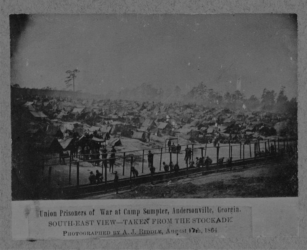
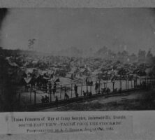
Union prisoners of war are pictured at the Andersonville Prison in Macon County on August 17, 1864. Malnutrition and poor sanitary conditions at the camp led to the deaths of nearly 13,000 of Andersonville's 45,000 prisoners, the highest mortality rate of any Civil War prison.
Courtesy of Civil War Treasures, New-York Historical Society
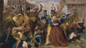
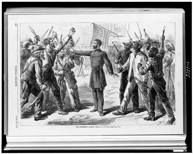
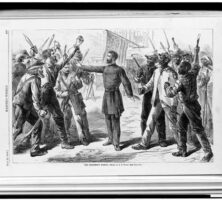
An 1868 sketch by A. R. Waud illustrates the difficulties faced by the Freedmen's Bureau, caught between white planters on one side (left) and formerly enslaved African Americans on the other (right). The bureau was established in 1865 after Union general William T. Sherman issued his Field Order No. 15, which called for the resettlement of freedpeople on confiscated lands.
Courtesy of Library of Congress, Prints and Photographs Division
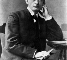
With his New South platform, Henry W. Grady advocated unity and trust between the North and South and helped to spur northern investment in Atlanta industries.
Courtesy of Stuart A. Rose Manuscript, Archives, and Rare Book Library, Emory University, Henry Woodfin Grady Papers.
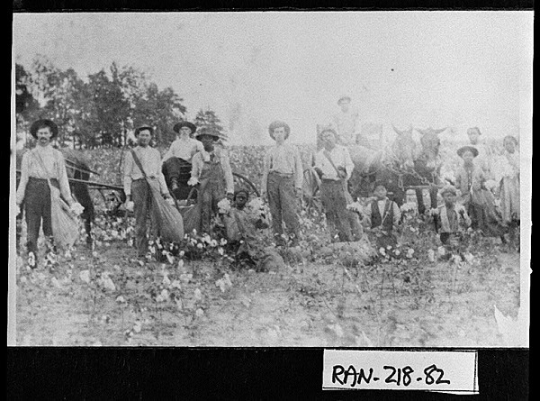
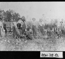
Sharecroppers, pictured in 1910, harvest cotton in Randolph County. Theoretically beneficial to both laborers and landowners, the sharecropping system typically left workers in deep debt to their landlords and creditors from one harvest season to the next.
Courtesy of Georgia Archives, Vanishing Georgia, #ran218-82.
In 1892 Georgia politics was shaken by the arrival of the Populist Party. Led by Thomas E. Watson of McDuffie County, this new party mainly appealed to white farmers, many of whom had been impoverished by debt and low cotton prices in the 1880s and 1890s. The Populists also attempted to win the support of Black farmers away from the Republican Party.
Courtesy of Georgia Historical Society.
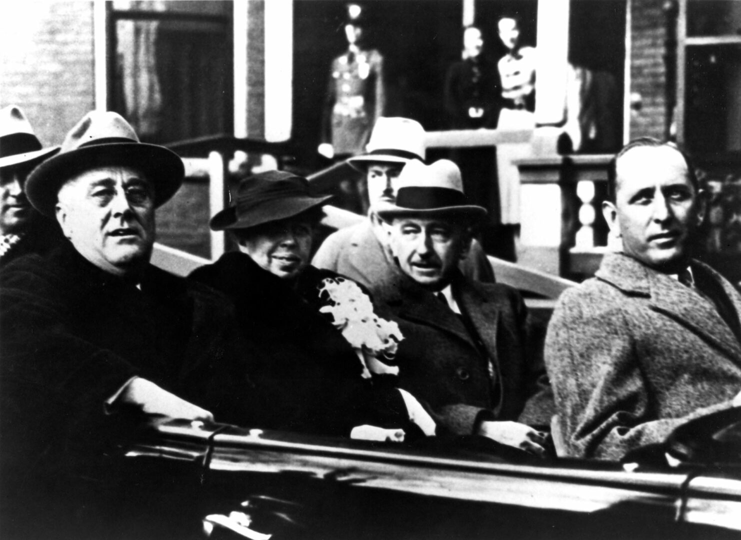
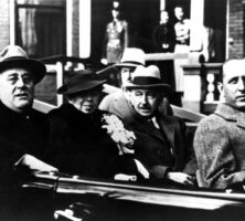
U.S. president Franklin D. Roosevelt and his wife, Eleanor Roosevelt, visit Atlanta in 1935, during the Great Depression. From left: Franklin D. and Eleanor Roosevelt, U.S. senator Walter F. George, and U.S. senator Richard B. Russell Jr.
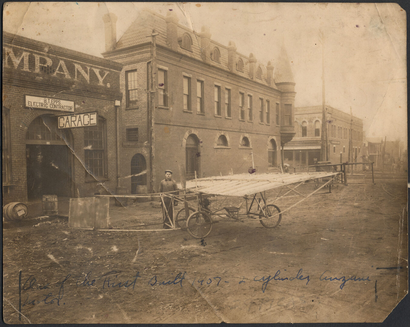
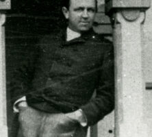
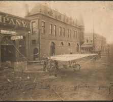
Georgia aviation pioneer Ben Epps is pictured with his first airplane outside his garage in Athens, 1907.
Courtesy of Georgia Archives, Vanishing Georgia, #
clr176-83.
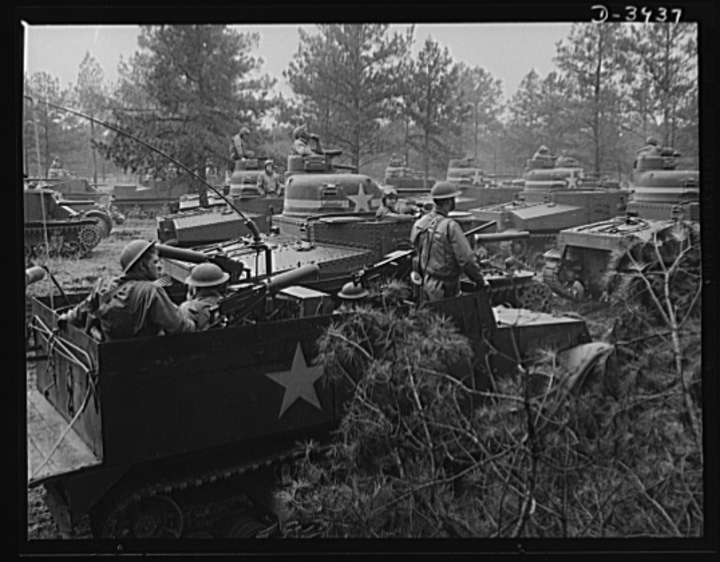
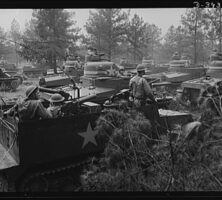
U.S. soldiers, pictured in the spring of 1942, undergo training at Fort Benning in Columbus. During World War II Fort Benning was the largest infantry training post in the world.
Courtesy of Library of Congress, Prints and Photographs Division
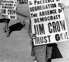
Students protest segregation at the state capitol building in Atlanta on February 1, 1962. The passage of the federal Civil Rights Act in 1964 and the Voting Rights Act in 1965 ended legal segregation across the nation.
Courtesy of Atlanta Journal-Constitution.
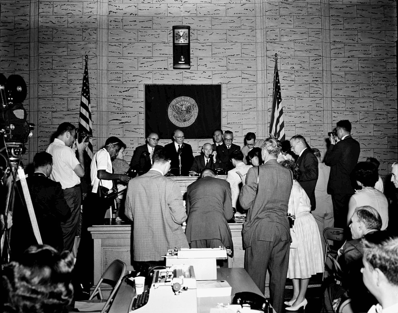
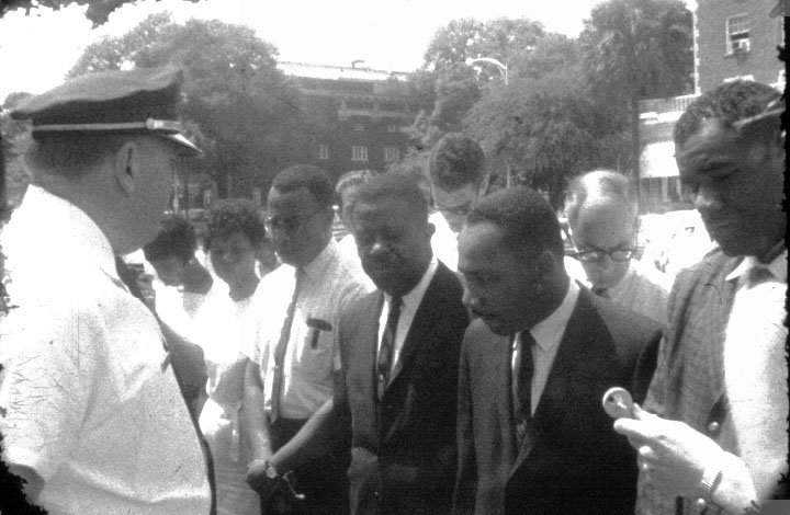
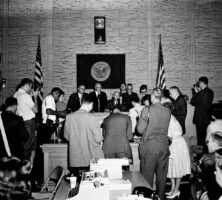
Reporters gather at Atlanta's city hall on August 30, 1961, the day that the city's schools were officially integrated. The recommendations of the Sibley Commission to the state legislature in 1960 contributed to the desegregation of schools across Georgia.
Courtesy of Special Collections & Archives, Georgia State University Library, Lane Brothers Commercial Photographers Photographic Collection.
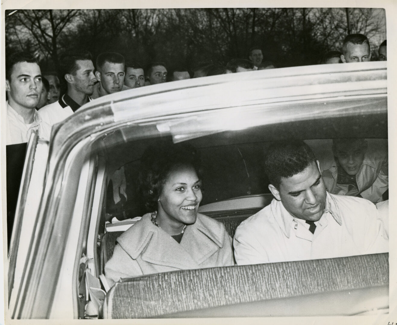
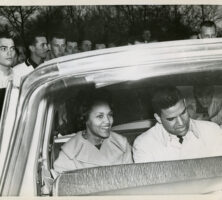
Charlayne Hunter and Hamilton Holmes, the first Black students to enroll at the University of Georgia, are pictured here at the end of their first day on campus in January 1961.
Courtesy of Atlanta Journal-Constitution.
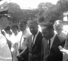
Martin Luther King Jr. (second from right) and Ralph David Abernathy (third from right) pray during their arrest in Albany on July 27, 1962. William G. Anderson, the president of the Albany Movement, asked King and Abernathy to help with efforts to desegregate the city.
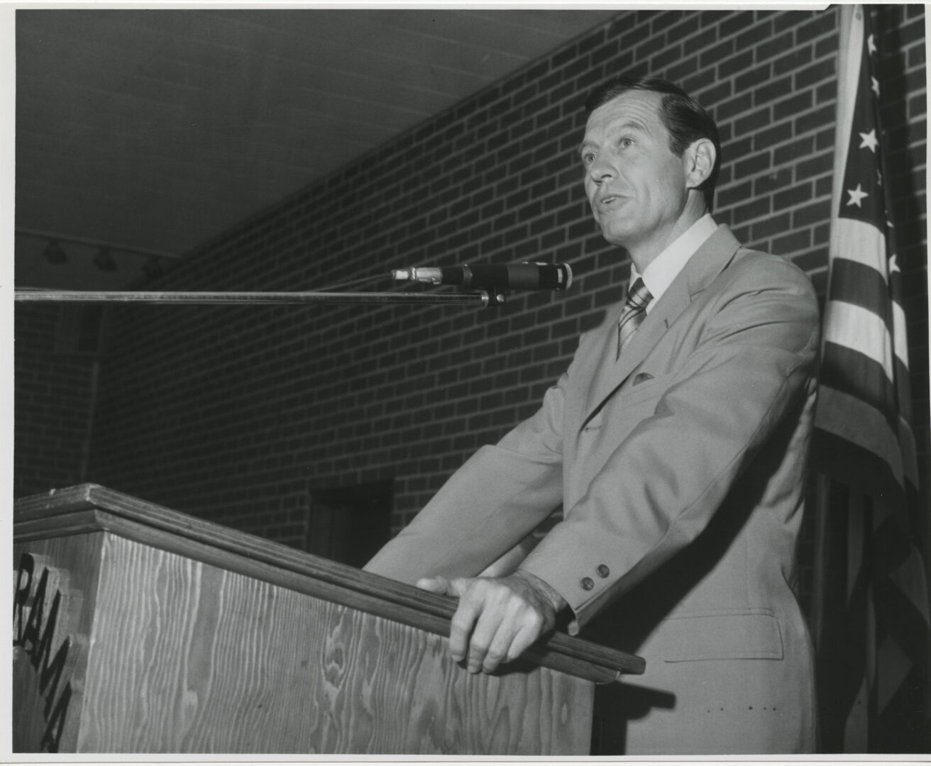
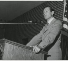
Augusta native Carl Sanders, elected governor of Georgia in 1962, brought the state into compliance with federal civil rights law during his single term in office.
In 1966 Lester Maddox defeated former governor Ellis Arnall in the Democratic gubernatorial primary in a major political upset. Subsequently, as a result of a close race between Maddox and Republican Bo Callaway, the General Assembly chose Maddox as governor.
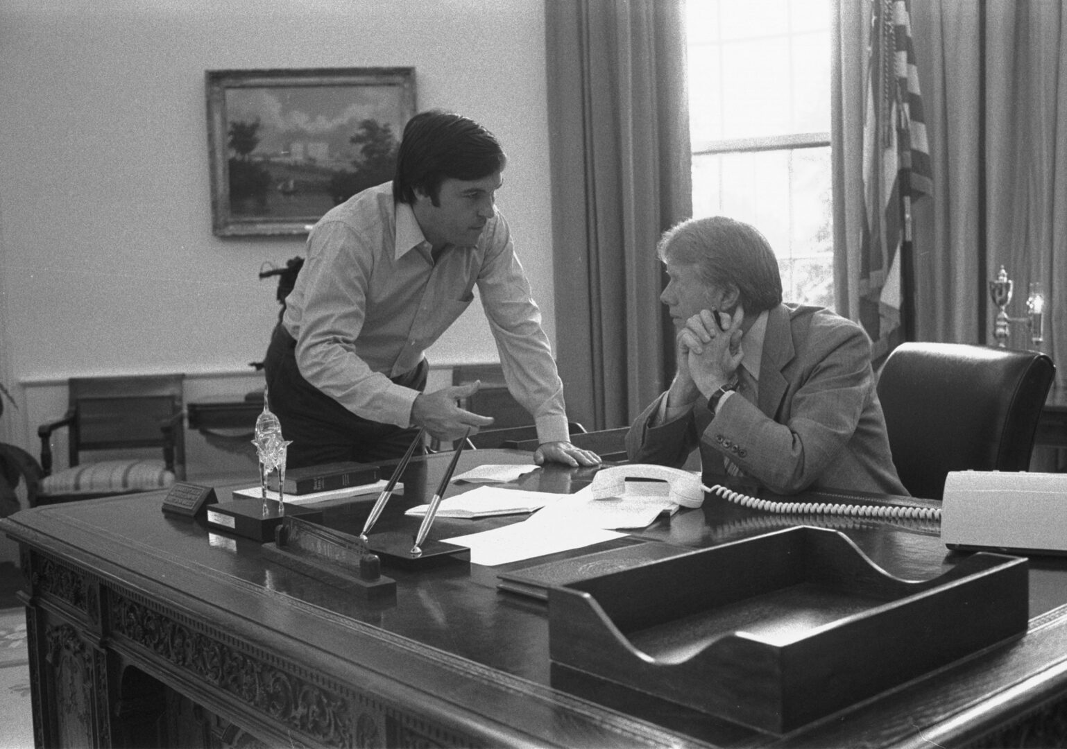
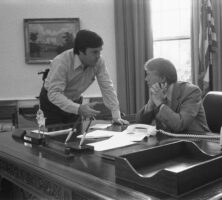
U.S. president Jimmy Carter (right) meets with Hamilton Jordan in the Oval Office of the White House in 1977. Jordan served as Carter's chief of staff from 1977 to 1980.
Courtesy of Jimmy Carter Presidential Library and Museum.
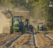
Georgia farmers lead the United States in peanut production, raising approximately 45 percent of the nation's total harvest. Grown in most south Georgia counties, peanuts are the official state crop.
Courtesy of Explore Georgia, Photograph by Ralph Daniel.
Latino workers plant loblolly pine seedlings in 1999 near Bremen, in Haralson County. Latino immigrants came to Georgia in large numbers during the 1980s and 1990s to work in the agriculture, construction, carpet, and poultry processing industries.
Courtesy of Atlanta Journal-Constitution.
Tourists on St. Simons Island gather outside one of the island's many shops. The island suffered an economic depression at the end of the cotton era in the 1830s, but its fortunes reversed with the arrival of the timber industry in the 1870s. Today St. Simons enjoys a strong tourist industry.
Courtesy of Explore Georgia.
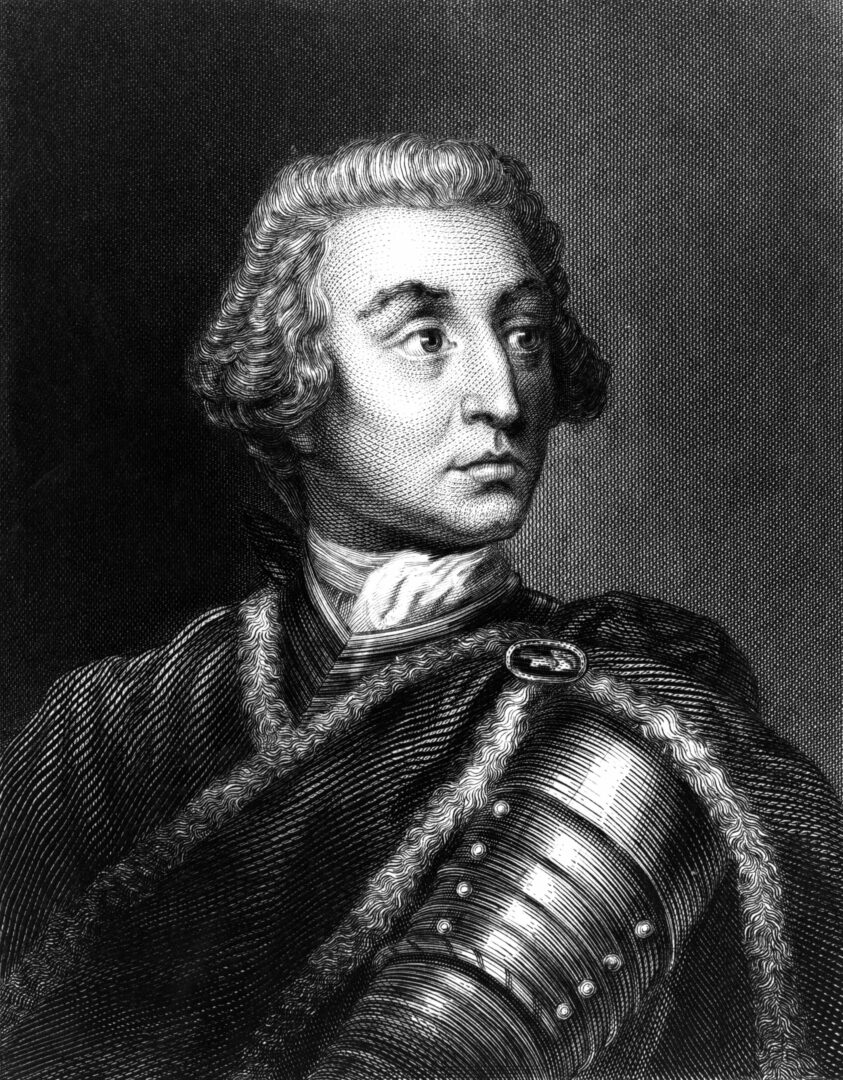
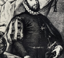
James Oglethorpe, a leader in the British movement to found a new colony in America, set sail for the new world on November 17, 1732, accompanied by Georgia's first settlers.
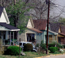
Unrestored shotgun houses line a street in Macon. The shotgun, a rectangular house type that is one room wide and two to four rooms deep, may have developed from a West African architectural tradition.
Courtesy of Elizabeth Lyon
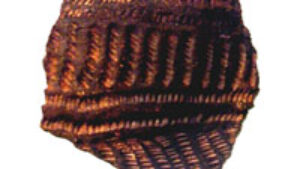
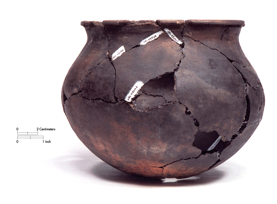
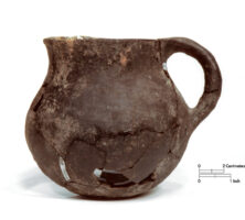
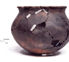
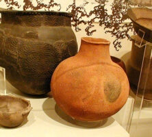
Colonoware, a form of earthenware pottery, was made by African Americans on plantations in Georgia, North Carolina, and South Carolina. Produced circa 1740, this pitcher was found during an exacavation in Charleston, South Carolina, during the late 1990s.
Courtesy of New South Associates
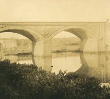
The Savannah-Ogeechee Canal, pictured circa 1888, was completed by enslaved laborers in 1829.
Courtesy of Georgia Historical Society, James S. Silva family papers, #GHS 2126-VM01-04 pg072.
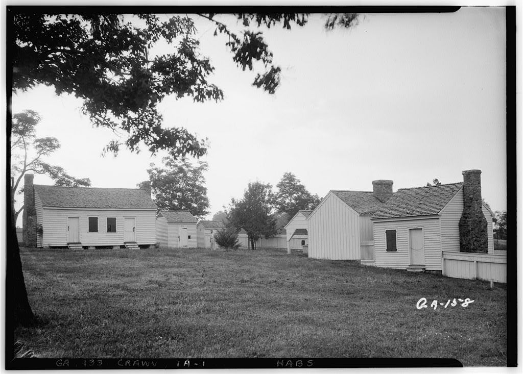
Slave quarters, pictured in 1936, stand at Liberty Hall in Taliaferro County, the homeplace of Georgia governor Alexander Stephens. African American structures on Georgia plantations were generally rectangular in shape, as opposed to the square forms preferred by Europeans.
Courtesy of Library of Congress, Prints and Photographs Division, Historic American Buildings Survey.
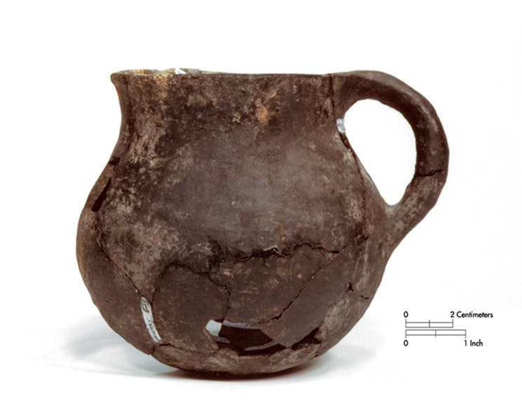
This colonoware jar, uncovered in South Carolina in the 1990s, dates to the mid-eighteenth century. Colonoware was made by African Americans on coastal plantations and has been found on several Georgia sites.
Courtesy of New South Associates
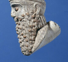
Dating to the 1850s, this Ninevian pipe was uncovered during an archaeological excavation conducted between 1989 and 1991 at the Springfield site near Augusta. The Springfield village was populated by free Blacks before the end of slavery in 1865.
Courtesy of New South Associates
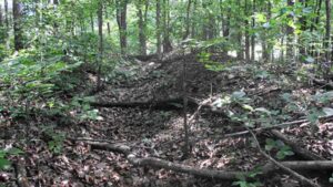
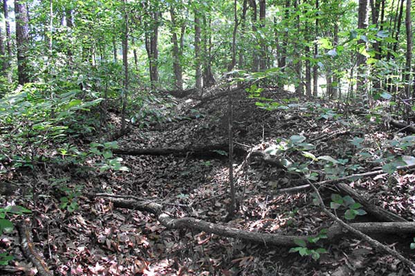
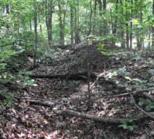
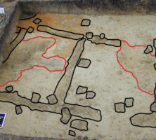
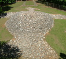
The outline of a wall trench was uncovered by archaeologists in 2000 at the Silk Hope Plantation, an eighteenth-century rice plantation in Bryan County. The markings in black show the locations of a wall trench and post features that form a slave dwelling, and the red outline shows the presence of pit features that were used for storage and other functions.
Courtesy of Brockington and Associates
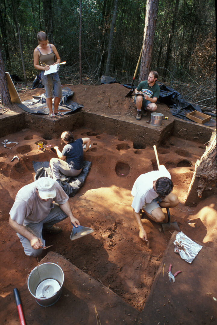
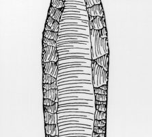
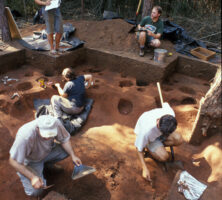
The excavation of the Singer-Moye Mounds in Stewart County has revealed the buried foundations of Indian buildings that were destroyed and abandoned more than 600 years ago. Thousands of ceramics fragments and animal bones have also been recovered.
Photograph by Elisabeth Hughes, New Georgia Encyclopedia
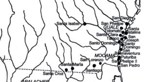
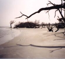
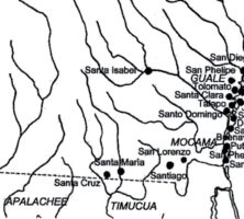
St. Catherines Island, located in Liberty County, is one of the barrier islands lining the coast of Georgia. The privately owned island, a National Historic Landmark, is about ten miles long and approximately one to three miles wide. From the 1590s to the 1680s a Spanish mission, Santa Catalina de Guale, was located on the island (at that time part of the Spanish colony La Florida).
Photograph by Jason D. Williams
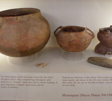
An example of Mississippian Lamar pottery, on display at the Ocmulgee Mounds Visitor Center in Macon.
Courtesy of Robert Foxworth
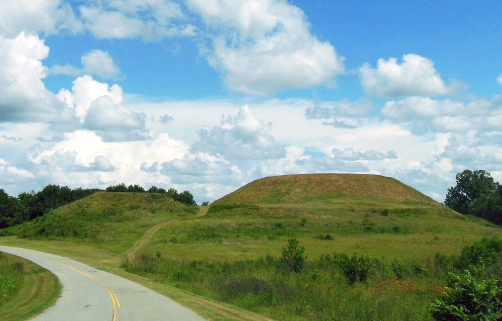
The earthen mounds at the Ocmulgee National Historical Park in Macon are the remains of a native culture that lived at the site between A.D. 800 and 1100, during the Early Mississippian period.
Photograph from National Park Service
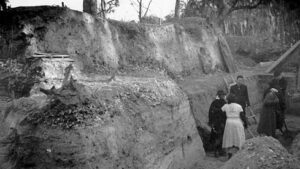
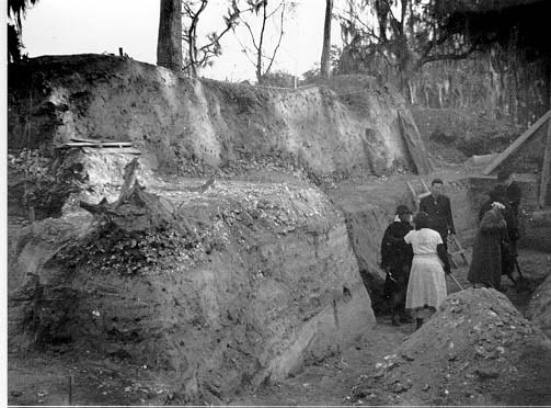
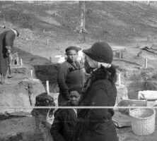
Excavation of the Irene mounds site, near Savannah, was led by several important archaeologists, especially Joseph R. Caldwell, who is pictured with an excavation team. Three different shell layers are visible in the earth behind the researchers.
Reprinted by permission of the Coastal Georgia Archaeological Society
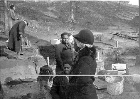
A group of African American women (pictured in December 1937) helped to excavate the Irene mounds site. The split oak basket, on the right, was made in Savannah especially for this project. The woman in the foreground is smoking a pipe.
Reprinted by permission of the Coastal Georgia Archaeological Society
A portion of the largest shell ring on Sapelo Island was excavated in 1950. The trench, cut into the ring by archaeologists, reveals white flecks of shell left behind by the hunter-gatherers who lived on the island during the Late Archaic Period, 5,000 to 3,000 years ago.
Courtesy of Victor D. Thompson
An archaeologist stands beside Shell Ring No. 1 on Sapelo Island. The shell rings, circular or semicircular in shape, are too large to be shown in their entirety by a single photograph.
Courtesy of Victor D. Thompson
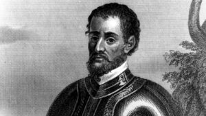
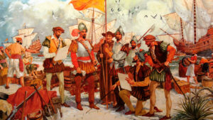
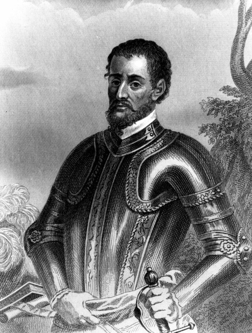
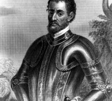
Hernando de Soto was a Spanish-born explorer and conqueror who landed in present-day Tampa Bay, Florida, in 1539 and came to the Georgia area in 1540. Chroniclers of the expedition described the Coosa River valley in glowing terms.
Courtesy of Georgia Info, Digital Library of Georgia.
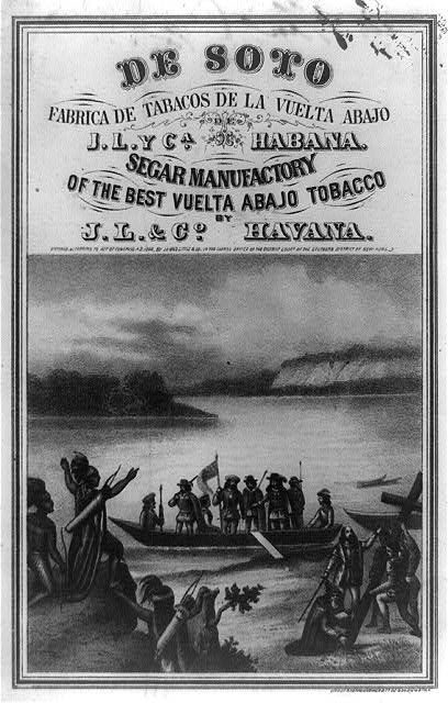
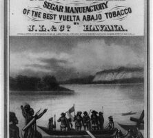
An 1866 tobacco label depicts Spanish explorer Hernando de Soto and his crew being welcomed ashore by Native Americans. De Soto entered Georgia twice in 1540, encountering the Altamaha, Capachequi, Coosa, Ichisi, Ocute, Patofa, Toa, and Ulibahali chiefdoms during his travels in the area.
Courtesy of Library of Congress, Prints and Photographs Division
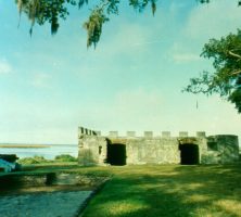
Georgia's Department of Natural Resources and the National Park Service join forces to offer an archaeological training program for teachers each summer at Fort Frederica National Monument on St. Simons Island. Students later return with their teachers to excavate a simulated colonial site.
Courtesy of Sea Island Company
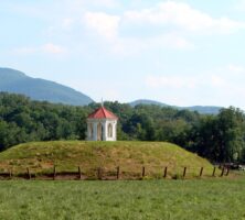
Located north of Eatonton in Putnam County, Rock Eagle is an Indian-made rock structure dating back to the Middle Woodland period (300 B.C. to A.D. 600).
Photograph by Brian McInturff
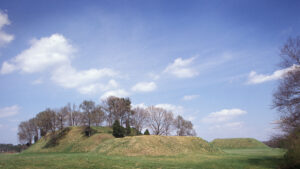
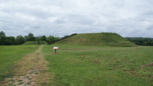
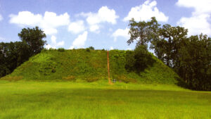
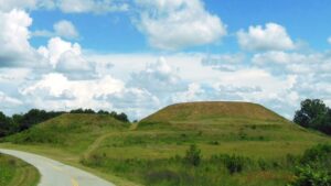
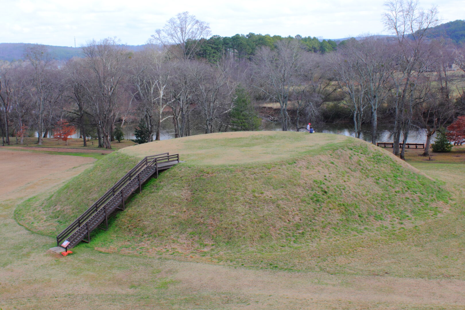
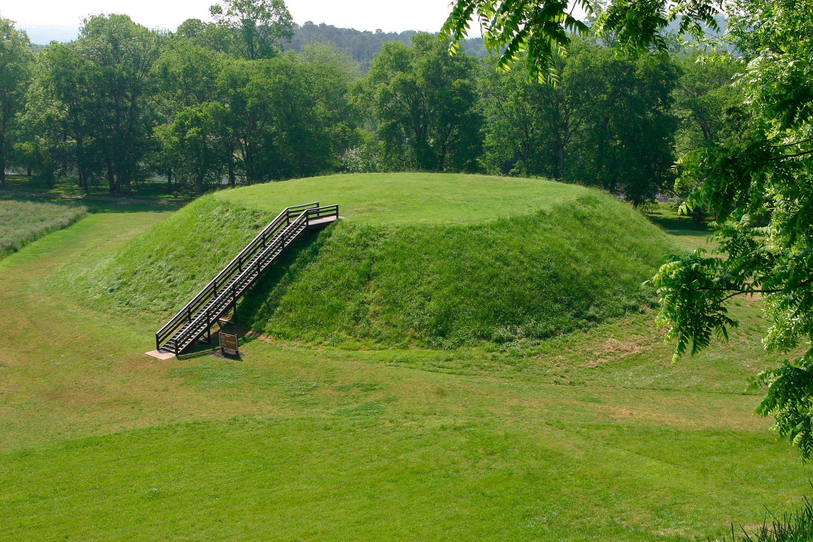
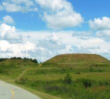
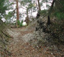
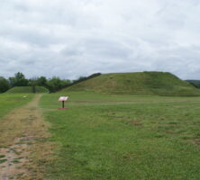
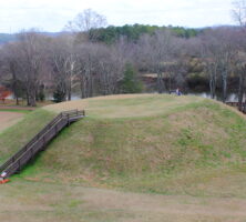
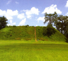
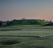
A path leading to two of the mounds at the Etowah Indian Mounds Historic Site. Located in Bartow County, the site is home to the second-largest Indian mound in North America, rises to a height of slightly more than 60 feet.
Photograph from Sharon Meier
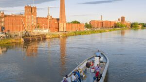
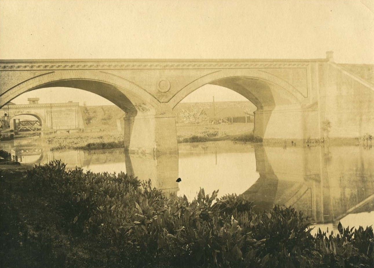
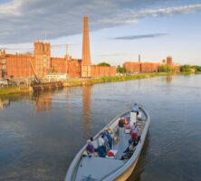
A modern tourboat passes the Confederate Powder Works chimney in Augusta along the Augusta Canal. The Georgia Community Greenspace Program has worked to preserve the Augusta Canal as an important historic and archaeological site.
Courtesy of Explore Georgia, Photograph by Ralph Daniel.
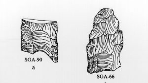
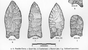
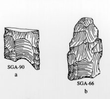
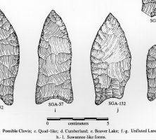
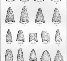
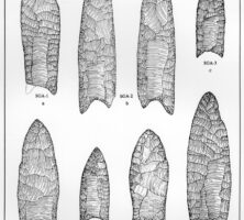
The Early Paleoindian subperiod is characterized by Clovis and related projectile point forms, relatively large lanceolate (lance-shaped) points with nearly parallel sides, slightly concave bases, and single or multiple basal flutes (channels) that rarely extend more than a third of the way up the body.
Courtesy of the University of Georgia Laboratory of Archaeology
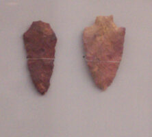
Commonly referred to as "arrowheads," these flint projectile points from the Archaic Period would have been used as spear tips or knives.
Courtesy of Ocmulgee National Monument, National Park Service
The Middle Paleoindian subperiod features smaller unfluted lanceolate projectile points such as the Suwannee types, among others.
Courtesy of the University of Georgia Laboratory of Archaeology
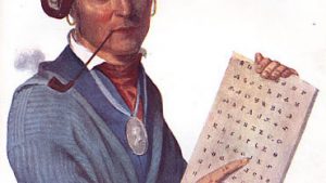
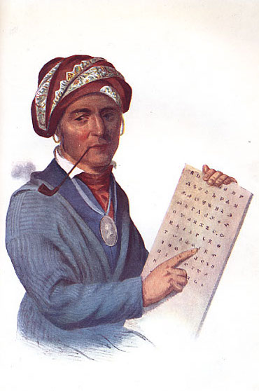
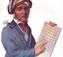
This hand-colored lithograph of Sequoyah (also called George Gist or George Guess), the legendary creator of the Cherokee syllabary, was made in 1833 after an oil portrait by Charles Bird King as part of a series depicting Native American leaders.
From The Indian Tribes of North America, by T. L. McKenney and J. Hall
The chiefdom of Ichisi was located between modern Macon and Perry on the Ocmulgee River. The capital town was probably located at the present-day Lamar archaeological site, a part of Ocmulgee Mounds National Historical Park.
Courtesy of Georgia Department of Economic Development.
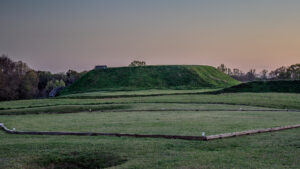
The Etowah mounds were built during the Lamar Period. Modern-day steps allow tourists to climb to the summit of the Etowah mounds.
Photograph by Muora
Although the original Late Prehistoric earthen platform mound has been completely excavated, a reconstruction of the Nacoochee Mound can be seen today on private property in the Nacoochee Valley.
Photograph by Martin LaBar
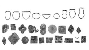
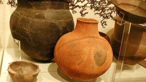
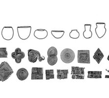
Mississippian Lamar pottery is distinctive because of its unique stamping and shape.
Courtesy of Robert Foxworth
An example of Mississippian Lamar pottery. Lamar pottery was made throughout Georgia and well into the adjacent states.
Courtesy of Robert Foxworth
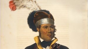
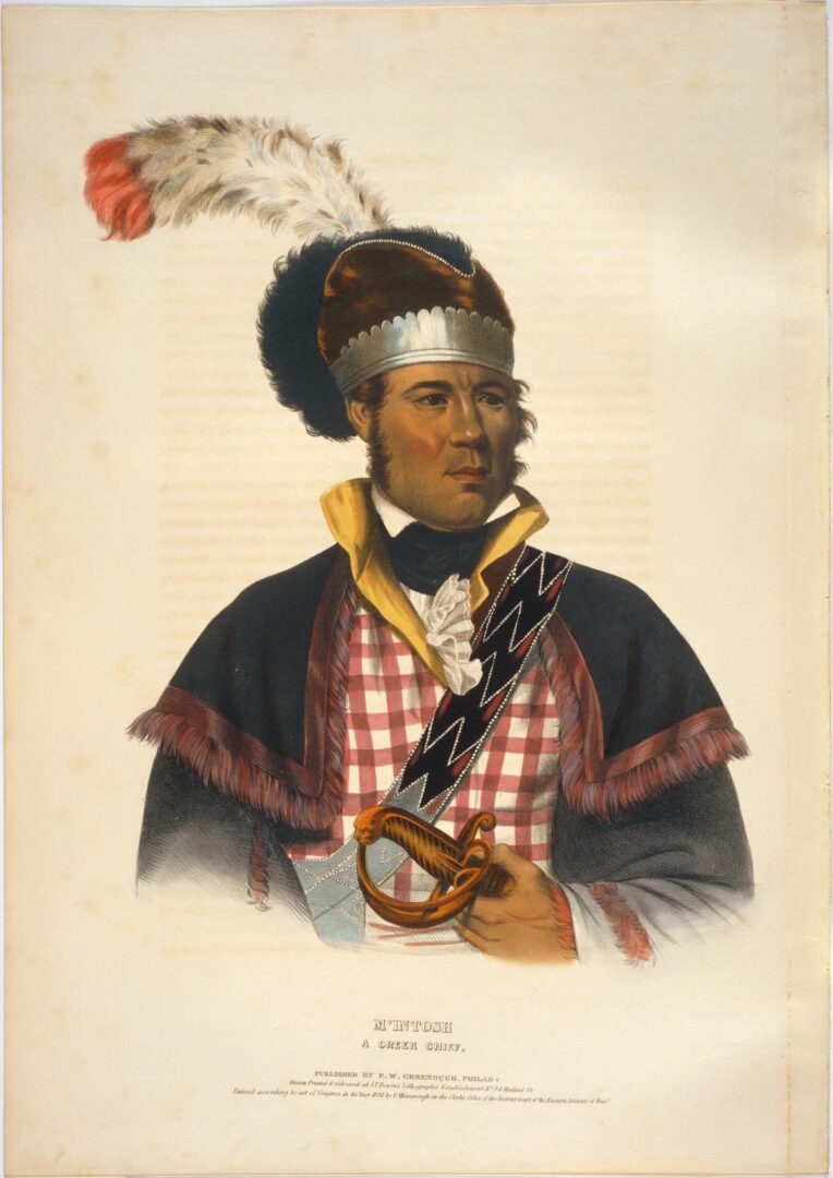
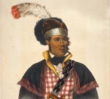
Charles Bird King's portrait of William McIntosh (ca. 1825). In 1825 McIntosh negotiated and signed the Treaty of Indian Springs, signing away all Creek lands in Georgia and thereby defying most of the reforms that he had encouraged and the laws that he had helped write.
Image from Archives and Rare Books Library, University of Cincinnati Libraries, McKenney and Hall: History of the Indian Tribes Collection.
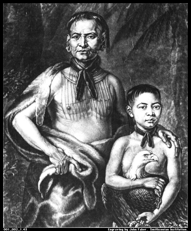
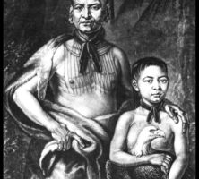
As a principal mediator between the native Creek (Muscogee) and English settlers during the first years of Georgia's settlement, Tomochichi (left) contributed to the establishment of peaceful relations between the two groups. His nephew, Toonahowi, is seated on the right in this engraving, circa 1734-35, by John Faber Jr.
A watercolor by Herbert Rudeen illustrates Tristan de Luna's historic landing at Pensacola Bay in August 1559. De Luna's failed plan to establish a Spanish presence along the lower Atlantic coast, the Gulf Coast, and the interior of the Southeast included the colonization of Ochuse (Florida), Coosa (Georgia), and Santa Elena (South Carolina).
Courtesy of Pensacola Historical Society
A 1791 engraving depicts Pedro Menendez de Aviles at about age fifty. Menendez de Aviles founded St. Augustine, Florida, the oldest European settlement in North America, in 1565, just before he explored the Georgia coastline.
From The Spanish Settlements within the Present Limits of the United States: Florida, 1562-1574, by W. Lowery
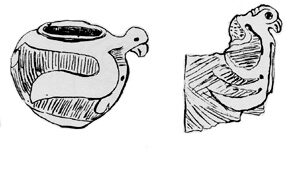
Drawings depict derived effigies with zoned incising found at the Davis Point excavation site at the Kolomoki Mounds. Weeden Island burial mounds are well known for the inclusion of elaborate animal effigy pots in large deposits.
From Excavations at Kolomoki, by W. H. Sears
The Kolomoki Mounds site in Early County is one of the largest prehistoric mound complexes in Georgia and includes at least eight mounds.
Courtesy of Kolomoki Mounds State Historic Park
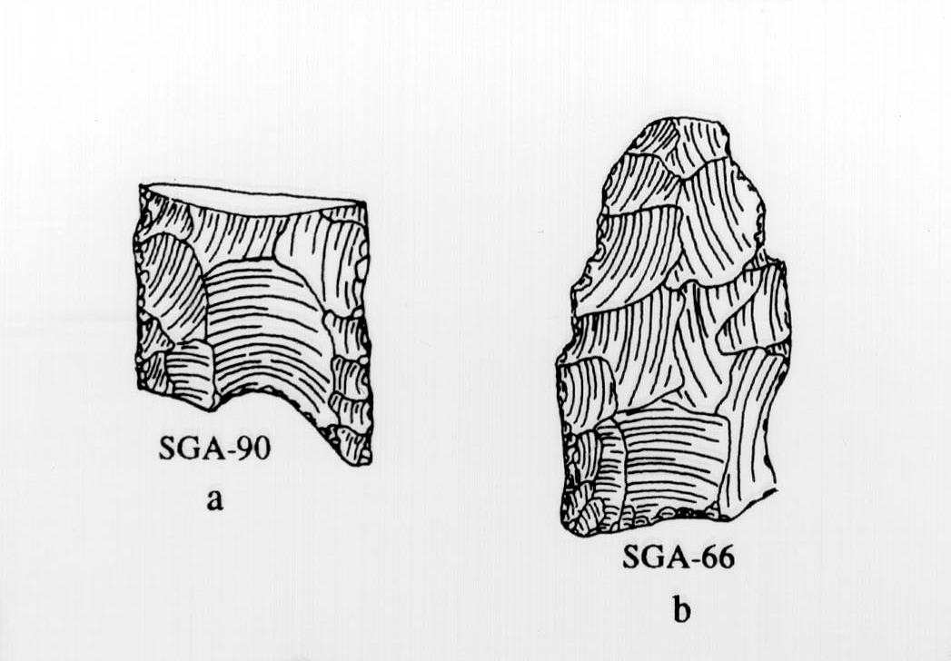
The Middle Paleoindian subperiod features fluted or unfluted points with broad blades and constricted handle elements, which may include the Cumberland type. Fluted points (pictured) have a channel or flute running from the base of the point.
Courtesy of the University of Georgia Laboratory of Archaeology
From the Late Paleoindian subperiod come Dalton and related point types, which are characterized by a lanceolate (lance-shaped) blade outline and a concave base ground on the lateral and basal margins, occasionally well thinned. Blade edges are frequently serrated and beveled.
Courtesy of the University of Georgia Laboratory of Archaeology
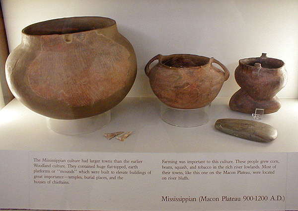
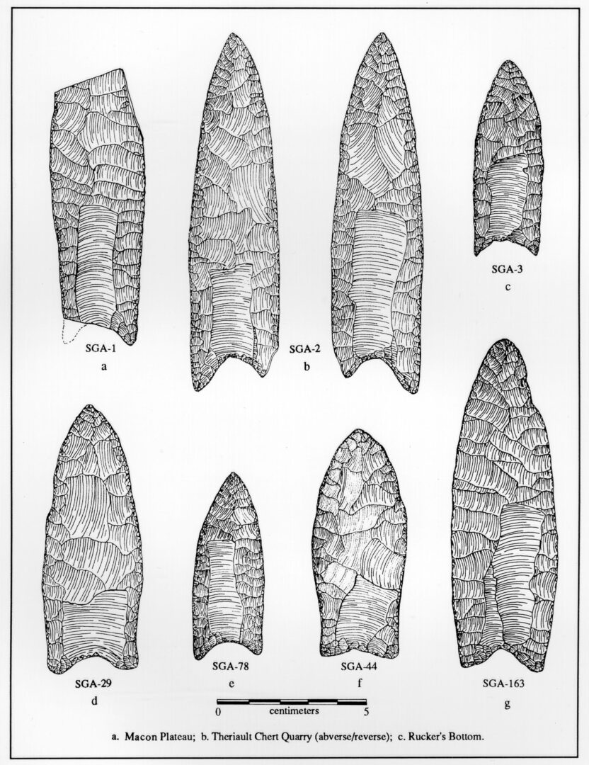
Only one fluted point was found at Macon Plateau, in spite of a massive excavation effort. The fluted point, missing the forward one-third of its length, was of the Clovis type of these artifacts.
Courtesy of the University of Georgia Laboratory of Archaeology
This copy of a Creek "hieroglyphick painting" was made in the 1770s by Bernard Romans. Romans was a British surveyor and engineer who worked in Florida during the 1770s. He made many notes on the Creeks.
The home of Cherokee chief James Vann was located north of the Moravian Mission at Spring Place. Invited by Vann and other Cherokee leaders, the Moravians provided a school for Cherokee children and housed 114 students between 1804 and 1833.
The Taloney Mission (later Carmel Mission) was founded by the Georgia Presbyterians in Pickens County along Talking Rock Creek. The Presbyterians established and ran a number of mission schools throughout Georgia from 1817 to 1833. The remains of the Taloney Mission were photographed between 1930 and 1960.
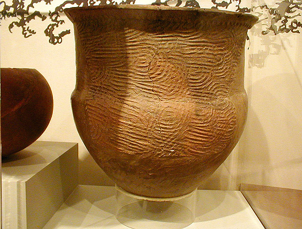
This type of pottery originated in northwestern Georgia and is found in small quantities throughout the state. It is from the Middle Mississippian subperiod.
Courtesy of Mark Williams
Stallings Island, located in the Savannah River eight miles upstream from Augusta, is best known for its very early pottery, a technological development that predated the advent of farming in Georgia by several millennia. Pictured are sherds of the punctated fiber-tempered pottery, ca. 3,800-3,500 years ago. The sherd on top is actually 11 centimeters wide.
Courtesy of Kenneth E. Sassaman
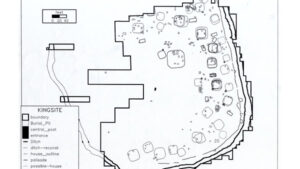
The King site in Floyd County covers a little more than five acres and is bounded by a defensive ditch and palisade. It was first occupied at some time during the first half of the sixteenth century.
Courtesy of David Hally
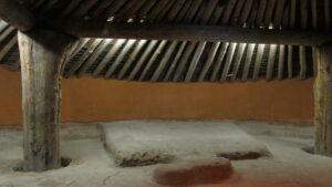
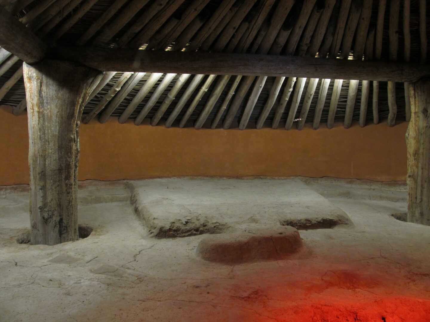
Photograph of ceremonial earthlodge which has been reconstructed and is today part of the Ocmulgee National Monument in Macon, Georgia.
Image from Ken Lund
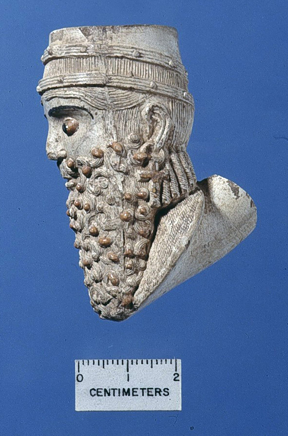
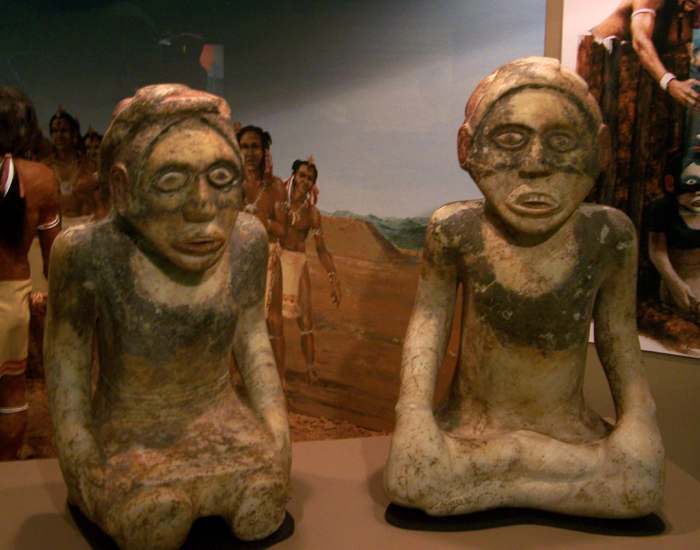
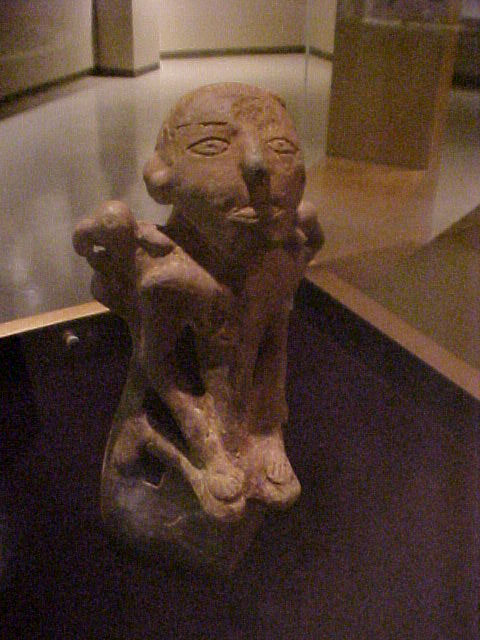
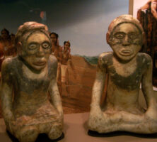
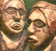
Archaeological excavation, carried out intermittently at the Etowah mound site for more than 100 years, has unearthed artifacts such as these figures, which have provided much information about life in the Mississippian Period.
Photograph from Wikimedia
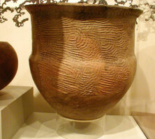
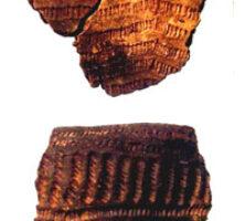
Swift Creek pottery is noted for its distinctive decoration. Complex curvilinear patterns were first carved into a wooden paddle, which was used to stamp the design into the soft clay walls of the pottery before it was fired.
Courtesy of Kennesaw State University
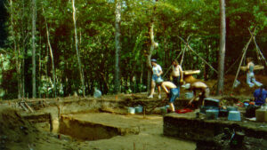
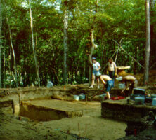
In 1978 and 1979 the University of Georgia's Department of Anthropology excavated portions of the Cane Island archaeological site before it was flooded. It now lies beneath Lake Oconee in Greene County, Georgia.
Courtesy of W. Dean Wood
Cane Island, the site of one of the earliest Native American farming villages in Georgia, was located in present-day Greene County along a shallow portion of the Oconee River known as Long Shoals. Wild plants and animals around the river likely supplied most of the food for the Cane Island residents.
Courtesy of W. Dean Wood
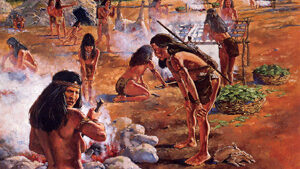
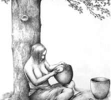
An illustration of what Sara's Ridge probably looked like during the Middle Archaic Period. The woman in the foreground is cooking with soapstone slabs, while hunters carry a deer toward racks where fish are hung over a fire.
From Beneath These Waters, by S. Kane and R. Keeton
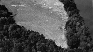
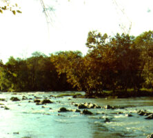
Archaeologists excavated a prehistoric Indian village in Rucker's Bottom near the Savannah River about 500 years after the civilization's height.
Modern-day steps lead to the summit of one of the Indian mounds at the Etowah site.
Courtesy of Georgia Department of Natural Resources, Georgia State Parks.
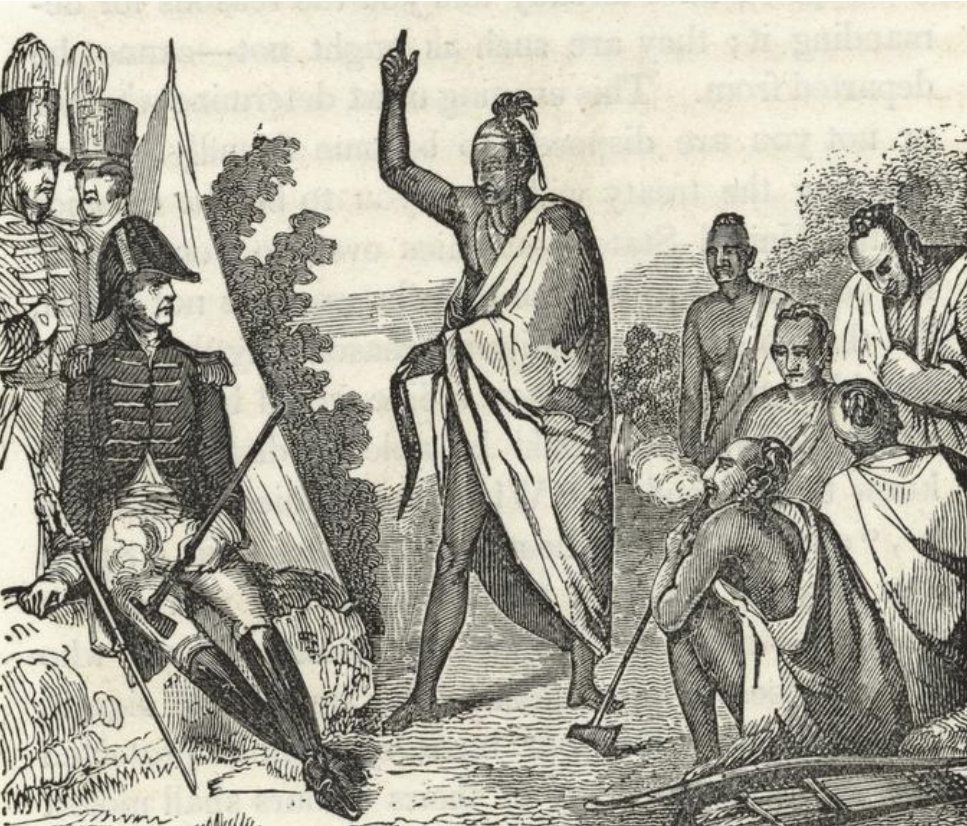
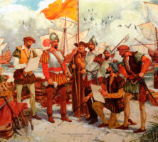
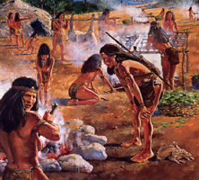
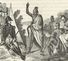
The Creek Indians meet with James Oglethorpe. By the time Oglethorpe and his Georgia colonists arrived in 1733, relations between the Creeks and the English were already well established and centered mainly on trade.
A civil war between the United States and the Creeks erupted in 1813. In a final battle in March 1814 at Horseshoe Bend in Alabama, General Andrew Jackson (left) directed the killing of 800 Creeks. The Red Stick War officially ended in August 1814 with the Treaty of Fort Jackson.
Image from the New York Public Library Digital Collections, The Miriam and Ira D. Wallach Division of Art, Prints and Photographs: Picture Collection.
A brief conflict between the United States and Creeks in 1836 ended with U.S. troops, assisted by Georgia and Alabama militia, rounding up Creeks and forcibly sending them to Indian Territory (Oklahoma).
Reprinted by permission of The Granger Collection, New York
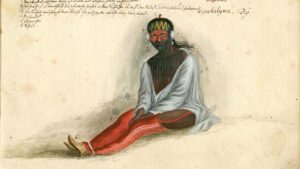
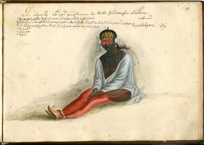
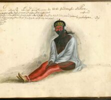
This watercolor portrait of "General" Kipahalgwa of the Yuchi Indians was painted by the German artist Philip Georg Friedrich von Reck around 1734. Kipahalgwa is depicted wearing an English-style shirt, leggings, and shoes.
Illustration by Philip Georg Friedrich von Reck
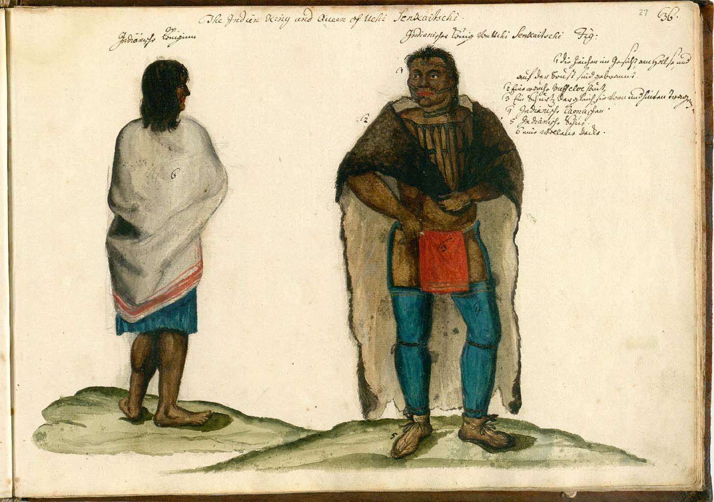
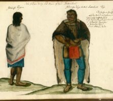
Painter Philip Georg Friedrich von Reck identifies this couple as Senkaitschi, a Yuchi king, and his queen. The queen's blanket, which the artist describes as "a British blanket from Charles Town," offers evidence of trade with Europeans.
Illustration by Philip Georg Friedrich von Reck
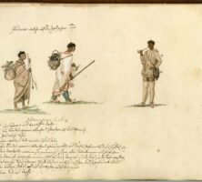
This illustration shows the Yuchi Indians of Georgia with popular adornments and accessories including: a) ring and pearl worn by some in the nose, b) corals, c) arrows and lines burned into the chest, and d) ladle made from a buffalo horn.
Illustrations by Philip Georg Friedrich von Reck
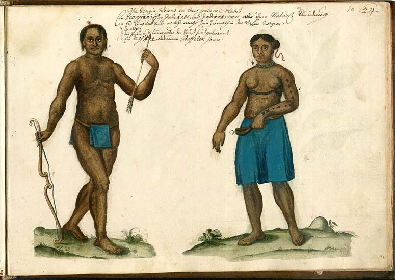
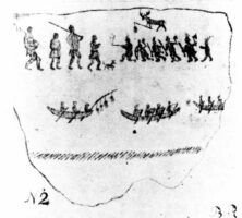
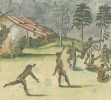
Georgia's Yuchi Indians were one of many refugee tribes in the area during the eighteenth century. They eventually joined with the Lower Creek Indians. Here the Yuchi Indians are depicted in a war dance.
Illustration by Philip Georg Friedrich von Reck
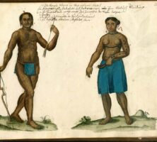
Yuchi Indians, depicted in traditional hunting clothing, also carry items acquired through trade with the English, notably the central figure's blanket and rifle.
Illustration by Philip Georg Friedrich von Reck
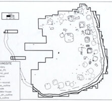
A view of the immediate area where the Macon Trading Post was located.
Photograph by Dsdugan / CC0
Archaeological excavation, carried out intermittently at the site for more than a hundred years, has unearthed artifacts such as these stone figures, which have provided much information life in the Mississippian Period.
Courtesy of Georgia Department of Economic Development.
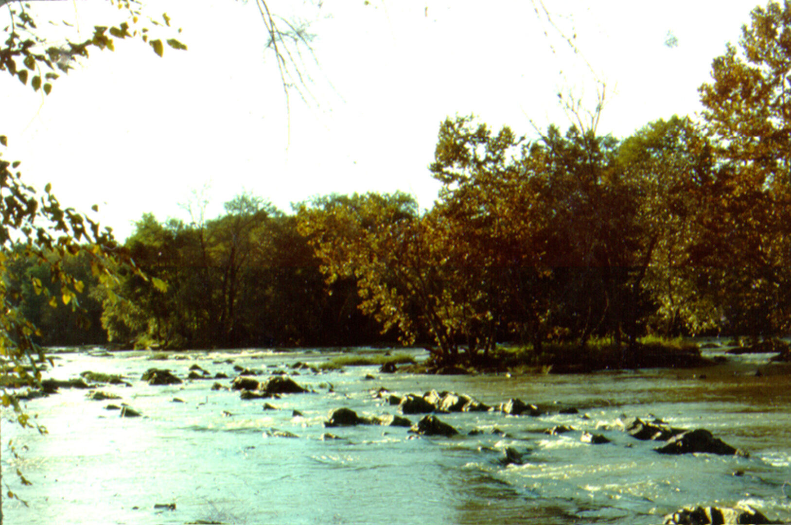
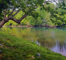
The Etowah River, with headwaters near Dahlonega, flows west-southwest for 140 miles to Rome, where it forms the Coosa River when it joins the Oostanaula River.
Image from Kevin Trotman
Archaeologists now recognize that the main occupation of the Kolomoki Mounds site dates to the Woodland Period (1000 B.C.-A.D. 900).
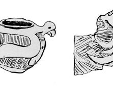
Ceramic artifacts were found during excavations of the Kolomoki Mounds in Early County.
Photograph by Bubba73, Wikimedia Commons
Courtesy of John Worth