The New Georgia Encyclopedia is supported by funding from A More Perfect Union, a special initiative of the National Endowment for the Humanities.
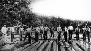
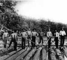
These men are rafting timber down the Oconee River in Laurens County, circa 1890.
Courtesy of Georgia Archives, Vanishing Georgia, #
lau123.
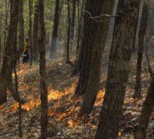
A worker at the Piedmont National Wildlife Refuge, located in Bibb and Twiggs counties, lights a prescibed fire in 2014. Burning the understory encourages the growth of pine trees, which provide habitat for the red cockaded woodpecker. Native Americans living in the Piedmont prior to European arrival also set surface fires to clear land for agriculture. The thick-barked pines survive, but most shrubs and saplings are killed, favoring an open forest with grasses and herbs.
Photograph by U.S. Fish and Wildlife Service Southeast Region
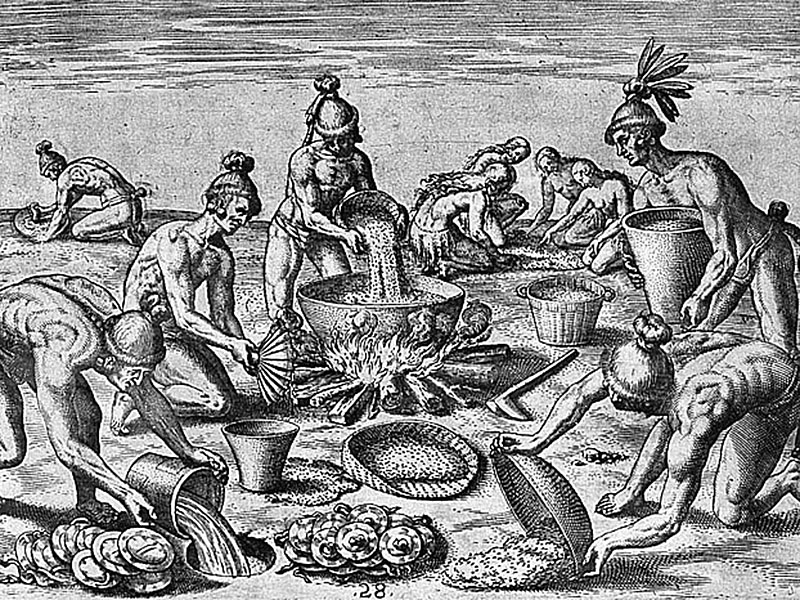
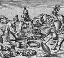
Native Americans in Georgia impacted species distributions. For instance, Yaupon holly leaves were dried and made into a highly caffeinated black tea, which was used for purification purposes. The holly leaves were traded far beyond the plant's native Coastal Plain range.
Engraving by Theodore de Bry after an original painting by Jacques Le Moyne de Morgues
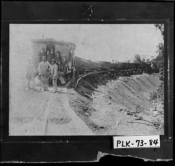
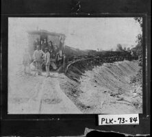
The East and West Railroad, built between Cartersville and Cedartown around 1900, is one of several railroads that came to Polk County in the late nineteenth and early twentieth centuries.
Courtesy of Georgia Archives, Vanishing Georgia, #
plk073-84.
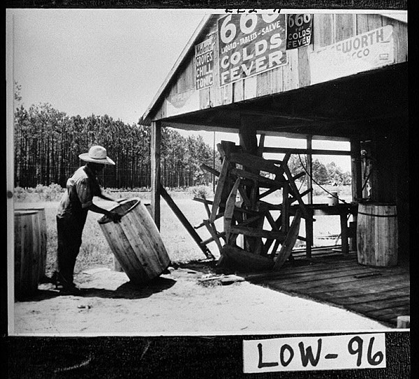
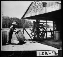
Anthony Head, a worker in a Lowndes County turpentine still, makes barrels for holding rosin, circa 1900. The naval stores industry formed an important part of the economy in wiregrass Georgia, of which Lowndes County is a part, in the early twentieth century.
Courtesy of Georgia Archives, Vanishing Georgia, #
low096.
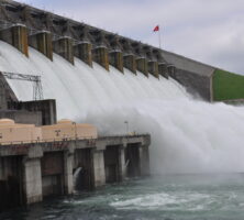
Construction on Hartwell Dam began in 1955 and concluded in 1963. The dam diverts the Savannah River and some of its tributaries into Lake Hartwell, which, with nearly 1,000 miles of shoreline, is one of the largest man-made bodies of water east of the Mississippi River.
Photograph by U.S Army Corps of Engineers Savannah District
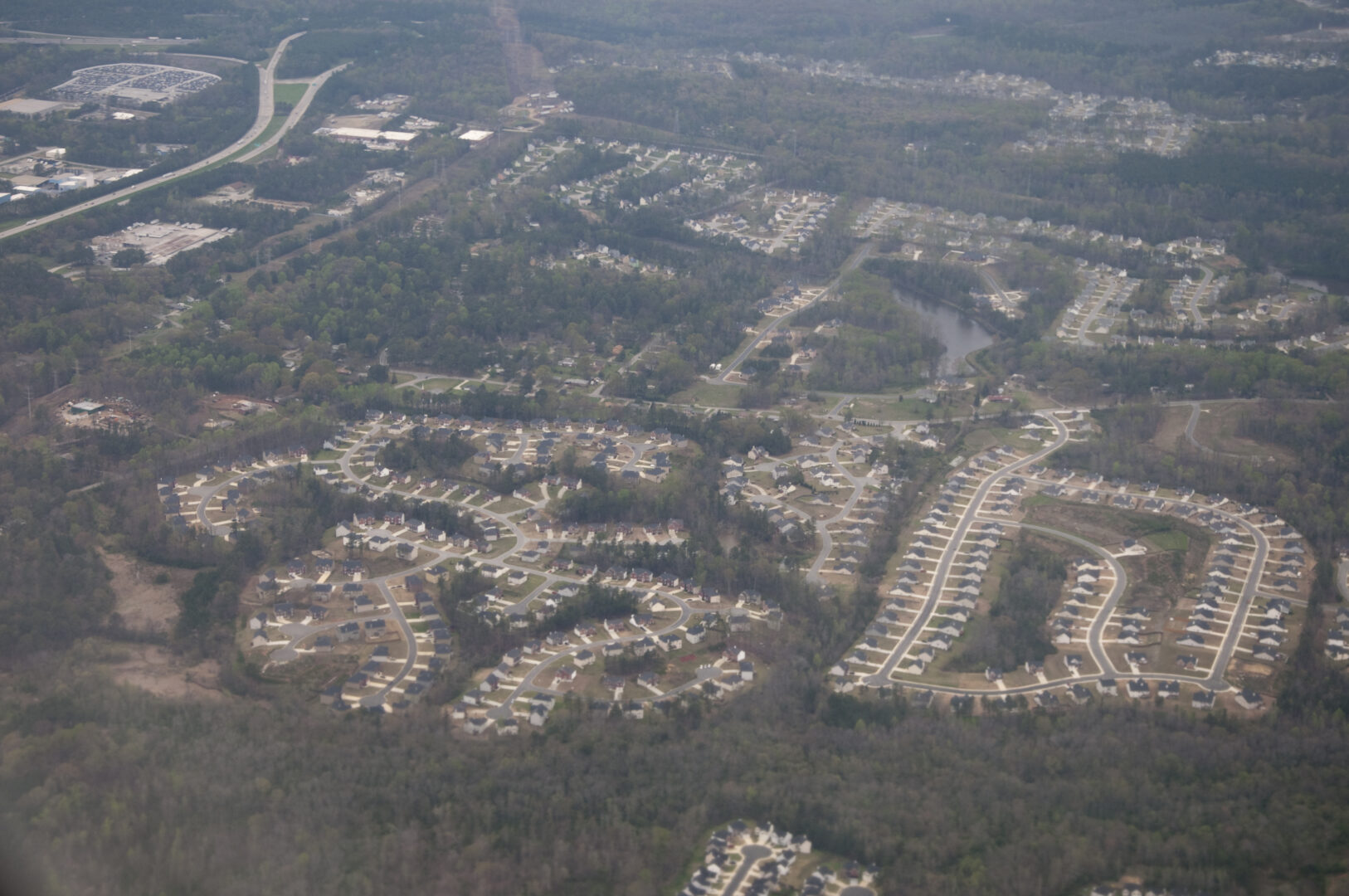
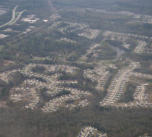
The doubling of Georgia's population has exacerbated pollution problems and fragmented the landscape through urban sprawl. This housing development in the Atlanta metropolitan area illustrates the loss of greenspace over a wide area.
Photograph by Maik
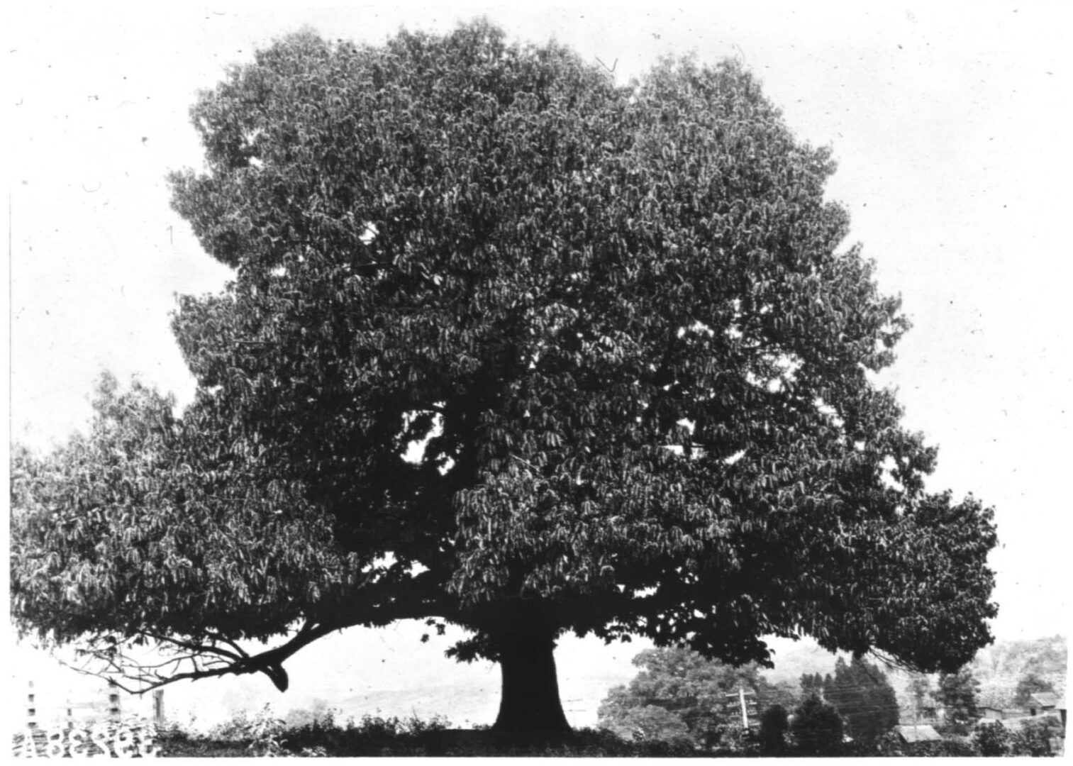
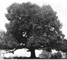
Vintage photo of an American chestnut tree, taken in the early twentieth century.
Courtesy of The American Chestnut Foundation
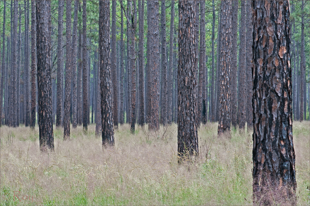
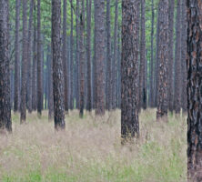
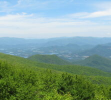
Longleaf pines and wiregrass dominate the landscape of southeast Georgia. Pines can grow quickly on clear-cut land, without competition for resources from other trees, especially hardwoods.
Photograph by Roy Cohutta
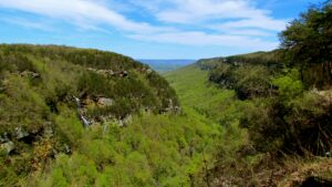
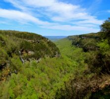
Cloudland Canyon State Park is located in Dade County, near the northern end of Lookout Mountain, in the Appalachian Plateau.
Photograph by Jeff Gunn
Brasstown Bald, located partly in Union County and partly in Towns County, was formed by the breaching of thrust faults by erosion, resulting in the exposure of rocks once deeply buried in the Appalachian Mountains. Situated in the Blue Ridge province, Brasstown Bald is the highest point in Georgia.
Photograph by Vicki's Nature
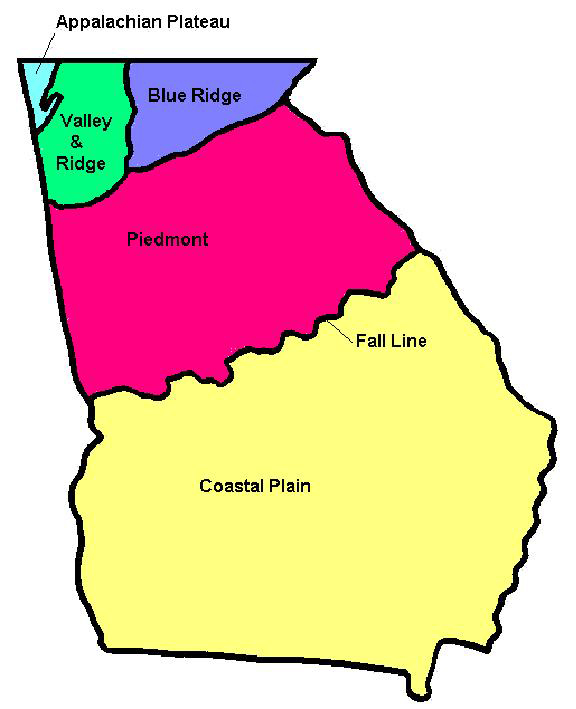
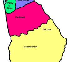
Georgia encompasses parts of five distinct geographic regions: the Appalachian Plateau, the Valley and Ridge, the Blue Ridge, the Piedmont, and the Coastal Plain.
Courtesy of Pamela J. W. Gore
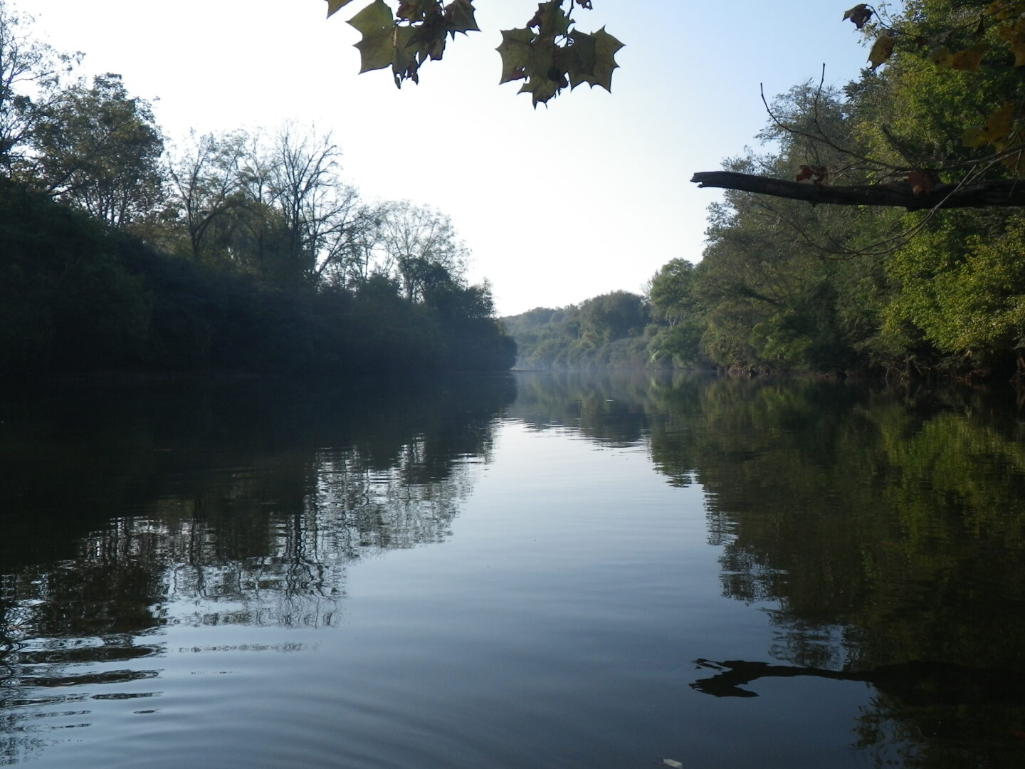
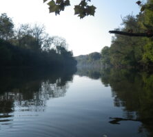
The Chattahoochee River, part of the Apalachicola-Chattahoochee-Flint river basin, is one of the nation's most endangered rivers. In addition to providing habitat for birds, mammals, and reptiles, the river supports six endangered or threatened mussel species. The river begins in the Blue Ridge Mountains and flows to southwest Georgia.
Photograph by Dianne Frost
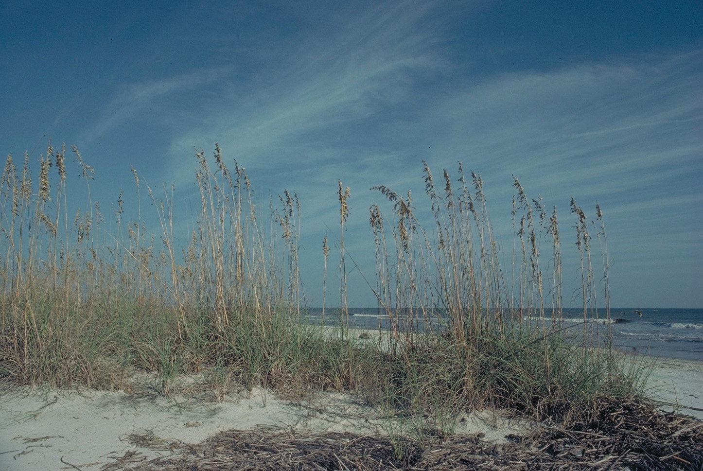
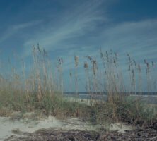
Sea oats grow along the coast of Blackbeard Island in Georgia's Lower Coastal Plain.
Courtesy of U.S. Fish and Wildlife Service