Environmental history is defined here as the history of human impact on the landscape. It provides a landscape record for scientists who seek to understand present ecological systems by learning about past environments. From a sociohistorical perspective, environmental history presents a record of human activities and the effects of those activities on the landscape.
Native American Influences
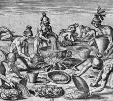
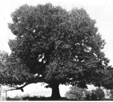
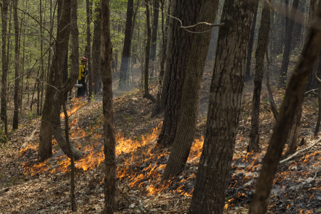
Humans arrived in the Southeast roughly 12,000 years ago. Over the millennia, Native Americans interacted with the landscape in numerous ways. Fire setting, first used to promote hunting, had perhaps the most significant impact. Indians set fires to drive game, increase forage for prey, and create clear views and easy passage through woodlands. Frequent fires fostered the survival of thick-barked oak and pine trees.
Photograph by U.S. Fish and Wildlife Service Southeast Region
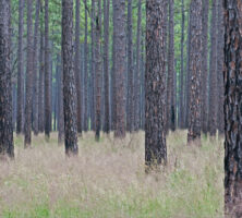
Fire setting was probably common in the Piedmont. Varying fire-setting regimes would have created a patchy landscape, in which frequently burned, open oak forests adjoined less recently burned areas crowded with saplings, briars, and shrubs or unburned areas with more thin-barked trees. In the Coastal Plain, lightning maintained longleaf pine stands carpeted with diverse herbs or wiregrass and bounded by firebreaks like cypress swamps; Indian-set fires may have supplemented the natural regime. Scholarly opinion differs as to the fire regime in the mountains. Fires from lightning strikes are rare and low in intensity in most mountain sites. Native Americans certainly supplemented the natural fire regime by burning in the river valleys to promote agriculture and probably burned many dry mountain ridges. Moist coves, on the other hand, would have burned less often.
The settlement of river valleys was also significantly affected by the environment. Cultures became increasingly sedentary, developing agriculture and constructing more permanent buildings along rivers. Fire setting cleared land for agriculture and fostered large stands of much-used cane along the rivers. These settlement trends culminated with the complex Mississippian culture, in which river valleys supported huge earthen mounds, stockades, residences, orchards, and cropland.
Thus, the landscape prior to European arrival was not entirely pristine. Rather, in a complex mosaic, human riverside settlements punctuated landscapes of large, fire-fostered pines and oaks alongside unburned areas such as cypress swamps in the Coastal Plain and huge cove hardwoods in the mountains.
European Settlement and Landscape Transformation
Europeans transformed the forested mosaic promoted by the Native Americans to a land forged for the production of goods for foreign markets. Huge harvests of forest resources in early colonial days demonstrated the size of the export market. Ginseng was collected to scarcity, and animal pelts were taken from southeastern forests in huge quantities. From 1700 to 1715 more than 1 million fox, elk, otter, and other skins were shipped from Charleston, South Carolina; from 1739 to 1761 more than 5 million pounds of deerskins alone were exported from the Southeast. Beavers were nearly hunted to extinction within the state, and buffalo and elk were disappearing by 1760. Of the commodities that followed, rice, cotton, and timber spurred perhaps the greatest changes in Georgia’s landscape.
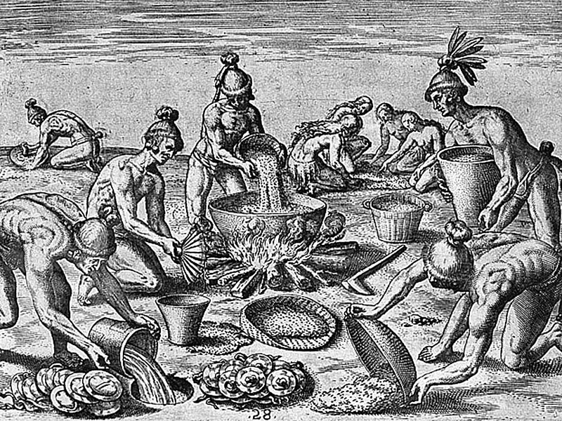
Engraving by Theodore de Bry after an original painting by Jacques Le Moyne de Morgues
Rice and Cotton
In 1750 the prohibition on slavery was lifted in Georgia, catalyzing large-scale commercial agriculture. Rice was the first commodity to transform a portion of Georgia’s landscape. Landowners cleared large swaths of forest to construct plantations and rice fields. However, tidal rivers inundated and drained the impounded rice, limiting the most intense human agricultural production to the tidal deltas.
Upon Eli Whitney’s invention of the cotton gin in 1793, cotton production spurred a landscape transformation across the Piedmont and the western and Upper Coastal Plain. Following a cascade of land cessions from Native Americans, farmers rolled across the land, growing cotton for profit and corn for livestock and human consumption. They cleared and farmed a plot of land for a few years, then abandoned the depleted soil and moved on. Staggering amounts of soil were eroded off the barren fields; on average, 7.5 inches of topsoil were lost. The eroded sediments washed into streams, burying milldams and depositing as much as eight to fifteen feet of silt on some streambeds. The higher streambeds and absence of plants to impede winter storm runoff caused widespread flooding. Intense cotton farming and its deleterious effects continued until the 1920s, when the boll weevil, plummeting prices, and depleted soils contributed to a sharp decline in production.
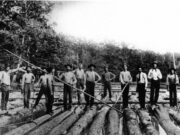
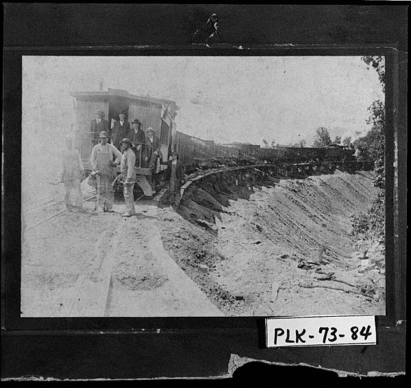
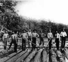
Industrial Logging
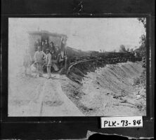
Prior to the 1860s commercial logging occurred primarily along navigable streams, where logs could be floated to downstream ports. However, after the Civil War (1861-65), the expansion of railroads and portable saw mills allowed access to remote mountain slopes and the interior Coastal Plain. At the same time northeastern forests were becoming depleted, and new markets for longleaf pine heartwood emerged. Lumber became a huge commodity in Georgia. The state was the nation’s leading producer of lumber in the 1860s and 1870s, and by 1890 Georgia sawmills were cutting more than 1.6 million board feet per day. Nearly all the longleaf pine forest was cut, as were the magnificent cypresses of the Okefenokee Swamp, and over time, the old-growth trees of the mountains. In addition, urbanization occurred along the railroad lines, and highway development began with the arrival of the automobile.
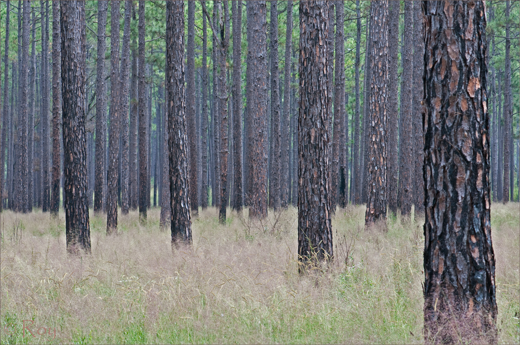
Photograph by Roy Cohutta
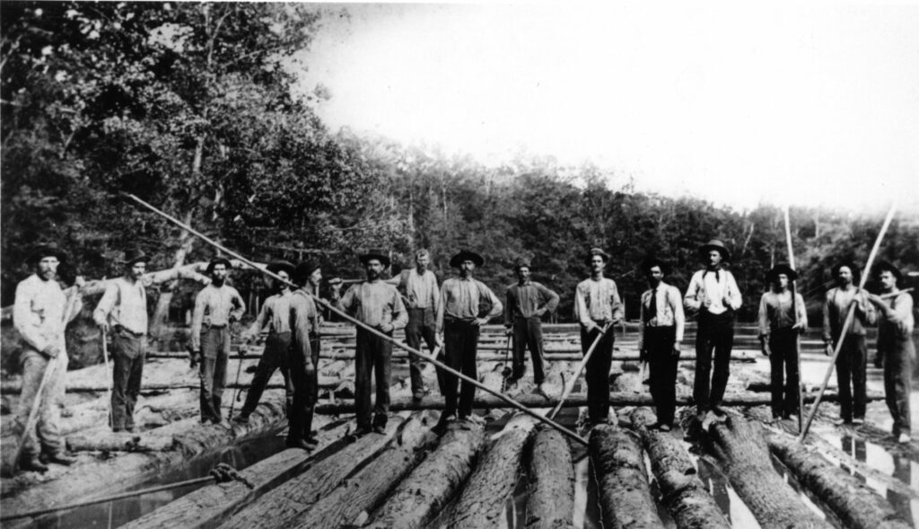
Courtesy of Georgia Archives.
Hence, by the 1930s commercial agriculture, industrial logging, and increasing urbanization had created a landscape far different from that first encountered by Europeans. The stumps and scraggly trees of cut-over land, silted streams and denuded hillsides of abandoned farms, and growing networks of towns and transportation corridors had replaced much of the forest mosaic.
Conservation and Reforestation
In the mid-1900s two trends changed the tenor of human impact on the Georgia landscape. First, soil and timber depletion spurred conservation efforts. Second, much of the barren land reverted to trees.
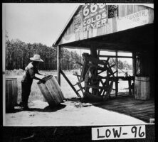
In 1935, as dust from the parched western states blew into Washington, D.C., Congress passed the Soil Conservation Act. The Georgia Soil Conservation Districts Law followed in 1937. Soil conservation districts were established throughout the state, encouraging farmers to build terraces, plant kudzu and lupine in barren fields, convert fields to pasture, and practice strip cropping and contour tillage. Erosion rates declined greatly. In 1944 Congress passed the Flood Control Act. The soil conservation districts became soil and water conservation districts and organized the construction of detention dams and recreational lakes, as well as stream dredging and channelization.
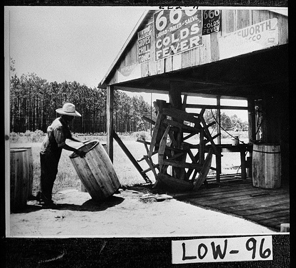
Courtesy of Georgia Archives.
An impetus to preserve wild landscapes had gained national momentum in the early twentieth century. Following that course, many state and national wildlife refuges, parks, and forests were established in Georgia in the 1920s and 1930s, in a movement that continued throughout the century.
While many farms adopted better farming practices, others were abandoned. In a trend that peaked in the 1960s, abandoned fields underwent secondary succession, a process in which grasses, shrubs, pines, and hardwoods succeed one another over time.

Photograph by U.S Army Corps of Engineers Savannah District
In the 1930s Charles Herty, a chemist at the University of Georgia, revolutionized land use in Georgia when he stimulated the pulpwood industry by using young pines to make white paper. Many old fields, particularly in the Coastal Plain, converted to pine plantations.
Thus a partially forested landscape reemerged in Georgia, although it was not the same forest encountered by the first Europeans. Highways and towns fragmented the woodlands, most trees were young second growth, and pine plantations lacked diversity. Fire suppression prevented open forests and the return of longleaf pines and encouraged more thin-barked trees in the Piedmont. Many natural wetlands, such as parts of the Okefenokee Swamp, had been drained for pine plantations and agriculture, even as dams created vast new lakes.
Urbanization and Regulation
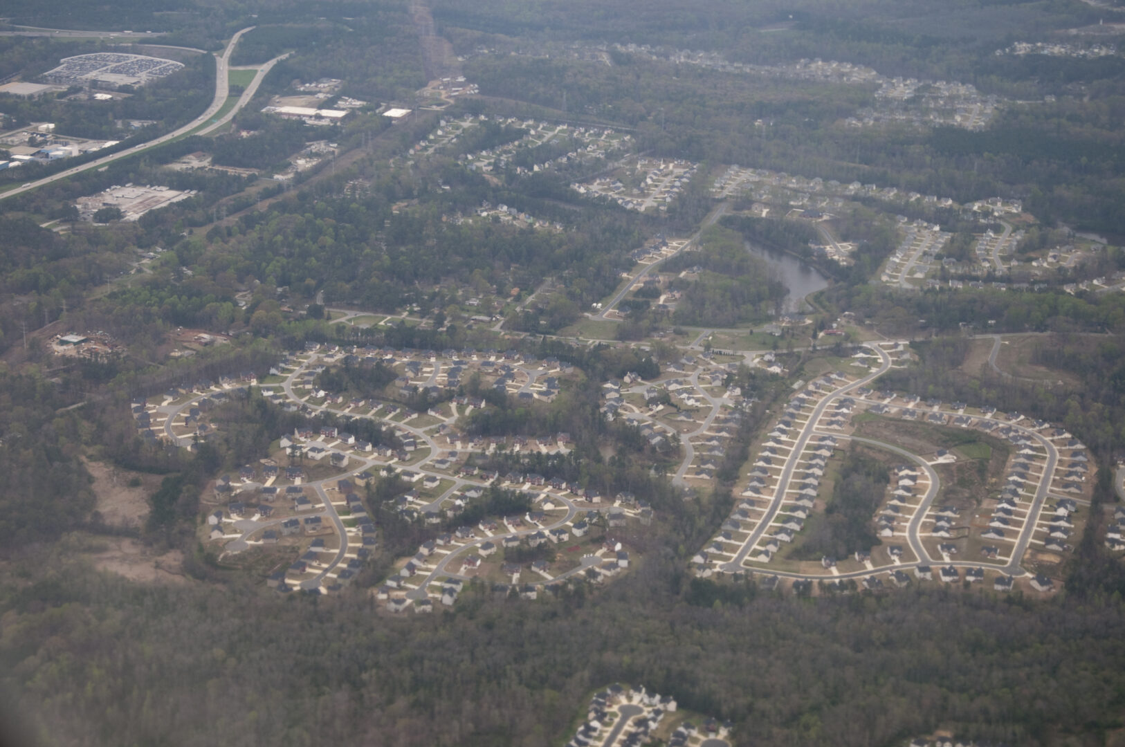
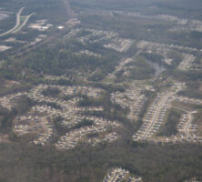
In the second half of the twentieth century, human-environment interactions became increasingly complex. By the 1960s a lack of regulation had permitted severe pollution problems. Urbanization accelerated. The population of Georgia doubled from roughly 4 million people in 1960 to more than 8 million in 2000, exacerbating pollution problems, straining water resources, and fragmenting the landscape through urban sprawl. At the same time, the science of ecology came of age and fostered an appreciation of biodiversity and an understanding of the links among species extinction, urban sprawl, and invasive exotic species.
Pollution and Water Supply Regulations
In 1960 very few air or water pollution controls existed. Industries released more than 400 toxic chemicals into the air, drinking-water quality was not regulated, and 70 percent of the municipal sewage in Georgia entered rivers untreated. Fossil fuel use spawned high levels of ground-level ozone in large urban areas. Construction sediment coated stream bottoms, and water supplies became problematic as demand from the growing population, industry, and agriculture increased. While ozone, water supply, and sediment issues remained problematic, state and national regulations successfully addressed many other problems and markedly improved the environment.
Urban Sprawl and Species Conservation
By the 1990s ecologists had found that urban sprawl sparked a decline in species diversity: it destroyed habitats, fragmented forests into small patches that failed to protect many species, and created barriers that prevented animals from searching out mates and food. Ecologists also found that invasive exotic (non-native) species threatened the survival of native species. This trend was first exhibited in the early 1900s with the devastating chestnut blight. Imported from Japanese nursery stock, this fungus decimated chestnut trees, which once made up 20 to 60 percent of the tree canopy in the mountains. Kudzu, fire ants, Chinese privet, dogwood anthracnose, and other exotic species continue to prey upon or displace native species.
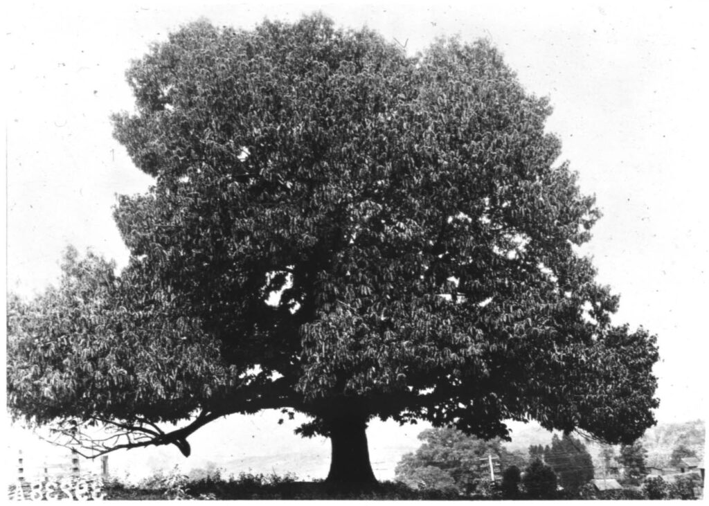
Courtesy of The American Chestnut Foundation

Photograph by Maik
Several forces countered these trends. In 1973 the federal Endangered Species Act was passed, spurring the protection of species in Georgia. Land conservation by many groups accelerated, and the Georgia Community Greenspace Program was created in 2000 through an act of the Georgia legislature. The voluntary program provided funds to encourage counties to preserve 20 percent of their land and water as permanent greenspace for the protection of natural resources and informal recreation.