The New Georgia Encyclopedia is supported by funding from A More Perfect Union, a special initiative of the National Endowment for the Humanities.
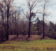
The excavation of the Singer-Moye Mounds in Stewart County has revealed the buried foundations of Indian buildings that were destroyed and abandoned more than 600 years ago. Thousands of ceramics fragments and animal bones have also been recovered.
Photograph by Elisabeth Hughes, New Georgia Encyclopedia
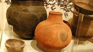
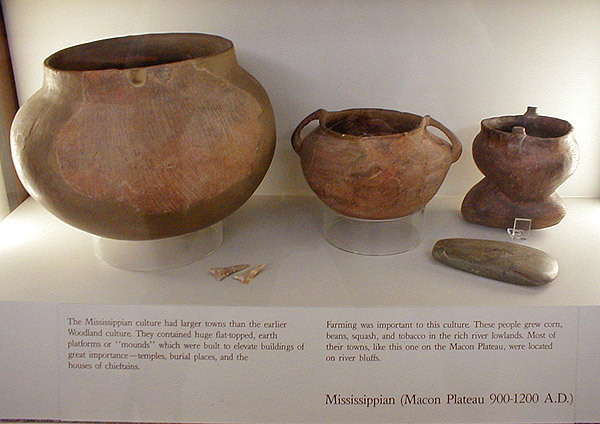
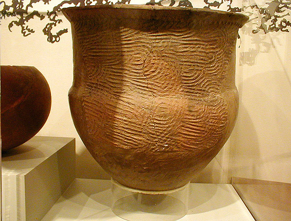
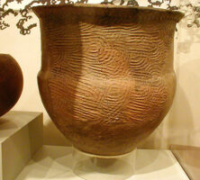
An example of Mississippian Lamar pottery, on display at the Ocmulgee Mounds Visitor Center in Macon.
Courtesy of Robert Foxworth
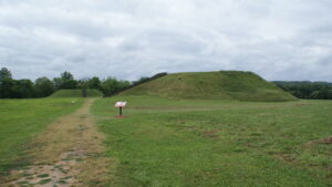
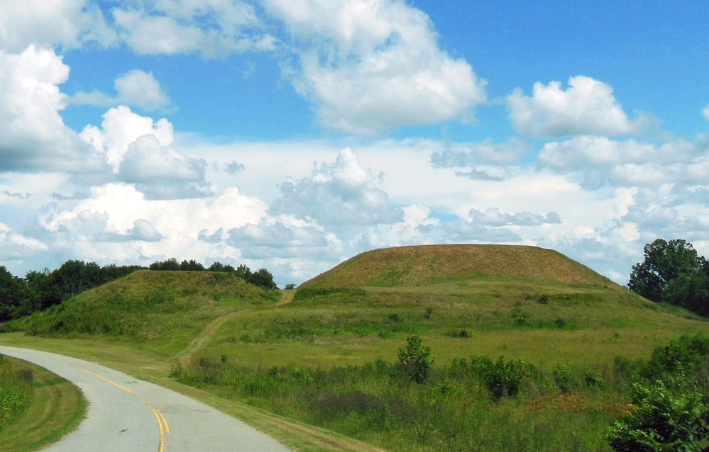
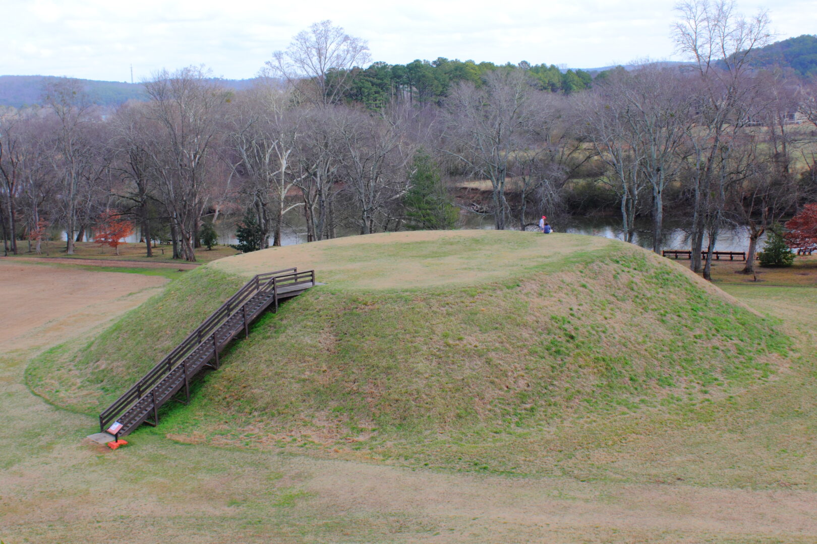
The earthen mounds at the Ocmulgee National Historical Park in Macon are the remains of a native culture that lived at the site between A.D. 800 and 1100, during the Early Mississippian period.
Photograph from National Park Service
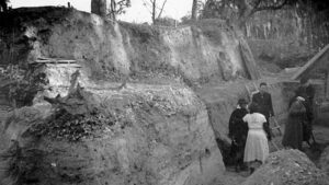
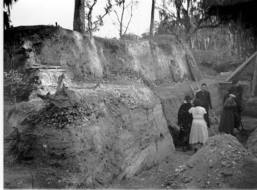
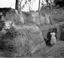
Excavation of the Irene mounds site, near Savannah, was led by several important archaeologists, especially Joseph R. Caldwell, who is pictured with an excavation team. Three different shell layers are visible in the earth behind the researchers.
Reprinted by permission of the Coastal Georgia Archaeological Society
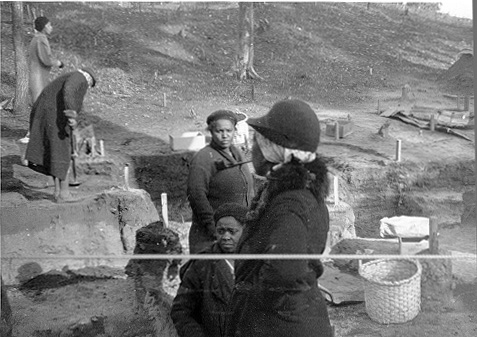
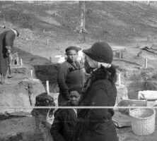
A group of African American women (pictured in December 1937) helped to excavate the Irene mounds site. The split oak basket, on the right, was made in Savannah especially for this project. The woman in the foreground is smoking a pipe.
Reprinted by permission of the Coastal Georgia Archaeological Society
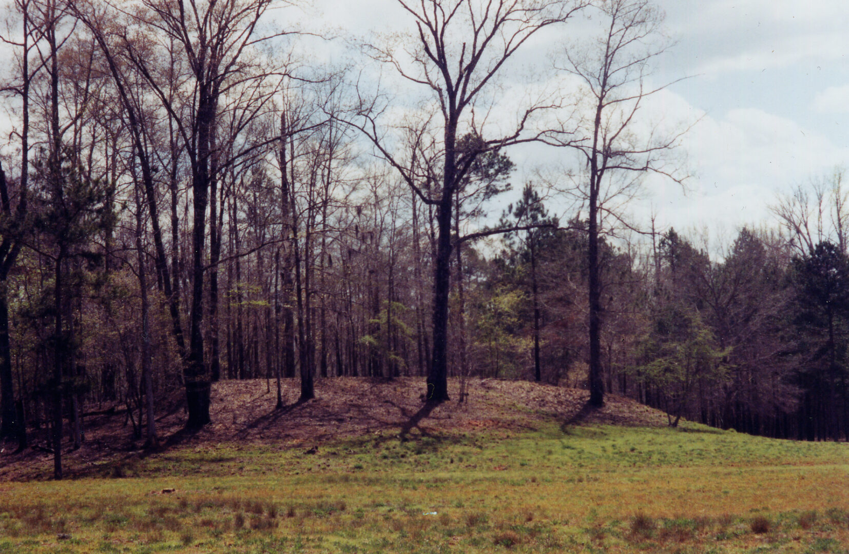
The chiefdom of Ichisi was located between modern Macon and Perry on the Ocmulgee River. The capital town was probably located at the present-day Lamar archaeological site, a part of Ocmulgee Mounds National Historical Park.
Courtesy of Georgia Department of Economic Development.
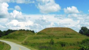
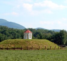
The Etowah mounds were built during the Lamar Period. Modern-day steps allow tourists to climb to the summit of the Etowah mounds.
Photograph by Muora
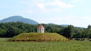
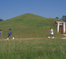
Although the original Late Prehistoric earthen platform mound has been completely excavated, a reconstruction of the Nacoochee Mound can be seen today on private property in the Nacoochee Valley.
Photograph by Martin LaBar
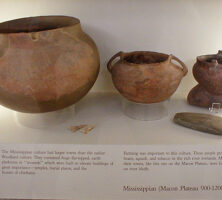
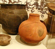
Mississippian Lamar pottery is distinctive because of its unique stamping and shape.
Courtesy of Robert Foxworth
An example of Mississippian Lamar pottery. Lamar pottery was made throughout Georgia and well into the adjacent states.
Courtesy of Robert Foxworth
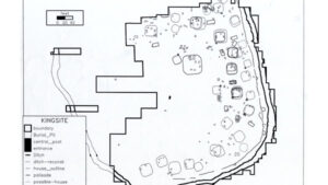
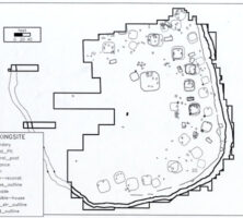
The King site in Floyd County covers a little more than five acres and is bounded by a defensive ditch and palisade. It was first occupied at some time during the first half of the sixteenth century.
Courtesy of David Hally
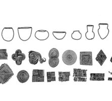
This type of pottery originated in northwestern Georgia and is found in small quantities throughout the state. It is from the Middle Mississippian subperiod.
Courtesy of Mark Williams
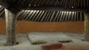
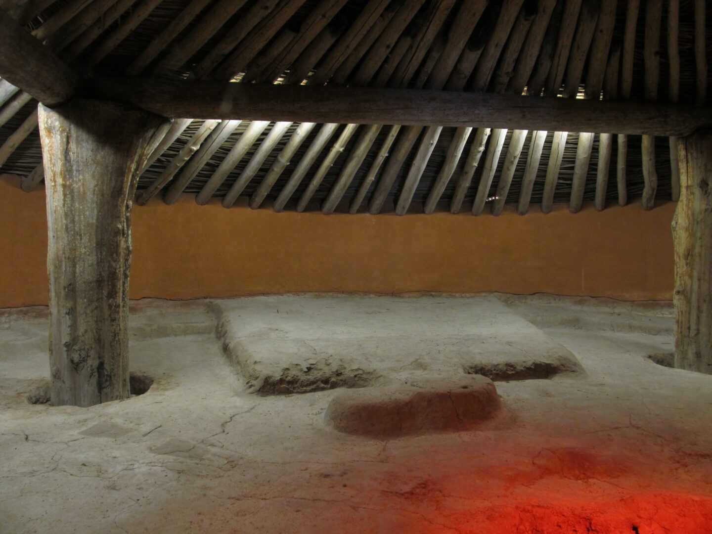
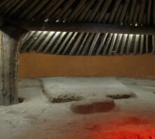
Photograph of ceremonial earthlodge which has been reconstructed and is today part of the Ocmulgee National Monument in Macon, Georgia.
Image from Ken Lund
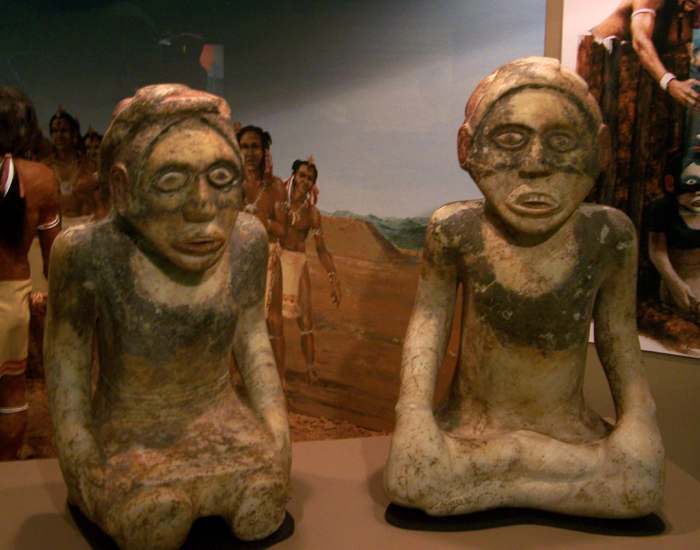
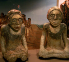
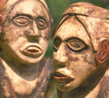
Archaeological excavation, carried out intermittently at the Etowah mound site for more than 100 years, has unearthed artifacts such as these figures, which have provided much information about life in the Mississippian Period.
Photograph from Wikimedia
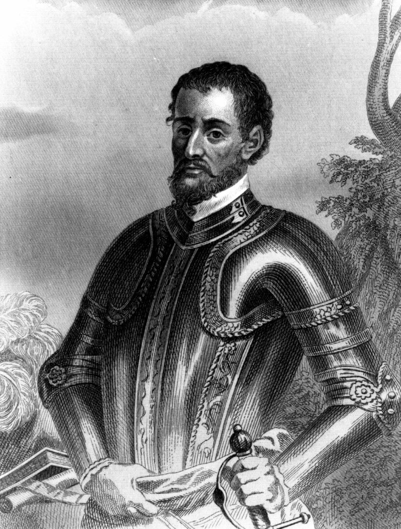
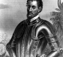
Hernando de Soto was a Spanish-born explorer and conqueror who landed in present-day Tampa Bay, Florida, in 1539 and came to the Georgia area in 1540. Chroniclers of the expedition described the Coosa River valley in glowing terms.
Courtesy of Georgia Info, Digital Library of Georgia.
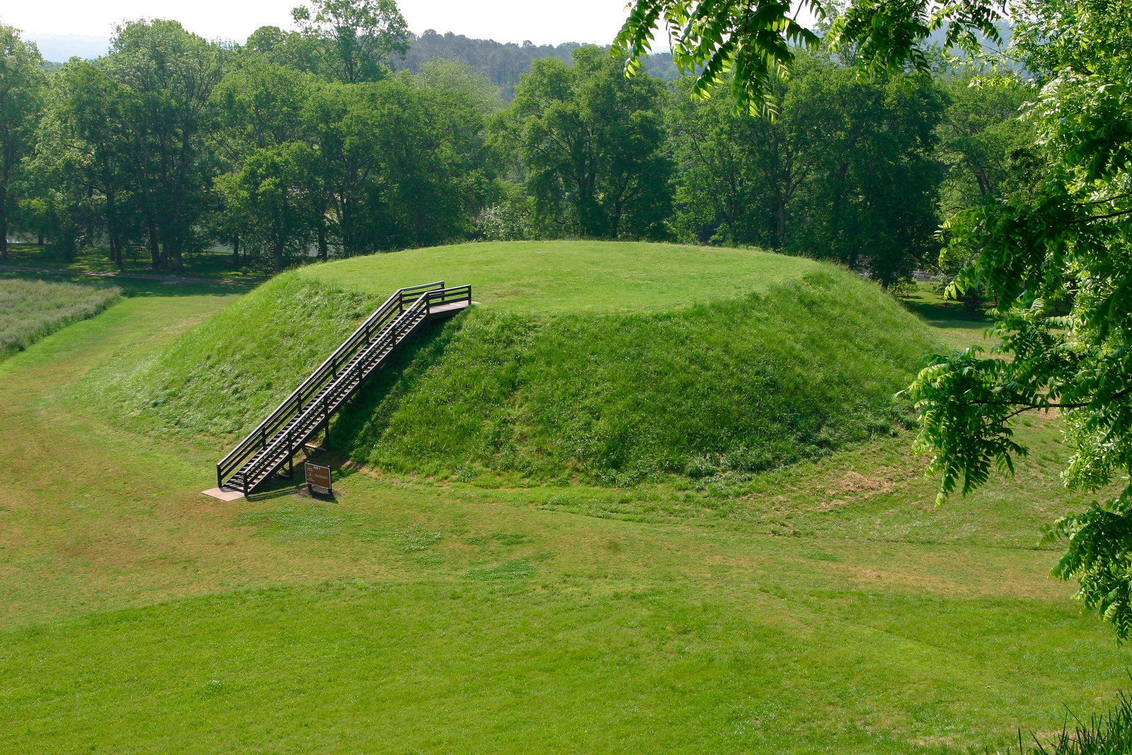
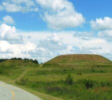
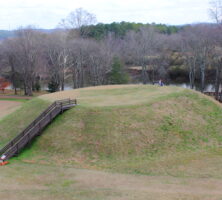
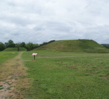
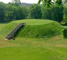
A path leading to two of the mounds at the Etowah Indian Mounds Historic Site. Located in Bartow County, the site is home to the second-largest Indian mound in North America, rises to a height of slightly more than 60 feet.
Photograph from Sharon Meier
Archaeological excavation, carried out intermittently at the site for more than a hundred years, has unearthed artifacts such as these stone figures, which have provided much information life in the Mississippian Period.
Courtesy of Georgia Department of Economic Development.
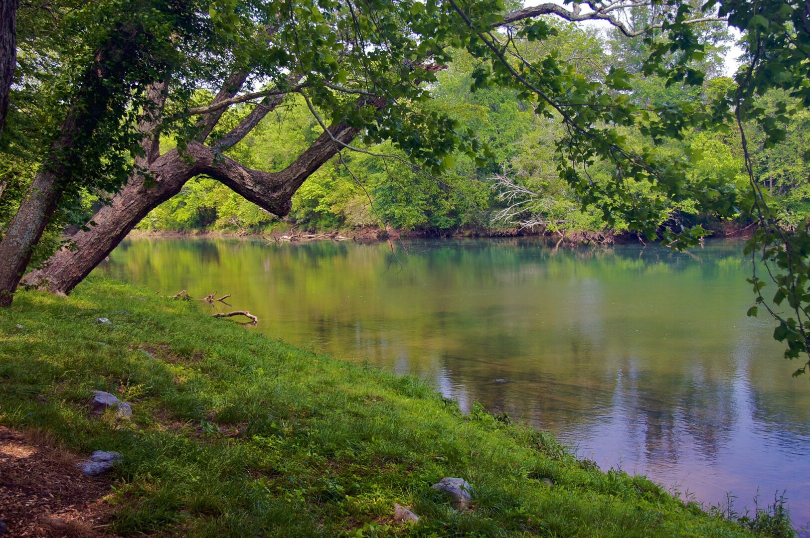
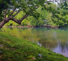
The Etowah River, with headwaters near Dahlonega, flows west-southwest for 140 miles to Rome, where it forms the Coosa River when it joins the Oostanaula River.
Image from Kevin Trotman
Modern-day steps lead to the summit of one of the Indian mounds at the Etowah site.
Courtesy of Georgia Department of Natural Resources, Georgia State Parks.