Fort Gaines, the seat of Clay County, sits on a 130-foot bluff overlooking the Chattahoochee River and the plains of Alabama. Originally part of the fifth land district of Early County, Clay County was created in 1854 by an act of the state legislature, which also made Fort Gaines the county seat.
The town is located approximately sixty-five miles south of Columbus and fifty miles west of Albany, at the intersection of Georgia highways 39 and 37. Fort Gaines is the only frontier fort in Georgia still surviving as an incorporated municipality.
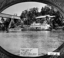
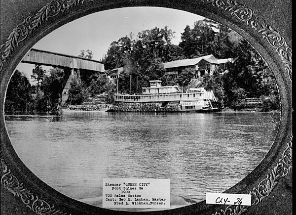
Fort Gaines, once called the “Queen City of the Chattahoochee” because of its importance to the riverboat trade, was founded in 1814 to protect white settlers in southwest Georgia and southeast Alabama from the Creek Indians. General Edmund Pendleton Gaines, born in Virginia in 1777, arrived at the fort in 1816 with the fourth infantry of the U.S. Army, which honored Gaines by naming the fort in his honor. Later, during the Civil War (1861-65), the fort protected residents from the Union army.
The town was chartered in 1830, and the railroad arrived in the 1850s. The old Frontier Cemetery is the burial place for many of the original founders of Fort Gaines and includes the grave of John Brown, the second president of the University of Georgia. The newer cemetery, New Park, was built around an Indian burial mound that dates back to about A.D. 200.
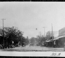
During the Civil War the schools in Fort Gaines were used as hospitals, and able men and boys left home to fight. After the war, the rebuilding process was slow. The next several decades brought paved roads, brick buildings, and modern necessities, but no substantial growth occurred until 1955.
The Walter F. George Lock and Dam, under construction from 1955 until 1963, brought an influx of new businesses and people. The dam is located within the city limits of Fort Gaines, and its locks are the second highest east of the Mississippi River. The lake formed by the dam covers 48,000 acres and reaches as far north as Columbus.
The population, according to the 2020 U.S. census, was 995.
Agriculture remains the main support for the town, although hunting, fishing, and recreational activities on the lake have increased with the presence of George T. Bagby State Park and its eighteen-hole Meadowlinks Golf Course, located about four miles north of Fort Gaines. Every year on the Saturday before Thanksgiving, the Fort Gaines Home and Garden Club sponsors an arts and crafts fair called “Christmas at the Fort” that takes place in the historic Frontier Village located on the Fort Gaines bluff.