McDuffie County is located on the geological fall line in east central Georgia along the Savannah River basin, thirty-five miles west of Augusta.
The county, carved from Warren and Columbia counties in late 1870 by an act of the Georgia General Assembly, was named for George McDuffie, a native Georgian and distinguished lawyer, statesman, governor, and U.S. senator of South Carolina. Although relatively small (260 square miles) and postbellum in its formation, McDuffie County boasts a sizeable colonial and political heritage that predates the county’s official inception by at least a century.
Early History
In 1767 royal governor James Wright granted to Quakers from Pennsylvania and North Carolina 12,000 acres of land along the present northern boundaries of McDuffie County. Three years later, the town of Wrightsborough was formally established and named in honor of the governor. Wright intended the settlement to be a buffer zone between the Creek and Cherokee Indians and the growing settlement of St. Paul Parish (present-day Augusta). It suffered accordingly. Indian hostilities, the American Revolution (1775-83), and the expansion of slavery all threatened the physical and economic safety of the neutral Quaker township. By 1800 most of its original families had relocated to the Midwest. Wrightsborough existed as a settlement into the twentieth century, if in name only, as its remaining inhabitants gradually assimilated into the religious, social, and civic norms of the predominantly Scots-Irish region.
Economy and Natural Resources
Traveling through Wrightsborough in the colonial period, Quaker naturalist William Bartram observed that the terrain was “chiefly a plain of high forests, savannas, and cane swamps,” and its soil “a deep, rich, dark mould, on a deep stratum of redish brown tenacious clay.” In fact, the area that became McDuffie County boasted natural resources and a wealthy agricultural heritage that defined its economic and political life until fairly recently. Gold, discovered along the Little River in the early nineteenth century, provided one of the area’s first industries. It was cotton, however, that created the bulk of McDuffie County’s wealth during that century. The county’s geographic location placed it among the most productive cotton land in the state, and the culture of enslaved workers and cotton production flourished. By 1880, 64 percent of the county’s 9,449 residents were African American.
While agrarian culture has changed radically since 1950, historical and natural resources continue to define twenty-first-century McDuffie County. Recreation and tourism are prominent factors in the contemporary economic and cultural life of the county, as are the kaolin and timber industries. One of the largest employers in the county is Shaw Industries.
People and Places
The county’s political tradition reflects its agrarian roots. Inheriting the passion, political philosophy, and agrarian advocacy of George McDuffie and nearby political heroes Robert Toombs and Alexander Stephens, U.S. senator Thomas E. Watson is remembered as McDuffie County’s most prominent statesman. Born in 1856, the “Sage of Hickory Hill” or “Sage of McDuffie County” earned fame at the bar and became an eloquent national advocate for the embattled farmer and common man during the New South period. Other notable McDuffie County statesmen and jurists include Augustus Wright and Randall Evans Jr., a judge for the Court of Appeals of Georgia.
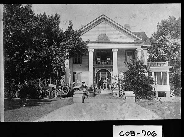
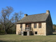
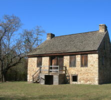
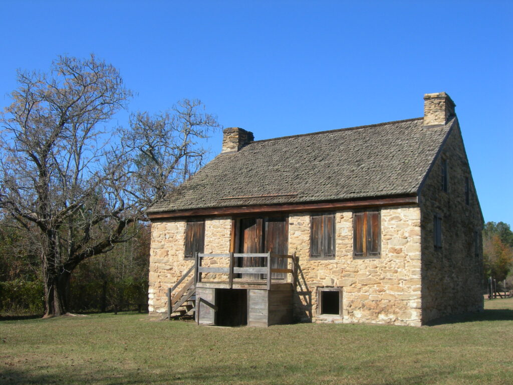
Heritage tourism is fueled by the county’s abundant historical sites, which include Hickory Hill (Watson’s home in Thomson), the Wrightsboro Historic District, Wrightsboro Church, and the Rock House. Wrightsboro Church, dating to 1810, stands on the site of the old Quaker meetinghouse. Near the Wrightsboro community is the Rock House, a stone farmhouse built in 1785. The Rock House is thought to be the oldest dwelling in Georgia with its original architecture intact.
According to the 2010 U.S. census, McDuffie County’s population is 21,632. There are two incorporated cities in the county, Thomson and Dearing. Thomson, with a population of 6,778, was incorporated in 1854 and established as the county seat in 1870. Dearing, with a population of 549, was named for William Dearing, a board member of the Georgia Railroad and Banking Company. The town was incorporated in 1910.
Fans of blues music make annual pilgrimages to the Blind Willie McTell Blues Festival, which honors the Thomson native “Blind Willie” McTell. Outdoor sports, including hunting and fishing, attract professional competition and revolve around nearby Clarks Hill Lake and its bordering wildlife management areas. Two local equestrian events, the Belle Meade Hunt and the Pine Top Horse Trials, bring to the county international exposure.
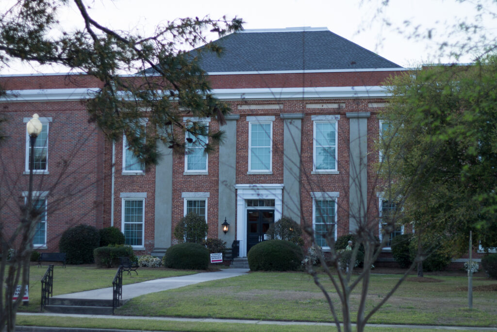
Augusta Technical College operates a satellite campus in Thomson.