Peachtree City, called “the most successful planned community in the nation,” encompasses twenty-four square miles in Fayette County. The city is situated about twenty-two miles south of Hartsfield-Jackson Atlanta International Airport and is accessible by Interstate 85 as well as Georgia Highways 54 and 74.
The CSX Railroad offers direct freight rail service, and its Falcon Field is an airport popular with private pilots. According to the U.S. Census Bureau the population of Peachtree City in 2020 was 38,244, an increase from the 2010 population of 34,364.

Peachtree City sits on land that was first settled by Native Americans about 2,000 years ago. In 1821 Fayette County was formed from land bought from the Creeks. Settlers who had fought with the Marquis de Lafayette in the American Revolution (1775-83) named the county after him. One of the last skirmishes of the Civil War (1861-65) was fought near present-day Peachtree City. The area remained mostly rural until the mid-twentieth century.
In the 1950s a group of real estate developers, Bessemer Securities, amassed land in Fayette County to build a planned community. It was decided that the town would be divided into smaller hamlets, each with its own stores, schools, and recreational areas. Named Peachtree City, it was chartered on March 9, 1959.
The city is home to both domestic and international companies, many situated in the 2,600-acre industrial park. Some of the major businesses in Peachtree City are Cooper Lighting, Fitel Interconnectivity, Hoshizaki-America, Panasonic, and TDK.
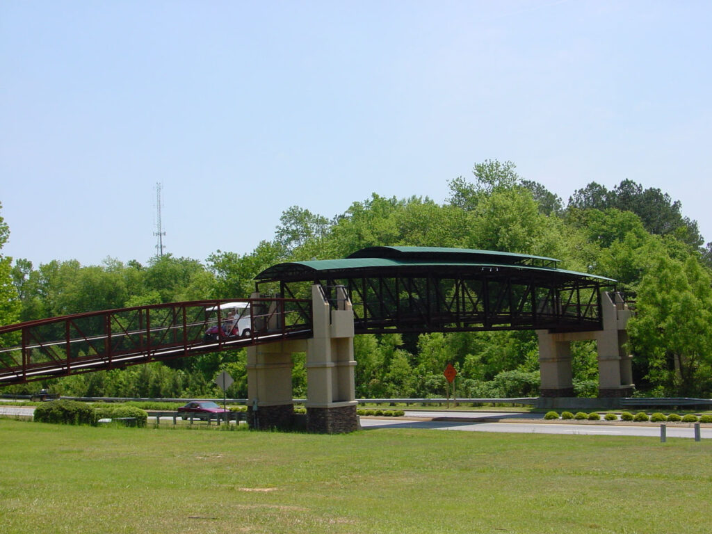
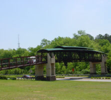
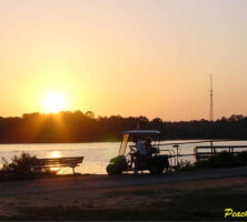
The city offers many attractions that are rare in a suburban community. The decorative fountain in front of the City Plaza complex was a gift from Japanese businesses located in Peachtree City. The city also has two lakes of approximately 250 acres each, three golf courses, five public pools, four parks, numerous outdoor sports and recreation areas, a large tennis complex, a BMX bicycle track, and a 2,200-seat outdoor amphitheater. One of the most appealing aspects of life in Peachtree City is the seventy miles of paved trails that surround the town. Residents use the paths for walking, bicycling, or riding their golf carts, a popular alternate mode of transportation. The trails connect to churches, schools, and neighborhoods.
The town was carefully designed with residential areas well removed from industrial areas. City regulations include restrictions on tree cutting, limitations on the height of fences and business signs, and regulated buffer zones around all of the town’s lakes, streams, and wetlands.
Today, Peachtree City has five “villages” within the city limits: Aberdeen, Braelinn, Glenloch, Kedron, and West Side. Future plans may include a new village that will add about 4,000 new residents to the city. In the original design Peachtree City was to have as many as 80,000 inhabitants. The current land plan allows between 40,000 to 50,000 residents to call Peachtree City home.