Sincere though General James Oglethorpe may have been about Georgia’s philanthropic rhetoric, he understood that the colony also had a vital military mission to fulfill. Imperial strategy demanded a sturdy settlement to defend South Carolina’s southern flank, both against Spanish Florida and unpredictable Southeastern Indians, and to secure the strategically vital Altamaha River against possible French encroachments from the west. Oglethorpe took these responsibilities seriously and, as soon as circumstances allowed, began the work of fortifying Georgia’s coastline in earnest. The decisions he made, for better or worse, shaped the colony’s early history and had much to do with its final southern border.
Early Strategic Concerns
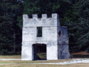
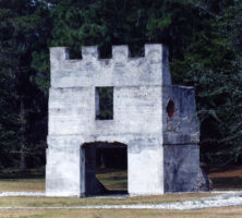
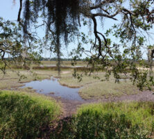
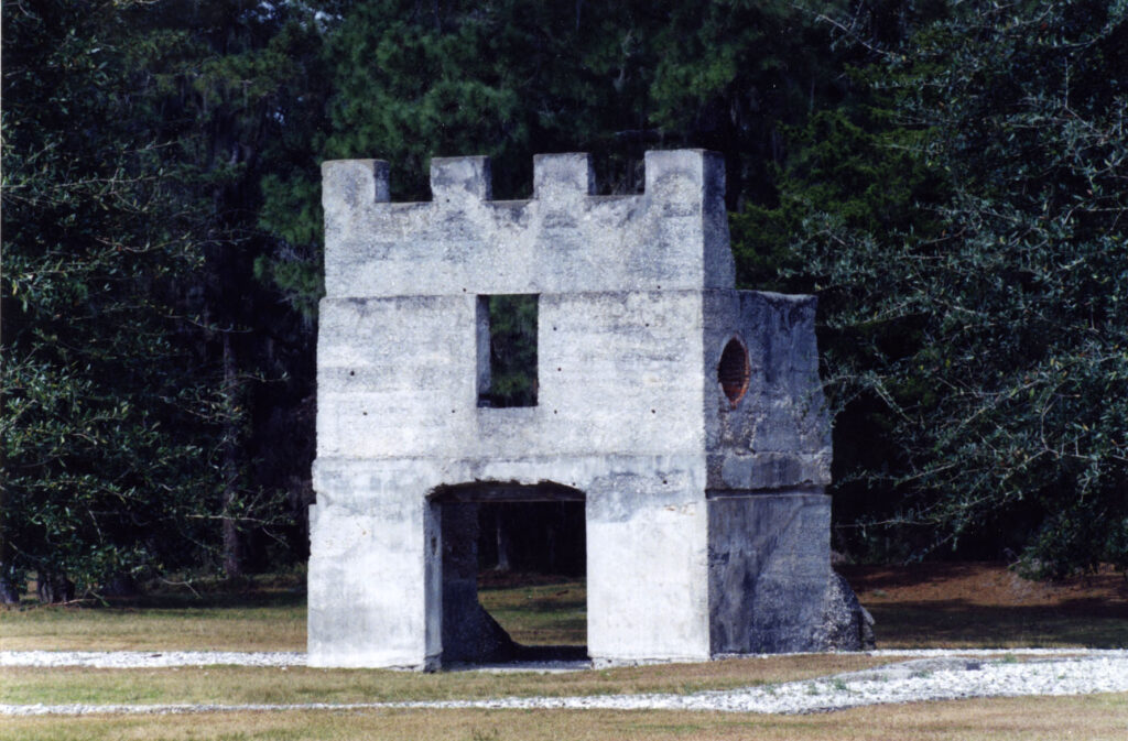
The establishment of Fort Frederica on St. Simons Island, south of the Altamaha River, in 1736 marked the beginning of Oglethorpe’s defensive scheme. His thinking was influenced heavily by Georgia’s maritime geography, which consists of an uninterrupted series of barrier islands running along the coast. They form a natural water route, known as the Inland Passage, which offers protection from the unpredictable weather and harsh conditions of the open sea. Long used by Indians traveling in canoes, the calmer waters of the Inland Passage quickly became the preferred route for Europeans as well. Oglethorpe therefore placed his coastal fortifications at key locations on these barrier islands in order to monitor and control access to the Inland Passage. On the southern end of St. Simons Island, for instance, he built Fort St. Simon to defend against enemy ships seeking to slip in from the open sea between St. Simons and Jekyll islands. The inlet between Jekyll and Cumberland islands, just southward, was guarded from 1736 until 1742 by a fortress erected on the northern end of Cumberland, named Fort St. Andrews. Still farther south, the inlet between Cumberland and Amelia islands was guarded by a small “scout station” until 1740, when Fort William was constructed on the southern tip of Cumberland Island.
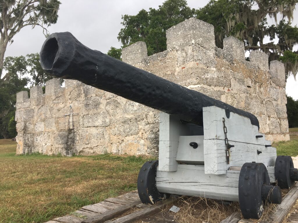
Image from HAL333
Imperial Ambitions and Rivalry, 1736-1748
Oglethorpe attempted to extend his coastal defenses well south of Georgia’s official boundary, stipulated in the colonial charter as “the most southern stream” of the Altamaha River. In 1736 he even began construction of a fort on St. Georges Island at the mouth of the St. Johns River, barely thirty-five miles from the Spanish stronghold of St. Augustine, Florida. Spanish anger over this intrusion ultimately forced the abandonment of Fort St. George, but Oglethorpe continued pressing to expand southward. Some scholars suspect that he may even have attempted to redraw versions of early Georgia maps to show fictive branches of the Altamaha River connecting to the St. Johns, thus implicitly redrawing the colony’s southern border. His ambitions, thwarted at St. Georges Island, paid off in 1738, when he persuaded the British Parliament to send a regiment of nearly 700 soldiers to the colony. The majority of these men were stationed at Fort Frederica, but Oglethorpe also posted 200 men farther south at Fort St. Andrews and a smaller company of perhaps 50 or 60 men on the southern end of Cumberland Island.
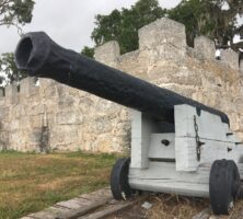
The first real test of Oglethorpe’s coastal defenses came with the War of Jenkins’ Ear. After an unsuccessful siege of St. Augustine in 1740, Georgians retreated into their fortifications to await the inevitable Spanish retaliation. Finally, in 1742, led by the Spanish governor Manuel De Montiano, thirty-six naval vessels carrying 2,000 infantrymen appeared off the Georgia coast. The first alarm was raised by the garrison at Fort William, which successfully kept several Spanish galleons from entering the inland waterway. Forewarned of the invasion, Oglethorpe mounted a spirited defense of his main base at Fort Frederica, culminating in the famous Battle of Bloody Marsh on St. Simons Island, in which his forces soundly defeated the Spanish. While retreating toward St. Augustine, however, Montiano drew level with Fort William on Cumberland Island and launched a massive assault on the tiny garrison, commanded by Lieutenant Alexander Stewart. Once again Georgia’s defenses held firm, and the Spaniards were compelled to withdraw.

Photograph by Forrest Shropshire
Decline and Inactivity, 1749-1783
The end of King George’s War in 1748 brought a downsizing of Georgia’s defenses. With the disbanding of the regiment in 1749, the southern portions of the colony, once the focus of Oglethorpe’s ambitious energies, entered a prolonged period of neglect and inactivity. Small garrisons continued to be posted for some time at Fort Frederica and Fort William, but Fort St. Andrews, Fort St. Simon, and the Amelia scout station rapidly fell into disuse. Probably by 1758 even Fort Frederica had been abandoned. During the American Revolution, British and American forces moved back and forth across the region repeatedly, attempting on several occasions to reoccupy Fort William on Cumberland Island. Such efforts, however, were brief and inconsequential. By the 1780s the coastal defense system pioneered by Oglethorpe fifty years earlier had been all but forgotten. It had served its purpose.
Courtesy of Ed Mathews, Amelia Island Images