Cumberland Island, composed of Great and Little Cumberland islands, is the largest and southernmost in a chain of barrier islands extending the length of Georgia, known collectively as the Sea Islands or sometimes as Georgia’s Golden Isles.
Most of Great Cumberland has become the Cumberland Island National Seashore, administered by the National Park Service (NPS). Visitor access is by private ferry from Fernandina Beach, Florida, or by NPS ferry from St. Marys, Georgia. Overnight and week-long camping are permitted through the NPS headquarters. Visitors come because of the island’s beauty and variety.
Ecology
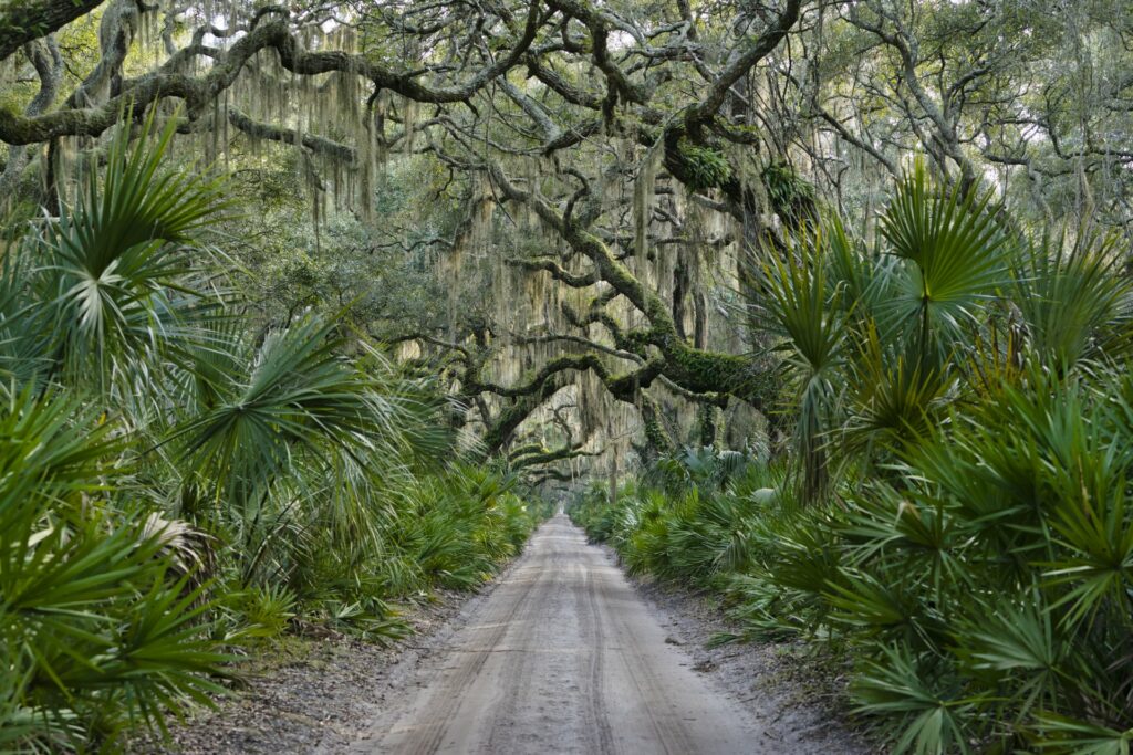
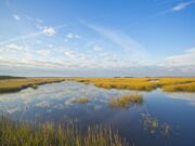
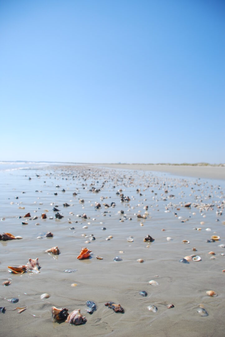
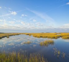
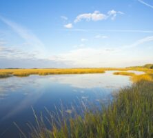
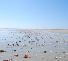
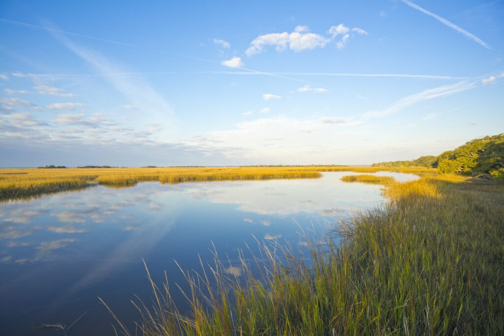
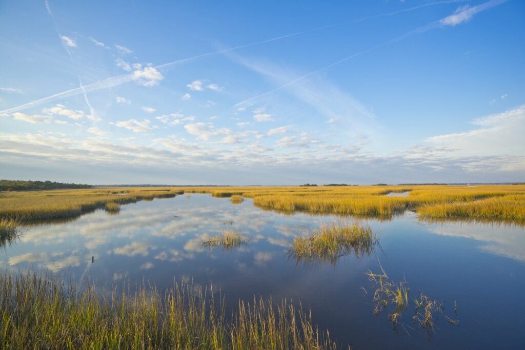
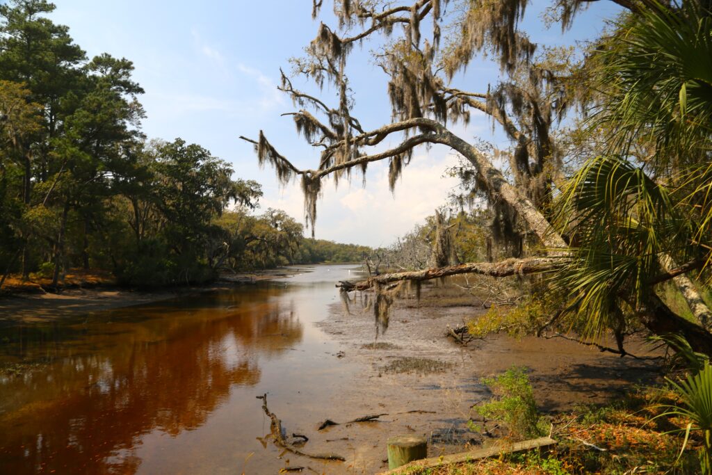
Georgia’s coast is marked by extensive marshes, once regarded as unproductive but now known to be highly productive ecological systems. The two Cumberlands together contain approximately 16,600 acres of high land. Great Cumberland’s beach is more than sixteen miles long. The island, marsh, and estuary system, a major ecological feature of the Sea Islands, is brilliantly displayed at Cumberland, because in more than 350 years there has been little disturbance. Sand beaches and dunes protect the islands from erosion and inundation by the sea. The islands protect the marshes from the force of the sea. The salt marshes trap sediments discharged from mainland rivers, protecting the appearance and recreational qualities of Cumberland’s beach. Its south end is marked by a high dune called Dungeness, a large spit, or finger, of sand and its platform. It is named after a spit in Kent, England—possibly the largest and most dangerous in the world.
History
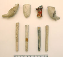
For thousands of years the island was visited cyclically by Timucuan Indians for shellfish. In the 1500s Spanish friars and soldiers, calling the island San Pedro Mocama, built a Catholic mission and a large fort. Sassafras, common to the Sea Islands, was a valuable medicinal shrub sought by Europeans. Cumberland’s size and excellent harbor brought about very early trade contacts between Spanish and aboriginal islanders. Between 1765 and 1769 thirteen Georgians received the first land grants on Cumberland. These tracts became the fifteen plantations and small farms cultivated by enslaved laborers during the nineteenth century.
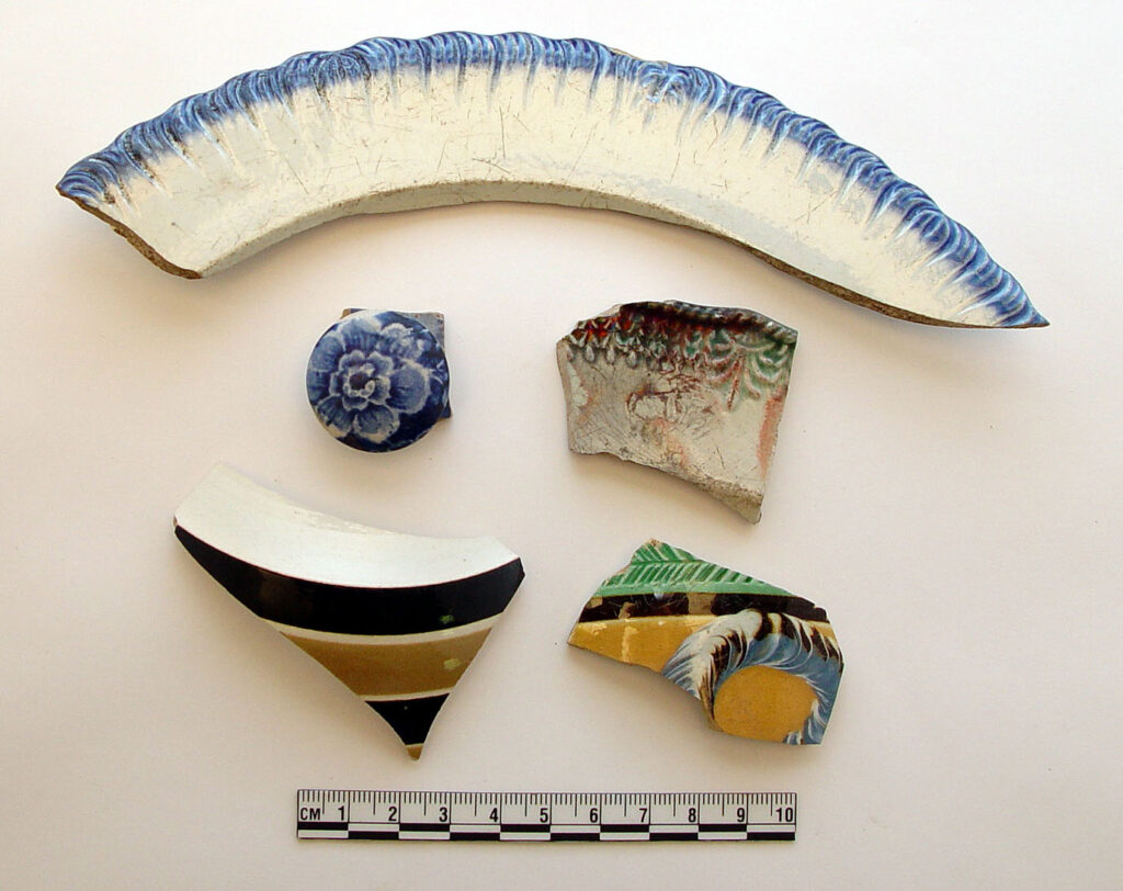
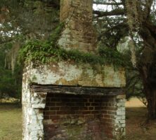
Dungeness Plantation, established by heirs of Revolutionary general Nathanael Greene, centered on a unique five-story mansion built in 1802 of tabby, a conglomerate locally made of shell and lime. Fire destroyed the mansion in 1866. Ruins of another house, built in 1884, stand at the same site today. During the War of 1812 an unprecedented arrival of the Royal Navy took away more than 1,400 coastal enslaved people. For eight weeks in 1815, the British flag was raised at Dungeness, to which enslaved people flocked in eager response to a British emancipation proclamation. The freedpeople moved to Bermuda, Nova Scotia, and Trinidad.
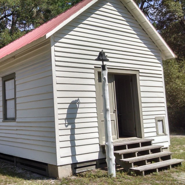
Although before 1800 Cumberland was almost uninhabited, by 1860 more than 500 enslaved people resided there, a seven to one ratio of enslaved-to-free whites. At the end of the Civil War (1861-65), military authorities placed Cumberland within the Sherman Reservation, a thirty-mile-wide land reserve running the length of the Georgia–South Carolina coast. It was established (1865-66) as a reservation for freedmen to receive land of their own. A small freedmen’s settlement grew up on Cumberland. Their Gullah-speaking descendants lie buried in a small cemetery at Cumberland’s North End, and a Baptist church, built by descendants, still stands.
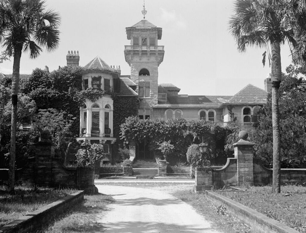
In 1881-82 Thomas M. Carnegie, a Pittsburgh, Pennsylvania, industrialist, bought two defunct plantations on Great Cumberland. His family and descendants built a lavishly appointed estate for hunting and entertaining. Still owners in the 1960s, the Carnegies—joined by other landowners—cooperated with the National Park Foundation, established 1967, to acquire land for public purposes. In 1972 the U.S. Congress legislated into existence the Cumberland Island National Seashore.
Resources
Horses and range cattle were early settlers’ first economic mainstay, but cotton was financially Cumberland’s most rewarding crop. Many foods, especially corn and peas, were raised for consumption on the plantation. Dungeness Plantation successfully produced oranges until insect infestation destroyed its large grove in 1837. Timber was lucrative from the earliest days of settlement. Cumberland’s live oaks were extensively cut by teams of loggers to fill naval contracts for masts and spars, and “live oaking” on Cumberland helped build the post-Revolutionary American navy. As the forest disappeared, new fields were cleared for cotton. Superior grades grown from Sea Island seed were eagerly sought by brokers from northern U.S. states and England. Sea Island cotton thread had a tensile strength almost equal to modern nylon, making it valuable for the gigantic high-speed looms of nineteenth-century manufactories.

Wildlife
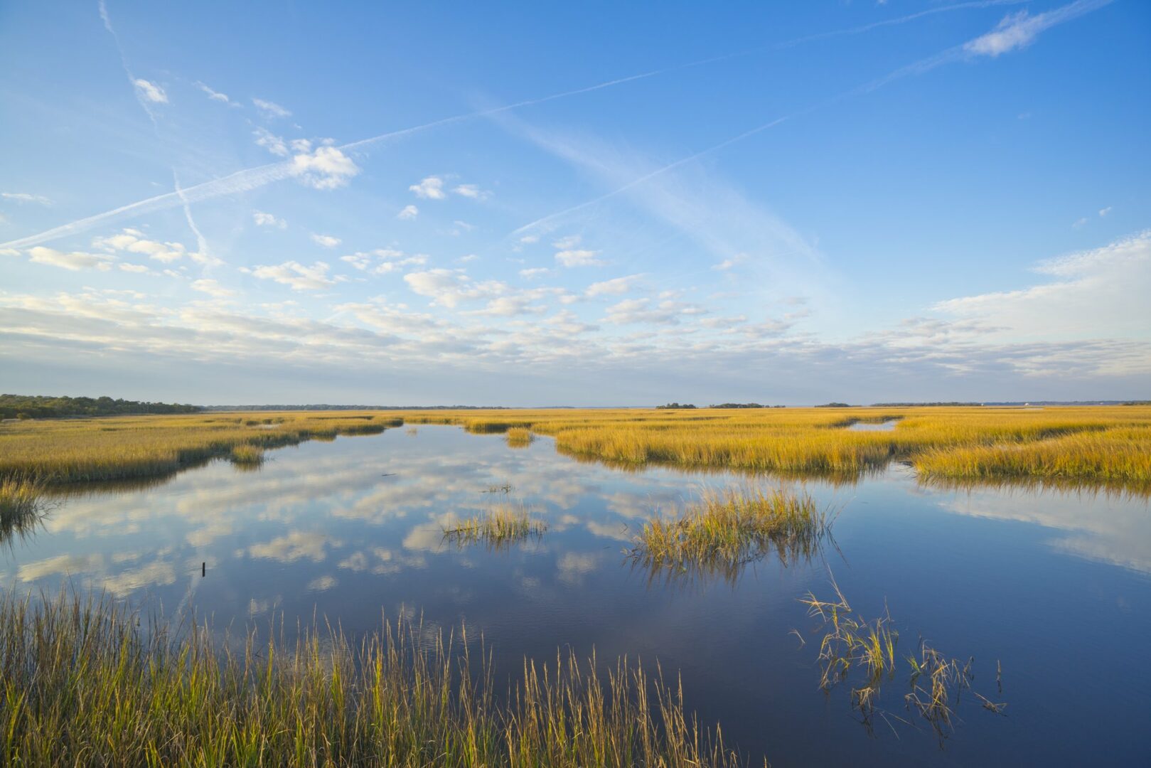
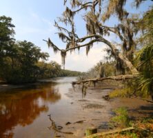
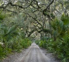
The loggerhead sea turtle is threatened by loss of nesting habitats and the general exploitation of shorefront property on North American beaches. Little Cumberland and the northern end of Great Cumberland provide approximately eight miles of desirable and protected nesting beach. Cumberland’s interior maritime forest is studded with saltwater coves, freshwater ponds, and inland swamps, all providing shelter for migratory ducks and such long-legged wading birds as the American ibis (“wood stork”), heron, and egret. Alligators inhabit the numerous small ponds and swamps, feeding upon small mammals or fish. Now the presence of open-range livestock, especially hogs, is discouraged because of their impact on turtle nesting. Wild horses, once a notable feature of Cumberland’s landscape, are being removed because they forage on sea oats and other beach grasses vital for dune stabilization.
Current and Future Status
Future use of the Sea Islands is of major interest to Georgia. Proposals for the commercial and recreational development of the islands have stimulated intense controversy in the state legislature, in local press and national magazines, and at public hearings. Cumberland remains in a relatively natural state because of its inaccessibility as well as the stewardship of past owners. Conflict continues over resource management issues on Cumberland. Administration of its unique wilderness area has proven to be a dilemma involving the NPS, conservationists, business interests, and island residents.