The New Georgia Encyclopedia is supported by funding from A More Perfect Union, a special initiative of the National Endowment for the Humanities.
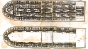
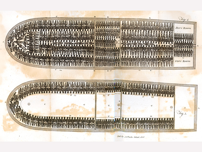
Africans captured to be sold into slavery crossed the Atlantic Ocean lying pressed together in crowded ships' holds. The city of Savannah served as a major port for the Atlantic slave trade from 1750, when the Georgia colony repealed its ban on slavery, until 1798, when the state outlawed the importation of enslaved people.
From The History of Rise, Progress & Accomplishment of the Abolition of the African Slave-trade by the British Parliament, by Thomas Clarkson
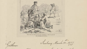
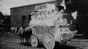
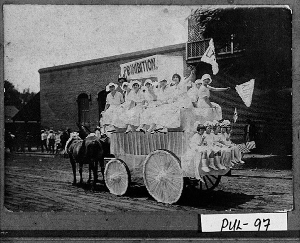
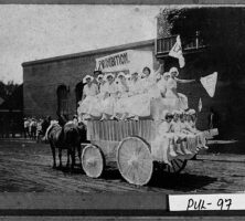
Young women and children ride on a parade float promoting prohibition in Hawkinsville (Pulaski County), circa 1919.
Courtesy of Georgia Archives, Vanishing Georgia, #
pul097a.
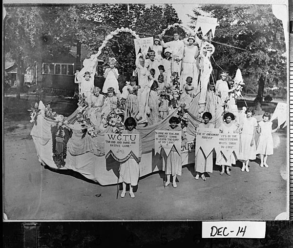
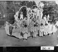
Women's Christian Temperance Movement (WTCU) members participate in the Decatur County centennial parade in Bainbridge, 1923. The WCTU formed its first Georgia chapter in 1880. Largely due to their efforts, Georgia passed a local option law in 1885.
Courtesy of Georgia Archives, Vanishing Georgia, #
dec014.
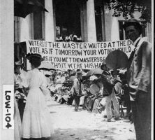
A crowd gathered in front of the Lowndes County courthouse in Valdosta for a prohibition vote in 1907. That year, Georgia became the first state in the South to pass a statewide ban on the production, transportation, and sale of alcohol.
Courtesy of Georgia Archives, Vanishing Georgia, #
low104.
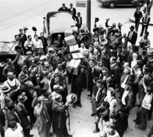
A crowd in Marietta celebrates the end of prohibition. In 1935 the Georgia legislature approved the Alcoholic Beverage Control Act, which called for a statewide referendum on the issue of repeal and tasked the State Revenue Commission with drafting new regulations to govern the sale and distribution of alcohol.
Courtesy of Special Collections & Archives, Georgia State University Library, Atlanta Journal-Constitution Photographic Archive.
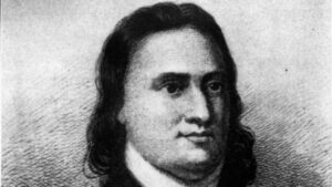
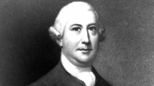
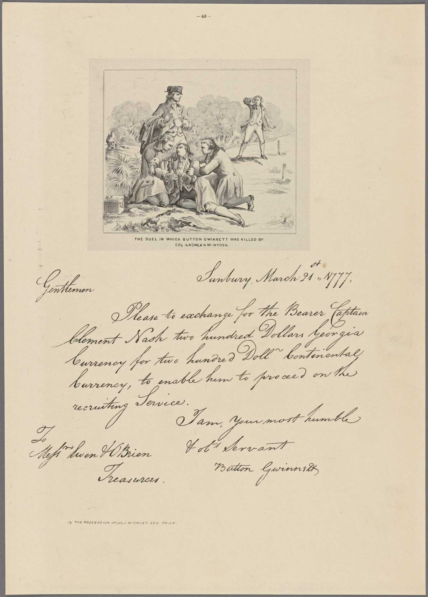
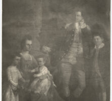
This 1777 engraving depicts the fatal duel between Button Gwinnett and Lachlan McIntosh.
Courtesy of New York Public Library, Manuscripts and Archives Division
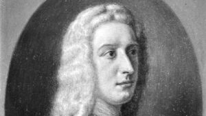
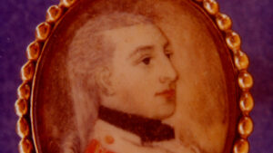
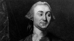
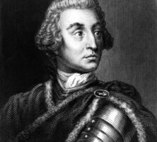
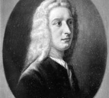
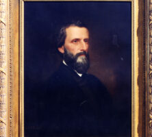
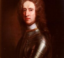
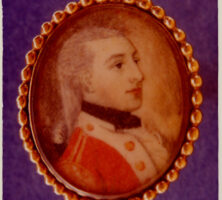
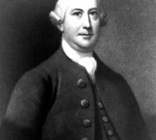
Button Gwinnett served in Georgia's colonial legislature, in the Second Continental Congress, and as president of Georgia's Revolutionary Council of Safety. He was one of three Georgia signers of the Declaration of Independence.
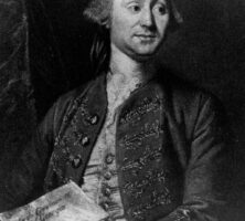
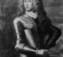
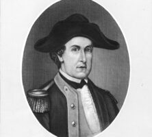
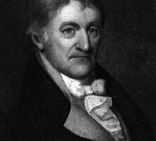
Lachlan McIntosh distinguished himself in a career that evolved over three critical eras in the state's early history, from the colonial period to the Revolutionary War to statehood.
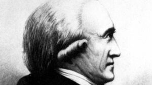
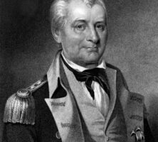
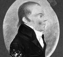
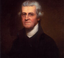
David B. Mitchell served three terms as governor of Georgia early in the nineteenth century. Before his election to the governor's office, he served as mayor as Savannah. Mitchell resigned in 1817 from his third gubernatorial term to accept the post of U.S. Agent to the Creek Indians.
Courtesy of Georgia Capitol Museum, University of Georgia Libraries
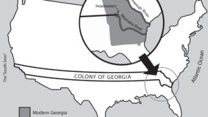
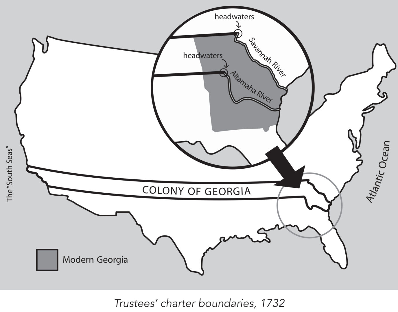
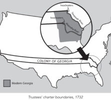
King George II granted James Oglethorpe and the Trustees a charter in 1732 to establish the colony of Georgia. This charter provided, among other things, that the new colony would consist of all the land between the headwaters of the Savannah and the Altamaha rivers, with its eastern boundary formed by the Atlantic Ocean and its western boundary by the "south seas," a reference to the Pacific Ocean.
Map by John Nelson. Reprinted by permission of William J. Morton
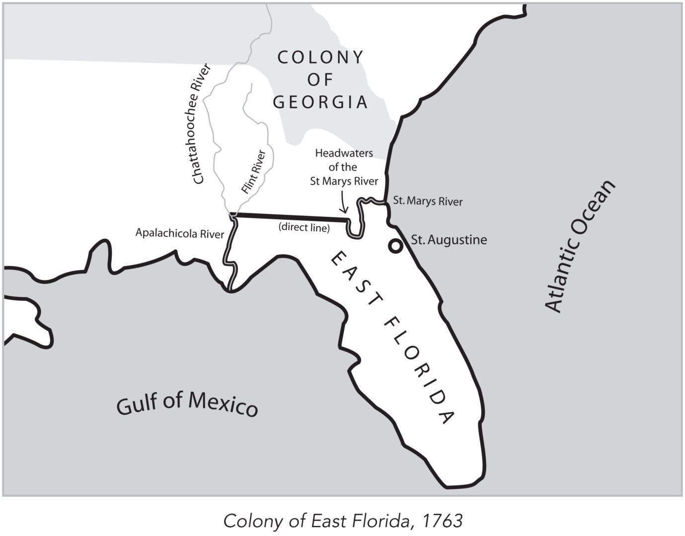
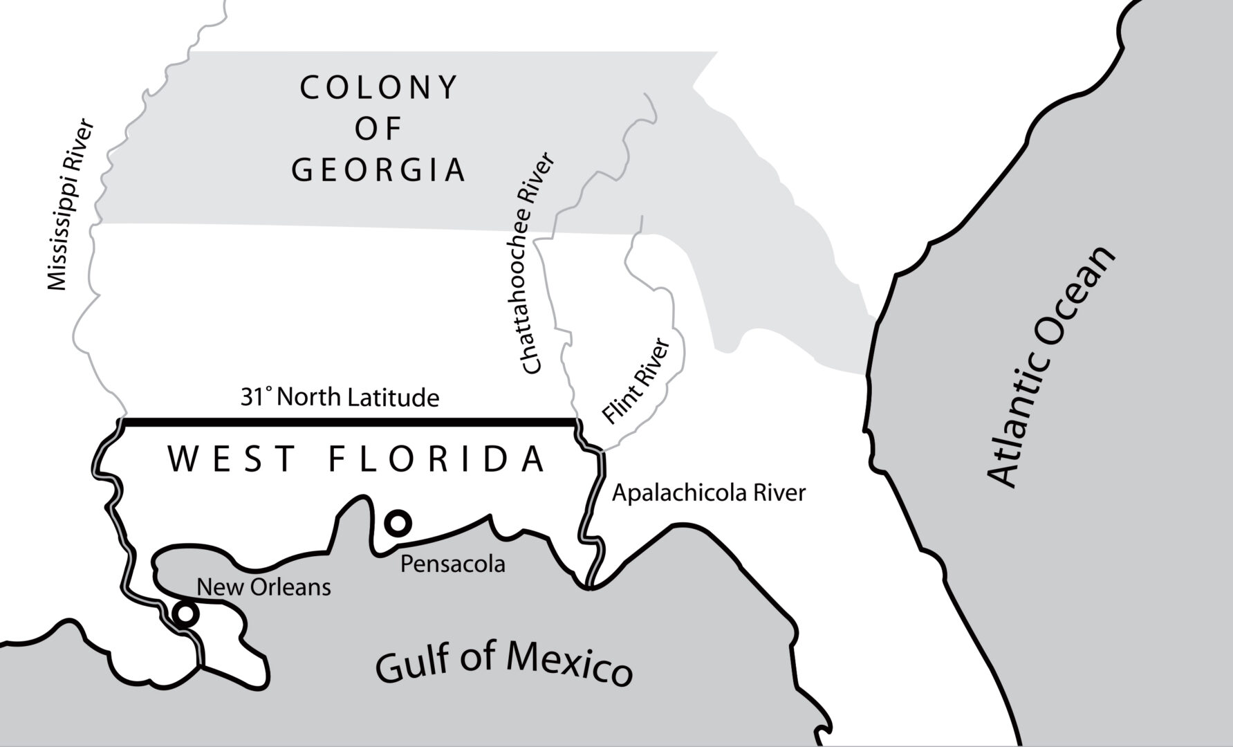
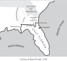
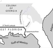
In 1763 the British divided what had been Spanish Florida into the two new colonies of West Florida and East Florida, with the Apalachicola River serving as the dividing line between them. East Florida was all the land east of the Apalachicola River, with St. Augustine as its capital.
Map by John Nelson. Reprinted by permission of William J. Morton
In 1763 the British divided what had been Spanish Florida into the two new colonies of West Florida and East Florida, with the Apalachicola River serving as the dividing line between them. West Florida, with Pensacola as its capital, extended west to the Mississippi River.
Map by John Nelson. Reprinted by permission of William J. Morton
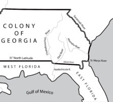
The appointment of James Wright in 1760 as governor of Georgia coincided with a period of expansion. By 1764 the boundaries of the colony had expanded to include those territories between the Mississippi and Chattahoochee rivers that had not been granted to the Florida colonies.
Map by John Nelson. Reprinted by permission of William J. Morton
In 1767 the governor of West Florida received permission from the king of England to advance the colony's northern border along the Mississippi and Chattahoochee rivers, where royal trading posts were located. Georgia's land holdings significantly decreased as a result.
Map by John Nelson. Reprinted by permission of William J. Morton
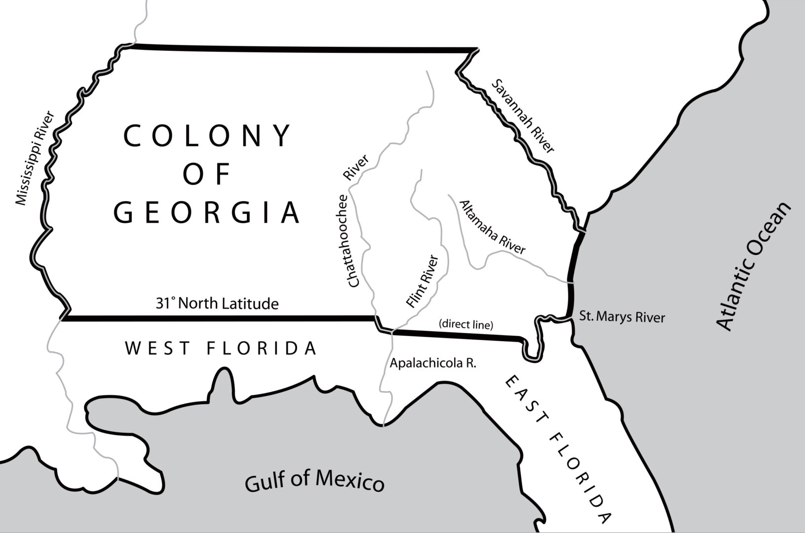
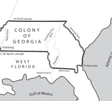
The 1783 Treaty of Paris, which ended the Revolutionary War (1775-83), fixed the 31st latitude north as the southern boundary of the new United States. The line extended from the Mississippi River eastward to the Chattahoochee River, moved down that river to its junction with the Flint River, and then followed a direct line east to the headwaters of the St. Marys River.
Map by John Nelson. Reprinted by permission of William J. Morton
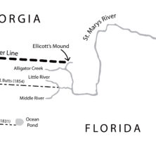
The Orr-Whitner line was accepted by Florida in 1861 and Georgia in 1866 as their official boundary, although the outbreak of the Civil War (1861-65) delayed the line's approval by the U.S. Congress until 1872.
Map by John Nelson. Reprinted by permission of William J. Morton
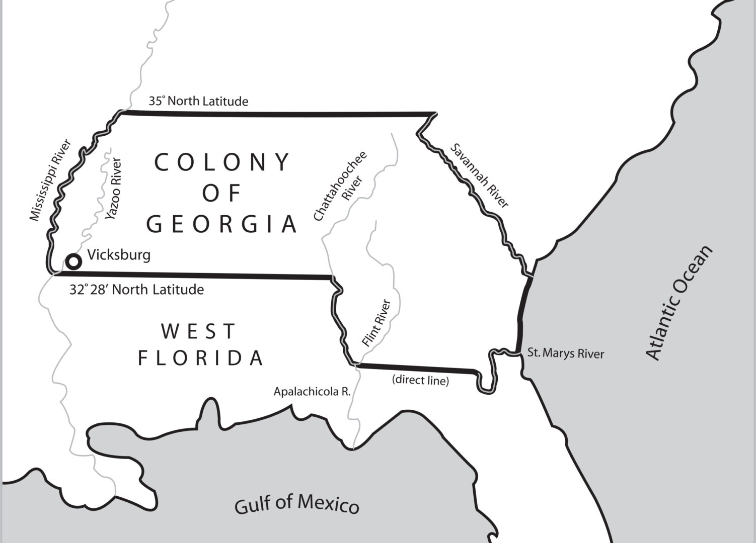
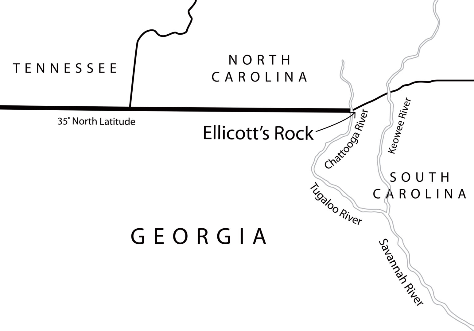
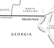
In 1811 Georgia hired Andrew Ellicott to survey and mark the location of the 35th latitude north, which formed the boundary between Georgia and North Carolina. In an 1812 letter to North Carolina governor William Hawkins, Ellicott states: "In the parallel of 35 degree N. latitude, on the west side of the Chatoga river, a stone is set up marked on the South side (G. lat 35 N.) and on the north side, (N.C.) for North Carolina." This map locates what is currently and erroneously called Ellicott's Rock on the east side of the Chattooga River.
Map by John Nelson. Reprinted by permission of William J. Morton
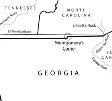
This map shows the surveyed line as marked by James Camak, which set Georgia's northern boundary line south of the 35th latitude north, including the offset known as Montgomery's Corner.
Map by John Nelson. Reprinted by permission of William J. Morton
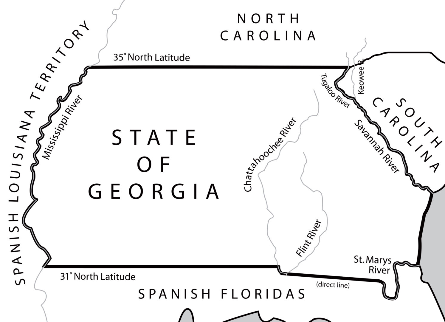
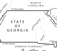
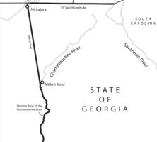
Following the 1802 Article of Agreement and Cession, Georgia's new western boundary began with the juncture of the Chattahoochee and Flint rivers in southwest Georgia and proceeded north to the great bend of the river (at present-day West Point, Georgia). From there it stretched for 160 miles to the Indian village of Nickajack on the Tennessee River and continued from there up to the 35th latitude north.
Map by John Nelson. Reprinted by permission of William J. Morton
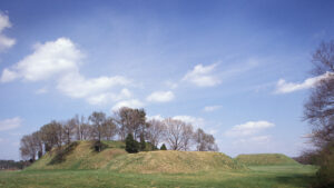
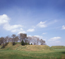
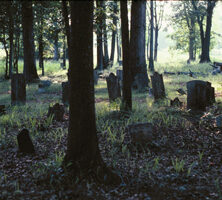
The Etowah Mounds in Bartow County include one of the largest Indian mounds in North America. The mounds, constructed during the Mississippian Period, served as platforms for public buildings in a town that occupied the site from around 1100 until the 1600s.
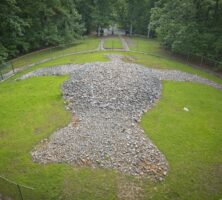
Rock Eagle, a stone effigy built by Native Americans during the Woodland Period, circa A.D. 200, is located in Putnam County. The structure, made of quartz cobbles, measures 102 feet across the wings.
Courtesy of Explore Georgia, Photograph by Ralph Daniel.
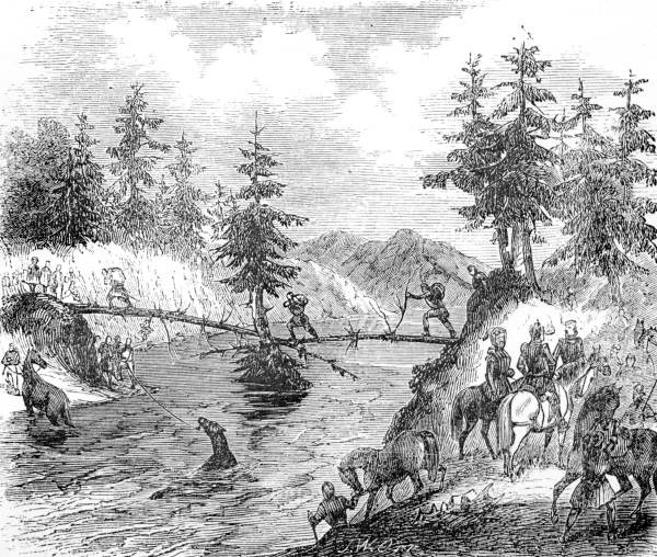
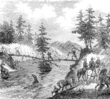
A drawing from Lambert A. Wilmer's Life, Travels and Adventures of Ferdinand de Soto, Discoverer of the Mississippi (1859) depicts Hernando de Soto and his men crossing the Chattahoochee River. The accidental introduction of European diseases by explorers destroyed many of the civilizations along the river's banks.
Courtesy of Florida State Archives, Photographic Collection.
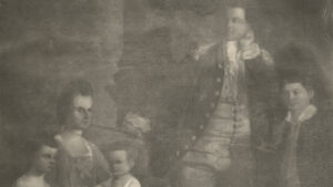
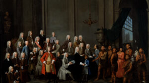
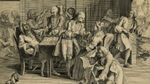
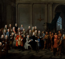
This oil painting by William Verelst shows the founders of Georgia, the Georgia Trustees, and a delegation of Georgia Indians in July 1734. One year later the Trustees persuaded the British government to support a ban on slavery in Georgia.
Courtesy of Georgia Info, Digital Library of Georgia.
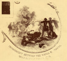
This sketch, likely a small portion of a larger work, depicts the Battle of Kettle Creek, which took place in Wilkes County on February 14, 1779, during the Revolutionary War. The original caption reads: "Engagement between the Whigs and Tories."
Courtesy of Kettle Creek Chapter of the National Society Daughters of the American Revolution
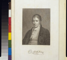
The inventor of the cotton gin, Eli Whitney lived in Georgia for just a year, on Catharine Greene's Mulberry Grove plantation near Savannah. After learning of the difficulty planters had with separating seeds from fibers in upland, or "short-staple," cotton, he set out to create a machine that could perform such a task more efficiently. His invention, the cotton gin, revolutionized the southern economy.
Courtesy of Library of Congress, Prints and Photographs Division
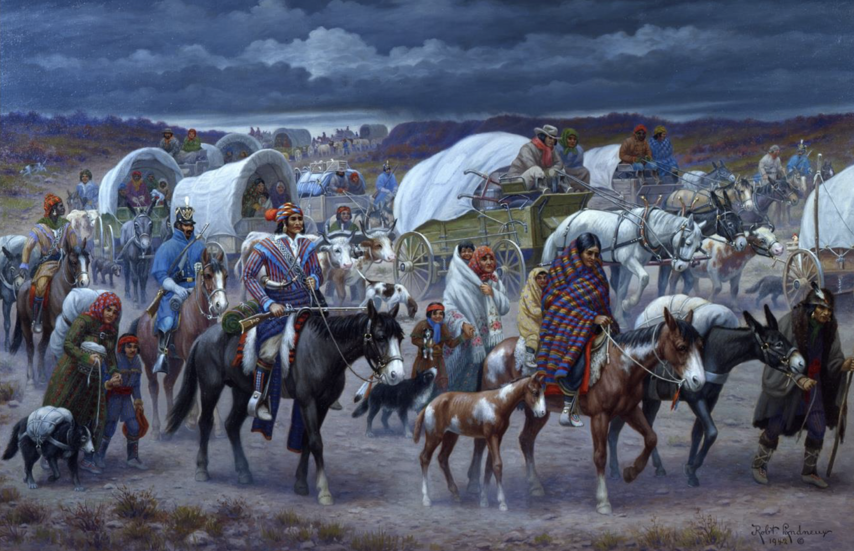
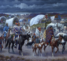
In his 1942 painting Cherokee Trail of Tears, Robert Lindneux depicts the forced journey of the Cherokees in 1838 to present-day Oklahoma.
Courtesy of Woolaroc Museum, Bartlesville, Oklahoma
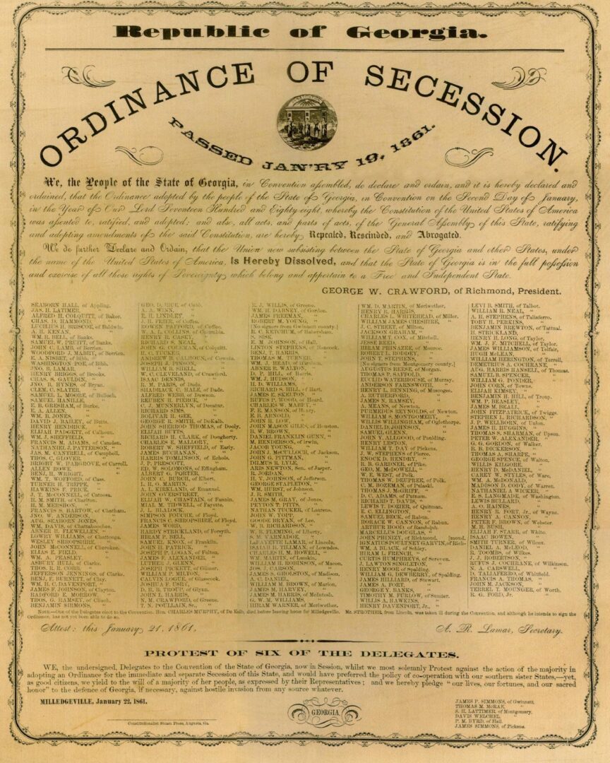
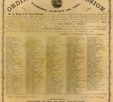
On January 21, 1861, the ordinance of secession was publicly signed in a ceremony by Georgia politicians. Two days earlier, delegates to a convention in Milledgeville voted 208 to 89 for the state to secede from the Union.
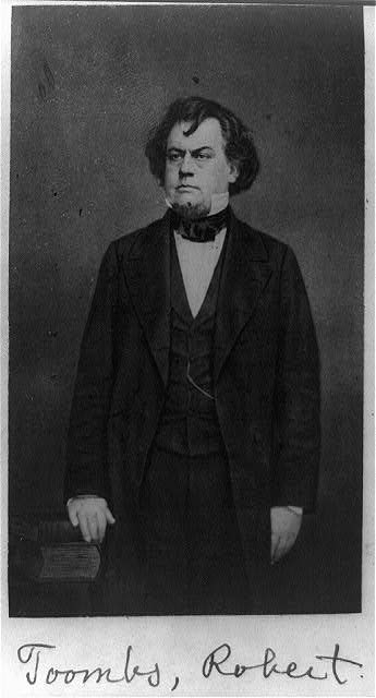
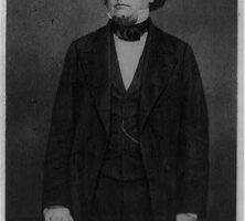
Wilkes County native Robert Toombs, pictured circa 1865, served briefly as the Confederate government's secretary of state and as a brigadier general during the Civil War.
Courtesy of Library of Congress, Prints and Photographs Division
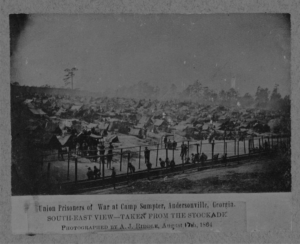
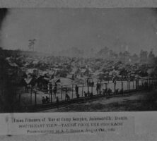
Union prisoners of war are pictured at the Andersonville Prison in Macon County on August 17, 1864. Malnutrition and poor sanitary conditions at the camp led to the deaths of nearly 13,000 of Andersonville's 45,000 prisoners, the highest mortality rate of any Civil War prison.
Courtesy of Civil War Treasures, New-York Historical Society
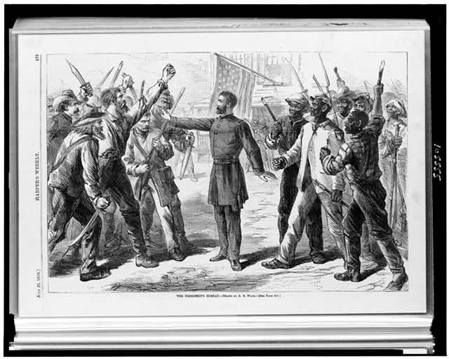
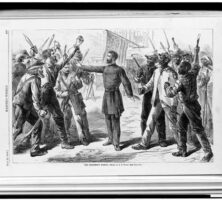
An 1868 sketch by A. R. Waud illustrates the difficulties faced by the Freedmen's Bureau, caught between white planters on one side (left) and formerly enslaved African Americans on the other (right). The bureau was established in 1865 after Union general William T. Sherman issued his Field Order No. 15, which called for the resettlement of freedpeople on confiscated lands.
Courtesy of Library of Congress, Prints and Photographs Division
With his New South platform, Henry W. Grady advocated unity and trust between the North and South and helped to spur northern investment in Atlanta industries.
Courtesy of Stuart A. Rose Manuscript, Archives, and Rare Book Library, Emory University, Henry Woodfin Grady Papers.
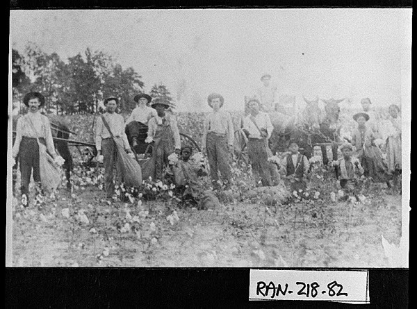
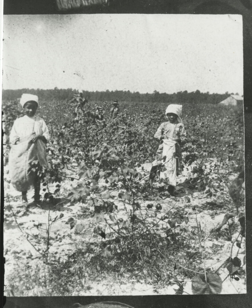
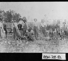
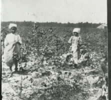
Sharecroppers, pictured in 1910, harvest cotton in Randolph County. Theoretically beneficial to both laborers and landowners, the sharecropping system typically left workers in deep debt to their landlords and creditors from one harvest season to the next.
Courtesy of Georgia Archives, Vanishing Georgia, #ran218-82.
In 1892 Georgia politics was shaken by the arrival of the Populist Party. Led by Thomas E. Watson of McDuffie County, this new party mainly appealed to white farmers, many of whom had been impoverished by debt and low cotton prices in the 1880s and 1890s. The Populists also attempted to win the support of Black farmers away from the Republican Party.
Courtesy of Georgia Historical Society.
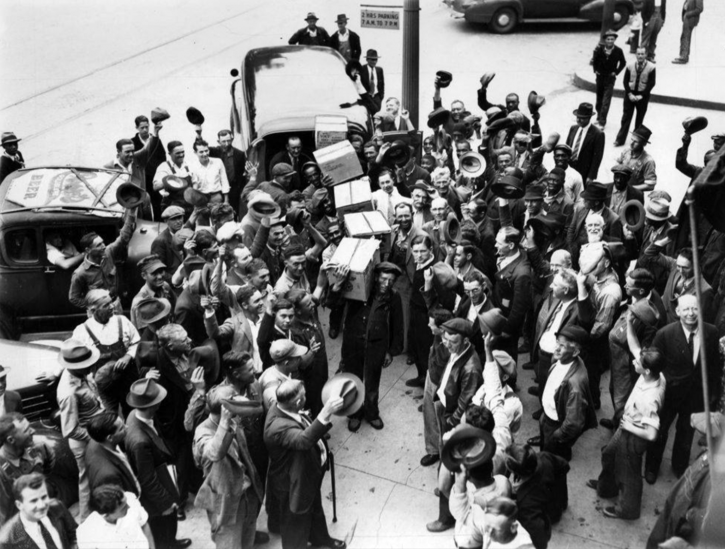
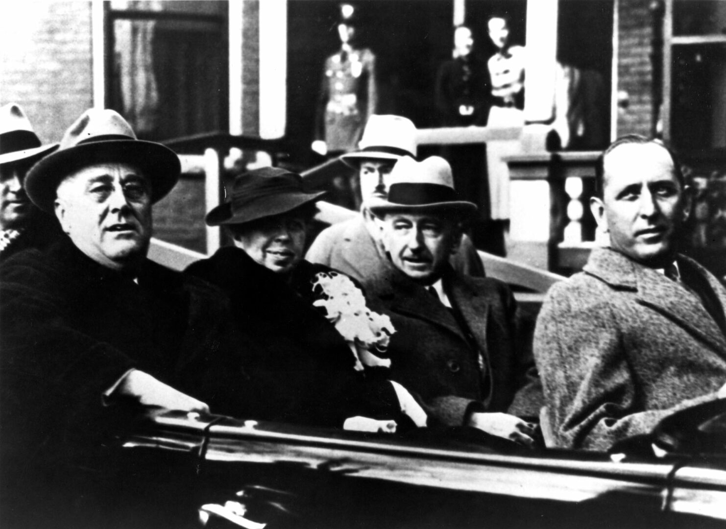
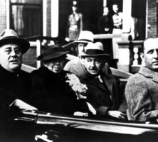
U.S. president Franklin D. Roosevelt and his wife, Eleanor Roosevelt, visit Atlanta in 1935, during the Great Depression. From left: Franklin D. and Eleanor Roosevelt, U.S. senator Walter F. George, and U.S. senator Richard B. Russell Jr.
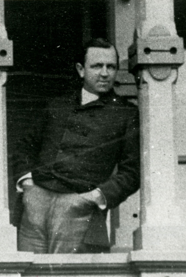
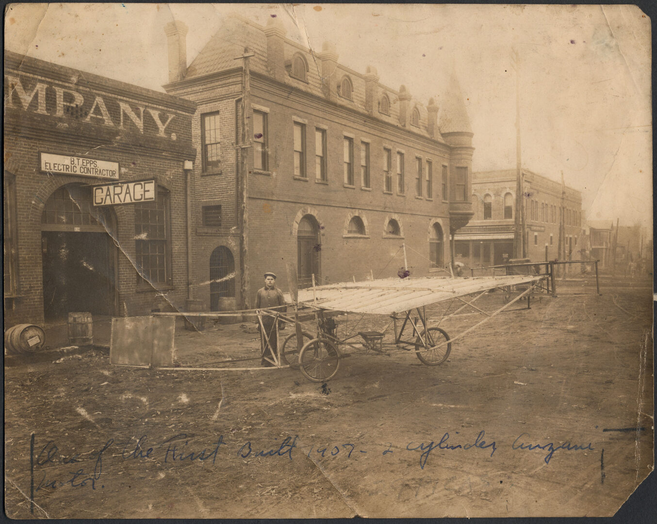
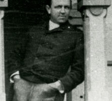
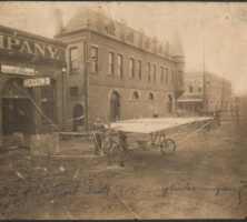
Georgia aviation pioneer Ben Epps is pictured with his first airplane outside his garage in Athens, 1907.
Courtesy of Georgia Archives, Vanishing Georgia, #
clr176-83.
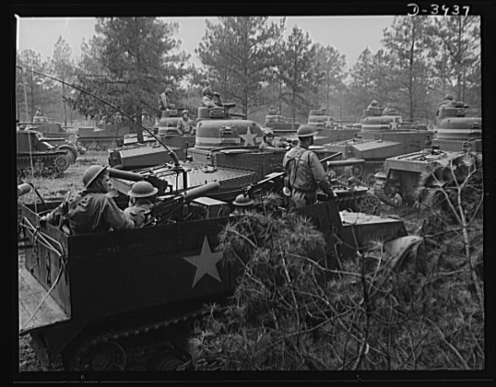
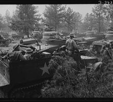
U.S. soldiers, pictured in the spring of 1942, undergo training at Fort Benning in Columbus. During World War II Fort Benning was the largest infantry training post in the world.
Courtesy of Library of Congress, Prints and Photographs Division
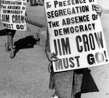
Students protest segregation at the state capitol building in Atlanta on February 1, 1962. The passage of the federal Civil Rights Act in 1964 and the Voting Rights Act in 1965 ended legal segregation across the nation.
Courtesy of Atlanta Journal-Constitution.
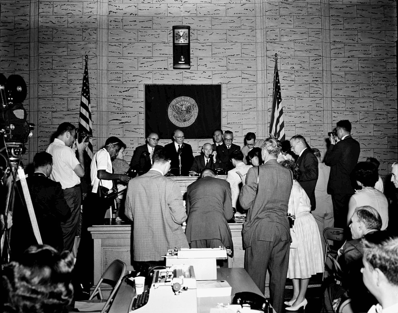
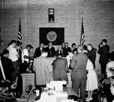
Reporters gather at Atlanta's city hall on August 30, 1961, the day that the city's schools were officially integrated. The recommendations of the Sibley Commission to the state legislature in 1960 contributed to the desegregation of schools across Georgia.
Courtesy of Special Collections & Archives, Georgia State University Library, Lane Brothers Commercial Photographers Photographic Collection.
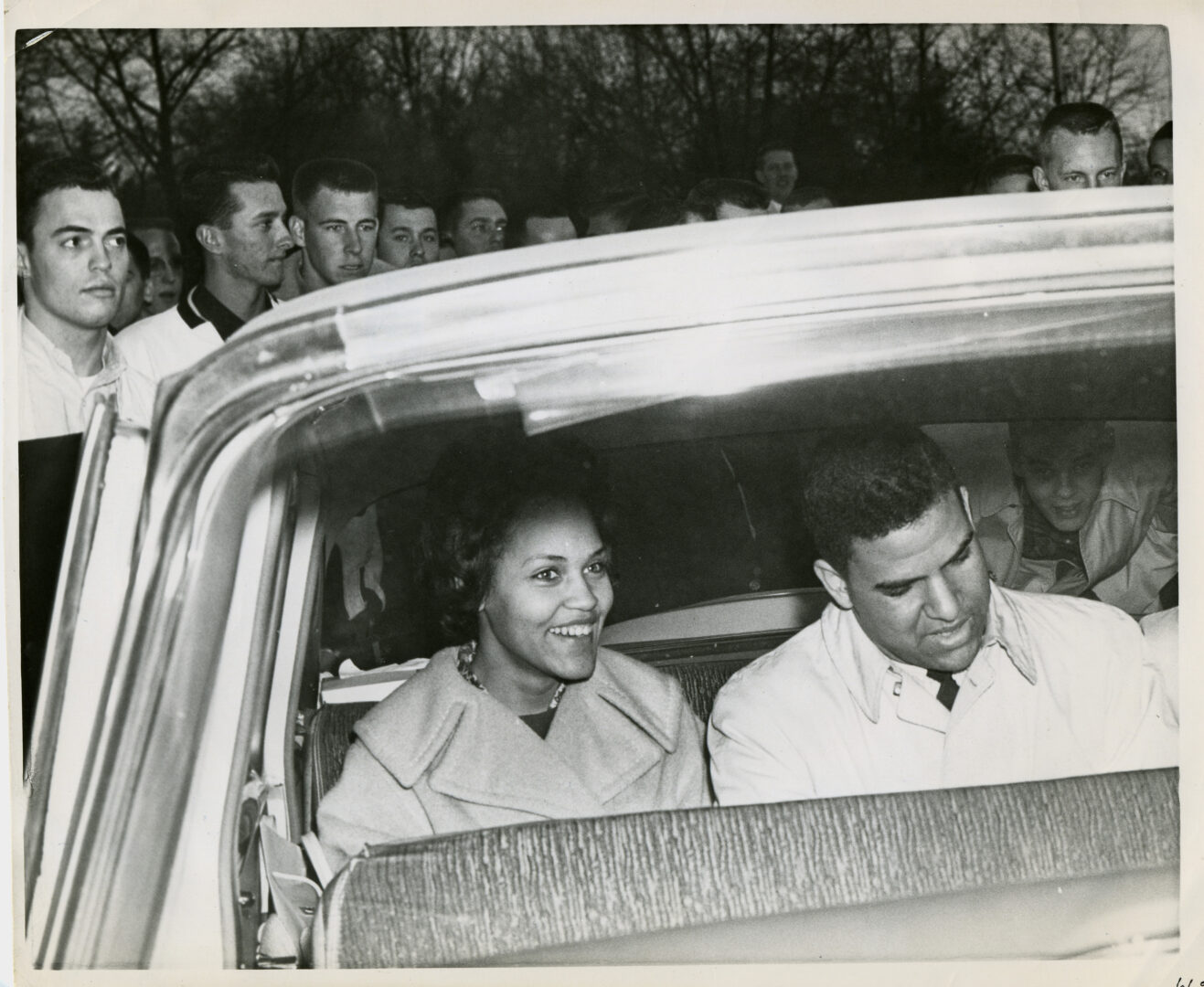
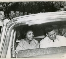
Charlayne Hunter and Hamilton Holmes, the first Black students to enroll at the University of Georgia, are pictured here at the end of their first day on campus in January 1961.
Courtesy of Atlanta Journal-Constitution.
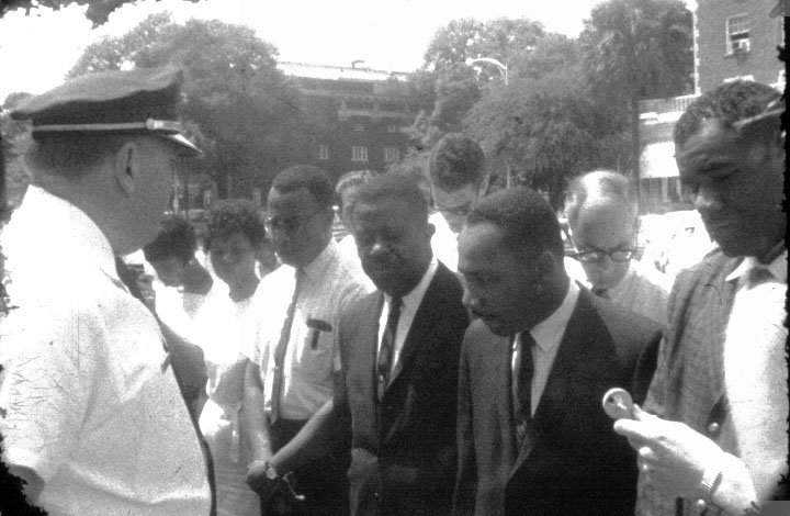
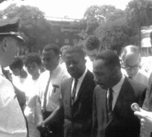
Martin Luther King Jr. (second from right) and Ralph David Abernathy (third from right) pray during their arrest in Albany on July 27, 1962. William G. Anderson, the president of the Albany Movement, asked King and Abernathy to help with efforts to desegregate the city.
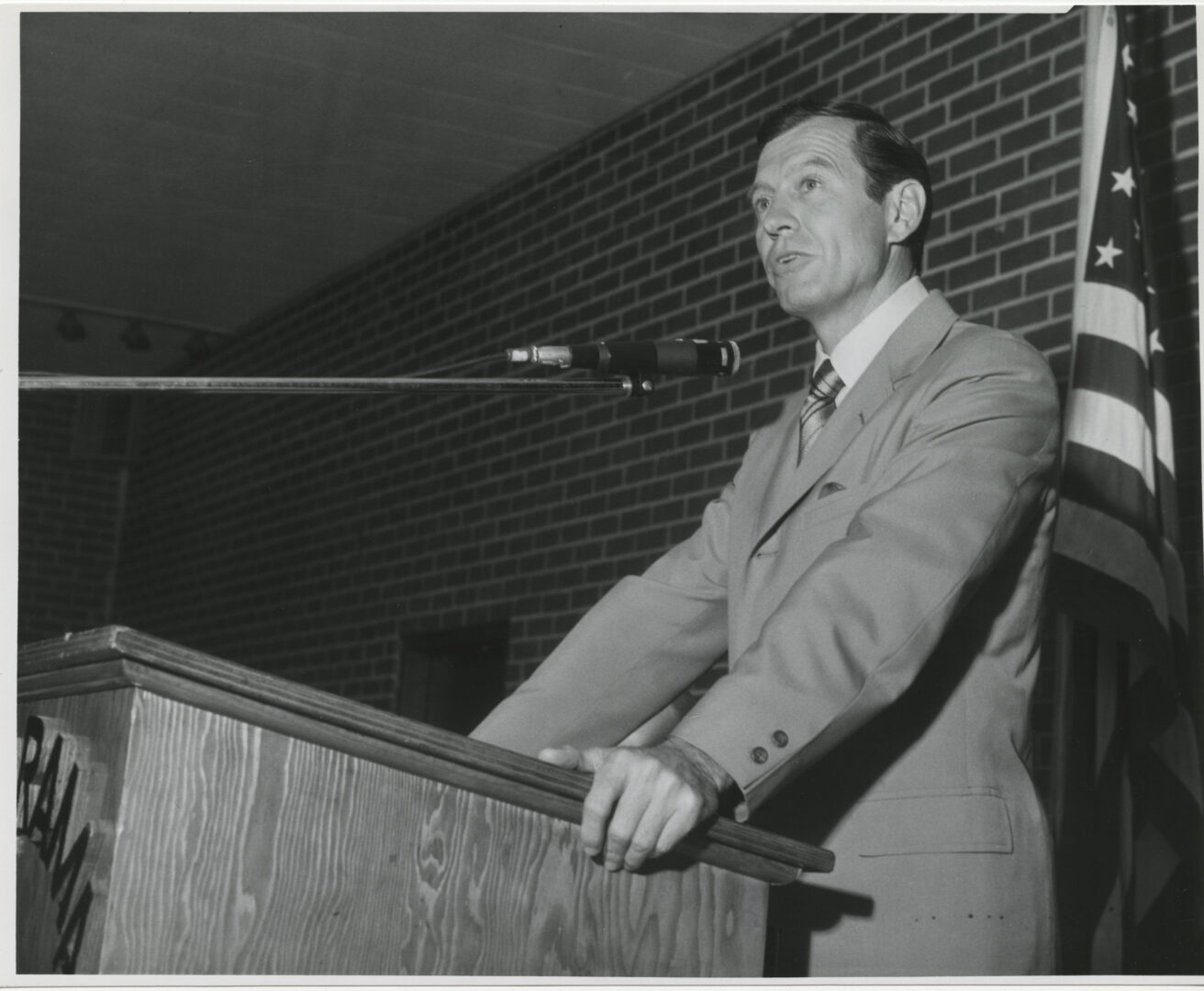
Augusta native Carl Sanders, elected governor of Georgia in 1962, brought the state into compliance with federal civil rights law during his single term in office.
In 1966 Lester Maddox defeated former governor Ellis Arnall in the Democratic gubernatorial primary in a major political upset. Subsequently, as a result of a close race between Maddox and Republican Bo Callaway, the General Assembly chose Maddox as governor.
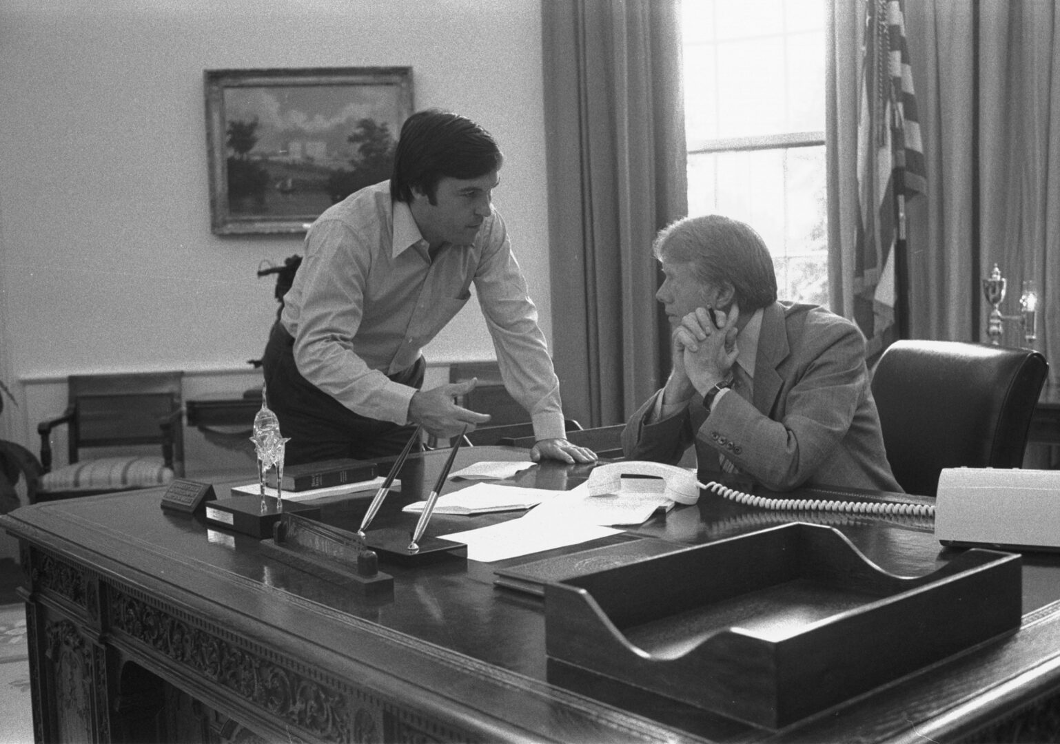
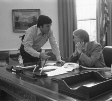
U.S. president Jimmy Carter (right) meets with Hamilton Jordan in the Oval Office of the White House in 1977. Jordan served as Carter's chief of staff from 1977 to 1980.
Courtesy of Jimmy Carter Presidential Library and Museum.
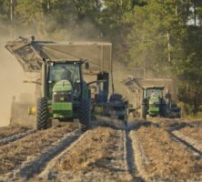
Georgia farmers lead the United States in peanut production, raising approximately 45 percent of the nation's total harvest. Grown in most south Georgia counties, peanuts are the official state crop.
Courtesy of Explore Georgia, Photograph by Ralph Daniel.
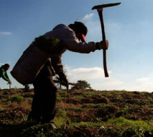
Latino workers plant loblolly pine seedlings in 1999 near Bremen, in Haralson County. Latino immigrants came to Georgia in large numbers during the 1980s and 1990s to work in the agriculture, construction, carpet, and poultry processing industries.
Courtesy of Atlanta Journal-Constitution.
Tourists on St. Simons Island gather outside one of the island's many shops. The island suffered an economic depression at the end of the cotton era in the 1830s, but its fortunes reversed with the arrival of the timber industry in the 1870s. Today St. Simons enjoys a strong tourist industry.
Courtesy of Explore Georgia.
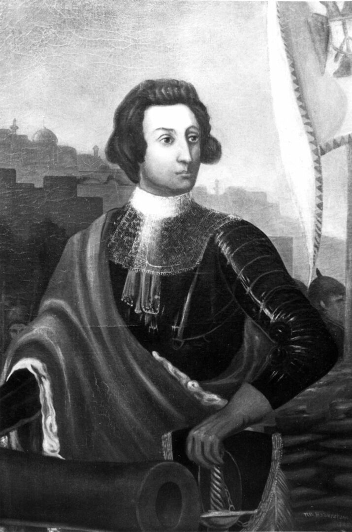
James Oglethorpe, a leader in the British movement to found a new colony in America, set sail for the new world on November 17, 1732, accompanied by Georgia's first settlers.
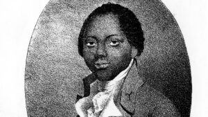
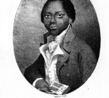
Sheftall Sheftall was the eldest son of Mordecai Sheftall, a successful Savannah merchant, shipper, and statesman. In 1777, during the Revolutionary War, Mordecai became a colonel, and he named Sheftall as his assistant. The following year both men were taken as prisoners by the British and held in the Caribbean for two years before being released.
Courtesy of Hargrett Rare Book and Manuscript Library, University of Georgia Libraries, Georgia Photo File.
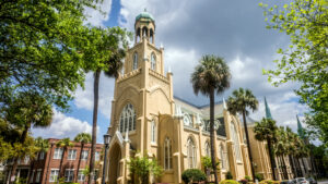
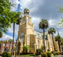
Congregation Mickve Israel in Savannah is the oldest Jewish congregation in the South and the third oldest in the United States. The congregation was founded during the establishment of the colony in 1733, and the current temple building was completed in 1878.
Photograph by Mark Kortum
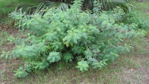
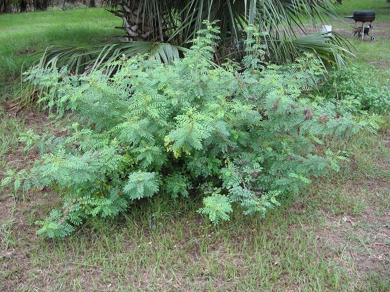
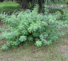
An indigo plant (Indigofera suffruticosa) grows wild on Ossabaw Island. Indigo was cultivated by colonial Georgians, and along with rice, was a lucrative crop until cotton surpassed it in the early 1800s.
Photograph by James Bitler
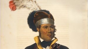
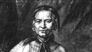
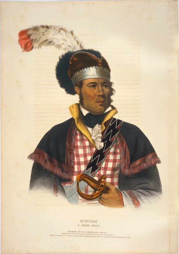
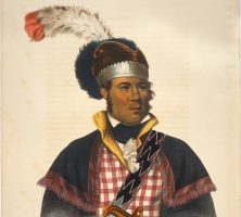
Charles Bird King's portrait of William McIntosh (ca. 1825). In 1825 McIntosh negotiated and signed the Treaty of Indian Springs, signing away all Creek lands in Georgia and thereby defying most of the reforms that he had encouraged and the laws that he had helped write.
Image from Archives and Rare Books Library, University of Cincinnati Libraries, McKenney and Hall: History of the Indian Tribes Collection.
A Lower Creek Indian chief, William McIntosh was born to a Scottish father and Creek mother and was fluent in the culture and language of both Creek and white societies. He supported the United States in its efforts to obtain Creek land, and his role in the 1825 Treaty of Indian Springs was considered a betrayal by Creeks.
Image from Alabama Department of Archives and History
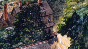
The McIntosh Inn, built in 1823 at Indian Springs in Butts County by Creek leader William McIntosh, thrived as a popular resort until the 1930s. In 1825 McIntosh signed the Treaty of Indian Springs with the U.S. government at the hotel; he was murdered three months later by angry Creeks who considered the agreement a betrayal.
Photograph by Melinda Smith Mullikin, New Georgia Encyclopedia
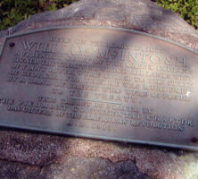
The marker reads: "Here on February 12, 1825, William McIntosh, a friendly chief of the Creek Indians, signed the Treaty by which all lands west of the Flint River were ceded to the State of Georgia. For this, he was murdered by a band of Creeks who were opposed to the treaty. This tablet is placed by The Piedmont Continental Chapter Daughters of the American Revolution A.D. 1911."
Photograph by Melinda Smith Mullikin, New Georgia Encyclopedia
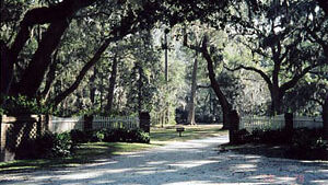
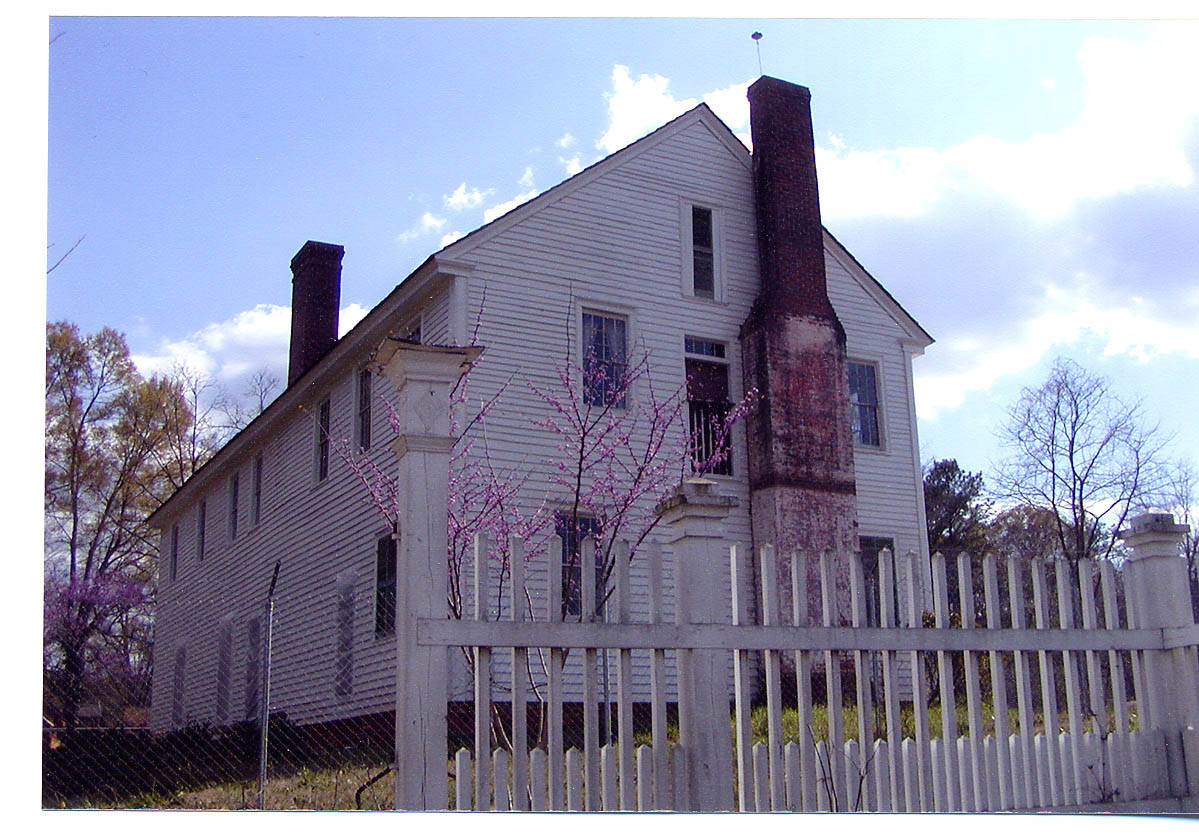
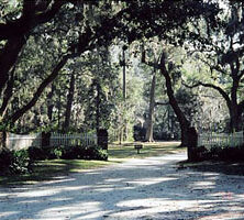
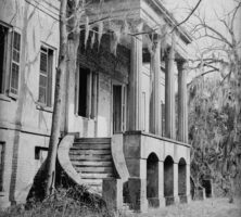
This tree-lined drive marks the entrance to Beaulieu Plantation, the estate of William Stephens, who came to Savannah in 1737 to serve as secretary of Trustee Georgia. Beaulieu was one of the leading river plantations, and Stephens experimented with grape and cotton cultivation.
Photograph by Carol Ebel
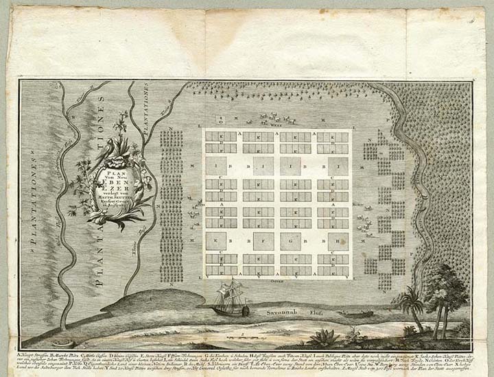
German artist Philip Georg Friedrich von Reck drew a map of New Ebenezer during his visit to the settlement in 1736. New Ebenezer, located on the bluffs above the Savannah River, was the second settlement established by the Georgia Salzburgers, a group of Protestants expelled from the Catholic province of Salzburg in 1731.
Illustration by Philip Georg Friedrich von Reck
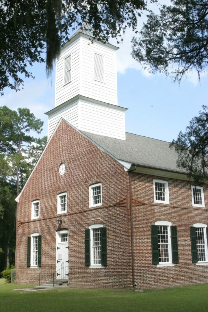
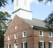
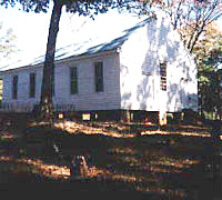
Jerusalem Church was established by the Salzburgers in Ebenezer during the 1730s. Ebenezer, left in ruins after the Revolutionary War, had disappeared by 1855, but Jerusalem Church, now known as Jerusalem Evangelical Lutheran Church, still stands. It is one of the few buildings in Georgia left intact after the Revolutionary War.
Photograph by Bruce Tuten
This sketch of the early Ebenezer settlement was drawn in 1736 by Philip Georg Friedrich von Reck. That same year the Salzburger settlement moved to a location closer to the Savannah River, where conditions were better for farming.
Print from Von Reck Archive, Royal Library of Denmark, Copenhagen
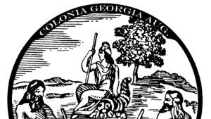
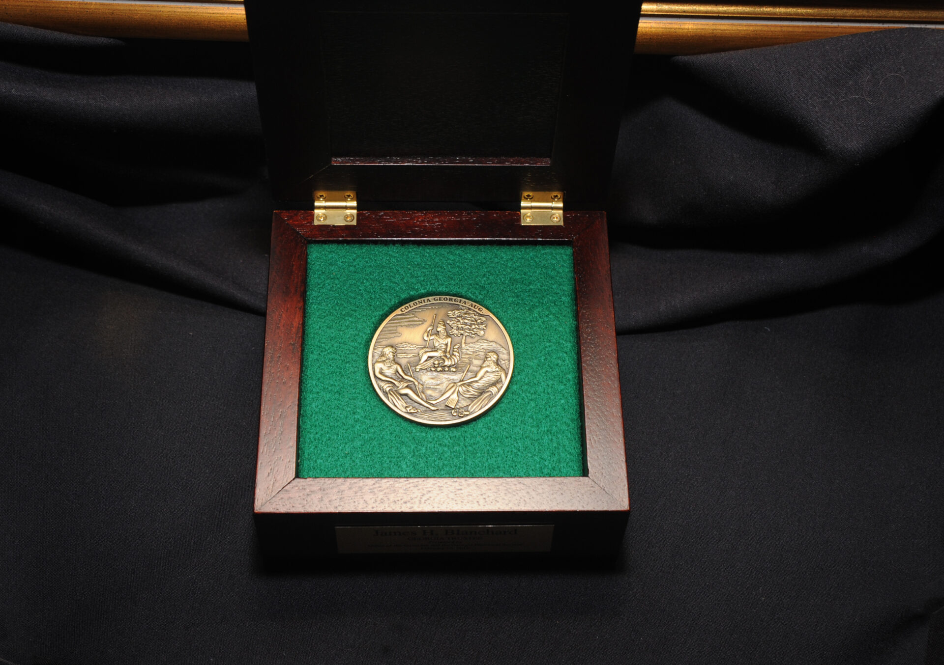
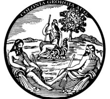
One face of the 1733 seal of the Georgia Trustees features two figures resting upon urns. They represent the Savannah and Altamaha rivers, which formed the northwestern and southeastern boundaries of the province. The genius of the colony is seated beside a cornucopia, with a cap of liberty on her head and a spear in one hand. The abbreviated Latin phrase Colonia Georgia Aug means "May the colony of Georgia prosper."
Courtesy of Georgia Historical Society.
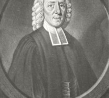
Lutheran minister Johann Martin Boltzius, along with religious refugees from Salzburger, founded the settlement of Ebenezer near Savannah in the early 1730s as a religious utopia. Boltzius hoped to create a successful economic system that was not dependent upon slavery.
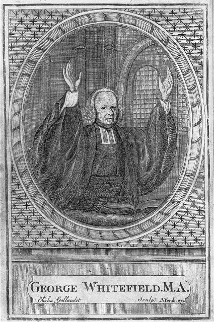
An engraving of Anglican minister George Whitefield, created in 1774, depicts him preaching at a church in New York. A popular figure of the eighteenth-century Great Awakening in America, Whitefield founded the Bethesda orphanage near Savannah in 1740.
Courtesy of Library of Congress, Prints and Photographs Division
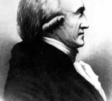
Benjamin Hawkins, a North Carolina native, served as the "Principal Temporary Agent for Indian Affairs South of the Ohio River" from 1796 until his death in 1816. Hawkins established the Creek Agency Reserve along the Flint River in present-day Crawford County, Georgia, where he lived with his wife and children. A skilled and fair diplomat, Hawkins encouraged Indians in his jurisdiction to adopt the U.S. government's "plan for civilization" as their best option for survival.
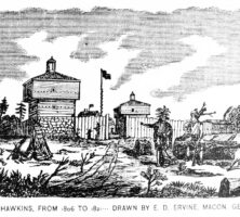
Indian Superintendent Benjamin Hawkins personally selected the location of Fort Benjamin Hawkins, which was built to protect settlers from the Creeks. Despite Hawkins's fear that the Creeks would attack the settlement, no problems arose during the fifteen years that the fort was used as an outpost. Fort Hawkins was later used as a supply hub during the War of 1812.
Courtesy of Middle Georgia Archives, Washington Memorial Library.
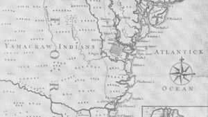
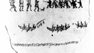
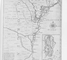
A map of Georgia, circa 1745, shows the territory inhabited by the Yamacraw Indians, a group formed in 1728 by disaffected Creek and Yamasee Indians. The Yamacraws, led by Tomochichi, established their first community on the bluffs of the Savannah River. After the arrival of James Oglethorpe in 1733, the group agreed to move north to accomodate Oglethorpe's plans to build an outpost, which later became the city of Savannah.
From History of Georgia, by C. Howell
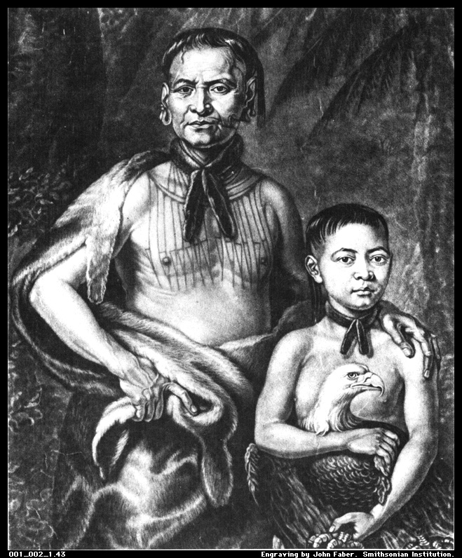
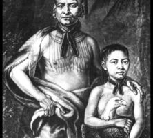
As a principal mediator between the native Creek (Muscogee) and English settlers during the first years of Georgia's settlement, Tomochichi (left) contributed to the establishment of peaceful relations between the two groups. His nephew, Toonahowi, is seated on the right in this engraving, circa 1734-35, by John Faber Jr.
Olaudah Equiano published one of the earliest known slave narratives, The Interesting Narrative, in London in 1789. The work chronicles his years of enslavement, which he spent sailing trade ships both at sea and along the Savannah River. Equiano purchased his freedom in 1766 and traveled widely thereafter.
From The Life of Olaudah Equiano, or Gustavus Vassa, the African, by O. Equiano
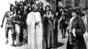
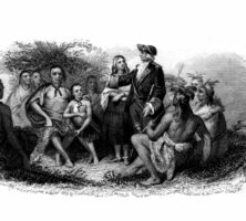
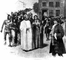
The Creek Indians meet with James Oglethorpe. By the time Oglethorpe and his Georgia colonists arrived in 1733, relations between the Creeks and the English were already well established and centered mainly on trade.
A replica of the original Quaker meetinghouse stands in Wrightsborough, which was founded in 1768 as a Quaker community in present-day McDuffie County. Opposed to slavery and therefore unable to compete in Georgia's economy, the Quakers, or Religious Society of Friends, began to leave the area during the late eighteenth century.
Courtesy of Sarah Shaw
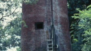
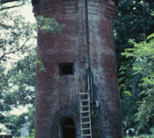
The water tower at Old Town Plantation is located approximately eight miles southeast of Louisville in Jefferson County. The plantation was established as a trading post around 1770 by Georgia Galphin, an Indian commissioner, on the site of an ancient Creek town.
Courtesy of Forrest Shropshire
James Oglethorpe founded the colony of Georgia in 1733 and built Fort Frederica, which became the center of colonial frontier defense, on St. Simons Island in 1736. Oglethorpe also recruited men from along the colonial milita to form the Rangers, a full-time military force.
Courtesy of Georgia Historical Society, Georgia Historical Society collection of portraits, #GHS 1361-PH-25-08-4841.
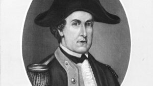
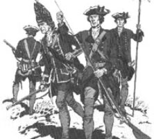
Three companies of the British Sixtieth Regiment of Foot were sent to the Georgia colony in 1763 by King George III to strengthen the defense of colonial garrisons against attack by the French and Spanish.
Courtesy of The Company of Military Historians
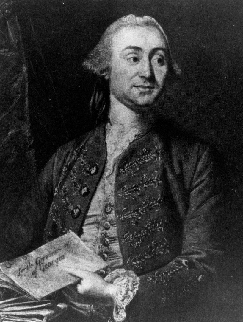
James Wright replaced Henry Ellis as royal governor of Georgia in 1760 and proved to be an efficient and popular administrator. During his tenure in office (1760-76) Georgia enjoyed a period of remarkable growth.
Courtesy of Hargrett Rare Book and Manuscript Library, University of Georgia Libraries, Georgia Photo File.
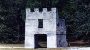
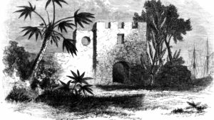
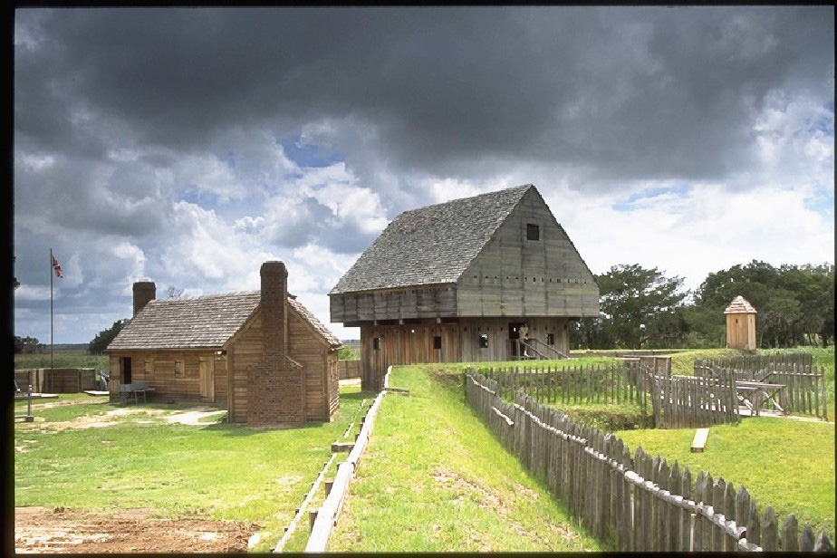
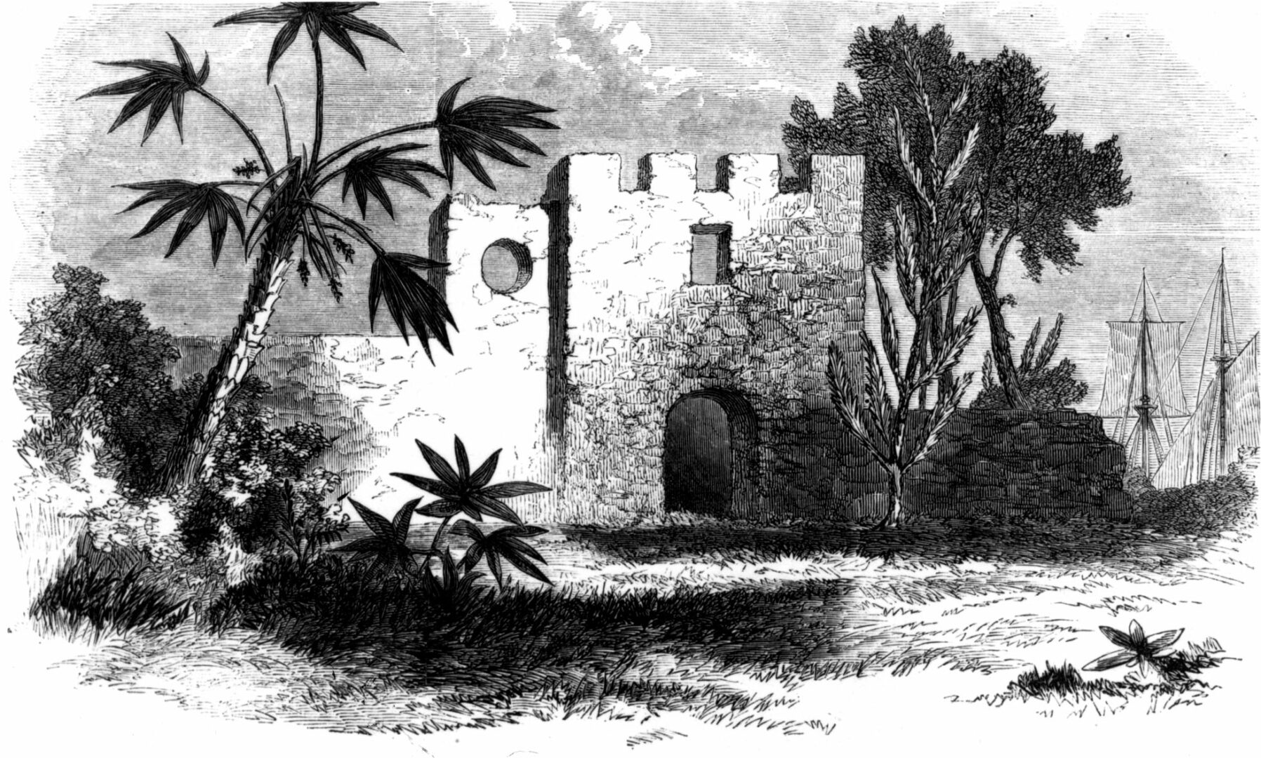
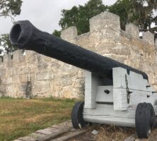
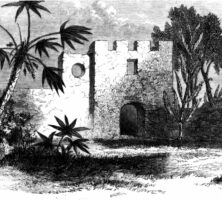
Fort King George was originally constructed at the mouth of the Altamaha River in 1721 to protect the British claim to the Georgia colony. The fort was garrisoned until 1732. More than 250 years later, the fort was reconstructed and today houses a museum and replicas of the blockhouse (pictured) and barracks.
Courtesy of Fort King George
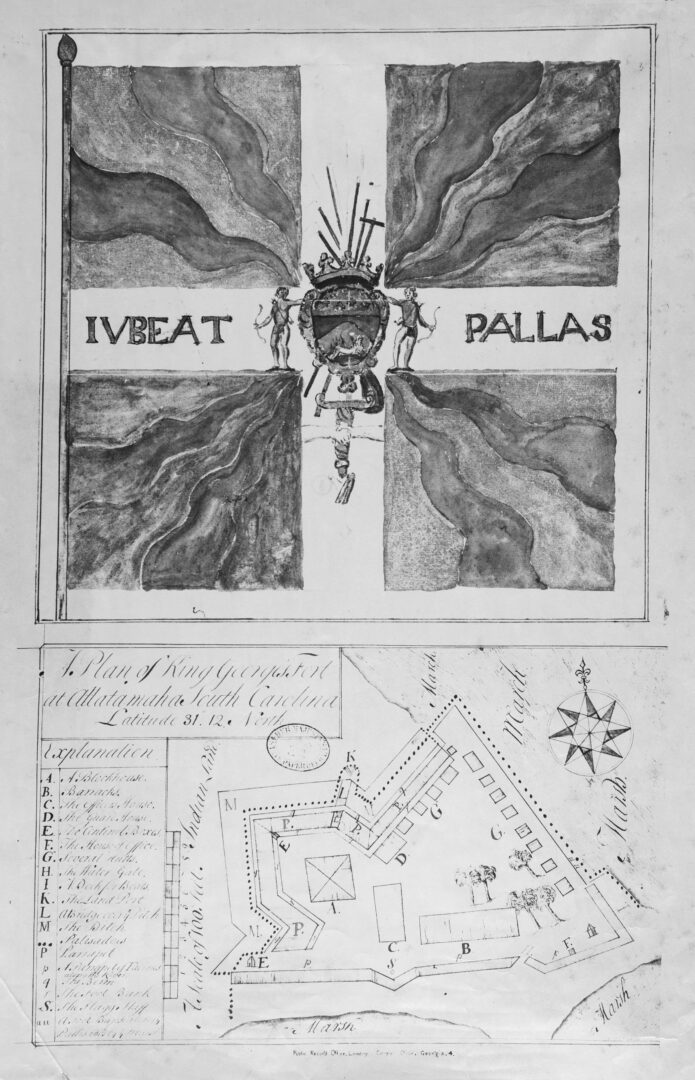
This map of Fort King George was likely drawn in 1722 by Colonel John "Tuscarora Jack" Barnwell, who established the fort near present-day Darien in 1721.
Courtesy of Georgia Archives.
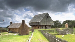
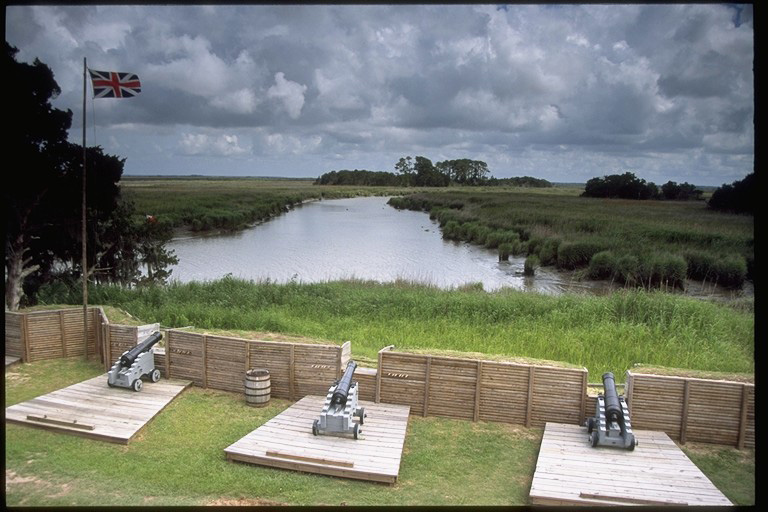
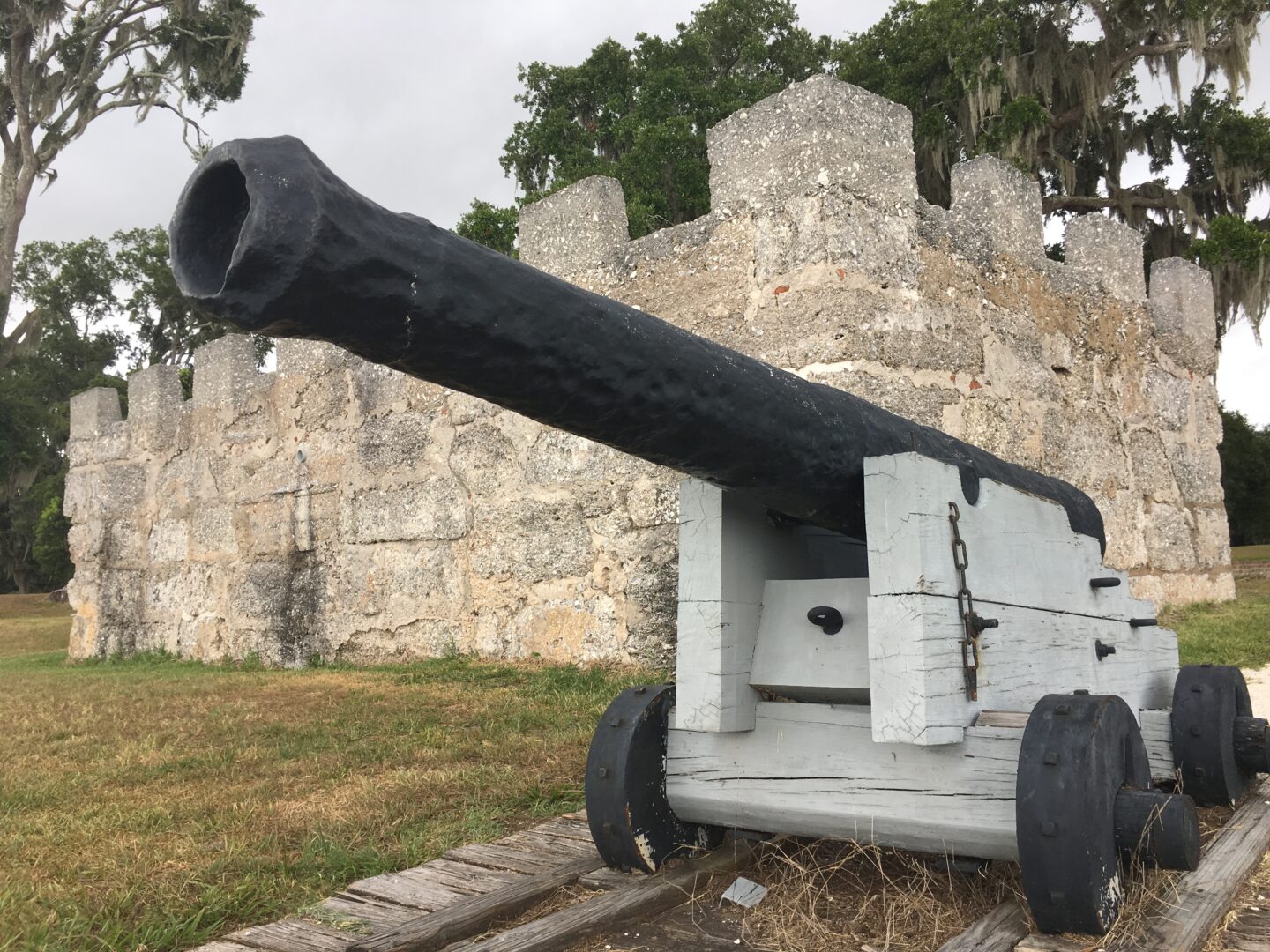
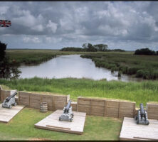
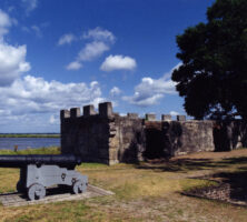
The Union Jack flies above three cannons overlooking Black Island Creek at the reconstructed Fort King George near Darien. The original British garrison was established in 1721 and abandoned in 1732. The site was added to the National Register of Historic Places in 1971 and reconstructed in 1988.
Courtesy of Fort King George
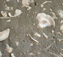
Traditional tabby, used for construction primarily along the coast, is composed of equal parts lime, water, sand, oyster shells, and ash. First introduced in Georgia by James Oglethorpe in 1736, tabby experienced revivals in the first half of the nineteenth century and again from the 1880s to 1920s.
Photograph by Jim Darby
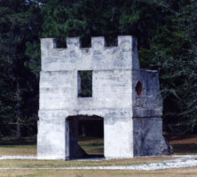
Among the archaeological ruins remaining at Fort Frederica on St. Simons Island are the soldiers' barracks (pictured), along with the king's magazine and the house foundations and walls. The structures are made of tabby, a limey mortar.
Courtesy of Ed Mathews, Amelia Island Images
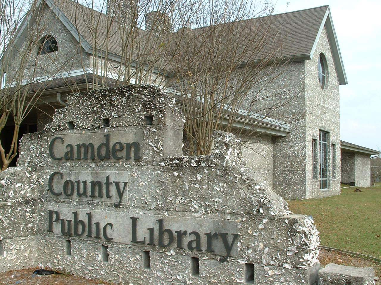
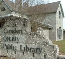
The Camden County Public Library was constructed in 1988 with "revival tabby," or traditional tabby mixed with Portland cement.
Photograph by Jim Darby
Tabby was used in the coastal Southeast from the late 1500s to the 1850s.
Courtesy of Patricia Barefoot
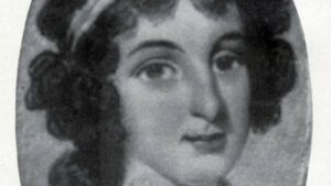
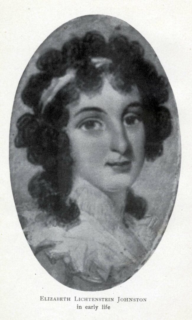
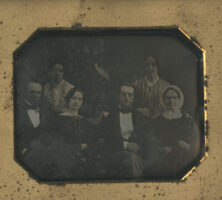
As a young girl, Elizabeth Lichtenstein Johnston first lived with her parents along the Little Ogeechee River in Georgia. In 1774, after the death of her mother, she was sent to Savannah, where she lived through the Revolutionary War. Johnston later wrote about her experiences during the war, including the 1779 siege on Savannah, in her memoir Recollections of a Georgia Loyalist.
Elizabeth Lichtenstein Johnston's memoir of the American Revolution, which she experienced as a young girl in Savannah, was published in 1901. The book, entitled Recollections of a Georgia Loyalist, provides one of the most detailed accounts available of a southern woman's experience during the war.
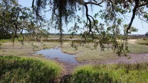
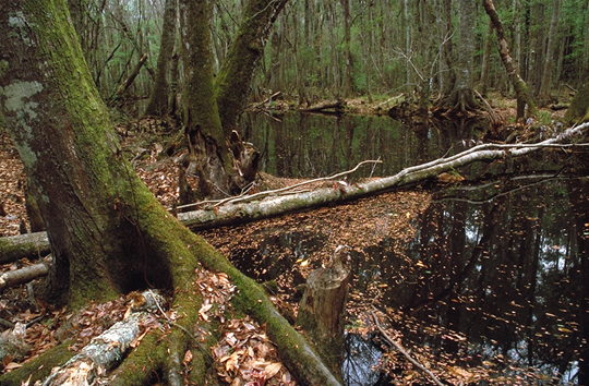
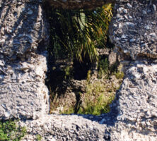
Ebenezer Creek in Effingham County was the site of Ebenezer, one of Georgia's first settlements. Founded by religious refugees from Salzburg during the 1730s, Ebenezer became a haven for other persecuted religious groups, including the Moravians.
Courtesy of Georgia Department of Economic Development.
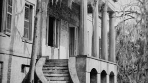
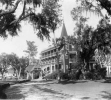
South front of the Wormsloe House, 1899. Victorian-style improvements were made to the family house by Wymberly Jones De Renne in the 1890s. The Victorian additions and ornamentation were removed by his daugher nearly forty-five years later.
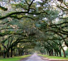
A narrow road adorned with live oak trees along either side makes for a dramatic entrance to the Wormsloe historic site.
Photograph by Jeff Gunn
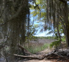
The Wormsloe site, on the Isle of Hope peninsula, was an important part of the defense of the Georgia colony against the Spanish. A guard post and a marine garrison were located at Wormsloe during the colonial era.
Photograph by Katherine Bowman
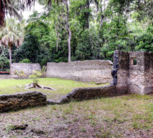
Noble Jones used tabby, a mixture of limestone, sand, and shells, to build fortifications at Wormsloe in 1740 for the defense of Savannah. In 1793 he began construction on a new tabby home, the ruins of which are still standing.
Image from G. Dawson
Historical works made up the majority of the books privately printed by George Wymberley Jones De Renne. He called four of his publications the "Wormsloe Quartos" in honor of his family's ancestral estate.
Courtesy of Eudora De Renne Roebling
Wymberley Wormsloe De Renne worked off and on most of his life to complete the library his father had begun. The Catalogue of the Wymberley Jones De Renne Georgia Library became the basis of the sale of the De Renne Georgia Library in 1938 to the Board of Regents of the University System of Georgia, for placement in the University of Georgia Libraries.
Courtesy of Eudora De Renne Roebling
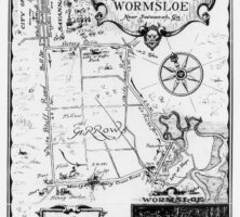
In 1927 the Wormsloe estate was opened to the public as Wormsloe Gardens. The site became a popular tourist attraction. A tourist map from 1930 shows the layout of the property at the time.
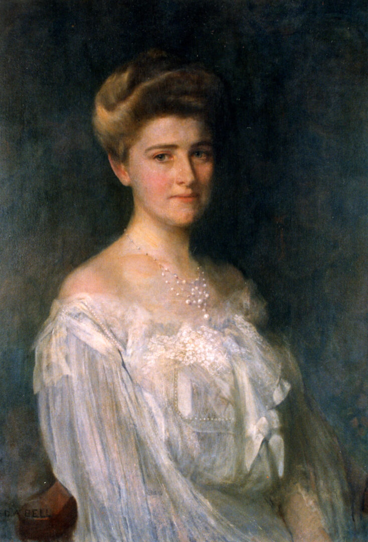
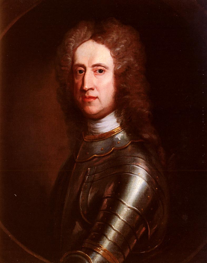
In 1953 Barrow incorporated the Wormsloe Foundation, one of whose activities was the publication of historical works. Barrow is pictured here in a portrait by Edward August Bell (ca. 1905).
Courtesy of Elfrida Barrow Moore
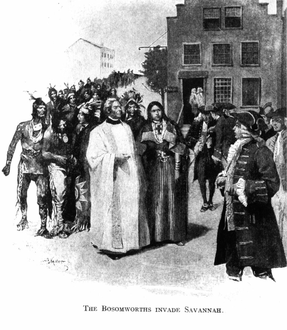
Mary Musgrove (pictured with her third husband, the Reverend Thomas Bosomworth) served as a cultural liaison between colonial Georgia and her Native American community in the mid-eighteenth century. She took advantage of her biculturalism to protect Creek interests, maintain peace on the frontier, and expand her business as a trader.
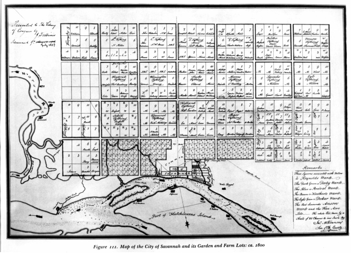
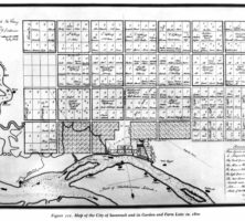
An early map of Savannah, drawn by John McKinnon circa 1800.
Courtesy of Hargrett Rare Book and Manuscript Library, University of Georgia Libraries, Rare Maps Collection.
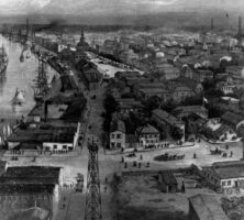
A drawing of the city of Savannah, circa 1889.
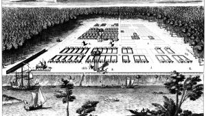
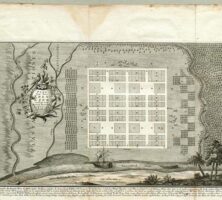
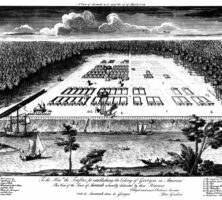
The original caption of this print by Paul Fourdrinier reads: "A View of Savannah as it stood on the 29th of March 1734. To the Hon[orable] Trustees for establishing the Colony of Georgia in America. This View of the Town of Savannah is humbly dedicated by their Honours Obliged and most Obedient Servant, Peter Gordon."
Button Gwinnett's signature is said to be one of the rarest and most valuable of the signers of the Declaration of Independence. The signature is housed at the Georgia Archives in Morrow.
Image from Wikimedia
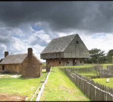
Little remains of the Quaker settlement of Wrightsborough, located in present-day McDuffie County.
Courtesy of Forrest Shropshire
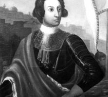
James Oglethorpe, the founder of Georgia, was a forward-thinking visionary who demonstrated great skill as a social reformer and military leader. This portrait is a copy of Oglethorpe University's oval portrait of Oglethorpe, which was painted in 1744. The portrait was discovered in England by Thornwell Jacobs and brought back to Atlanta to hang in the president's office at Oglethorpe University.
Courtesy of Georgia Info, Digital Library of Georgia.
James Oglethorpe, along with a twenty-one-member Board of Trustees, founded the colony of Georgia in 1733 and directed its development for nearly a decade. Although the board appointed Anglican clergy to the new colony, Oglethorpe welcomed settlers of a variety of religious persuasions.
Courtesy of Oglethorpe University
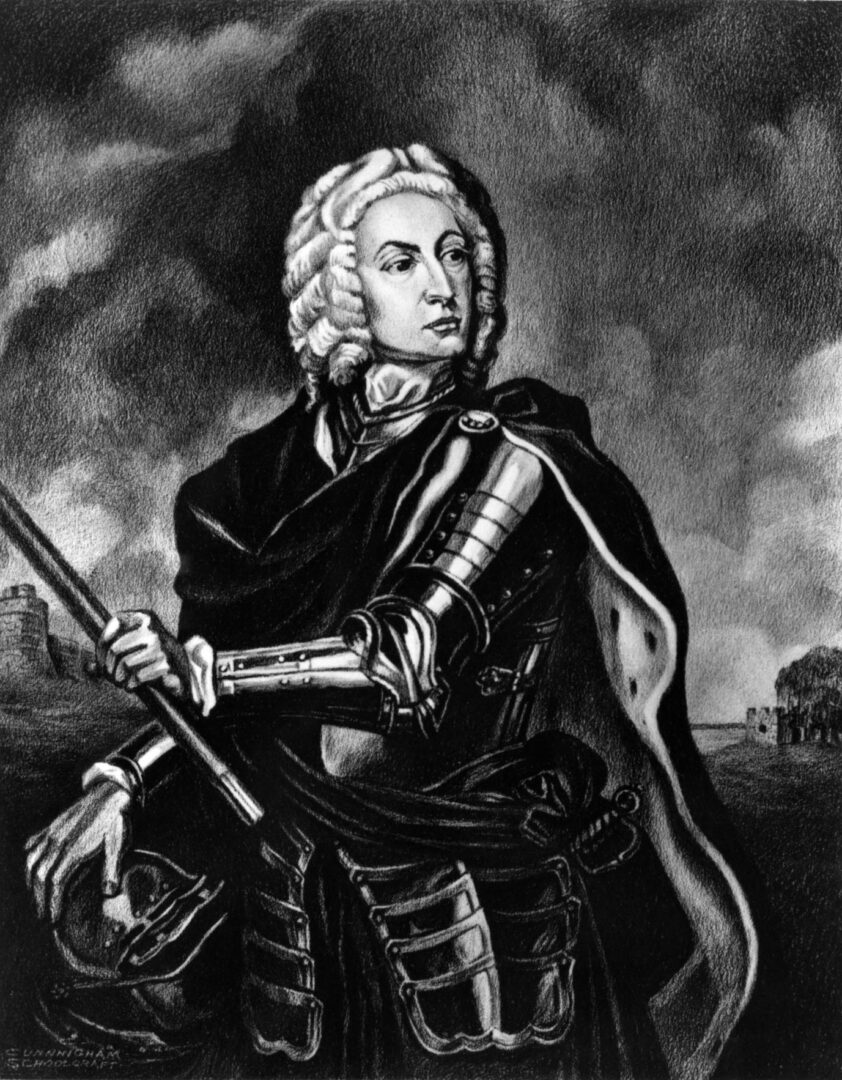
James Oglethorpe defended the new colony of Georgia militarily, holding the titles of general and commander in chief.
Courtesy of Georgia Info, Digital Library of Georgia.
Georgians have honored founder James Oglethorpe by naming a county, two cities, a university, and numerous schools, streets, parks, and businesses for him.
Courtesy of Georgia Historical Society, Georgia Historical Society collection of portraits, #GHS 1361-AF-327.
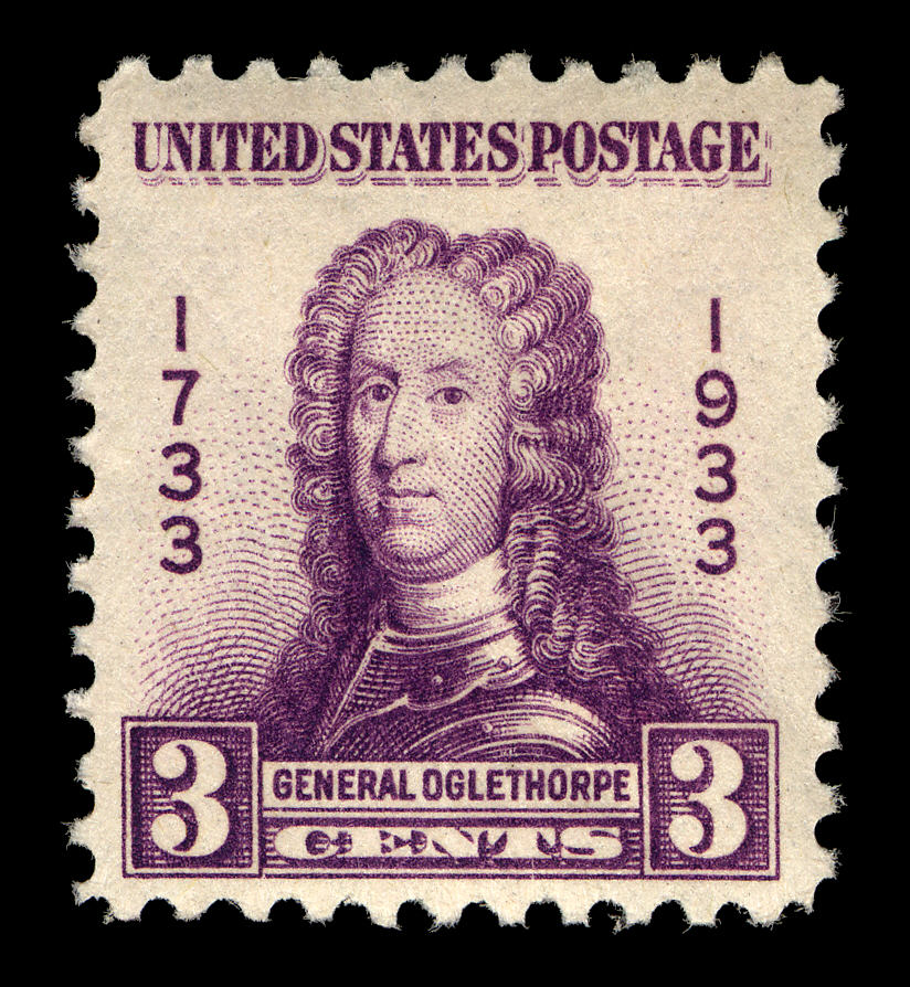
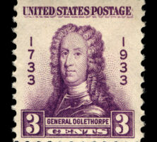
The U.S. Postal Service issued a stamp featuring Georgia founder James Oglethorpe for the state's bicentennial anniversary in 1933.
Courtesy of Smithsonian National Postal Museum
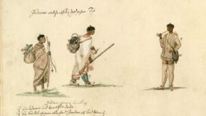
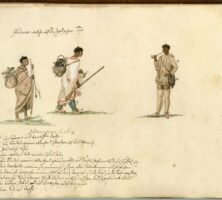
Yuchi Indians, depicted in traditional hunting clothing, also carry items acquired through trade with the English, notably the central figure's blanket and rifle.
Illustration by Philip Georg Friedrich von Reck
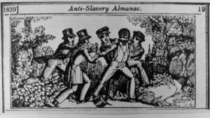
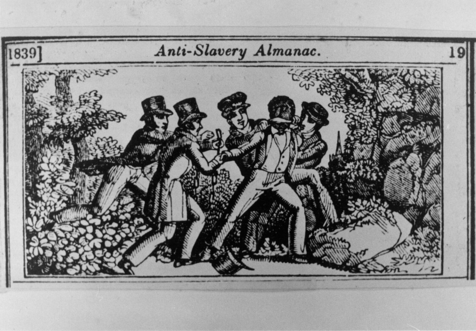
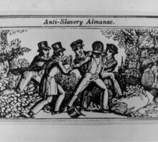
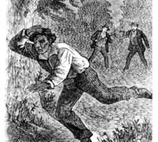
A woodcut depicts the capture of a fugitive from slavery by a slave patrol. Slave patrols were common in Georgia from 1757 until the end of the Civil War in 1865.
From The American Anti-Slavery Almanac for 1839
A Georgia statute ordered white adults to ride the roads at night, stopping all enslaved people they encountered and making them prove that they were engaged in lawful activities. Patrollers required enslaved people to produce a pass, which stated their owner's name as well as where and when they were allowed to be away from the plantation and for how long.
From The Underground Railroad, by William Still
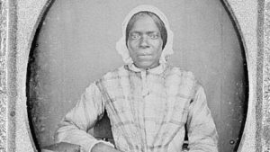
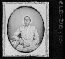
Rare daguerreotype of an enslaved woman in Watkinsville, photographed in 1853. A placard with the date "1853," which reads correctly for the camera, is visible. The use of a book as a prop is unusual for an image of an enslaved person.
Courtesy of Georgia Archives, Vanishing Georgia, #
clr210-92.
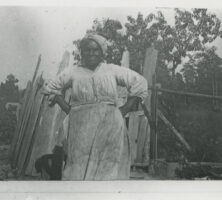
Enslaved women played an integral part in Georgia's colonial and antebellum history. Scholars are beginning to pay more attention to issues of gender in their study of slavery and are finding that enslaved women faced additional burdens and even more challenges than did some enslaved men.
Courtesy of Hargrett Rare Book and Manuscript Library, University of Georgia Libraries, Robert E. Williams Photographic Collection.
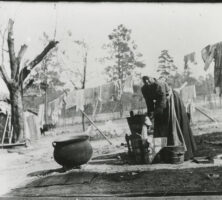
Antebellum planters kept meticulous records of the people they enslaved, identifying several traditionally female occupations, including washerwomen.
Courtesy of Hargrett Rare Book and Manuscript Library, University of Georgia Libraries, Robert E. Williams Photographic Collection.
Enslavers clothed both male and female enslaved children in smocks and assigned them such duties as carrying water to the fields. As the children neared the age of ten, slaveholders began making distinctions between the genders.
Courtesy of Hargrett Rare Book and Manuscript Library, University of Georgia Libraries, Robert E. Williams Photographic Collection.
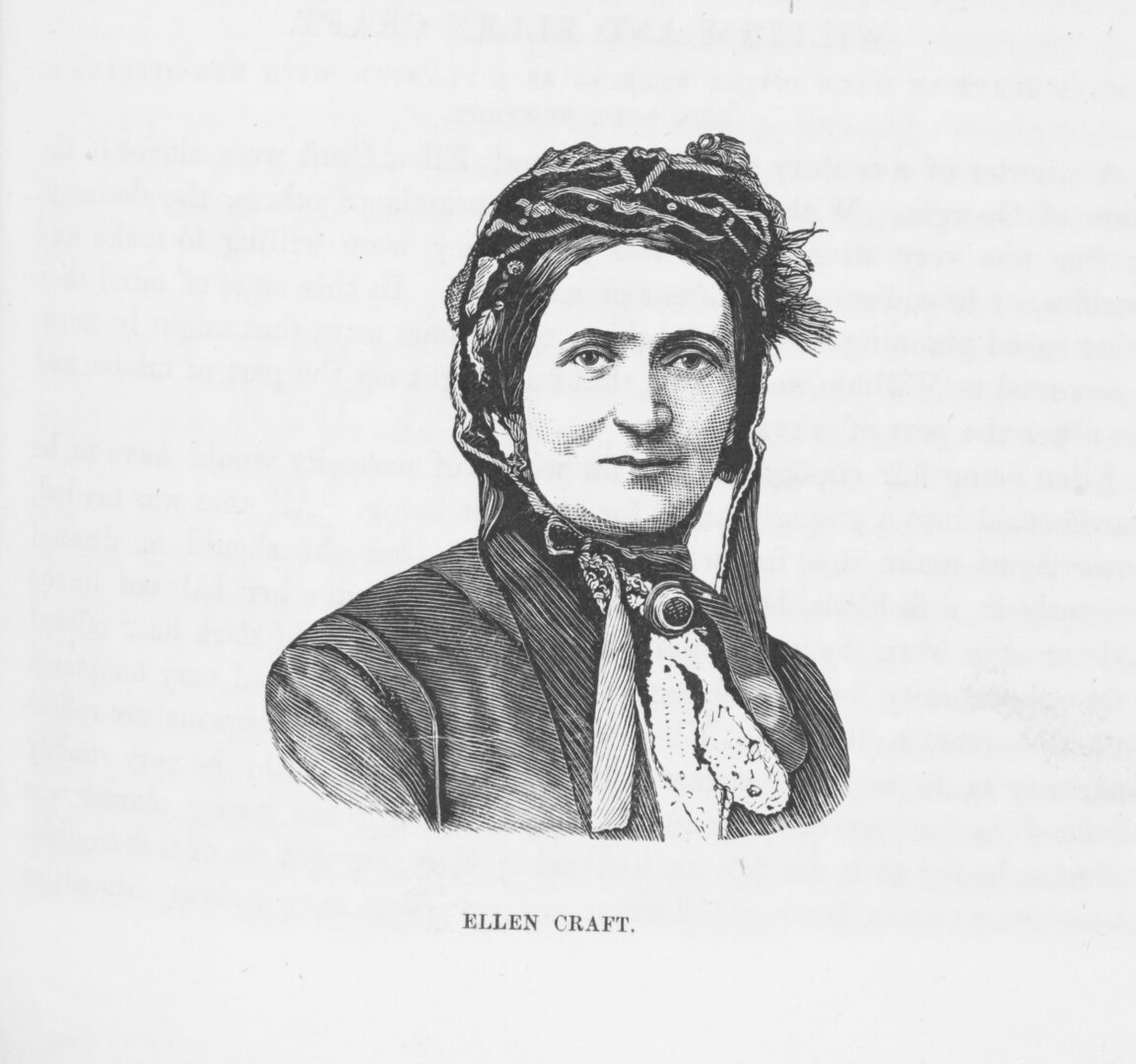
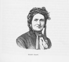
The daughter of an African American woman and her white enslaver, Ellen looked white and was able to escape slavery by disguising herself as a southern slaveholder.
From The Underground Rail Road, by W. Still
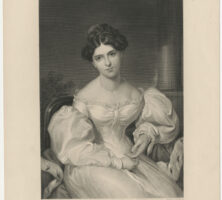
An English actress, Kemble married Pierce Mease Butler and was upset to learn of the family's slave labor operations. She eventually published an account of her impressions of slavery, after divorcing Butler and losing custody of their two children.
Courtesy of Hargrett Rare Book and Manuscript Library, University of Georgia Libraries, Georgia Photo File.
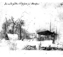
Peter Tondee and his business partner built a silk filature on Reynolds Square in 1759. The building served multiple public functions before it was destroyed by fire in 1839.
Courtesy of Carl Solana Weeks
Peter Tondee's Long Room, which stood at the northwest corner of Broughton and Whitaker streets in Savannah, became center stage for the political drama that brought a fledgling province into the ranks of the war for American liberty, and it served for several years during and after the Revolution as the seat of government for the new state.
Courtesy of Walter Wright and David A. Hammond
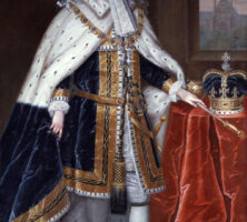
King George II of England signed the charter creating the colony of Georgia on April 21, 1732. Originally administered by a board of trustees, the colony later came under the direct governance of the king, from 1752 until his death in 1760, when his grandson George III assumed the throne.
Courtesy of Georgia Info, Digital Library of Georgia.
Noble W. Jones was prominent among Georgia's Whig leaders before and during the American Revolution, serving in both the provincial and state legislatures and in the Continental Congress. Portrait by Charles Willson Peale, circa 1781.
Courtesy of Telfair Museums, Courtesy of the Wormsloe Foundation.
John Viscount Percival, the earl of Egmont, was the first president of the common council and the dominant figure among the Trustees until his retirement in 1742. He acted as Georgia's champion in Parliament.
From History of Georgia, by C. Howell
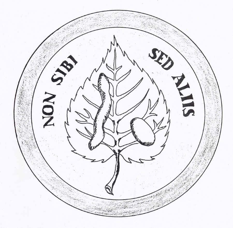
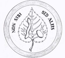
One face of the seal adopted by the Georgia Trustees features a silkworm, mulberry leaf, and cocoon, representing their hopes that the colonists would establish a thriving silk industry. The Latin motto Non sibi sed aliis translates as "Not for self, but for others."
Courtesy of Georgia Historical Society.
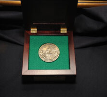
A bronze replica of the 1733 seal of the Trustees is presented to recipients of the Georgia Trustees honor, which is awarded annually by the Georgia Historical Society and the Office of the Governor.
Courtesy of Georgia Historical Society.
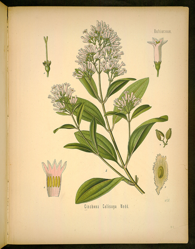
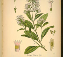
Peruvian bark (Cinchona calisaya), also known as quinine, was grown during the mid-eighteenth century in the Trustee Garden at Savannah. Cultivated by the Georgia colonists as a medical botanical for the lowering of fevers, quinine was later used in the nineteenth century to treat malaria.
From Kohler's Medizinal-Pflanzen, by F. E. Kohler
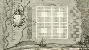
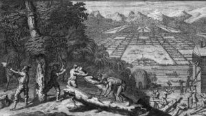
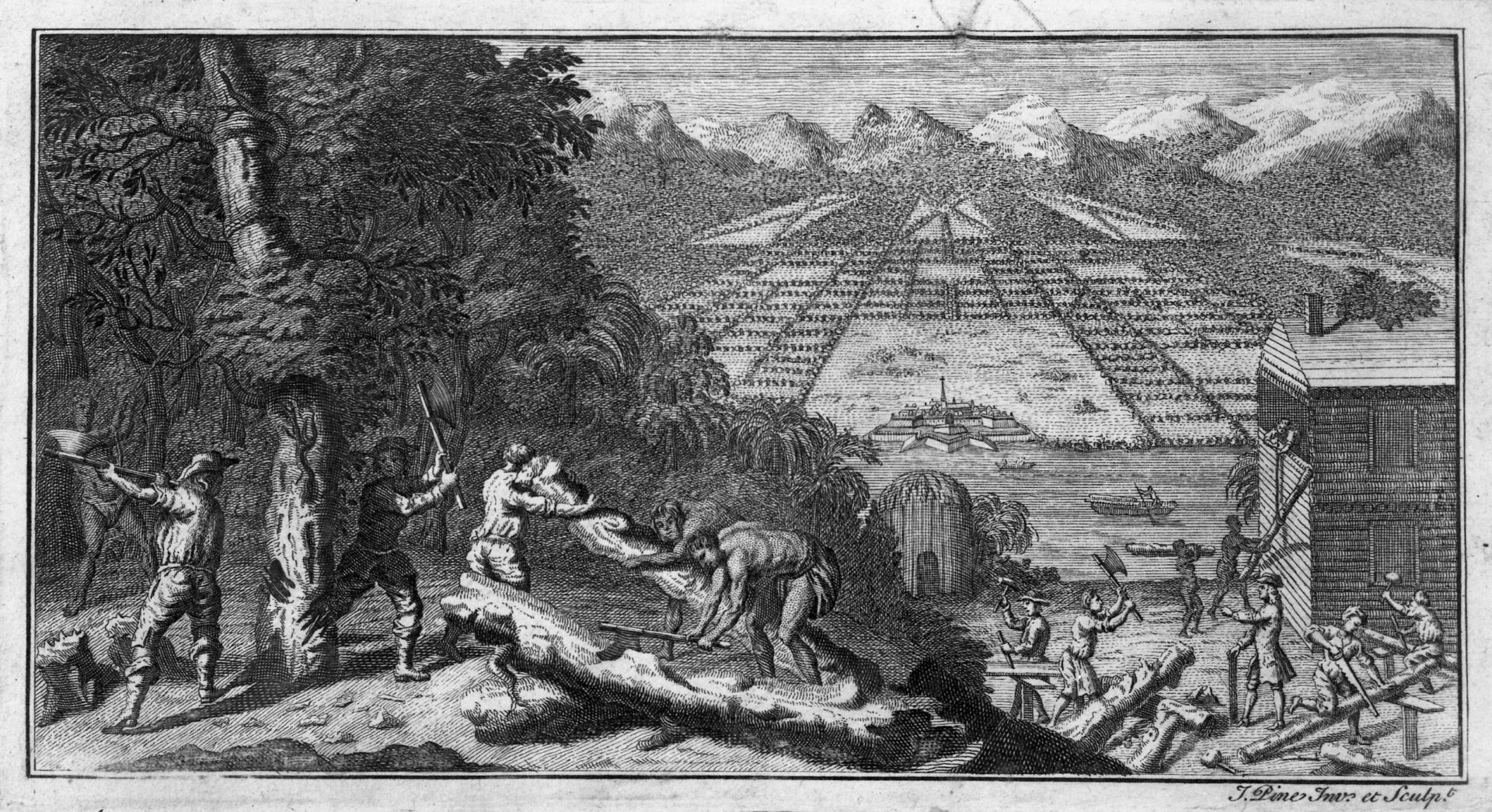
Even before the Savannah settlement was a reality, artist John Pine produced this imaginary depiction of clearing the land. The central clearing in the background of his 1732 engraving may reflect the early planners' vision of a public garden as an integral part of the new colony.
Courtesy of Hargrett Rare Book and Manuscript Library, University of Georgia Libraries, Georgia Photo File.
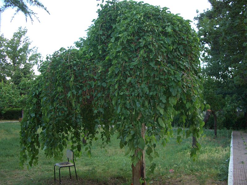
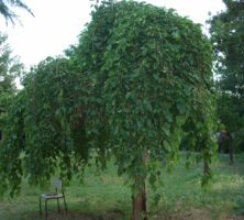
The white mulberry tree (Morus alba) was introduced to Georgia in 1734, when James Oglethorpe established the Trustee Garden in Savannah. Mulberry leaves are used to feed silkworms, which the colonists raised to make silk for shipment to England.
Photograph by Wikimedia
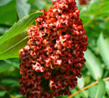
Sumac (Rhus glabra), a native North American plant with medicinal properties, was cultivated in the Trustee Garden by early settlers to the Georgia colony and sent to London, England. The garden was established in 1734 as an agricultural experiment station modeled after the physick and botanical gardens at Oxford and Chelsea in England.
Image from formulanone
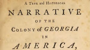
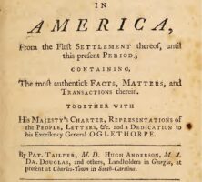
During the 1730s, Scottish settler Patrick Tailfer led a group of colonists, knowns as the Malcontents, in protest of various laws and policies enforced by the Georgia Trustees. His 1740 tract, entitled A True and Historical Narrative of the Colony of Georgia, was read in influential circles but failed to make a substantial impact on the circumstances of the Malcontents.
From A True and Historical Narrative of the Colony of Georgia in America, by P. Tailfer
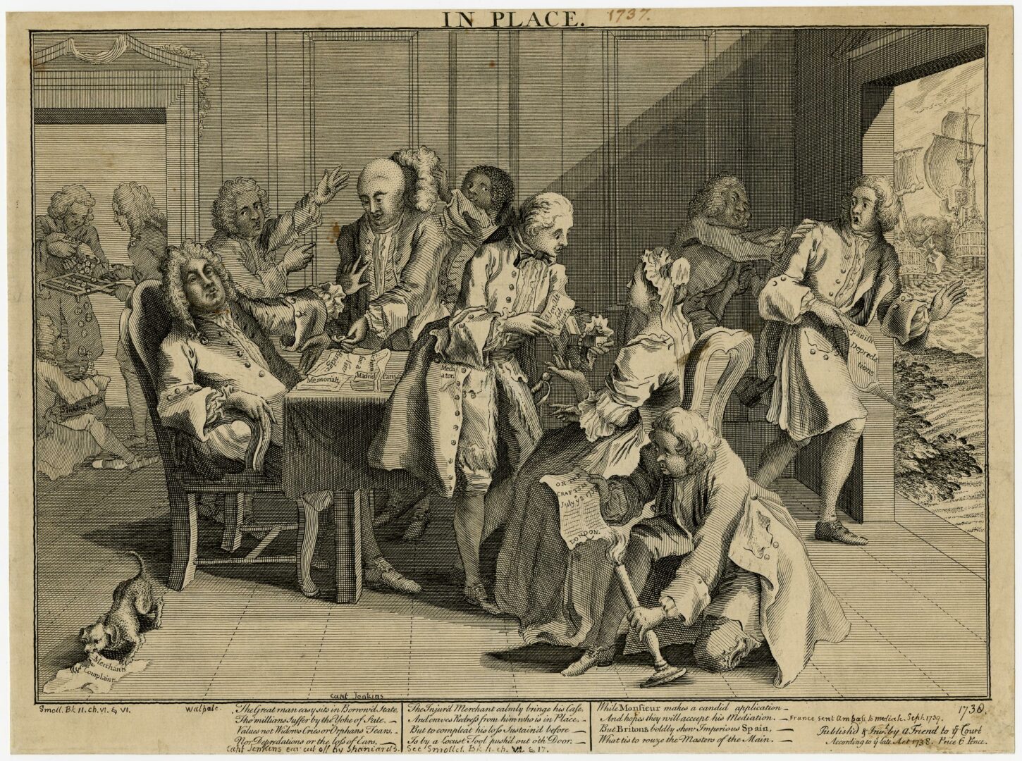
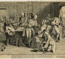
The pickled ear of Captain Robert Jenkins became a rallying point for Englishmen eager to challenge Spanish power in the New World. The 1738 satirical cartoon depicts Prime Minister Robert Walpole swooning when confronted with the Spanish-sliced ear, which led to the War of Jenkins' Ear in 1739.
Courtesy of British Museum, London
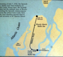
In the 1742 Battle of Bloody Marsh on St. Simons Island, General Oglethorpe's soldiers defeated Spanish forces in what was the only Spanish invasion of Georgia during the War of Jenkins' Ear. The battle earned its name from its location rather than from the number of casualties, which were minimal.
Photograph by Forrest Shropshire
Once formal hostilities began in 1739 between the Spanish and English over the land between South Carolina and Florida, shipping on the Atlantic Ocean suffered frequent interruption from acts of piracy by both sides. These skirmishes escalated into the War of Jenkins' Ear and the Battle of Bloody Marsh.
Image from Wikimedia
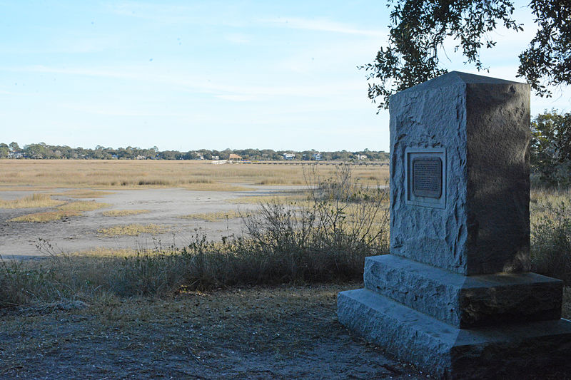
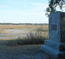
A monument marks the location of the Battle of Bloody Marsh, which was fought between the English and the Spanish on St. Simons Island in 1742.
Photograph by Jud McCranie, Wikimedia
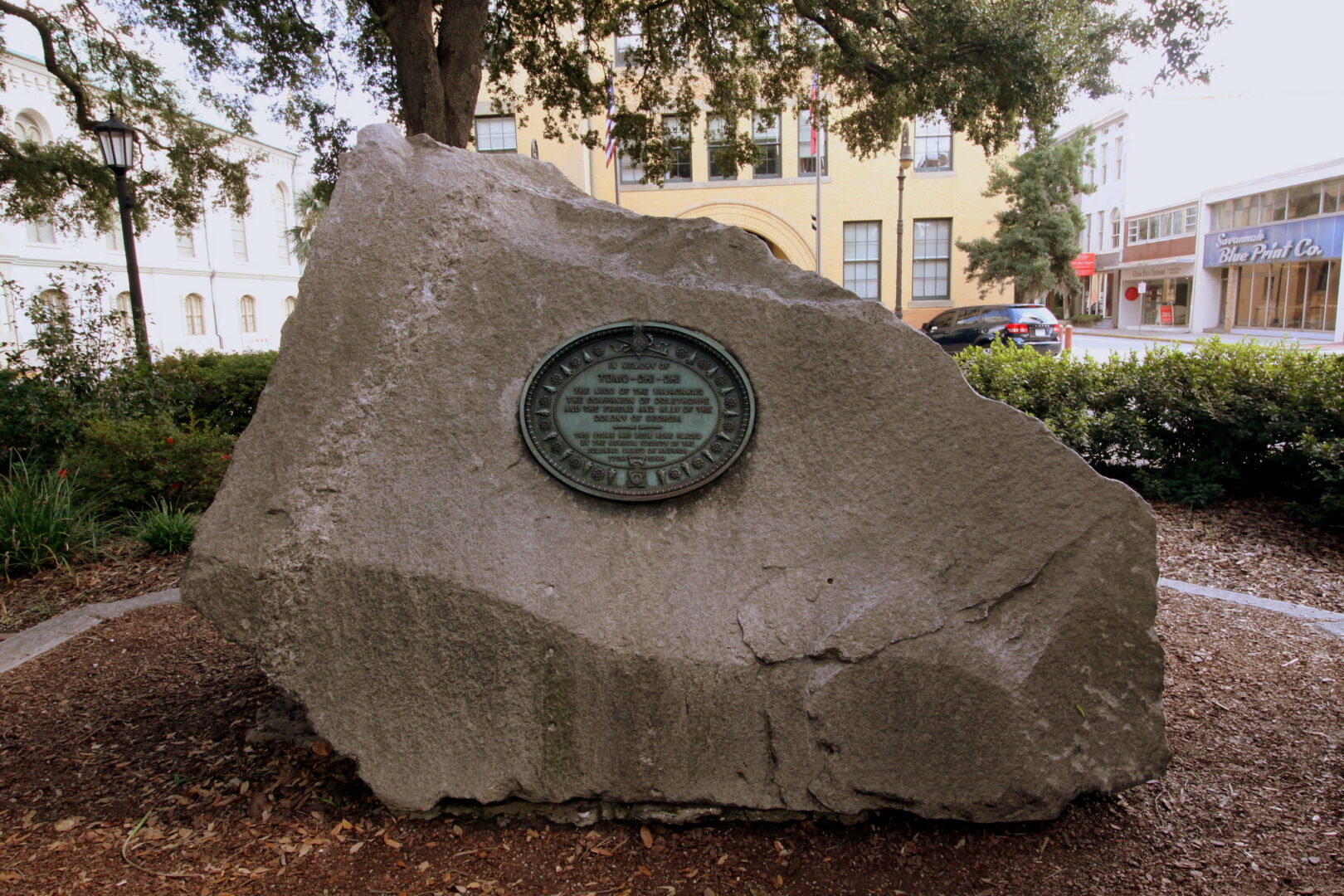
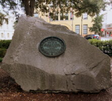
A large granite boulder with a decorative copper plate was installed in Savannah's Wright Square, southeast of the original grave marker, on April 21, 1899. The plate is inscribed to "the mico of the Yamacraws, the companion of Oglethorpe, and the ally of the colony of Georgia."
Image from Brent Moore
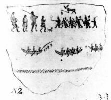
This copy of a Creek "hieroglyphick painting" was made in the 1770s by Bernard Romans. Romans was a British surveyor and engineer who worked in Florida during the 1770s. He made many notes on the Creeks.
The restored magazine building was constructed from tabby and brick ca. 1740. Powder and ammunition were stored in the existing rooms, while the missing north section was used for soldiers' quarters and offices.
Image from HAL333
Designed to defend the southern frontier from the continued presence of Spanish colonials in the American Southeast, Fort Frederica on St. Simons Island served as the British military headquarters in colonial America.
The British regiment at Frederica disbanded in May 1749. In April 1758, a great fire swept Frederica, reducing much of it to ashes. Today the ruins form the Fort Frederica National Monument.
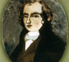
Archibald Bulloch was a Revolutionary soldier, a leader of Georgia's Liberty Party, and the state's first chief executive and commander in chief. Bulloch County in southeast Georgia was named for him upon its creation in 1796.
Courtesy of Hargrett Rare Book and Manuscript Library, University of Georgia Libraries, Georgia Photo File.
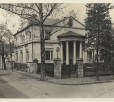
Architect William Jay built this villa on Orleans Square in Savannah in 1819 for Archibald Bulloch. The house was razed in 1916, and the Savannah Municipal Auditorium was constructed on the site. In turn, the Savannah Civic Center was built on the site, replacing the auditorium, in the 1970s.
Courtesy of Georgia Historical Society, Foltz Photography Studio (Savannah, Ga.), photographs, 1899-1960, #GHS 1360-08-08-01.
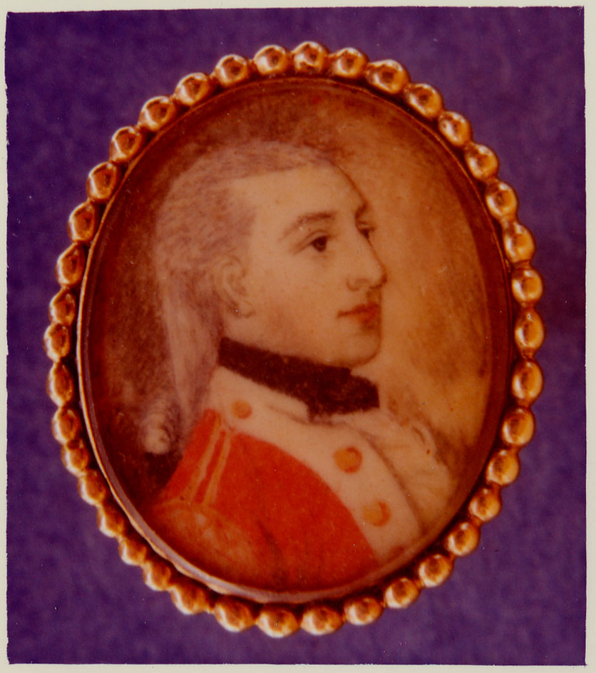
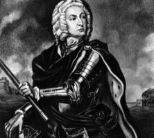
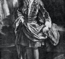
Before his governorship of Georgia in 1785, Savannahian Samuel Elbert served as commander of both Georgia's militia and Continental Line during the Revolutionary War.
Courtesy of Hargrett Rare Book and Manuscript Library, University of Georgia Libraries, Georgia Photo File.
Elijah Clarke was among the few heroes of the Revolutionary War from Georgia. Even though he was wounded several times, Clarke led several successful frontier guerrilla campaigns against British soldiers and American Loyalists during the war. Clarke County is named for him.
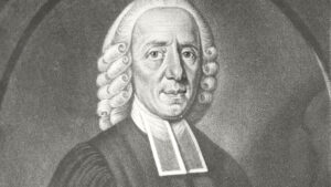
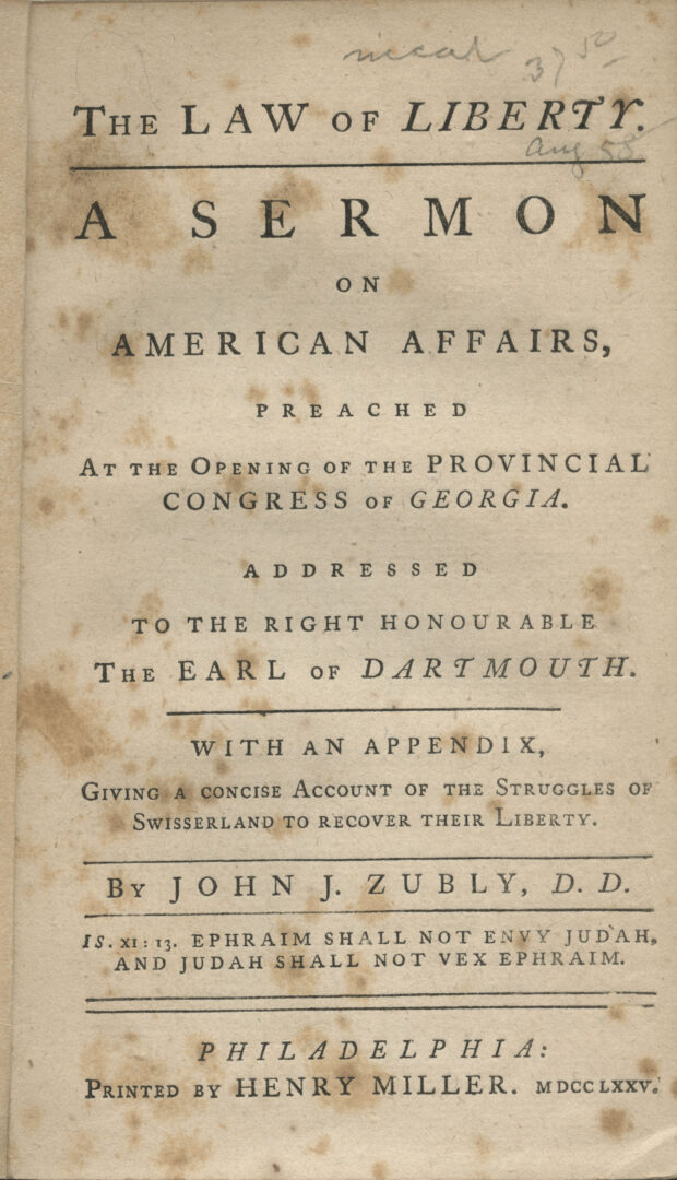
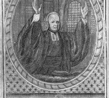
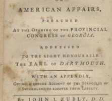
The front page of one of John Zubly's sermons.
James Habersham (ca. 1712-75) arrived in colonial Georgia from England in 1738. Habersham was prominent in the economic and political life of colonial Georgia.
Courtesy of Hargrett Rare Book and Manuscript Library, University of Georgia Libraries, Georgia Photo File.
Joseph Habersham became a zealous revolutionary in 1774 and was appointed to the Confederation Congress in the 1780s.
Courtesy of Hargrett Rare Book and Manuscript Library, University of Georgia Libraries, Georgia Photo File.
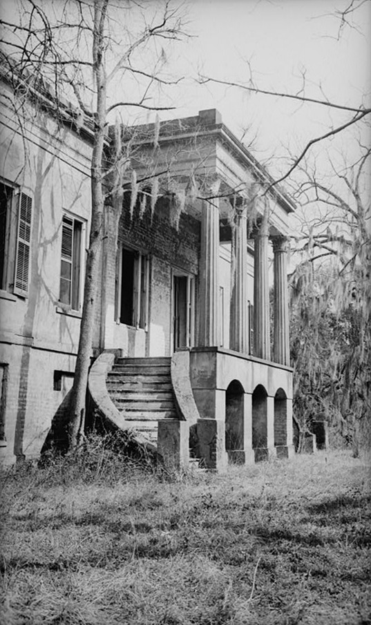
The Hermitage Plantation (1830), outside of Savannah, was owned by the French settler the Marquis de Montalet. Architect Charles Cluskey designed the house. Handmade bricks made at the plantation in the 1840s can be seen in some Savannah houses.
Courtesy of Library of Congress, Prints and Photographs Division
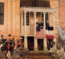
In this painting, Lafayette is portrayed reviewing the Georgia Hussars, the Chatham Artillery, and the Savannah Volunteer Guards from the balcony of the Owens-Thomas House in Savannah during his 1825 visit to the state.
Courtesy of Preston Russell
The Butlers of South Carolina and Philadelphia owned extensive rice and cotton plantations on the Sea Islands of Georgia.
Grandson and namesake of Pierce Butler, Pierce Mease Butler inherited part of his grandfather's massive fortune and holdings on the Georgia Sea Islands.


