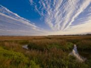
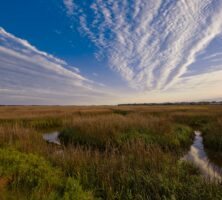
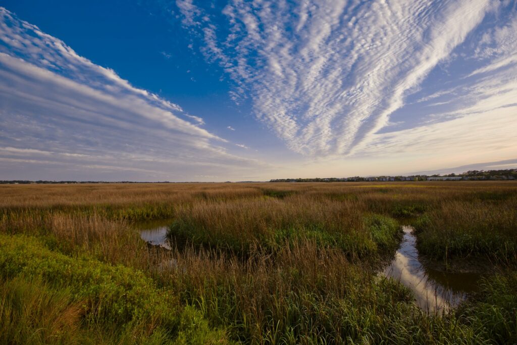
Georgia’s coast is more than 100 miles in length. Its most impressive natural feature is the chain of barrier islands that fringe the shoreline. Separating the islands from the mainland is a belt of tidal marshes, four to six miles wide. Amid the marshes, and running the length of the coast, are the waterways that, from the earliest years of the region’s European occupation, have been known as the inland passage.
Courtesy of Explore Georgia.
Travel and Communication
The natural “water highway” of this inland passage provided a protected route for intracoastal maritime traffic, enabling smaller craft to avoid the outside passage along the coast, a route often impassable due to frequent Atlantic Ocean northeasters and tropical storms. Spanish traders and Franciscan friars traveled the waterway between the friars’ chain of missions in the sixteenth and seventeenth centuries. English colonists utilized the route to transport cargoes of rice and indigo to the markets in Charleston, South Carolina, and in Savannah.
During the antebellum period, when large rice and cotton plantations were established on the Sea Islands and in the freshwater river estuaries, the inland waterway was increasingly utilized. Small coasting vessels transported plantation commodities to the larger markets for sale. These craft called at the tidewater plantations to load bags of cotton and tierces, or barrels, of rice for shipment. The rural nature of the islands and mainland coast made the waterway a crucial link with the outside world for the shipment and receipt of domestic goods, plantation equipment and supplies, as well as mail.
Despite Georgia’s relatively short coastline, the Union navy had a difficult task in containing Confederate smugglers and blockade runners during the Civil War (1861-65) because the convoluted network of creeks and rivers afforded many opportunities for escape. The inland waterway thus facilitated communication between plantations despite the Union blockade offshore and in the sounds.
Navigation
During the postbellum period, the U.S. Army Corps of Engineers began the regular dredging of Georgia’s inland waterway. Certain sections of the waterway, primarily those behind the barrier islands where the tides meet and cause shoaling (or dividings), require periodic dredging. Such examples are the Florida Passage–Bear River segment between Ossabaw Island and the Bryan County mainland, North Newport River west of St. Catherines Island, Buttermilk Sound northwest of St. Simons Island, and Jekyll Creek and the Cumberland Dividings.
The inland waterway on the Georgia coast also passes through two areas known as “narrows,” with both areas exhibiting a tendency to shoal. Narrows along the inside route have posed problems for mariners since colonial times. Colonial surveyor William Gerard DeBrahm noted the presence of a narrows on a 1770 map of Amelia Island, which is located just south of Cumberland and is today part of Florida. The narrows was indicated by a “pine tree—a mark to go through the Narrows . . . at this branch the Tides meet.” At Skidaway Narrows south of Savannah and west of Skidaway Island, and at Creighton Narrows in McIntosh County between Creighton and Sapelo islands, dredging has been necessary since the early 1900s to keep the channel open.
These narrows are man-made channels. During the nineteenth century, steamboats approaching Savannah from the south were required to take a circuitous passage between Skidaway and Wassaw islands through Romerly Marsh, which was navigable only at high tide. Along the west side of Sapelo Island, vessels had to negotiate Mud River, a wide, shallow stream that, as its name implies, was navigable only at high tide. Steamboats frequently ran aground. To eliminate these navigational difficulties, the Corps of Engineers, with congressional appropriations, dredged cuts through the marsh at Skidaway Narrows in 1905 and Creighton Narrows in 1908.
Commerce
The River and Harbor Act of 1890 authorized the corps to maintain a steamboat channel between Savannah and Fernandina, Florida, at a mean low-water depth of seven feet. During this period steamboat lines utilized the entire route, making semiweekly trips between the Savannah and St. Johns rivers, with stops at Darien, Brunswick, St. Marys, and Fernandina. Freight vessels utilized both the waterway and the connecting freshwater rivers (Altamaha, Ogeechee, Satilla, and Savannah) to transport cargoes of cotton, guano, naval stores, rice, and seafood. Other steam vessels were engaged in working the productive oyster beds along the coast. Georgia’s oyster industry in the 1890s and early 1900s was the most active on the East Coast.
The greatest use of the inland waterway during this period, however, was in connection with the lumber industry. An 1890 Corps of Engineers report noted that 25 million feet of lumber were towed annually from the mouth of the Altamaha River to loading grounds in Sapelo Sound or at St. Simons Sound.
The River and Harbor Act of 1938 created the federally maintained Atlantic Intracoastal Waterway (AICW) and authorized the deepening of the mean low-water channel from seven to twelve feet throughout its length. The channel deepening was largely to accommodate the increasing size of vessels, including tugboats, barges, pleasure craft, and commercial fishing vessels, that utilized the AICW. Another factor was the increased use of the AICW for industrial concerns in Savannah, Brunswick, and Jacksonville, Florida. In 1936 more than 18,000 tons of crossties, lumber, and poles were shipped along the inland route from Brunswick and Savannah to points north and south.
The opening of pulp mills in the mid-1930s required larger barges to facilitate the shipment of long-haul commerce over the AICW. The Corps of Engineers began regular maintenance of the waterway, including the dredging that is a necessary activity. The corps, in the 1930s and 1940s, obtained from the state of Georgia the marshland rights-of-way along the passage for the disposal of spoil from dredging work.