The Ocmulgee River is the westernmost major tributary of the Altamaha River system. The Ocmulgee begins at an elevation of around 1,000 feet above sea level in the headwaters of the Yellow, Alcovy, and South rivers in north central Georgia. Southeast of Atlanta, the rivers flow into the impoundment of Lake Jackson and emerge as the Ocmulgee River, which joins the Oconee River 241 miles downstream to form the Altamaha. Along the way, the Ocmulgee and its tributaries drain an estimated 6,180 square miles in sections of thirty-three counties.
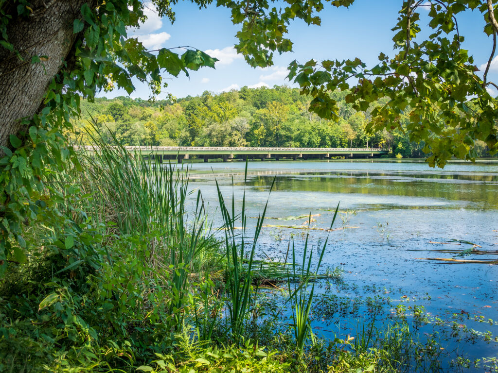
Image from Lee Coursey
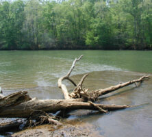
When it first emerges from Lake Jackson, the Ocmulgee scatters shoals and pools and carves a succession of very narrow valleys through the red clay soil and metamorphic bedrock of the Piedmont region. Above Macon, the Ocmulgee crosses into the fall line, a twenty-mile-wide transitional zone that marks the beginning of the Coastal Plain at the Mesozoic shoreline of the Atlantic Ocean.
As the Ocmulgee drops to the Coastal Plain, its slope gentles, its currents become shallower and darkened with silt, and its floodplain broadens to as much as three miles across, becoming a thickly wooded landscape of hardwood swamps, creeks, and oxbow lakes. Below Abbeville the river begins a dramatic easterly sweep—the “Big Bend”—which cradles rolling hills of longleaf pine forests and hardy undergrowth.
In Georgia’s wiregrass region, the Ocmulgee is joined by the Little Ocmulgee River a few miles before it merges with the Oconee River. In the area known locally as “The Forks,” the Ocmulgee and Oconee become the Altamaha River and complete the tideland descent to Georgia’s coast at Darien.
Early Inhabitants
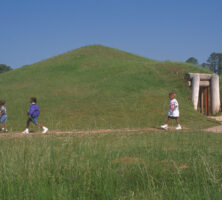
Archaeologists have collected evidence of an unbroken chain of civilization in the Ocmulgee River basin dating from the Ice Age migration of humans across North America. Between 10,000 and 15,000 years ago,nomadic Paleoindian hunters moved southeastward across the continent into Georgia, leaving behind scraping tools and flint spearpoints in the Ocmulgee floodplain. Archaic hunter-gatherers in the river basin (ca. 8000-1000 B.C.) used a distinctive fiber-tempered pottery and different types of stone tools, where later earthen mounds and sherds of elaborately marked pottery mark the locations of Woodland Period villages (ca. 1000 B.C.-A.D. 900). Mississippian culture appears to have arrived at the Ocmulgee River basin around A.D. 900. On the Macon plateau and in the nearby Ocmulgee bottomlands, stretches of farmsteads and gardens constructed around elaborate ceremonial mounds are the most prominent evidence of this early Mississippian influence. The Ocmulgee National Monument, founded in 1936 and operated by the National Park Service, preserves these mounds.
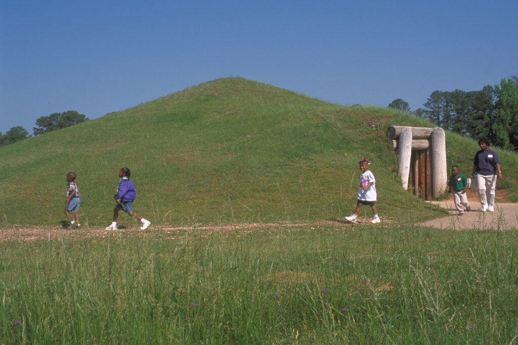
Courtesy of Georgia Department of Economic Development.
European Exploration
Europeans first reached the Ocmulgee River in 1540, when Spanish explorer Hernando de Soto’s expedition came to Ichisi, a late Mississippian chiefdom that archaeologists now locate on the floodplain south of Macon. By the mid-seventeenth century, however, the Indians who had fed de Soto’s party on corncakes, wild onions, and roasted venison had been devastated by disease and social disruption and had disappeared from the region.
By 1690 English traders from the Carolinas had established a post adjoining the “Okmulgee town” on the river’s east bank, near present-day Macon. Spreading inland from Charles Town (later, Charleston), South Carolina, to the Ocmulgee region, the English found various settlements of loosely affiliated tribes. One group, the Hitchiti-speaking Okmulgees, lived in towns scattered between the Towaliga River and Walnut Creek. In the Hitchiti language Okmulgee means “where water boils up,” and it was generally thought to have referred to the big springs at Indian Springs. The word first appears in Spanish accounts of an Apalachicola town on the Chattahoochee River, however, and some historians argue that it referred not to the river in central Georgia but to the waters of the Chattahoochee, from whose banks the Okmulgee Indians had migrated northeastward earlier in the seventeenth century. To the Okmulgees the river was known as Ochese-hatchee, or Ochese Creek, which in turn spawned the name that the English traders gave the confederation of tribes—the “Creek people” or Creeks.
Eighteenth-Century Settlers
On the eighteenth-century frontier, trade drew the Creeks and whites closer together and land claims ripped them apart. In the Yamasee War of 1715, Carolinian soldiers destroyed Okmulgee Town and drove out its inhabitants. When General James E. Oglethorpe founded the colony of Georgia in 1733, he managed, through negotiations with the Creek chiefs, to settle the immediate Georgia coast in relative peace. Yet Oglethorpe’s Royal grant had proposed that colonial expansion could proceed inland as far as the Ocmulgee River, regardless of the Creeks’ claims to the land, and although the whites’ pressures to settle Georgia’s interior abated somewhat, they never disappeared.
As the end of the Revolutionary War (1775-83) brought new overland migrations from Virginia and the Carolinas, the new state of Georgia obtained concessions to Creek tribal lands up to the Oconee River, and the U.S. government continued placing forts and trading houses in Creek territory bordering the Ocmulgee. With the 1805 Treaty of Washington, the Ocmulgee River became the southwestern boundary of the United States. Finally, in successive treaties signed at Indian Springs, the Creeks first ceded lands west of the Ocmulgee to the Flint River (1821), and then were forced to give up the rest of their lands in Georgia (1825).
Nineteenth-Century River Traffic and Trade
In the eighteenth and nineteenth centuries, wagon and stagecoach trails followed the old Indian trails along the Ocmulgee, linking settlements and frontier forts like Fort Hawkins along the east bank. By the 1820s numerous ferry landings linked settlements in the newly opened western territories with principal roads from Monticello, Clinton, and Milledgeville (the new state capital) on the Upper Ocmulgee, and from Marion, Hartford, and Jacksonville on the lower leg.
Commercial river navigation of this era depended upon log rafts loaded down with field and farm produce and guided by pole-handling crews who rode their lumber “down to Darien,” where it could be sold to sawmills. These raftsmen played a major role in Georgia’s economy, yet their story survives primarily through rafting folklore. As cotton production expanded into the rich Lower Ocmulgee bottomlands, steamboat navigation offered the fastest route to coastal markets.
Because the river was frequently narrow and winding, and unnavigably shallow in the dry months, however, it had never been particularly well suited to commercial boat traffic. The best that steamboats could do in the 1820s was to make the trip partway from the coast and transfer their goods to poleboats, which could be pushed the rest of the way to Macon by enslaved people. The first steamboat reached Macon in 1829, and the first commercial steamboat to make the full Darien-to-Macon run arrived in 1833. In late 1835 three steamboat companies operated on the river, and by the end of the decade there was a steady flow of traffic transporting cotton and lumber to the markets of Savannah and Darien from the wharves of Macon, Hawkinsville, Abbeville, Jacksonville, and Lumber City, and from the river landings of prosperous Ocmulgee River plantations.
With the building of the railroads in the late 1830s and early 1840s, the Ocmulgee’s importance for shipping cotton traffic from its rich bottomlands to the coast dwindled. The lobby for channel improvements and proposed canals was diverted to the raising of capital for the railways, and the first great era of Ocmulgee River traffic was all but over by 1847-48, when barely 1 percent of Macon’s cotton shipments to Savannah were by boat.
What the rails took away from the river in cotton, they would return in part in pine trees. In the Ocmulgee region below the Hawkinsville-Dublin road, longleaf pine (Pinus palustris) forests thrived in the wiregrass belt, and in the mid-eighteenth century the lumber industry found that these “yellow” or “Georgia” pines provided the perfect substitute for the now-depleted northern white pine. In the immediate post–Civil War (1861-65) period, the destruction of the central Georgia railroads by Union general William T. Sherman’s army meant that the river again became an important means of commercial transportation, particularly for the independent lumber manufacturers, who did not have a great deal of capital.
The rebuilding of the railways fed the timber and naval stores industries in the Oconee basin by bringing in equipment for cutting, milling, and turpentine distillation. River traffic remained the cheaper, more available means of transportation for many sawmillers and turpentine men. Each year between 1870 and 1900, steamboats again regularly traveled the Ocmulgee laden with cotton bales, although their major cargo by now was barrels of rosins and gum spirits. In 1889 the U.S. Army Corps of Engineers reported nine steamboats running regularly on routes originating at Hawkinsville, Abbeville, and Lumber City. Meanwhile, thousands of raft runners from the Ocmulgee-Oconee region made the downriver journey in ways not too different from their pioneer predecessors, “drifting” bunches of hewn timbers out of the river-basin swamps and creeks and then tying them together to make the 175-foot-long rafts they guided downriver.
Power, Water Supply, and the Environment: The Twentieth Century and Beyond
Large timber companies eventually depleted the pine forests, and their regular wages lured raftsmen from the irregularly navigable river. Thus, even in their peak years of operation in the 1880s, the Ocmulgee steamboats were no longer coastal transportation so much as they were mere feeders for rail hubs. After 1895 Ocmulgee River commercial navigation decreased yearly, by 1909 steamboat traffic to Macon had ceased, after 1924 there was no regular traffic, and by 1944 commercial traffic on the Ocmulgee had ceased altogether. Proposals to increase the Ocmulgee’s navigability arose occasionally in the twentieth century, but none materialized into projects of any proportion beyond periodic efforts on the part of the U.S. Army Corps of Engineers to remove snags and obstructions.
By the end of World War I (1917-18), Georgia’s vision for the Ocmulgee concentrated on the river’s potential for supplying electric power and water for homes and business, and waterfront recreational areas for an expanding population. Of the reservoirs built within the Ocmulgee River basin today, Georgia Power Company’s hydroelectric plant at Lloyd Shoals Dam (built 1910) in Butts County and its Plant Scherer thermoelectric facility near Juliette are the largest impoundments.
Photograph by Melinda S. Mullikin, New Georgia Encyclopedia
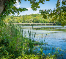
Lake Jackson, which is formed by the Lloyd Shoals Dam, has 135 miles of shoreline and more than 4,700 surface acres that are heavily used for recreational boating and fishing. Until World War II (1941-45) Lake Jackson was the state’s largest lake, and its waterfront was rapidly developed. For economic and environmental reasons, the Lloyd Shoals Dam and Lake Jackson would remain the first and only major impoundment project on the main stem of the Ocmulgee. Later reservoirs—such as Lake Juliette on Rum Creek and the Lake Tobesofkee Recreation Area on Tobesofkee Creek—have been built on creeks with pumping mechanisms that enable them to periodically draw allocations off the Ocmulgee’s channel flow.
In 1995 there were fifty-two public water supply facilities providing an estimated 234 million gallons per day to 1,360,000 people in communities throughout the Ocmulgee River basin. Self-supplied (private) industries and businesses withdrew slightly less, approximately 200 million gallons a day. Major users were thermoelectric plants, irrigation (for crops like cotton, corn, soybeans, and peanuts, as well as for nurseries, athletic fields, and golf courses), and large industries (paper and pulp mills, textiles, clay and gravel mining, and chemical manufacturers). The majority of water supplies in the Upper Ocmulgee watershed (the region draining into the river basin from Macon northward) were surface-water withdrawals. The region below the fall line mostly depended on groundwater obtained from aquifers beneath the Lower Ocmulgee watershed (from Macon to the Oconee River), but an estimated thirteen municipalities along the lower reach were permitted to discharge wastewater into the Ocmulgee, according to 2001 state statistics. At the end of the twentieth century, growth in population and use presented Ocmulgee River users at both ends of the basin with a growing problem of reduced streamflow and increased pollution.
Concern over the Ocmulgee’s ability to withstand expanding use began before World War I. In 1913 Bibb County enacted legislation regulating the Macon area’s discharge of sewage waste into the Ocmulgee River. Meanwhile, the Ocmulgee’s value as a source of fish and wildlife was generally recognized—the world-record biggest largemouth bass had been caught in Montgomery Lake, an oxbow lake near Jacksonville, in 1932—and efforts to preserve the basin’s natural resources began with the establishment of the Piedmont National Wildlife Refuge in 1939. The refuge was established on 35,000 acres of uplands pine forest to protect the habitats of various animals, including endangered red-cockaded woodpeckers (Picoides borealis).
In the 1990s conservationists initiated efforts to construct an Ocmulgee “greenway,” a series of riverfront parks linking protected wildlife areas and historic sites along the river between Jackson and Warner Robins. Along the easternmost of the Ocmulgee’s source tributaries, the Alcovy River east of Covington, another greenway project arose in the 1990s to protect the Piedmont river system with extensive hardwood swamps, including the northernmost inland example of a tupelo gum swamp. In 2000 Bond Swamp National Wildlife Refuge, home to endangered bald eagles and songbirds, became the second national wildlife refuge in the Ocmulgee River basin. Located six miles below Macon and linked to the proposed greenway, Bond Swamp encloses one of the few bottomland hardwood swamps not displaced by farm or pine plantations in the state.
As the twentieth century ended, outdoorsmen, conservationists, and environmental scientists came to the Ocmulgee River much as the Native Americans and white settlers before them had done, looking to it for sustenance and a greater connection to the natural order of life. As they did so, governmental agents and local communities from Lawrenceville to Lumber City were engaging in discussions about the allocation of the Ocmulgee’s water supplies for the twenty-first century.