Wilkinson County, near the geographic center of Georgia, was established in 1803 from territory between the Oconee and Ocmulgee rivers ceded by the Creek confederation.
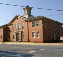
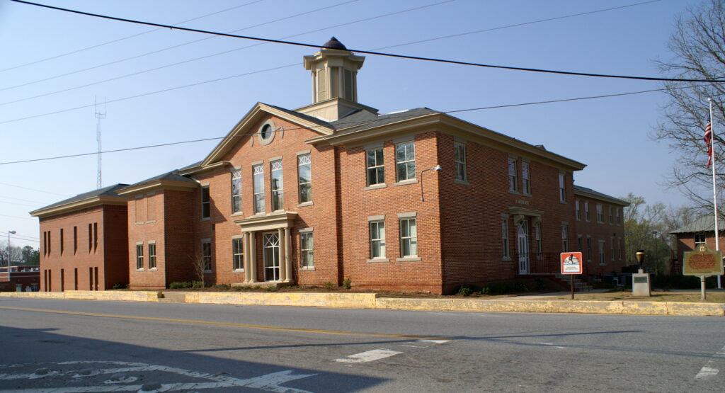
The Georgia state legislature divided the area into Wilkinson and Baldwin counties. A later treaty, which pushed the frontier of Georgia west to the Ocmulgee River, added land to the earlier portion and gave rise to the need for smaller county areas. The legislature then partitioned Laurens and Telfair counties from Wilkinson and established their boundaries in 1807. Two years later Twiggs County was created from Wilkinson. The county was named for General James Wilkinson, a veteran of the American Revolution (1775-83) and one of the federal commissioners who negotiated the Creek cessions. Its landscape rises approximately 400 feet above sea level at its highest point and covers almost 450 square miles, making it the forty-third largest county in Georgia. The seat is Irwinton, established on May 11, 1816, and named for three-term Georgia governor Jared Irwin.
Early History
Drained by the Oconee River and its numerous tributary creeks, Wilkinson County was home to Native Americans from the Archaic period (8,000 to 1,000 B.C.) into historical times. Creek towns and fields were situated along waterways and paths in the area that became Wilkinson County. For several decades the area was caught in the midst of friction among Federal forces charged with maintaining garrisoned forts on frontier boundaries; white settlers eagerly occupying newly ceded lands; and Creek natives contesting the increasing inroads made by those settlers.
In 1803 Benjamin Hawkins, principal agent for the Creeks, chose a tract of land along the Flint River in present-day Crawford County to build the Creek Agency Reserve. Hawkins’s jurisdiction included Wilkinson County. Representatives of the federal government and members of the Creek confederation signed two treaties, the Treaty of Fort Wilkinson (1802) and the Treaty of Washington (1805), that transferred the land between the forks of the Ocmulgee and Oconee rivers to the state of Georgia. Commissioners Creek (also known as Commissioner Creek), which flows through present-day Wilkinson County, was named for the U.S. commissioners who negotiated the Treaty of Fort Wilkinson. The newly acquired lands were opened for settlement and distributed in a lottery held at Louisville, then the state capital, in 1807.
Agriculture was the economic mainstay of Wilkinson County during the nineteenth century. Cotton and food crops were planted by local farmers for domestic use and shipment to market. Early transportation in the county consisted of roads, often following Creek footpaths, which connected area settlements with rivers, forts, and fords; ferries soon replaced the shallow river crossings used by Native Americans. Steamboats plied the Oconee as far north as Milledgeville in the first decades of the county’s development until agricultural practices caused silt to narrow the navigation channels. Crossroads communities, such as Allentown, emerged as stagecoach stops and post offices for the surrounding area. In 1843 the Central of Georgia Railway completed its line through Wilkinson, encouraging the growth of such communities as Gordon, the junction of a spur line to Milledgeville; Toomsboro; and McIntyre, named for Sarah McIntyre, the first station agent.
Civil War
During the Civil War (1861-65), the county raised at least four regular army regiments for the Confederacy, including the Wilkinson Invincibles. Those at home saw Union forces traverse the region during the March to the Sea in 1864. Union general George Stoneman’s raiders destroyed railroad lines in the county before the Confederates intercepted them on July 31, 1864. Irwinton lost its courthouse and school to Northern troops who crossed the Oconee River near Toomsboro; these troops were subsequently attacked by Georgia militia forces on November 23.
Industry and Economy
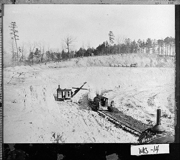
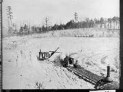
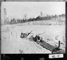
Postwar years brought increased railroad development to middle Georgia; a small portion of the Macon-Savannah line crossed into the far southern portion of the county and gave Allentown a railway depot. Economic depression set in during the first half of the twentieth century. Deposits of kaolin were found near Gordon around 1916, and the mining and refining industry that developed around the mineral’s source gave the county a new revenue stream to join those derived from agriculture and pulpwood plantations.
Present-day Wilkinson County has a mixed economy of manufacturing, construction, agricultural, educational, service, and extractive industries. Beef cattle and hogs, silage, soybeans, peanuts, corn, and wheat are grown in the county.
According to the 2020 U.S. census, the population of Wilkinson County was 8,877, a decrease from the 2010 population of 9,563.