Twiggs County, in central Georgia, was created by the state legislature in 1809 by the division of Wilkinson County. The county’s name honors John Twiggs, a Revolutionary War (1775-83) general.
Located on the fall line, its terrain includes both Upper Coastal Plain and lower Piedmont features. Bounded on the west by the Ocmulgee River, Twiggs County covers 360 square miles and adjoins Bibb, Bleckley, Jones, Houston, and Wilkinson counties.
Places of interest include the Ocmulgee Wildlife Management Area, which Twiggs shares with Bleckley County, and the Bond Swamp National Wildlife Refuge, which Twiggs shares with Bibb County. According to the 2020 U.S. census, the population was 8,022, a decrease from the 2010 population of 9,023.
Settlement
Early inhabitants of the area were members of the Mississippian culture that prospered in Georgia centuries before contact with European explorers. The region then became home to Creek Indians, whose towns were located along trading paths and waterways in the area. In 1802 the Treaty of Fort Wilkinson transferred control of the area to the state of Georgia.
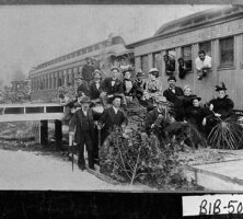
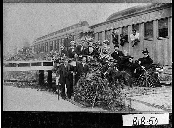
Settlements in the area were determined primarily by transportation technologies. Wagon roads widened from existing Creek trails became migration routes for settlers who arrived to establish farms and towns. Their settlements clustered first around river fords, then commercial crossroads and railroad junctions. Towns grew at Rain’s Store (later Jeffersonville) and Danville, named for merchant Daniel Hughes, the father of U.S. congressman Dudley Hughes. Bullard was first the site of a steamboat landing on the Ocmulgee River; it later became Bullard Depot on the Southern Railway. Westlake began as a ferry crossing known as Buzzard Roost.
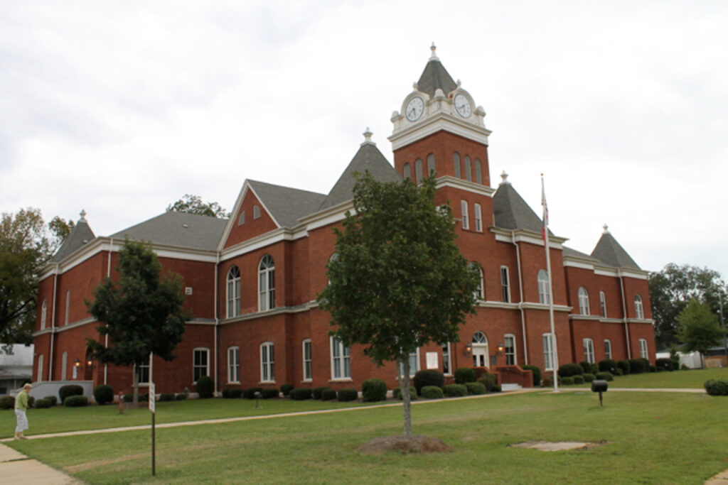
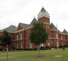
The county seat was originally mandated by the legislature to occupy the most convenient location for the citizenry, toward the center of the new county. A site was surveyed, and the town, named Marion for Revolutionary War general Frances Marion, was incorporated in 1816. Near that site, now deserted, geographers mapped the exact geographic center of the state. In 1868 nearby Jeffersonville became the county seat. That decision necessitated the dismantling of the first courthouse and its removal by oxcart to the new location. The present brick courthouse was completed in 1904. Jeffersonville is the only incorporated city in the county.
Other communities include Huber, an older agricultural settlement renamed in the 1910s to indicate the prominence of the Huber kaolin processing plant nearby, and Adams Park, a real-estate investor’s planned community and recreation center. The construction of Interstate 16 gave Twiggs County increased access to both the coastal areas of Georgia and the metropolitan areas to the north, once more placing the area in its historic context as a crossroads of commerce and migration.
Economy
Twiggs County farmers became part of the southern plantation system in the nineteenth century with the development of upland cotton, which they grew for export. After the Civil War (1861-65), agriculture remained a predominant business in the area, along with the later addition of forestry products and, in the twentieth century, kaolin mining.
Railroads arrived in the county with the construction of the Macon and Brunswick (later Norfolk Southern) line in 1861, which was completed in 1870. The Macon, Dublin, and Savannah Railroad (later CSX), completed in 1891, passed through Dry Branch, Fitzpatrick, and Ripley, bringing increased commercial opportunities to those communities. With the development of the national highway system in the 1920s, local merchants served traffic moving between Atlanta and Savannah on U.S. Highway 80, also known as the Dixie Overland Highway. The Dixie Overland Highway Association’s motto was “The Shortest and Only Year Round Ocean-to-Ocean Highway.”