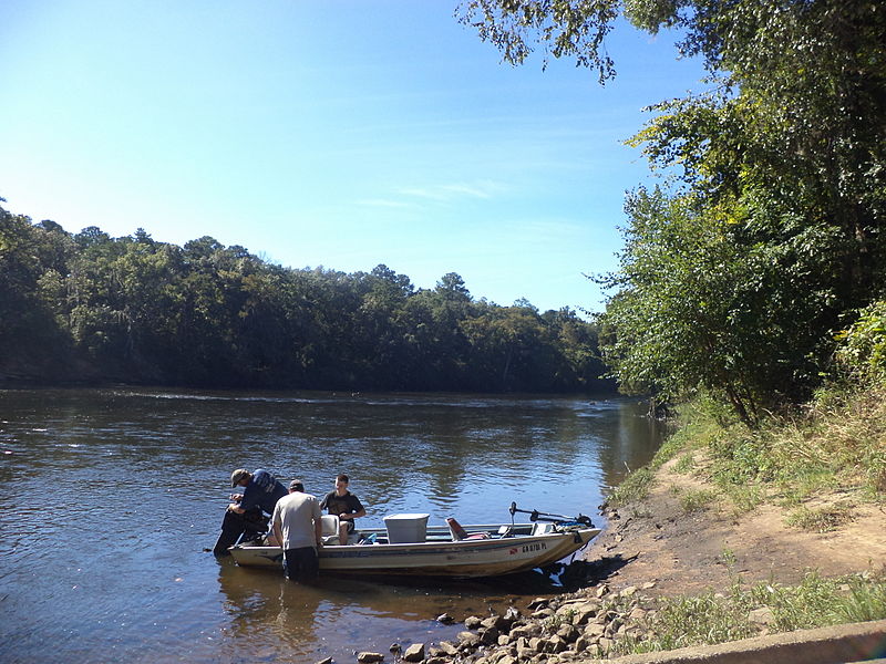
The Flint River, which stretches from the Piedmont to the Chattahoochee River in southwest Georgia, is one of only forty rivers in the nation’s contiguous forty-eight states that flow unimpeded for more than 200 river miles.
The Flint has had many names. One early name given to the river and to the village settled by ancient Eastern Woodland tribes near today’s city of Albany is Thronateeska, or Thlonotiaske, meaning “flint picking-up place.” The Muskogee Indians called the river Hlonotiskahachi, ronoto being Muskogean for “flint.” When Hernando de Soto first saw it on March 5, 1540, he named it Rio de Capachequi. Later Spaniards called it the Rio Pedernales, pedernal meaning “flint” in Spanish.
Length and Route
The length of the river depends on how one defines length: a boater would cover nearly 350 miles in the Flint’s meandering channel within a basin measuring only 212 miles in length. The river passes through two power-generating lakes—Lake Blackshear near Cordele and Lake Chehaw near Albany—before it meets the Chattahoochee River 265 miles downstream from its headwaters at the Jim Woodruff Lock and Dam and creates Lake Seminole in the southwest corner of the state. The single river that leaves Lake Seminole is known as the Apalachicola, which flows through Florida to the Gulf of Mexico.

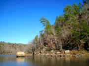
Photograph by J. S. Clark
The Flint River has an unusual source. It begins as groundwater seepage in west central Georgia at what is today the mouth of a concrete culvert on the south side of Virginia Avenue in Hapeville, an Atlanta suburb. The water that collects there quickly disappears under the runways of Hartsfield-Jackson Atlanta International Airport as it flows southward through the culvert. It is joined by water from such tributaries as Sullivan, Mud, and Camp creeks. Fifty miles downstream, this water has transformed itself into one of Georgia’s most scenic and diverse rivers. Near Culloden, the Flint crosses the fall line, dropping 400 feet over the next fifty miles as it journeys down the Coastal Plain.
Between the Flint’s urban beginning and its reservoir ending, its watershed—which includes the cities of Jonesboro, Thomaston, Montezuma, Marshallville, Cordele, Americus, Albany, and Bainbridge—drains some 8,460 square miles. This watershed can be divided into three distinct regions, the Upper, Middle, and Lower Flint, based on landscape, channel characteristics, flora, and fauna.
Flora and Fauna
Though the Flint begins in metropolitan Atlanta, self-purification occurs from the river’s unimpeded flow and its abundant wetlands, which filter pollutants. The Flint’s northernmost swamp occurs in the Jonesboro area. Downstream, Magnolia Swamp lies just north of the fall line, Beechwood Swamp just south of it. Together these two swamps make up what is locally called the Great Swamp. The Flint’s largest wetland, the Chickasawhatchee Swamp, lies farthest south and is Georgia’s second-largest deepwater swamp.
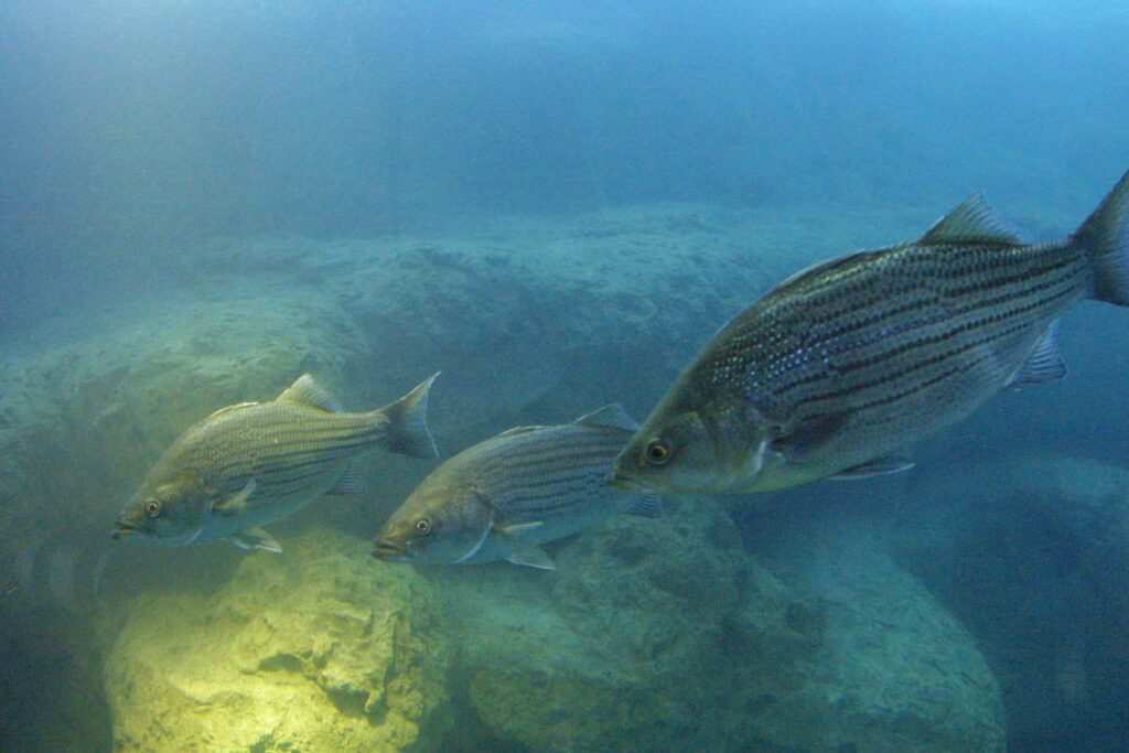
The river is thus home to an abundance of unusual animals and plants. Unique to the Apalachicola-Chattahoochee-Flint system are the shoal bass, which is highly prized among fishermen, and the Halloween darter. The Halloween darter was discovered in the early 1990s by researchers at the University of Georgia’s Institute of Ecology (later Odum School of Ecology), who in 2009 gave the small fish its scientific name of Percina crypta. The Flint is also home to more than twenty species of freshwater mussels. The Lower Flint contains springs and caves, which are home to the Georgia blind cave salamander and the Dougherty Plain cave crayfish. The shoals spider lily, discovered in the 1770s by naturalist William Bartram, can be found on the Flint, along with greenfly orchids, corkwood, needle palm, and the very rare relict trillium. The Flint River’s Atlantic white cedar swamps are the most distant from the coast to be found; these trees are usually encountered in such locations as the Great Dismal Swamp in Virginia and North Carolina or peat bogs in New England.
Historic Development
White settlers poured into western Georgia to farm the land between the Flint and Chattahoochee rivers in the early nineteenth century, often setting up large cotton plantations. In 1828 the Apalachicola-Chattahoochee-Flint river system began supporting steamboat travel. By 1860 more than twenty-six steamboat landings dotted the Flint between Bainbridge and the river’s junction with the Chattahoochee. Steamboats traveled upriver as far as Montezuma until the sandy, shifting riverbed of the Middle Flint proved too treacherous. Steamboats below Bainbridge continued to thrive and remained in operation until about 1928, mostly to ship cotton to the port of Apalachicola. Smaller boats and barges traveled from Bainbridge to Albany. While steamboats navigated the Flint lengthwise, numerous ferries traversed the river. The last ferry across the Flint, near Marshallville, closed in 1988.
The combined effects of the Civil War (1861-65), soil erosion, the boll weevil, and the Great Depression of the 1930s devastated Flint region farmers, who gradually diversified their crops to include peanuts, soybeans, vegetables, and wheat. Dairying and the raising of cattle and hogs also became important to the area’s agricultural economy. Agriculture remains important to this region, and use of the Flint’s watershed for irrigation is a topic of keen interest and hot debate. Early industry consisted mostly of gristmills, using waterpower from the Flint’s tributaries.
Recent Developments
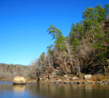
In the 1960s the U.S. Army Corps of Engineers investigated the feasibility of building a dam at Sprewell Bluff near Thomaston. At the time, dams were proliferating nationwide, so there was surprise and even anger when Governor Jimmy Carter, after conducting extensive interviews with some fifty interested parties, vetoed the dam in 1974. This decision proved wise for the health of the river; Sprewell Bluff remains today a unique botanical melting pot of Coastal Plains flora growing in proximity to plants and trees usually found in Georgia’s mountainous areas.
Photograph from Wikimedia
The Flint River has also figured prominently in the lengthy tristate “water war.” Since 1992 Alabama, Florida, and Georgia have struggled to allocate fairly the states’ shared water resources. In question are the Apalachicola-Chattahoochee-Flint and the Alabama-Coosa-Tallapoosa river basins, both originating in Georgia. A key issue is Atlanta’s future growth—the Chattahoochee flows through Atlanta, and the Flint originates just south of the city. A final agreement has yet to be reached.
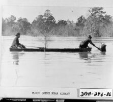
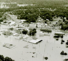
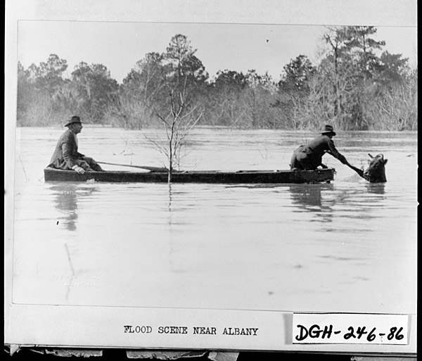
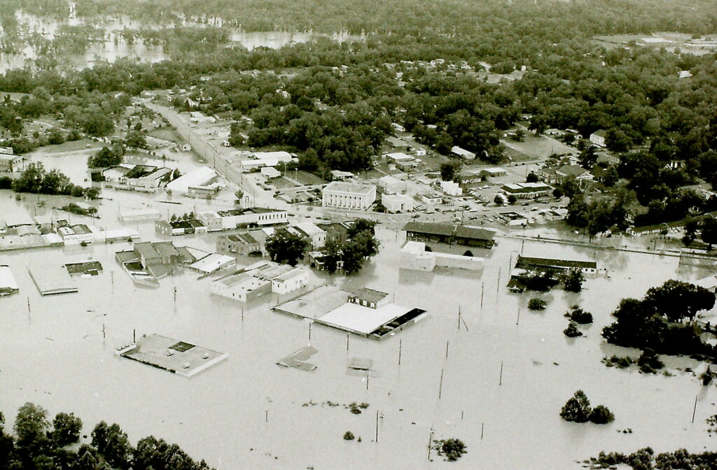
Natural disasters have also thrust the Flint River into the headlines. In early July 1994, the tropical storm Alberto stalled over western Georgia. Not only did runoff from the city of Atlanta dump millions of gallons of water into the Upper Flint, but the storm dropped enough rain on southwest Georgia to submerge some cities, including Montezuma and Newton, and to cause the worst flood in Albany’s recorded history. Numerous counties in the Flint basin were declared federal disaster areas; at least thirty-one people died, including fifteen in Americus and four in Albany. A second flood in Albany in March 1998 prompted plans for a levee, which are still being argued.
Courtesy of Georgia Archives.
Paradoxically, from the summer of 1998 to the end of 2003, Georgia experienced a severe drought. The Lower Flint, because of its shallow aquifer discharge, was especially threatened. In 2000 the General Assembly passed the controversial Flint River Drought Protection Act, which aims to preserve a minimum flow in the river by paying farmers in southwest Georgia not to irrigate their land from area streams during severe drought years.
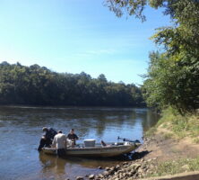
Photograph from 161st Military History Detachment
Another problem arose during a January 2002 snowstorm, when a drainpipe became clogged at Hartsfield-Jackson International Airport, allowing de-icing fluids to overflow into the Flint. The result was the detection of trace amounts of ethylene glycol and propylene glycol in drinking water drawn from as far downstream as Fayette County. The pipe was repaired, and people were assured that the amounts were not harmful to them, but the fragile relationship between the Flint’s ecosystem and the people who inhabit it was once again dramatically highlighted.
The Future of the Flint
The city of Albany uses tourism and leisure to educate people about the importance of the Flint River’s unique ecosystem. In September 2004 the city opened the Flint RiverQuarium, a $30 million complex whose centerpiece is a 175,000-gallon, 22-foot-deep, open-air constructed “blue hole” filled with the flora and fauna found in the Flint’s ecosystem. “Blue holes” are the natural springs that rise from deep underground caverns in southwest Georgia. The water remains at a constant 68 degrees, which inhibits bacterial growth and allows the clear water to reflect the color of the sky.
Courtesy of Flint RiverQuarium
Another promising sign for the Flint’s future lies on one of the many old cotton plantations along the Lower Flint. Ichauway, located near the town of Newton, was owned by Coca-Cola magnate Robert Woodruff until his death in 1985. In 1991 the Woodruff Foundation established the Joseph W. Jones Ecological Research Center, named for the chairman emeritus of the Woodruff Foundation, at Ichauway. The center’s mission is to be a 29,000-acre outdoor laboratory devoted to the study of longleaf pine, aquatic ecology, and water resources. A staff of 100 scientists and other researchers work there, exploring ways to protect the resources of the Flint River watershed.
Floods, droughts, and man-made occurrences, with their instantaneous and widespread coverage by the press, have called attention to the Flint River in ways previously unimagined. People of the Flint basin know that the days have long passed when its water can be taken for granted. They recognize the need to balance the use of the river’s many rich resources with the protection of its delicate and unique ecosystems. Until the twentieth century, the Flint River was important to southwest Georgians. In today’s interconnected world, it is important not only to all Georgians but also to people in surrounding states.