The New Georgia Encyclopedia is supported by funding from A More Perfect Union, a special initiative of the National Endowment for the Humanities.
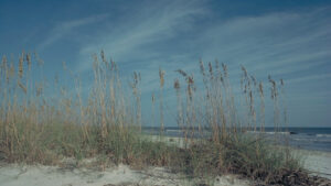
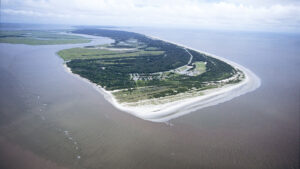
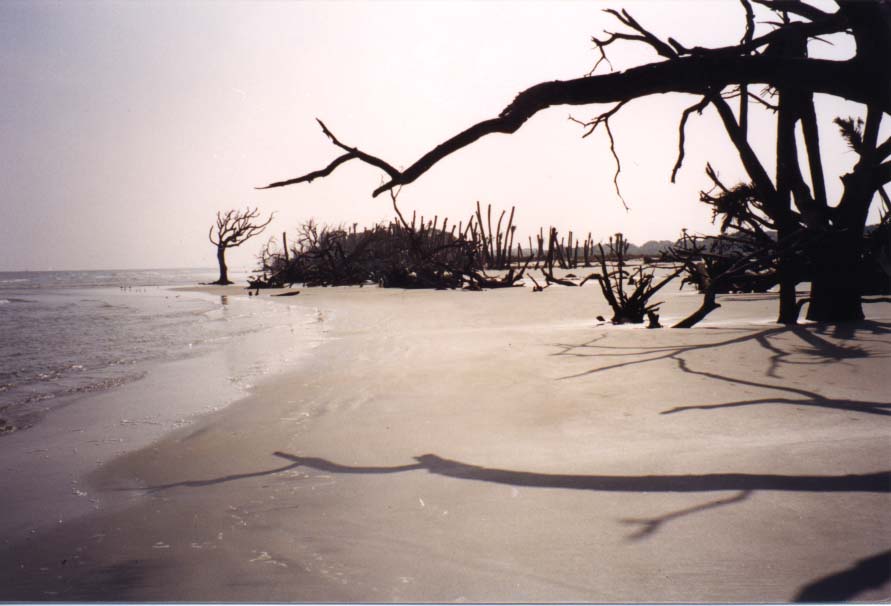
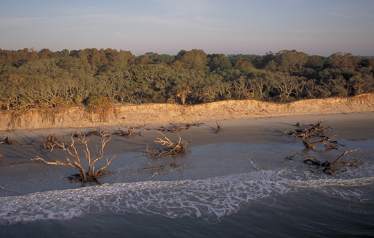
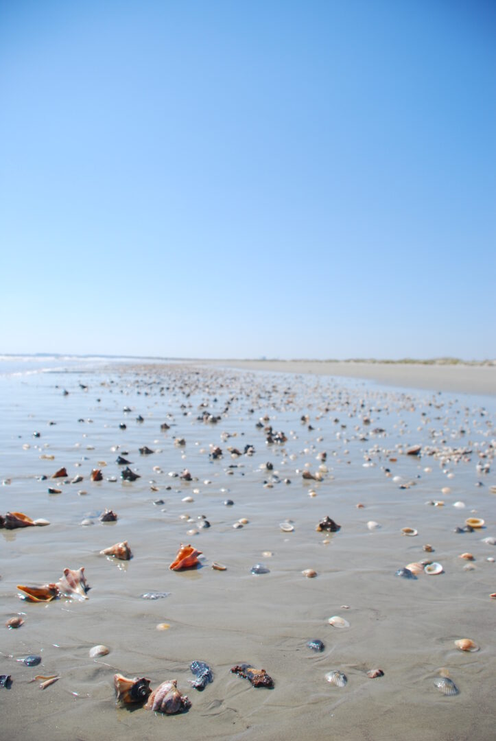
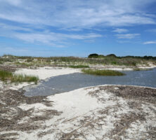
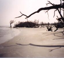
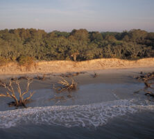
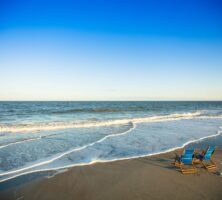
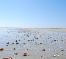
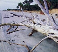
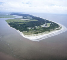
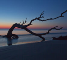
Wide, sandy beaches like this one on Wassaw Island are typical of Georgia's barrier islands. Wassaw is one of more than a dozen barrier islands that stretch along Georgia's 100-mile coast.
Photograph by Bruce Tuten
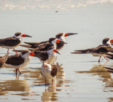
Skimmers on the coast of Amelia Island. The tern-like birds feed by flying low over the water, skimming for fish.
Image from Lee Coursey
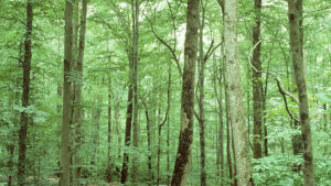
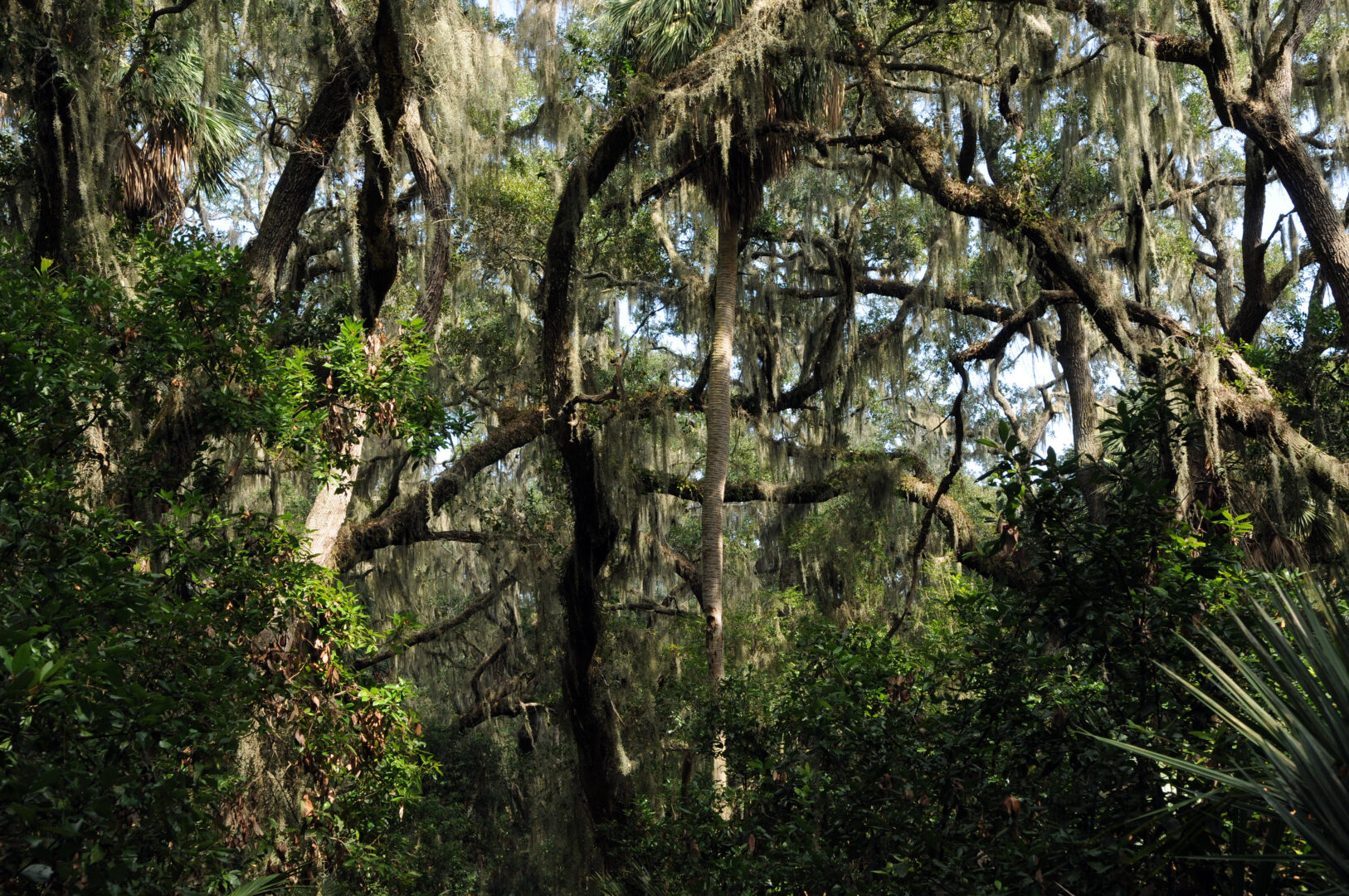
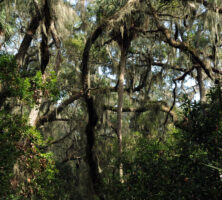
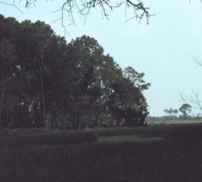
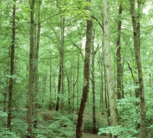
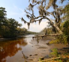
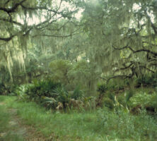
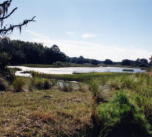
The forests on Wassaw Island include cedar, oak, and pine, as well as an understory of holly, magnolia, and other plants.
Photograph by Garry Tucker, USFWS
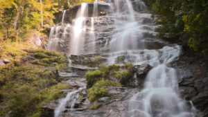
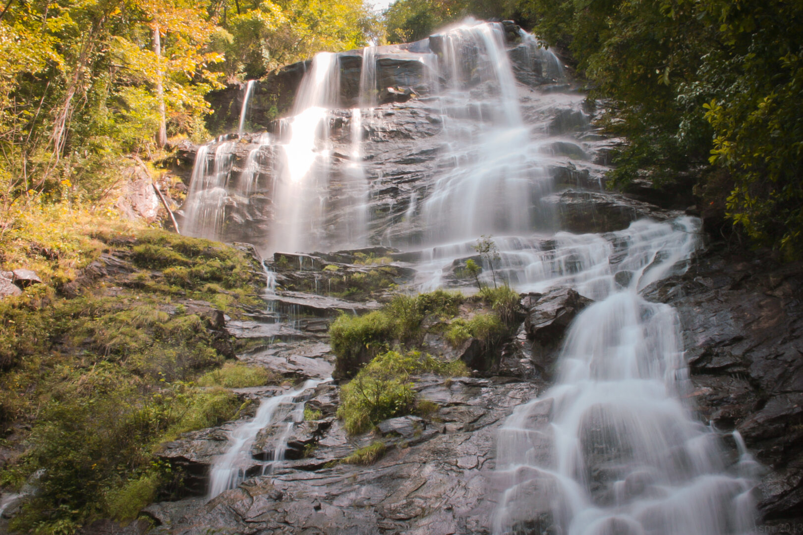
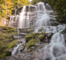
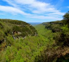
Located in Dawson County, Amicalola Falls derives its name from the Native American word meaning "tumbling waters." Just one of many waterfalls in Georgia's Blue Ridge Mountains, Amicalola Falls is the highest, with a drop of 729 feet.
Photograph by Ryan McKee
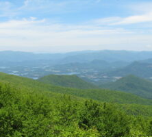
Brasstown Bald, located partly in Union County and partly in Towns County, was formed by the breaching of thrust faults by erosion, resulting in the exposure of rocks once deeply buried in the Appalachian Mountains. Situated in the Blue Ridge province, Brasstown Bald is the highest point in Georgia.
Photograph by Vicki's Nature
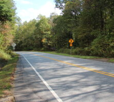
The Russell-Brasstown Scenic Byway is a forty-one-mile paved loop that lies entirely within the Chattahoochee National Forest in Georgia's Blue Ridge Mountains. It extends north from Helen to Brasstown Bald and then southwest to Raven Cliff Falls and Wilderness Area and Dukes Creek Falls. Due to changes in elevation, the byway enjoys an extended fall color season.
Image from Thomson200
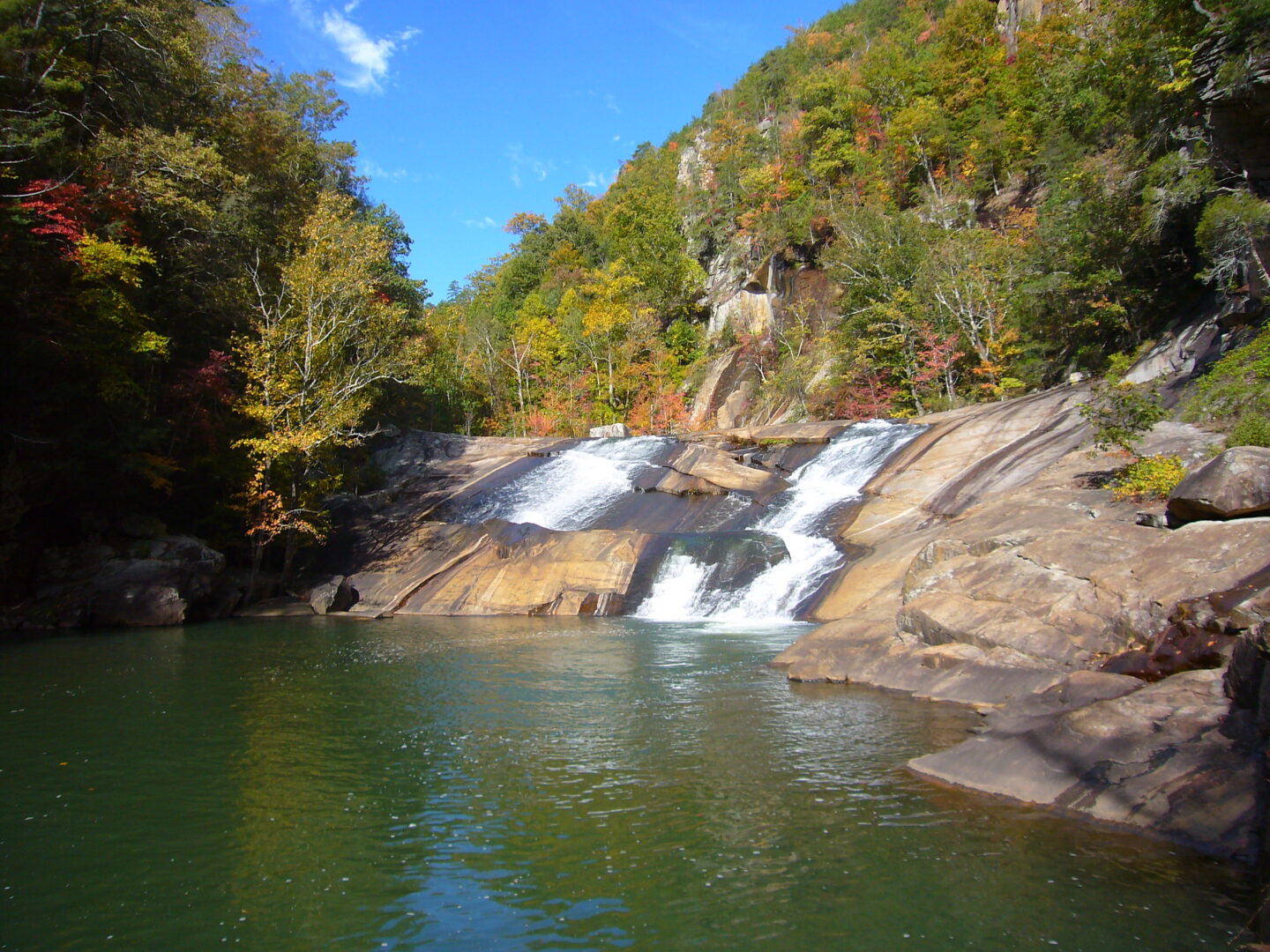
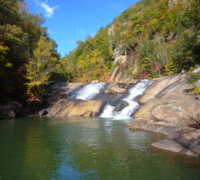
The falls and scenery at Tallulah Gorge State Park, located in northeast Georgia, attract thousands of visitors each year. The gorge, located in the state's Blue Ridge geological province, is cut through a large section of the metamorphic rock quartzite.
Image from Martin Bravenboer
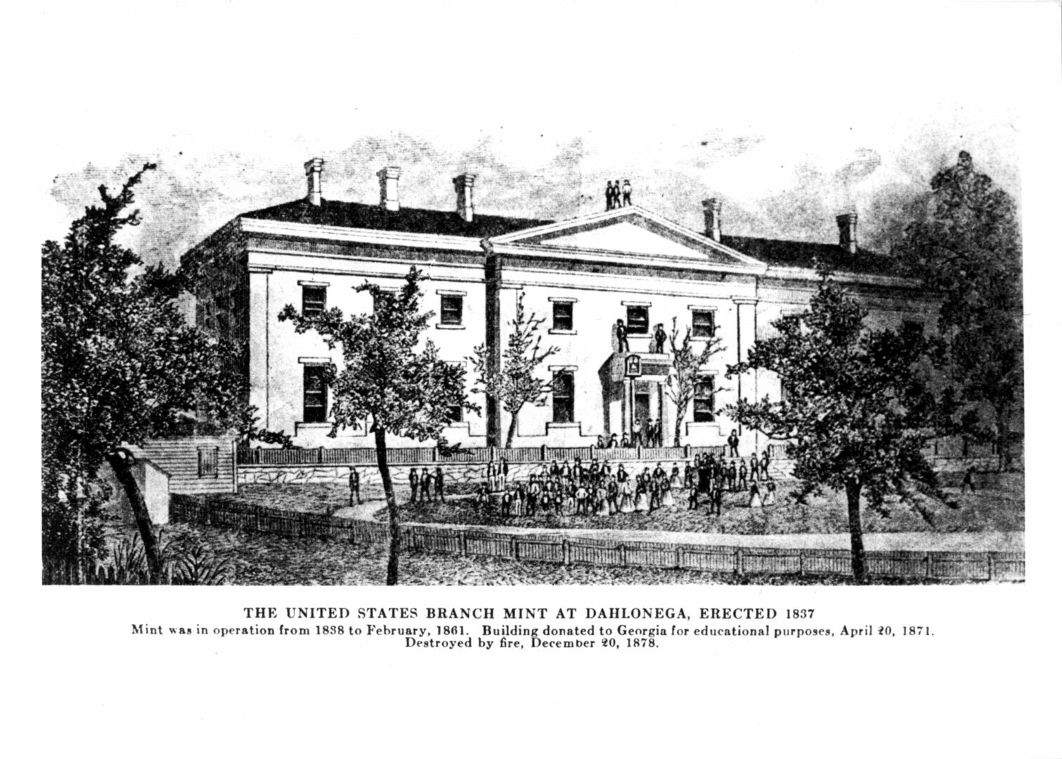
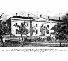
In 1838 a federal Branch Mint went into operation at Dahlonega. It coined more than $100,000 worth of gold in its first year, and by the time it closed in 1861, it had produced almost 1.5 million gold coins with a face value of more than $6 million.
Courtesy of Dahlonega Mountain Signal
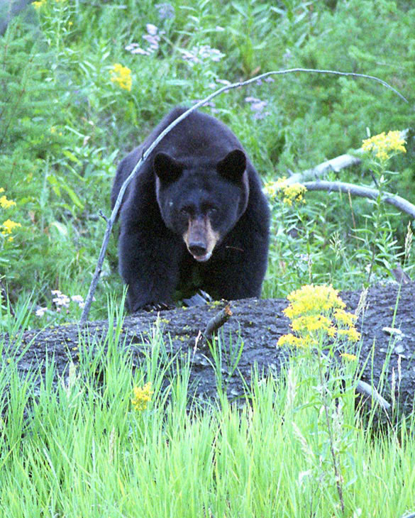
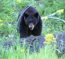
Black bears (Ursus americanus) are commonly found in Georgia's Blue Ridge Mountains in places like the Chattooga River watershed. They also are found along the Ocmulgee River drainage system in central Georgia and along the Okefenokee Swamp in southeast Georgia.
Photograph by Terry Spivey, USDA Forest Service
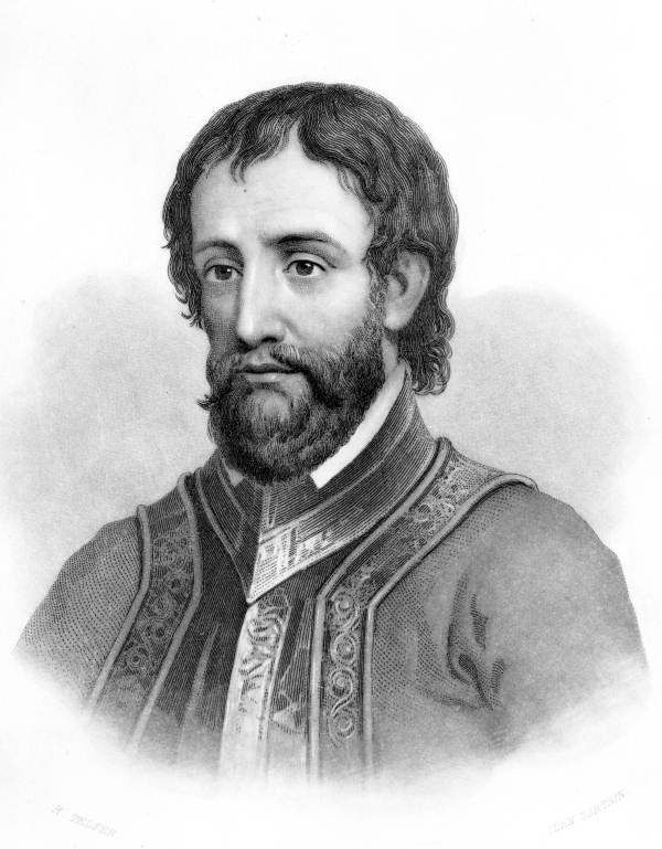
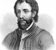
As part of his exploration of what is now the state of Georgia, Hernando de Soto traveled through the Blue Ridge Mountains. He likely spent time near Carters Lake, which is near Ellijay in Gilmer County.
Courtesy of Florida State Archives, Photographic Collection.
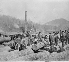
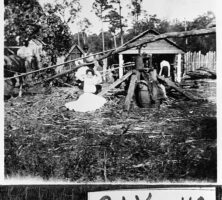
This photograph shows workers at a sawmill in Rabun County circa 1900. Logging operations such as this one in Georgia's Blue Ridge Mountains removed many old-growth trees, including these huge specimens.
Courtesy of Georgia Archives, Vanishing Georgia, #
rab334.
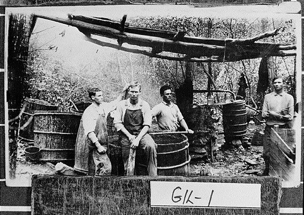
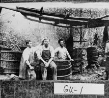
This photograph shows a group of men standing beside a moonshine still near Ellijay in Gilmer County. Although moonshining was practiced throughout Georgia, it is most often associated with the Blue Ridge Mountains in north Georgia, where moonshine "wars" occurred throughout the late nineteenth century.
Courtesy of Georgia Archives, Vanishing Georgia, #
gil001.
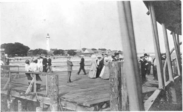
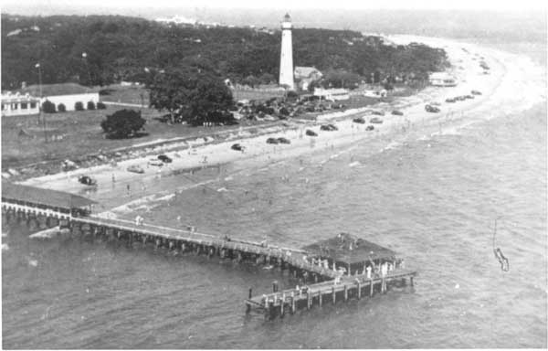
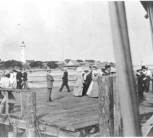
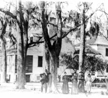
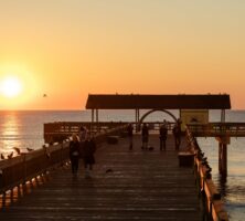
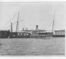
Visitors to St. Simons Island gather on its pier in the late nineteenth century. The tourism industry, still a primary economic activity on the island today, began in the 1870s, and by the 1880s a grand hotel and pier had been built on the southeastern end of the island.
Courtesy of Coastal Georgia Historical Society.
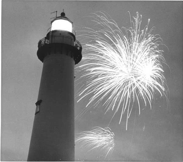
The lighthouse on St. Simons Island, pictured during a fireworks display in 1989, replaced the island's original lighthouse, which was dynamited by Confederate troops in 1862 as they retreated from Union forces. The occupying Union troops used the island as a camp for freedpeople.
Courtesy of Coastal Georgia Historical Society.
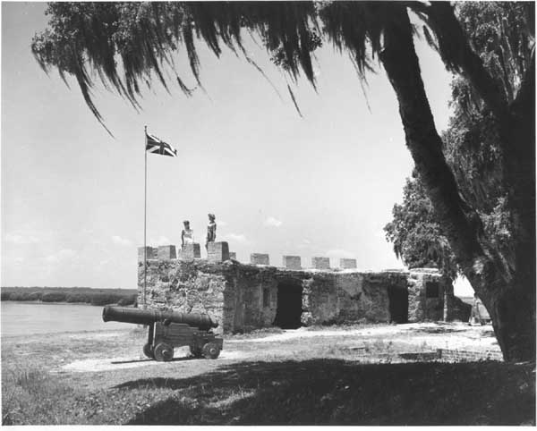
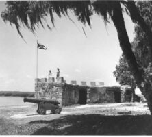
Fort Frederica, pictured in 1905, was built by James Oglethorpe on St. Simons Island in 1736. From the time of its establishment until 1749, the fort served as the headquarters for the British military on the Georgia coast.
Courtesy of Coastal Georgia Historical Society.
Ebos Landing, pictured in 2004, was the site of an 1803 slave rebellion, during which a group of Ebo Africans drowned themselves rather than submit to slavery.
Photograph by Elisabeth Hughes, New Georgia Encyclopedia
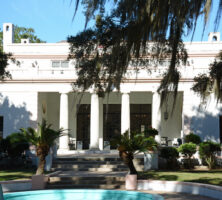
The Retreat Plantation house on St. Simons Island was owned by Major William Page from 1804 until his death in 1827, when his daughter, Anna Matilda Page, and her husband, Thomas Butler King, inherited it. The house, no longer standing, was located on the southwestern tip of the island.
Courtesy of Coastal Georgia Historical Society.
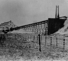
Timber from St. Simons Lumber Mills on St. Simons Island was shipped to market from this dock in Brunswick. After coming to a halt during the Civil War, the timber industry on the island was revived during the 1870s.
Courtesy of Coastal Georgia Historical Society.
The village on St. Simons Island, pictured in 1946, grew during World War II, with the establishment of a naval air base and radar school on the island. In addition to a growing permanent population, St. Simons also attracted increasing numbers of vacationers from the mainland during the war.
Courtesy of Coastal Georgia Historical Society.
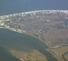
St. Catherines Island, located in Liberty County, is one of the barrier islands lining the coast of Georgia. The privately owned island, a National Historic Landmark, is about ten miles long and approximately one to three miles wide. From the 1590s to the 1680s a Spanish mission, Santa Catalina de Guale, was located on the island (at that time part of the Spanish colony La Florida).
Photograph by Jason D. Williams
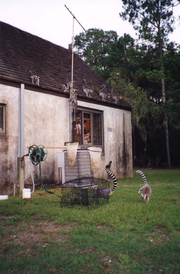
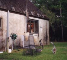
Lemurs wander the grounds of a laboratory on St. Catherines Island. The subject of extensive biological surveys, the island once served as a refuge for endangered animals under the administration of the Wildlife Conservation Society of the Bronx Zoo in New York City.
Photograph by Jason D. Williams
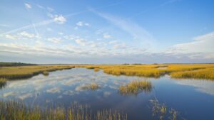
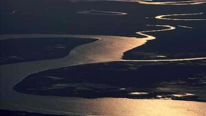
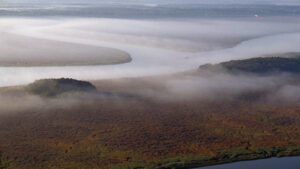
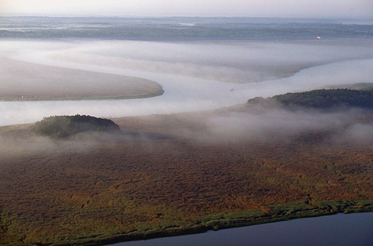
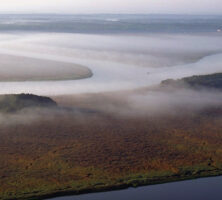
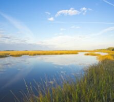
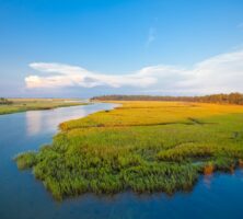
Georgia's Lower Coastal Plain geographic province comprises the barrier islands and the mainland coastal region, which extends inland from the shore for approximately seventy miles. The state's shoreline continually shifts, as the barrier islands are altered through wind, waves, currents, and tides.
Courtesy of Georgia Department of Economic Development.
The Okefenokee Swamp, located in the Lower Coastal Plain geographic province, supports a variety of plant and animal life. The swamp is the largest in North America, covering approximately 700 square miles.
Photograph from John Whitehill
One of the barrier islands that protect the Georgia coast, Blackbeard covers more than 5,600 acres. The island is a National Wildlife Refuge and is managed by the U.S. Fish and Wildlife Service.
Courtesy of U.S. Fish and Wildlife Service
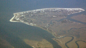
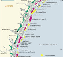
Barrier islands, also known as the Golden Isles, line the coast of Georgia. The Lower Coastal Plain extends for sixty-five to seventy miles between the Savannah and St. Marys rivers and contains the remains of older and higher shorelines west of the present coast. Previously occupied by Native Americans, today these ancient shorelines support the cities of Savannah, Darien, and Brunswick.
Courtesy of V. J. Henry
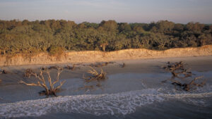
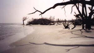
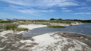
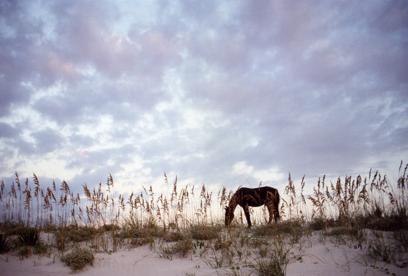
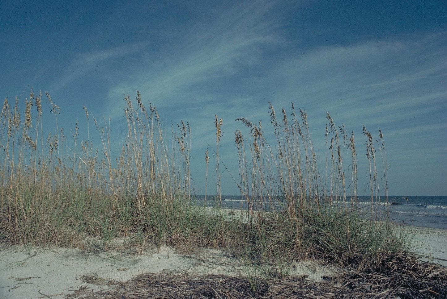
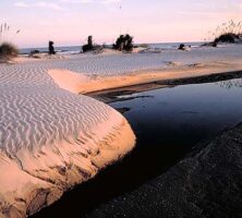
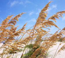
Sand dunes are a prominent feature on Cumberland Island, one of the barrier islands lining the coast of Georgia. Facing the ocean on the eastern side of the islands, the sand dunes are formed by wind and waves and stabilized by such plants as sea oats and morning glories.
Courtesy of Georgia Department of Economic Development.
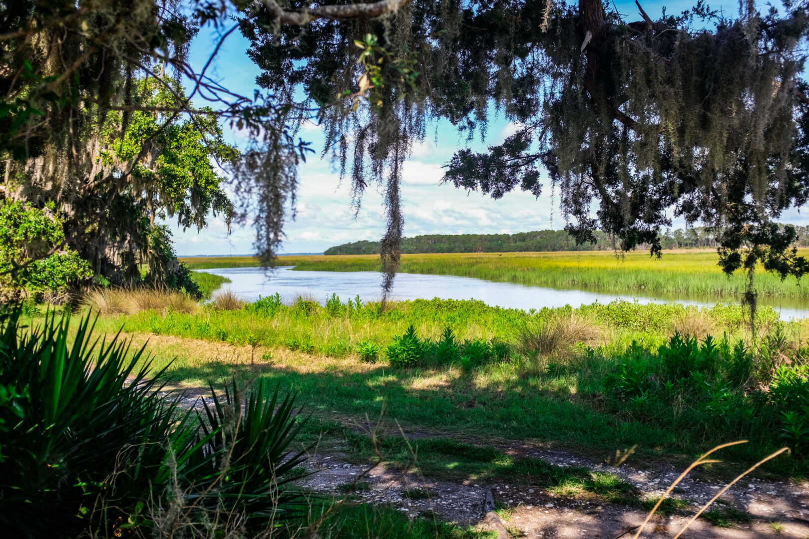
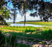
Marshes along the western side of Sapelo Island meet the maritime forest of the island's interior. The marsh, dominated by smooth cordgrass, transitions abruptly to the maritime forest, which is dominated by live oaks, the state tree.
Courtesy of National Oceanic and Atmospheric Administration, National Estuarine Research Reserve Collection.
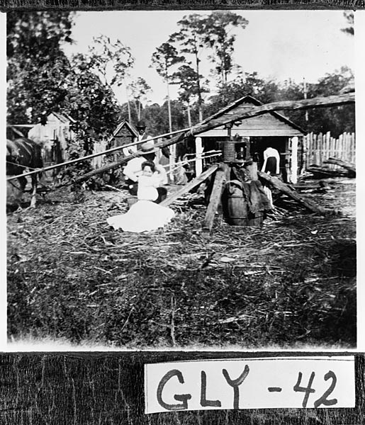
Workers on St. Simons Island grind sugar cane, one of the crops raised on Georgia's barrier islands in the eighteenth and nineteenth centuries. A number of other crops were raised on the island during this time as well, including indigo, rice, and Sea Island cotton.
Courtesy of Georgia Archives, Vanishing Georgia, #
gly042.
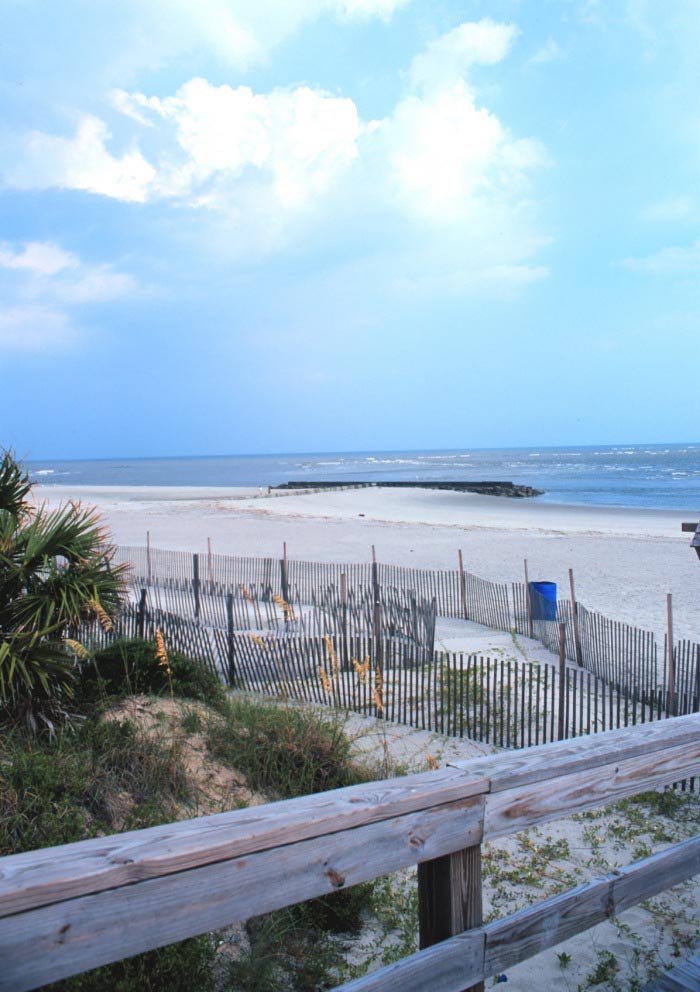
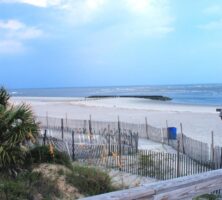
Fences erected to combat erosion line the beaches of Tybee Island, one of the barrier islands along the Georgia coast. Currently experiencing significant erosion as a result of rising sea levels, the Tybee beaches are maintained through renourishment projects and protected by man-made sea walls.
Photograph by William Folsom. Courtesy of National Oceanic and Atmospheric Administration
Tybee Island, formerly known as Savannah Beach, is located about eighteen miles east of Savannah. A popular destination for tourists, Tybee is home to approximately 3,400 year-round residents.
Image from James St. John
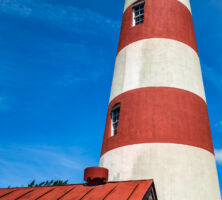
Because of its strategic location at the mouth of the Savannah River, Tybee Island has played an important role in the military history of Georgia. The island's lighthouse, constructed in 1736, was used as part of a warning system during the War of 1812.
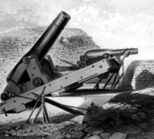
Fort Pulaski, completed in 1847, could mount 146 cannons, some on the parapet atop the seven-and-a-half-foot-wide walls and others in casemates inside the walls. The fort is positioned at the mouth of the Savannah River, across from Tybee Island.
Courtesy of Georgia Historical Society.
The beach on Tybee Island is a popular destination during the summer months for both tourists and Savannah residents. At the end of the nineteenth century, physicians often encouraged patients to "take the salts" at Tybee in the hopes of curing such ailments as asthma and allergies.
Courtesy of Explore Georgia, Photograph by Ralph Daniel.
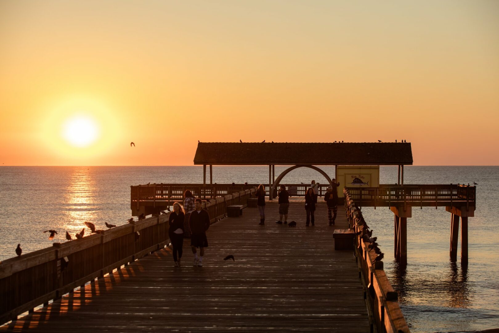
The Tybee Pavilion, located at the end of a pier on Tybrisa Street, is used for festivals and other special events throughout the year. The original Tybrisa Pavilion, which burned down in 1967, was popular for its crystal ball, big bands, and dime dances early in the twentieth century.
Courtesy of Explore Georgia, Photograph by Ralph Daniel.
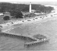
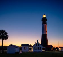
The lighthouse on Tybee Island is the island's most recognized landmark. Constructed in 1736, the lighthouse is one of the oldest in the nation still in operation. Renovations began on the lighthouse in 1999, and in 2002 ownership and management of the lighthouse transferred to the Tybee Island Historical Society.
Courtesy of Explore Georgia, Photograph by Ralph Daniel.
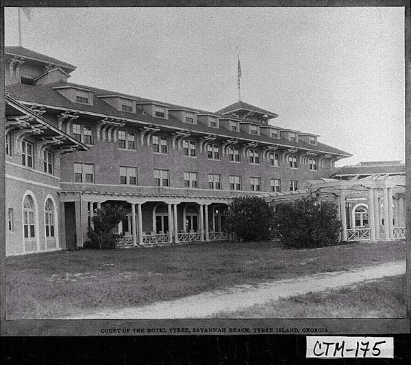
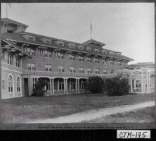
Hotel Tybee, shown here about 1930, was one of several grand hotels built on Tybee Island around the turn of the twentieth century, during the area's heyday as a resort community.
Courtesy of Georgia Archives, Vanishing Georgia, #
ctm175.
One of the few stands of original oak and hickory forests remaining in Georgia is located at Fernbank Forest in Atlanta. Trail guides at the Fernbank Science Center offer programs in the forest for both students and the general public throughout the year.
Courtesy of Fernbank Science Center
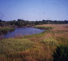
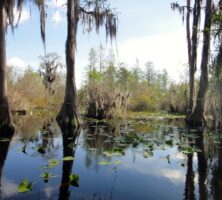
Many blackwater rivers originate in the Coastal Plain. Large floodplains and swamp systems are often associated with these river systems, which are critically important for restoring groundwater, preserving wildlife habitat, and reducing water pollution.
Courtesy of Georgia Department of Economic Development.
The island, marsh, and estuary system of Cumberland Island is a highly productive ecological system.
Courtesy of Explore Georgia, Photograph by Ralph Daniel.
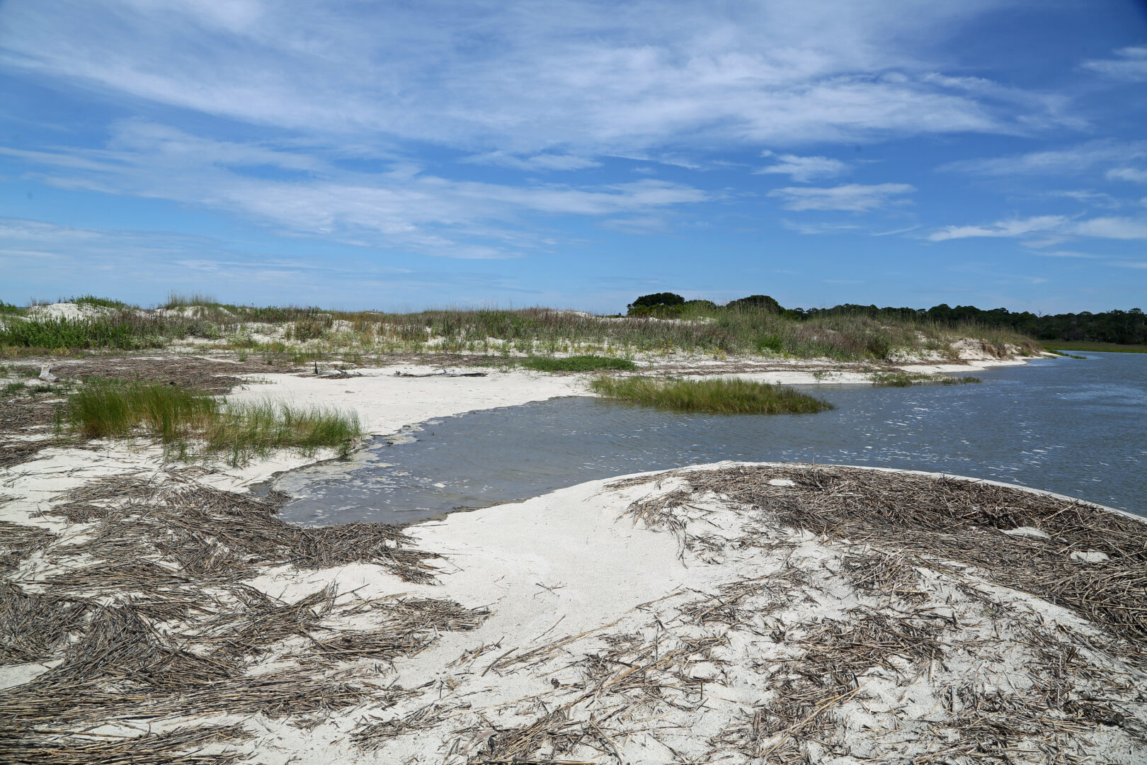
Sand dunes protect Cumberland from erosion and inundation by the sea.
Photograph by Sean McMenemy
Marshes trap sediments discharged from mainland rivers, protecting the appearance and recreational qualities of Cumberland's beach.
Courtesy of Explore Georgia, Photograph by Ralph Daniel.
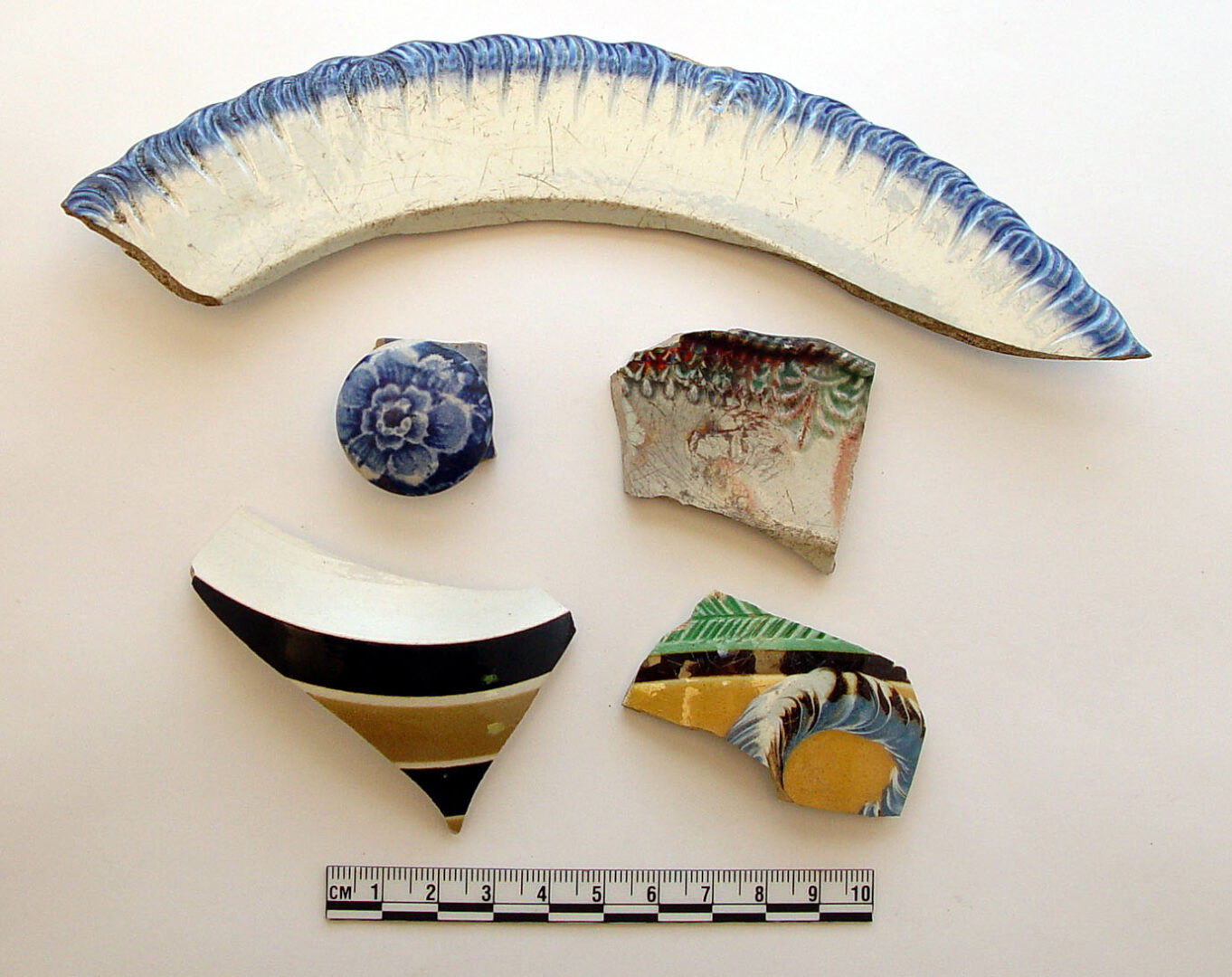
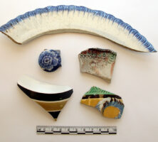
Pottery fragments dating to the era of slavery, excavated from Cumberland Island.
Courtesy of Southeast Archaeological Center
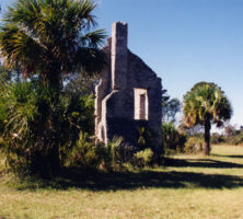
Dungeness Plantation was built on the south end of Cumberland Island in 1884 by Thomas Carnegie. Only ruins of the structure remain.
Courtesy of Library of Congress, Prints and Photographs Division, Historic American Buildings Survey, Photograph by Philip E. Gardner.
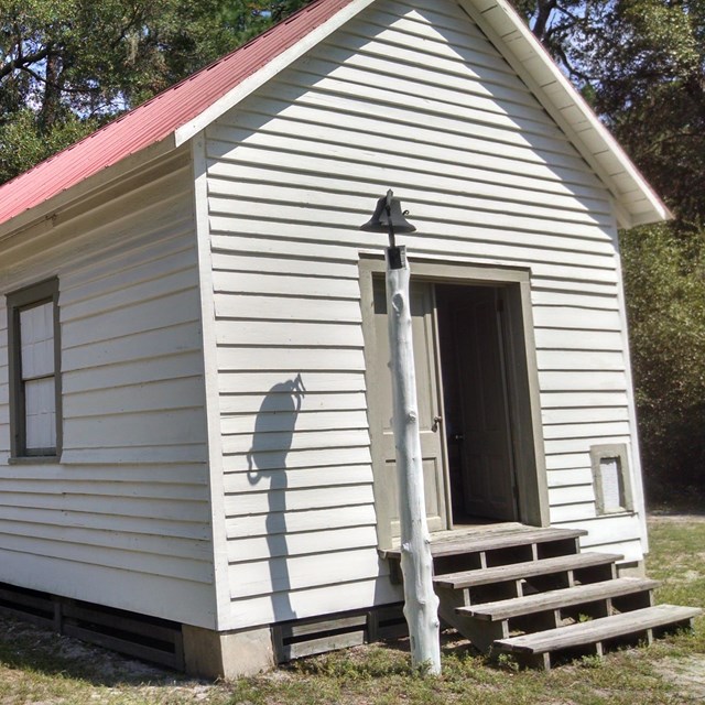
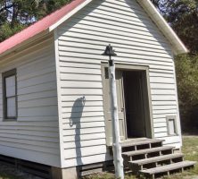
The First African Baptist Church, constructed in 1937, is on the northern end of Cumberland Island.
Photograph from National Park Service
Cumberland's interior maritime forest is studded with saltwater coves, freshwater ponds, and inland swamps, all providing shelter for migratory ducks and long-legged wading birds.
Image from JR P
Cumberland Island was established as a national seashore in 1972. Its beaches are protected from development.
Image from Maigh
Cumberland's interior maritime forest includes live oaks and saw palmettos.
Courtesy of Explore Georgia, Photograph by Ralph Daniel.
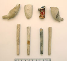
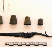
Nineteenth-century tobacco pipes excavated on Cumberland Island.
Courtesy of Southeast Archaeological Center
Sewing and tailoring tools from slavery days, excavated on Cumberland Island.
Courtesy of Southeast Archaeological Center
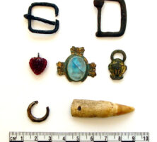
Personal adornments probably worn by enslaved people, excavated on Cumberland Island.
Courtesy of Southeast Archeological Center
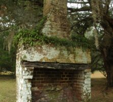
A fireplace that once was part of a slave cabin on Cumberland Island.
Image from NPCA
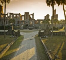
Ruins of the Dungeness Mansion on Cumberland Island. The mansion, built by Thomas Carnegie on the former site of Catharine Greene Miller's estate, burned in the mid-twentieth century.
Courtesy of Explore Georgia, Photograph by Ralph Daniel.
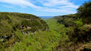
Cloudland Canyon State Park is located in Dade County, near the northern end of Lookout Mountain, in the Appalachian Plateau.
Photograph by Jeff Gunn
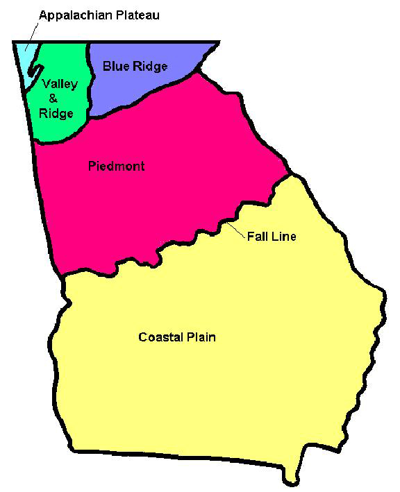
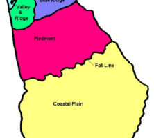
Georgia encompasses parts of five distinct geographic regions: the Appalachian Plateau, the Valley and Ridge, the Blue Ridge, the Piedmont, and the Coastal Plain.
Courtesy of Pamela J. W. Gore
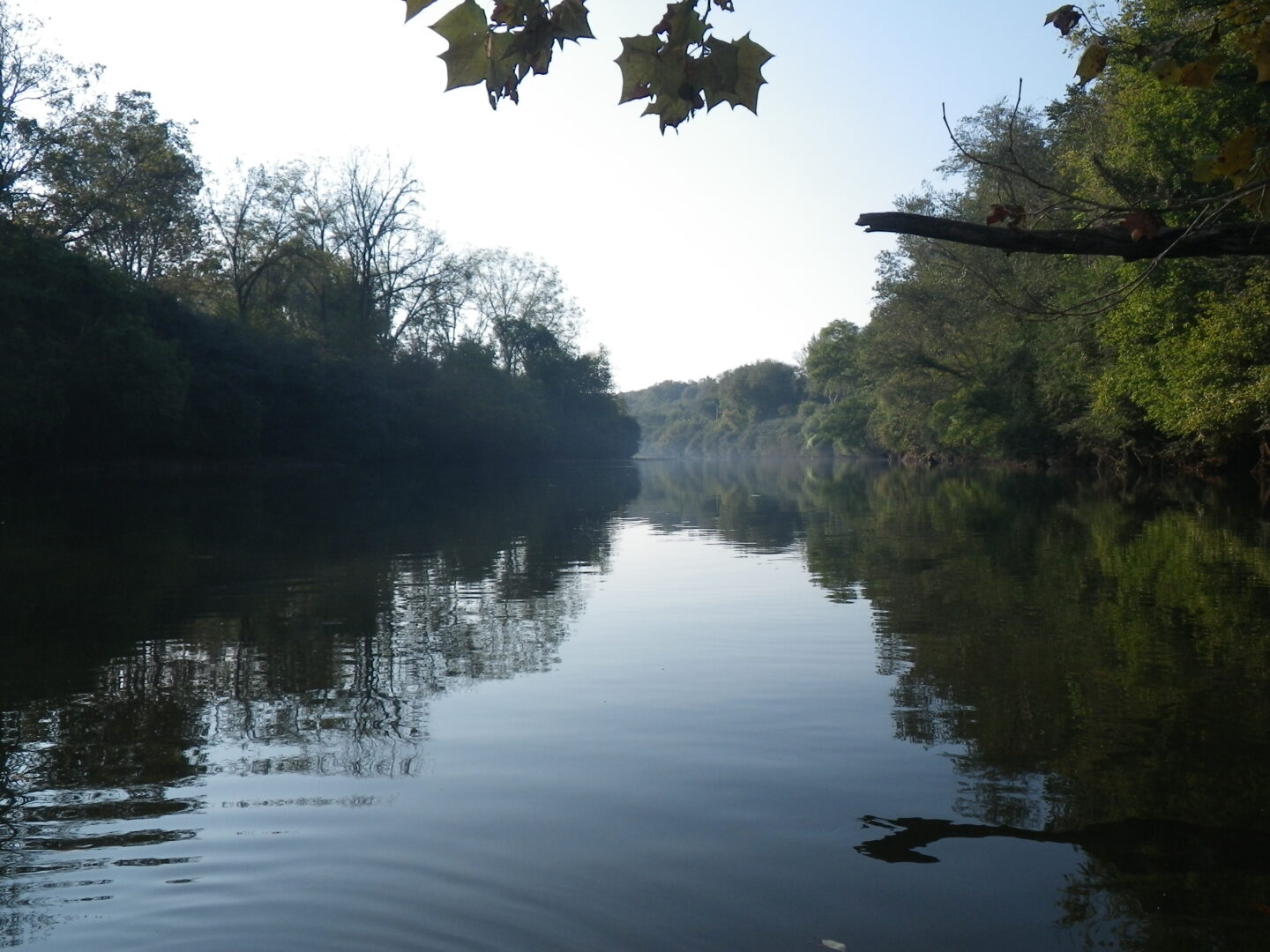
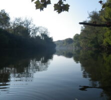
The Chattahoochee River, part of the Apalachicola-Chattahoochee-Flint river basin, is one of the nation's most endangered rivers. In addition to providing habitat for birds, mammals, and reptiles, the river supports six endangered or threatened mussel species. The river begins in the Blue Ridge Mountains and flows to southwest Georgia.
Photograph by Dianne Frost
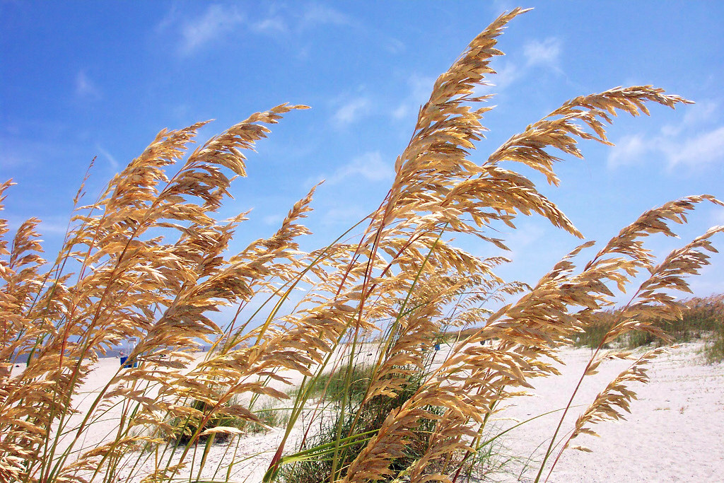
Sea oats grow along the coast of Blackbeard Island in Georgia's Lower Coastal Plain.
Courtesy of U.S. Fish and Wildlife Service
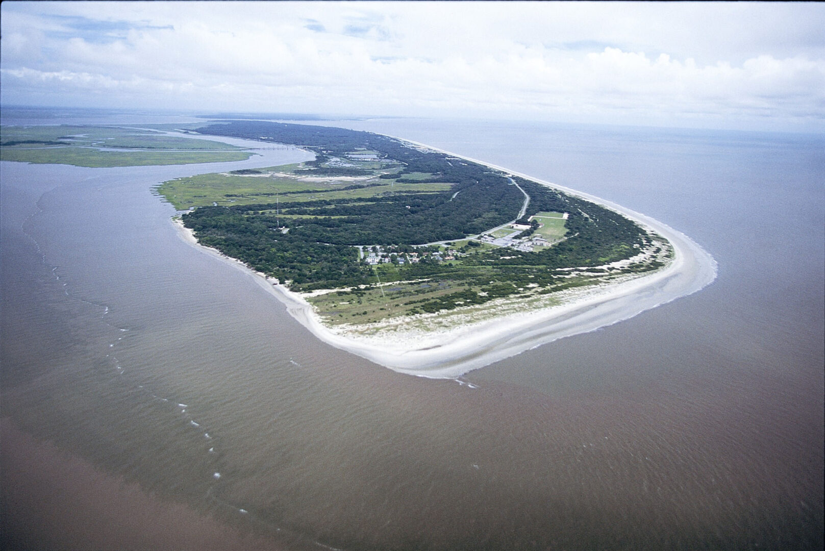
Lying twenty miles south of Savannah, Ossabaw is the principal barrier island of the upper Georgia coast (11,800 upland acres) and the third largest of Georgia's Sea Islands.
Courtesy of Buddy Sullivan
The durable timber from live oaks, plentiful on Blackbeard Island, was used for shipbuilding in the first half of the nineteenth century. The island was purchased as a federal timber reserve by the U.S. Navy Department in 1800.
Courtesy of U.S. Fish and Wildlife Service
Ships entering Georgia ports reported first to the disinfecting wharves of the South Atlantic Quarantine Station, which was established in 1883 on Blackbeard Island for the detention and treatment of ship crews and cargoes infected with yellow fever.
From Images from the History of the Public Health Service, by R. Kondratas
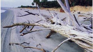
The remains of dead trees, mostly live oaks, jut out of the sand like sculpture in "The Boneyard" on Blackbeard Island. The term is used to describe the areas of beach on barrier islands where old trees are buried and exposed over and over as the tides change the shape of the islands.
Courtesy of U.S. Fish and Wildlife Service
The western side of Jekyll Island is fronted by Jekyll Creek and salt marsh, and the eastern edge of the island is defined by its beach and the Atlantic Ocean.
Courtesy of Jekyll Island Museum
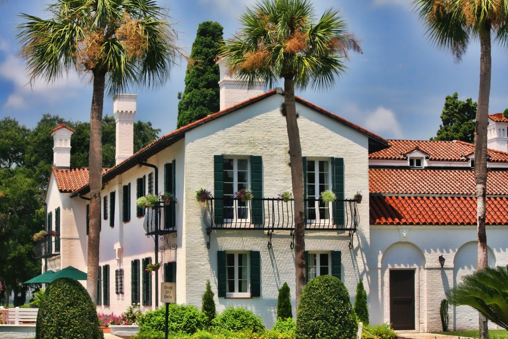
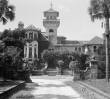
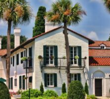
Built in 1919, the Crane Cottage was one of the most expensive homes ever built on Jekyll Island during the Jekyll Island Club era. The Italian Renaissance mansion was designed to resemble a villa in northern Italy admired by Richard Teller Crane Jr. Landscaped gardens were an important component of the estate's beauty.
Image from Evangelio Gonzalez
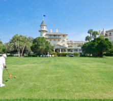
The original clubhouse for the Jekyll Island Club was completed late in 1887. In 1978 the 240-acre club district was designated a National Historic Landmark, and seven years later work began to restore the clubhouse and annexes into a world-class hotel and resort named the Jekyll Island Club Hotel.
Courtesy of Explore Georgia, Photograph by Ralph Daniel.
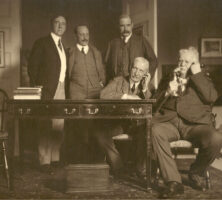
AT&T president Theodore Vail (with telephone, far right) joined the opening ceremony for the first transcontinental telephone line from his home on Jekyll Island. With Vail are (left to right) architects Welles Bosworth and Samuel Trowbridge, banker J. P. Morgan, and businessman William Rockefeller.
Courtesy of Jekyll Island Museum
Since 1950 Jekyll has operated under the auspices of the Jekyll Island Authority. The island has become renowned for the preservation of its natural and historic resources, and it provides public access to thousands of visitors annually.
Courtesy of Explore Georgia, Photograph by Ralph Daniel.
Little St. Simons Island, consisting mostly of low tidal salt marsh with forested upland tracts on its eastern (ocean) side, is privately owned and is accessible only by water.
Courtesy of Explore Georgia, Photograph by Ralph Daniel.
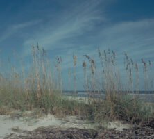
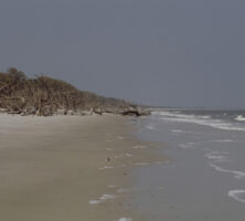
Sea Oats grow wild on the beach in Tybee Island.
Image from Melissa Johnson
An English actress, Kemble married Pierce Mease Butler and was upset to learn of the family's slave labor operations. She eventually published an account of her impressions of slavery, after divorcing Butler and losing custody of their two children.
Courtesy of Hargrett Rare Book and Manuscript Library, University of Georgia Libraries, Georgia Photo File.
One of a series of barrier islands, Sea Island is approximately five miles long and one and a half miles wide at its widest point. A causeway connects the island with St. Simons Island, its larger neighbor to the west.
Courtesy of Georgia Department of Economic Development.
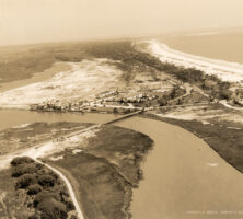
Aerial view of Sea Island in 1931.
Courtesy of Sea Island Company
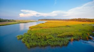
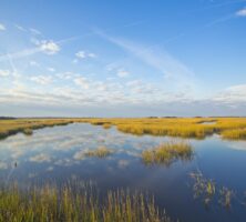
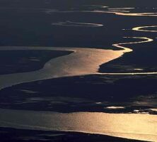
Coastal tides bring nutrients from estuaries connected by tidal creeks to the marshes. Outgoing tides carry nutritious marsh products back into the estuaries. There, the products help to sustain large numbers of other marine organisms. The outgoing tides also remove wastes from the marsh.
Courtesy of Georgia Department of Economic Development.
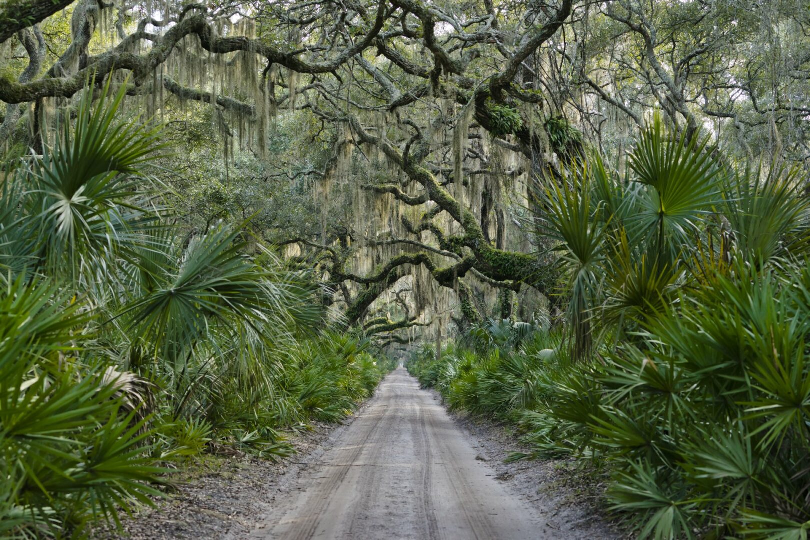
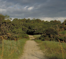
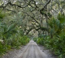
A scenic road cuts through the wilds of Sapelo Island. The barrier island is home to abundant plant and animal life.
Image from Kevin
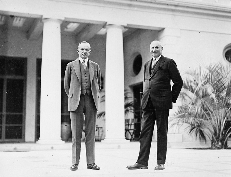
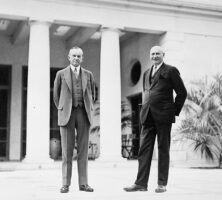
Detroit automotive engineer Howard Coffin (right) visits with U.S. president Calvin Coolidge (left) on the porch of "The Big House"—the south-end tabby-stucco structure originally built by Thomas Spalding in 1810. Coffin owned much of Sapelo Island from 1912 to 1934.
Courtesy of Georgia Archives, Vanishing Georgia, # sap118.
North Carolina tobacco heir Richard J. Reynolds Jr. utilized the island as a part-time residence for thirty years, from 1934 until his death in 1964. His widow sold her holdings on Sapelo to the state of Georgia in two separate transactions in 1969 and 1976.
Image from Bubba73 (Jud McCranie)
A hurricane in October 1898 seriously undermined the foundation of the original Sapelo Lighthouse. In September 1905 a new lighthouse—a 100-foot steel pyramidal tower with a kerosene-lit flashing light—was activated and a third-order Fresnel lens was installed.
Image from Kevin
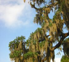
Spanish moss hangs from the trees across much of Savannah and coastal Georgia.
Image from Via Tsuji
Thomas Spalding reintroduced the use of tabby, a local mixture of oyster shell, lime, sand, and water, as a primary building material on the coast.
Courtesy of Patricia Barefoot
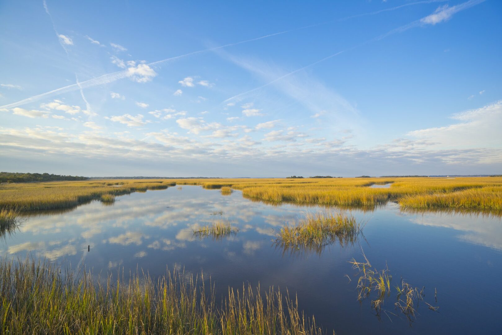
A salt marsh extends between the mainland and Sapelo Island, one of the barrier islands lining the Georgia coast. According to estimates by the Georgia Department of Natural Resources, salt marshes cover more than 378,000 acres in the state.
Photograph by Darby Carl Sanders