The New Georgia Encyclopedia is supported by funding from A More Perfect Union, a special initiative of the National Endowment for the Humanities.
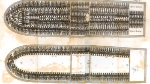
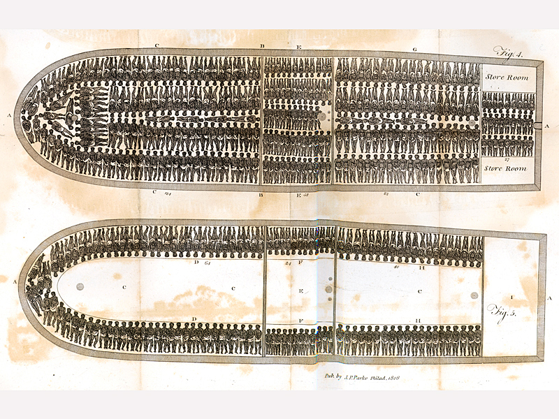
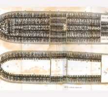
Africans captured to be sold into slavery crossed the Atlantic Ocean lying pressed together in crowded ships' holds. The city of Savannah served as a major port for the Atlantic slave trade from 1750, when the Georgia colony repealed its ban on slavery, until 1798, when the state outlawed the importation of enslaved people.
From The History of Rise, Progress & Accomplishment of the Abolition of the African Slave-trade by the British Parliament, by Thomas Clarkson
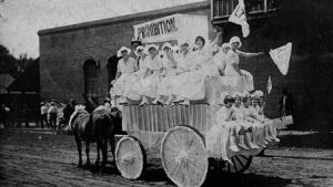
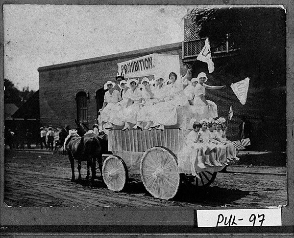
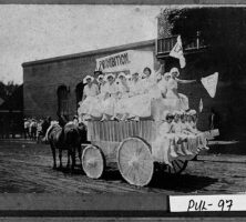
Young women and children ride on a parade float promoting prohibition in Hawkinsville (Pulaski County), circa 1919.
Courtesy of Georgia Archives, Vanishing Georgia, #
pul097a.
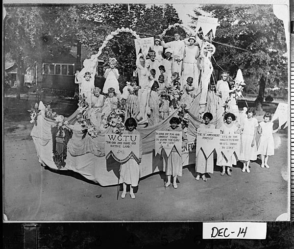
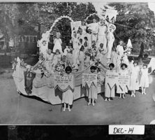
Women's Christian Temperance Movement (WTCU) members participate in the Decatur County centennial parade in Bainbridge, 1923. The WCTU formed its first Georgia chapter in 1880. Largely due to their efforts, Georgia passed a local option law in 1885.
Courtesy of Georgia Archives, Vanishing Georgia, #
dec014.
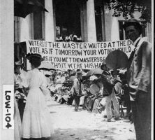
A crowd gathered in front of the Lowndes County courthouse in Valdosta for a prohibition vote in 1907. That year, Georgia became the first state in the South to pass a statewide ban on the production, transportation, and sale of alcohol.
Courtesy of Georgia Archives, Vanishing Georgia, #
low104.
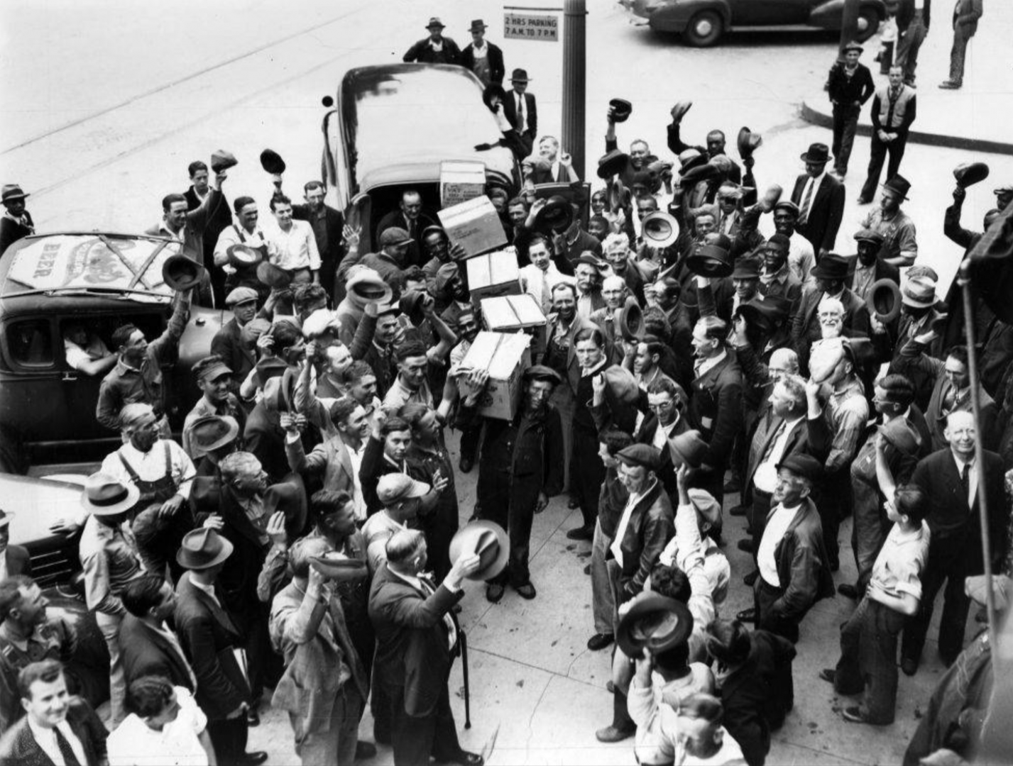
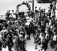
A crowd in Marietta celebrates the end of prohibition. In 1935 the Georgia legislature approved the Alcoholic Beverage Control Act, which called for a statewide referendum on the issue of repeal and tasked the State Revenue Commission with drafting new regulations to govern the sale and distribution of alcohol.
Courtesy of Special Collections & Archives, Georgia State University Library, Atlanta Journal-Constitution Photographic Archive.
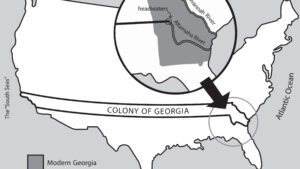
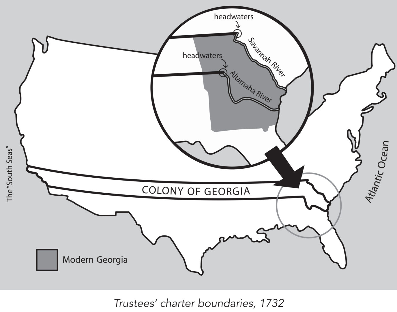
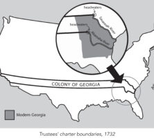
King George II granted James Oglethorpe and the Trustees a charter in 1732 to establish the colony of Georgia. This charter provided, among other things, that the new colony would consist of all the land between the headwaters of the Savannah and the Altamaha rivers, with its eastern boundary formed by the Atlantic Ocean and its western boundary by the "south seas," a reference to the Pacific Ocean.
Map by John Nelson. Reprinted by permission of William J. Morton
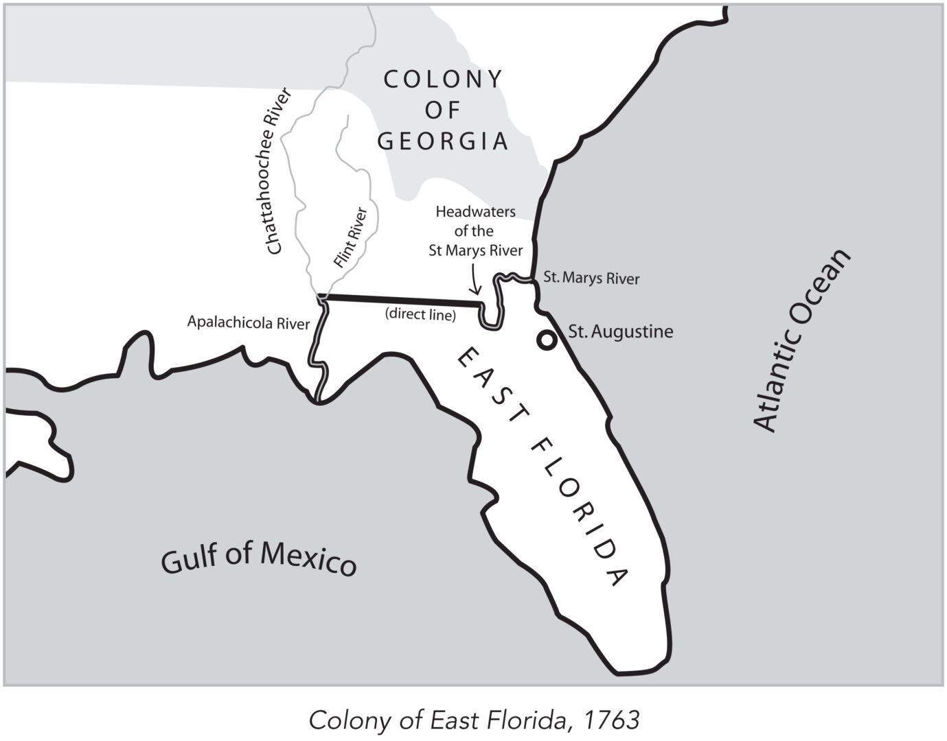
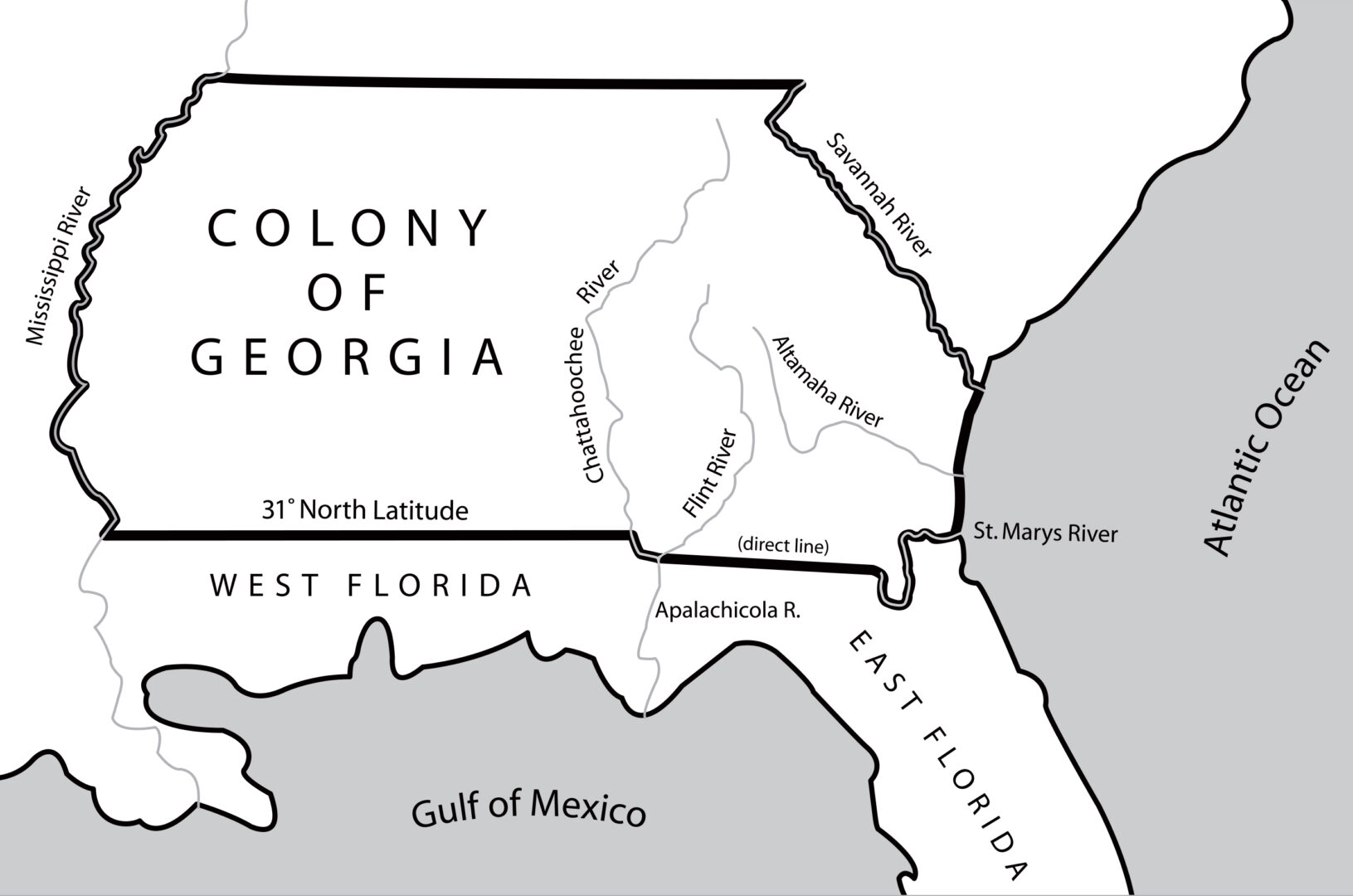
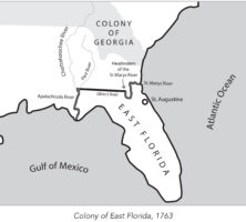
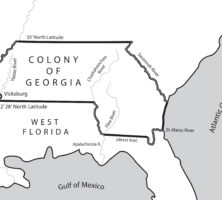
In 1763 the British divided what had been Spanish Florida into the two new colonies of West Florida and East Florida, with the Apalachicola River serving as the dividing line between them. East Florida was all the land east of the Apalachicola River, with St. Augustine as its capital.
Map by John Nelson. Reprinted by permission of William J. Morton
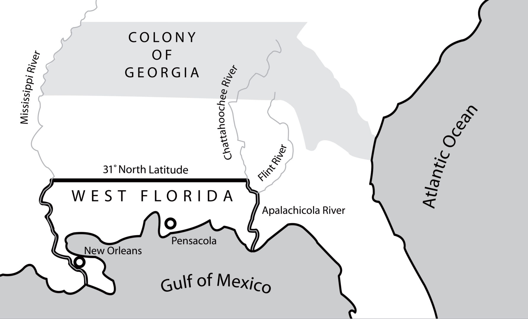
In 1763 the British divided what had been Spanish Florida into the two new colonies of West Florida and East Florida, with the Apalachicola River serving as the dividing line between them. West Florida, with Pensacola as its capital, extended west to the Mississippi River.
Map by John Nelson. Reprinted by permission of William J. Morton
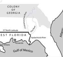
The appointment of James Wright in 1760 as governor of Georgia coincided with a period of expansion. By 1764 the boundaries of the colony had expanded to include those territories between the Mississippi and Chattahoochee rivers that had not been granted to the Florida colonies.
Map by John Nelson. Reprinted by permission of William J. Morton
In 1767 the governor of West Florida received permission from the king of England to advance the colony's northern border along the Mississippi and Chattahoochee rivers, where royal trading posts were located. Georgia's land holdings significantly decreased as a result.
Map by John Nelson. Reprinted by permission of William J. Morton
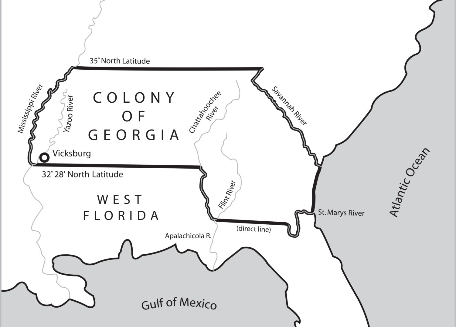
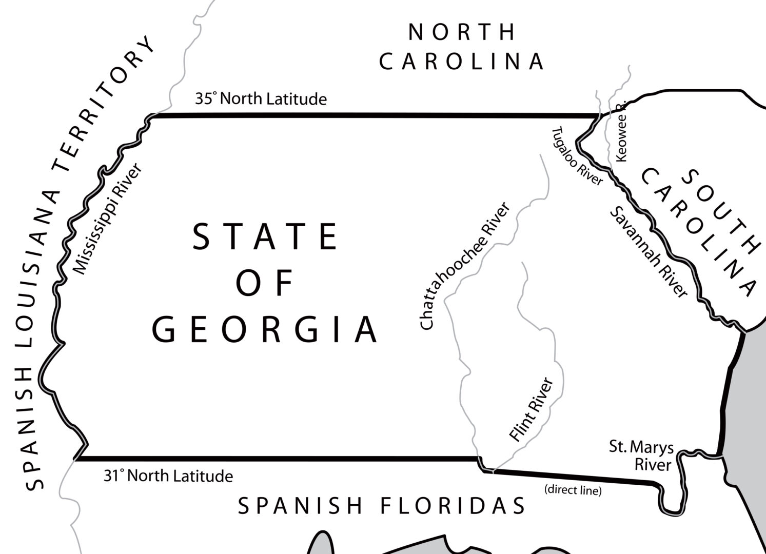
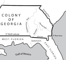
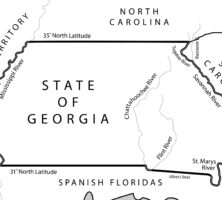
The 1783 Treaty of Paris, which ended the Revolutionary War (1775-83), fixed the 31st latitude north as the southern boundary of the new United States. The line extended from the Mississippi River eastward to the Chattahoochee River, moved down that river to its junction with the Flint River, and then followed a direct line east to the headwaters of the St. Marys River.
Map by John Nelson. Reprinted by permission of William J. Morton
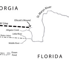
The Orr-Whitner line was accepted by Florida in 1861 and Georgia in 1866 as their official boundary, although the outbreak of the Civil War (1861-65) delayed the line's approval by the U.S. Congress until 1872.
Map by John Nelson. Reprinted by permission of William J. Morton
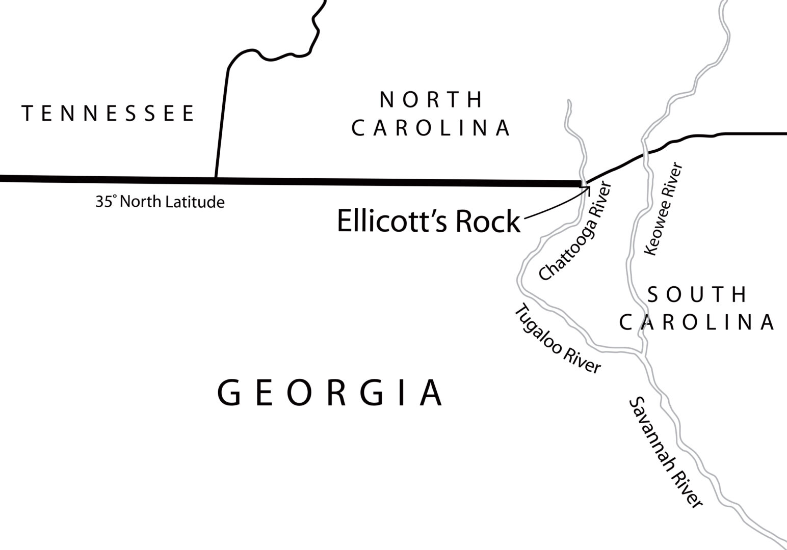
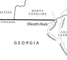
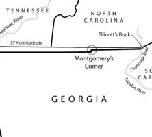
In 1811 Georgia hired Andrew Ellicott to survey and mark the location of the 35th latitude north, which formed the boundary between Georgia and North Carolina. In an 1812 letter to North Carolina governor William Hawkins, Ellicott states: "In the parallel of 35 degree N. latitude, on the west side of the Chatoga river, a stone is set up marked on the South side (G. lat 35 N.) and on the north side, (N.C.) for North Carolina." This map locates what is currently and erroneously called Ellicott's Rock on the east side of the Chattooga River.
Map by John Nelson. Reprinted by permission of William J. Morton
This map shows the surveyed line as marked by James Camak, which set Georgia's northern boundary line south of the 35th latitude north, including the offset known as Montgomery's Corner.
Map by John Nelson. Reprinted by permission of William J. Morton
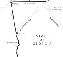
Following the 1802 Article of Agreement and Cession, Georgia's new western boundary began with the juncture of the Chattahoochee and Flint rivers in southwest Georgia and proceeded north to the great bend of the river (at present-day West Point, Georgia). From there it stretched for 160 miles to the Indian village of Nickajack on the Tennessee River and continued from there up to the 35th latitude north.
Map by John Nelson. Reprinted by permission of William J. Morton
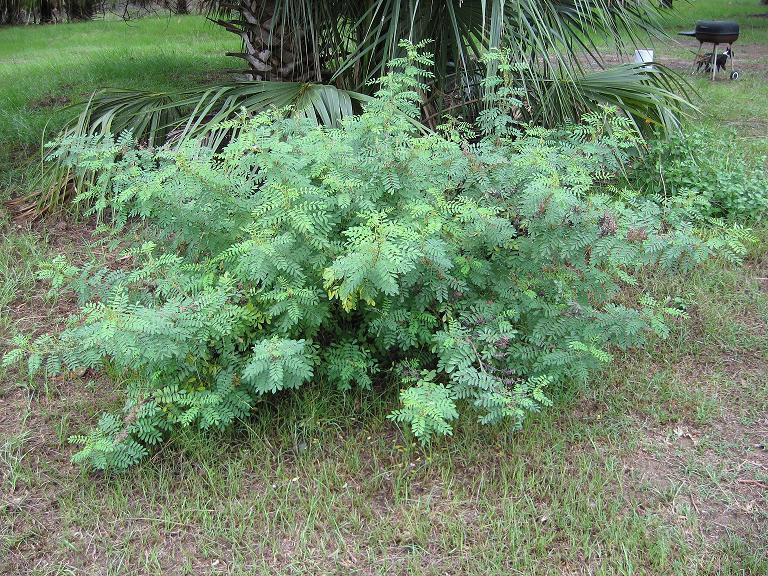
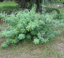
An indigo plant (Indigofera suffruticosa) grows wild on Ossabaw Island. Indigo was cultivated by colonial Georgians, and along with rice, was a lucrative crop until cotton surpassed it in the early 1800s.
Photograph by James Bitler
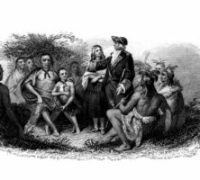
The Creek Indians meet with James Oglethorpe. By the time Oglethorpe and his Georgia colonists arrived in 1733, relations between the Creeks and the English were already well established and centered mainly on trade.
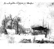
This sketch of the early Ebenezer settlement was drawn in 1736 by Philip Georg Friedrich von Reck. That same year the Salzburger settlement moved to a location closer to the Savannah River, where conditions were better for farming.
Print from Von Reck Archive, Royal Library of Denmark, Copenhagen
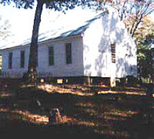
A replica of the original Quaker meetinghouse stands in Wrightsborough, which was founded in 1768 as a Quaker community in present-day McDuffie County. Opposed to slavery and therefore unable to compete in Georgia's economy, the Quakers, or Religious Society of Friends, began to leave the area during the late eighteenth century.
Courtesy of Sarah Shaw
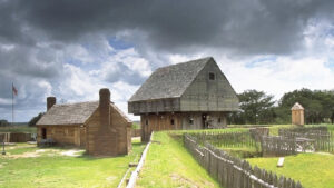
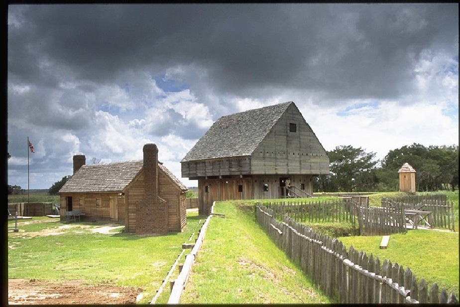
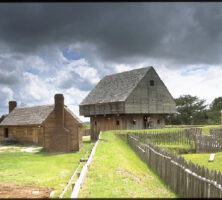
Fort King George was originally constructed at the mouth of the Altamaha River in 1721 to protect the British claim to the Georgia colony. The fort was garrisoned until 1732. More than 250 years later, the fort was reconstructed and today houses a museum and replicas of the blockhouse (pictured) and barracks.
Courtesy of Fort King George
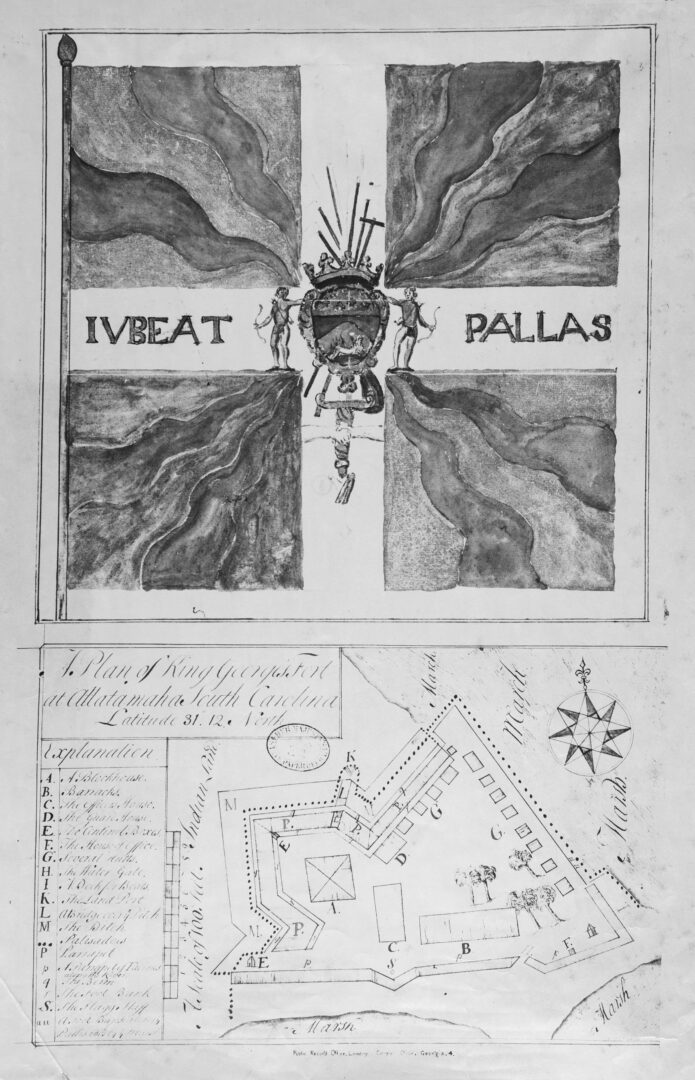
This map of Fort King George was likely drawn in 1722 by Colonel John "Tuscarora Jack" Barnwell, who established the fort near present-day Darien in 1721.
Courtesy of Georgia Archives.
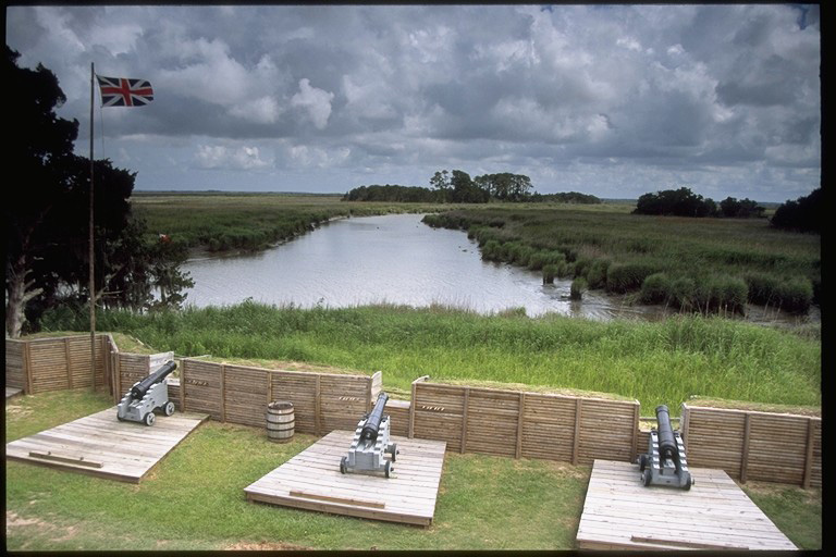
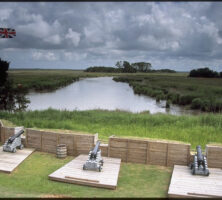
The Union Jack flies above three cannons overlooking Black Island Creek at the reconstructed Fort King George near Darien. The original British garrison was established in 1721 and abandoned in 1732. The site was added to the National Register of Historic Places in 1971 and reconstructed in 1988.
Courtesy of Fort King George
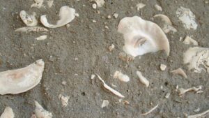
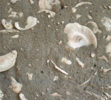
Traditional tabby, used for construction primarily along the coast, is composed of equal parts lime, water, sand, oyster shells, and ash. First introduced in Georgia by James Oglethorpe in 1736, tabby experienced revivals in the first half of the nineteenth century and again from the 1880s to 1920s.
Photograph by Jim Darby
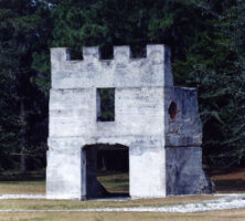
Among the archaeological ruins remaining at Fort Frederica on St. Simons Island are the soldiers' barracks (pictured), along with the king's magazine and the house foundations and walls. The structures are made of tabby, a limey mortar.
Courtesy of Ed Mathews, Amelia Island Images
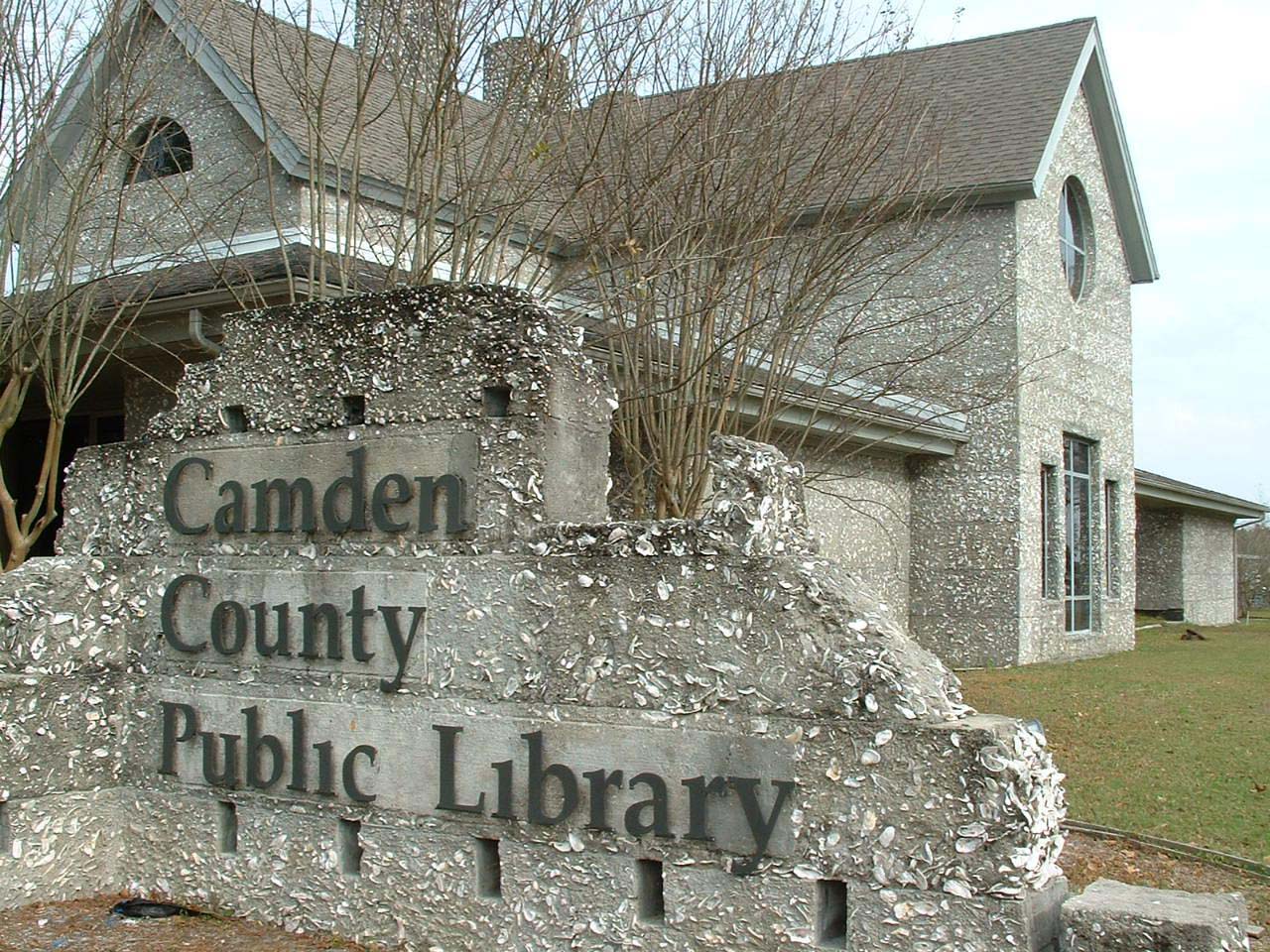
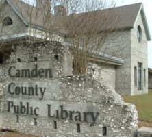
The Camden County Public Library was constructed in 1988 with "revival tabby," or traditional tabby mixed with Portland cement.
Photograph by Jim Darby
Tabby was used in the coastal Southeast from the late 1500s to the 1850s.
Courtesy of Patricia Barefoot
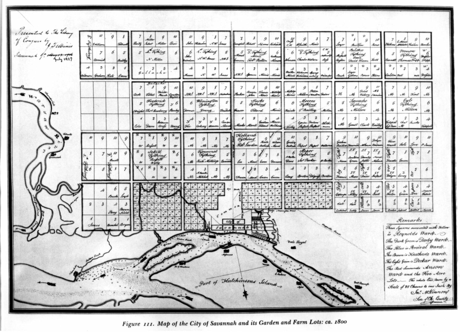
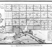
An early map of Savannah, drawn by John McKinnon circa 1800.
Courtesy of Hargrett Rare Book and Manuscript Library, University of Georgia Libraries, Rare Maps Collection.
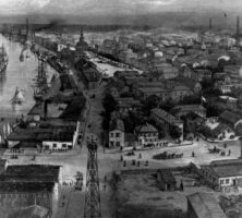
A drawing of the city of Savannah, circa 1889.
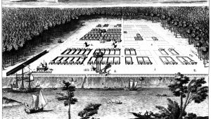
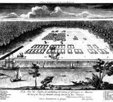
The original caption of this print by Paul Fourdrinier reads: "A View of Savannah as it stood on the 29th of March 1734. To the Hon[orable] Trustees for establishing the Colony of Georgia in America. This View of the Town of Savannah is humbly dedicated by their Honours Obliged and most Obedient Servant, Peter Gordon."
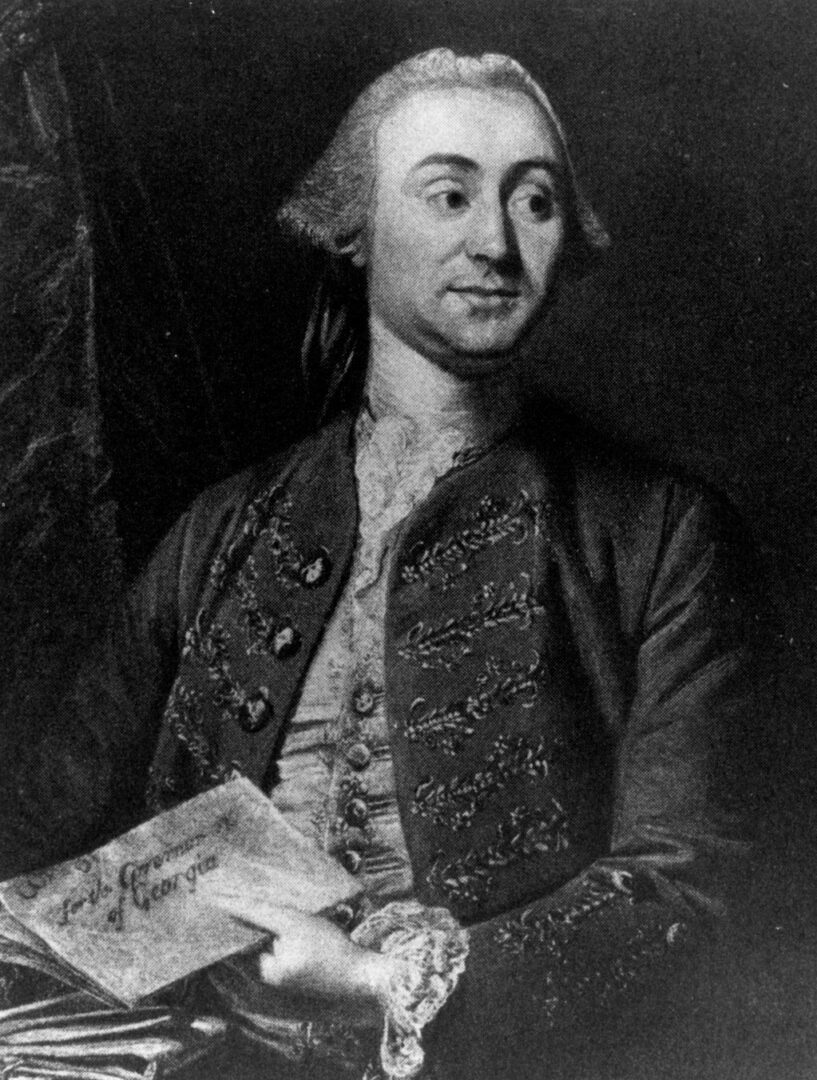
James Wright replaced Henry Ellis as royal governor of Georgia in 1760 and proved to be an efficient and popular administrator. During his tenure in office (1760-76) Georgia enjoyed a period of remarkable growth.
Courtesy of Hargrett Rare Book and Manuscript Library, University of Georgia Libraries, Georgia Photo File.
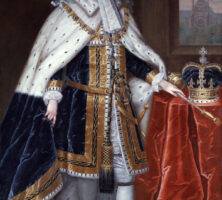
King George II of England signed the charter creating the colony of Georgia on April 21, 1732. Originally administered by a board of trustees, the colony later came under the direct governance of the king, from 1752 until his death in 1760, when his grandson George III assumed the throne.
Courtesy of Georgia Info, Digital Library of Georgia.
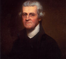
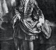
Noble W. Jones was prominent among Georgia's Whig leaders before and during the American Revolution, serving in both the provincial and state legislatures and in the Continental Congress. Portrait by Charles Willson Peale, circa 1781.
Courtesy of Telfair Museums, Courtesy of the Wormsloe Foundation.
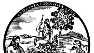
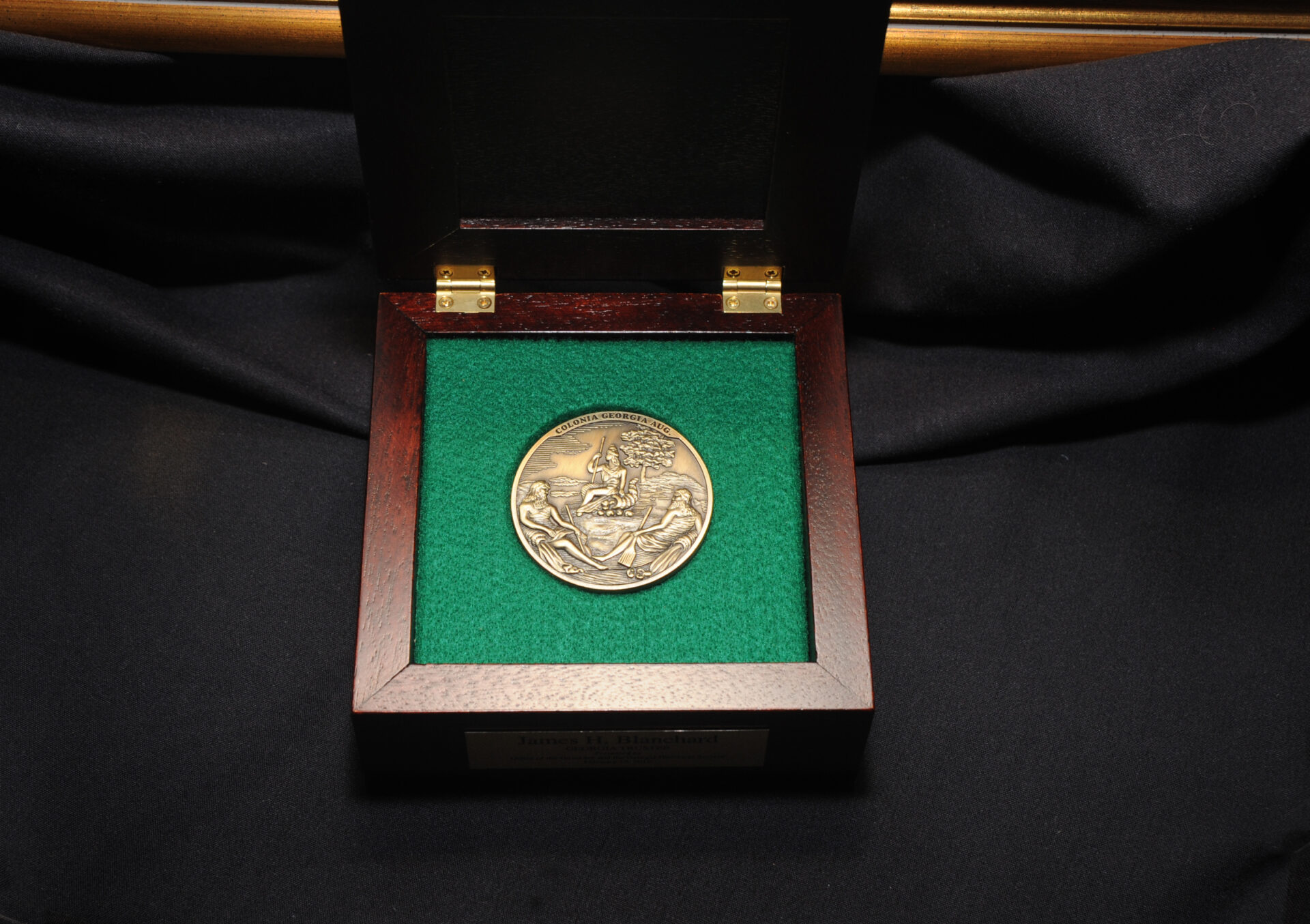
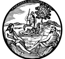
One face of the 1733 seal of the Georgia Trustees features two figures resting upon urns. They represent the Savannah and Altamaha rivers, which formed the northwestern and southeastern boundaries of the province. The genius of the colony is seated beside a cornucopia, with a cap of liberty on her head and a spear in one hand. The abbreviated Latin phrase Colonia Georgia Aug means "May the colony of Georgia prosper."
Courtesy of Georgia Historical Society.
James Oglethorpe, a leader in the British movement to found a new colony in America, set sail for the new world on November 17, 1732, accompanied by Georgia's first settlers.
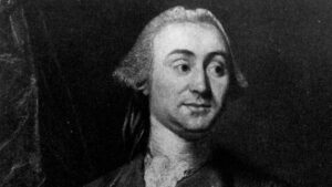
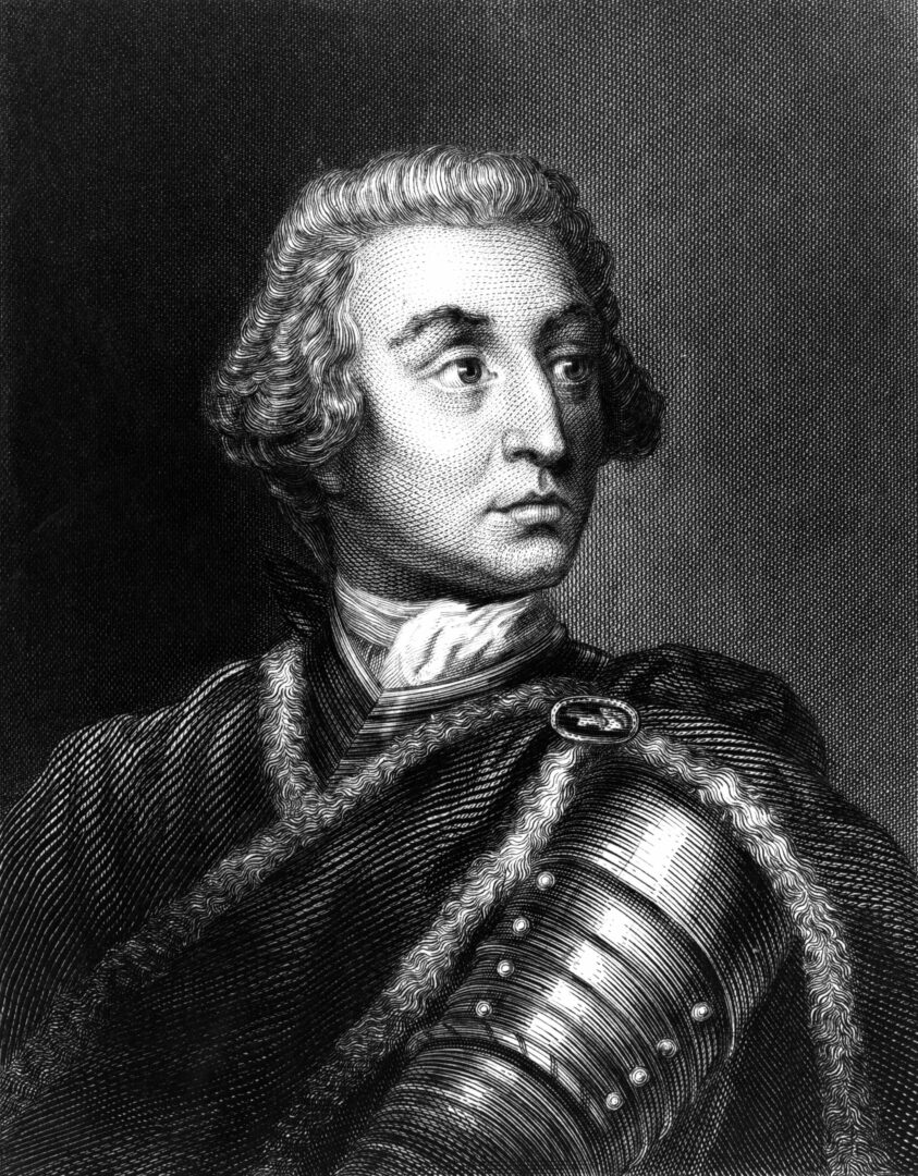
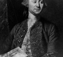
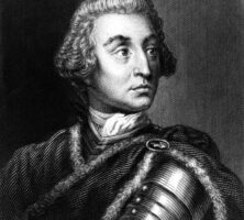
John Viscount Percival, the earl of Egmont, was the first president of the common council and the dominant figure among the Trustees until his retirement in 1742. He acted as Georgia's champion in Parliament.
From History of Georgia, by C. Howell
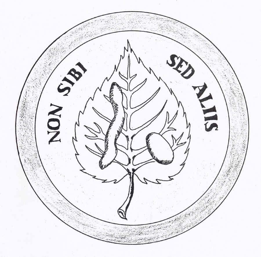
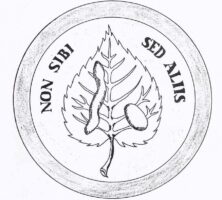
One face of the seal adopted by the Georgia Trustees features a silkworm, mulberry leaf, and cocoon, representing their hopes that the colonists would establish a thriving silk industry. The Latin motto Non sibi sed aliis translates as "Not for self, but for others."
Courtesy of Georgia Historical Society.
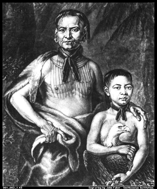
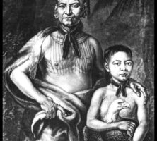
As a principal mediator between the native Creek (Muscogee) and English settlers during the first years of Georgia's settlement, Tomochichi (left) contributed to the establishment of peaceful relations between the two groups. His nephew, Toonahowi, is seated on the right in this engraving, circa 1734-35, by John Faber Jr.
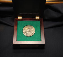
A bronze replica of the 1733 seal of the Trustees is presented to recipients of the Georgia Trustees honor, which is awarded annually by the Georgia Historical Society and the Office of the Governor.
Courtesy of Georgia Historical Society.
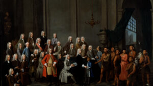
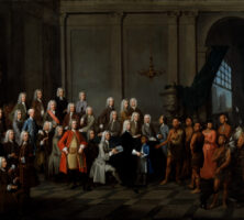
This oil painting by William Verelst shows the founders of Georgia, the Georgia Trustees, and a delegation of Georgia Indians in July 1734. One year later the Trustees persuaded the British government to support a ban on slavery in Georgia.
Courtesy of Georgia Info, Digital Library of Georgia.
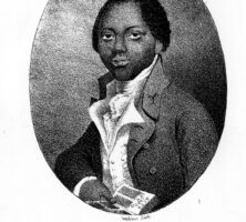
Olaudah Equiano published one of the earliest known slave narratives, The Interesting Narrative, in London in 1789. The work chronicles his years of enslavement, which he spent sailing trade ships both at sea and along the Savannah River. Equiano purchased his freedom in 1766 and traveled widely thereafter.
From The Life of Olaudah Equiano, or Gustavus Vassa, the African, by O. Equiano