

Conservation & Management
Sub-Topics
The New Georgia Encyclopedia is supported by funding from A More Perfect Union, a special initiative of the National Endowment for the Humanities.
Jane Hurt Yarn, an influential advocate for environmental conservation in Georgia, is pictured in Atlanta, circa 1995. She served on U.S. president Jimmy Carter's Council on Environmental Quality and was instrumental in the creation of Gray's Reef National Marine Sanctuary, located off the coast of Jekyll Island.
Courtesy of Atlanta Journal-Constitution.
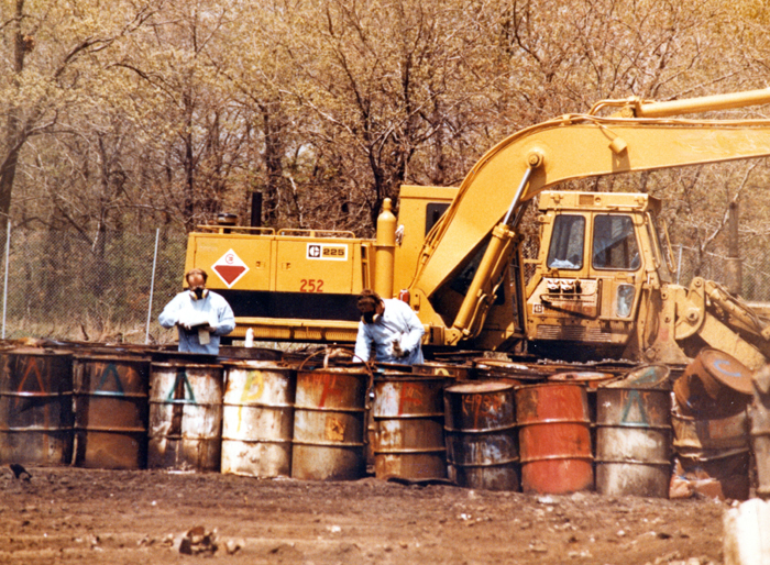
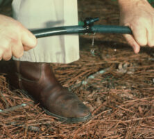
Proper procedures for handling hazardous waste include labeling and maintaining inventories of dangerous substances, as well as creating emergency-response plans in case of accidental releases.
Photograph by Jeremy Brooks
Household garbage is compacted at the Seminole Road Landfill in DeKalb County, pictured in 2005. Subtitle D of the Resource Conservation and Recovery Act (RCRA) regulates the proper management of landfills in order to protect the surrounding environment and communities.
Courtesy of Atlanta Journal-Constitution, Photograph by Rich Addicks..
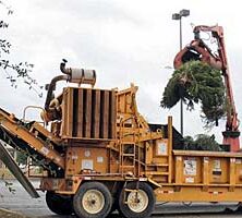
Christmas trees in Bainbridge are chipped into mulch in January 2009 as part of the statewide "Bring One for the Chipper" tree recycling program. The chipping was a joint effort by the City of Bainbridge and Keep Decatur County Beautiful.
Courtesy of Bainbridgega.com
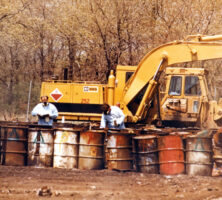
Hazardous solid waste consists of material that has been discarded and poses a threat to human health or the environment. Disposal of hazardous wastes, much of which are produced as by-products of industrial processes, is regulated by Subtitle C of the federal Resource Conservation and Recovery Act.
Courtesy of U.S. Geological Survey. Photograph by S. C. Delaney
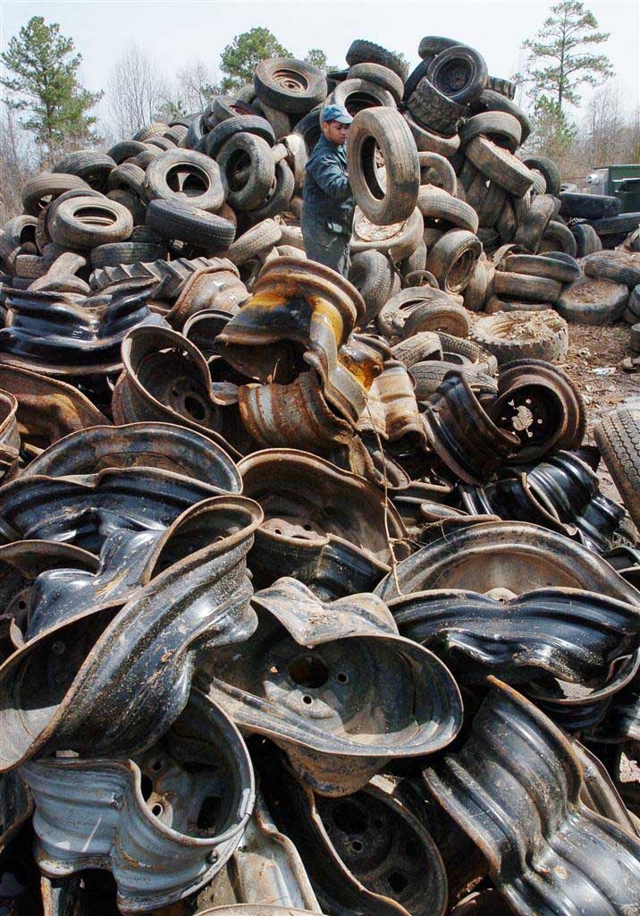
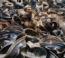
An employee at the Seminole Road Landfill in DeKalb County separates old car tires from rims in preparation for recycling. The management of solid and hazardous waste is covered by the Resource Conservation and Recovery Act (RCRA) of 1976, which was passed to help protect human and environmental health and to reduce waste.
Courtesy of Atlanta Journal-Constitution, Photograph by Rich Addicks..
Recycle 4 Georgia is a program administered by the Office of Environmental Management of the Georgia Department of Community Affairs. The program encourages local governments to manage waste through recycling by providing recycling trailers for special events.
Courtesy of Recycle 4 Georgia
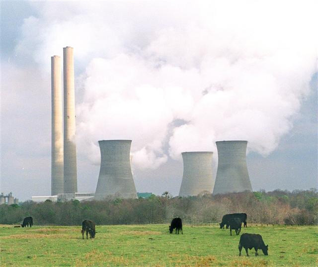
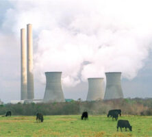
Major sources of industrial toxins in Georgia include agriculture, manufacturing, and coal-fired electrical power generation. Georgia Power Company's Bowen plant, a coal-fired power plant in Bartow County, is the nation's top producer of sulfur dioxide, a toxic substance.Photograph by Joe McTyre.
Courtesy of Atlanta Journal-Constitution.
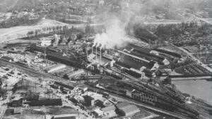
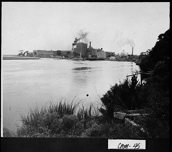
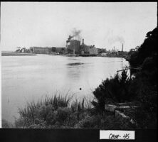
The Gilman Paper Company, pictured in 1952, was located in Camden County. Like other paper mills, the Gilman Paper Company released a variety of toxins into the surrounding environment during its years of operation. The site of the plant was later cleaned under Superfund legislation.
Courtesy of Georgia Archives, Vanishing Georgia, #
cam045.
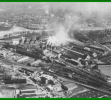
Georgia Power Company's Scherer plant is one of twelve coal-fired power plants operating in Georgia as of 2009. These plants produce approximately 64 percent of the state's electricity with coal mined in other states.
Courtesy of Atlanta History Center, Photograph by W. A. Bridges..
Georgia Power Company's Bowen coal-fired power plant, pictured in 1977, is located in Bartow County. Toxins produced by burning coal include carbon dioxide, sulfur dioxide, nitrogen oxides, and mercury compounds.Photograph by Charles Pugh.
Courtesy of Atlanta Journal-Constitution.
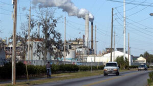
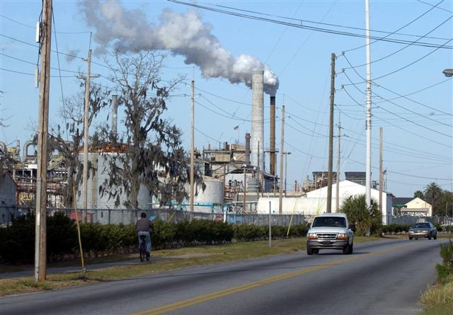
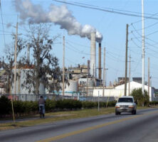
Hercules Inc. in Brunswick, pictured in 2004, is an active chemical processing plant. The U.S. Environmental Protection Agency identified the plant as a Superfund site because of contamination from toxic waste.
Courtesy of Atlanta Journal-Constitution.
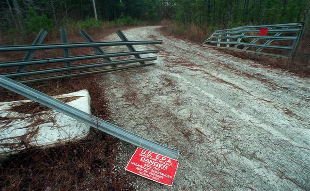
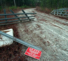
A broken gate in Coweta County marks the entrance to a Superfund site, where 2-3 million tires were once burned. The U.S. Environmental Protection Agency oversees the cleanup of toxic-waste sites under the federal Comprehensive Environmental Response, Compensation, and Liability Act (CERCLA, or Superfund).
Courtesy of Atlanta Journal-Constitution.
The Atlantic Steel Mill in Atlanta operated for more than 100 years before closing in 1998. The contamined 138-acre site on which the mill stood was cleaned as part of the largest brownfield reclamation project in the nation. In 2001 it reopened as Atlantic Station, a mixed-use development complex.
Courtesy of U.S. Environmental Protection Agency
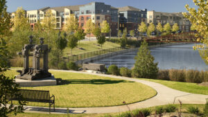
Atlantic Station, a development on the west side of Atlanta, was built on a reclaimed brownfield and designed according to the principles of New Urbanism, an architectural movement that offers an alternative to the suburban, automobile-dependent lifestyle.
Courtesy of Atlantic Station
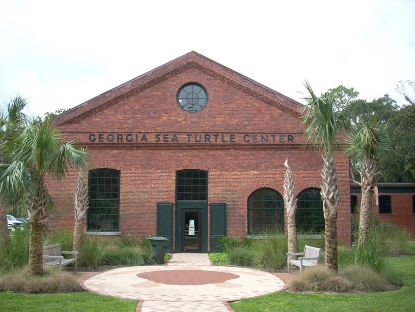
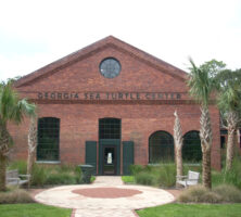
The Georgia Sea Turtle Center on Jekyll Island opened in 2007 to provide veterinary care to injured sea turtles and to educate the public about sea turtle conservation. The facility was built on a reclaimed brownfield, the former site of a coal-fired power plant that had contaminated the property with various industrial toxins.
Courtesy of Georgia Sea Turtle Center
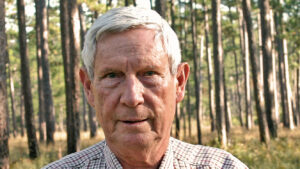
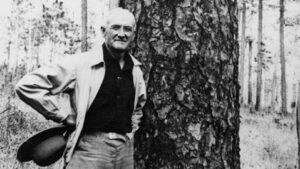
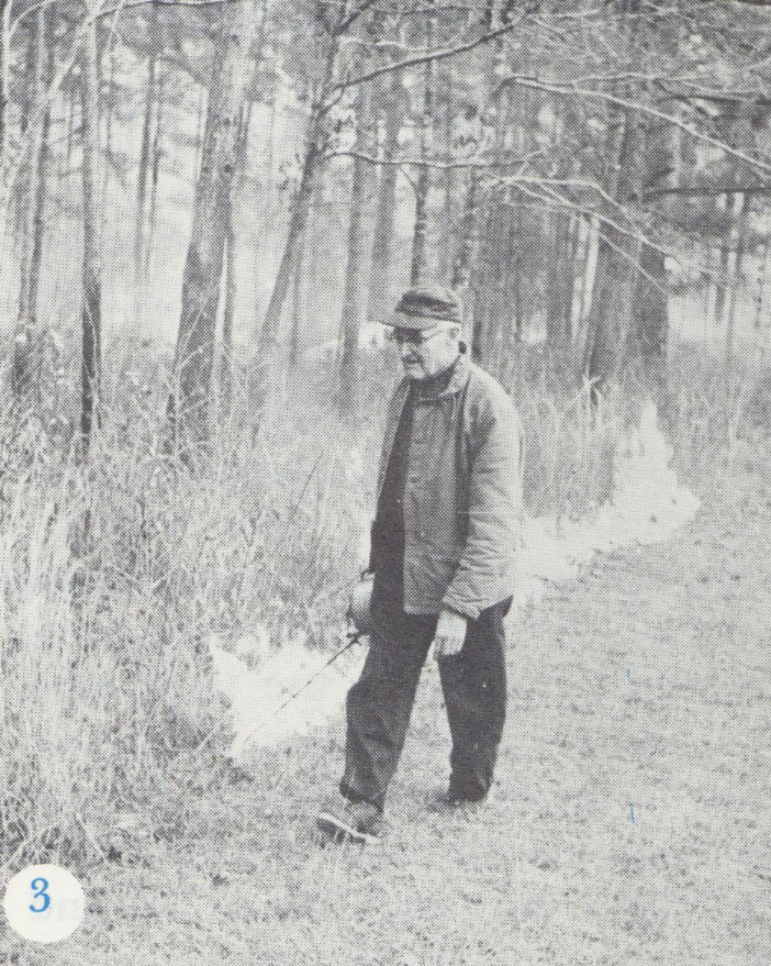
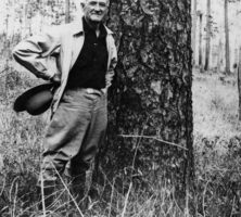
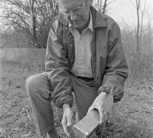
Herbert Stoddard, a renowned southern conservationist of the twentieth century, was an authority on the bobwhite quail and a pioneer in the development of both land and wildlife management practices. Much of Stoddard's work was conducted at Sherwood, his 1,000-acre property in Grady County.
Courtesy of Tall Timbers Research Station & Land Conservancy
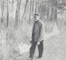
Naturalist Herbert Stoddard ignites a controlled burn on his longleaf pine preserve, Sherwood, in Grady County, circa 1966. Stoddard was a staunch advocate of using fire in the management of the wiregrass and longleaf pine ecosystem of south Georgia.
Courtesy of Tall Timbers Research Station & Land Conservancy
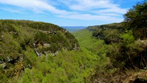
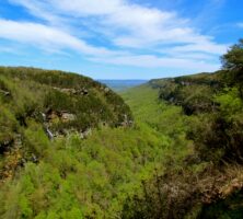
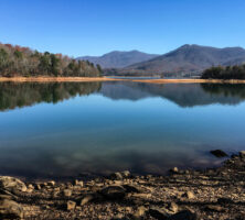
Cloudland Canyon State Park is located in Dade County, near the northern end of Lookout Mountain, in the Appalachian Plateau.
Photograph by Jeff Gunn
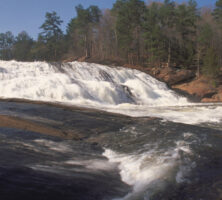
High Falls State Park, near Jackson in Butts County, is a popular destination along the Towaliga River for camping and boating. The town of High Falls, established in the early 1800s, became a ghost town during the 1880s, when the railroads gained prominence over waterways for commercial transportation.
Courtesy of Georgia Department of Economic Development.
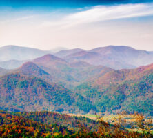
Black Rock Mountain State Park in the Blue Ridge Mountains is located in Rabun County along the Eastern Continental Divide. At an altitude of 3,640 feet, Black Rock Mountain is the highest state park in Georgia and offers numerous scenic overlooks and hiking trails.
Image from Bradley Huchteman
Indian Springs State Park, located in Butts County, is one of the first two state parks to be established in Georgia. In 1927 the state passed a resolution to preserve the Indian Springs Reserve, and in 1931 the park was founded as part of the newly created Georgia State Parks System.
Image by David Dugan
The F. D. Roosevelt State Park, located on Pine Mountain in Harris County, was named for U.S. president Franklin D. Roosevelt, who maintained a home in nearby Warm Springs. The park was established under Roosevelt's New Deal policies in the mid-1930s.
Courtesy of Explore Georgia, Photograph by Ralph Daniel.
The Georgia Veterans Memorial State Park in Cordele County was established in honor of U.S. veterans. The park offers a museum featuring wartime memoribilia, as well as a lodge, conference center, and golf course.
Image from Courtney McGough
The fifty-six-room lodge at Amicalola Falls State Park in Dawson County was built during the 1980s. The park's primary attraction is the 729-foot Amicalola Falls, the highest waterfall in Georgia.
Image from J. Stephen Conn
Vogel State Park was established in 1931 as one of the first two state parks in Georgia. Located at the base of Blood Mountain in Union County, Vogel offers scenic mountain trails and close proximity to Brasstown Bald, the highest point in the state.
Courtesy of Explore Georgia, Photograph by Ralph Daniel.
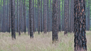
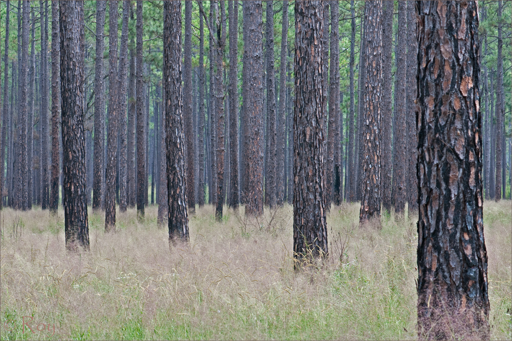
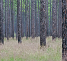
Longleaf pines and wiregrass dominate the landscape of southeast Georgia. Pines can grow quickly on clear-cut land, without competition for resources from other trees, especially hardwoods.
Photograph by Roy Cohutta
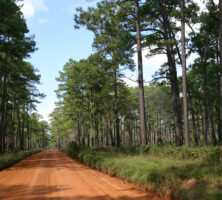
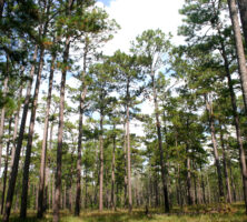
A stand of old-growth longleaf pines lines a road on Greenwood Plantation in Thomas County. Although longleaf pines covered more than 4 million acres in Georgia early in the twentieth century, by 1997 the acreage in the state was estimated to be 376,400.
Photograph by Julius F. Ariail Jr.
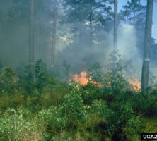
Longleaf pines, the dominant species in a fire-dependent ecosystem, rely on seasonal fires to clear away understory species, including wiregrass, that prevent the pine seeds from germinating. Today such fires are carefully managed by foresters in their efforts to recover and conserve the longleaf ecosystem.
Photograph by USDA Forest Service Archives, USDA Forest Service. Courtesy of Forestry Images
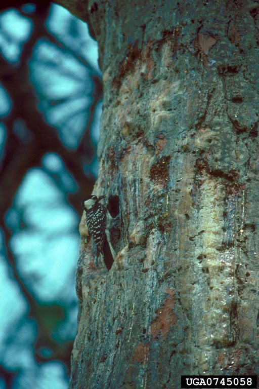
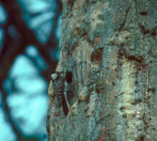
The red-cockaded woodpecker (Picoides borealis) is one of many species endangered by the destruction of the longleaf pine-grassland ecosystem. The only woodpecker species to make cavities in living pine trees, the red-cockaded woodpecker prefers to make its home in longleaf pines. Its cavities are later inhabited by other species in the longleaf forest, including other birds, squirrels, insects, and reptiles.
Photograph by Erich G. Vallery, USDA Forest Service. Courtesy of Forestry Images
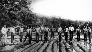
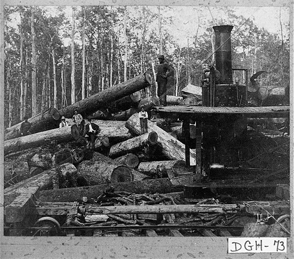
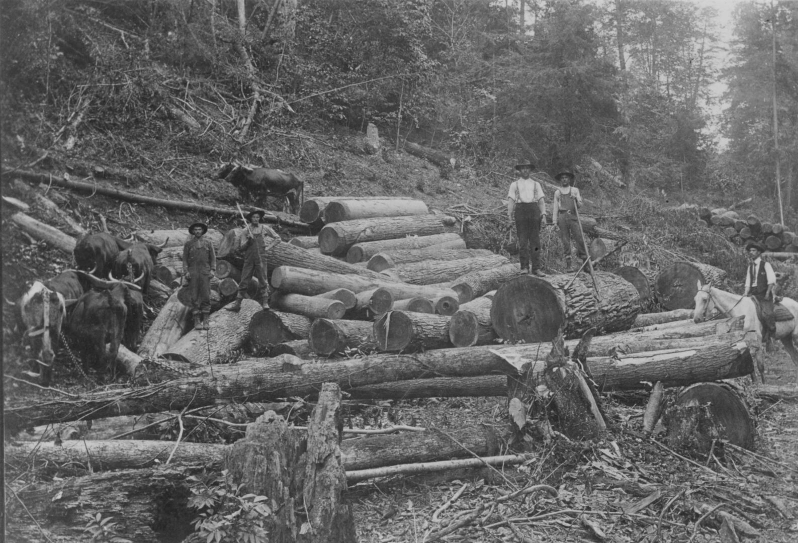
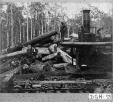
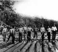
Employees of the Red Cypress Lumber Company harvest logs in Dougherty County, circa 1905. The timber and naval stores industries, both important economic activities in Georgia during the nineteenth and twentieth centuries, were reliant on the longleaf pines in the state's Upper Coastal Plain.
Courtesy of Georgia Archives, Vanishing Georgia, #
dgh073.
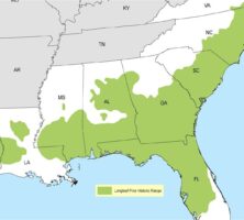
The native range of the endangered longleaf pine and grassland forest ecosystem once covered approximately 90 million acres, from southern Virginia to east Texas. In 1936 around 4 million acres were found in Georgia, reduced to 376,400 acres by 1997.
Image by U.S. Fish and Wildlife Service
Saltpeter, or potassium nitrate, was mined from caves during the eighteenth and nineteenth centuries and used to make gunpowder. Several caves in Georgia, including the Kingston Saltpeter Cave in Bartow County, were excavated for the substance during both the Revolutionary War and the Civil War.
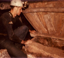
A caver investigates the remains of a wooden vat used to hold the soil excavated during the process of mining saltpeter, or potassium nitrate. Water added to the soil leached out the nitrates and collected in troughs at the base of the vat.
Courtesy of Joel M. Sneed
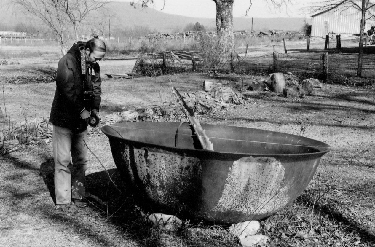
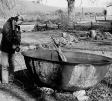
A kettle formerly used in saltpeter operations was removed from a north Georgia cave and put into use on a local farm. Kettles were used to boil water containing potassium nitrate, or saltpeter, in order to extract the substance for use in the production of gunpowder.
Courtesy of Joel M. Sneed
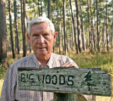
Leon Neel stands at the entrance to the Big Woods of Greenwood Plantation in Thomas County. Neel spent his career promoting the ecological management of the longleaf pine forests in Georgia and Florida.
Photograph by Julius F. Ariail Jr.
A stand of longleaf pines grows at the Greenwood Plantation in Thomas County. The longleaf pine ecosystem is naturally managed by fire, and the use of prescribed annual burning, as was promoted by Georgia ecologist Leon Neel, is fundamental to the maintenance of the forest.
Photograph by Julius F. Ariail Jr.
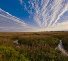
A man-made channel known as the Atlantic Intracoastal Waterway allows watercraft to navigate the marshes separating Georgia's barrier islands from the mainland.
Courtesy of Explore Georgia, Photograph by Ralph Daniel.
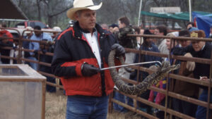
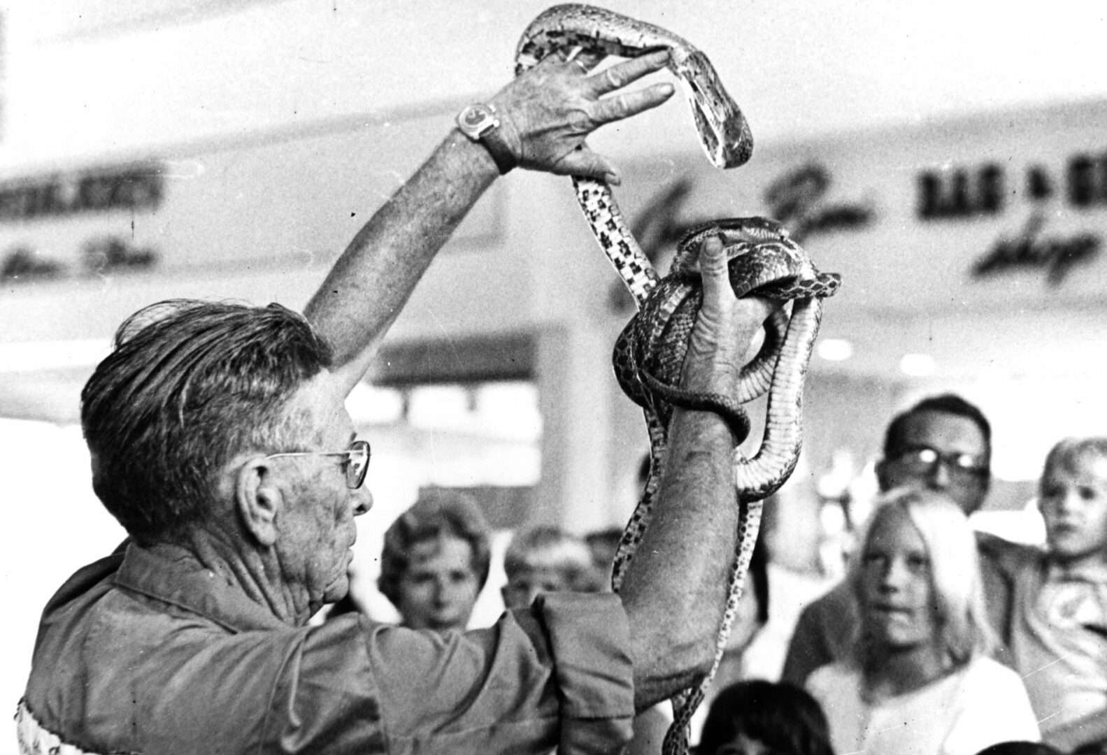
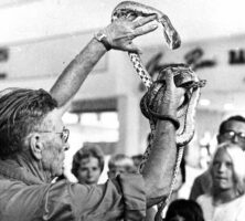
At a Whigham Roundup a rattlesnake is displayed for festivalgoers who want a closer view.
Courtesy of John B. Jensen, Georgia Department of Natural Resources
A rattlesnake is placed in an enclosure following weighing at a Claxton Roundup.
Courtesy of John B. Jensen, Georgia Department of Natural Resources
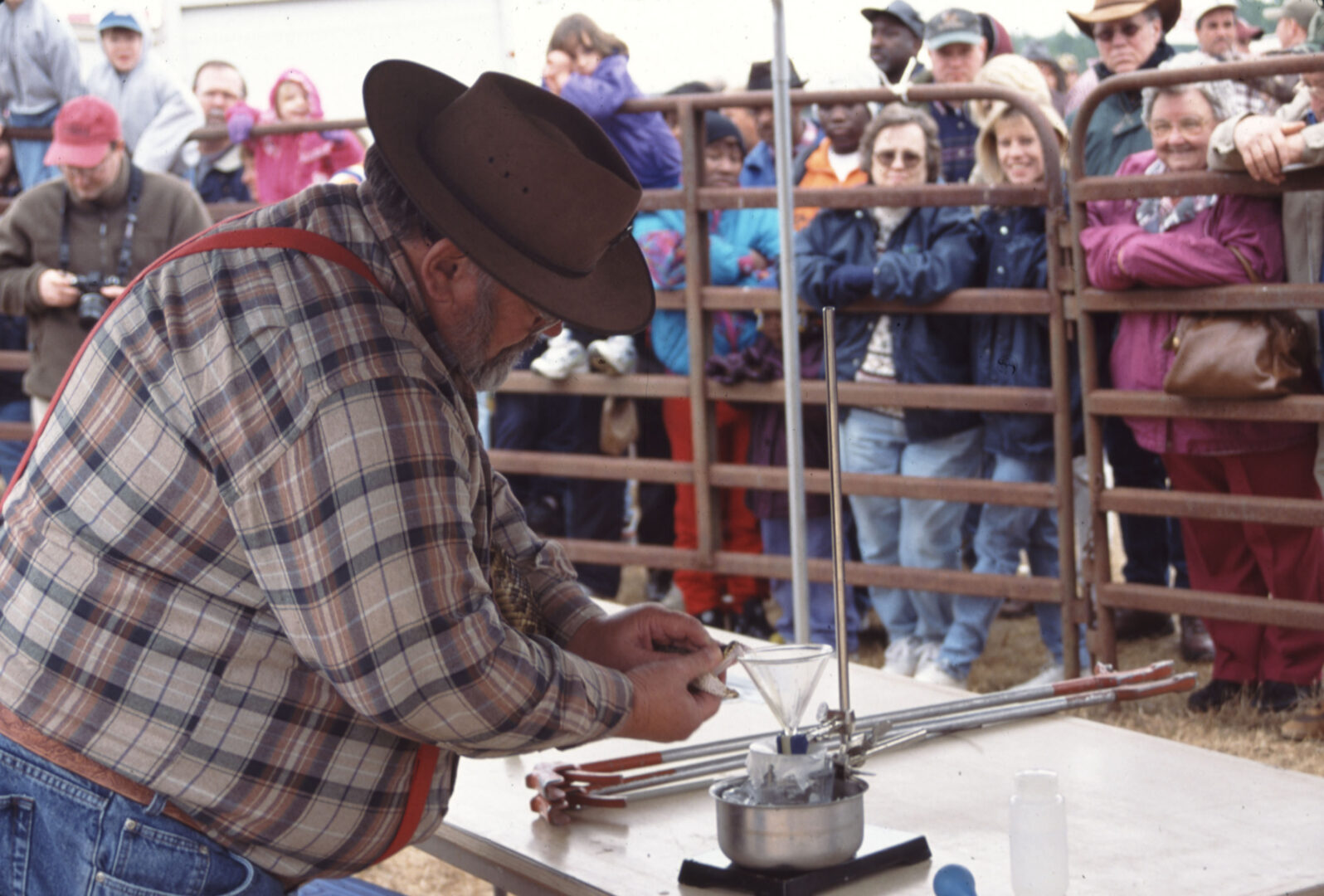
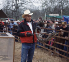
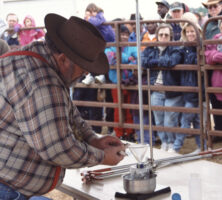
Venom extraction at a Whigham Rattlesnake Roundup.
Courtesy of John B. Jensen, Georgia Department of Natural Resources
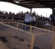
Rattlesnakes contained within enclosures at a Claxton Roundup. Between 300 and 600 snakes are typically collected for the roundups.
Courtesy of John B. Jensen, Georgia Department of Natural Resources
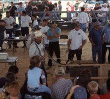
A rattlesnake roundup takes place in Fitzgerald, the seat of Ben Hill County, in 1974. Originally intended to reduce venomous snake populations in the community, Fitzgerald's annual roundup was replaced in 2001 with a wild chicken festival, in part because of public condemnation of the practice.
Courtesy of Georgia Archives, Vanishing Georgia, #
ben331.
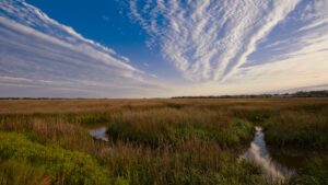
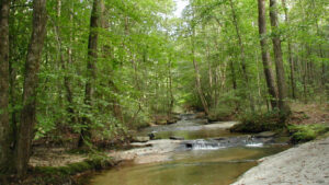
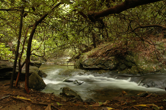
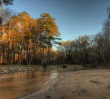
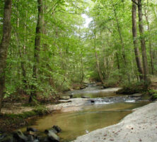
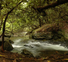
The acquisition of such potential greenspace as this stream corridor helps to connect other greenspaces, preserve animal habitat, and maintain water quality.
Courtesy of Leslie Edwards
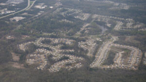
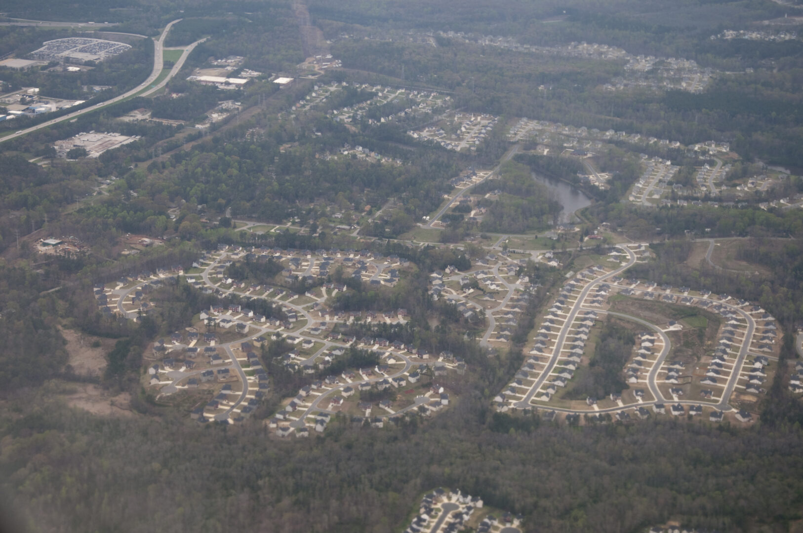
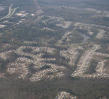
The doubling of Georgia's population has exacerbated pollution problems and fragmented the landscape through urban sprawl. This housing development in the Atlanta metropolitan area illustrates the loss of greenspace over a wide area.
Photograph by Maik
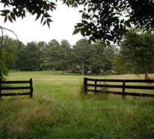
This former pasture, now an example of preserved rural land, provides greenspace in the midst of rapid development.
Courtesy of Leslie Edwards
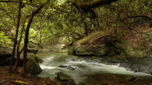
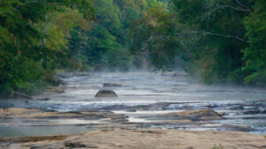
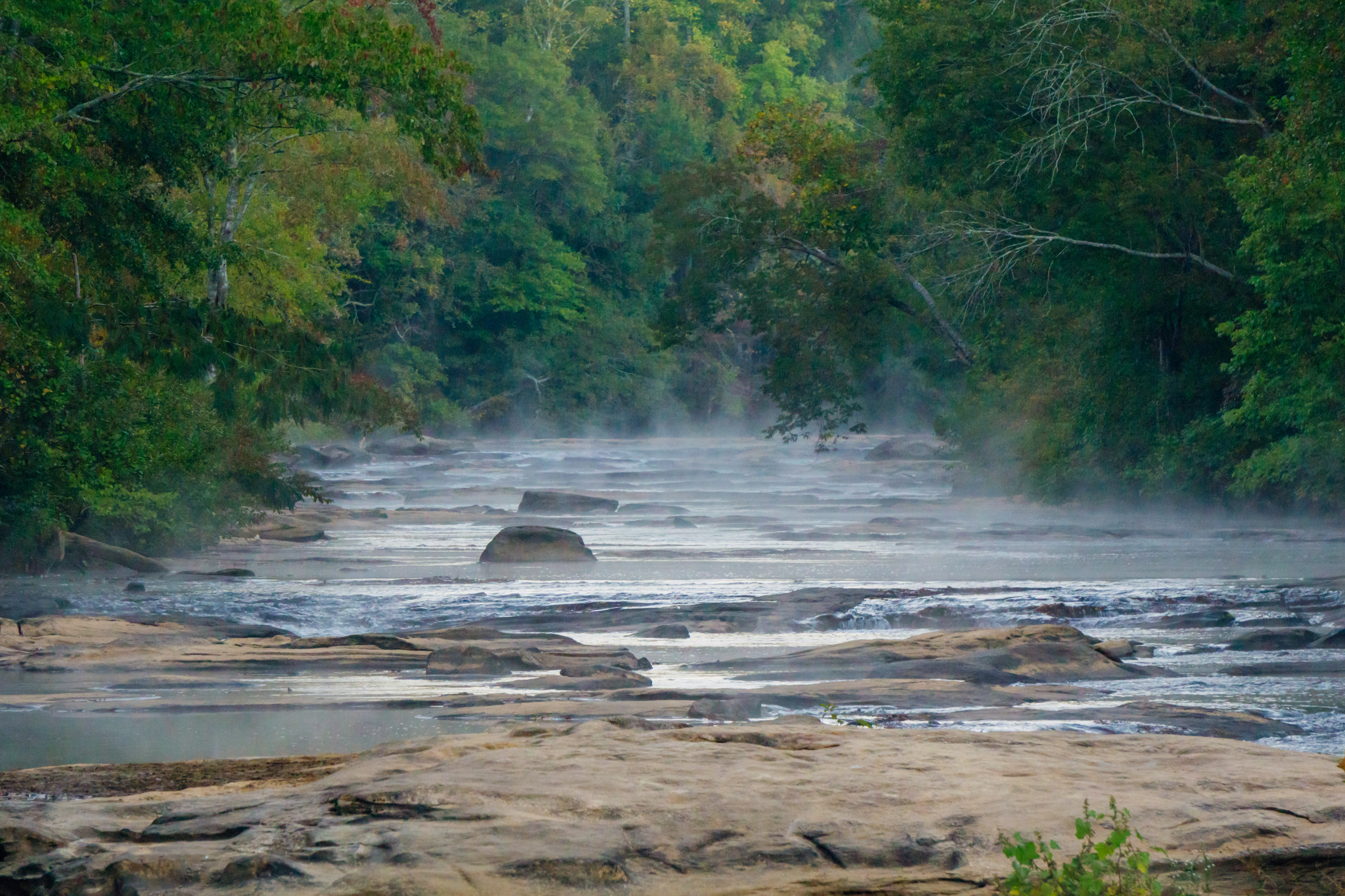
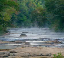
A stream flows through the Chattahoochee National Forest, a large portion of which lies in Gilmer County.
Courtesy of Georgia Department of Economic Development.
Large portions of the Cohutta Wilderness Area lie in the Blue Ridge Mountains of Fannin County. Designated a wilderness area by the federal government in 1976, Cohutta today covers around 40,000 acres in Georgia and Tennessee and is the largest wilderness area east of the Mississippi River.
Courtesy of Georgia Department of Economic Development.
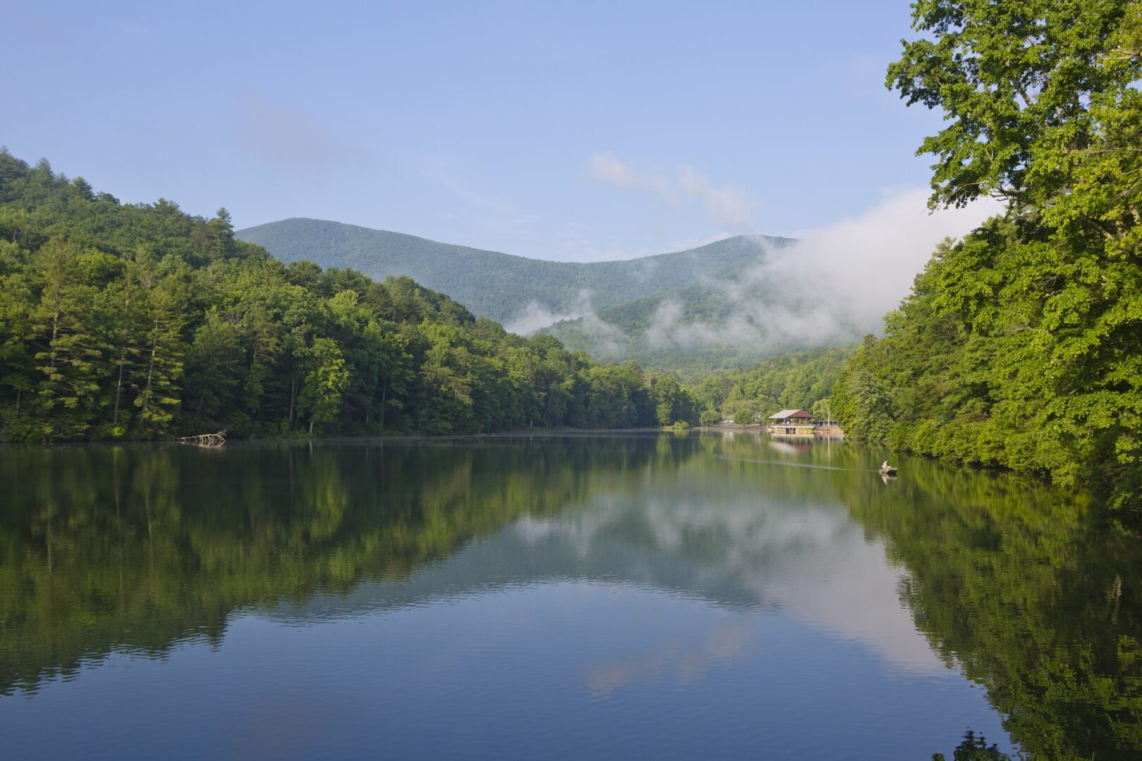
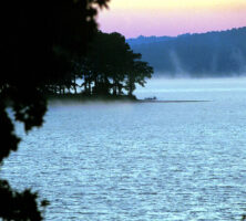
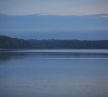
A popular boating destination, West Point Lake in Troup County is formed by an impoundment of the Chattahoochee River. The lake covers 25,900 acres in area and has a shoreline of 525 miles.
Courtesy of U.S. Army Corps of Engineers
Lake Allatoona was created in 1950 by the U.S. Army Corps of Engineers for flood control. At more than 12,000 acres, Allatoona is one of the larger lakes in the state.
Image from Ronnie
Lake Rabun was created in 1915 by the Georgia Power Company. Today, residents enjoy water sports, such as jet-skiing, at the Rabun County lake.
Photograph from Wikimedia Commons
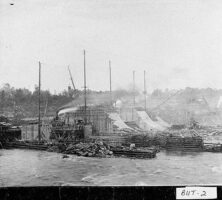
Dam construction, ca. 1909, on the Ocmulgee River near Jackson, in Butts County.
Courtesy of Georgia Archives, Vanishing Georgia, #
but002.
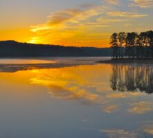
The Georgia Power Company built Lake Oconee in 1979. The area around the lake includes a golf course and a resort.
Courtesy of Explore Georgia, Photograph by Ralph Daniel.
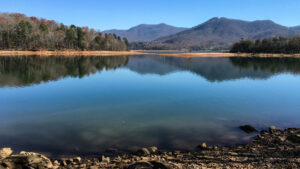
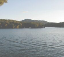
Lake Chatuge, in the north Georgia mountains, was created by the Tennessee Valley Authority during World War II.
Image from Shawn Taylor
Lake Hartwell, named after Revolutionary War hero Nancy Hart, provides drinking water, hydropower, and public entertainment to millions of people each year. The reservoir, which borders Georgia and South Carolina, exists because of Hartwell Dam on the Savannah River.
Courtesy of UGA Archway Partnership
These men are rafting timber down the Oconee River in Laurens County, circa 1890.
Courtesy of Georgia Archives, Vanishing Georgia, #
lau123.
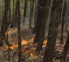
A worker at the Piedmont National Wildlife Refuge, located in Bibb and Twiggs counties, lights a prescibed fire in 2014. Burning the understory encourages the growth of pine trees, which provide habitat for the red cockaded woodpecker. Native Americans living in the Piedmont prior to European arrival also set surface fires to clear land for agriculture. The thick-barked pines survive, but most shrubs and saplings are killed, favoring an open forest with grasses and herbs.
Photograph by U.S. Fish and Wildlife Service Southeast Region
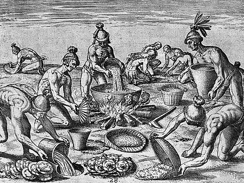
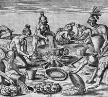
Native Americans in Georgia impacted species distributions. For instance, Yaupon holly leaves were dried and made into a highly caffeinated black tea, which was used for purification purposes. The holly leaves were traded far beyond the plant's native Coastal Plain range.
Engraving by Theodore de Bry after an original painting by Jacques Le Moyne de Morgues
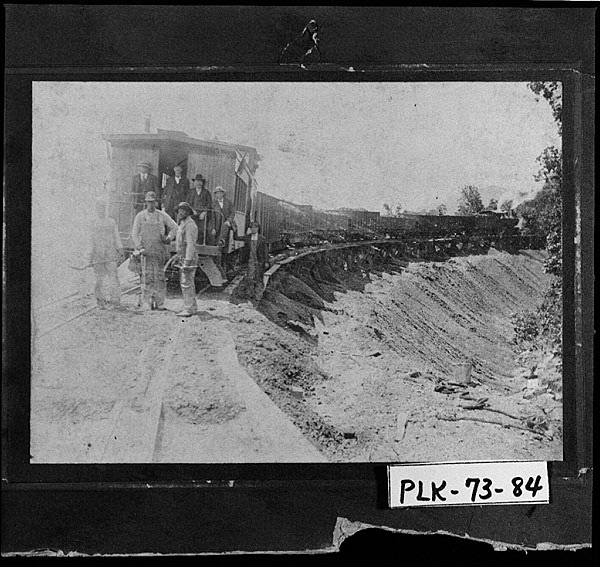
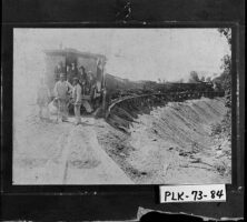
The East and West Railroad, built between Cartersville and Cedartown around 1900, is one of several railroads that came to Polk County in the late nineteenth and early twentieth centuries.
Courtesy of Georgia Archives, Vanishing Georgia, #
plk073-84.
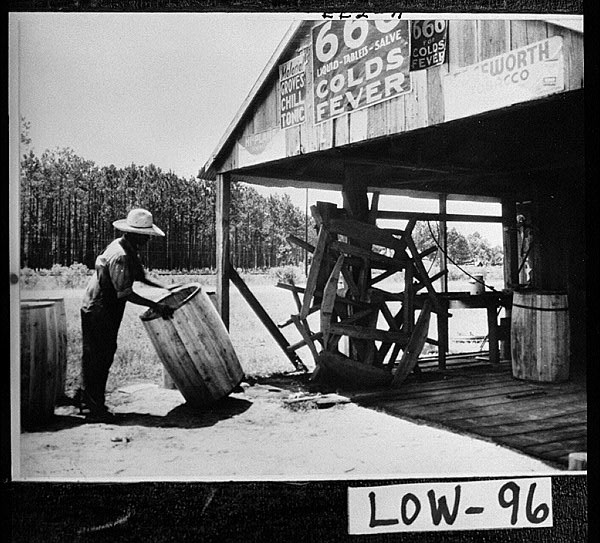
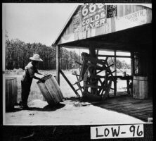
Anthony Head, a worker in a Lowndes County turpentine still, makes barrels for holding rosin, circa 1900. The naval stores industry formed an important part of the economy in wiregrass Georgia, of which Lowndes County is a part, in the early twentieth century.
Courtesy of Georgia Archives, Vanishing Georgia, #
low096.
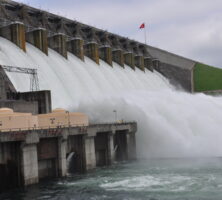
Construction on Hartwell Dam began in 1955 and concluded in 1963. The dam diverts the Savannah River and some of its tributaries into Lake Hartwell, which, with nearly 1,000 miles of shoreline, is one of the largest man-made bodies of water east of the Mississippi River.
Photograph by U.S Army Corps of Engineers Savannah District
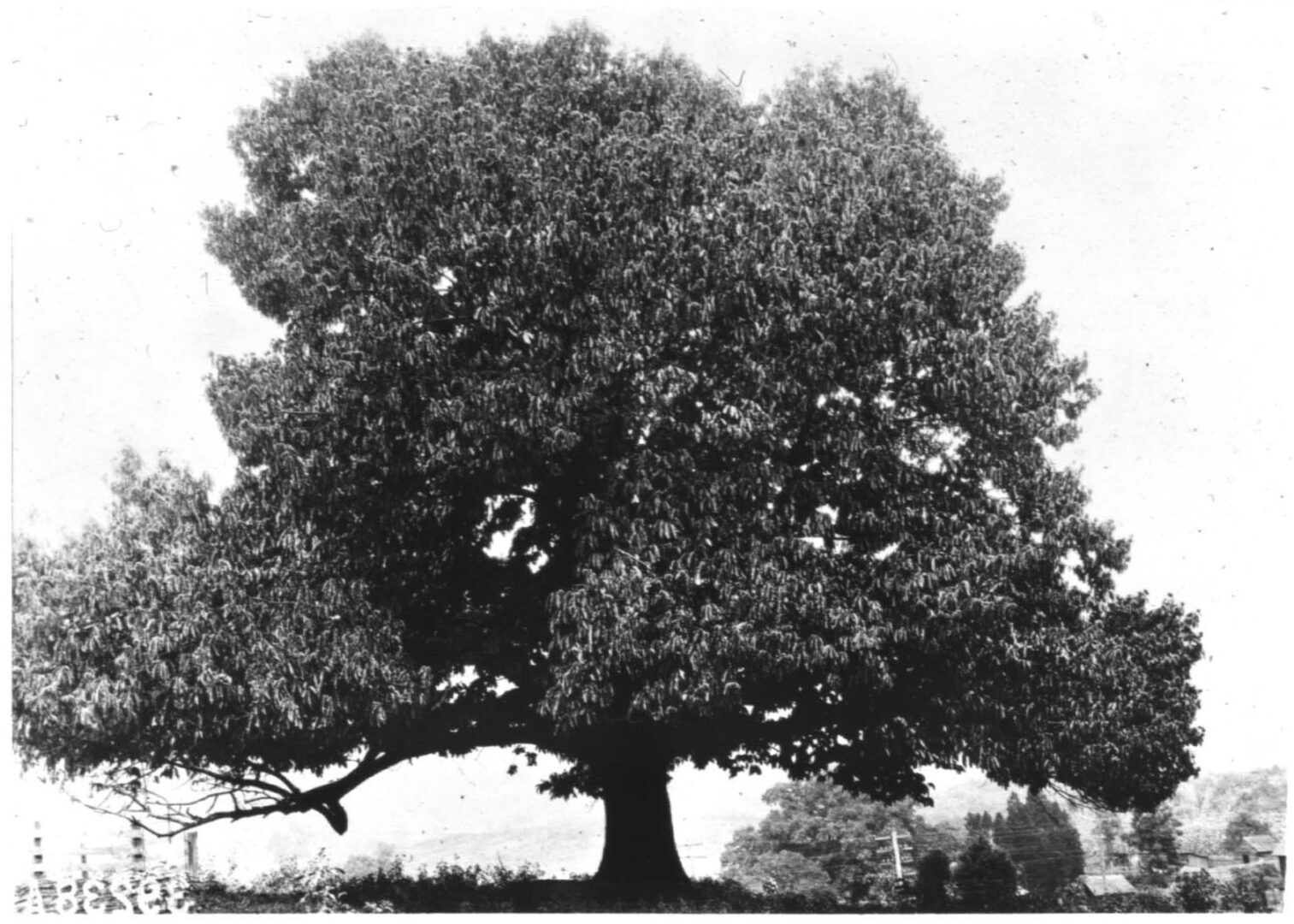
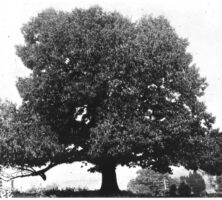
Vintage photo of an American chestnut tree, taken in the early twentieth century.
Courtesy of The American Chestnut Foundation
Despite the fact that Georgia receives an average of fifty inches of rain annually, demands placed on the state's water resources have increased greatly during the last thirty years, making water a major environmental concern.
Photograph by Bradley Huchteman
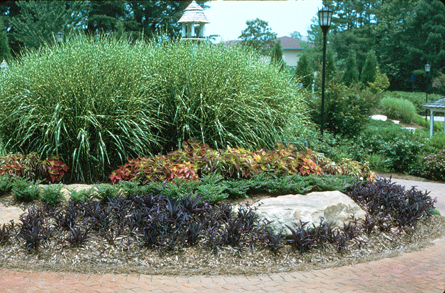
Appropriate maintenance is critical once the other six water-saving steps of Xeriscape gardening are in place.
Photograph by Gary L. Wade
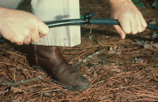
Efficient irrigation is one of the seven steps involved in Xeriscape gardening, a method of gardening used primarily in urban areas to conserve water while maintaining lawns and plants. Drip irrigation and hand watering help target irrigation to plants that need it.
Photograph by Gary L. Wade
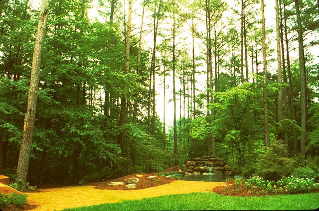
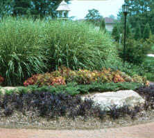
Proper planning and design are important, both for designing a new landscape and for adding to an existing landscape. When possible, incorporate existing native vegetation, including trees, into the landscape.
Photograph by Gary L. Wade
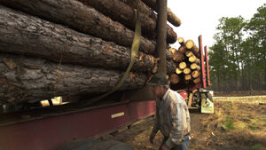
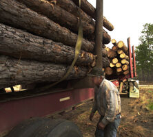
The logging industry thrives in Georgia in the twenty-first century.
Courtesy of Atlanta Journal-Constitution.
The Laurel Brake on the Tallulah River. Early settlers used draft animals, like the oxen shown here, to haul logs.
Courtesy of Mars Hill College, Appalachian Room Archives, Gennett Collection.
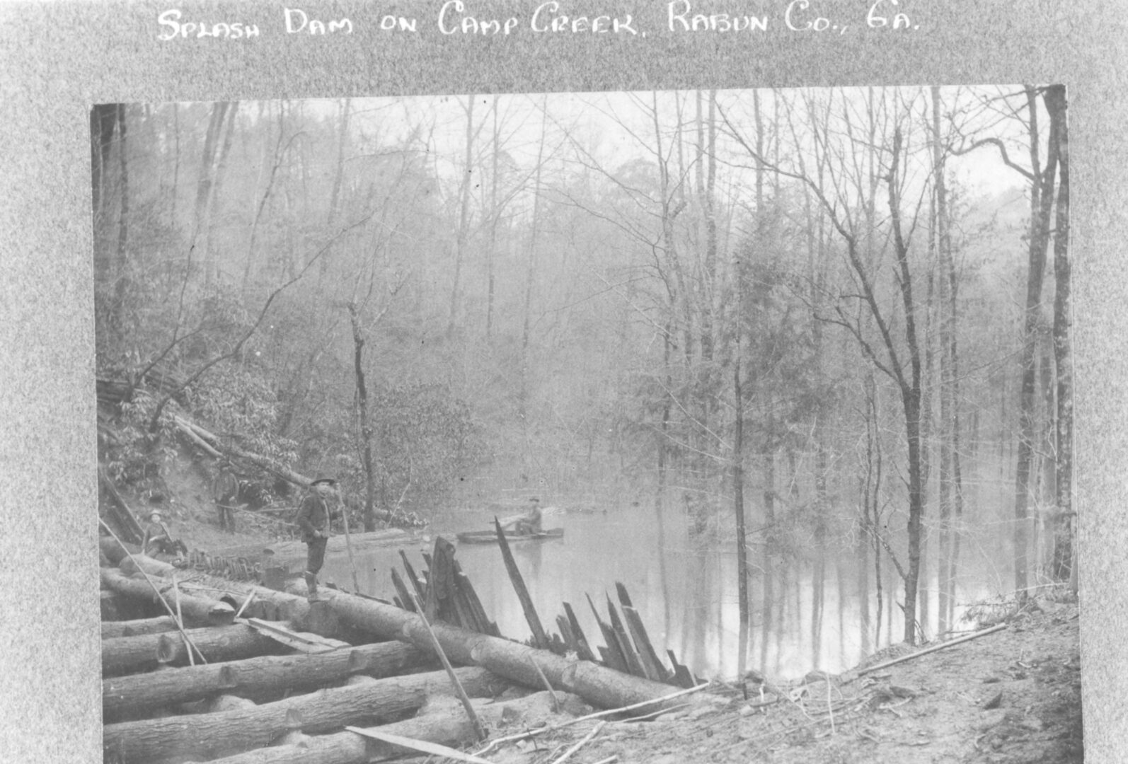
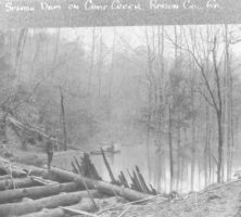
A splash dam built by the Gennett Lumber Company on Camp Creek, in Rabun County. Splash dams are log structures that raise the water level enough to back up a large quantity of cut timber.
Courtesy of Mars Hill College, Appalachian Room Archives, Gennett Collection.
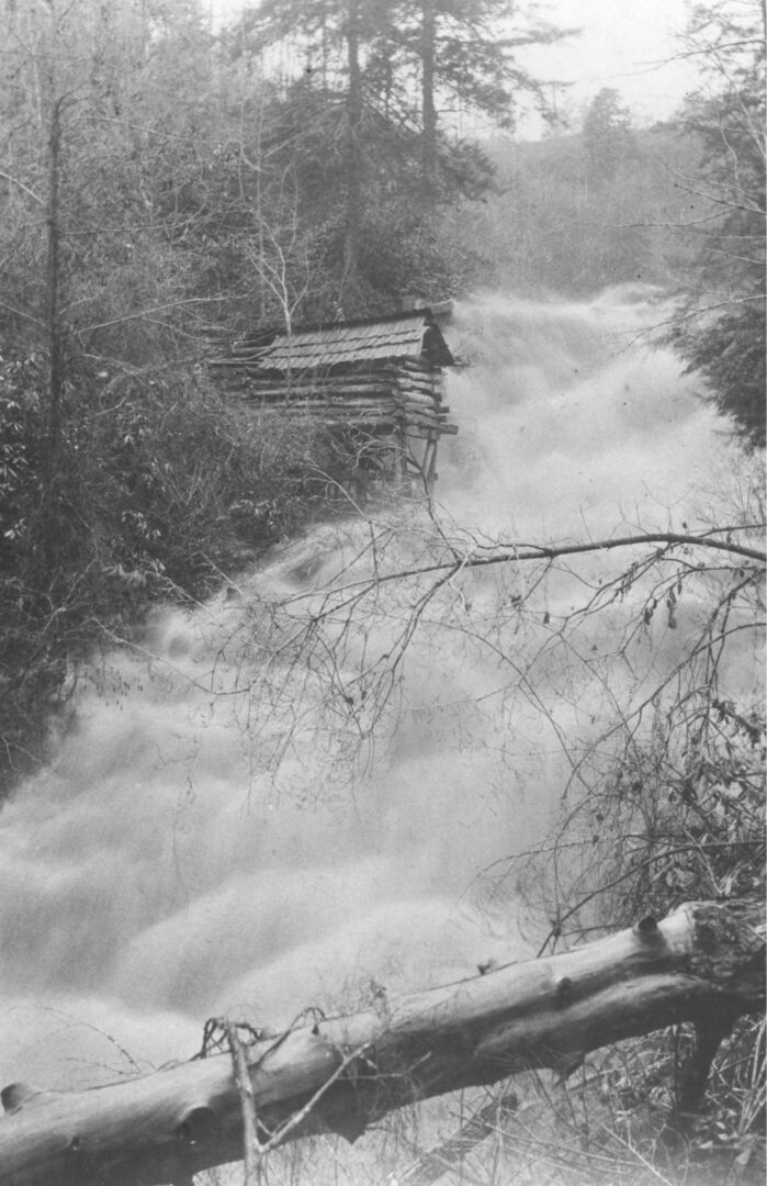
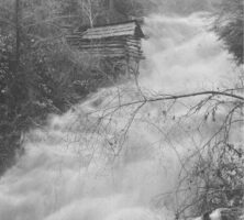
This splash dam on Camp Creek releases its power and quickly moves harvested timber downstream.
Courtesy of Mars Hill College, Appalachian Room Archives, Gennett Collection.
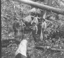
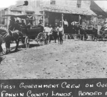
The first government crew from the U.S. Forest Service to arrive in Fannin County, May 1911. The forest service was created to protect forested land from overharvesting and poor forestry practices.
Courtesy of Mars Hill College, Appalachian Room Archives, Gennett Collection.
The Chattahoochee National Forest was established in 1937 by the U.S. Forest Service. National forest land is protected from development.
Image from JR P
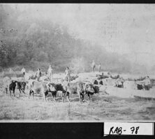
Workers at a logging operation in the Persimmon community in Rabun County, ca. 1907. Teams of oxen are shown hauling logs.
Courtesy of Georgia Archives, Vanishing Georgia, #
rab078.
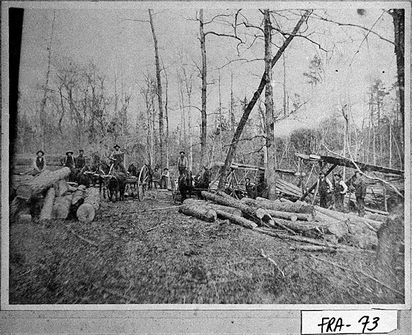
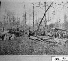
Crew and equipment at a logging camp in Franklin County, ca. 1900.
Courtesy of Georgia Archives, Vanishing Georgia, #fra073.
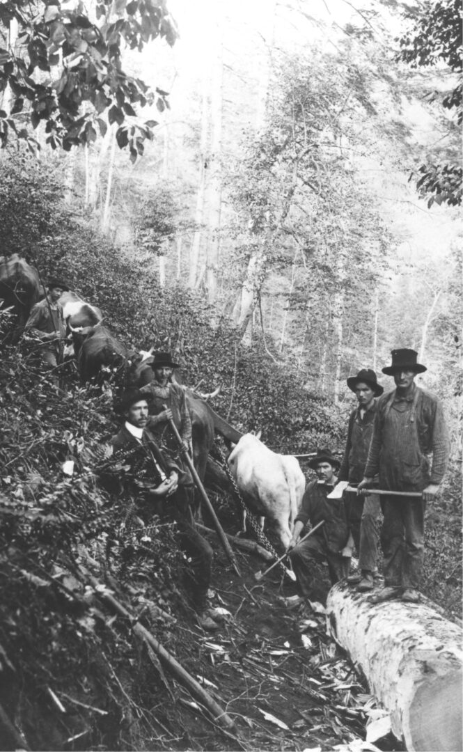
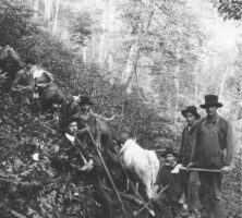
A logging crew with a team of oxen, working on the Cliff Creek in Rabun County.
Courtesy of Mars Hill College, Appalachian Room Archives, Gennett Collection.
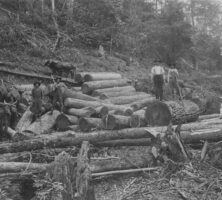
A logging crew with some oxen, working on Camp Creek in Rabun County.
Courtesy of Mars Hill College, Appalachian Room Archives, Gennett Collection.
A splash dam on Camp Creek in Rabun County, built by the Gennett Lumber Company.
Courtesy of Mars Hill College, Appalachian Room Archives, Gennett Collection.
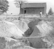
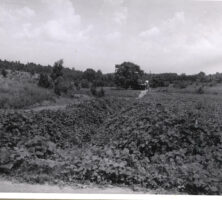
Pioneer agriculture and sharecropping in the nineteenth and twentieth centuries led to the massive erosion of topsoil across nearly 10 million acres of Georgia's farmland, resulting in loss of productivity in the soil and silting in the state's streams and creeks.
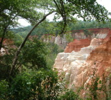
The unconsolidated sandstone bluffs of Providence Canyon in Stewart County were formed during the Cretaceous Period and are among the oldest exposed Coastal Plains rock formations in the state.
Courtesy of Matthew M. Moye
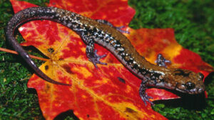
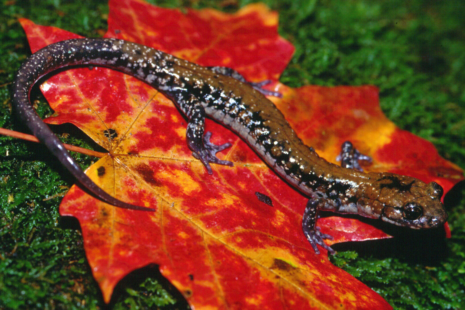
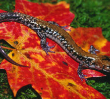
The Pigeon Mountain salamander (Plethodon petraeus) is found only on the eastern slopes of Pigeon Mountain in northwestern Georgia.
Courtesy of Georgia Department of Natural Resources.
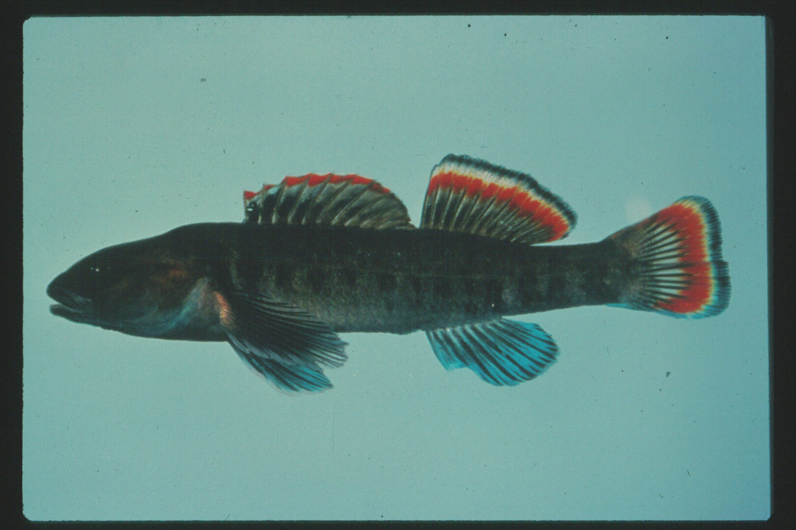
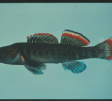
The Etowah darter (Etheostoma etowahae) is a fish restricted to the upper reaches of the Etowah River (Coosa River basin) in Georgia.
Courtesy of Georgia Department of Natural Resources.
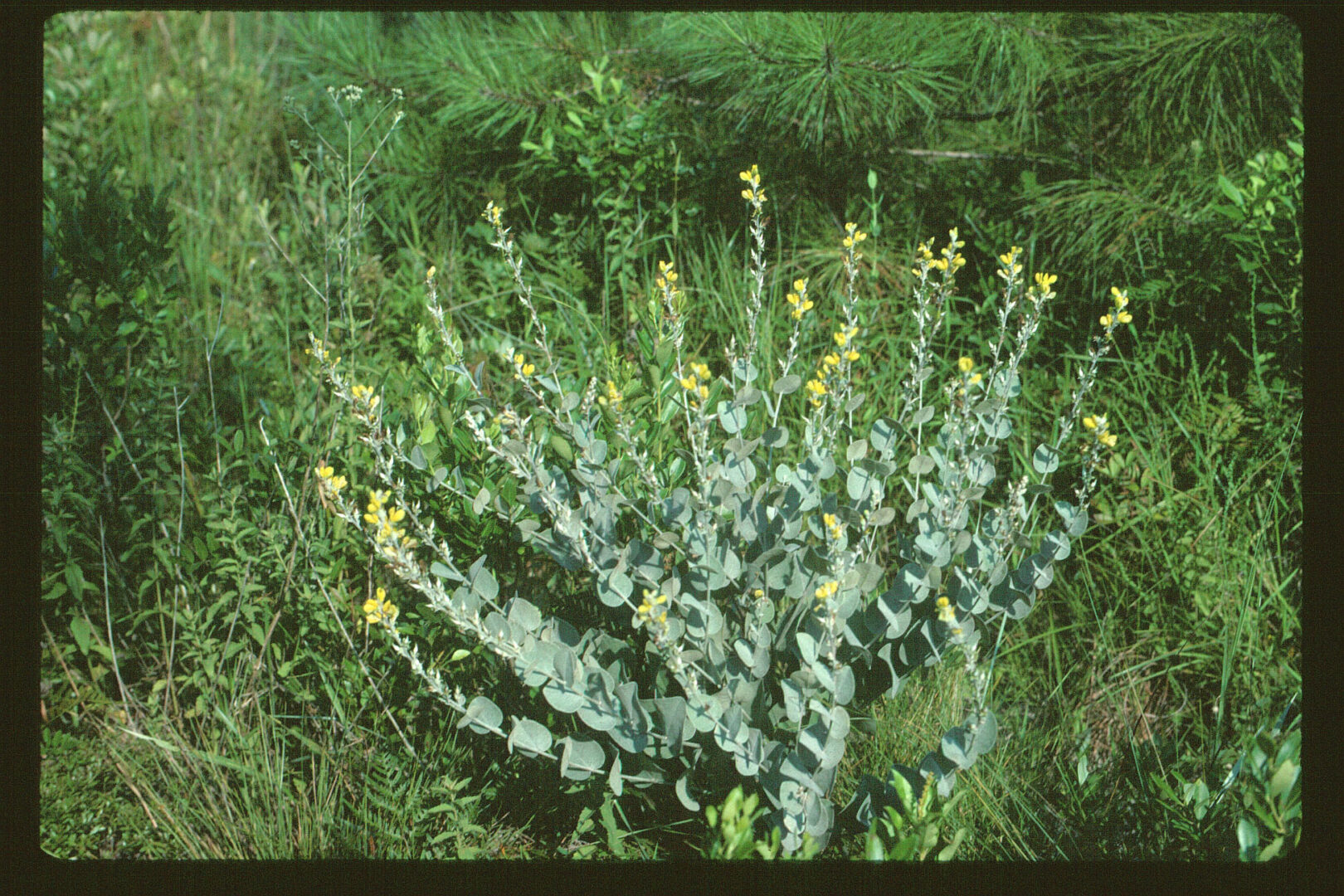
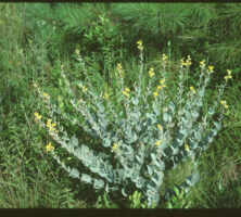
Hairy rattleweed (Baptisia arachnifera) is a perennial legume with heart-shaped leaves clasping the stem. It is greenish-gray and covered with dense, cobwebby hairs. This plant is native to Wayne and Brantley counties, Georgia.
Courtesy of Georgia Department of Natural Resources.
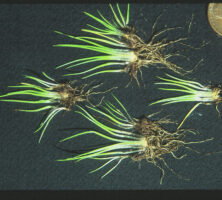
The mat-forming quillwort (Isoetes tegetiformans) is a spore-producing (no flowers) plant found only in a few granite outcrops of the Georgia Piedmont region.
Courtesy of Georgia Department of Natural Resources.
Metropolitan Atlanta has nearly 16,000 miles of roads, the second highest per capita of any other city in the nation. It also has the fifteenth worst traffic congestion in the country and the eighteenth worst year-round particle pollution.
Photograph by Doug Waldron
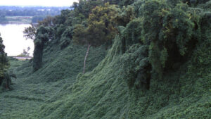
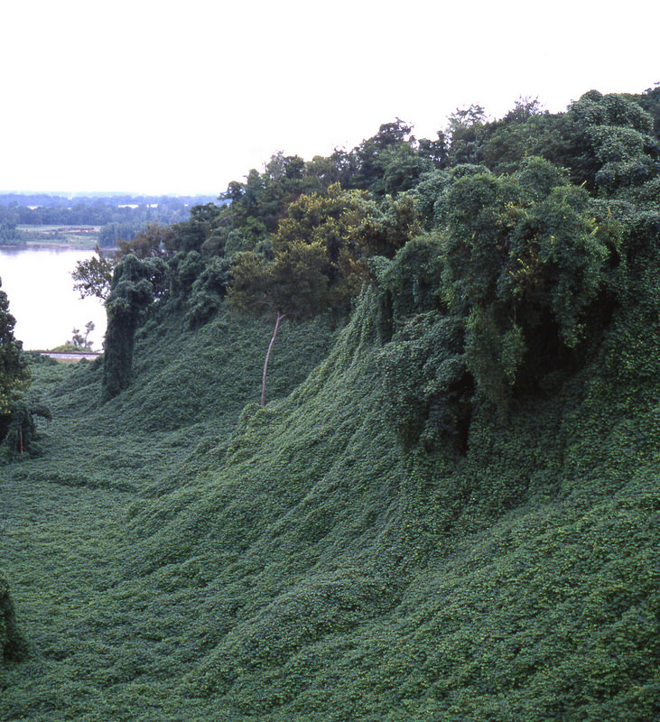
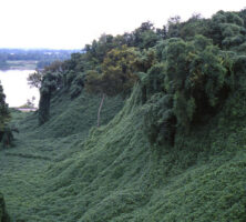
Kudzu (Pueraria lobata; formerly P. Thunbergiana) is a prolific weedy vine and botanical newcomer that has covered millions of acres in Georgia and the Southeast and has made its way into southern folklore and culture
Photograph by NatureServe
Between 1935 and 1942 Soil Conservation Service nurseries grew 100 million kudzu seedlings. They were shipped throughout the Southeast and distributed to farmers, who used the vine on rilled and gullied croplands, and to railroads and highway departments that planted the seedlings along exposed rights-of-way.
Courtesy of Special Collections & Archives, Georgia State University Library, Atlanta Journal-Constitution Photographic Archive, #AJCP554-01b.
Kudzu, an aggressive invasive species, grows upward or outward at the rate of 60 to 100 feet per season. It engulfs and smothers trees and establishes dense mats along the sunny sides of roads.
Photograph by Chris Dilworth
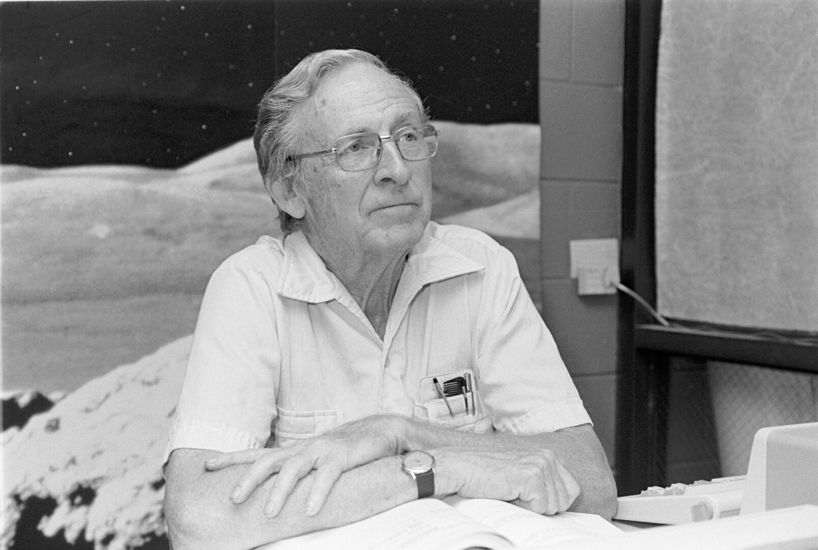
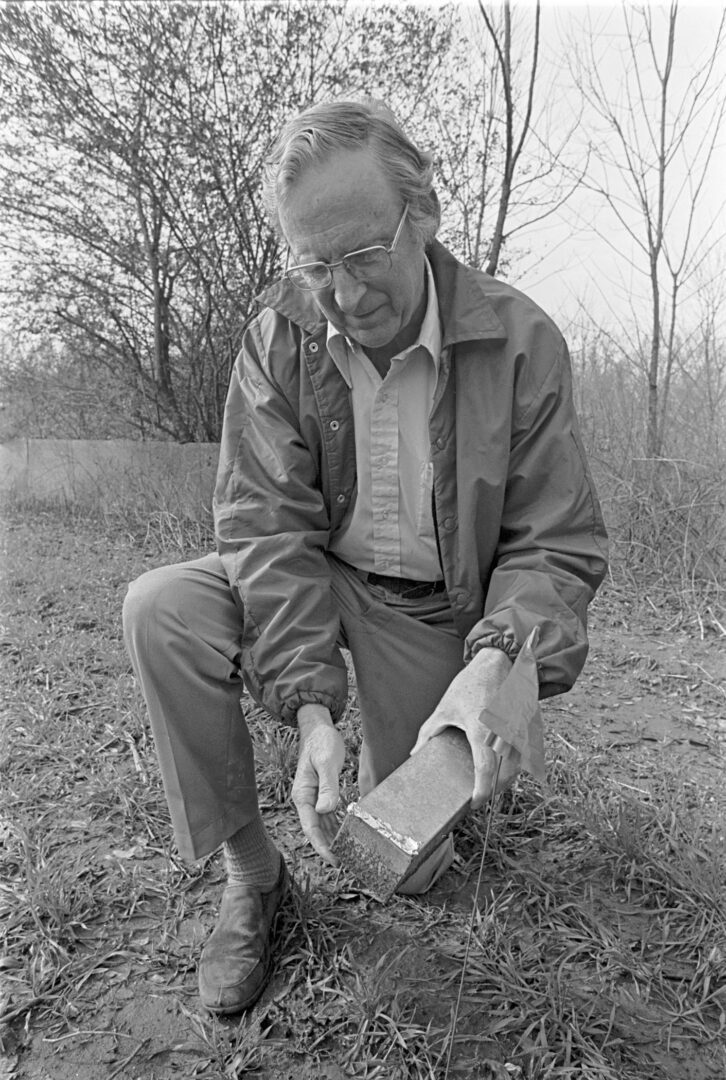
In 1964, as president of the Ecological Society of America, Odum announced in the journal BioScience the establishment of a "new ecology," a "systems ecology" that dealt with the world as a whole, bringing all of the ecosystem sciences together.
Courtesy of University of Georgia Photographic Services
Odum was instrumental in the founding of the University of Georgia's Savannah River Ecology Laboratory, University of Georgia Marine Institute on Sapelo Island, and the Institute of Ecology, which was later renamed in his honor.
Courtesy of University of Georgia Photographic Services
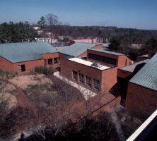
The Eugene P. Odum School of Ecology is the primary academic unit for ecological research and teaching at the University of Georgia.
Courtesy of University of Georgia Photographic Services. Photograph by Paul Efland
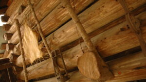
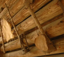
Tools used by nineteenth-century inhabitants of the Okefenokee Swamp.
Courtesy of Georgia Department of Economic Development.
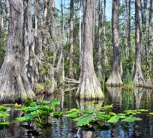
Cypress swamps, winding waterways, and floating peat mats are a major part of the Okefenokee's habitat mosaic.
Image from Timothy J
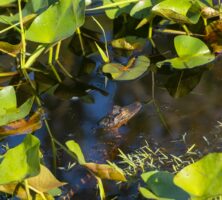
The swamp's distinctive ecosystem is the subject of legends, tall tales, and personal experience narratives about bears, alligators, and encounters with the natural world.
Courtesy of Explore Georgia, Photograph by Geoff L. Johnson.
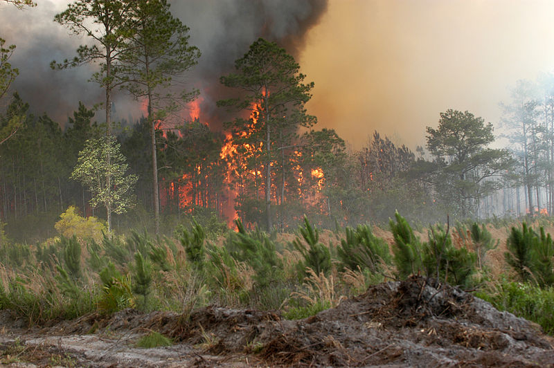
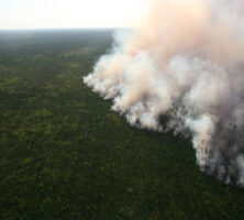
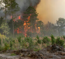
The Honey Prairie Fire, a massive wildfire in the Okefenokee Swamp, is pictured on April 30, 2011, two days after a lightning strike in the swamp ignited the blaze. The fire burned more than 300,000 acres in the swamp over the next three months.
Courtesy of U.S. Fish and Wildlife Service
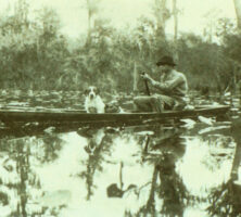
Traditional poled boats, suited to maneuvering in tight water, were used in the days of alligator hunting and frog gigging. The swamp is now a federal wildlife refuge.
Courtesy of Zach S. Henderson Library, Georgia Southern University, Delma E. Presley Collection of South Georgia History and Culture.
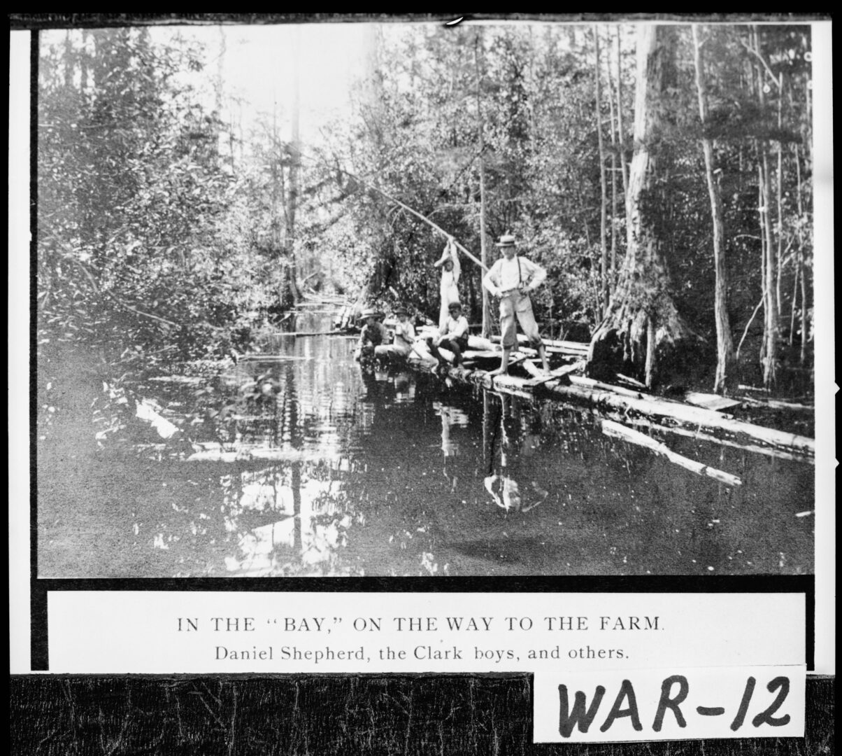
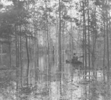
Several local farmers travel through the Okefenokee Swamp in Ware County, circa 1900. At more than 700 square miles, the Okefenokee is the largest swamp in North America.
Courtesy of Georgia Archives, Vanishing Georgia, #
war012.
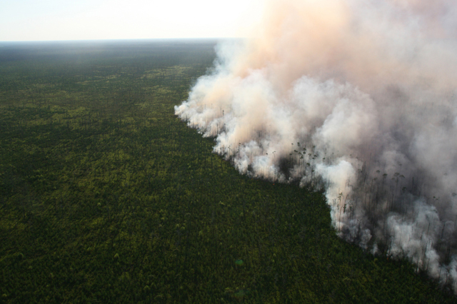
In 2007 lightning strikes caused the largest wildfire in Georgia's history, which burned more than 564,000 acres. Known as the Bugaboo Scrub Fire or the Georgia Bay Complex Fire, it took almost two months to put out.
Photograph from FEMA


