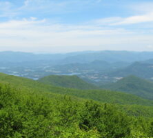
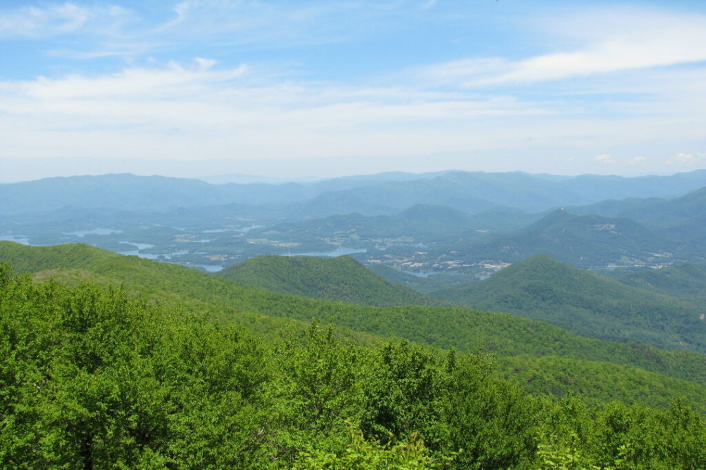
The Blue Ridge Mountains in northeast Georgia make up the state’s highest mountain range. The range of rugged ridges and rounded, weathered peaks varies in elevation from 1,600 to 4,700 feet and harbors spectacular mountain scenery, as well as some of the world’s richest biological diversity. In addition, the range contains Georgia’s wettest areas, with higher elevations getting more than eighty inches of rain annually on average.
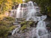
Photograph by Vicki's Nature
The Blue Ridge, so named because its peaks and ridges often appear wrapped in a soft blue haze, consists of a nearly unbroken chain of mountains stretching from Virginia and North Carolina and extending nearly 100 miles into Georgia. It makes up the southernmost part of the Appalachian mountain chain, a vast complex of ranges that extends from north Georgia through New England.
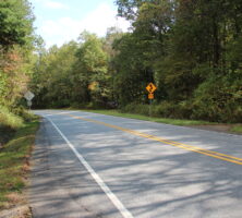
Northwest Georgia consists of several smaller ranges—the Cohuttas, the Unakas, and the Cumberland Plateau. They are separated from the Blue Ridge by geologic formations known as the Hightower-Jasper Ridges and the McCaysville Basin in north central Georgia, along a boundary roughly marked by Georgia Highway 5. The Blue Ridge’s southern boundary is along the Brevard Fault, at an elevation of 1,700 feet, where the Piedmont province begins. The Blue Ridge occupies all or portions of eleven counties in Georgia: Dawson, Fannin, Gilmer, Habersham, Lumpkin, Pickens, Rabun, Stephens, Towns, Union, and White.
The Blue Ridge Mountains’ crest, for much of its length, forms the drainage dividing line known as the Eastern Continental Divide, which separates rivers flowing eastward into the Atlantic Ocean from those flowing westward to the Gulf of Mexico. For instance, Georgia’s Chattahoochee River basin, whose waters flow into the gulf, rises near the borders of Union and Towns counties. The Etowah River, which also flows to the gulf, rises in Lumpkin County. The headwaters of the Savannah River, which flows to the Atlantic, are the Chattooga River, which rises in the Blue Ridge near the juncture of the Georgia, North Carolina, and South Carolina borders.
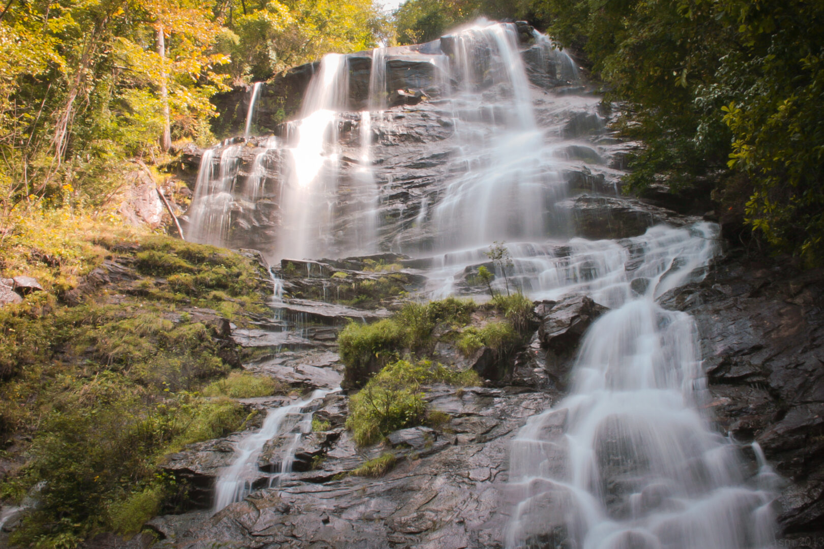
Photograph by Ryan McKee
Natural Resources and Recreational Opportunities
Most of the Blue Ridge Mountains are part of the 750,000-acre Chattahoochee National Forest, managed by the U.S. Forest Service. Within its bounds are Georgia’s highest peaks. The highest, Brasstown Bald (4,784 feet), is partly in Towns County and partly in Union County. Instead of rising to a distinctive peak, Brasstown Bald is unusual in that it is a barely discernible rise in Wolfpen Ridge, which extends for miles to the north and south. Other tall peaks include Rabun Bald (4,694 feet) in Rabun County and Tray Mountain (4,430 feet) in Towns and White counties. The southern terminus of the famed Appalachian Trail is on Springer Mountain (3,782 feet) in Gilmer County; Blood Mountain (4,461 feet) in Union County is the highest peak on Georgia’s portion of the trail.
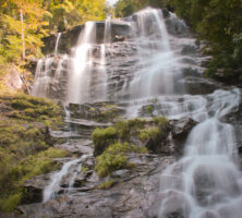
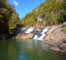
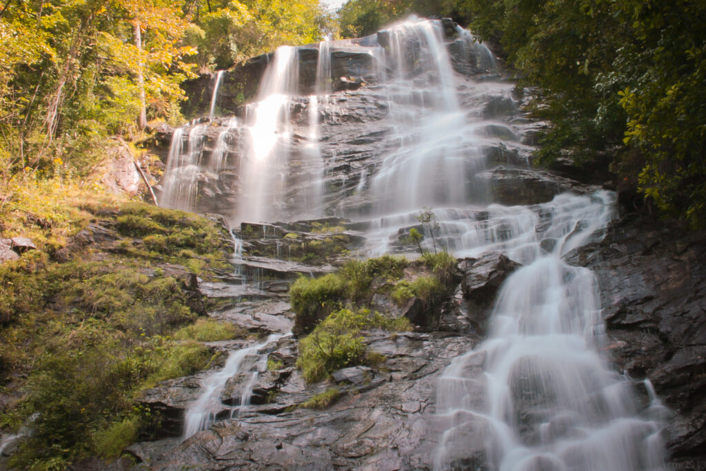
The Blue Ridge also has impressive gorges and canyons, the most notable of which is Tallulah Gorge, which spans the border between Habersham and Rabun counties and is one of the state’s most visited tourist destinations. Spectacular waterfalls include Amicalola (the tallest east of the Mississippi River), Anna Ruby, Hiawassee, and Toccoa. The Chattooga, Toccoa, Tugaloo, and other rivers in the region are popular recreation areas, particularly for whitewater rafters, canoers, and kayakers. These rivers provide the waters for a number of reservoirs, including Lake Burton, Lake Chatuge, and Lake Rabun, that also enhance the recreational opportunities in the area. Two much larger lakes, Lanier and Hartwell, are situated in the foothills just south of the Blue Ridge.
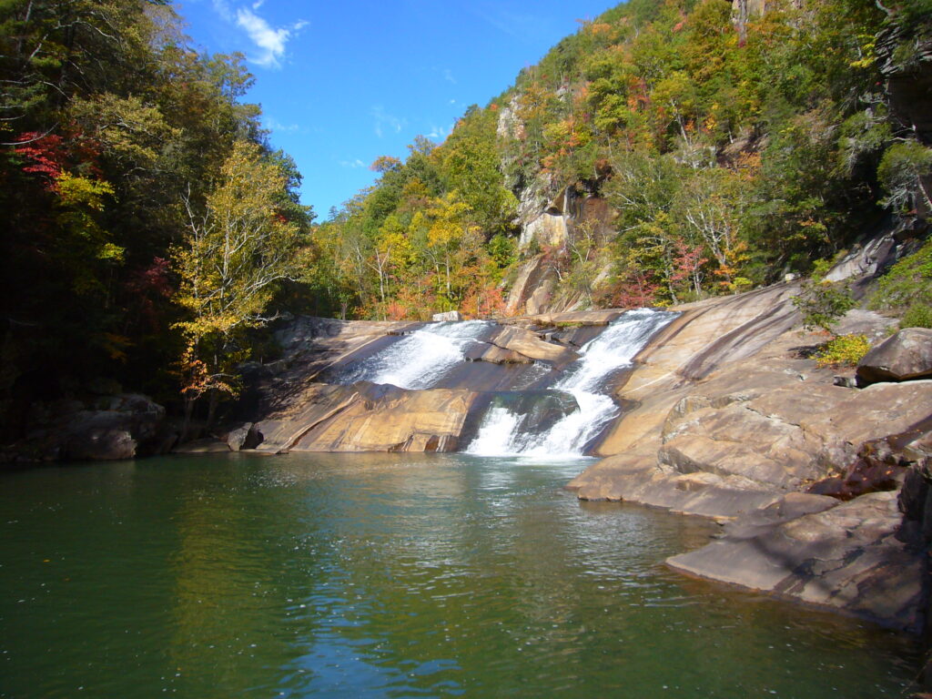
Image from Martin Bravenboer
Some of Georgia’s most-visited state parks are found in the Blue Ridge Mountains, including Amicalola Falls, Black Rock Mountain, Tallulah Gorge, Unicoi, and Vogel. The mountains also are home to most of Georgia’s pristine wilderness areas, including Blood Mountain, Brasstown Bald, Ellicott Rock, Mark Trail, Raven Cliff, and Tray Mountain.
Geology
Georgia’s Blue Ridge Mountains are part of a longer geologic system that forms an almost unbroken wall running down the eastern edge of the Blue Ridge province from Virginia. Rarely more than a few miles wide in Virginia, North Carolina, and South Carolina, the Blue Ridge mountain range turns to the west and widens up to sixty miles in some places within Georgia.
The geology and topography of the Blue Ridge are the results of mountain-building processes that began more than 500 million years ago. The processes include rock folding, faulting, upward thrusting, and a great collision that took place about 300 million years ago between the North American and African continents in a process called plate tectonics. The collision buckled the Earth’s surface and pushed huge masses of rocks westward, causing them to pile up. For the past 100 million years, erosion has carved away much of Georgia’s mountains, leaving only their cores standing. Erosion continues today and is constantly altering the landscape of the Blue Ridge Mountains and the rest of the southern Appalachians. Geologic resources of the Blue Ridge include copper, gold, marble, talc, and other minerals. Gold was mined at Dahlonega in Lumpkin County in the early 1800s; a branch mint there produced gold coins from 1838 to 1861.

Courtesy of Dahlonega Mountain Signal
Natural Resources
Georgia’s Blue Ridge Mountains enjoy one of the world’s most botanically rich mixtures of temperate climate plants, with northern U.S. species mixing with their southern kin. Biologists contend that the Blue Ridge mountain range and its parent chain, the southern Appalachians, have the greatest mixture of temperate climate plants in the world, except for eastern temperate Asia, located at about the same latitude. Forests account for nearly 90 percent of the land cover in the Blue Ridge, a higher percentage than in any other region of the state. Agriculture and other land uses are limited primarily to the flat floodplains of creeks and rivers.
Examples of forest types found in the Blue Ridge include broadleaf deciduous cove forests on moist, cool north-facing slopes; stunted oak forests of ridges; and oak-hickory forests that comprise the bulk of the Appalachian slope forests. Shrub, grass, and heath balds, and hemlock and mixed oak-pine forests also are significant.
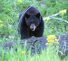
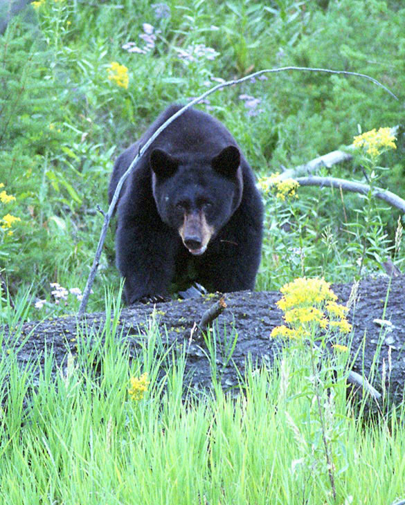
Black bear, grouse, songbirds, turkey, wild boar, whitetail deer, many species of amphibians and reptiles, thousands of species of invertebrates, and a variety of small mammals are found in the Blue Ridge. The area also is generally part of the Appalachian flyway for birds, especially tanagers, thrushes, vireos, and warblers.
Photograph by Terry Spivey, USDA Forest Service
This richness in flora and fauna is presumed to be the result of several factors, including rainfall, climate, and soil types. The common crystalline rock types include gneiss, quartzite, and schist, covered by well-drained, acidic, brownish, loamy soils. Many areas average more than 60 inches of rainfall a year; higher elevations may get as much as 80 inches. Temperatures in mountain valleys average six to eight degrees cooler than the nearby Piedmont in the summer months. At higher elevations the difference can be ten to twelve degrees.
Human History
The Spanish conquistador Hernando de Soto was the first European to travel into the Blue Ridge Mountains, probably visiting the Nacoochee Valley and a site near Carters Lake. Naturalist William Bartram was introduced to the diverse plant life of the southern Appalachians by way of Georgia’s Blue Ridge on a well-chronicled trip he made through the area in 1775.
Bartram found few white settlers in the region, which was populated with Cherokee Indians. The Cherokees, or their predecessors, are believed to have settled in Georgia’s mountains as early as the mid-1400s, and they developed an agricultural society, raising crops of corn, beans, and melons. They also hunted deer and bear, and used many native plants for medicinal purposes. By the end of the eighteenth century, English, German, Scots-Irish, and other European settlers began arriving in Cherokee territory in significant numbers. The Cherokees were friendly at first but fought with settlers when provoked.

Courtesy of Florida State Archives
After gold was discovered in Lumpkin and White counties in the late 1820s, the ensuing gold rush of the 1830s, along with a more general western migration by land-hungry settlers, precipitated the eviction of the Cherokees and their forced migration to Oklahoma on the infamous Trail of Tears in 1838-39. The cooler climate and scenic beauty of the region led to the establishment of antebellum summer resorts in Clarkesville, Cleveland, and Tallulah Falls.
Many Blue Ridge communities, which were relatively removed from the market economy of Georgia’s plantation system and included very few enslaved people, were divided in their loyalties when the state seceded from the Union and the Civil War (1861-65) began. Parts of the region suffered from intense guerrilla warfare as a result of those divisions, as did other parts of southern Appalachia.
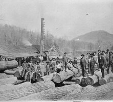
After the Civil War, the copper industry developed along the Tennessee-Georgia border, causing great damage to the forests because of the large amounts of timber needed to fuel copper smelters. Even greater forest damage resulted from the lumber industry that emerged at the end of the nineteenth century. Mountain forests were stripped bare of trees by major logging operations centered near the towns of Dahlonega, Ellijay, and Helen, as well as by numerous smaller sawmills.
Similar devastations of other forests around the nation prompted the creation of a national movement to restore and preserve forests. Georgia’s Blue Ridge mountain lands were some of the first acquired by the U.S. government for this purpose. The Chattahoochee National Forest was established in 1937. Since then, one of the most important benefits of the Chattahoochee forest has been a clean water source for metropolitan Atlanta.
Courtesy of Georgia Archives.
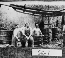
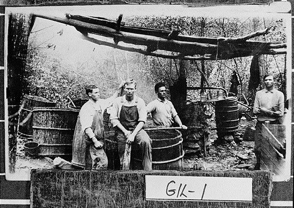
It was also during the late nineteenth century that the production of illegal alcohol—particularly corn whiskey and apple or peach brandy—generated moonshine “wars” throughout the southern mountains. These wars extended well into the twentieth century and were particularly intense in Georgia’s Blue Ridge, where Internal Revenue Service agents, or “revenuers,” did battle with mountain residents who resented and resisted paying federal taxes on this traditional staple of mountain agriculture.
Culture
Georgia’s Blue Ridge Mountains have a rich cultural heritage associated with the southern Appalachians. Out of that heritage came many varieties of folk art and music, including bluegrass. Bluegrass music is a unique sound that features mostly acoustic instruments and combines elements of both traditional Scottish and Irish folk music. Music and other aspects of mountain culture and folklife are celebrated at the Georgia Mountain Fair, held every August since 1950 in Hiawassee.
The Foxfire magazine and books, published by students since the late 1960s, first at Rabun Gap–Nacoochee School and today at Rabun County High School, have chronicled the history, culture, traditions, and daily life in Appalachia and the Blue Ridge Mountains. James Dickey’s novel Deliverance, published in 1970, conveyed a very different, and far more negative, image of the region and its people.