The New Georgia Encyclopedia is supported by funding from A More Perfect Union, a special initiative of the National Endowment for the Humanities.
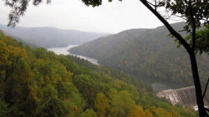
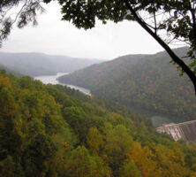
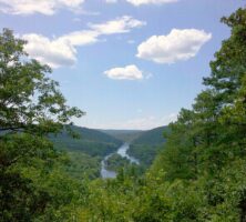
The Tugaloo Dam, located on the Tugaloo River in northeast Georgia, is one of many impoundments that occur within the Savannah River basin. Such dams provide hydroelectric power and water reserves to municipal areas, but they also threaten the health of the watershed's ecosystem.
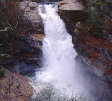
Photograph by Joel Shiver
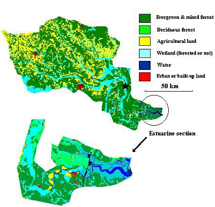
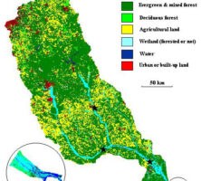
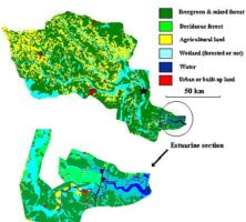
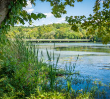
The Ogeechee River is one of five rivers that form a collective river basin in Georgia's Coastal Plain. The tea-colored water of these rivers, which are known as blackwater rivers, is caused by high concentrations of dissolved organic material.
Image from Jet Lowe
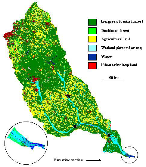
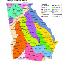
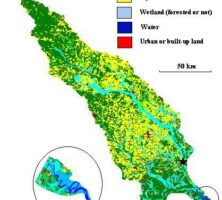
Fourteen river basins, or watersheds, lie within Georgia's borders. The Altamaha, Ocmulgee, Oconee, Ogeechee, Satilla, Savannah, and St. Marys basins drain into the Atlantic Ocean. The Chattahoochee, Coosa, Flint, Ochlockonee, Suwanee, Tallapoosa, and Tennessee basins drain into the Gulf of Mexico.
Courtesy of Georgia Water Coalition
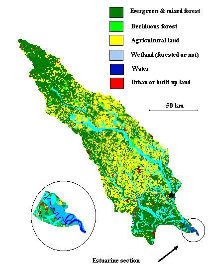
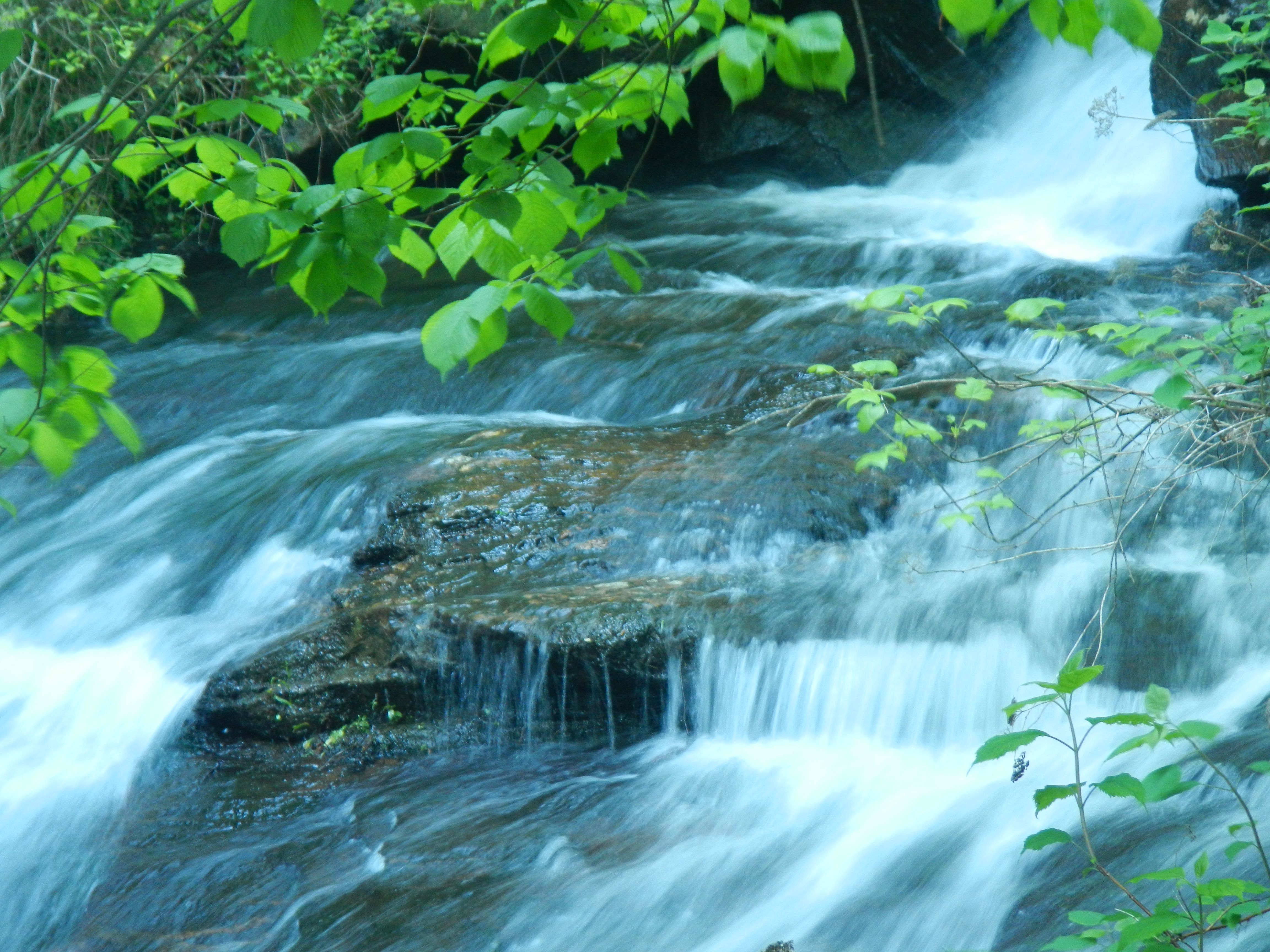
The Ogeechee River, one of only forty-two free-flowing rivers in the United States longer than 200 kilometers, drains from the eastern part of Georgia to the Atlantic Ocean.
Courtesy of Georgia Rivers LMER
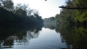
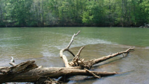
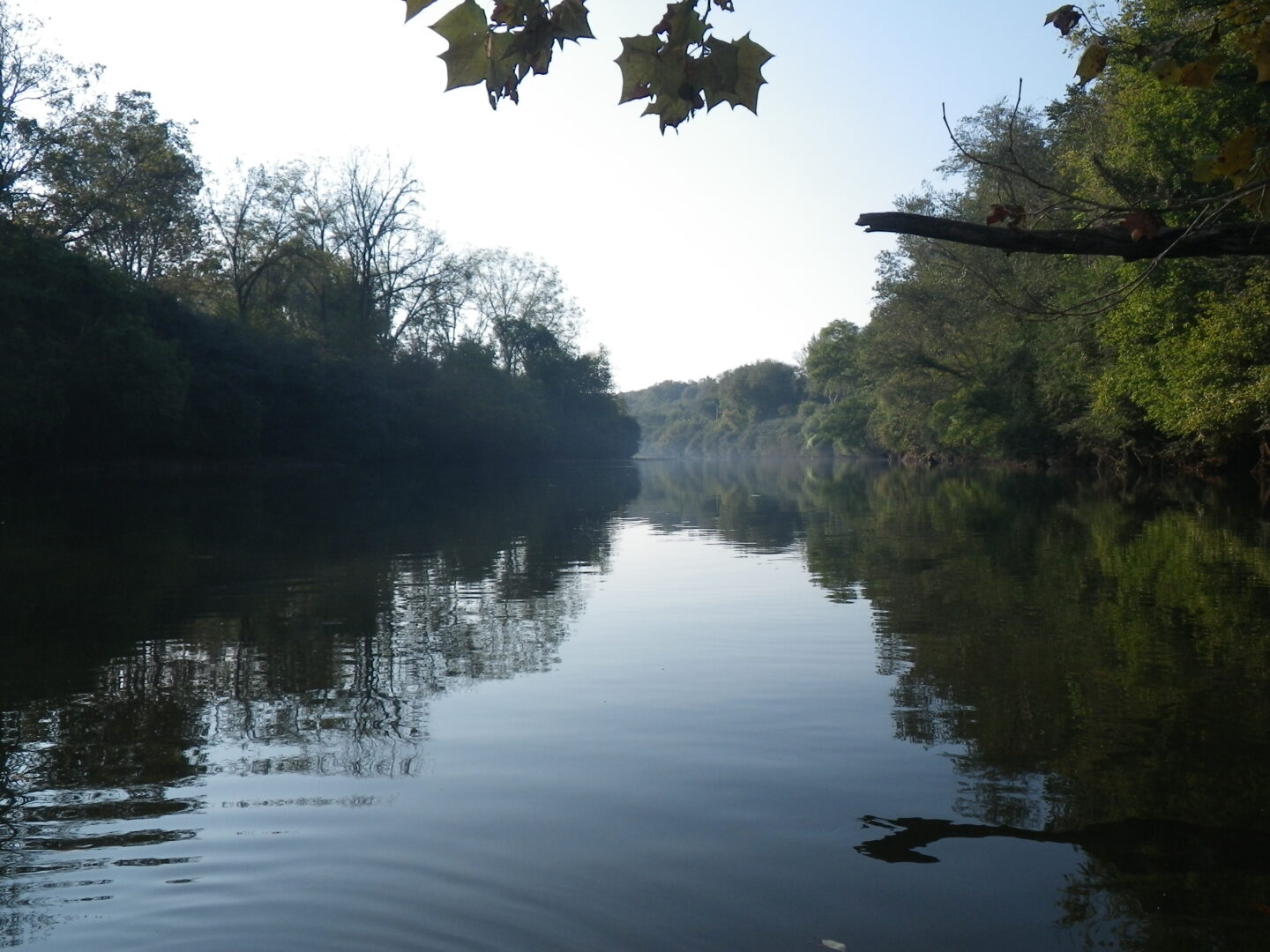
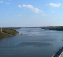
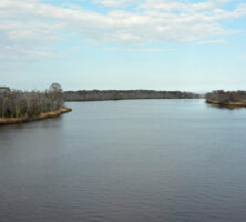
The Savannah River, which forms the boundary between Georgia and South Carolina, begins at Lake Hartwell in northeast Georgia and flows south to Savannah, where it empties into the Atlantic Ocean.
Image from jpellgen (@1179_jp)
The Tallapoosa River (pictured in Elmore County, Alabama) originates in Georgia's Paulding County, west of Atlanta. The river covers 720 square miles in Georgia before entering Alabama, where its remaining 3,960 square miles lie.
Image from cmh2315fl
The Coosa River, formed by the confluence of the Etowah and Oostanaula rivers in Rome, empties into the Gulf of Mexico. The river supports more than 147 species of fish and contains the world's largest diversity of freshwater snails and mussels.
Image from CarolinePope22
The Flint River, which begins in Georgia's Piedmont region, is part of the Apalachicola-Chattahoochee-Flint river basin, which drains portions of Alabama, Florida, and Georgia. It flows to the Chattahoochee River in southwest Georgia.
Photograph from Doug Bradley
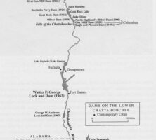
The Chattahoochee River, part of the Apalachicola-Chattahoochee-Flint river basin, is one of the nation's most endangered rivers. In addition to providing habitat for birds, mammals, and reptiles, the river supports six endangered or threatened mussel species. The river begins in the Blue Ridge Mountains and flows to southwest Georgia.
Photograph by Dianne Frost
A popular boating destination, West Point Lake in Troup County is formed by an impoundment of the Chattahoochee River. The lake covers 25,900 acres in area and has a shoreline of 525 miles.
Courtesy of U.S. Army Corps of Engineers
The Oconee River begins in the Appalachian Mountains and joins with the Ocmulgee River to form the Altamaha River in Georgia's Upper Coastal Plain. The cities of Athens, Milledgeville, and Dublin are located along the Oconee.
Courtesy of Explore Georgia, Photograph by Ralph Daniel.
The Altamaha River, formed by the convergence of the Oconee and Ocmulgee rivers, drains into the Atlantic Ocean at Darien. The Altamaha watershed is the largest in Georgia and the third largest in the United States to drain into the Atlantic.
Courtesy of Georgia Rivers LMER
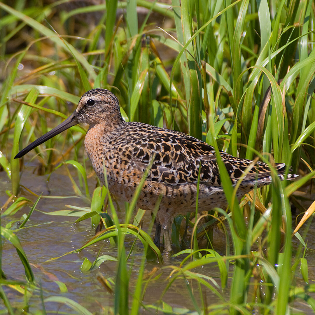
The Altamaha River watershed provides habitat for numerous nesting and migratory birds, as well as for more than 100 rare and endangered aquatic species.
Image from Electronic Collection of Georgia Birds
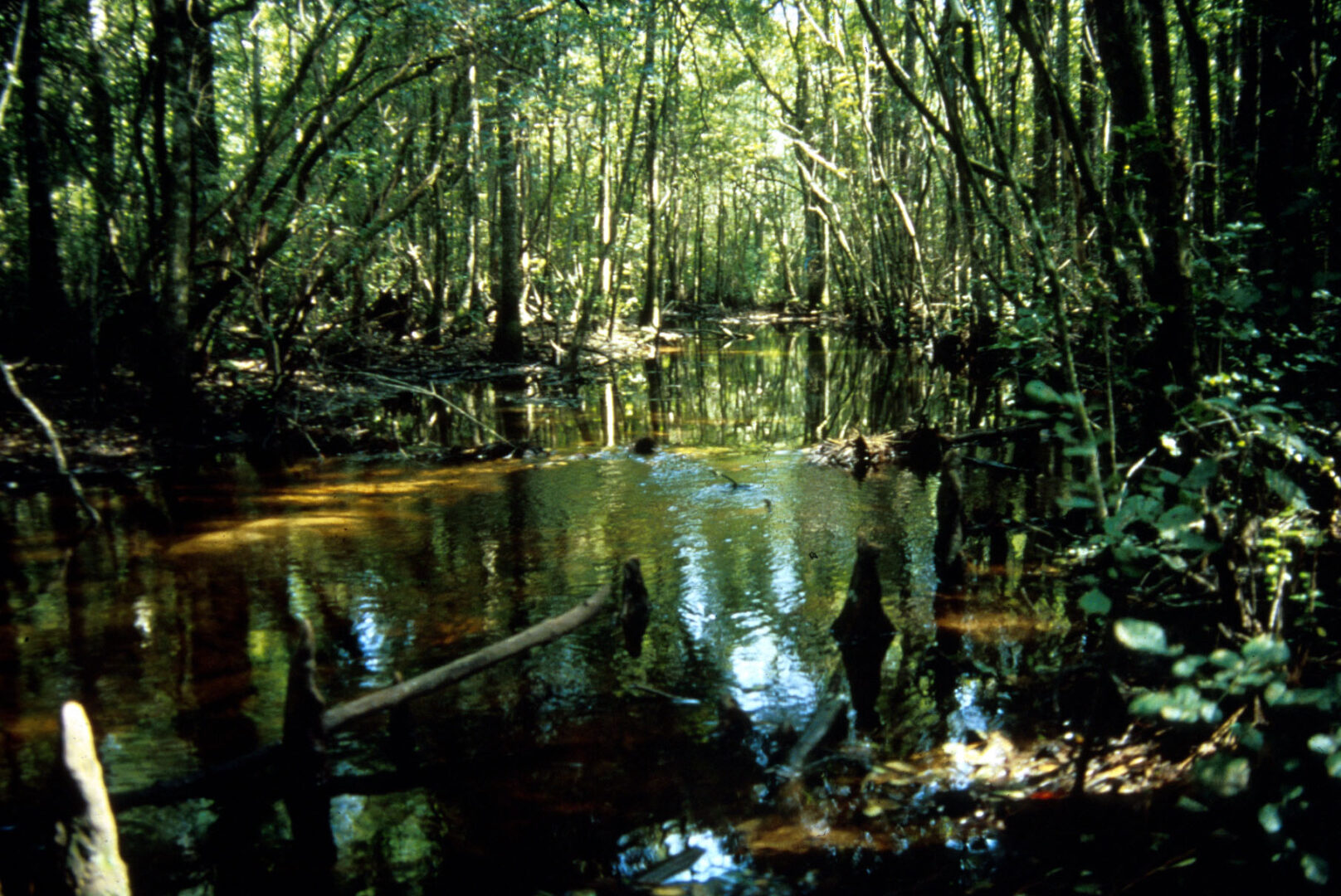
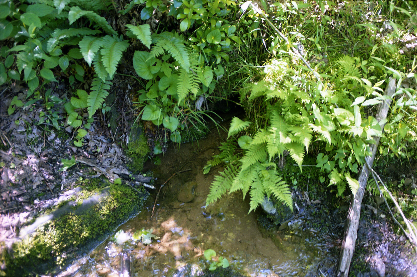
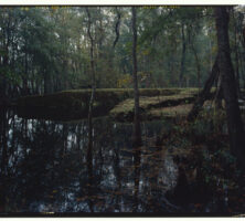
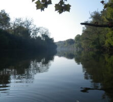
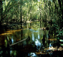
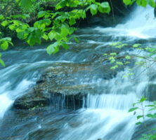
A third-order tributary of the Ogeechee River, a blackwater river that begins in Greene County, flows through a densely forested area in the Coastal Plain.
Courtesy of J. L. Meyer
The Satilla River, one of five blackwater rivers in Georgia, begins in Ben Hill County and lies entirely within the Coastal Plain. It drains to the Atlantic Ocean. Pollution levels are very low in the Satilla, which is bordered by cypress and black gum forests.
Courtesy of Georgia Rivers LMER
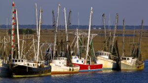
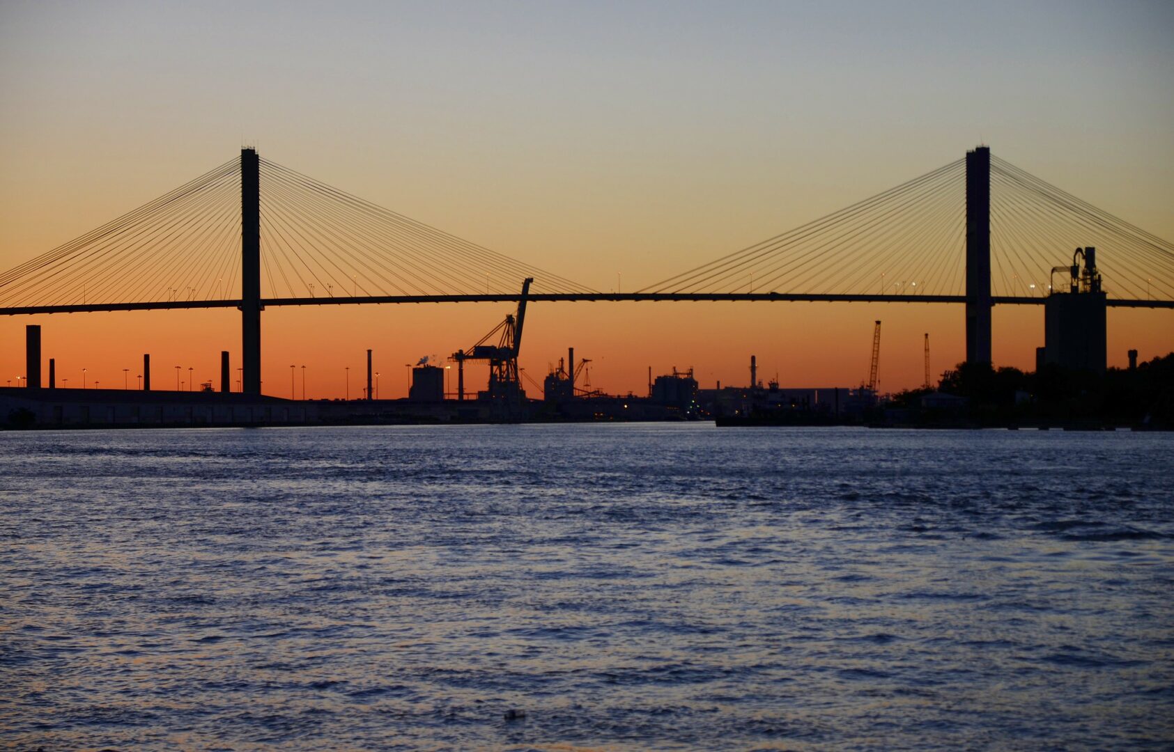
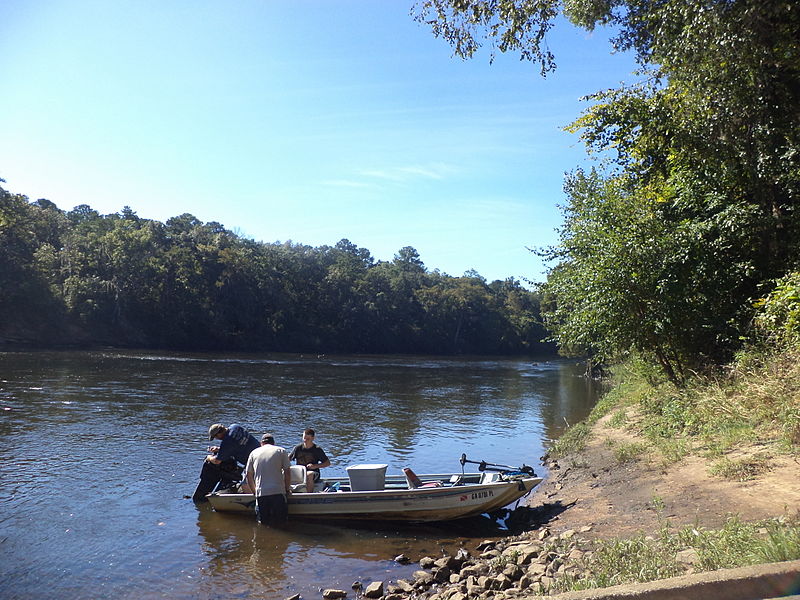
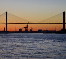
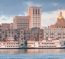
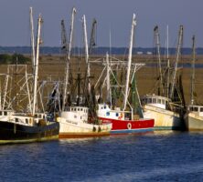
One of the busiest ports on the East Coast of the United States, Savannah handles approximately 80 percent of the shipborne cargo entering Georgia.
Photograph by Ron Cogswell
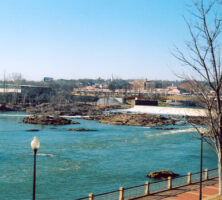
The Savannah River, which originates in Hart County at the confluence of the Seneca and Tugaloo rivers, flows for 313 miles to the Atlantic Ocean. The river has played in important role in the state's human history and forms the basis for one of the most diverse ecosystems in the world.
Courtesy of Explore Georgia, Photograph by Ralph Daniel.
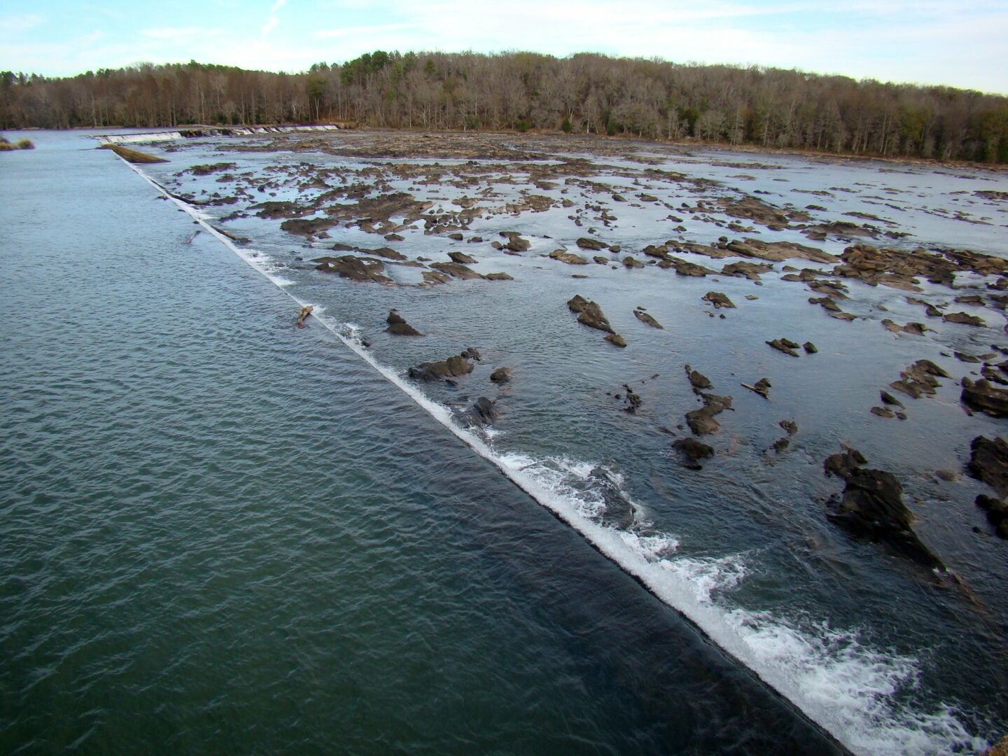
A diversion dam on the Savannah River pushes water to the headgate and locks of the Savannah-Ogeechee-Altamaha Canal, in Augusta. Along its route from the Piedmont to the Atlantic Ocean, the Savannah River is diverted for various purposes, including navigation, the generation of electricity, and water for human consumption.
Image from Stacie Wells
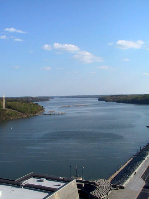
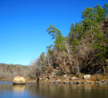
The Savannah River is impounded along its upper stretch to form Lake Richard B. Russell at the Russell Dam. Other reservoirs along the upper Savannah are Lake Hartwell and Clarks Hill Lake.
Photograph by Darby Carl Sanders
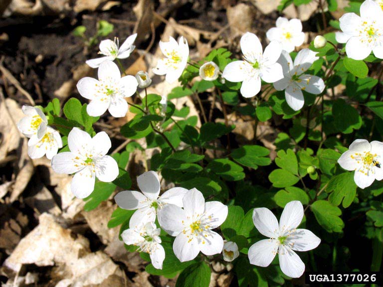
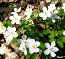
False rue anemone is one of the more than seventy-five rare plant species native to the Savannah River basin. The anemone, along with bottle-brush buckeye and relict trillium, is found along river bluffs near Augusta.
Courtesy of Joseph O'Brien, USDA Forest Service, www.forestryimages.org
The Savannah River flows past downtown Savannah. The river has played an integral role in the development of human settlements in Georgia, from the Paleoindian period to the present day.
Courtesy of Explore Georgia, Photograph by Ralph Daniel.
Workers load cotton bales onto a ship docked on the Savannah River at Savannah, circa 1880. The river served as an important shipping channel throughout the nineteenth century and into the early twentieth.
Courtesy of Georgia Archives, Vanishing Georgia, #
ctm345-86.
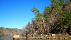
The fifty-mile Chattooga River begins in North Carolina and flows through South Carolina and Georgia. One of the few rivers to qualify for the national designation of a Wild and Scenic River, the Chattooga is protected from development and motorized vehicles along its banks by a one-fourth-mile-wide corridor on each side.
Photograph by Brenda Wiley
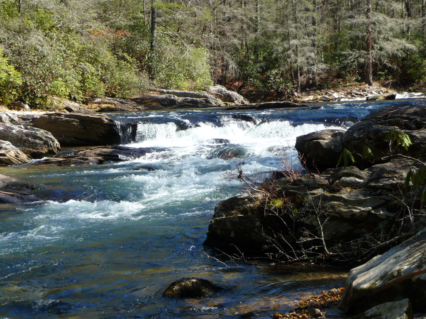
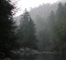
The Chattooga Rivers flows through the Ellicott Rock Wilderness Area, located on the shared borders of Georgia, North Carolina, and South Carolina. The forests adjacent to the river are among the most biologically diverse in the nation.
Photograph by Joel Shiver
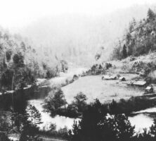
The effects of the timber industry are visible in this photograph taken from the Chattooga River, at the mouth of the Tallulah River. During the late nineteenth century, extensive logging in southern forests threatened the fragile ecosystem of the Chattooga River watershed.
Courtesy of Mars Hill College, Appalachian Room Archives, Gennett Collection.
The Flint River, named for the stone along much of its shore, supports many varieties of local wildlife. Originating near Atlanta, the river flows south for more than 200 miles, feeding two power-producing lakes along the way, as well as providing farmers with water for crop irrigation.
Photograph by J. S. Clark
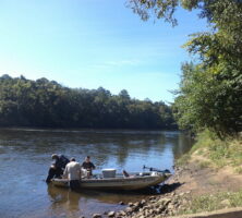
Fishing is a popular activity on the Flint River, which flows for more than 200 miles from the Piedmont region to the Chattahoochee River in southwest Georgia. Fishermen prize the river's shoal bass, a fish unique to the Apalachicola-Chattahoochee-Flint river system.
Photograph from Wikimedia
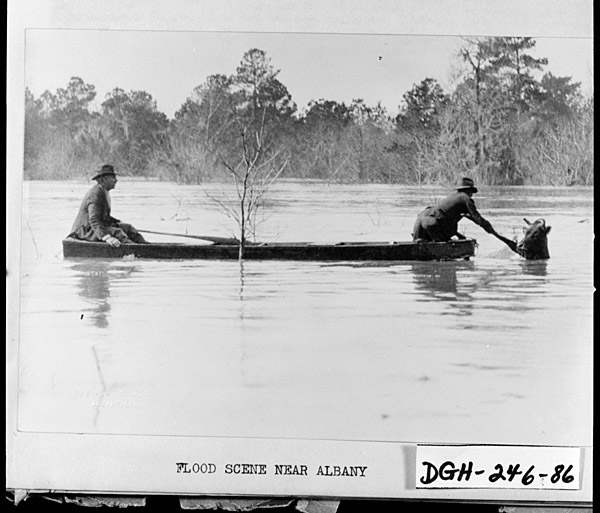
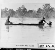
Two men attempt to rescue a cow in high water near Albany during the Flint River flood of 1925. The Flint River has overrun its banks several times in Albany's history; the most severe flood occurred in the summer of 1994, when the river crested in the city at more than forty-three feet.
Courtesy of Georgia Archives, Vanishing Georgia, #
dgh246-86.
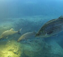
Fish swim in the constructed "blue hole" at the Flint RiverQuarium, which opened in Albany in 2004. The 22-foot-deep tank is modeled on the natural blue holes, or springs rising from underground caverns, that occur along the Flint River in southwest Georgia.
Courtesy of Flint RiverQuarium
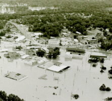
In 1994, due to tropical storm Alberto, the Flint River overflowed its banks and flooded Montezuma. The water rose as high as the rooftops, and whole buildings were engulfed in the flood.
Photograph from 161st Military History Detachment
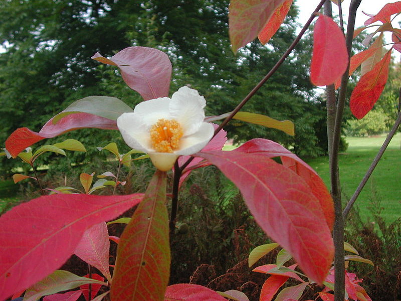
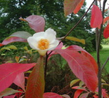
The Franklin tree or lost camellia (Franklinia alatamaha), once native only to Georgia, was discovered along the banks of the Altamaha River in the mid-eighteenth century and was last recorded in the wild by nurseryman and plant collector in 1803. All known specimens today are in cultivation.
Photograph from Francine Riez, Wikimedia
The riparian zone along the sides of the Altamaha River is thick with vegetation. The plants in the riparian zone are diverse. Common trees include river birch, laurel oak, southern red oak, post oak, willow, red maple, sycamore, locust, hickory, red cedar, cypress, and sweet gum.
Image from Bubba73 (Jud McCranie)
Darien is a coastal tidewater town about sixty miles south of Savannah, located at the mouth of the Altamaha River. The port town's origins can be traced to the earliest years of colonial Georgia.
Courtesy of Explore Georgia, Photograph by Ralph Daniel.
The Altamaha River Delta in Glynn and McIntosh counties is a major reserve for migratory and wintering birds. The Georgia Department of Natural Resources estimates this area supports at least 55,000 species of seabirds and shorebirds annually.
Image from Electronic Collection of Georgia Birds
The Ocmulgee River runs from Macon just south of Lumber City before converging with the Oconee to form the Altamaha River.
Photograph by Melinda S. Mullikin, New Georgia Encyclopedia
The Ocmulgee River flows right through Macon. In fact, Macon is the dividing line between two very different Ocmulgees. To the north of Macon, the river is rocky. Below Macon, the river turns sandy and slowly meanders southward.
Image from Lee Coursey
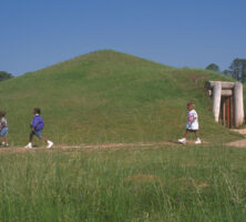
The chiefdom of Ichisi was located between modern Macon and Perry on the Ocmulgee River. The capital town was probably located at the present-day Lamar archaeological site, a part of Ocmulgee Mounds National Historical Park.
Courtesy of Georgia Department of Economic Development.
Archaeological evidence indicates that humans have lived along the banks of the Chattahoochee River for a very long time.
From Flowing through Time: A History of the Lower Chattahoochee River, by L. Willoughby
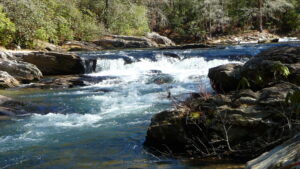
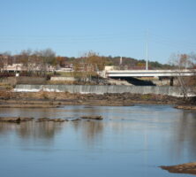
The Chattahoochee River flows through Columbus, one of the cities located along the fall line marking the boundary between the Piedmont and Coastal Plain geologic provinces. The hard rocks of the Piedmont form outcrops that create rapids and waterfalls along the fall line.
Photograph by andrewI04
This spring near Jacks Knob Trail in Union County is the likely source of the Chattahoochee River. Georgia is a headwaters state—many rivers begin in the state, but none within its borders has its origins elsewhere.
Courtesy of Edwin L. Jackson
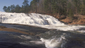
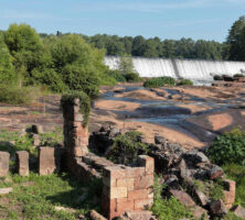
High Falls State Park, near Jackson in Butts County, is a popular destination along the Towaliga River for camping and boating. The town of High Falls, established in the early 1800s, became a ghost town during the 1880s, when the railroads gained prominence over waterways for commercial transportation.
Courtesy of Georgia Department of Economic Development.
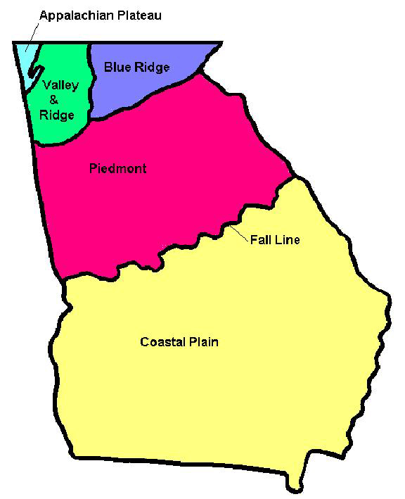
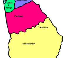
Georgia encompasses parts of five distinct geographic regions: the Appalachian Plateau, the Valley and Ridge, the Blue Ridge, the Piedmont, and the Coastal Plain.
Courtesy of Pamela J. W. Gore
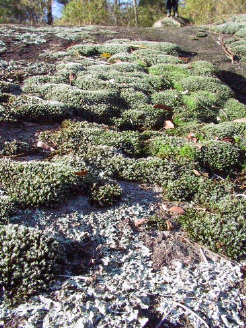
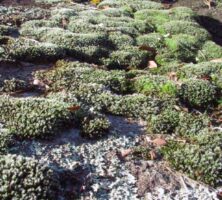
Lichens and mosses grow on a granite outcrop at Panola Mountain State Park in Stockbridge. As resurrection plants, lichens and mosses are able to resume photosynthesis after a drought, making them ideally suited to the desert-like conditions on the outcrops.
Photograph by Melinda Smith Mullikin, New Georgia Encyclopedia
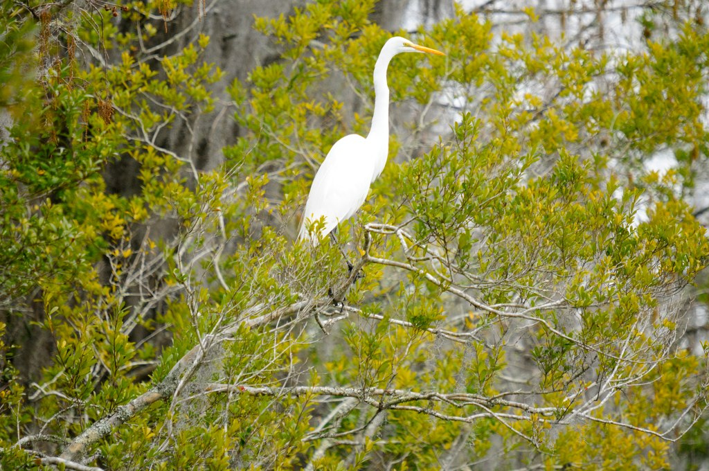
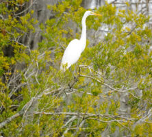
A great egret perches on a branch in the Okefenokee Swamp.
Photograph by Siddharth Sharma
One end of Georgia's fall line, which marks the boundary between the hard rocks of the Piedmont geologic province and the softer rocks of the Coastal Plain, is located in Columbus. Marked by waterfalls and rapids, the fall line stretches across the state to Augusta.
Photograph by Pamela J. W. Gore
Amicalola Falls in Dawson County is one of Georgia's most popular attractions.
Photograph by Darren Duke
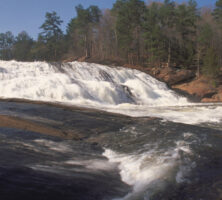
Falls also exist in central Georgia, where the Coastal Plain gives rise to the Piedmont Plateau. The most notable of these is High Falls at High Falls State Park, near Jackson in Butts County.
Image from gary riley
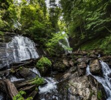
Anna Ruby Falls, in the heart of the Chattahoochee National Forest, marks the junction of Curtis and York creeks. Curtis Creek drops 153 feet and York Creek 50 feet to form the twin falls known as Anna Ruby Falls.
Courtesy of Explore Georgia, Photograph by Geoff L. Johnson.
Tempesta Falls is located in northeast Georgia's Tallulah Gorge State Park, near the Rabun and Habersham county line. Tempesta, one of a series of four main cataracts that make up Tallulah, today only roars to life on selected weekends in the spring and autumn.
Photograph by Mark Morrison