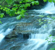
Georgia has a wide variety of waterfalls: some are high with sheer drops, some are tumbling cascades, and others are rushing shoals or small ledge-type falls. Several state parks have been developed around these natural wonders and play host to thousands of visitors each year. Many falls also are located in the wilds of the Chattahoochee and Oconee National Forests of northern and central Georgia. There are dozens, perhaps hundreds, of other waterfalls on private lands across the state.
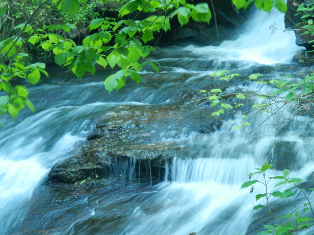
Photograph by Darren Duke
Waterfall Types
Waterfalls can be classified as either “constructive” or “destructive.” Most of the state’s falls are of the destructive variety, which means that over time these falls will recede upstream as the watercourse erodes and levels. In the Coastal Plain of Georgia, where there is no great elevation change, some falls exist in sinkholes. On the Cumberland Plateau of northwest Georgia, “caprock” waterfalls are prevalent. A caprock fall occurs when a stream meets resistant rock (usually limestone) that lies atop softer rock (usually sandstone and shale). Large amphitheaters are formed when the softer, underlying rock erodes, leaving the harder caprock in place. The most notable example of this type of fall is found at Cloudland Canyon State Park.
An example of a constructive fall is on Pocket Branch, in Walker County. This stream’s waters are mineral-laden and form “tufa,” or calcite rock formations much like the terraced hot springs of Yellowstone National Park. The Pocket Branch formations are of the rare, cold-water variety. This mineral buildup has rippled folds with a drapery-like appearance.
Geography, Flora and Fauna, and Water Levels
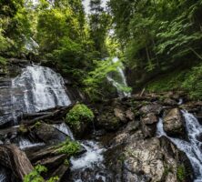
Most of Georgia’s waterfalls occur in the central and northern part of the state because a fall line runs across this region from Columbus to Augusta. The fall line is a geologic boundary that marks the divide between the hard, crystalline rocks of the Piedmont to the north, and the softer sedimentary rocks of the Upper Coastal Plain to the south. Erosion of the sedimentary rock by streams flowing off the crystalline rock creates steep stream gradients and waterfalls.
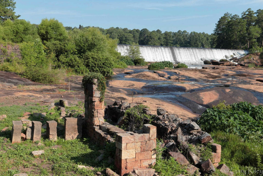
Image from gary riley
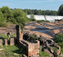
The most notable of the falls in central Georgia is High Falls at High Falls State Park, near Jackson in Monroe County. High Falls is the site of a once-prosperous town that grew up around a gristmill powered by the Towaliga River’s falling waters. In the 1880s High Falls became a ghost town when a major rail line bypassed it.
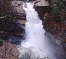
Rabun County, in northeast Georgia, is the state’s most prolific waterfall location. The abrupt change in elevation, combined with several large, plateaulike drainage areas, makes the area ripe for waterfalls. Wet-weather falls, such as Ada-Hi Falls at Black Rock Mountain State Park, occur where drainages are small. Waterfalls located in northwest Georgia also are of the wet-weather variety. Often the falls on Johns Mountain (Keown Falls), near Villanow in Walker County, are just a trickle or are completely dry. However, colorful mosses and algae cover the perpetually moist rock.
The “spray zones” that surround most waterfalls support rare plants and animals (most notably salamanders) that can exist only in humid environs such as these. The air temperature and humidity are relatively stable in these spray zones. Dipper-type birds hunt the rich, oxygenated waters at their base, and trout thrive in cooler waters found in the mountain locations.
Waterfalls also act as natural barriers to certain types of aquatic life. A pool below the falls on Overflow Creek, in Rabun County, is known locally as the “Eel Pool,” for it limits the migration of native eels.
Rainbow trout (from the western states) and brown trout (from Europe) were introduced into southern mountain streams in the mid-nineteenth century. The native species (brook trout) do not compete well with these transplants. On many streams brook trout are stocked and exist without this introduced competition because of the natural barrier protection that a waterfall affords.
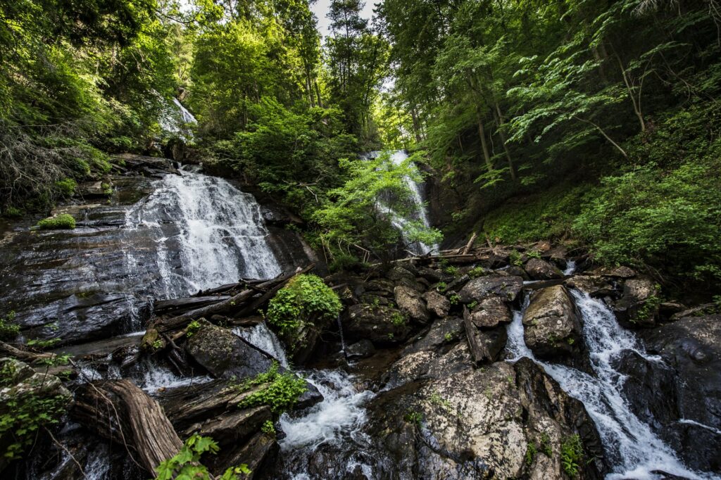
Courtesy of Explore Georgia.
Stream levels fluctuate widely from season to season. Waterfalls are an obvious indicator of an abundance or lack of rainfall. During the severe drought of 1999-2000 stream levels were down by two-thirds in many cases. Northeast Georgia traditionally is the state’s wettest region, receiving upwards of seventy inches of rainfall annually. The northwest is the state’s driest region. Winter and spring are generally the wettest seasons; fall is the driest.
Special Places
The most wondrous of the state’s falls are in northeast Georgia’s Tallulah Gorge State Park, near the Rabun County and Habersham County line. The names of its falls suggest both great power (Tempesta, Hurricane, and Oceana) and romance (L’Eau d’Or [a.k.a. Ladore, French for “water of gold”] and Bridal Veil). Until the early twentieth century the once-mighty Tallulah River flowed freely, carving a deep and scenic gorge. Dammed just above the gorge, its waters were diverted for power generation to fill the electrical needs of a booming Atlanta and northeast Georgia.
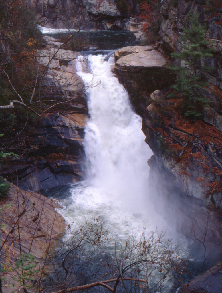
Photograph by Mark Morrison
Before the dam’s construction (completed in 1913) the falls were a major attraction, considered the “Niagara of the South.” A writer in the September 28, 1819, issue of the Georgia Journal claimed, “The cataract of Niagara and its great whirlpool and banks, is the only superior natural curiosity to the Rapids of Tallulah, that I have ever seen.” The town of Tallulah Falls had fine hotels, and the Tallulah Falls Railroad brought in the tourists. Gorge promoters, on two occasions, hired aerialists to cross it. During a hair-raising walk by Professor Leon on July 24, 1886, a stabilizing rope snapped. Leon finished half of his proposed round-trip walk before a horrified crowd. The most publicized crossing was made by Karl Wallenda on July 18, 1970, long after the river was dammed. The towers that held his wire are still in place, though the north tower now lies on its side.
In 1911, an era when humans attempted to master nature in every way, the most hotly contested environmental battle of the day was waged to keep the Tallulah River flowing free. The leader of this fight was Helen Dortch Longstreet, the young widow of Confederate general James Longstreet. She led the Tallulah Falls Conservation Association against Georgia Power Company and Governor Joseph M. Brown, spending her time and fortune in a vain effort to stop the damming of the Tallulah River.
Twice a year, spring and fall, the river is allowed to flow at its predam levels. During these scheduled water releases, a limited number of experienced kayakers are permitted to put in their boats below the third fall (Hurricane) and kayak through Oceana, Bridal Veil, Sweet Sixteen, and the remaining rapids. Park visitors are not permitted within the gorge during these water releases, but from an overlook visitors may watch the kayakers go over Oceana Falls.
North Georgia’s Amicalola Falls derives its name from the native Cherokee word meaning “tumbling waters.” Amicalola is the state’s highest waterfall, with a total drop of 729 feet. It is located in Amicalola Falls State Park, one of Georgia’s most popular attractions. From an overlook atop the falls, one may witness the mountains-to-piedmont transition.
Photograph by Darren Duke
Another popular fall with native roots is the 186-foot-high Toccoa Falls (“toccoa” is the Cherokee word for “beautiful”). It is located on the campus of Toccoa Falls College. In November 1977 an earthen dam on the creek above the falls burst after torrential rains and flooded the campus, taking the lives of thirty-nine people as they slept.
Anna Ruby Falls, near Helen, is named for the daughter of a Confederate colonel who once owned the surrounding lands. This double fall is one of the state’s most beautiful and heavily visited.
On Pine Mountain, in west central Georgia, is Cascade Falls. Located on the Pine Mountain Trail and adjacent to a rock formation called the Wolf Den, it was one of U.S. president Franklin D. Roosevelt’s favorite spots.