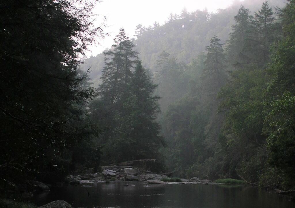
The Chattooga River descends rapidly from the Blue Ridge geologic province and forms the majority of Georgia’s northeast boundary between Rabun County and South Carolina’s Oconee County. Today, the National Forest Service manages the Chattooga, also known as James Dickey’s “Deliverance River,” as a National Wild and Scenic River. The Chattooga remains one of the only major free-flowing southern Appalachian rivers.
Chattooga Geography
The fifty-mile Chattooga River begins at the base of Whitesides Mountain (elevation 4,930 feet) near Cashiers, North Carolina. The river empties a 180,000-acre basin (approximately 280 square miles) covering three states, including 122,000 acres of public land in three national forests: Nantahala (North Carolina), Chattahoochee-Oconee (Georgia), and Sumter (South Carolina). The river ends in the Georgia Power Company’s Tugaloo Lake (elevation 890 feet) in northeast Georgia at the confluence with the Tallulah River. At this juncture the river becomes the Tugaloo River, and after passing through the Tugaloo and Yonah dams—hydroelectric dams operated by Georgia Power—it flows into Lake Hartwell. From there the mountain water eventually travels an additional three hundred miles to the Atlantic Ocean via the Savannah River.
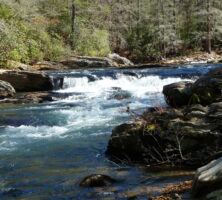
Photograph by Brenda Wiley
The region’s mountainous topography and prevailing weather patterns, including moisture-rich air from the Gulf of Mexico, act together to drop more than eighty inches of rain and snow annually in the Chattooga’s headwaters. These wet conditions help make this region one of the most biologically diverse in the nation. The Chattooga River’s adjacent forests contain softwood and hardwood species, including Virginia and white pines, as well as yellow poplar and oak varieties. The understory of this forest canopy comprises dogwoods, rhododendrons, mountain laurel, and ferns. Many native plant and animal species, including eastern hemlock, trillium, lady slipper, and salamanders, are particularly sensitive to air and water pollution, as well as to exotic and invasive plants, animals, and insects.
Cherokee Chattooga
Cherokee Indians occupied the Chattooga River watershed prior to European arrival. Chattooga, or Tsatugi, has a variety of meanings, including: “he drank by sips,” or “he has crossed the stream and come out upon the other side.” Early European explorers and travelers, as well as recent archaeologists, recorded the existence of Chattooga Town near the confluence of the Chattooga River and the West Fork of the Chattooga River. English maps note the town’s location, and a census taken in 1721 counted approximately ninety people living in the village. This Cherokee Lower Town was sited to the south of today’s Highway 28 bridge on the South Carolina side of the Chattooga River. Archaeologists have recovered evidence that Cherokees resided in the town, possibly as early as the late 1600s until about the mid-1700s, and constructed numerous structures, including a council-townhouse, pavilions, storage buildings, and other seasonal-use structures. The river bottom’s terrain would likely have included dense stands of river cane and permitted the Cherokees to cultivate agricultural products on rich alluvial soils. By the conclusion of the American Revolution (1775-83), the Cherokees had left the Chattooga’s watershed, and Cherokee removal from Georgia became formal policy in 1838.
White Settlement
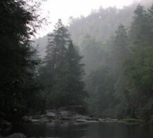
Europeans entered the Chattooga River watershed primarily from the South Carolina upcountry via trade routes that originated in Augusta or in Charleston, South Carolina. English naturalist William Bartram noted evidence of former Cherokee villages like Chattooga Town but more often described the Chattooga watershed’s incredible flora and fauna when crossing the “delightful river” in the vicinity of Warwoman Creek in 1775.
Photograph by Joel Shiver
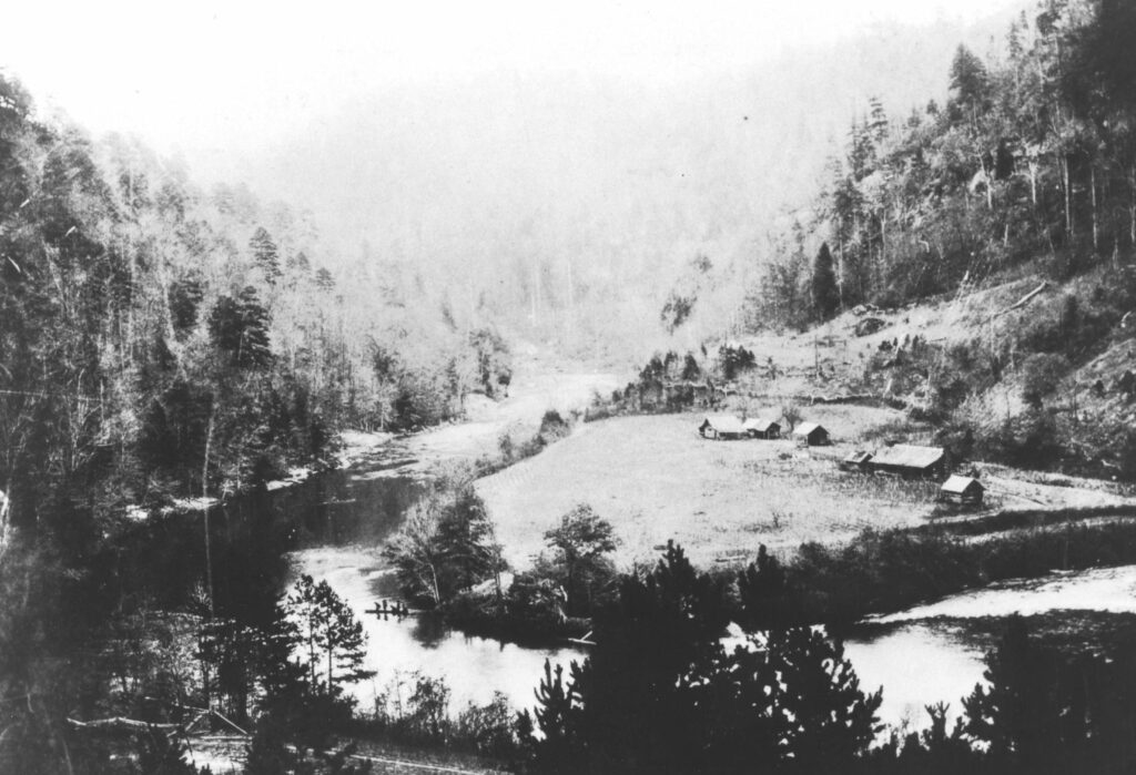
After the American Revolution, veterans received land grants that spurred more settlement in Rabun County, which became a formal county in 1819. One important 1820s establishment in the watershed was the Russell homestead. Located on the South Carolina side of the river and just downriver from the former Chattooga Town site, this property served as a working farm and tavern. Travelers, mostly from South Carolina’s Lowcounty, crossed the Chattooga River near the Russell house en route to Highlands, North Carolina.
In 1852 boosters from Charleston, South Carolina; Knoxville, Tennessee; and Cincinnati, Ohio, hatched a plan to connect their cities via the Blue Ridge Railroad. The proposed 195-mile line would have crossed the Chattooga where Dick’s Creek enters the river, thereby connecting Clayton, Georgia, by rail with Walhalla, South Carolina. However, rising costs associated with extensive tunnel engineering and the economic collapse brought on by the Civil War (1861-65) halted completion of the road by a new group of investors organized under the Black Diamond Railroad Company.
Logging the Chattooga
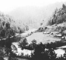
Between the Civil War’s end and the early 1900s, forest removal in the Georgia mountains shifted from a localized and unregulated economic activity to a federally organized and international business. Local timber operators, like Andrew and Nat Gennett, purchased timber rights and property in the Chattooga River watershed after 1902. The Gennetts and other loggers relied on techniques (like splash dams) and technology that often damaged the land more drastically than previous timbering activity. To counter these impacts on the national level, the U.S. Congress passed the Weeks Act in 1911, which empowered the U.S. Forest Service to begin purchasing cutover private lands for the purpose of controlling soil erosion, replanting timber, and maintaining navigable waterways. The founding land purchases established the Chattooga River watershed’s national forests.
Courtesy of Mars Hill College, Appalachian Room Archives
Wild and Scenic Chattooga
The 1968 Wild and Scenic Rivers Act named the Chattooga River eligible for inclusion in a new national water conservation system. The new Wild and Scenic River system was designed to conserve and restore unique rivers across the country. Protecting the Chattooga River primarily served to balance extensive dam construction in adjacent southern watersheds. On May 10, 1974, Congress designated the Chattooga a Wild and Scenic River after a decade-long study program managed by the Forest Service, with significant input from the Georgia Natural Areas Council, the Georgia Conservancy, the Georgia Power Company, and independent river activists. Of the Chattooga’s fifty-seven protected miles, forty are classified as wild, two and a half as scenic, and nearly fifteen as recreational.
James Dickey’s novel Deliverance (1970) and the film version of it, which was filmed on the river in 1972, introduced the nation to the Chattooga. River visitation skyrocketed from fewer than 1,000 to more than 20,000 between 1971 and 1974. A dozen drowning fatalities, general concerns for visitors’ safety, and the need to regulate commercial guide services hastened the river’s full Wild and Scenic River designation in 1974.
Approximately 50,000 visitors raft, canoe, or kayak the Chattooga each year. Sumter National Forest maintains numerous hiking trails for day and overnight use, including several miles of the William Bartram