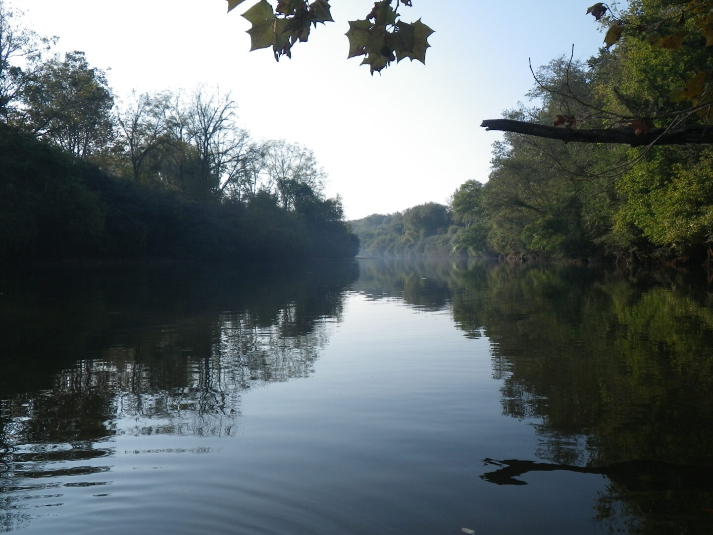
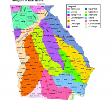
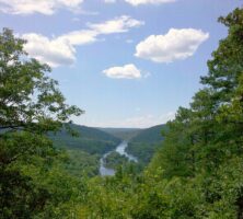
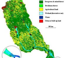
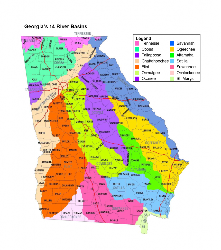
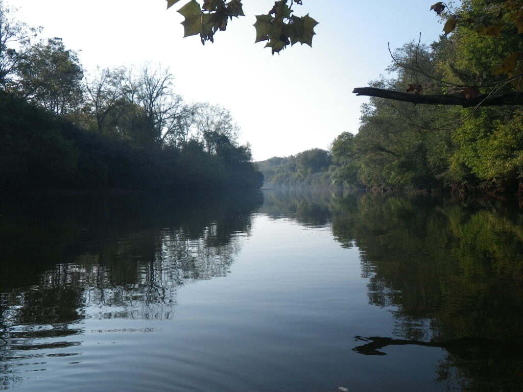
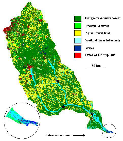
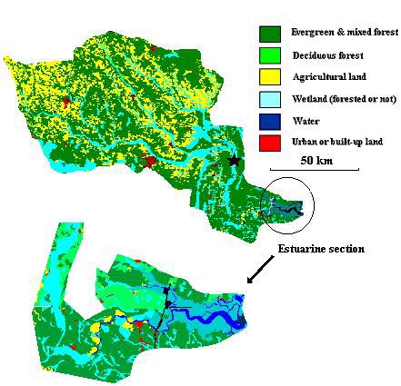
Georgia’s natural resources include fourteen river basins, which support a rich diversity of native fish and mussel species. A river basin consists of the entire geographic area (hillside, valley, plain) from which water flows into the primary river, which is made up of an intricate network of smaller rivers and streams. Rain falling within a river basin, or watershed, runs downhill until it reaches a stream. Small streams join other streams and flow into a river, and eventually that river flows into the sea.
The fourteen river basins of Georgia are the Altamaha, Chattahoochee, Coosa, Flint, Ochlockonee, Ocmulgee, Oconee, Ogeechee, Satilla, Savannah, Suwanee, St. Marys, Tallapoosa, and Tennessee. The Savannah River, which begins at the confluence of the Seneca and Tugaloo rivers in the northeast part of the state, forms the border between Georgia and South Carolina. It empties into the Atlantic Ocean near Savannah. The Tennessee River, part of the northwestern Coosa and Tallapoosa river basins, flows northward and enters the Mississippi River via the Ohio River. Both the Coosa River, which begins in the Blue Ridge Mountains, and the Tallapoosa River, which begins in the Piedmont, flow into the Mobile River basin in Alabama. Farther south, the Chattahoochee and Flint river basins include the highly urbanized Atlanta metropolitan area; these rivers eventually merge and empty into the Gulf of Mexico. In central Georgia, the Oconee and Ocmulgee rivers merge to form the Altamaha River, which flows to the Atlantic Ocean. Three of the five blackwater rivers in Georgia’s coastal plain, the Ogeechee, Satilla, and St. Marys rivers, drain to the Atlantic Ocean, while the remaining two, the Suwanee and Ochlockonee, are Gulf Coast drainages.
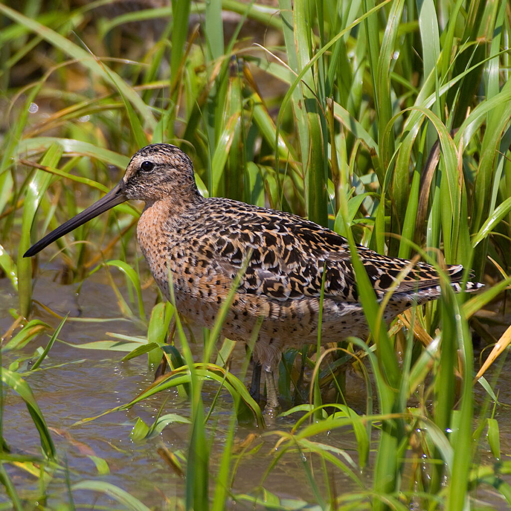
Image from Jet Lowe
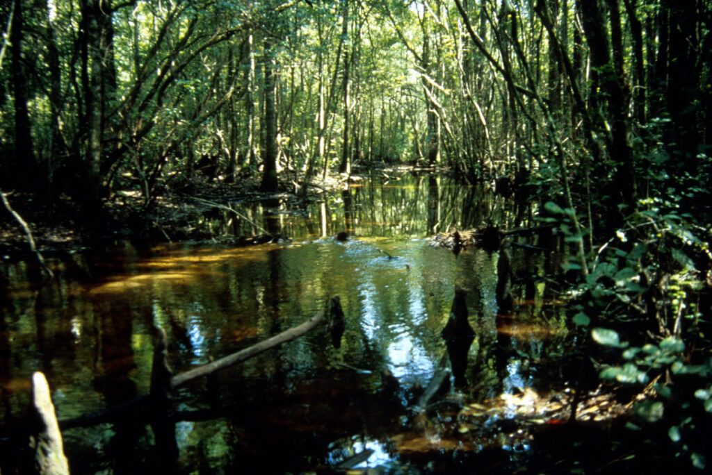
Courtesy of Georgia Water Coalition
Rivers provide not only habitat for fish, aquatic invertebrates, amphibians, and terrestrial fauna but also recreational opportunities, water supplies for communities, irrigation for agriculture, and a means of transportation. The river basins in Georgia are nonrenewable public resources critical to the integrity of natural environments and public health. To that end several organizations are committed to the protection and conservation of Georgia’s rivers, including American Rivers, Georgia Adopt-A-Stream, Georgia Canoeing Association, Georgia River Network, Georgia Wildlife Federation, National Wildlife Federation, Nature Conservancy, and Trout Unlimited.
Georgia has a vast diversity of surface and groundwater resources. The Environmental Protection Agency estimates that Georgia has 44,056 miles of perennial streams, 23,906 miles of intermittent streams, and 603 miles of ditches and canals. Georgia has 4.8 million acres of wetlands, 425,382 acres of public lakes and reservoirs, 854 square miles of estuaries, and 100 miles of coastline. In the forty-eight contiguous states, there are only forty-two free-flowing rivers greater than 200 kilometers in length, and Georgia contains five such rivers: the Flint, Ogeechee, Satilla, St. Marys, and Suwannee.
Populations in the northern part of Georgia rely heavily on surface water supplies, and populations south of the fall line rely mainly on groundwater supplies. Both surface and groundwater sources are highly susceptible to contamination from runoff (known as nonpoint source pollution) from leaking landfills and underground storage tanks, as well as from industrial processes. Some of the critical issues for the state’s long-term supply of groundwater and surface water supplies include saltwater intrusion in the upper Floridan aquifer of coastal Georgia, the equitable allocation of water with Alabama and Florida, and the growing demand on limited water resources in metropolitan Atlanta. Two additional issues facing southwest Georgia are the depletion of the Clayton aquifer and the reductions in flow through the Flint River basin resulting from surface and groundwater withdrawals for irrigation.
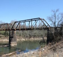
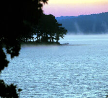
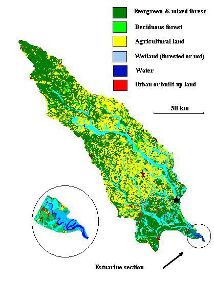
Savannah River Basin
The Savannah River basin includes portions of North Carolina, South Carolina, and Georgia and flows through the Blue Ridge Mountains, Piedmont, and Coastal Plain of Georgia.
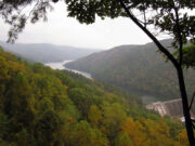
The Savannah River forms the boundary between South Carolina and Georgia and begins at Lake Hartwell, in Hart County, at the confluence of the Seneca and Tugaloo rivers. From this point it flows southeast to Savannah, where it empties into the Atlantic Ocean. Above the junction of the Seneca and Tugaloo rivers, the major headwater streams of the Seneca River are the Keowee River and Twelve Mile Creek. The Tugaloo River is formed by the union of the Tallulah and Chattooga rivers. These headwater streams originate on the southern slopes of the Blue Ridge Mountains in North Carolina and Georgia.
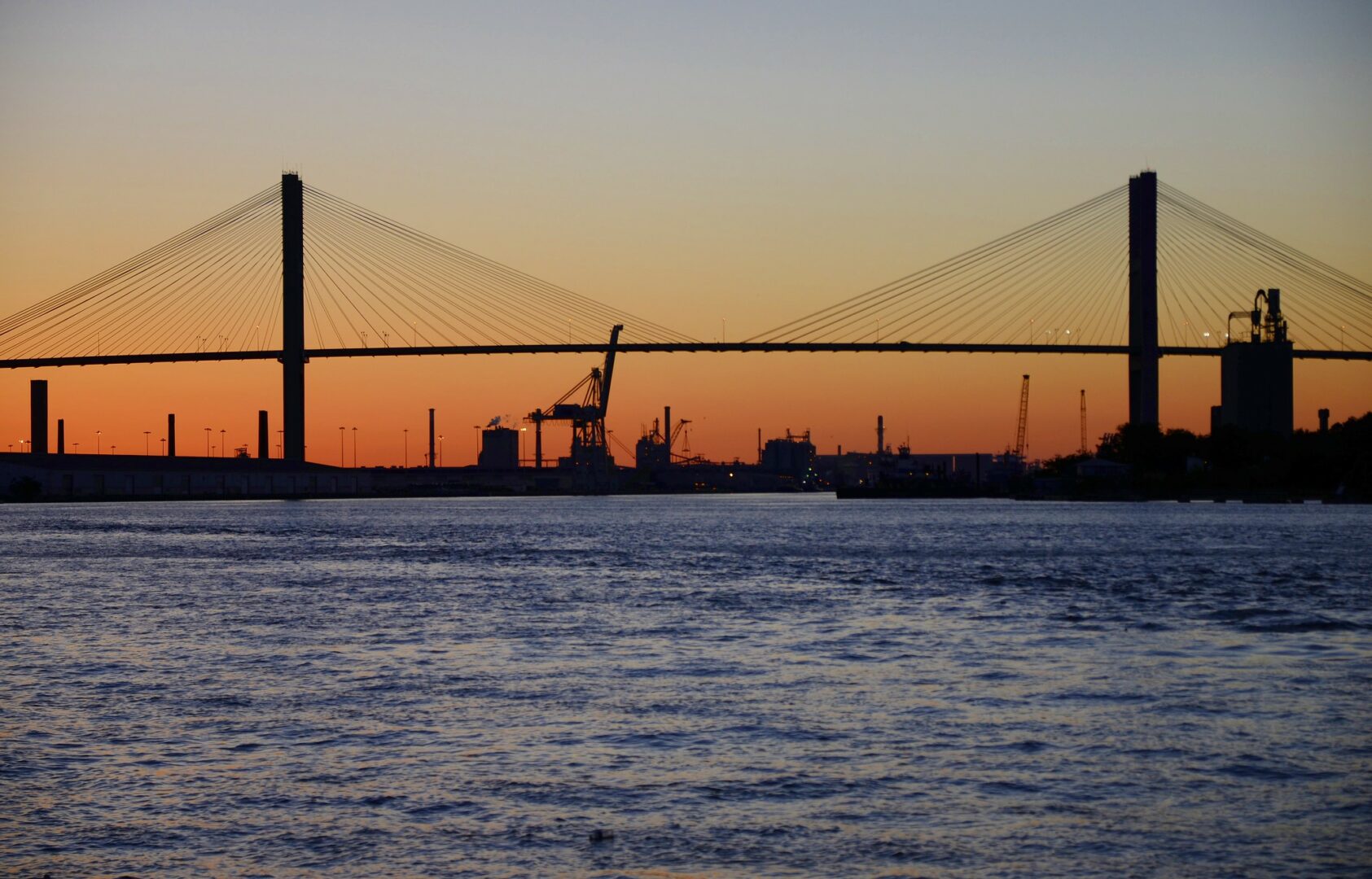
Flow, sediment load, and the flood plain of the Savannah River have been modified by eleven large dams above the fall line, which impound more than 180,000 acres of water. Below the fall line, dredging and channelization have altered the historical legacy of the Savannah. As a result the Savannah lacks the vast vegetated flood plains in the freshwater tidal zone that are characteristic of such other Georgia estuaries as the Altamaha River. However, the Savannah does have extensive developments of more saline intertidal vegetational zones near the sea. The Savannah National Wildlife Refuge seeks to protect, preserve, and educate the public about the diversity and fragility of this river system.
In the late 1990s the federal Environmental Protection Agency (EPA) outlined significant man-made and natural threats to the Savannah River system. For example, the construction of dams to provide hydroelectric power and to reserve surface water to sustain municipal water requirements leads to releases of cold water with low dissolved oxygen, which can result in massive fish mortalities below the dam. Development in the watershed can lead to increased urban/storm water runoff, nonpoint source releases into the watershed, and the loss of critical wetland habitats.
Discharges and releases from the Savannah River Site, a nuclear materials processing center in South Carolina that was listed as an EPA Superfund site in 1989, also threaten the health of the Savannah. As the drought in Georgia continues, the water tables continue to drop farther beneath the surface. As the water tables drop, concerns increase over saltwater intrusion into groundwater supplies and the potential for an interaction with surface water supplies.
Coosa, Tallapoosa, and Tennessee River Basins
The Coosa and Tallapoosa River basins originate in north Georgia and continue across the border into Alabama. The Tennessee River basin includes portions of Alabama, Georgia, Kentucky, Mississippi, North Carolina, Tennessee, and Virginia.
The Tallapoosa River originates west of Atlanta, in Paulding County. The Tallapoosa River basin occupies 4,680 square miles, of which 720 square miles (15 percent) lie in Georgia and 3,960 square miles (85 percent) lie in Alabama. The Tallapoosa supports cold- and warm-water fisheries as well as a rich diversity of species unique to this river. Species important to anglers include largemouth, spotted, and redeye bass; rainbow trout; black crappie; and channel catfish. The Tallapoosa is a free-flowing river in Georgia with no major impoundments until it reaches the Harris Reservoir in Alabama.
The Coosa River, formed by the convergence of the Etowah and Oostanaula rivers in downtown Rome, is the major eastern tributary of the Mobile River basin and empties into the Gulf of Mexico in southwest Alabama. The Coosa River is a significant striper fishery with one of the few naturally reproducing populations of striped bass in the state and is home to more than 147 species of fish. The river also has the largest diversity worldwide of freshwater snails and mussels, despite the documented disappearance of numerous molluscan species. For example, it is estimated that 35 of the 50 freshwater mussel species that once probably inhabited the Coosa River basin have been extirpated; several of these species are now considered extinct. According to estimates by the Nature Conservancy, the Etowah River, which flows into the Coosa, has more imperiled species than any other river system of its size in the southeastern United States.
The Tennessee River originates in the Appalachian Mountains and eventually joins the Ohio River. The largest tributary of the Ohio, the Tennessee is most notable for its abundance and diversity of freshwater fishes. Recognized as one of the most diverse rivers in North America, the Tennessee River supports about 240 fish species.
The Coosa, Tallapoosa, and Tennessee rivers are home to many threatened and endangered aquatic species. Two of the endangered species in these river basins are the Conasauga logperch, Percina jenkinsi, and the amber darter, Percina antesella. These species were once found throughout the Coosa, Tallapoosa, and Tennessee river basins and have been federally listed as endangered since 1985. The Conasauga logperch grows to approximately six inches in length and is characterized by many tigerlike vertical stripes over a yellow background and a piglike conical snout. Like other logperches, the Conasauga logperch feeds by flipping stones over with its snout and consuming the aquatic invertebrates living beneath. The amber darter is a short, slender-bodied fish that is generally fewer than two-and-a-half inches in length. The fish’s upper body is golden brown with dark saddle-like markings, and its belly is a yellow-to-cream color. The throats of breeding males are blue in color. The amber darter feeds primarily on snails and insects.
Chattahoochee and Flint River Basins
The Chattahoochee and Flint rivers are part of a larger Apalachicola-Chattahoochee-Flint (ACF) river basin, which flows through the states of Georgia, Alabama, and Florida. The Chattahoochee River drains an area of 8,770 square miles and is the most heavily used water resource in Georgia. Its headwaters begin at the southern edge of the Blue Ridge Mountains in Union County, at an altitude above 3,000 feet, and flow 430 miles to the Chattahoochee’s confluence with the Flint River in southwest Georgia at Lake Seminole, in Seminole County. The Flint River is approximately 350 miles long and drains an area of 8,460 square miles. Most of the larger tributaries in the ACF river basin are located in the lower reaches of the Flint River basin.
The headwaters of the Chattahoochee and Flint rivers occur north of the fall line in the Blue Ridge and Piedmont respectively. Water supplies in the headwater region derive primarily from surface waters. South of the fall line are the Providence aquifers and upper Cretaceous strata. The Providence aquifer system is the deepest of the principal aquifers in southern Georgia and consists of sand and gravel separated by clay and silt confining beds. The lower reaches of both rivers are part of the Floridan aquifer system, a karst limestone aquifer that is susceptible to contamination. This aquifer is one of the most productive worldwide. The hydrology connecting the Floridan aquifer and the Flint River results in groundwater discharge contributing to baseflow more in the Flint River than in the Chattahoochee River. Groundwater flow into the Chattahoochee River is one-fifth of that discharging into the Flint River.
Environmental Concerns
One of the most endangered rivers in the nation, the Chattahoochee River provides valuable wildlife habitat for migratory birds, mammals (including deer, beaver, and otter), and reptiles and amphibians. There are four federally endangered and two federally threatened mussel species found in the Chattahoochee and Flint river basins. The four endangered mussels—the fat threeridge (Amblema neislerii), shinyrayed pocketbook (Lampsilis subangulata), Gulf moccasinshell (Medionidus penicillatus), and oval pigtoe (Pleurobema pyriforme)— have been federally listed as endangered since 1997. The two threatened mussels are the chipola slabshell (Elliptio chipolaensis) and purple bankclimber (Elliptoideus sloatianus). All six mussel species prefer main-channel or large-stream sandy habitats with slow to moderate currents.
Six percent of the surface waters sampled in the upper Flint River and 19 percent of those sampled in the lower Flint River are categorized as impaired by the Environmental Protection Agency. Nonpoint sources and urban/storm water runoff are the primary contributors to pollution in the Flint.
The highest impairment of surface waters in the Chattahoochee River occurs in the upper and middle reaches of the river, which flow through Atlanta. The upper Chattahoochee is ranked in the top 10 percent of the most polluted watersheds in the state of Georgia and in the top 20 percent in the nation. Significant contributions to this pollution include urban/storm water runoff, nonpoint and municipal point sources, and combined sewer outflows.
Impoundments
The U.S. Army Corps of Engineers has constructed sixteen mainstem dams, which create large impoundments for flood control, water supply, power, and commercial navigation, in the ACF river basin. Thirteen of these dams are on the Chattahoochee River. Along most of the river’s length, hydroelectric plants release water to produce hydropower and to control the river’s flow. In the early 1800s dam construction in the basin began on the Chattahoochee River above the fall line at Columbus to take advantage of natural elevation gradients for power production. During low flow periods, stored water is used to supplement the discharge of the river. There have been marked decreases in the frequency of high and low flows since the start of operation of Buford Dam in 1956, and river flows fluctuate daily below the reservoirs along the Chattahoochee River. Lake Lanier provides 65 percent of the water storage to regulate flows, yet it drains only 5 percent of the ACF river basin.
Four large reservoirs along the Chattahoochee River include Lake Lanier (38,000 acres in area and 540 miles of shoreline), West Point Lake (25,900 acres in area and 525 miles of shoreline), Lake Walter F. George (45,180 acres in area and 640 miles of shoreline), and Seminole (37,500 acres in area and 500 miles of shoreline).
Two hydropower dams located on the Flint River impound run-of-the-river reservoirs (which means that the amount of water flowing through the dam is the same amount flowing into the reservoir from the river upstream) and do not appreciably influence the monthly flow of the Flint River. The dams do alter the daily flow regime, however. The Flint River lacks impoundments for more than 200 river miles.
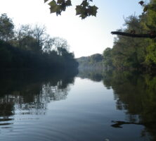
Ocmulgee, Oconee, and Altamaha River Basins
The headwaters of the Oconee and Ocmulgee rivers originate in the foothills of the Appalachians and meet to form the Altamaha River in the Upper Coastal Plain. Atlanta and Macon are major metropolitan areas along the Ocmulgee River. Along the Oconee River, Athens is located in the headwater region, and Milledgeville and Dublin are located in the middle and southern reaches of the river. Farther downstream of the confluence between the Ocmulgee and Oconee rivers, the Ohoopee River, a blackwater tributary, joins the Altamaha.
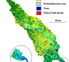
A major continental divide occurring between the Ocmulgee and Flint rivers causes the Altamaha River basin to drain into the Atlantic Ocean. The Altamaha River basin is the largest watershed in the state of Georgia and the third largest in the United States draining into the Atlantic Ocean.
Three distinct groundwater aquifers influence the Altamaha River basin. In the northern headwaters of the Ocmulgee and Oconee rivers, crystalline-rock aquifers dominate. In the lower reaches of these rivers, cretaceous aquifer systems lie beneath the surface. The Altamaha River is part of the large Floridan aquifer system. Groundwater aquifers that occur near the fall line are exposed or close to the surface. South of the fall line, which includes the Altamaha River, the majority of domestic water supplies comes from groundwater sources.
A total of 137 river miles marks the distance between the convergence of the Oconee and Ocmulgee rivers and the entry of the Altamaha into the Atlantic Ocean near Darien. The tidal estuary at the mouth of the Altamaha functions as a linkage between the freshwater habitats of the river basin with the saltwater system of the Atlantic Ocean. During the 1800s the Altamaha River was a major route for shipping to the Georgia coast.
Agriculture dominates the landscape of the Ocmulgee, Oconee, and Altamaha basins and has a direct impact on the health of the watershed. The Ocmulgee River officially begins southeast of Atlanta, where the Yellow, Alcovy, and South rivers converge at Lake Jackson. Downstream the Ocmulgee’s watershed is dominated by agriculture and forested areas. The Oconee River headwaters arise in a highly forested region, but the presence of agriculture increases as the Oconee flows southeastward toward the Altamaha River. The ninety-mile coastal flood plain of the Altamaha River is covered with dense timber and underbrush.
The upper reaches of both the Oconee and Ocmulgee watersheds have been particularly affected by a combination of pollutants from urban runoff, storm sewers, municipal point sources, and combined sewer outflows. In the Altamaha River watershed, nonpoint source pollution contributes to organic enrichment, metals contamination, and fish consumption advisories in the Altamaha and its tidal estuarine system.
The National Dam Inventory documents 276 dams in the upper Oconee River watershed, while a detailed scale analysis found more than 5,400 impoundments in the watershed. These figures demonstrate that the majority of the reservoirs in this watershed are unaccounted for and that their environmental impacts can be underestimated. Two large dams (greater than twenty-five-feet high) were built along the mainstem of the Oconee River, creating Lake Sinclair and Lake Oconee. Neither the Ocmulgee River nor the Altamaha River has large dams built along its mainstem.
More than 100 rare and endangered aquatic species are found in the Altamaha. The watershed provides habitats for nesting and breeding migratory birds as well as for common game species. In 1991 the Nature Conservancy initiated an ecological survey to assess the biological resources and potential threats to the integrity of freshwater species diversity in the Altamaha River. This fragile watershed sustains several imperiled pearly mussel species, some of which are found nowhere else in the world.
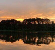
Blackwater River Basins
Five rivers in Georgia’s Coastal Plain form a collective river basin: the Ochlockonee, Ogeechee, Satilla, St. Marys, and Suwannee. The Ogeechee, which begins in Greene County; the Satilla, which begins in Ben Hill County; and the St. Marys, which begins in Charlton County, are Atlantic Coast drainages. The Suwannee, which begins in Dooly County, and the Ochlockonee, which begins in Worth County, drain to the Gulf of Mexico. The St. Marys and Suwannee rivers also drain portions of the Okefenokee Swamp, and the St. Marys River forms the boundary between Georgia and Florida.
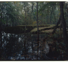
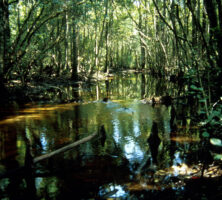
Each of these rivers drains sandy soils that lack the ability to retain dissolved organic matter leached from terrestrial vegetation. For that reason their water is tea-colored, and they are referred to as blackwater rivers. Even though there are high concentrations of dissolved organic matter in the blackwater river basin, the suspended sediment levels are low. Extremely low concentrations of dissolved oxygen occur in blackwater rivers during the warmer months of the year. These rivers have very little change in elevation per unit river length and extensive floodplains. The pH of the Ogeechee River is near 7.0 since there is a large input of carbonate-rich water from Magnolia Springs. The Satilla River has a much lower pH (around 5.0) and lies entirely within the Coastal Plain. Development and industrial or residential pollution is very low, and there is relatively little agricultural runoff into the river basin. Cypress and black gum forests fill the floodplain swamps that border the length of the Satilla River.
Historically, large amounts of woody debris and snags created an intricate patchwork of blackwater rivers and riparian zones. These stream bottoms consist primarily of constantly shifting sand, and woody debris and snags provide a stable habitat for insects and thus are vital to the secondary production of aquatic insects. Snagging operations at the turn of the twentieth century changed the rivers. For example, wood-removal operations were more intense in the Satilla River than in the Ogeechee River; hence less woody debris remains in the main channel of the Satilla.
Flooding plays an important role in the exchange between the surrounding watershed and the main channel of each blackwater river. The highest concentrations of total organic carbon occur during these flooding periods, and the lowest concentrations are measured during low flow periods. This exchange between the mainstem and the floodplain occurs because of the lack of impoundments and the low gradient of these rivers.