Stewart County, created by the state legislature in 1830, was named for Daniel Stewart, an Indian fighter, Revolutionary War (1775-83) veteran, and the great-grandfather of U.S. president Theodore Roosevelt.
Rich in historic, natural, archaeological, architectural, and cultural resources, Stewart County is nevertheless poor in wealth. To reconcile this disparity, county leaders in 1965 began forging a new economy in tourism. This effort is emerging today as a major alternative to the traditional economies of peanuts, cotton, and pine trees. At the zenith of the county’s prosperity in 1850, Stewart ranked as the tenth most populous in Georgia. By 2003 it was the state’s ninth least populous county. According to the 2020 U.S. census, the population was 5,314.
Early History
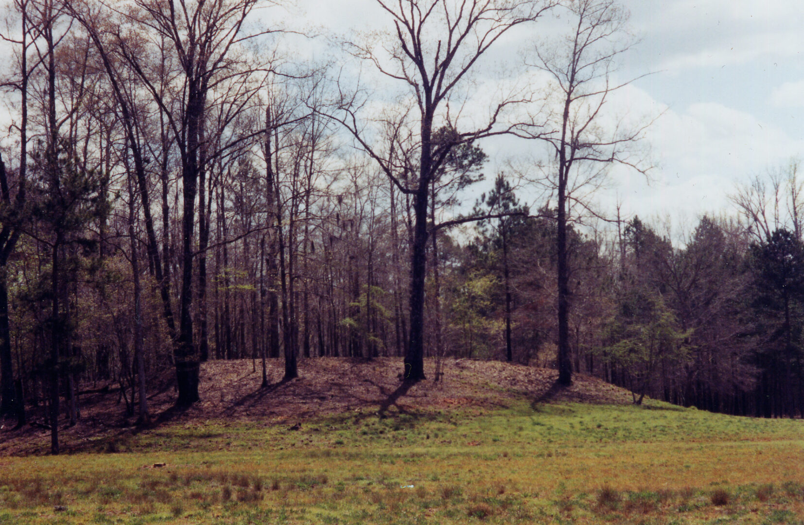
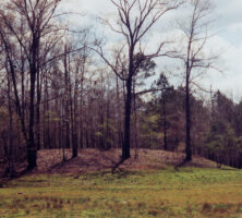
Thousands of years ago Native Americans recognized the many strategic advantages of the land known today as Stewart County. The Mississippian Culture placed two major mound systems, known today as the Rood Mounds and Singer-Moye Mounds, here during the Mississippian middle period (A.D. 1100-1350).

Located along the fall line, Stewart County’s entire western border is composed of the Chattahoochee River and the Alabama state line. Only about twenty miles downriver from Columbus (the northerly point of large-craft navigation), Stewart County traditionally provided a link between the Piedmont region of Georgia and the Gulf of Mexico.
The first Europeans in present-day Stewart County were the Spanish, who moved through the area about 1639. However, legal settlement began with the state’s fifth land lottery, held in 1827, when Lee County became one of five new west Georgia counties. In 1828 the state sectioned off the western part of Lee to create Randolph County, which in turn was divided on December 23, 1830, tocreate Stewart. In 1853 the eastern part of Stewart became Kinchafoonee (later Webster) County, and in 1858 the newly established Quitman County absorbed a western piece of Stewart.
The treaty that wrested west Georgia from Native Americans ended in conflict. By 1836 the remaining Creek Indians began ambushing homes and communities in desperation. The settlers called on Governor William Schley for protection. Schley sent state militia volunteers from Gwinnett County to establish three local forts—Ingersoll, Jones, and McCreary. On May 15, 1836, the river settlement of Roanoke was burned by a reported 300 Indians. On June 9 the Battle of Shepherd’s Plantation marked an end to skirmishes in the county and, essentially, in the state.
A Brief Prosperity
The county population exploded from 1836 to 1850. Settlers poured in, mainly from other fall line counties, especially Jones, Washington, and Wilkes. Stewart soon became one of Georgia’s top-three cotton producers (more than 7.6 million pounds in 1850). Lumpkin, in turn, served as the area’s center of commerce and stagecoach routings.

By the 1850s, however, signs of decline began to manifest. Rail construction—connecting Savannah to west Georgia’s cotton producers—passed north and south of the county but not through it. It would be 1885 before a rail finally entered Stewart, leading to the incorporation of Richland in 1889.
Additionally, the European-influenced farming practices of the time led to devastating soil erosion in Stewart County. Underlying soil structures in the area yielded multiple gullies in place of the once-fertile crop fields. As the soil washed away, so too did Stewart County’s economic strength. Stewart County lost population in every decade of the twentieth century.
A New Hope
Just as they had overproduced cotton, farmers—including those in Stewart County—also overproduced peanuts, a crop that the government began promoting during World War I (1917-18). By the mid-twentieth century, professionally managed forests began to supplant even the peanut fields. By 1990 forests covered 87 percent of the acreage in the county.
In light of this dramatic change from row crops to trees, some of Stewart County’s citizens realized that a new industry needed to be developed. (Forestry allowed for more free time, as it was not as labor intensive as agriculture.) A group formed in 1965 to restore a derelict stagecoach hotel, and the restoration of the 1836 Bedingfield Inn, on Lumpkin’s courthouse square, became the first small-town community preservation project in Georgia. The citizens hoped to attract tourists to the county, marking the beginning of heritage tourism in rural Georgia.
The early success of the inn restoration caused the same group to establish a living history museum based on the collections of John Word West at Jonesboro. Westville, which opened near Lumpkin in 1970, was a simulated 1850s village, comprising actual historic buildings of Georgia. In 1989, Westville received 49,000 visitors a year, but by 2012, only about 13,000 people visited the village. The museum closed in 2015 and was relocated to nearby Columbus.
The county is home to other historic and natural attractions. Providence Canyon was designated a state park in 1971. Providence is actually a series of erosion gullies on 1,003 acres of land, but the multicolored 150-foot-deep “canyons” attracted tourist and media attention throughout the twentieth century.
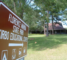
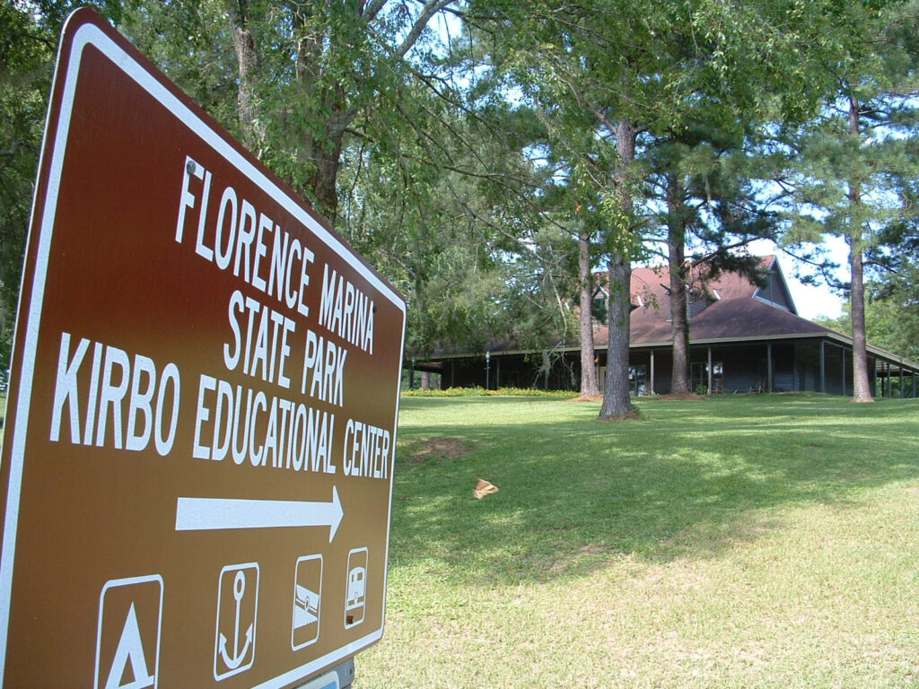
Florence Marina State Park subsequently opened in 1986. The park provides a gateway to the Chattahoochee River and its many recreational possibilities. The Kirbo Educational Center at the park offers information on both the Native Americans of the area as well as the once-prosperous town of Florence, burned in the Creek wars of 1836. About 800 acres of the Eufaula National Wildlife Refuge are located along the Chattahoochee’s eastern shores in Stewart County. The Hannahatchee Wildlife Management Area, in the northern part of the county, gives hunters a 5,600-acre site to enjoy.
The Towns
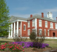
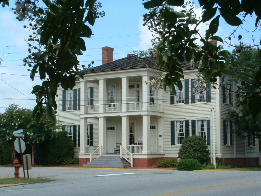
The incorporated cities of Lumpkin and Richland and the unincorporated communities of Omaha and Louvale all boast reasonably intact historic districts. The economic histories of these towns are written in their architecture. Lumpkin, the county seat, offers a stagecoach-trail driving tour of antebellum homes. Built in 1895 and rebuilt in 1923 by architect T. F. Lockwood after a fire, the county courthouse presides over the town square and business district. The Bedingfield Inn is the only remaining wooden structure on the square.
Richland, as old as Lumpkin, became the larger city with the coming of the railroad. Richland’s relation to geography and rail is striking. The city sits atop the watershed between the Chattahoochee and Flint rivers. Rails, once connecting Americus to Montgomery, Alabama, and Columbus to Tallahassee, Florida, cross at Richland. Tourists can enjoy the many late Victorian and early-twentieth-century homes there.
Omaha, nestled in the northwest corner of the county near the juncture of the Chattahoochee River and Hannahatchee Creek, seems hidden from the current century. Founded in the 1890s, when the railroad arrived, Omaha is mentioned in James Joyce’s 1922 novel, Ulysses, as the fictional scene of mob racial violence.
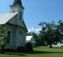
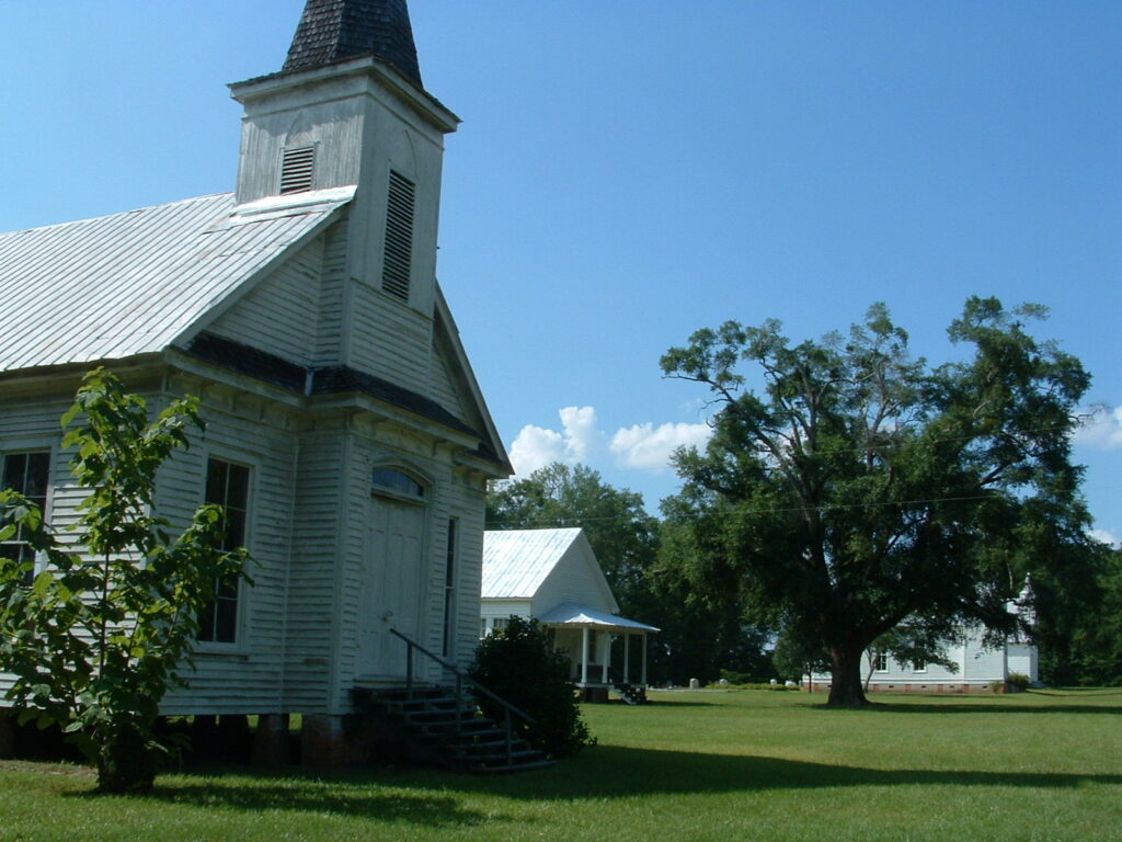
Another community within Stewart County is Louvale. Best known for its “Church Row,” Louvale’s Primitive Baptist, Methodist, and Baptist churches form a religious courtyard of sorts, with a community center among the churches. Louvale is long and narrow, stretching about six miles along U.S. Highway 27.
Dozens of other communities have disappeared, or nearly so. One that still survives is Green Grove, an African American community formed in the wake of the Civil War (1861-65). A Baptist congregation, established in 1886, continues to meet today. From 1937 to 1958 Green Grove Missionary Baptist Church operated a school for the community until the county board of education built a new brick facility for Black children in Lumpkin.
Prominent Citizens
Prominent Stewart County natives and residents have included Clement Evans, a Confederate general, Methodist minister, and historian; political leader and Confederate general Robert Toombs, who owned a plantation on the Chattahoochee River; Sidney Root, a businessman, Confederate military advisor, and aspiring architect; architect John Wellborn Root; and Lillian Gordy Carter, mother of U.S. president Jimmy Carter.