The Piedmont geologic province, underlain by igneous and metamorphic rocks, forms the foothills of the Appalachian Mountains. The region contains some of the most distinctive landmarks in Georgia and is the source for many of the state’s most important raw materials.
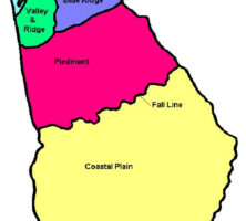
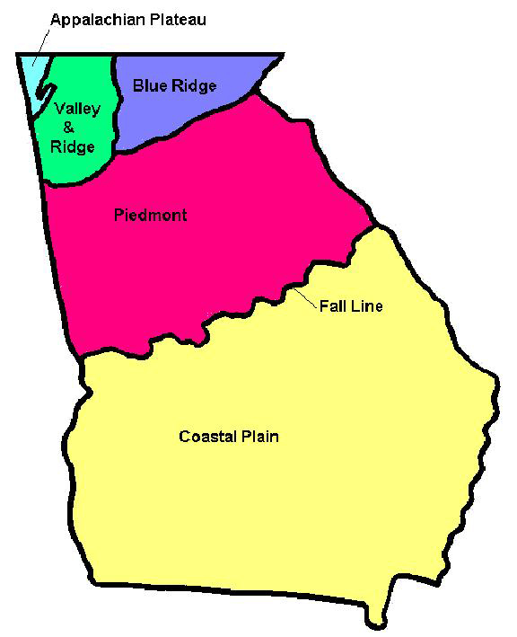
The Piedmont extends west to east across Georgia, from the edge of the Coastal Plain in the south to the Blue Ridge chain of the Appalachian Mountains in the north. It is an area of generally modest relief, rolling hills, and narrow valleys that contrasts with the more dramatic relief of the Blue Ridge. The diversity of Piedmont rocks, the scale of their variation, and the complexity of their interrelationships have made the study of them a challenge.
Rocks and Geologic Structures
Major, long-inactive fault zones divide the Piedmont into several belts. The fault zones and the rocks between them generally have a northeastern strike, parallel to the overall trend of the Appalachian Mountains, which rose during the Cambrian period, about 500 million years ago. In spite of much detailed work by many geologists, not all agree on the extent, interrelationships, and significance of these faults, although general patterns of development have been established.
In a broad sense, the northern boundary of the Piedmont is the Hayesville-Allatoona fault. This fault separates the Blue Ridge on the north from the northern Piedmont, or eastern Blue Ridge, on the south. This contested ground, bounded on the south by the Brevard zone, contains Kennesaw Mountain and the Dahlonega gold belt as well as several other gold-bearing trends. South of the Brevard zone, which continues across the state, lies what most people consider to be the true Piedmont province. This area, in turn, is subdivided into the Inner Piedmont, Pine Mountain, Charlotte, Uchee, and Kiokee belts by the Towaliga, Bartletts Ferry, Goat Rock, Middletown-Lowndesville, Modoc, Ocmulgee, and Dean Creek faults. The granitic Elberton, Stone Mountain, Ben Hill, and Palmetto batholiths (masses of igneous rock below the earth’s surface) occur within the Piedmont. Deformation of the Ben Hill and Palmetto batholiths near the Brevard zone indicates that these masses formed before some of the geologic movement along the Brevard.
Major amphibolite, or metamorphic bodies, also occur in these belts. These bodies contain remnants of severely deformed pillow lavas, or mounds of lava that are indicative of submarine extrusions. The Carolina Slate belt contains the remnants of shallow subvolcanic intrusions, volcanic sediments, and extrusive rocks, all part of an island system characterized by explosive volcanism and hydrothermal activity, much like today’s Japanese and Philippine islands and the floor of the Sea of Japan. Graves Mountain, whose deposits are thought to be exhalative (caused by submarine hot water vents) in origin, also occurs in the Carolina slate belt. At one time, the metamorphic rocks of the Piedmont may have formed the substructure of a volcanic arc, which has been compared to the present-day Indonesian arc.
Courtesy of Pamela J. W. Gore
The Piedmont was one of the early subjects of the Consortium for Continental Reflection Profiling (COCORP) project. Seismic reflections were used to determine the deep structure of the Piedmont area. Interpretation of COCORP data indicates that the Piedmont consists of a thin slab of rock that was thrust a great distance from the southeast onto the North American continent.
Highlights of the Piedmont
Dimension stone (used for construction blocks and monuments) is quarried from large granitic batholiths, such as the Elberton batholith, in east Georgia, while significant amounts of crushed stone, the main component of roads and other construction projects, are quarried from bodies of gneiss and granite in the Piedmont, including sites around Augusta, Atlanta, and Columbus. Additionally, Stone Mountain is a world-class granite mass. The clay deposits in central Georgia formed from the weathering of such Piedmont granite bodies.
Graves Mountain is known for kyanite, pyrophyllite, lazulite, pyrite, and rutile as well as many other minerals. The aluminum-rich mineral kyanite was mined at Graves Mountain from about 1963 to 1984 for use in ceramics and insulators. Some of the last kyanite mined was used in insulating tiles for space shuttles. The rutile found at Graves Mountain is the only mineral occurrence in Georgia noted in the classic Dana’s Manual of Mineralogy. Mining for well-formed rutile crystals began in the nineteenth century.
Gold deposits found near Dahlonega in 1829 caused what many consider to be the first major gold rush in the United States, and mining technology developed at Dahlonega traveled west to California with the forty-niners.
Soapstone Ridge in Atlanta, as well as numerous amphibolite bodies in other parts of the Piedmont, are the remnants of an ancient oceanic lithosphere (the earth’s crust and upper mantle).
The Pine Mountain ridge, extending from the Chattahoochee River to east of the Flint River, consists of Hollis quartzite, a metamorphosed quartz sandstone, as well as metamorphosed mudstone and (in Alabama) marble. This ridge was formed by a suite of sedimentary rocks deposited on the shallow shelf of the North American continent hundreds of millions of years ago.
Photograph by andrewI04
Numerous dikes of diabase, a fine-grained rock, that cut through the Piedmont are evidence of the fracturing and igneous activity during the final mountain-building event of the Paleozoic era, when Pangaea, the early supercontinent, was torn apart. This event produced the Atlantic Ocean, leaving North and South America on one side, and Europe and Africa on the other.
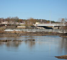
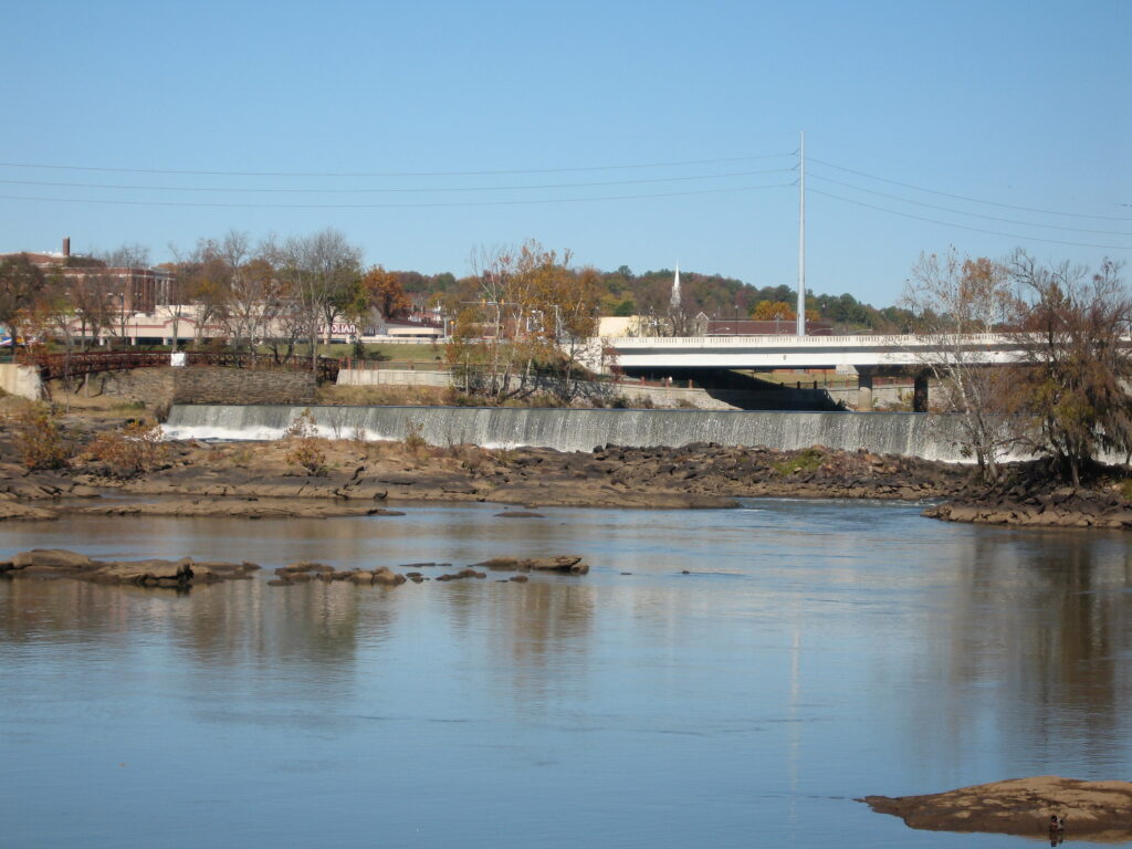
The fall line forms the transition between the Coastal Plain and the Piedmont. Along this line, the hard rocks of the Piedmont start cropping out to produce rapids and waterfalls. The communities of Augusta, Columbus, Macon, and Milledgeville developed at such places, where modes of water transportation had to change. The power of the rivers was also harnessed at these sites for manufacturing.