The Appalachian Trail is the world’s longest continuous hiking trail that is maintained and marked. It spans much of the length of the Appalachian mountain chain, running 2,167 miles through fourteen states from Georgia to Maine.
Its route in Georgia follows the crest of the Blue Ridge Mountains, covering approximately 77 miles from its beginning at Springer Mountain to Bly Gap at the North Carolina border.
History of the Trail
Benton MacKaye, a Massachusetts forester and philosopher, conceived the idea of the Appalachian Trail in 1921. He envisioned it as a means of reinvigorating the nation’s pioneer spirit and as a refuge, both physical and mental, against the encroaching urbanization and modernization of twentieth-century American life. A conference convened by MacKaye in Washington, D.C., in 1922 spurred efforts by interested parties in several states along the proposed route. The first section of the trail was constructed in New York State later that year. Initial plans called for Lookout Mountain, which straddles Georgia and Tennessee at Chattanooga, to be the trail’s southern terminus.
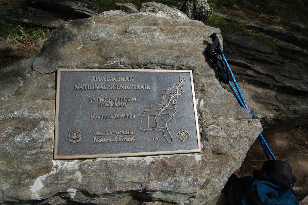
Progress on the project remained sporadic until 1925, when a permanent Appalachian Trail Conference (later Appalachian Trail Conservancy) was established. Construction of the trail in New England and Pennsylvania proceeded more rapidly than it did in the South. Only in 1930 did the Georgia Appalachian Trail Club begin work on the trail’s southernmost section. By then, revised plans had moved the trail’s route eastward, and its southern terminus was officially established on Mt. Oglethorpe, near Amicalola Falls. (In 1958, because of encroaching development in that area, the terminus was moved twenty miles north to Springer Mountain.) Construction of the trail in Georgia was carried out by Trail Club members, the U.S. Forest Service, various local hiking groups, and after 1933, Civilian Conservation Corps (CCC) workers. The trail’s completion date is usually considered to have been 1937, when a final section was opened in Maine, near its northern terminus of Mt. Katahdin.
Description of the Trail
Access to the trail on Springer Mountain can be gained from several trailheads. The most commonly used is an eight-mile connector from Amicalola Falls State Park. The Appalachian Trail proceeds northeastward from the peak of Springer Mountain. It begins in Gilmer County and generally follows the southern boundary of Union County and the southern and eastern border of Towns County. For its entire length in Georgia, it cuts through the Chattahoochee National Forest; Georgia is one of only three states in which the trail lies entirely within federally protected forestland. The U.S. Forest Service works with the Appalachian Trail Conference and the Georgia Appalachian Trail Club to maintain the trail and protect the wilderness areas through which it passes.
Altitudes along the Georgia section of the trail range from 2,500 feet to over 4,400 feet; its highest points are Blood Mountain (4,458 ft.) and Tray Mountain (4,430 ft.). Several other trails and at least five highways intersect the Appalachian Trail along its Georgia route, providing other, often easier, points of access. Eleven shelters are spaced from six to eight miles apart along the trail. Most are primitive, three-sided, open-front structures or lean-tos that can accommodate four to six hikers overnight. The oldest shelter, on Blood Mountain, is also the most substantial—a fully enclosed two-room stone cabin built by the CCC in 1937. Fewer than 10 percent of the trail’s users hike its entire length or attempt to. Most who do begin in Georgia and move northward.
Literature
In addition to a number of guides to the Appalachian Trail, several travelers’ accounts offer more anecdotal or descriptive information on the Georgia section of the trail. These range from Elmer C. Adams’s Walking in the Clouds (1939), the first account by a hiker who finished the entire length of the trail, to Bill Bryson’s A Walk in the Woods (1998), a humorous commentary on his aborted attempt to do the same in 1996. Bryson and a companion began their trek at Springer Mountain and gave up their quest just after moving through the Great Smokies in North Carolina. Thus much of their experience on the trail focuses on the Georgia section, and many readers are said to have found his condescending depictions of the people and the region offensive.
In 2015 a film version of A Walk in the Woods appeared. It was produced by Robert Redford, who plays Bill Bryson alongside Nick Nolte, who plays Bryson’s hiking companion. Much of the film was made on location in Georgia, including scenes filmed at Amicalola Falls State Park and Neels Gap, and in Buford and Kennesaw.