Georgia has a vast geologic history covering at least 1 billion years.
During this time, the formation and erosion of mountain ranges, dramatic climactic changes, several episodes of flooding by the sea, and volcanic eruptions have influenced the state’s geology. The geologic history of Georgia is not completely known or fully understood, and many significant questions remain.
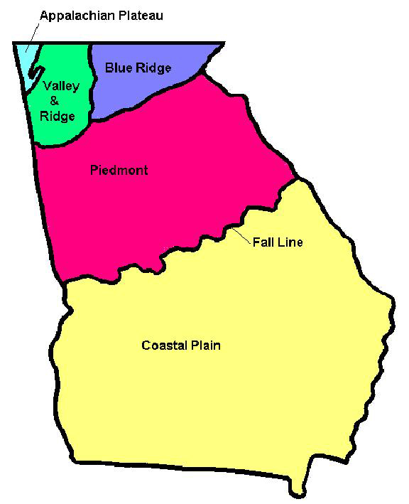
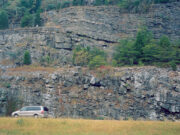
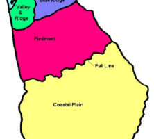
The state can be subdivided into five regions or provinces based on characteristic landforms, types and ages of rocks, and geologic structures. These provinces are known as the Coastal Plain, Piedmont, Blue Ridge, Valley and Ridge, and Appalachian Plateau. The geologic history of each province is unique, but all the histories are interrelated. Geologic time is divided into eras, periods, and epochs, and these time units are used to describe the major events in Georgia’s geologic history.
Precambrian Era
The oldest rocks in Georgia are found in the Piedmont and Blue Ridge provinces and are Proterozoic in age (1 to 1.3 billion years old). These rocks were originally deposited as sediment, which was compressed into sedimentary rocks and then altered by heat and pressure into a metamorphic rock called gneiss. The metamorphism occurred about 1 billion years ago during a mountain-building event, or orogeny, in eastern North America called the Grenville Orogeny. This orogeny was accompanied by the intrusion of granite and other igneous rocks, which were also metamorphosed. The rocks were folded, faulted, uplifted, and then eroded. These metamorphic rocks, called the Grenville gneisses, form the “basement” upon which the younger rocks of the Appalachian mountain system have been deposited.
Between 630 and 700 million years ago, the rifting (or splitting apart of the continent) began, which led to the opening of the Iapetus Ocean (or proto–Atlantic Ocean) along the eastern margin of North America. From the Late Proterozoic to the Early Cambrian, the Grenville mountains eroded, and streams transported sediments to the sea, which covered much of Georgia at that time. These sediments were compacted into sedimentary rocks and later metamorphosed to the gneiss, marble, metaconglomerate, phyllite, quartzite, schist, and slate found in the Blue Ridge and/or Piedmont regions of Georgia.
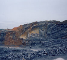
Volcanic islands were present in this ancient sea, and eruptions produced igneous rocks, which were also later metamorphosed. Today these rocks are amphibolite, hornblende gneiss, and other metavolcanic rocks. Gold was deposited from mineral-rich hot waters moving through cracks in the volcanic rocks on the sea floor. This gold has been mined in the Dahlonega area since its discovery in 1828.
Paleozoic Era
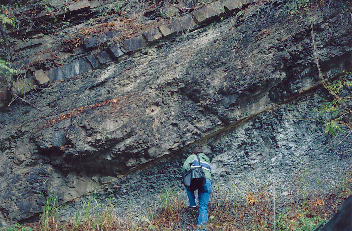
From the Cambrian to the Pennsylvanian periods, the southeastern part of North America lay south of the equator in a relatively tropical climatic zone. The Iapetus Ocean was offshore, roughly where the Atlantic Ocean is today. As the sea flooded over the eastern edge of North America during the Paleozoic, a thick (5 to 10 kilometers or more) sequence of shallow marine sediments was deposited. A series of three mountain-building events affected eastern North America during the Paleozoic. These orogenies caused metamorphism, folding, faulting, and igneous intrusions in the Piedmont and Blue Ridge, as well as the folding and faulting of the sedimentary rocks of the Valley and Ridge and the Appalachian Plateau.
Cambrian Period, Ordovician Period, and Silurian Period
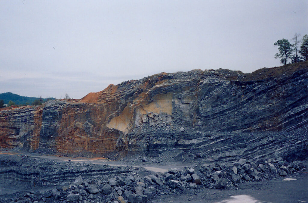
During the Cambrian period (542 to 490 million years ago), sandstones, dolostones, and shales were deposited on beaches and in shallow seas covering the eastern edge of North America. During the Late Cambrian and Early Ordovician periods, carbonate rocks, or limestones, were deposited in the warm, shallow waters of this sea. The environment was much like that of the present-day Great Bahama Bank. Numerous animals, including corals, brachiopods, snails, nautiloid cephalopods, crinoids, trilobites, and bryozoans, inhabited the shallow sea.
During the Ordovician period (488 to 444 million years ago), the Iapetus Ocean began to close as a drifting continental tectonic plate neared eastern North America. This movement caused a downwarping of the seafloor and produced a chain of volcanic islands and mountains to the east. Volcanic eruptions in eastern North America about 454 million years ago spread as far south as Georgia, as far west as the Mississippi River, and eastward into Europe, which at that time was situated quite a bit closer to North America. Several beds of volcanic ash, now weathered to a clay called bentonite, are interbedded with Ordovician limestones in northwestern Georgia.
A volcanic island arc and possibly a small continent collided with North America in the Middle to Late Ordovician period, resulting in the formation of a large mountain range to the east. This mountain-building event is called the Taconic Orogeny. Sediments eroded from the Taconic mountain range during the Late Ordovician and Early Silurian were carried westward, forming a delta system that discharged sand and mud into the shallow seas covering the central part of North America. Sea levels dropped worldwide at the end of the Ordovician period because of the buildup of glacial ice near the South Pole.
Devonian Period
During the Devonian period (416 to 359 million years ago), a large continent called Baltica (Europe) collided with northeastern North America, and a volcanic island arc called the Avalon terrane (or Carolina terrane) collided with eastern North America. These events caused a second Paleozoic mountain-building event, called the Acadian Orogeny, to occur about 380 million years ago. A mountain range, known as the Acadian highlands, was formed along North America’s east coast. Erosion occurred as most of Georgia remained high and dry following this mountain-building event. Between the Middle Silurian and the Middle Devonian, no sedimentary rocks were deposited in Georgia, or those deposited were eroded away before the end of the Devonian.

During the Late Devonian, a shallow sea flooded the northwestern part of Georgia and much of central North America. A unit of chert and a thin (up to about 10 meters thick), widespread layer of black shale were deposited. This shale, called the Chattanooga Shale, contains uranium and has been dated at 350 million years old. The presence of pyrite and organic matter and an almost complete lack of fossils suggest that the Chattanooga Shale was deposited in stagnant, oxygen-deficient seawater.
Mississippian Period
During the Mississippian Period (359 to 318 million years ago), thick deposits of limestone and chert formed in the warm, shallow sea that covered northwestern Georgia and much of central North America. Animals inhabiting this sea included Archimedes bryozoans, blastoids, brachiopods, corals, and crinoids. In some areas shales and sandstones were also deposited as a delta built outward from the Acadian highlands to the east-southeast. By the end of the Mississippian, the seas withdrew as another glaciation began.
The third and final Paleozoic mountain-building event, beginning in the Late Mississippian and continuing throughout the Pennsylvanian and Permian periods, affected the Appalachian region. This event, the Alleghanian orogeny, was caused by the collision of Africa (part of the continent of Gondwana) with North America, resulting in the complete closure of the Iapetus Ocean and the formation of the supercontinent Pangaea. The Alleghanian orogeny produced the folds and thrust faults in both the Valley and Ridge and the Appalachian Plateau. In addition, Piedmont and Blue Ridge rocks were thrust west-northwestward on top of the folded and faulted sedimentary rocks of the Valley and Ridge.
Pennsylvanian Period
During the Pennsylvanian period (318 to 299 million years ago), most of Georgia was located within the core of a large Appalachian mountain range, which was 4 to 7 kilometers high and rivaled the Himalayan mountain system (in present-day Asia) in size. There was no ocean to the east; rather, the continent of Africa was welded to North America. The sea lay far to the west, in central North America. Along the western side of the Appalachian mountain range lay a vast swampy lowland covered by lush tropical forests that were inhabited by fern-like plants, huge insects, and amphibians. Rivers flowed westward, depositing sandstones, conglomerates, and mudstones as the mountains eroded. Extensive coal deposits formed in the swamps. Sea levels fluctuated as glaciers near the South Pole advanced and retreated. Sandstones deposited during the Early Pennsylvanian are present on Lookout Mountain in northwest Georgia. No record of the events occurring during the Middle Pennsylvanian to Permian periods are preserved in Georgia, suggesting that this was a time of erosion.
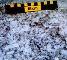
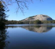
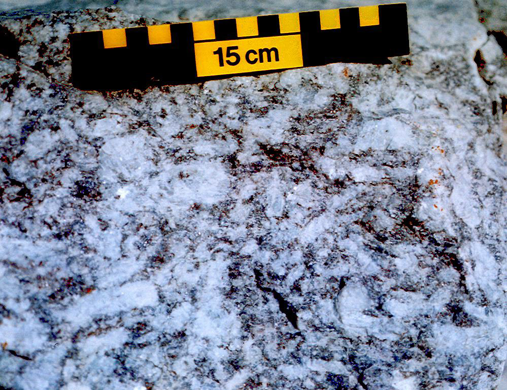
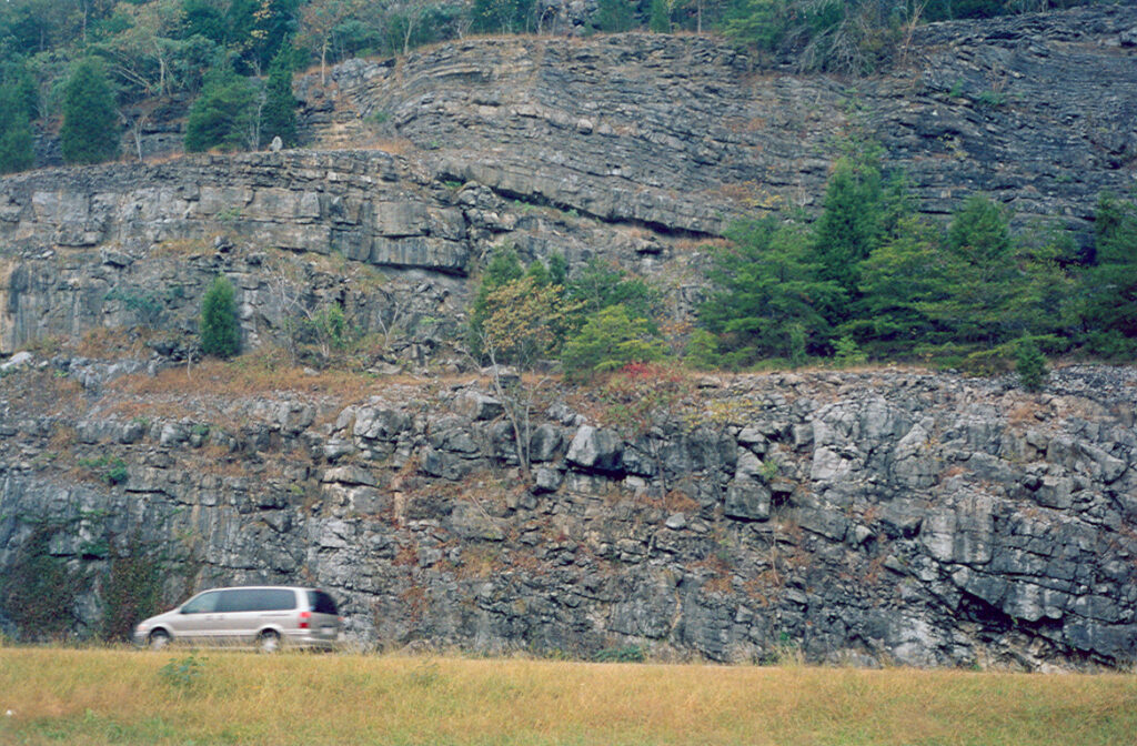
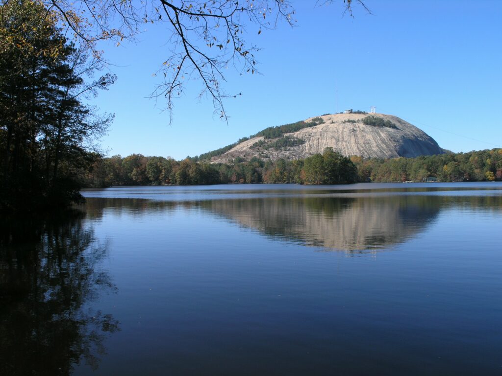
During the compression that accompanied the Alleghanian orogeny, rocks in the Piedmont and Blue Ridge areas were metamorphosed. In some places temperatures were so high that the rocks began to melt and huge bodies of granitic magma began to form deep within the core of the mountain range. Radiometric dates from Stone Mountain, one such granite body, show that this event occurred 265 to 325 million years ago, during the Pennsylvanian period. Elberton granite is similar in age. Because of the metamorphism and intense folding and faulting, interpreting the historical geologic details of many rocks in the Piedmont and Blue Ridge is difficult.
Mesozoic Era and Cenozoic Era
Triassic Period and Jurassic Period
Mesozoic fault-bounded rift basins, which contain Late Triassic and Early Jurassic sedimentary rocks, are found in the subsurface of Georgia. They are buried beneath the younger sedimentary rocks of the Coastal Plain, as well as beneath continental shelf sediments. Several dozen of these basins are present along the Atlantic seaboard between Florida and Nova Scotia, Canada. These fault-bounded basins formed as the Atlantic Ocean began to open and as Africa began to rift or split away from North America. The Mesozoic basins are filled with a variety of nonmarine sedimentary rocks ranging from red sandstones and siltstones to fine-grained shales and coarse-grained conglomerates deposited in river and lake environments.
Associated with these rift basins, and exposed throughout the Piedmont, are thin, elongated intrusions of diabase, a black, fine-grained igneous rock. These dikes formed as rifting occurred, and they represent cracks parallel with the rift occupied by the opening Atlantic Ocean basin. They are oriented roughly northwest-southeast, and the diabase is similar in composition to the basalt on the Atlantic Ocean floor. These diabase dikes range in age from about 180 to 230 million years old. As rifting occurred and the Atlantic Ocean opened, a slice of the African continental plate was left attached to North America. This remaining bit of the African continent underlies coastal and south Georgia.
Following the deposition of the Triassic-Jurassic sedimentary rocks of the buried Mesozoic rift basins, approximately 100 million years of erosion occurred before the Late Cretaceous rocks of the Coastal Plain were deposited. The youngest rocks in Georgia are found in the Coastal Plain Province. These rocks range in age from Late Cretaceous to Holocene (97 million years old to the present). Cretaceous sedimentary rocks overlap Piedmont metamorphic and igneous rocks at the fall line, which follows a series of waterfalls marking the upstream extent of navigable waters in the state.
Cretaceous Period and Paleogene Period
During the Cretaceous period (145 to 65.5 million years ago), the climate was much warmer than it is today, and tropical conditions existed in Georgia. No glaciers existed at the poles, and as a result, sea level was much higher than it is at present. The Atlantic Ocean covered southeastern Georgia inland as far as present-day Macon, Columbus, and Augusta, and left marine sediments containing mollusk shells, sharks’ teeth, bits of turtle shell, and the occasional dinosaur bone. Dinosaurs roamed Georgia during the Cretaceous and sometimes floated out to sea after they died. The remains of such dinosaurs as the duck-billed hadrosaurs and the ferocious carnivore Albertosaurus, a close relative of Tyrannosaurus rex, are found in Late Cretaceous rocks (65 to 100 million years old). The Cretaceous ended with the extinction of the dinosaurs, possibly as a result of an asteroid impact or a combination of natural causes.
From the Late Cretaceous period to the Middle Eocene epoch of the Paleogene period (about 40 to 100 million years ago), large quantities of kaolinite, a white alumino-silicate clay resembling chalk, were deposited in middle Georgia. (Kaolin is mined for use in the manufacture of glossy paper, plastic, rubber, paints, ceramics, and other products. Georgia is the world’s leading producer of kaolin.) This clay derives from the weathering of feldspar, a mineral found in Piedmont rocks. The clay was transported by streams and deposited in deltas, estuaries, and coastal marshes.
Marine deposits associated with kaolin, including abundant limestone, indicate that the Coastal Plain was flooded by a warm, shallow sea. This sea was inhabited by mollusks, sand dollars, foraminifera, bryozoans, and an early whale with hind legs (38 to 41 million years ago), an evolutionary remnant from an ancestor that walked on land.
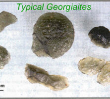
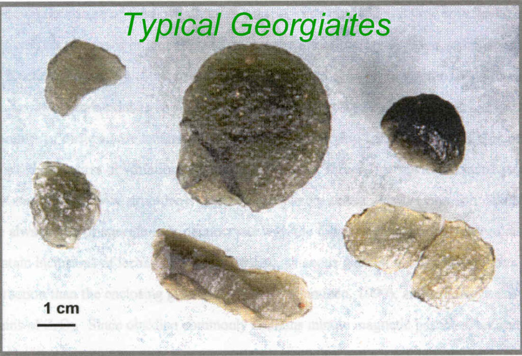
A dramatic event occurred about 35 million years ago during the Eocene era, when an asteroid or comet struck the Chesapeake Bay region of Virginia. The impact shattered and melted the rocks at the point of impact, forming a crater 90 kilometers in diameter and ejecting droplets of molten rock, which flew through the air for hundreds of kilometers. The molten rock cooled to form coin-sized, translucent, green glassy stones known as tektites, some of which landed in the sea covering east-central Georgia.
The climate cooled dramatically near the end of the Eocene, and during the remainder of the Cenozoic era, glaciers began to grow and the worldwide sea level dropped. The seas receded from Georgia, and sediments derived from the erosion of the Appalachian Mountains and the Piedmont built eastward. Sediments were deposited at a thickness of more than 5,000 meters, or 5 kilometers, in the Coastal Plain area and thickened toward the southeast.
Neogene and Quaternary Periods
Glaciers periodically covered much of northern North America during the Pleistocene epoch (2.5 million to 11,700 years ago), although Georgia remained ice-free. The seas alternately flooded and retreated from the land along the coast as the glaciers advanced and receded. During peak glacial episodes, sea level was about 100 to 120 meters lower than at present, and the coast was out near the edge of the continental shelf. Between glaciations, sea level stood as much as 50 meters above present levels. Sea-level high stands are marked by beach ridges. Beaches were dominated by white quartz sand, but during times of rising sea level or higher wave energy, concentrations of black sands, rich in such heavy minerals as ilmenite, zircon, rutile, epidote, sillimanite, staurolite, magnetite, tourmaline, and kyanite, formed on the beaches. Some of these heavy mineral sands are present in Pleistocene beach ridges near the Okefenokee Swamp and contain valuable economic deposits of titanium.
During the Pleistocene, Georgia was inhabited by mammals not seen today, including mastodons, mammoths, elephants, camels, bison, tapirs, and giant ground sloths up to 6 meters tall. The climate was arid at times during the Pleistocene. About 20,000 years ago, rivers dried up and strong winds from the west blew the river sand into large dunes. Pleistocene sand-dune fields remain along the east side of several rivers, including the Flint, Ohoopee, and Canoochee.