The water cycle in Georgia, like the water cycle across the planet, describes the continuous motion of water throughout the biosphere. Within Georgia, the water cycle is broadly responsible for moving water from the atmosphere to streams, rivers, and lakes, on to the Atlantic Ocean, and back into the atmosphere.
Precipitation
Water in Georgia originates mainly as rainfall and occasionally as snow or sleet. On average, annual rainfall increases with elevation, with the greatest amounts (more than sixty inches per year) falling on the southern Appalachian Mountains in north Georgia—specifically the Blue Ridge region—and forming a temperate rainforest.
Georgia experiences little monthly or seasonal variations in rainfall, resulting in a relatively uniform distribution of precipitation throughout any given year. Some years and months are drier than others, however. Years with a strong El Niño (a warm ocean current along the coast of Ecuador and Peru in the equitorial Pacific that can cause catastrophic weather conditions around the world) tend to be wetter than normal, while La Niña (cooler than usual temperatures in the equatorial Pacific Ocean) years are drier. Overall, the annual precipitation varies by as much as 40 percent of the mean, so that the northeast Georgia city of Athens, for example, which has an average annual rainfall of forty-eight inches, can receive almost seventy inches or less than thirty inches in any given year.
Courtesy of Georgia Department of Economic Development.
The source of precipitation varies during the year as well. Frontal storms (disturbances along the boundaries between cold and warm air masses) are common during the fall, winter, and spring. These storms cover large areas and can be accompanied by short-duration, high-intensity rainfall along cold fronts. Lower intensities are commonly observed with warm fronts and after cold fronts have passed.
Convective thunderstorms (storms with heavy rain, thunder, and lightning induced by rising, unstable humid air) are common in Georgia during the summer months. These storms are localized, generally short-lived, and often accompanied by high-intensity rainfall near their center. These storms can cause localized flooding in the area affected.
Tropical depressions, tropical storms, and hurricanes along the Georgia coast are most likely to occur between June and November. These events may cause long-duration rainfall of moderate to high intensity over large areas. In 1994 Tropical Storm Alberto—which lasted two days, brought as much as twenty-four inches of precipitation in some places, and covered an area greater than 1,000 square miles—caused widespread flooding along the Flint and Ocmulgee rivers.
Evapotranspiration
Water on the earth’s surface is returned to the atmosphere either by evaporation of free water from soil and ponds or by the process of plant transpiration, which is water use by plants through stomata, or small openings in their leaves. Free-water evaporation is highly variable, with maximum rates occurring on warm, dry, windy days, and lowest rates on cold, wet, calm days.
Photograph by Jeff Gunn
Plant transpiration is affected by the same factors as evaporation and also by the plant leaf area. Deciduous (hardwood) trees lose their leaves in the fall, substantially decreasing plant transpiration rates. Evergreens, such as pines and live oaks, continue to transpire throughout the winter, although at a lower rate than during the summer.
Monthly evapotranspiration (a combination of water loss by both evaporation and transpiration) is greatest during the summer, decreasing during the winter. Evapotranspiration is lowest in the cooler Georgia mountains, where more plant species are deciduous, and highest in southern Georgia near the warmer Atlantic and Gulf coasts with their evergreen species.
Urban areas have less evapotranspiration than forested areas, because the lower vegetation density reduces transpiration and because there are fewer free-water surfaces and thus less evaporation. Suburban areas, however, have more evapotranspiration because of supplemental irrigation during droughts (lawn watering, for example) and greater free-water surfaces (swimming pools, for example).
Overall, approximately 70 percent of Georgia precipitation is lost as evapotranspiration. This means that the remaining 30 percent is the source of all streamflow, or flow of water in rivers and streams. Although lower evapotranspiration in cities means that more water is available for streamflow, the water generally runs off quickly and is of poor quality.
Streamflow
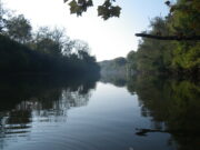
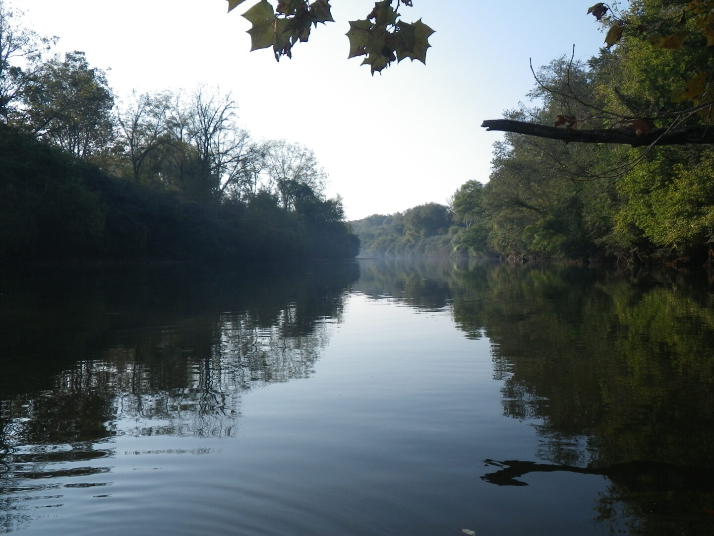
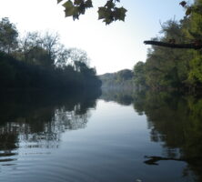
Rivers and streams in Georgia generally begin in the northern part of the state and flow toward either the Atlantic Ocean or the Gulf of Mexico. In south Georgia the rivers and streams that run into the Gulf generally flow to the south and southwest, while rivers in the northernmost part of the state flow westward into Alabama or northward into North Carolina and Tennessee. The rivers that flow into Alabama combine to form the headwaters of the Mobile River, and the rivers that flow north combine to form the Tennessee River, which eventually joins with the Mississippi River before entering the Gulf. Thus, in many ways, Georgia is a headwaters state—many rivers begin here, and excepting the Chattooga River bordering Georgia in the northeast, no rivers in the state have their origins elsewhere.
Courtesy of Edwin L. Jackson
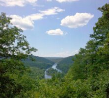
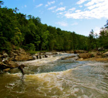
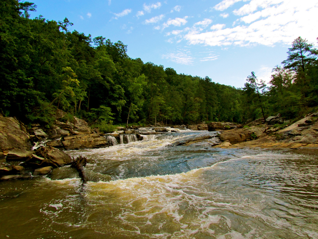
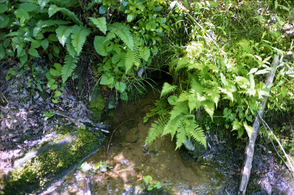
The rivers and streams in the Blue Ridge Mountains of north Georgia are generally steep, fast-flowing, cold, and clear. They provide ideal aquatic habitats, and north Georgia boasts some of the highest aquatic diversity in the world. Stream beds are generally rocky or are covered with boulders, gravels, and sands. Water clarity is generally good, with low turbidity (lack of clarity in water caused by soil or organic matter) except where roads and developments have disturbed the natural soil cover.
Rivers and streams in the Valley and Ridge region of northwest Georgia are unique in many ways. Because of the geology of the area, the mineral content of these streams is high, favoring such shelled organisms as mussels. Natural streams run clear and are abundant in fish species. Unfortunately, erodible soils and rapid development have resulted in the catastrophic loss of most mussel species in the last fifty years.
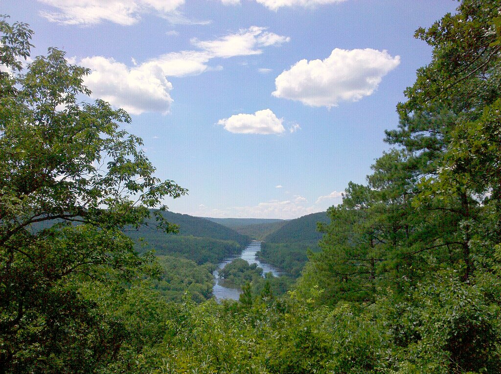
In the Piedmont, rivers are slower because of the flatter, rolling topography. Streams are often larger because larger watersheds contribute to them. Water generally runs muddy after rainstorms because of the older, more erodible soils and greater development in the Piedmont. These rivers are also greener because of the growth of algae, a plant that floats in water. Though usually too small to see individually, groups of algae can form visible mats, especially in the presence of excessive nutrients (nitrogen and phosphorus) from municipal, industrial, and agricultural sources.
Photograph by Doug Bradley
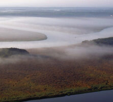
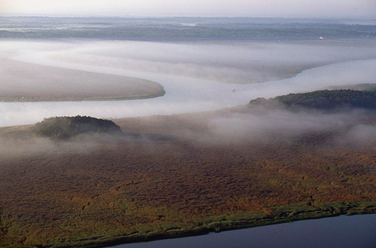
Atlantic Coastal Plain rivers are broad and slow-moving, with floodplain wetlands that attenuate large flows. These rivers flow into estuaries bounded by the barrier islands off the Georgia coast. Lowland areas are marshy, making agriculture difficult and favoring forests and forest industries.
Carolina bays (roughly circular depressions with sand rims) are found on the Upper Coastal Plain, while the Okefenokee Swamp is formed on the Lower Coastal Plain behind Trail Ridge, an elongated mound of sand parallel to the Atlantic Coast extending through Florida and Georgia. The presence of organic compounds from decaying vegetation gives many of the rivers and streams a dark, blackwater appearance.
Rivers and streams that flow to the Gulf of Mexico are also unique. Because the carbonate Floridan aquifer (a geologic formation beneath all of Florida, south Georgia, and parts of Alabama and South Carolina that enables water to flow readily into wells) is closer to the surface in southwest and south central Georgia, there is more aquifer interaction. Lime sinks, sinkholes, and springs are common. The waters ebb and flow between the ground and the surface depending upon the balance between precipitation and evapotranspiration.
Groundwater
Natural flow in rivers and streams originates from subsurface (ground) water. In cities, rain flows off roofs and streets directly into streams, but rain in natural settings soaks into the soil and percolates slowly downward to the water table, where it is stored and released slowly to streams.

Photograph by Dianne Frost
Groundwater storage in the Blue Ridge and Piedmont regions is limited by shallow depth to bedrock and by limited porosity (the volume of openings within soil or rocks) in the bedrock. Most groundwater is stored in the saprolite (weathered bedrock) and takes only a few months on average to reach the nearest stream.
In the Valley and Ridge region, and especially the Coastal Plain, groundwater is more readily available because the bedrock can store more water. The Floridan aquifer in the Coastal Plain and the limestone aquifers in the Ridge and Valley have large (albeit finite) storage capacities. Water may take thousands of years to travel from its point of recharge to its point of discharge. Groundwater recharge occurs where water is added to subsurface aquifers; a good example is on the Withlacoochee River near Valdosta, where a large sinkhole “swallows” the entire flow of the river most of the year. Most groundwater recharge in the rest of Georgia is diffuse, however, adding small amounts to groundwater over large areas. Groundwater discharge occurs as springs—for example, Magnolia Springs near Millen and Radium Springs near Albany. Groundwater discharge can also be diffuse, causing high water tables, such as in swamps and marshes. Some discharge occurs offshore as well, as diffuse upward flow through the seafloor and as large offshore springs, the so-called blue holes.
The northern fall line (along the Cartersville Fault) separates the Ridge and Valley from the Blue Ridge and Piedmont, and the southern fall line separates the Coastal Plain from the Piedmont. The aquifers in the Valley and Ridge, as well as in the Coastal Plain, are generally sandwiched by lower permeability formations (geologic units that transmit water).
Overpumping by cities and industries from the confined aquifers in coastal areas has caused water levels to drop, leading to salt-water upconing (salt water moving upward from below) as well as salt-water intrusion (leakage into the aquifer from the ocean above).
Upward leakage from previously artesian aquifers has been reduced or eliminated by overpumping, which has caused declines in freshwater inputs to rivers and coastal wetlands. By removing the water that helps support the land surface, groundwater use has also caused the land surface to sink.