Georgia’s rocks and geological structures define the shape and relief of the land, providing the topographic tapestry on which the state’s history has been played out. The story of Georgia’s geology stretches far back into the distant past and tells a tale of ancient tropical seas, mountains pushed up by the collision of continents, and ocean basins opening as continents rift apart.
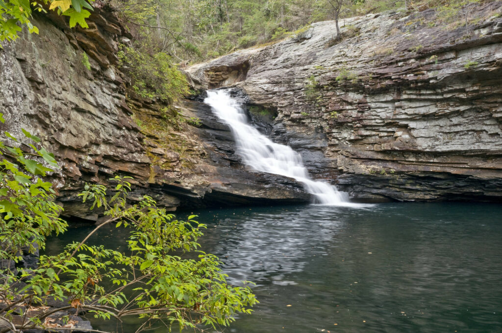
But the story of Georgia’s geology is not just about the past. Georgia is rich in such geological resources as marble, granite, and kaolin; production of these resources accounts for a large proportion of Georgia’s wealth. In addition, the geological beauties of rock, river, and mountain provide the attractions that annually draw thousands of tourists to Georgia’s state parks and other recreational areas.
Geological Provinces
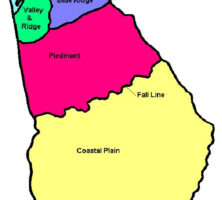
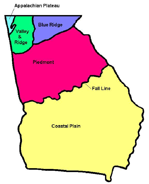
From the Sea Islands to the Blue Ridge Mountains, Georgia features some of the most varied and interesting terrain in eastern North America. Georgia’s geology can be thought of as a patchwork of different geological regions, each with its own distinctive look, rock types, and geological history. These different regions are called geological provinces. From the oldest to the youngest, Georgia’s provinces are the Piedmont, Blue Ridge, Valley and Ridge, Appalachian Plateau, and the Coastal Plain.
The Oldest Rocks: The Piedmont and Blue Ridge
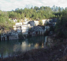
Running northeast to southwest through the center of the state, the Piedmont and Blue Ridge provinces are composed mainly of igneous rocks (formed by the cooling and crystallization of molten magma) and metamorphic rocks (caused by extremely high temperatures and pressures deep below the earth’s surface). In the area around Elberton huge quarries mine world-famous bodies of granite, an igneous rock, while valuable deposits of slate and marble lie within the Piedmont rocks of central Georgia. Piedmont and Blue Ridge rocks not only have undergone intense metamorphism but also show the effects of having been bent, twisted, and contorted by tremendous compressional forces within the earth’s crust, not once but many times. Large ancient faults, long inactive, that slice through the Piedmont area offer further evidence of these enormous forces.
The features of Georgia’s Piedmont and Blue Ridge were caused by forces within the crust associated with the formation of the Appalachian Mountains. Extending from central Alabama all the way to maritime Canada, the Appalachian Mountain chain is one of the great mountain belts, and its history begins far back in Earth’s history, when the eastern margin of North America ran from central Georgia to Newfoundland, Canada. Due to continental drift, the Appalachian margin of North America was the site of numerous continental “collisions,” each one the cause of more metamorphism, deformation, and igneous activity.
During the Carboniferous period, North America collided with the ancient continent of Gondwana to form the supercontinent Pangaea. When Pangaea broke apart due to continental drift during the Triassic period, the great Appalachian chain was also torn apart. Today, segments of the old Appalachians are found in northern South America, North America, northwestern Africa, Greenland, Great Britain, and the Scandinavian region of Europe.
Valley and Ridge and the Appalachian Plateau
Separating the Piedmont province from the Valley and Ridge is a great tear in the earth’s crust called the Cartersville Fault. This fault marks the place where Piedmont metamorphic rocks were shoved westward over sedimentary rock layers of the Valley and Ridge, probably due to the collision of Gondwana with North America during the Paleozoic era. This collision ended the long history of the Appalachians. More specifically, the Cartersville Fault is the Georgia segment of a much larger fault zone that runs from Alabama to Pennsylvania.
To the west of the Cartersville Fault lie the Valley and Ridge province and the Appalachian Plateau. Rocks of these provinces are generally as ancient as those of the Piedmont but have not been subjected to the intense degree of metamorphism that the Piedmont has. For this reason, they still contain their original sedimentary textures, structures, and fossils. The rocks in these areas occur as layers (also called strata) and consist mainly of sandstones, shales, limestones, and dolostones.
Sedimentary rocks originally were deposited in horizontal layers, but in the Valley and Ridge area these layers have been folded and faulted, squeezed and deformed by the same continental collision event that pushed Piedmont metamorphic rocks westward up and over the Valley and Ridge strata along the Cartersville Fault. As a result, the layers are no longer horizontal but are bent into great folds. As these bent and folded layers of rock gradually weather and erode, they form the long winding ridges and valleys from which the province takes its name. Many of these rocks contain abundant fossils and are famous among paleontologists, both professional and amateur. From these fossils and the rocks that contain them, it is clear that most Valley and Ridge strata formed in ancient seas that inundated the interior of North America numerous times during the Paleozoic era. Views of these folded rock layers may be seen in the rock outcroppings along Interstate 75 between Cartersville and Chattanooga, Tennessee, as well as along many state and county roads in the area.

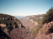
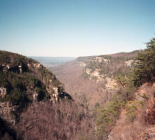
In the Appalachian Plateau, sedimentary layers are largely undeformed and therefore are still horizontal. At lower elevations, these rocks are mainly limestones and dolostones similar to rocks seen in the Valley and Ridge province. Forming the upland areas of the Plateau region, however, are Pennsylvanian-age sandstones, shale, and coal beds that formed along the coastline of an ancient seaway that extended at times from northwest Georgia all the way to Nevada. These rocks are also fossiliferous and contain beautifully preserved fossils of land-dwelling animals and plants that lived in those coastal forests, marshes, and river floodplains. These rock strata may be seen exposed at Lookout Mountain and Sand Mountain, particularly at Cloudland Canyon State Park just east of Trenton.
Coastal Plain Province
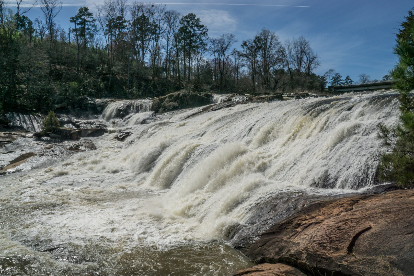
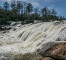
Looking at Georgia’s geologic map, one can see a distinct change in the character of the land on either side of the fall line. The fall line crosses through the center of the state from Augusta in the east through Macon and on to Columbus in the west and marks the place where rivers flowing off the Piedmont and onto the Coastal Plain have prominent waterfalls and rapids (hence the term fall line). Technically, this line runs from Georgia to New York, forming the boundary between the hard, crystalline rocks of the Piedmont and Blue Ridge and the softer, more erodible strata of the Coastal Plain. The rapids and waterfalls that define the fall line are caused by the different characteristics of the rocks on either side. Rivers cannot erode very deeply into the hard rocks of the Piedmont, but they can easily erode the soft strata of the Coastal Plain. Rapids and falls are formed as the erosion of soft strata results in the streams’ channels becoming steeper along the fall line.
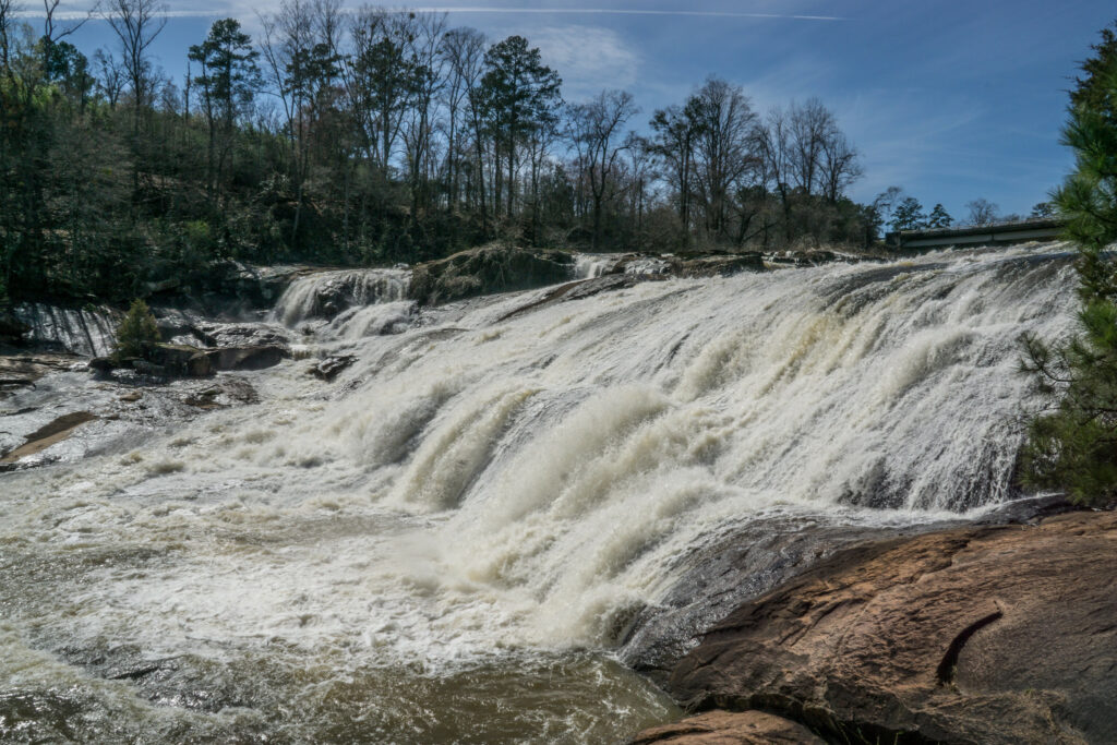
South of the fall line are sedimentary strata of the Coastal Plain. In most areas of the Coastal Plain, the strata are undeformed and virtually unaltered. Indeed, in some places these ancient sedimentary strata are still soft, looking almost exactly as they did when they were first deposited. These strata contain fossils that clearly show their age, however.
The oldest Coastal Plain strata in the state are of Triassic, Jurassic, and Lower Cretaceous age. They cannot be seen at the surface, though, because they lie deeply buried beneath younger sedimentary layers. Even though they are buried, they can still be studied by an analysis of drill cores taken from them and by such remote-sensing technology as seismic profiling. From these types of studies, geologists have learned that Georgia’s deeply buried Coastal Plain sediments formed during the time when North America began to break away from the supercontinent, Pangaea.
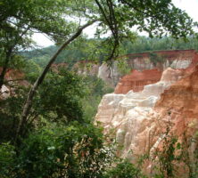
The oldest Coastal Plain rocks that are exposed at the surface are of Upper Cretaceous age. These rocks are exposed at the surface in the region between Columbus and Macon and are composed mainly of sandstones, shales, and marls, many containing well-preserved fossils. These fossils and the nature of the sedimentary strata that contain them indicate that they formed in a coastal setting when the sea level was higher than it is today. The deposits accumulated in estuaries, tidal flats, lagoons, barrier islands, and in the shallow sea just offshore. As sea level fluctuated during the Cretaceous, the location of the shore shifted back and forth, leaving deposits all the way from Columbus to Lumpkin. The vertical, unconsolidated sandstone bluffs of Providence Canyon State Park, west of Lumpkin, represent the top formation of these Cretaceous strata. In the region from Macon to Augusta, Cretaceous strata are covered by younger rocks except in river valleys, where stream erosion has cut through the overlying strata to expose the Cretaceous underneath.
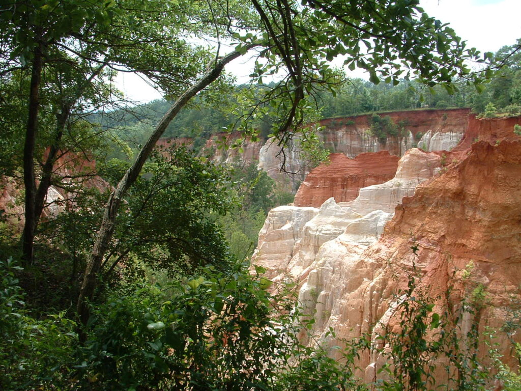
Fossils found in the Cretaceous deposits include large numbers of marine invertebrates, including clams, oysters, snails, and extinct Nautilus-like mollusks called ammonites. Also found is a rich collection of vertebrate fossils, notably the remains of duckbill dinosaurs, giant crocodiles, pterosaurs, and the recently discovered Appalachiosaurus montgomeriensis, a relative of the famous Tyrannosaurus rex.
Most of Georgia’s Coastal Plain strata formed during the Paleogene period, which covers the time frame from the extinction of the dinosaurs up to what is commonly known as the Ice Ages. These deposits vary widely in their appearance and composition. In many areas, Paleogene Coastal Plain deposits are sandstone, shale, and mudrocks, which are very similar to the Upper Cretaceous rocks beneath them. Like those older deposits, Paleogene strata also formed at or near the ancient coast during times when the sea level was higher than it is today. During the Eocene epoch, sea level was particularly high, and limestone deposits formed extensively in southwestern Georgia; today, these rocks underlie the Dougherty Plain west and south of Albany. The Eocene limestones are very porous and form a major groundwater aquifer system that provides the main source of groundwater in the region. In the central and eastern Georgia Coastal Plain, Paleogene strata are represented by deposits that formed both in coastal and shallow-sea settings as well as in river floodplains adjacent to the coast.
Strata of Eocene age in Georgia’s central and eastern Coastal Plain contain large deposits of highly pure kaolinite clay. Kaolin is used in many ways: for ceramics, for the manufacture of medicine, for plastics, and especially for the production of high-gloss paper used for color printing. Georgia is the world’s largest producer of kaolin, and the clay is one of the state’s leading economic resources. Also found in these strata are valuable deposits of bauxite, the principal ore of aluminum.
Paleogene Coastal Plain strata are also fossiliferous and often contain well-preserved remains of ancient organisms. Indeed, the official Georgia state fossil is the tooth of the giant fossil shark, Carcharocles (formerly Carcharodon) megalodon. Also found are the remains of an ancient whale, which still retains remnants of hind legs from the time when the whale’s ancestors lived on land.
Modern Coast
Because Georgia’s Coastal Plain strata all decline gently toward the modern coast, the youngest geological deposits in the state are in lowcountry, or coastal Georgia. These strata represent geological formation in coastal settings.
Georgia’s coast consists of a chain of sandy barrier islands called the Sea Islands. These islands were inhabited by Native Americans long before the arrival of Europeans in the sixteenth century, and they were later the site of African American communities founded by fugitives from slavery. Today, Georgia’s Sea Islands are important tourist destinations. The islands are mainly composed of beach and dune sand, which is constantly washed by waves and blown about by the persistent sea and land breezes. The islands are called barrier islands because they are separated from the mainland by shallow lagoons and marshes.
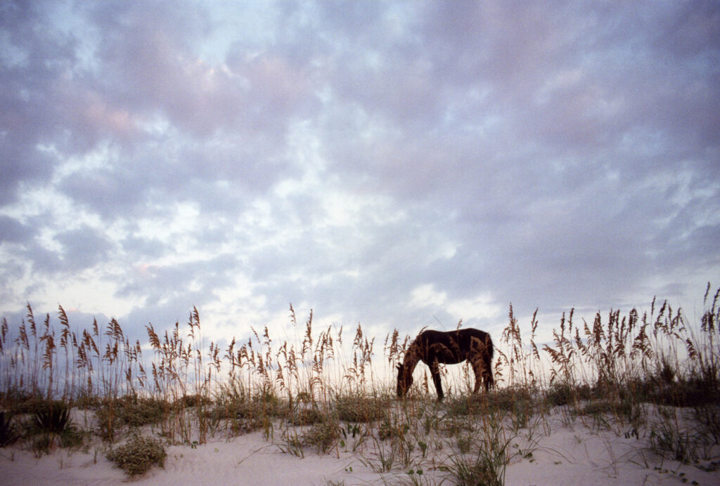
The highest tidal range along the southeastern shoreline from Cape Hatteras, North Carolina, to Miami Beach, Florida, occurs along the Georgia coast. For this reason tidal marshes and mudflats are extensively developed between the sandy Sea Islands and the mainland. The lagoons, marshes, and flats are of great importance to the coastal economy, both because they function as nurseries for young fish and because the seagrasses that grow on the tidal marshes provide a major source of nutrients to coastal fish.
Just inland from the coast are a series of low sand ridges running from north to south in lowcountry Georgia; these ridges represent former positions of the shore that formed at times of higher sea level during the Pleistocene epoch. The Pleistocene, also known as the Ice Ages, was a time of changing sea levels as the great continental glaciers of northern North America and Eurasia advanced and retreated. For this reason there are today in Georgia five or more of these low sand ridges, almost like stair-steps down to the sea.
Georgia’s Geological Bounty
Because Georgia has such a variety of different geologic terrains, the state is also rich in valuable geologic resources. In the Elberton area of Georgia’s Piedmont are world-famous bodies of finely textured gray granite. Georgia’s granite has been used for building stone, headstones, statuary, and monuments around the world. Georgia’s Piedmont also has major deposits of marble, slate, and other stone resources used for building materials, dimension stone, and crushed rock for highway construction.
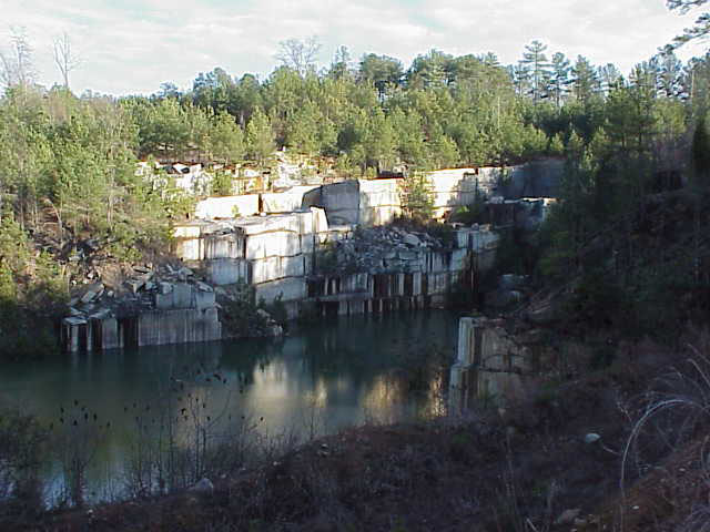
In the Valley and Ridge Province, important geological resources include limestones and dolostones. These rocks are used in many ways, including as crushed stone and dimension stone. Limestones are of particular importance as a source of lime for the manufacture of cement and concrete. Both limestone and dolostone are also used in the chemical industry.
Pennsylvanian sandstones from the top of Sand Mountain and Lookout Mountain have been used as building and dimension stone. Perhaps of more importance are the coal deposits in the Appalachian Plateau province. Although these coals are not as thick or abundant in Georgia as they are in adjacent Alabama and Tennessee, they have been mined locally for many years. An unintended benefit of coal mining is piles of waste rock, mainly shales, from the mining operations; in these shales preserved plant fossils may be found.
The Coastal Plain also has important geologic resources. As already noted, the central and eastern Coastal Plain has important kaolin clay deposits. These deposits, derived from the intense weathering of Piedmont rocks like granite and gneiss, formed during the Paleogene period. These rocks contain the mineral feldspar, the chemical weathering of which produces kaolin clay. The clay pits of east Georgia are among the largest quarries in the state. Other important Coastal Plain resources include bauxite, sand, limestone, and crushed stone for building materials.
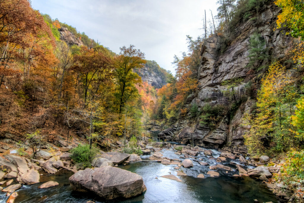
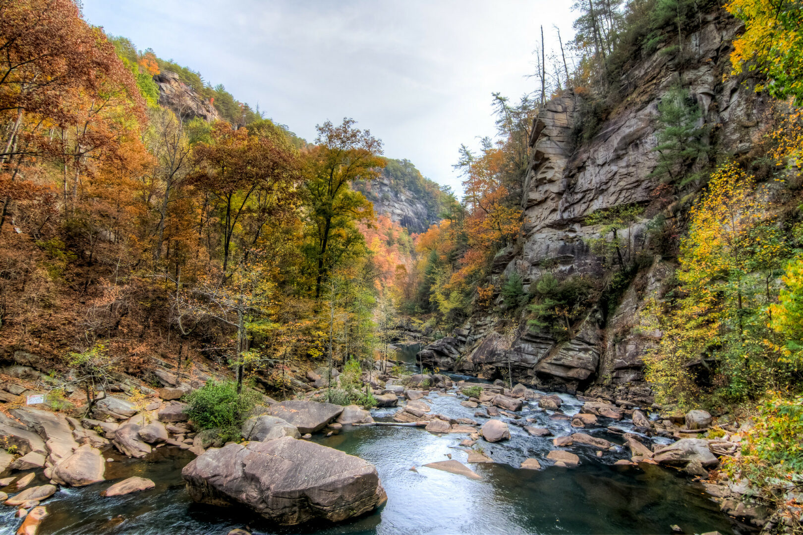
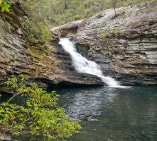
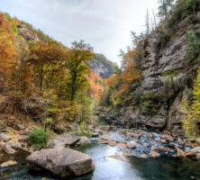
Another aspect of Georgia’s geological bounty is the land itself. Georgia is widely known for its natural beauty, and visitors from around the nation and the world come every year to see and enjoy Georgia’s scenery. Tourists visit the Sea Islands to bathe in the ocean, the Blue Ridge Mountains to gaze down into the spectacular Tallulah Gorge, southwest Georgia to visit Providence Canyon, or northwest Georgia to see Rock City or camp at Cloudland Canyons. Highlighting the state’s natural beauty are the many state parks in Georgia.
A vital resource, though sometimes not thought of as geological, is water. Georgia has abundant clean-water resources, but groundwater is also a major resource in the state and is being utilized more and more as the needs of agriculture, industry, and Georgia’s communities grow.


